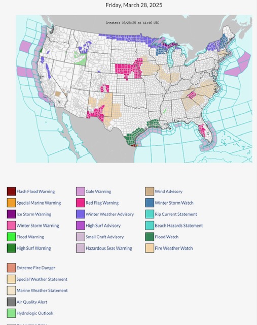
FYI… latest NWS Watches, Warnings & Advisories for Friday, March 28, 2025.
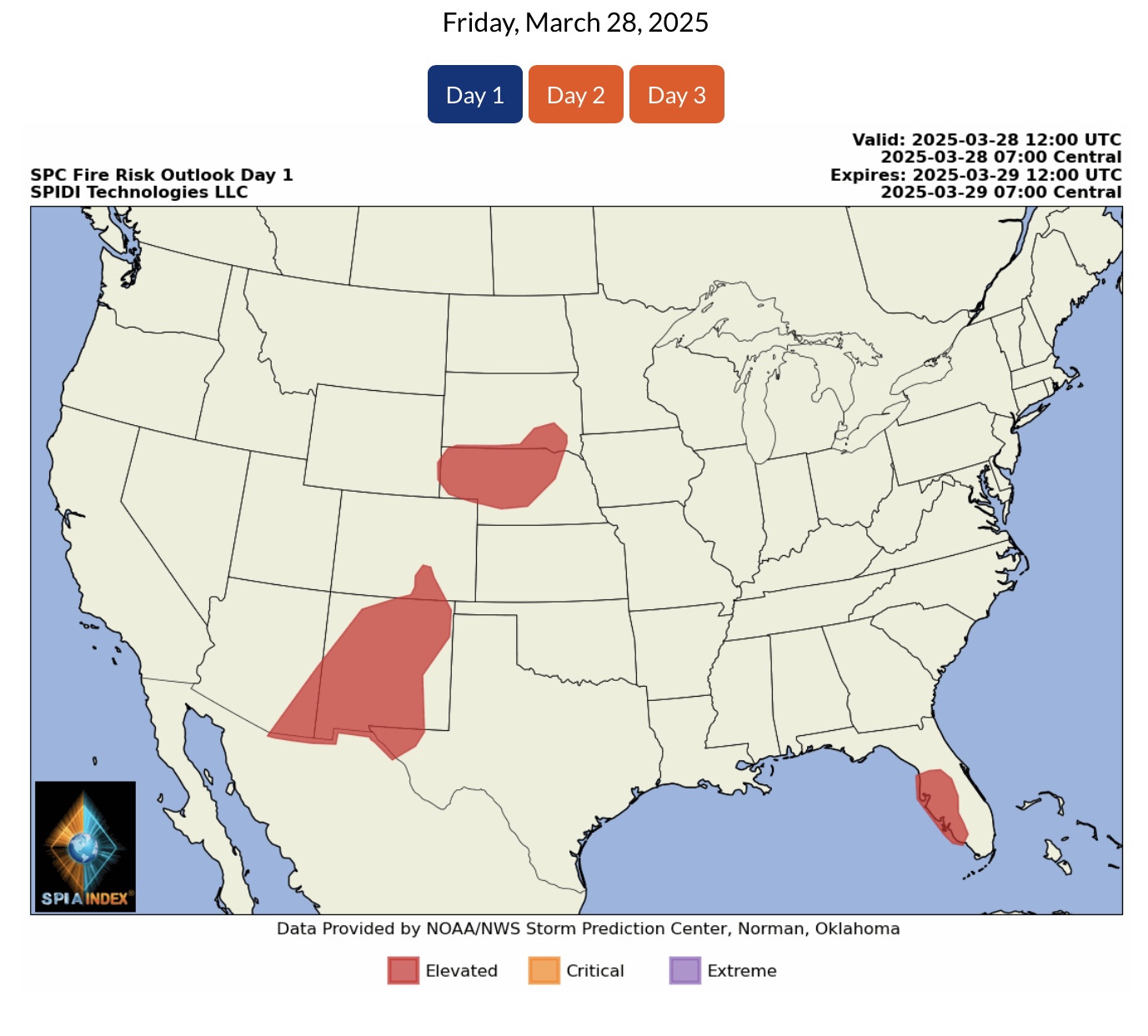
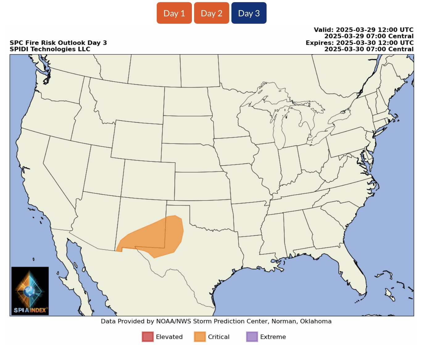
Note RED FLAG FIRE WARNINGS parts MN, SD, NE, IA, KS, CO, NM, TX, TN, NC, SC & FL. Fire Weather Watch parts NM, TX, MN, IA, IL, IN, VA, TN, NC, SC & GA.
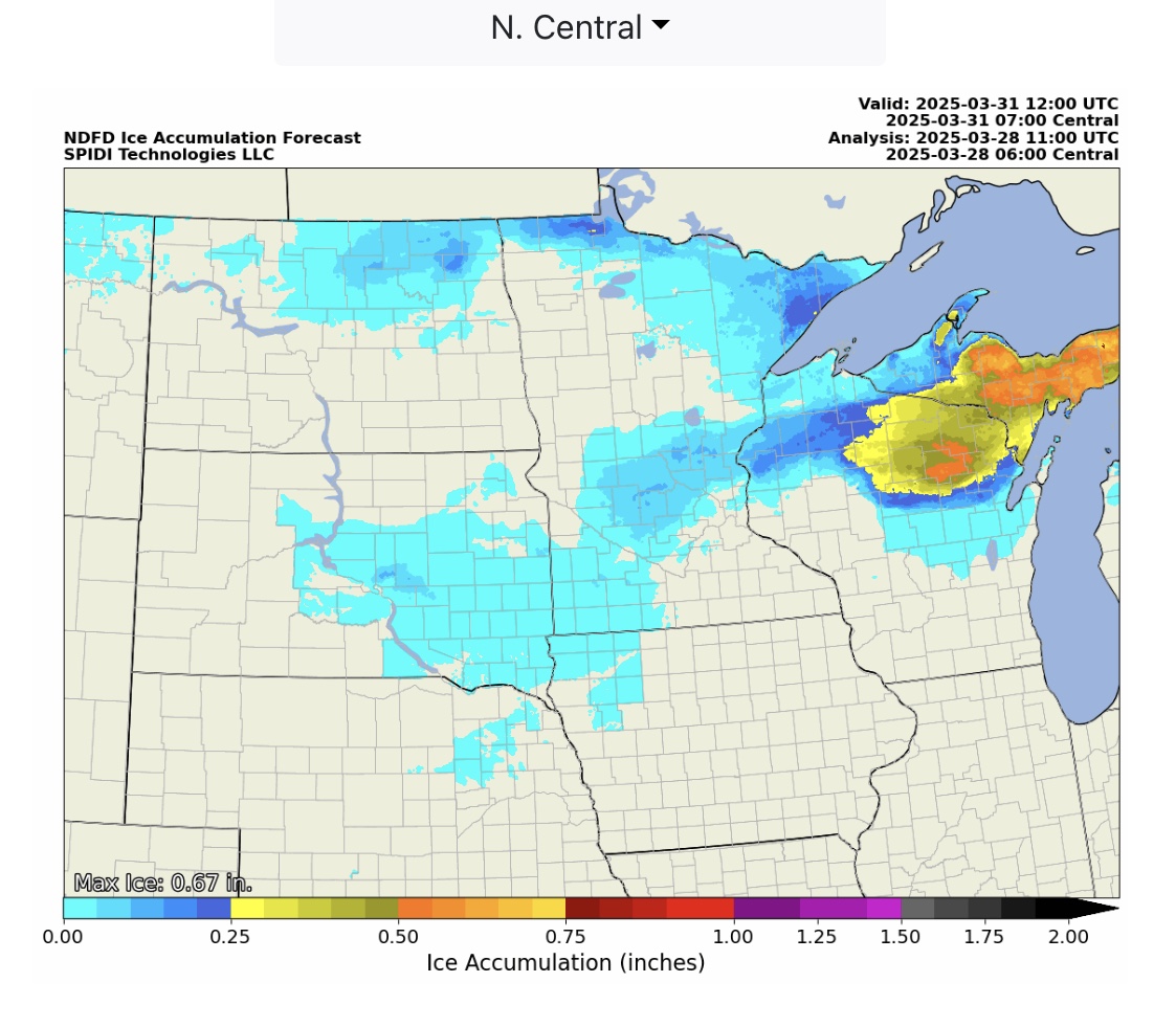
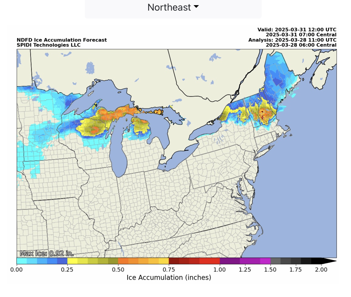
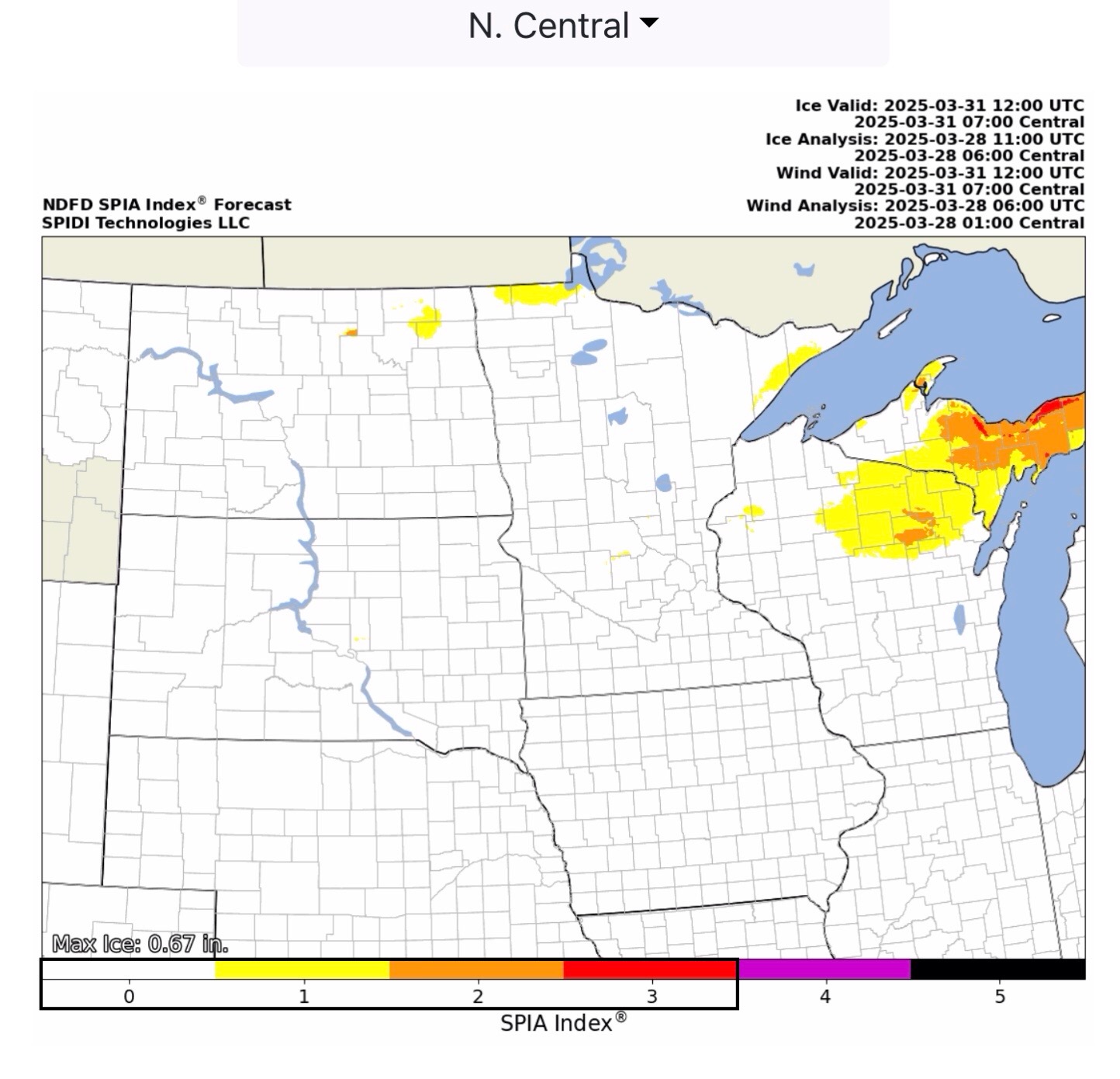
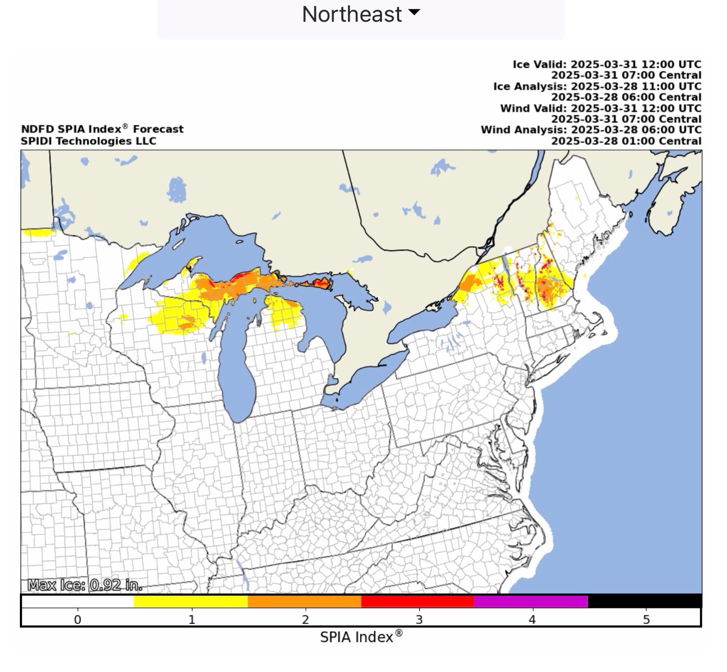
Note ICE STORM WARNING across parts of the MI Upper Peninsula. This ice storm event will move east over the next 3 days, bringing with it ice accumulation totals from 0.25” up to nearly 1.00” in some areas of WI, MI & MI Upper Peninsula, NY, VT, NH & ME. The current SPIA Index ice impact forecasts range from Level 1 to Level 5 for this event, which could bring excessive infrastructure damage to overhead utilities in several states.
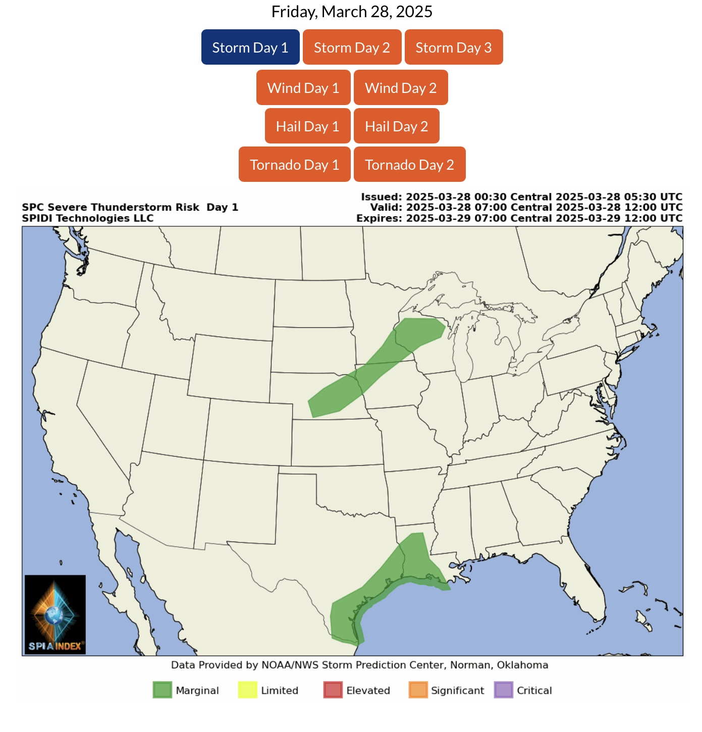
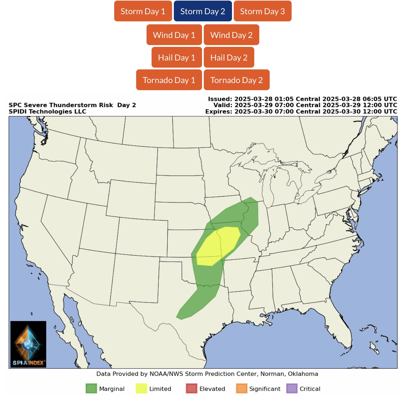
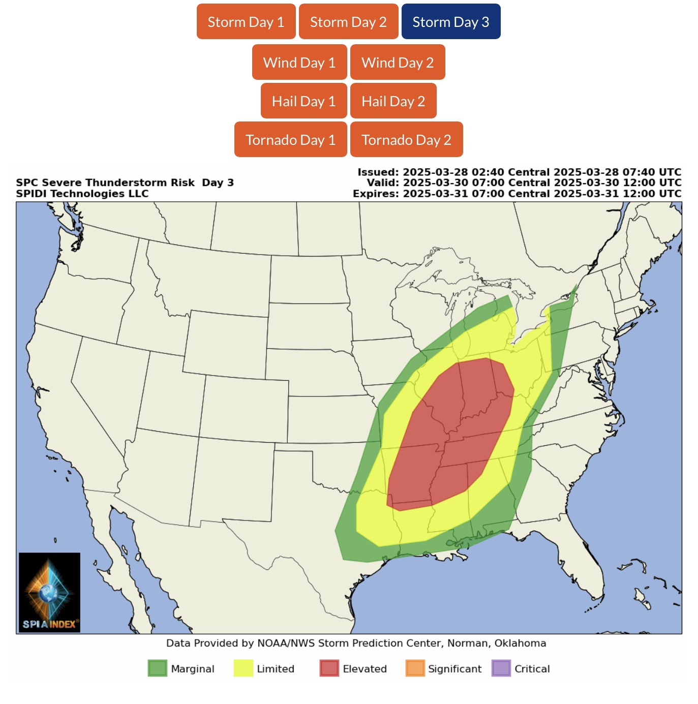
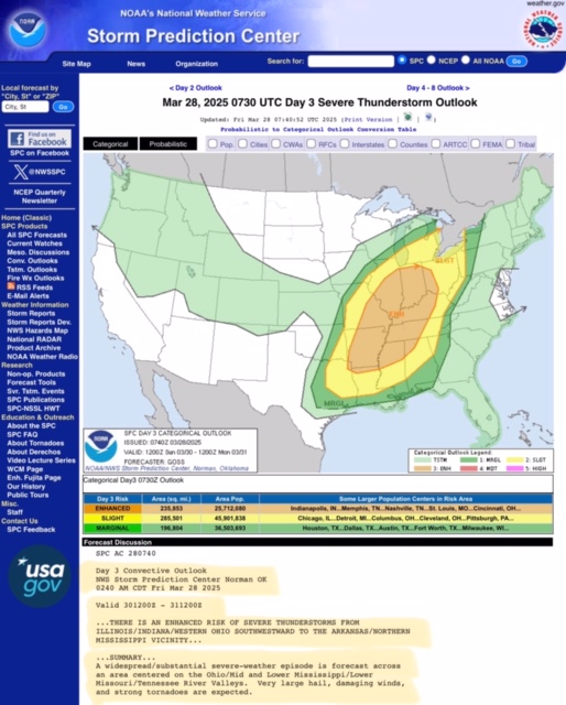
On Sunday, a large area from AR to OH is at an ELEVATED RISK for SEVERE THUNDERSTORMS. This risk includes damaging winds, large hail, and the threat of multiple tornadoes, with some large tornadoes possible.
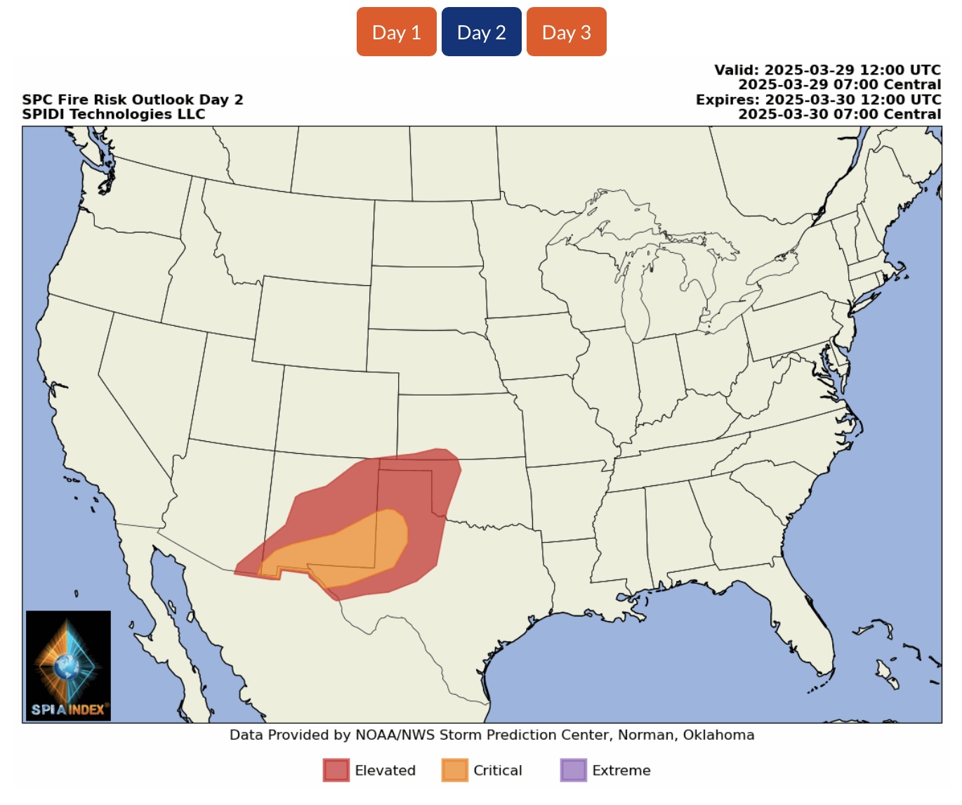
ELEVATED to CRITICAL Fire Risk on Day 2 (Saturday) for parts AZ, NM, CO, KS, OK & TX.

 Show/hide attachments