Two separate icing events: 1) over the next 12 to 48 hours, freezing rain is still in the forecasts of all 3 Long-Term Models (GFS, Euro or ECMWF, and NWS NBM) for parts of WV, northern VA, MD & much of PA. 2) second event begins Monday night or Tuesday in TX & OK and moves east into AR, MO, KY, TN, southern VA & northern NC by Thursday & Friday of next week…
Sidney Sperry 07 Feb 2025 22:17 UTC
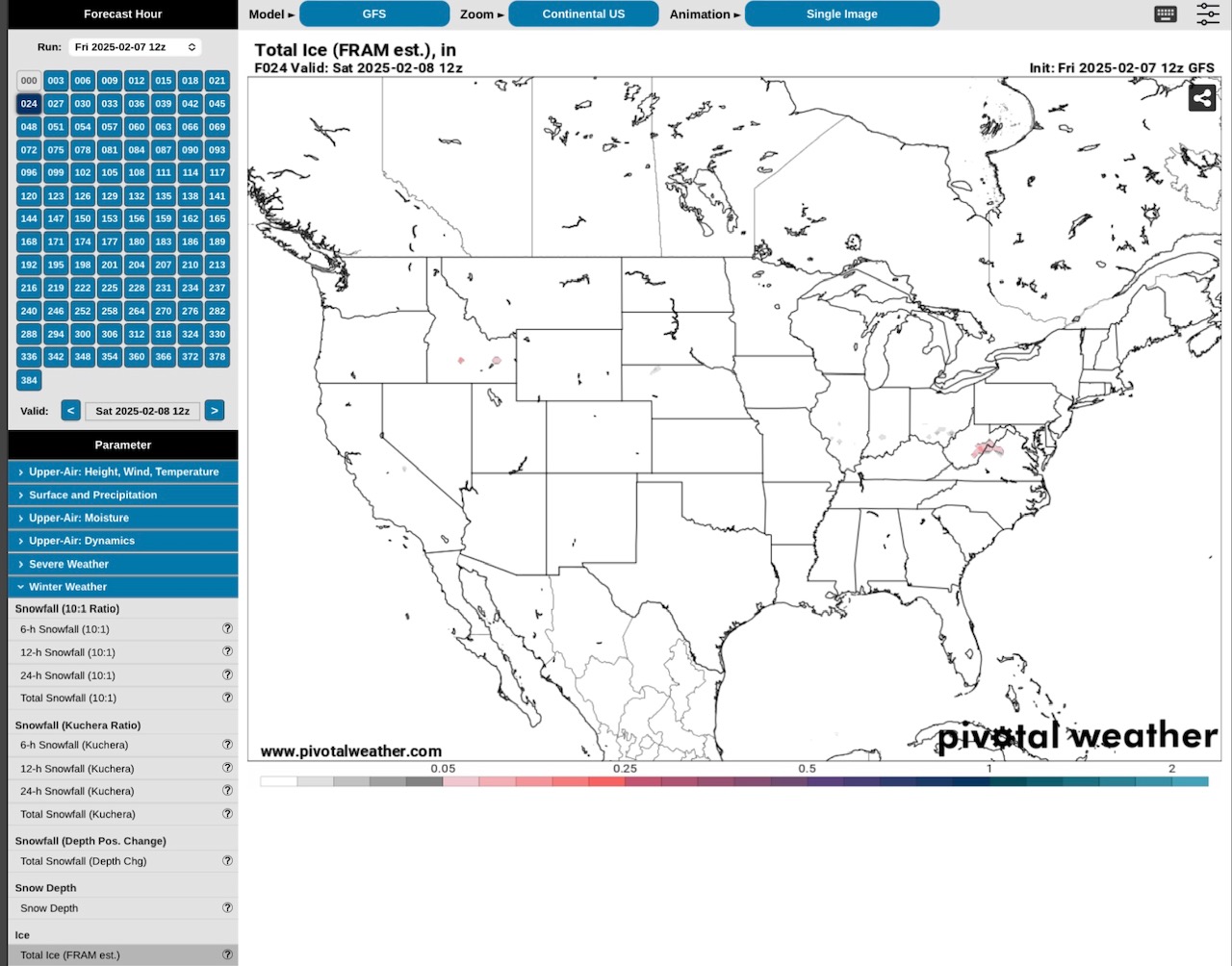
GFS, Storm #1, ending Sunday.
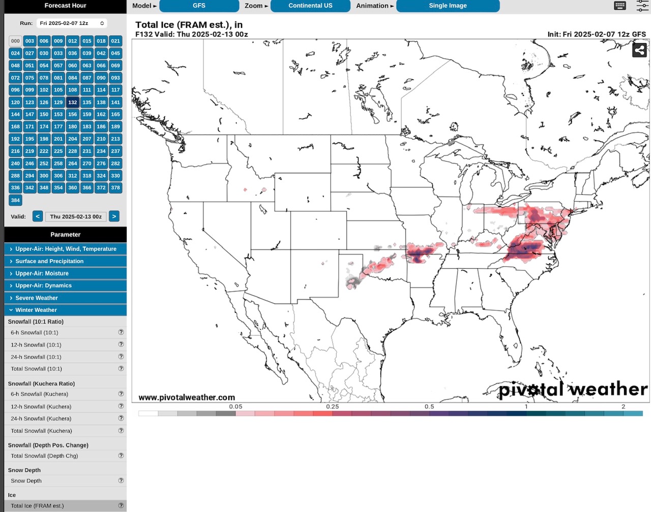
GFS Model, Storm #2, beginning Tuesday in OK, MO & AR
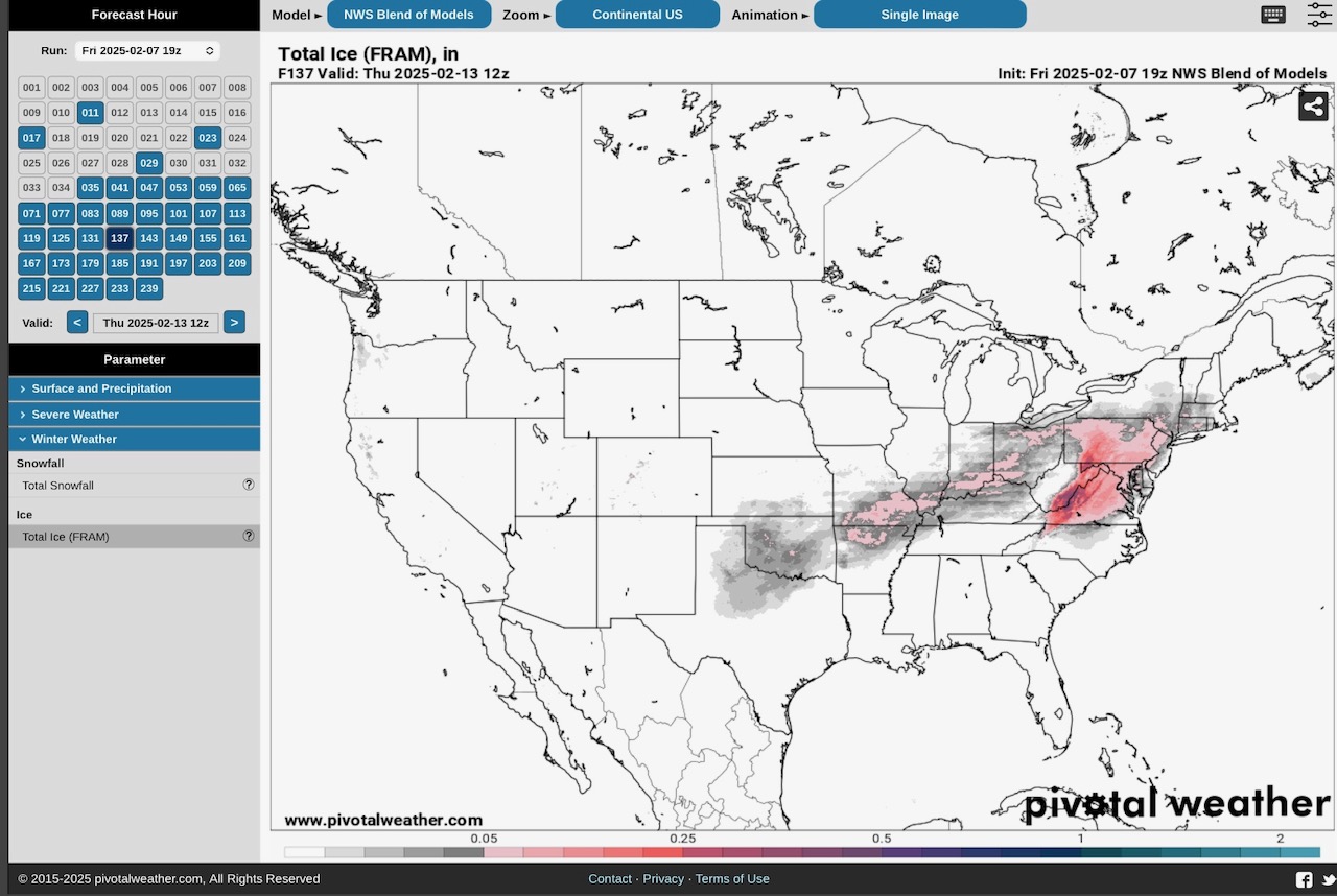
GFS, Storm #2, ending Thursday or Friday, 2/13 or 2/14. Amounts 1/4” to 6/10” range
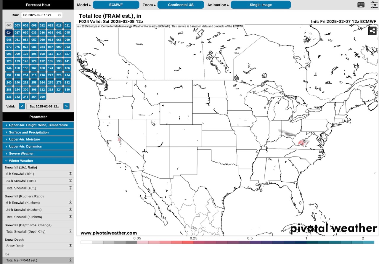
Euro or ECMWF Model, Storm #1
Euro or ECMWF Model, Storm #1 ending Sunday…
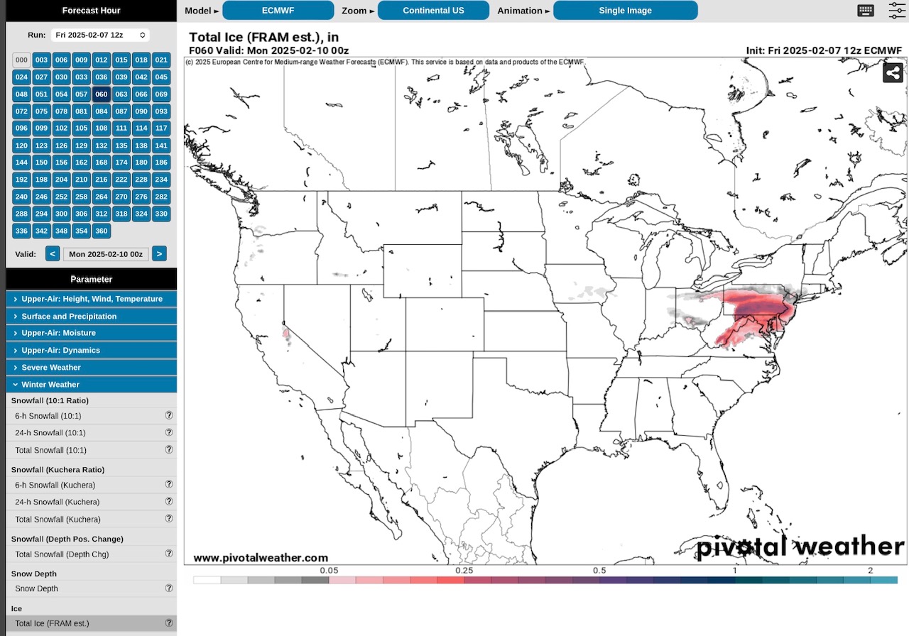
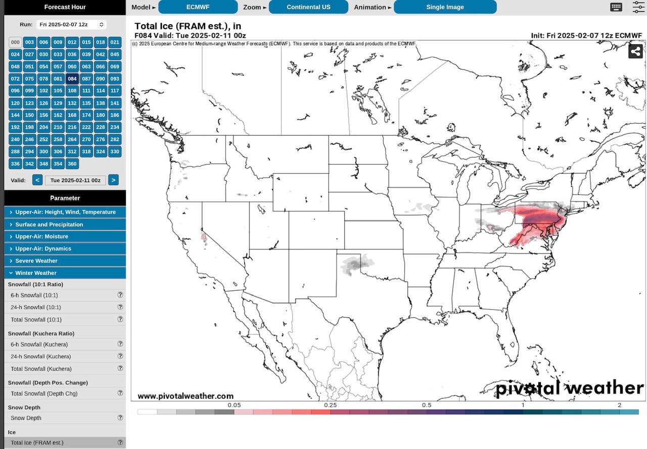
Euro or ECMWF Model, Storm #2, beginning in TX & OK on Tuesday & moving east…
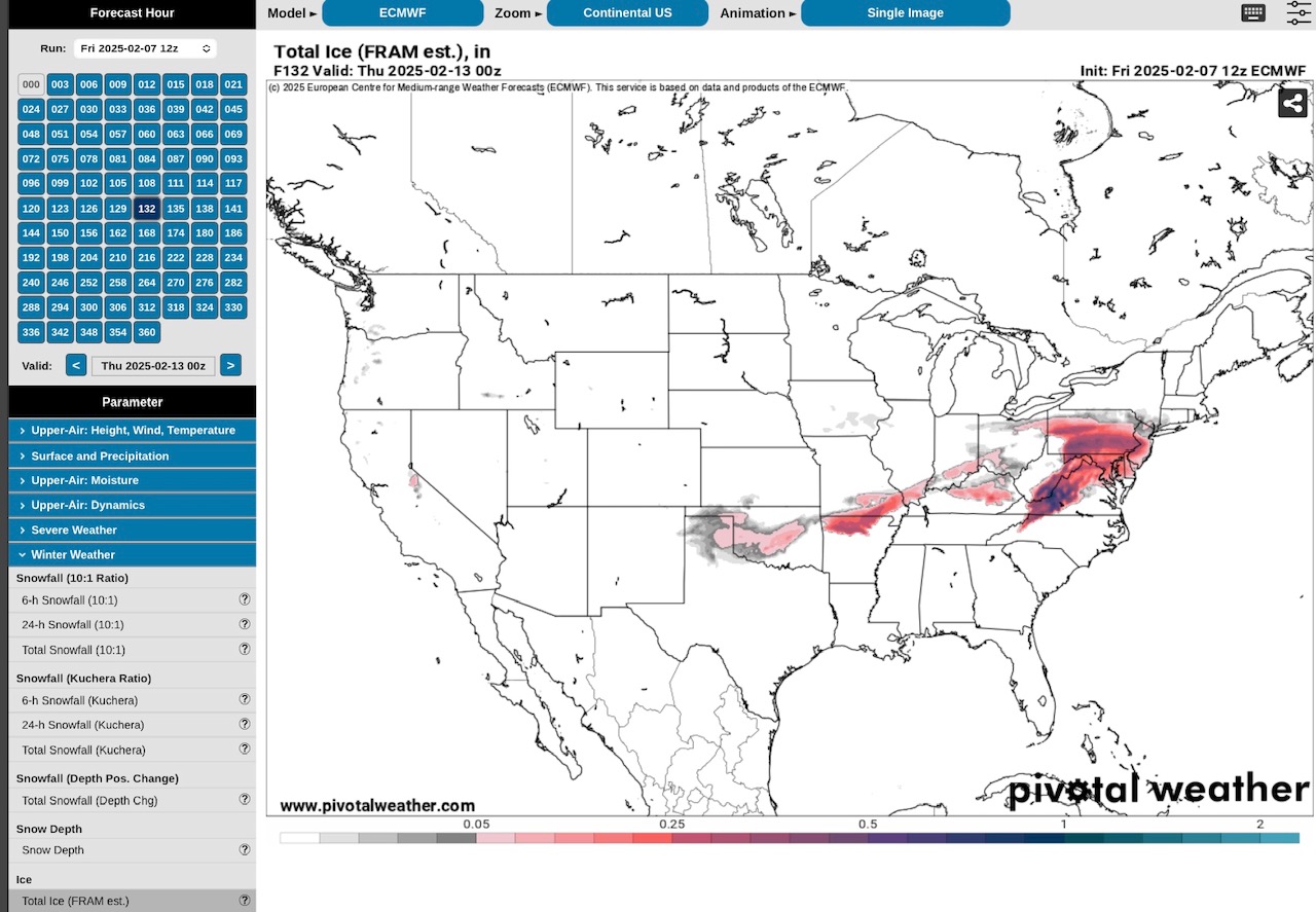
Euro or ECMWF Model, Storm #2, ending Thursday or Friday, 2/13 or 2/14. 1/4” to 6/10”
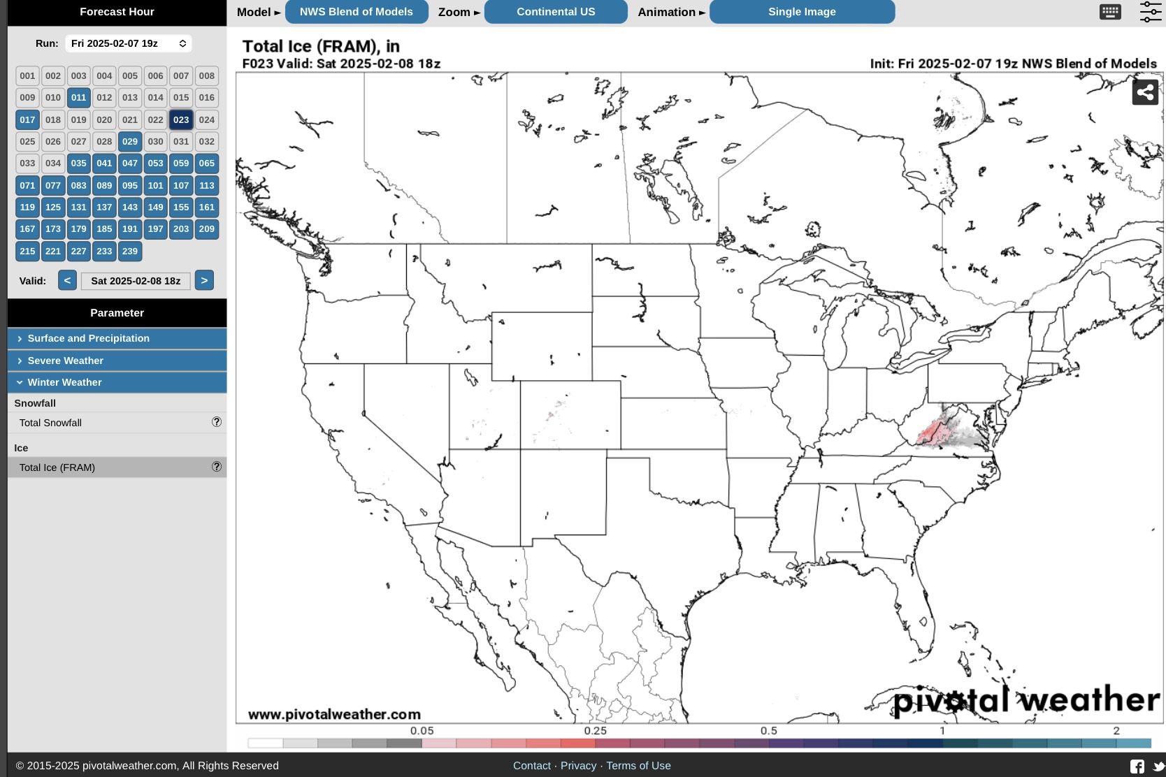
NBM Model, Storm #1, ending Sunday
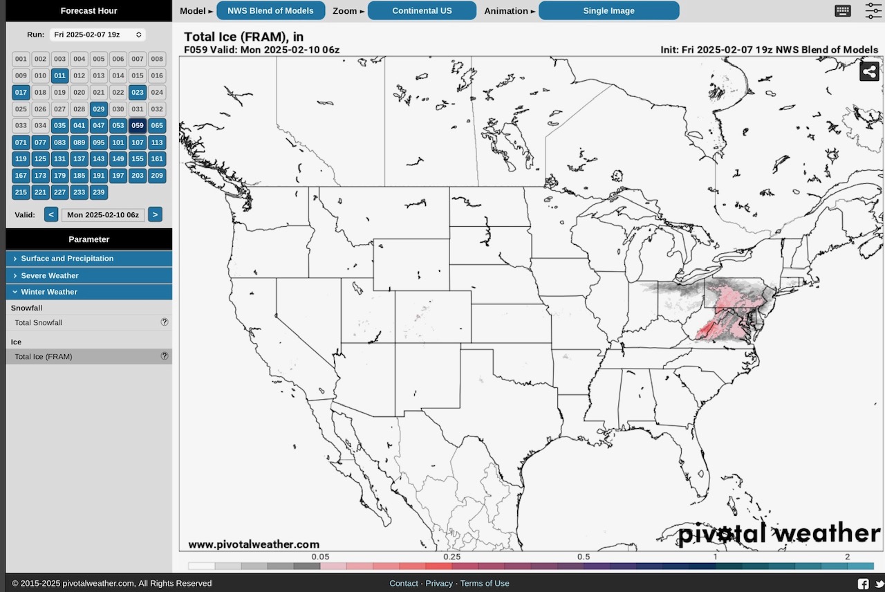
NBM Model, Storm #2, beginning Tuesday in KS, OK, MO & AR and moving east…
NBM Model, Storm #2, ending Thursday or Friday, 2/13 or 2/14. Amounts 1/10” to 3/8”.
Sid Sperry
Sent from my iPad

 Show/hide attachments