Latest Long-Term Model Forecasts for Snow & Ice, Tuesday thru Saturday, January 21 - 25, 2025. Beginning dates and ending dates for Snow first in the GFS, Euro or ECMWF, and National Blend of Models or NBM; then beginning and ending dates for Ice from those same Long-Term Forecast Models (GFS, ECMWF and NBM).
Still some agreement among these 3 Long-Term Forecast Models in forecasting the potential for a Snow and Ice event across the South Central and Southeast Regions from Tuesday through Friday or Saturday of next week. Now 4 days out from potential start of this event - but still some possibilities of changes in forecast footprints and amounts.
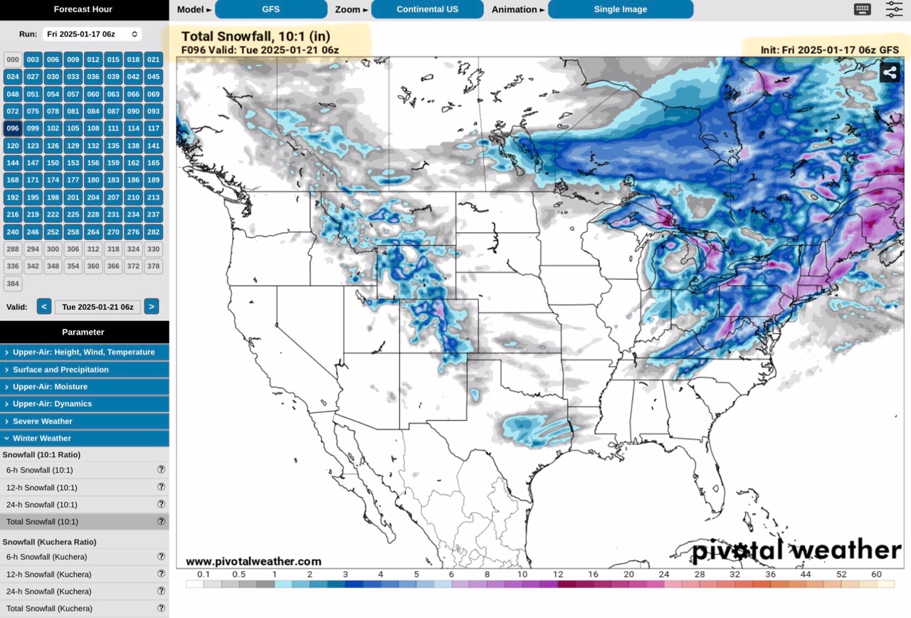
GFS Model, Total Snow Forecast, beginning Tuesday, January 21.
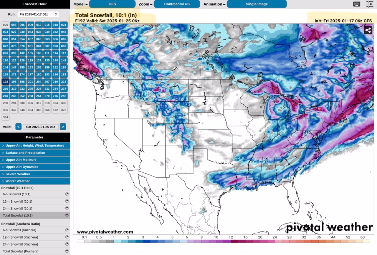
GFS Model, Total Snow Forecast, ending Saturday, January 25.
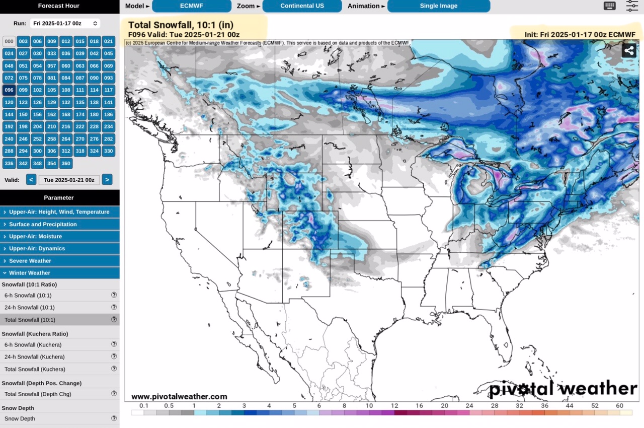
Euro or ECMWF Model, Total Snow Forecast, beginning Tuesday, January 21.
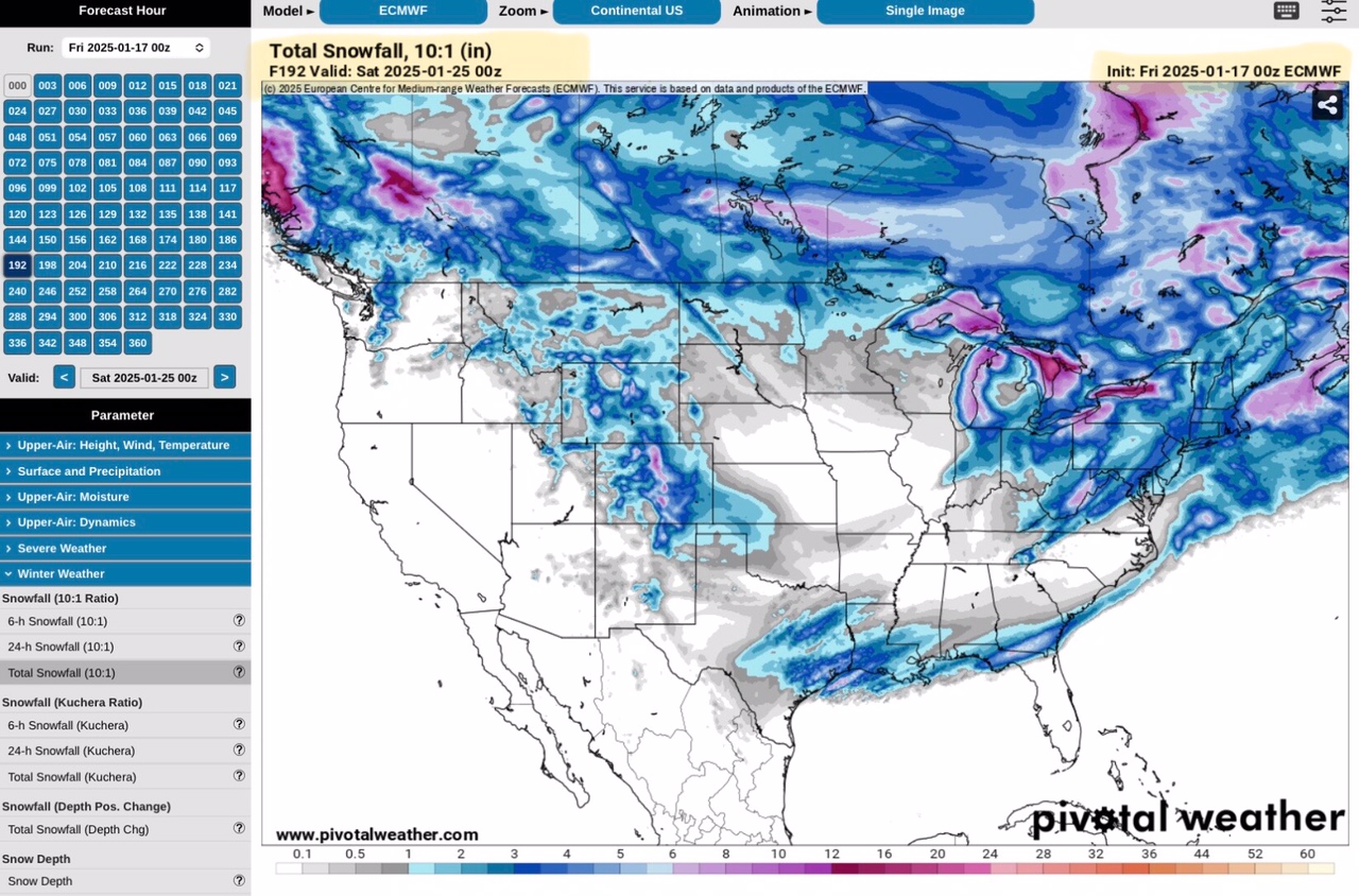
Euro or ECMWF Model, Total Snow Forecast, ending Saturday, January 25.
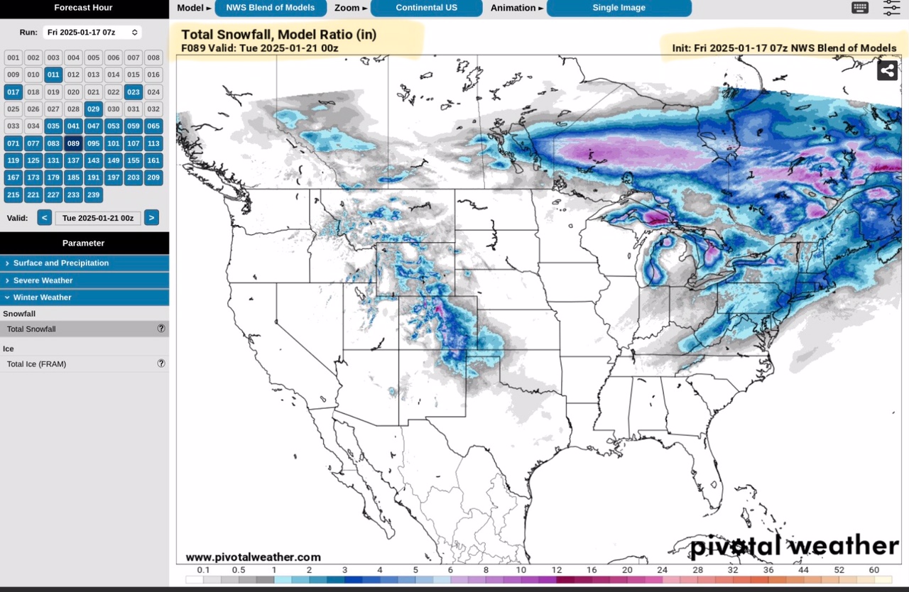
NBM Model, Total Snow Forecast, beginning Tuesday, January 21.
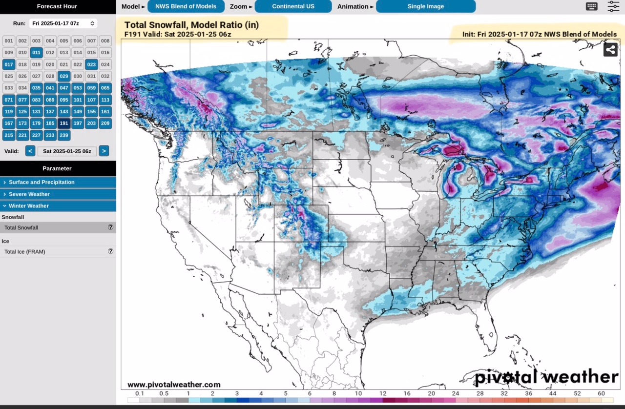
NBM Model, Total Snow Forecast, ending Saturday, January 25.
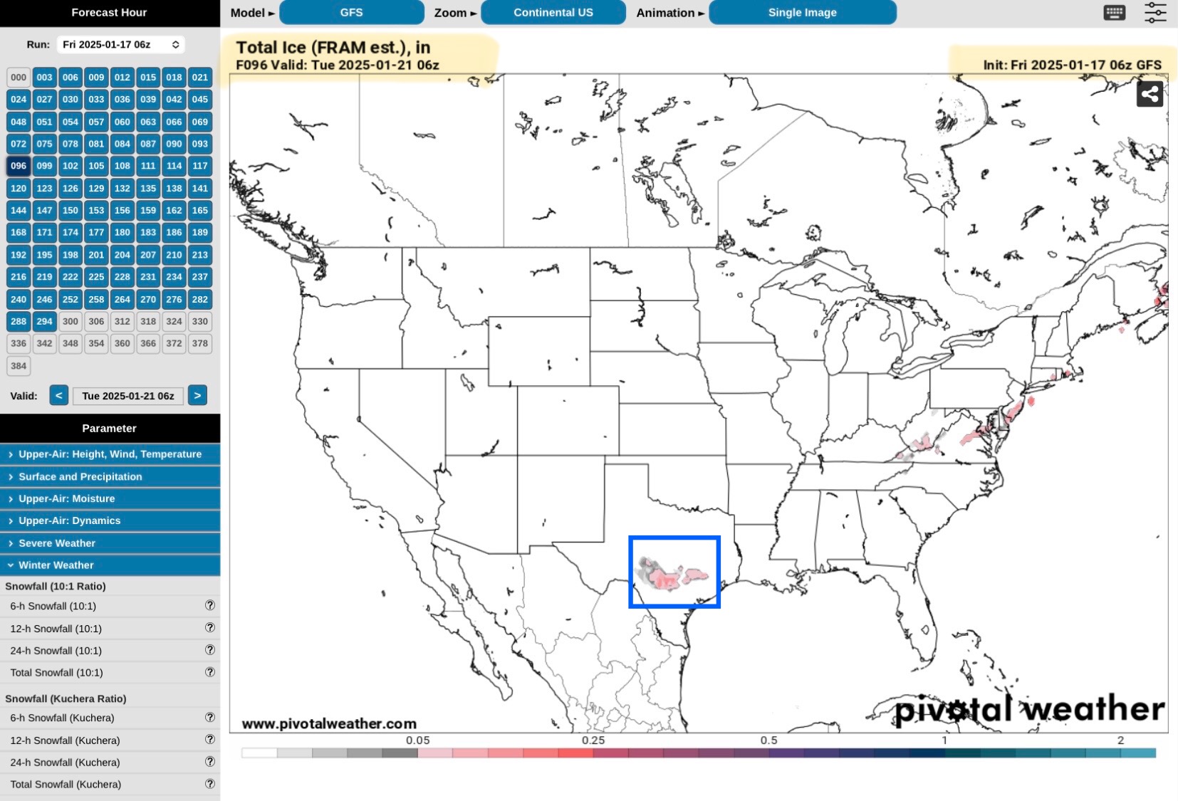
GFS Model, Total ICE Forecast, beginning Tuesday, January 21.
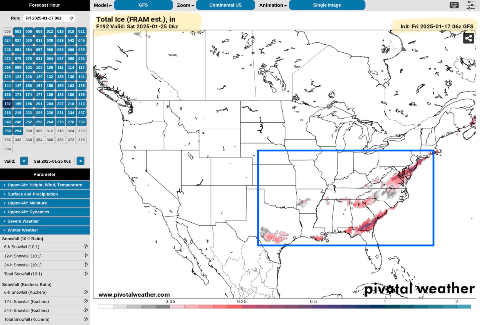
GFS Model, Total ICE Forecast, ending Saturday, January 25.
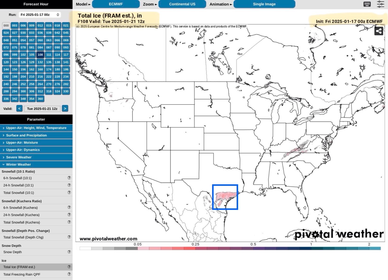
Euro or ECMWF Model, Total ICE Forecast, beginning Tuesday, January 21.
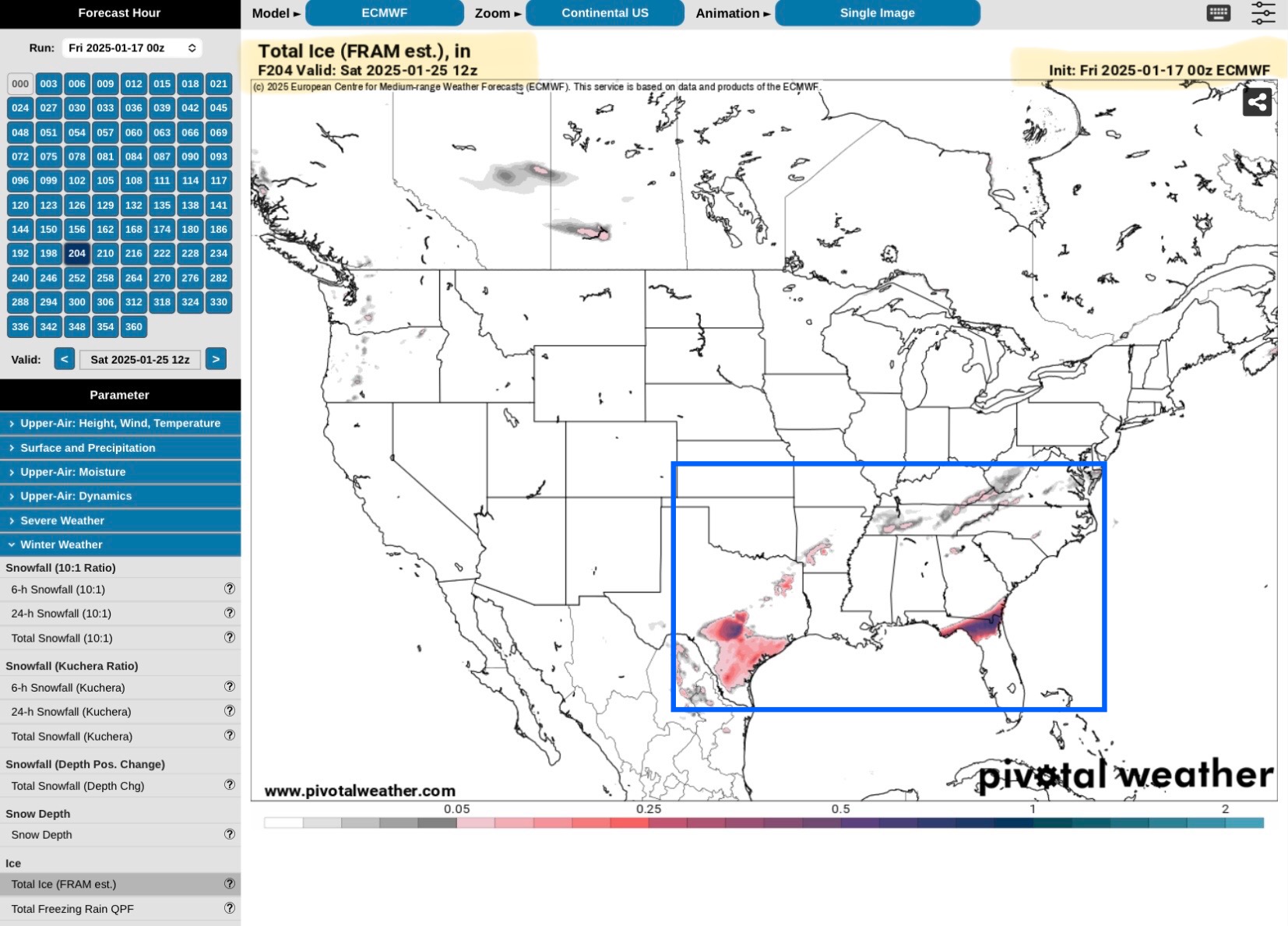
Euro or ECMWF Model, Total ICE Forecast, ending Saturday, January 25.
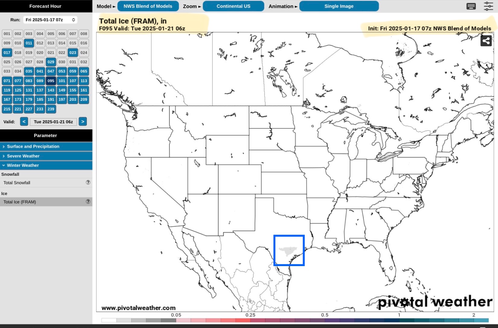
NBM Model, Total ICE Forecast, beginning Tuesday, January 21.
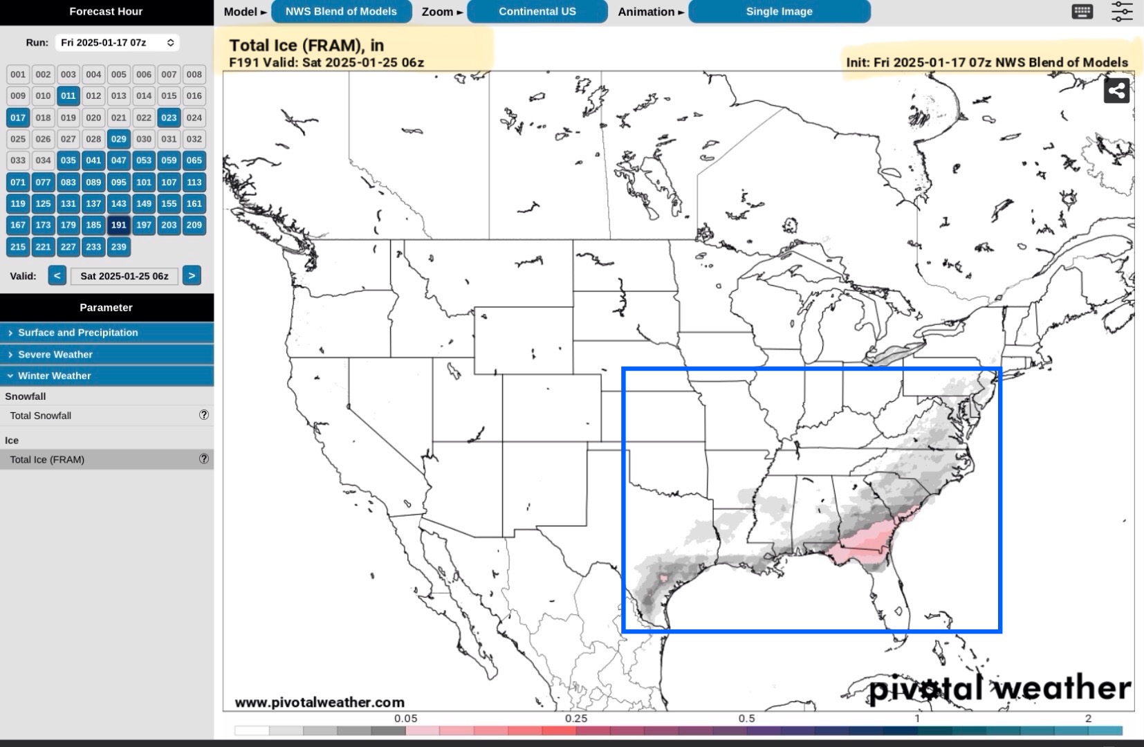
NBM Model, Total ICE Forecast, ending Saturday, January 25.
Amounts vary from 0.05” to 1/10” up to 5/8”, possibly 3/4” in some isolated areas of northern FL and southern GA in these latest model runs.

Sid Sperry

Sent from my iPad

 Show/hide attachments