Long-Term Model Snow & Ice Forecasts through Midnight Saturday, January 25…
Sidney Sperry 16 Jan 2025 16:07 UTC
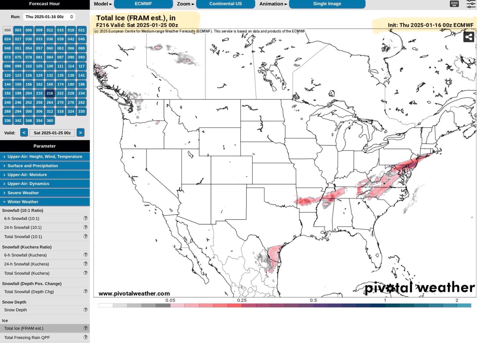
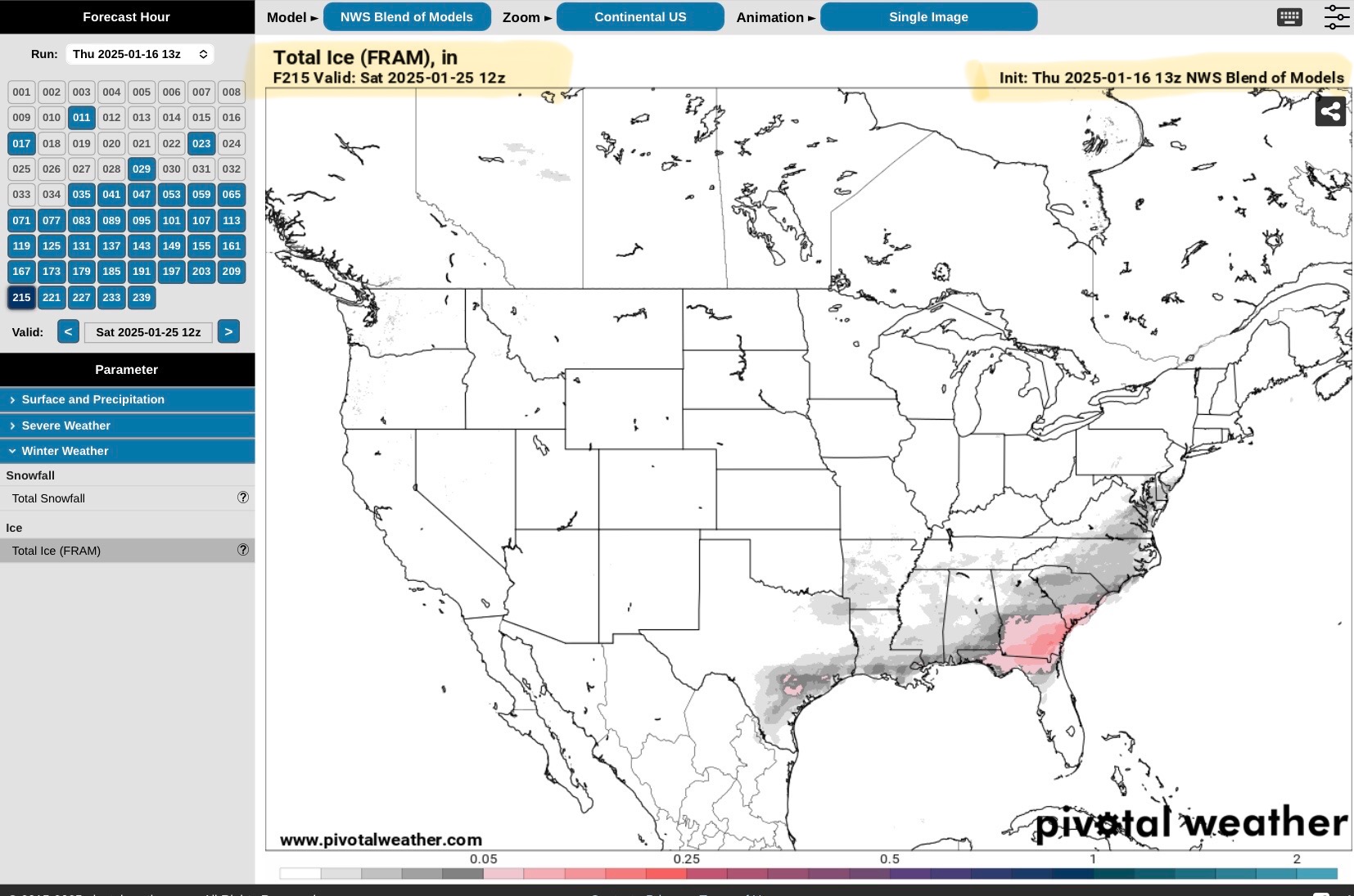
Here’s an update from 3 Long-Term Forecast Models (GFS, Euro or ECMWF and NBM) on next week’s Snow and Ice Totals. Again, we are still 4 to 5 days out from the start of any snow or ice across the South Central and Southeast Regions, so just know that these forecasts could - and likely will - change some as far as footprint path and amounts are concerned. Better and more reliable forecasts for Snow and Ice will begin about 72-hours in advance of the event, meaning better forecast confidence by this Saturday and Sunday. What seems fairly certain is that any freezing rain event will likely start in TX or eastern OK, western AR, and move from west to east over 3 to 4 days next week, from Tuesday through Friday. Ice amounts still vary from < 1/10” to around 1/2” in some areas. Feel free to call, text, or email me with any questions you may have.
Sid Sperry
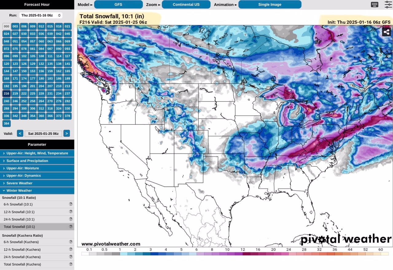
Total Snow Forecast, GFS Model, ending Midnight Saturday, 1/25/25
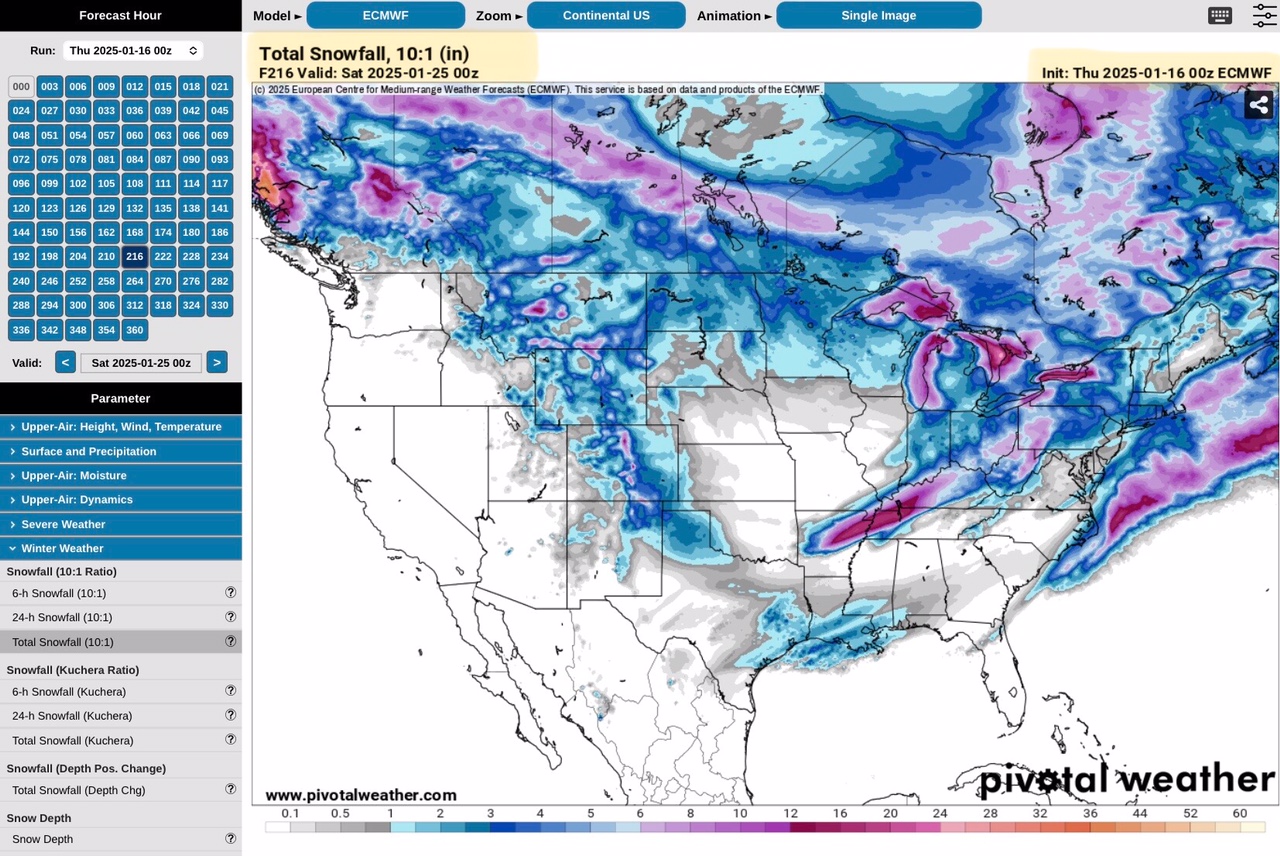
Total Snow Forecast, Euro or ECMWF Model, ending 6pm CT Friday, 1/24/25
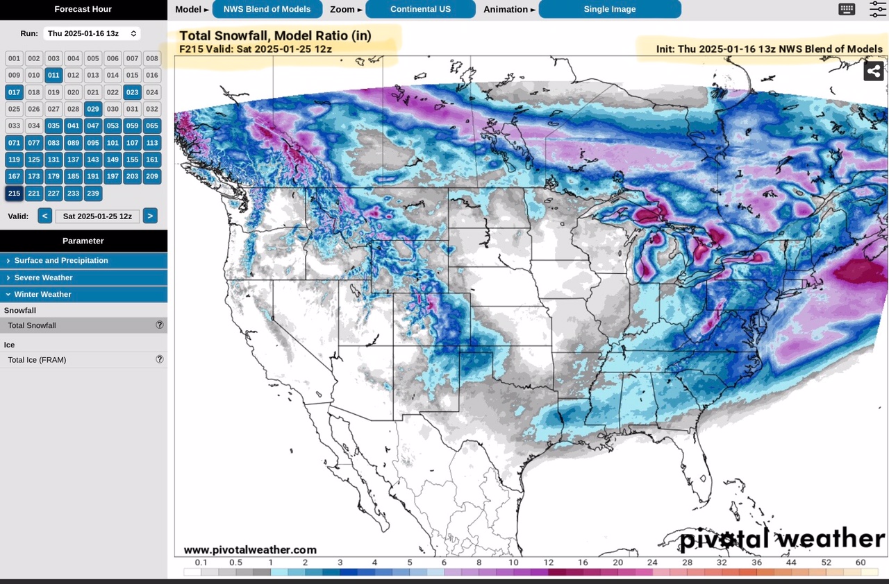
Total Snow Forecast, NBM model, ending 6am CT Saturday, 1/25/25.
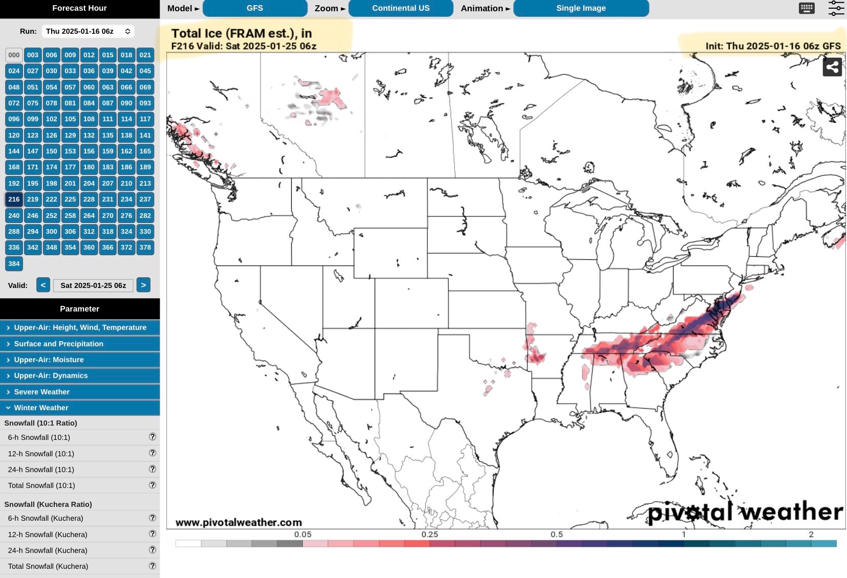
Total Ice Forecast, GFS model, ending Midnight Saturday, 1/25/25.
Total Ice Forecast, Euro or ECMWF model, ending 6pm CT Friday, 1/24/25.
Total Ice Forecast, NBM model, ending 6am CT Saturday, 1/25/25.
Sid Sperry

Sent from my iPad

 Show/hide attachments