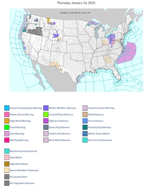
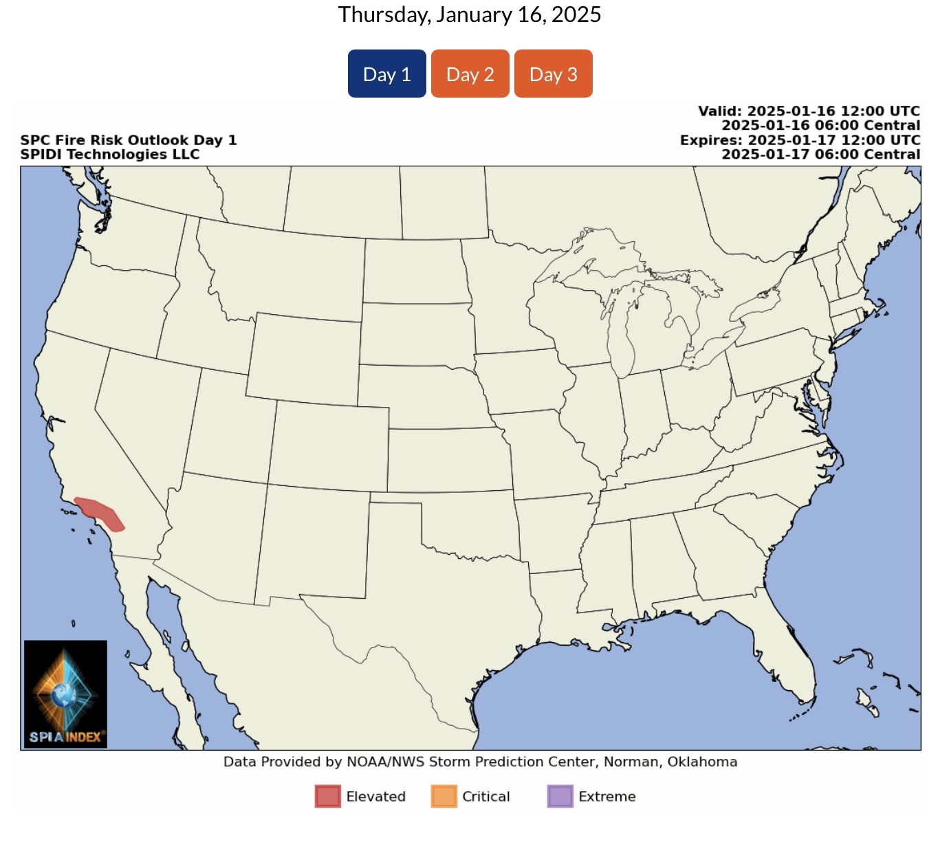
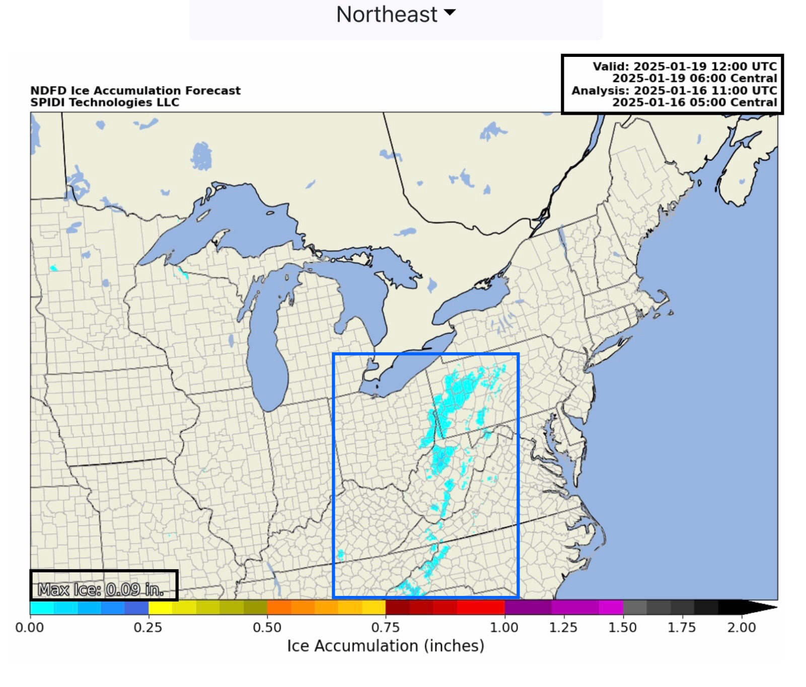
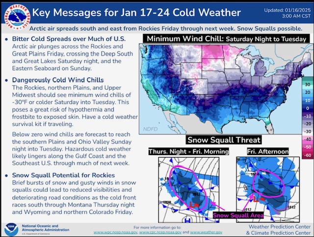
Latest NWS Watches, Warnings & Advisories for Thursday, January 16, 2025. Note Red Flag Fire Warnings continue in parts southern CA. High Wind Warnings parts MT & WY; High Wind Watch parts sw TX. Winter Storm Warning parts PA, MD & WV. Fire Risk in parts southern NM & across GA. Light ice < 1/10” in PA, OH, WV, VA, NC.
Sidney Sperry 16 Jan 2025 13:04 UTC
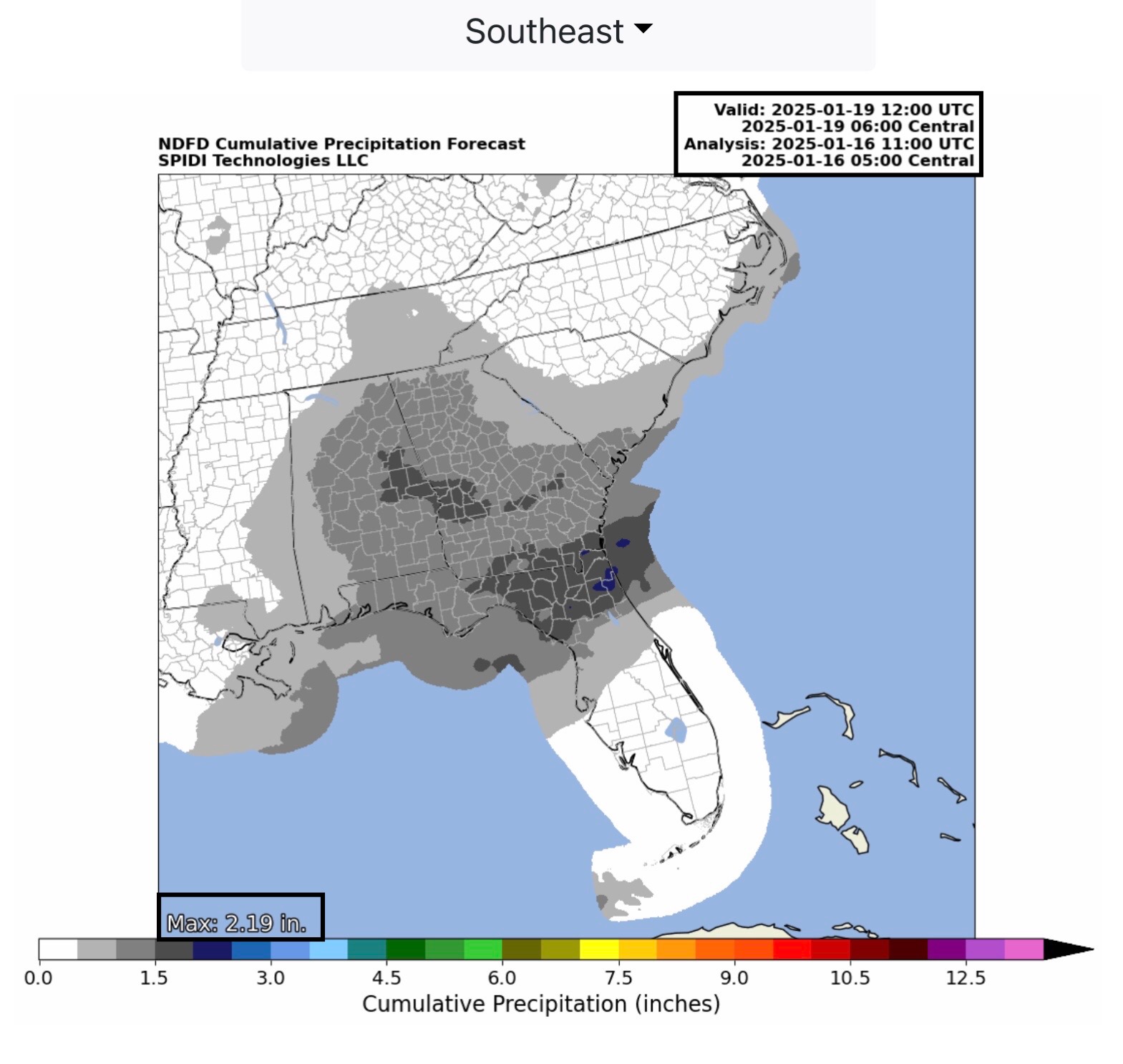
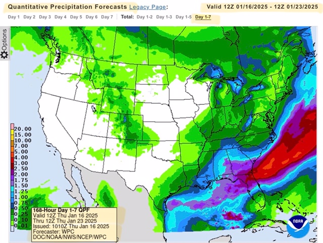
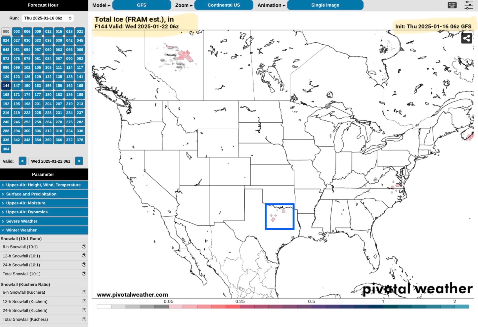
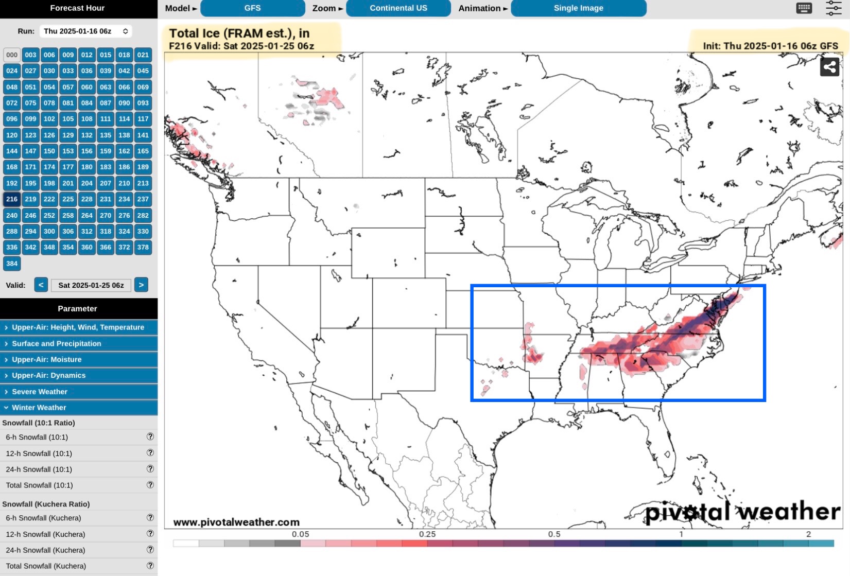
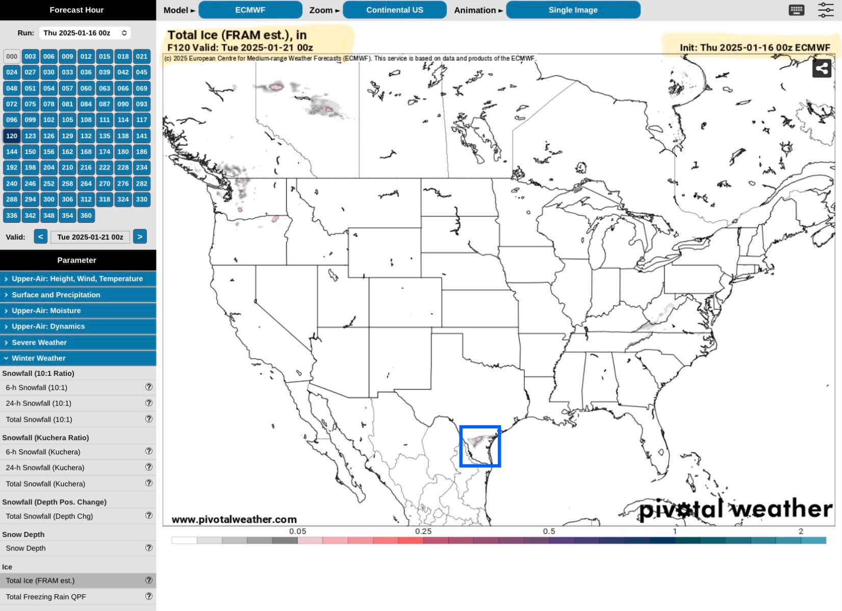
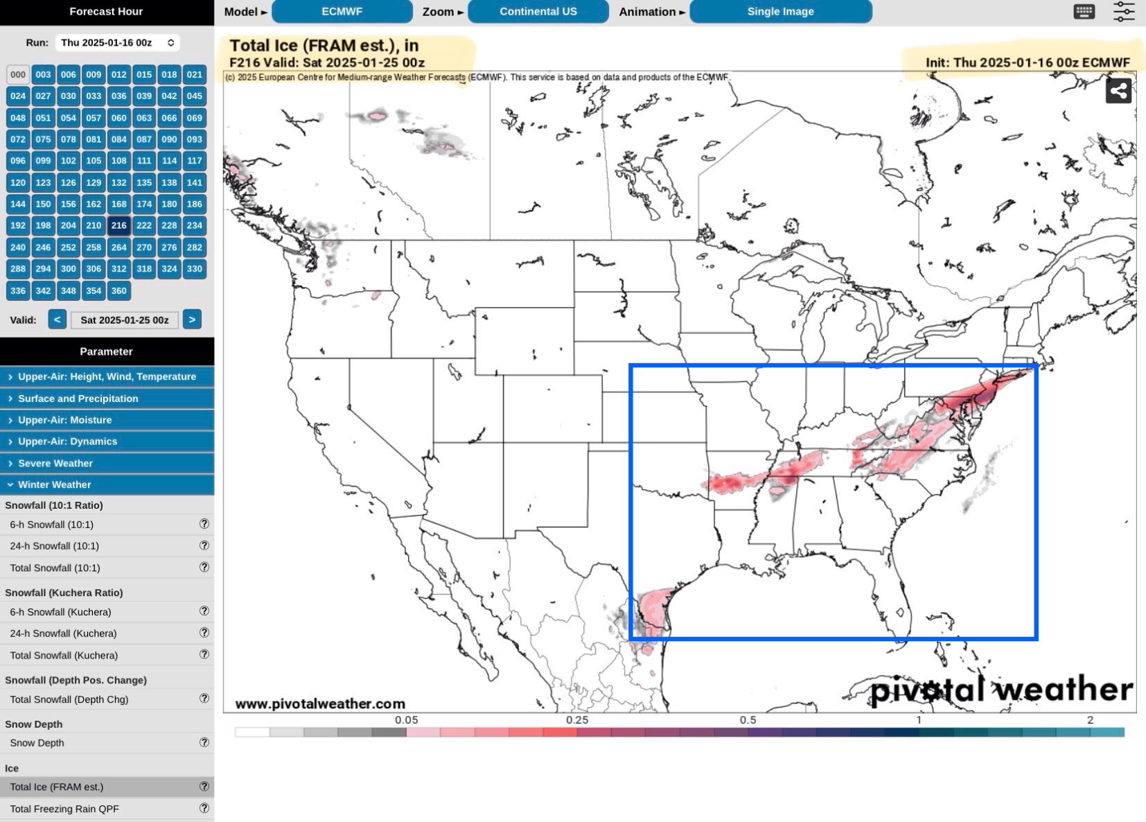
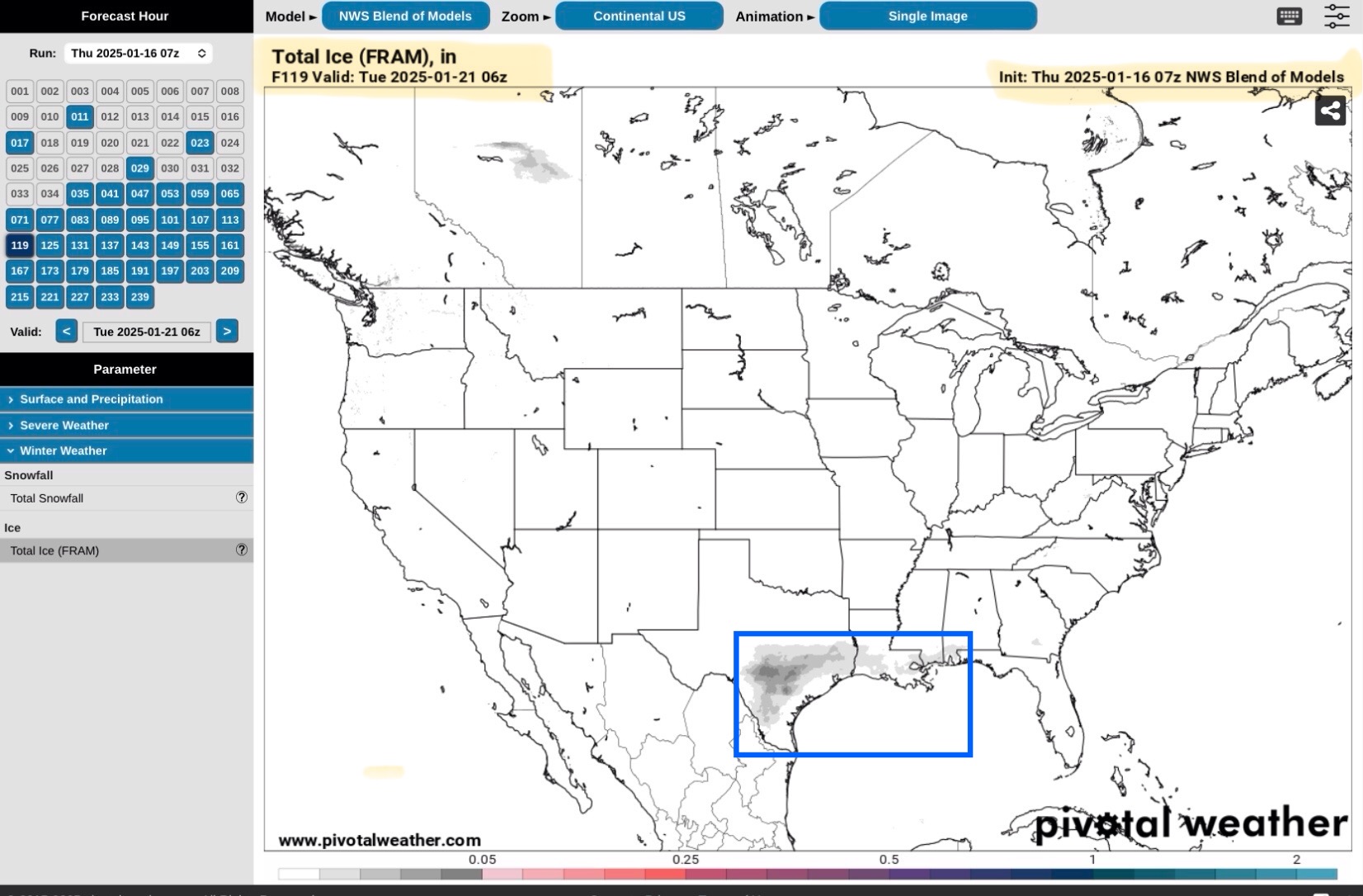
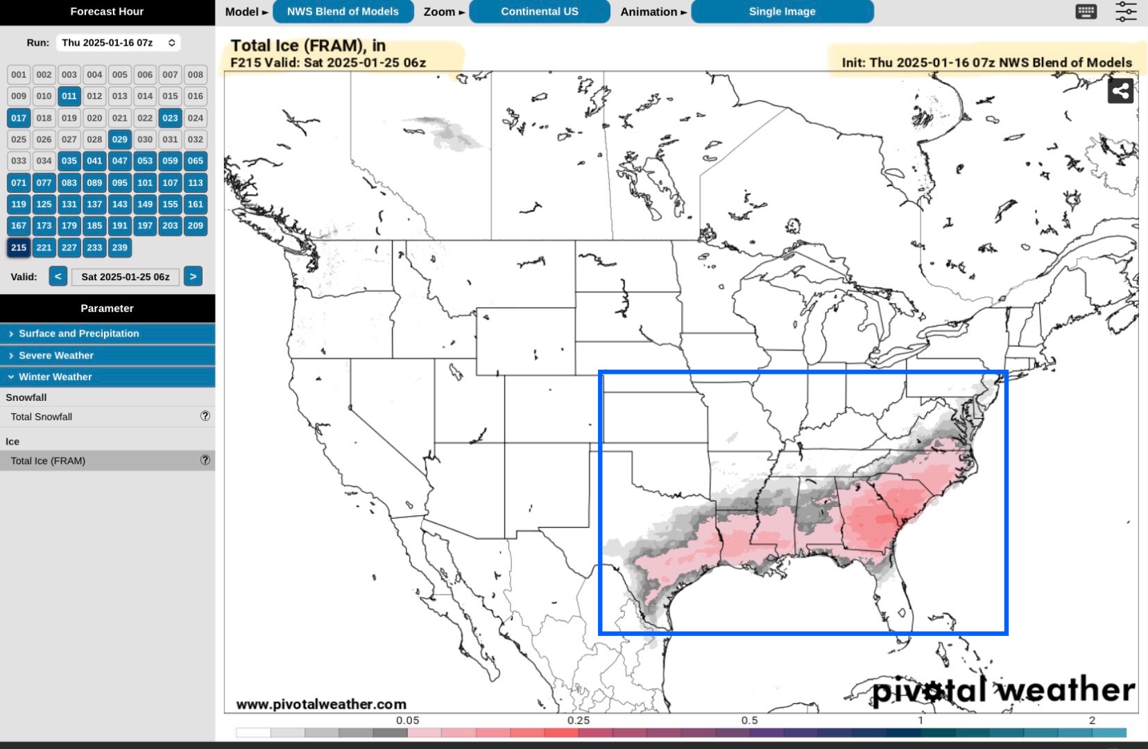
Three of the often used Long-Term Forecast Models (GFS, Euro or ECMWF, and NBM) are still in relative agreement on the possibility of a freezing rain and potential icing event beginning late Monday night or early Tuesday morning, January 20-21, and continuing through late Friday or early Saturday, January 24-25.

These Long-Term Model Forecast impact paths differ slightly, with both the GFS and Euro or ECMWF models shifting the potential footprint paths a bit further north in the South Central and Southeast Regions than that of the NWS National Blend of Models or NBM. Forecast Ice amounts are still quite varied, but in the 1/10” to up to 1/2” range. Confidence is increasing among the models and forecasters that potential exists for a freezing rain and icing event in parts of the South Central and Southeast Regions during the Tuesday to Friday time frame next week. Still 5 days out, so forecasts could change.

Sid Sperry

 Show/hide attachments