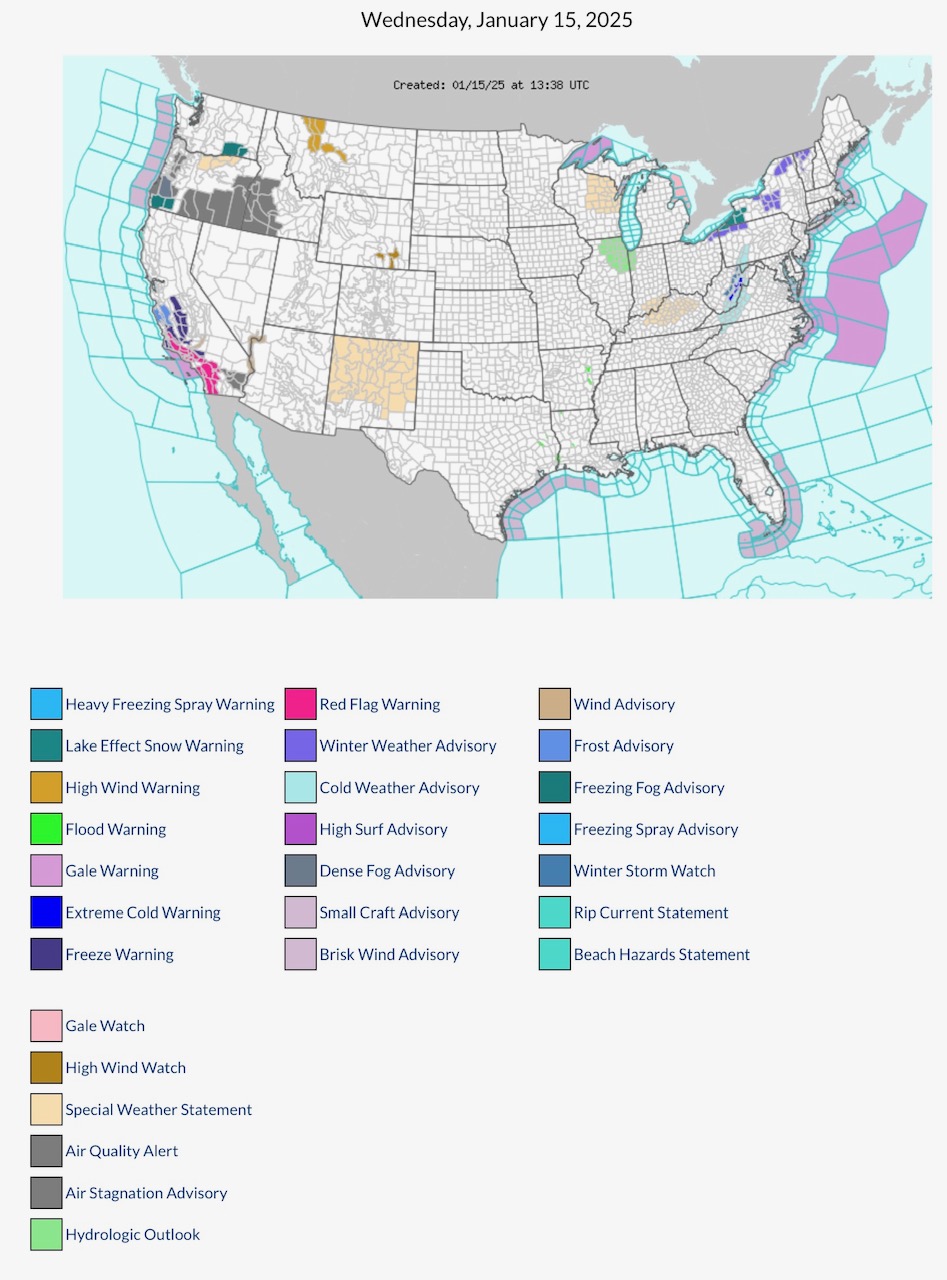
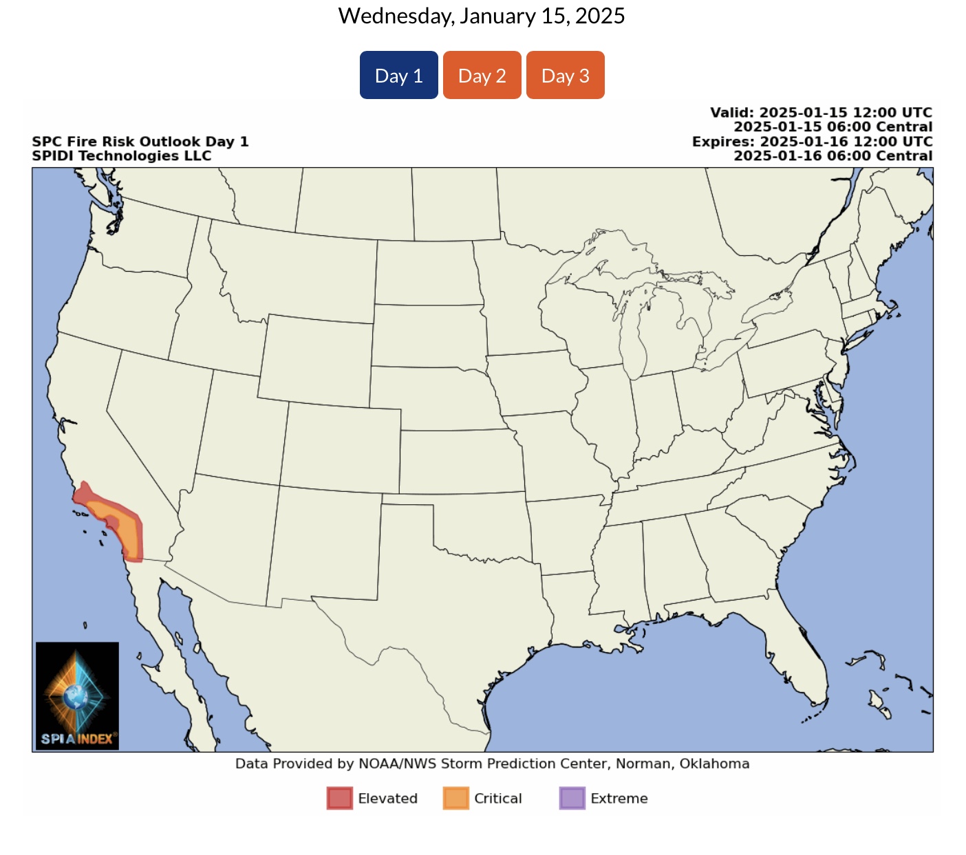
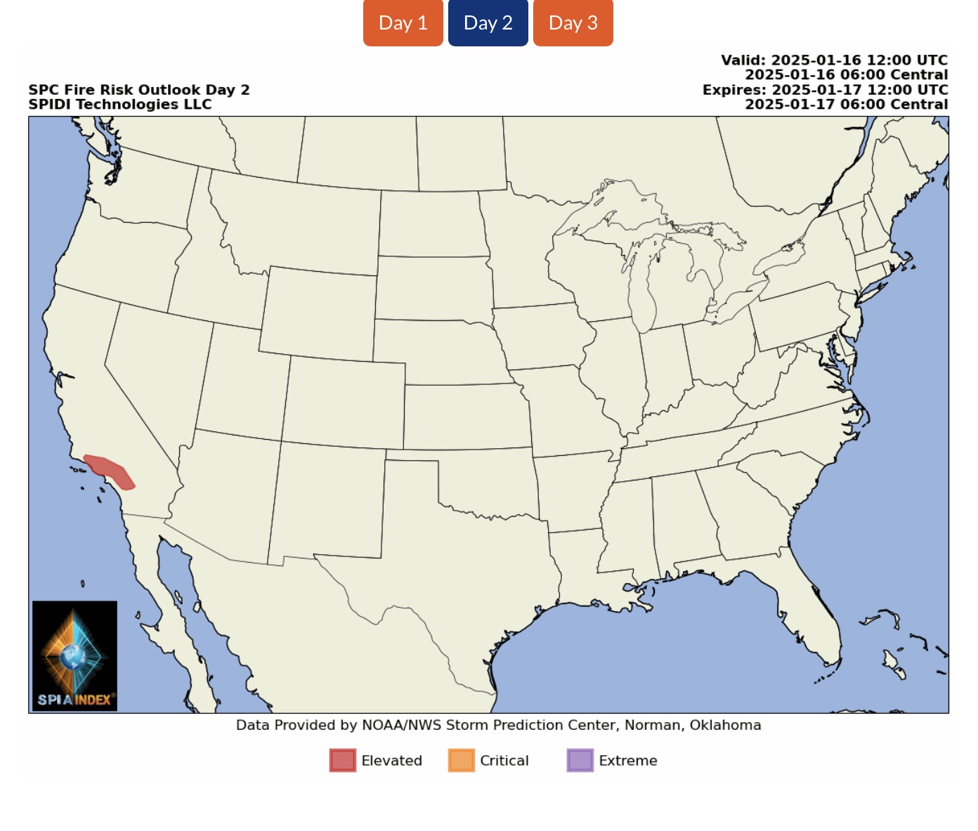
Latest NWS Watches, Warnings & Advisories. Note continuing Red Flag Warnings across parts southern CA. High Wind Warnings parts MT, WY & CA. Lake Effect Snow Warning parts PA & NY.
Sidney Sperry 15 Jan 2025 14:17 UTC
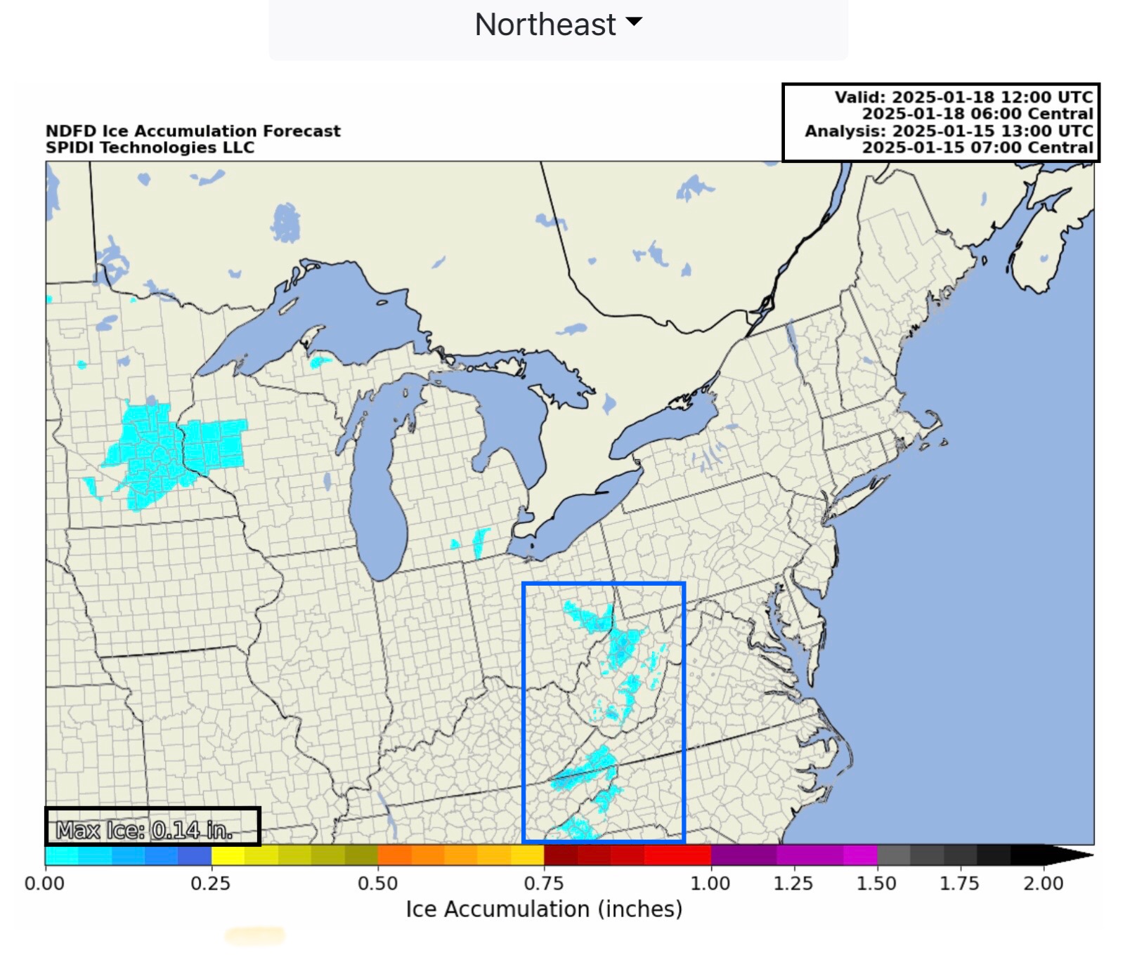
Note ice accumulation forecast for Saturday in parts of OH, WV, VA, TN & NC. It’s only 0.14” at most, and will likely NOT cause any significant impacts to electric or communications infrastructure; however, this NWS forecast agrees with what Long Term forecast models have been predicting for a few days now.
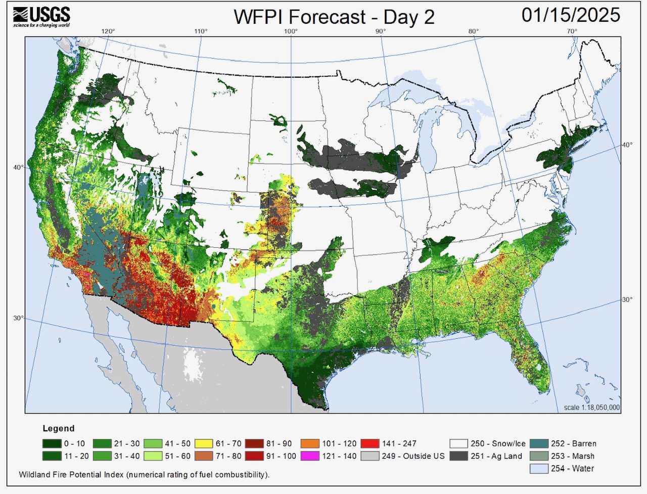
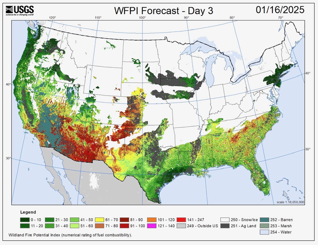
Also note the extremely high USGS Wildland Fire Potential Index levels in parts CA, NV, AZ, NM and now eastern CO and northern/western TX. Lack of any significant rainfall or precipitation in any form is increasing the Wildfire Risk in these areas.
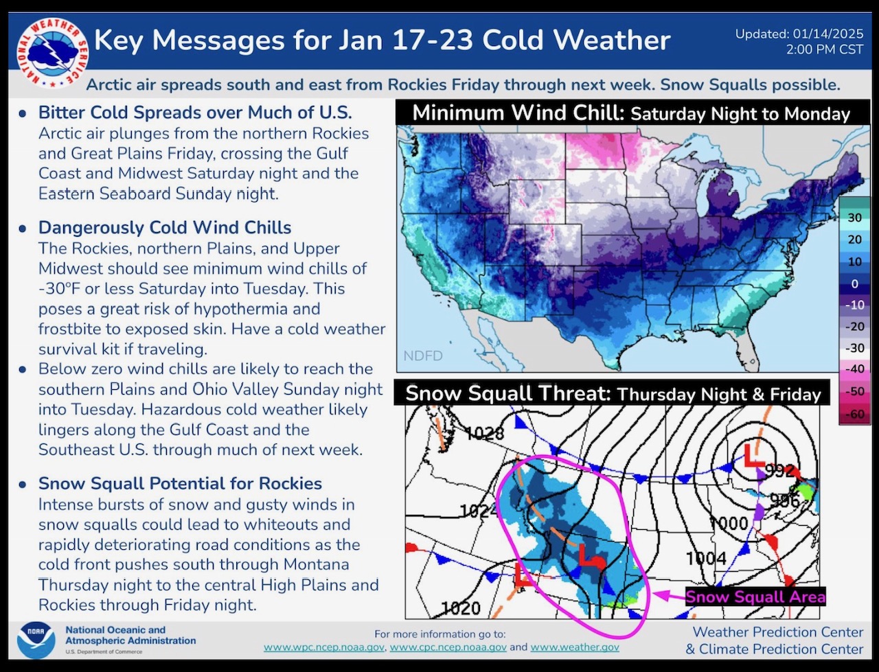
Extremely COLD Temperatures and Wind Chills on the horizon from January 17 thru 23.
Will send latest Long Term Model outlooks later today. - Sid Sperry
Sid Sperry

Sent from my iPad

 Show/hide attachments