Ice and Snow in the NWS Forecasts beginning late Wednesday night in west TX, then continuing into TX, OK, AR, LA & MS on Thursday and Friday, January 9 & 10.
Sidney Sperry 07 Jan 2025 01:01 UTC
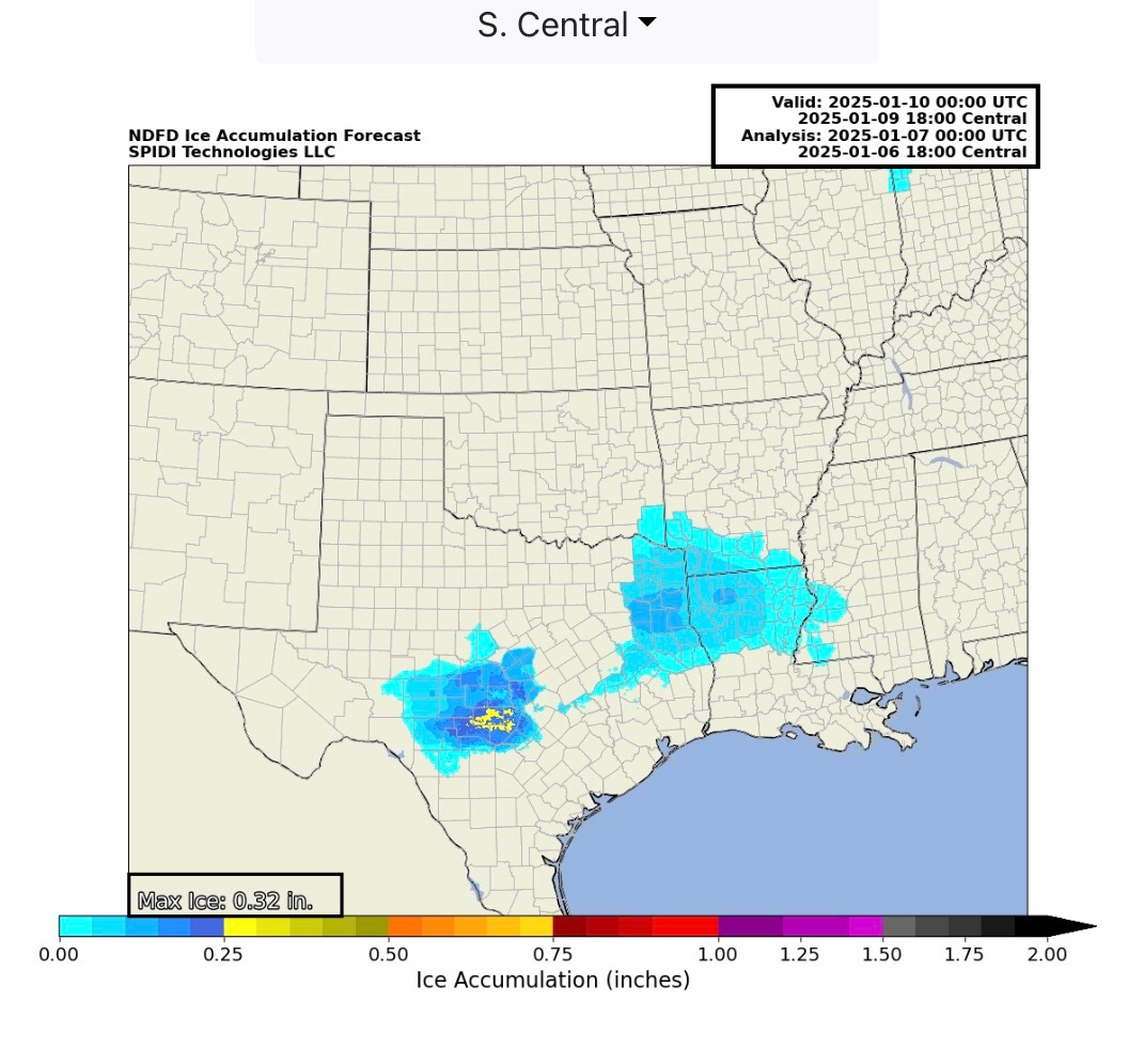
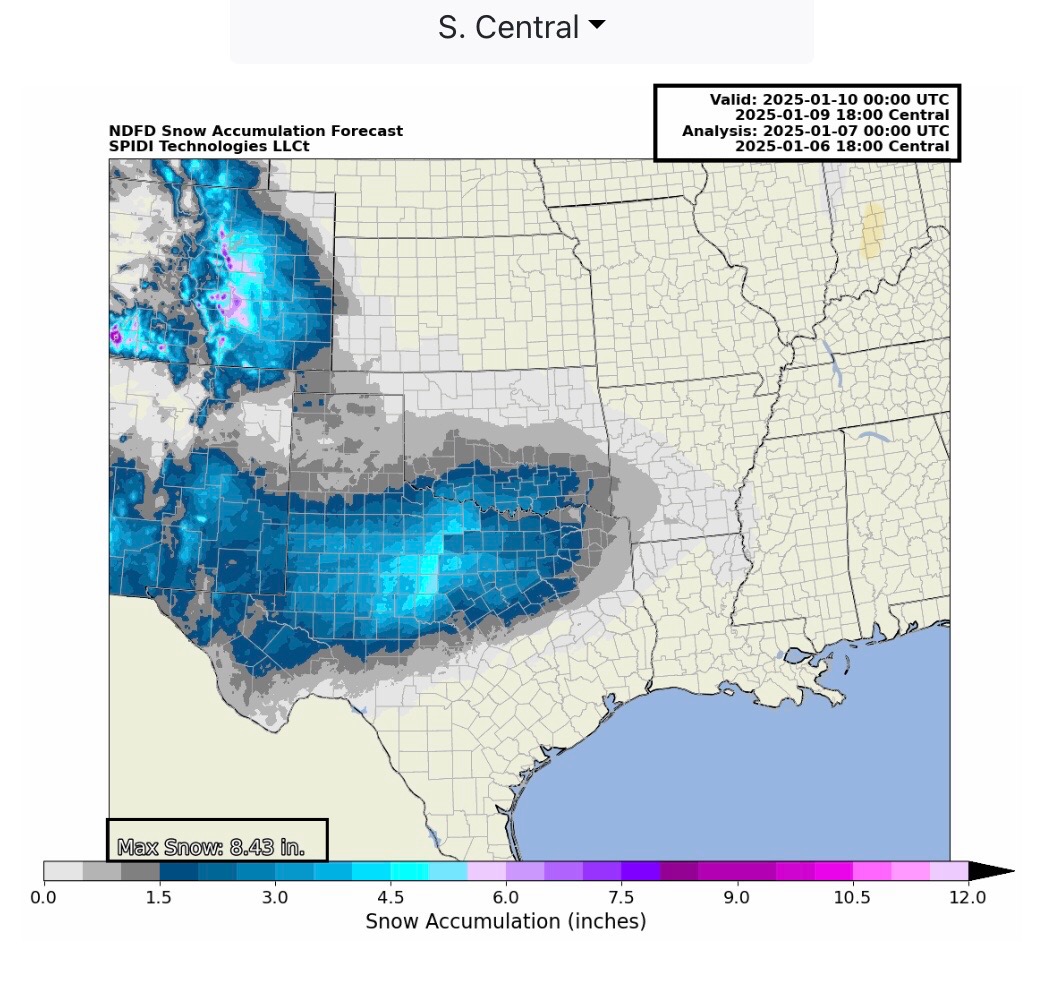
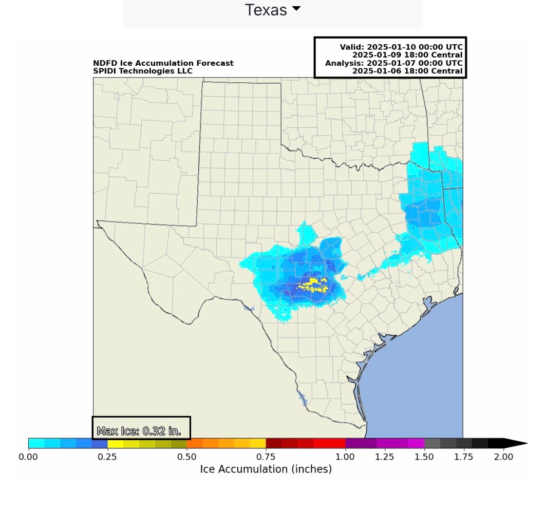
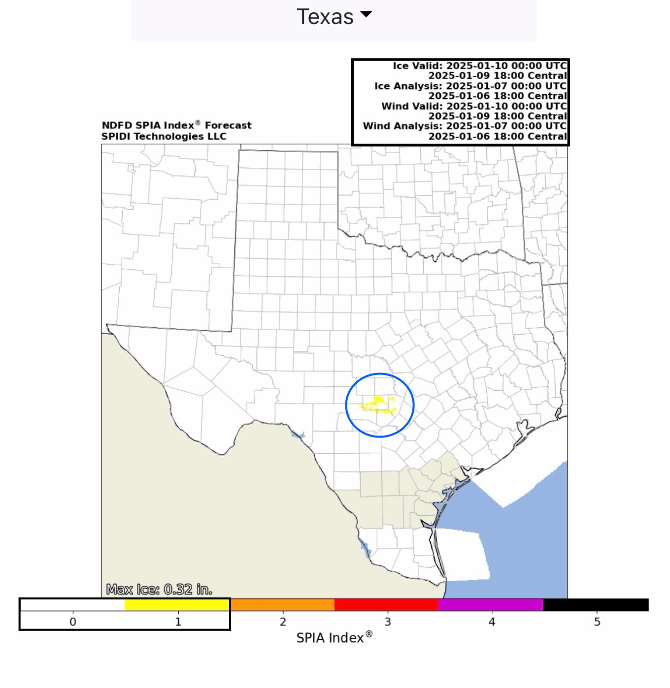
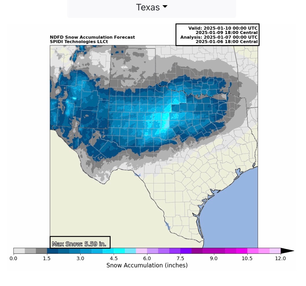
Max ICE in the NWS Forecast Grids is currently at 0.32” in parts south-central Texas. The current SPIA Index Ice Impact Forecast for Electric and Communications Utilities is at Level 1 in parts south-central Texas. Up to 8.5” of SNOW is being forecast for parts of southern CO, and up to 5.5” of SNOW is currently being forecast for parts of central and north-central TX. Up to 3+” of SNOW is possible across parts of southern OK.
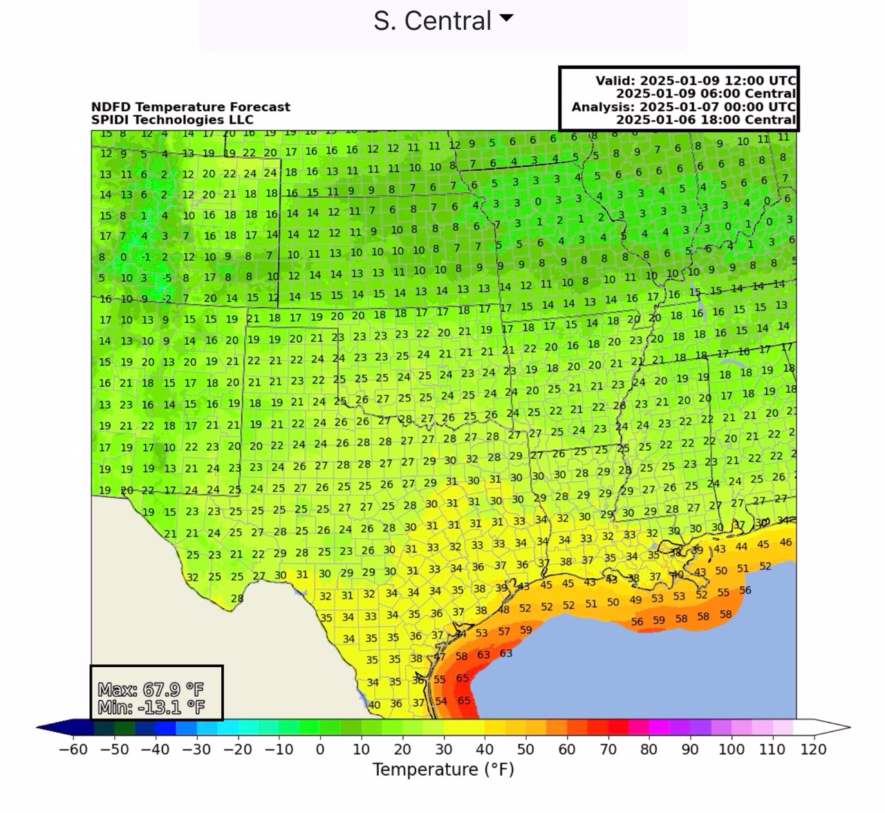
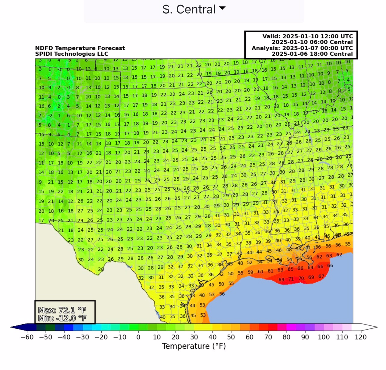
(NOTE: This is the “front end” of the NWS 72-hour forecast; more data will become available later tonight and tomorrow morning for a more definitive footprint path for both ice and snow across parts of the South Central and Southeast Regions on Thursday through Sunday. Morning Low Temperatures will be in the Teens and Low Twenties.
Sid Sperry

 Show/hide attachments