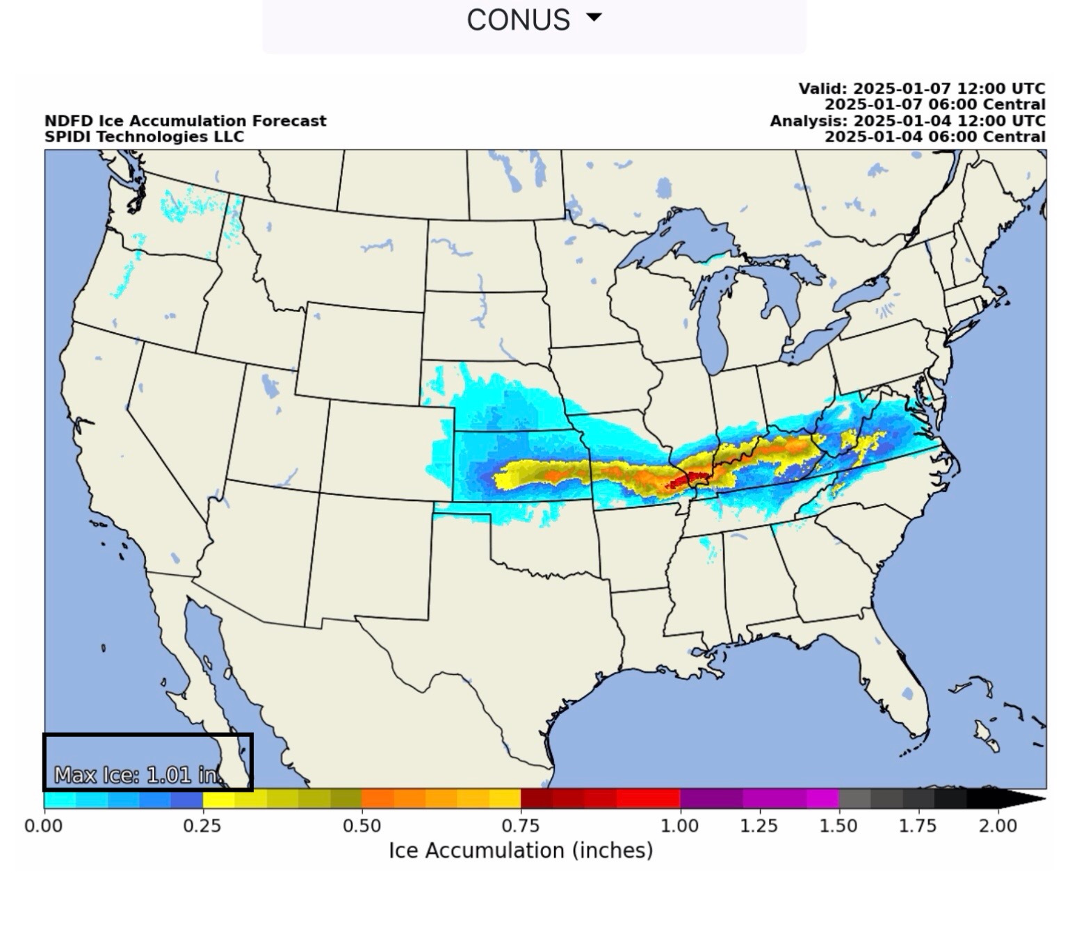
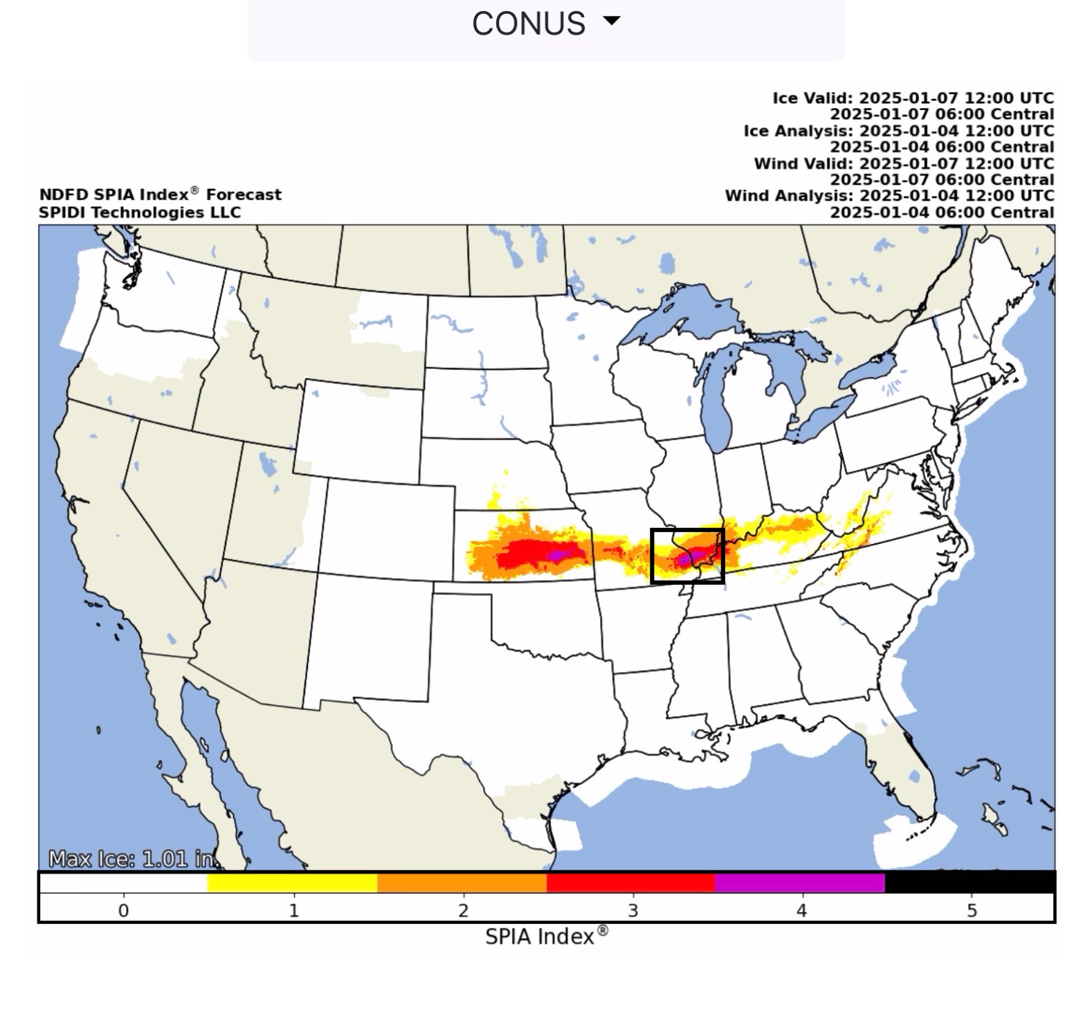
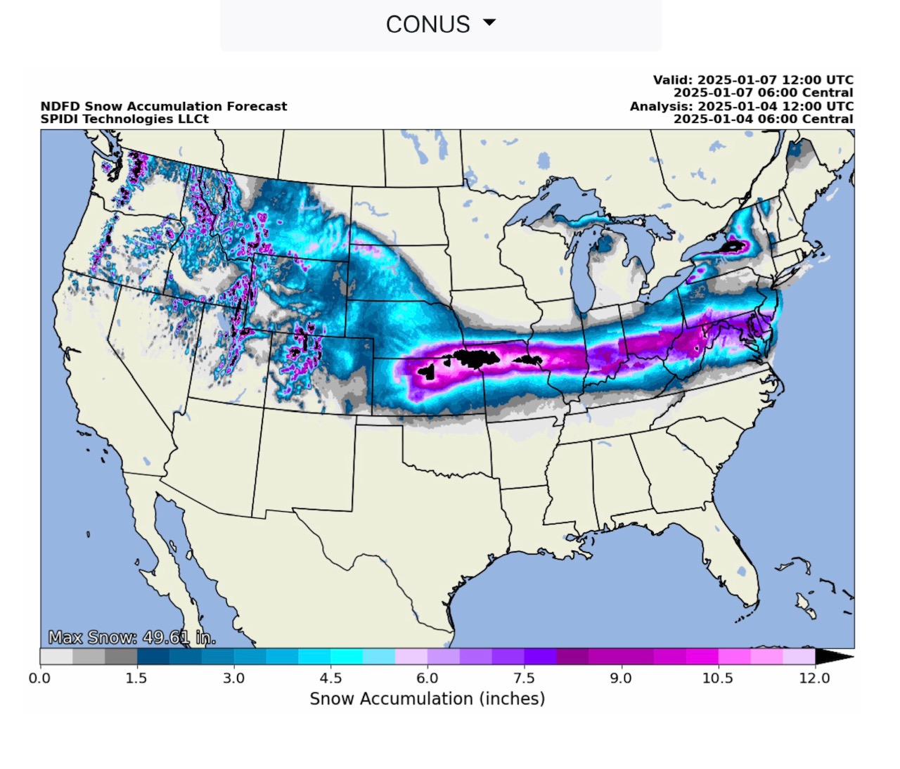
National and Regional Views for Total Ice Accumulation Forecasts from NWS, the SPIA Index Ice Impact Forecasts, and NWS Forecasts for Total Snow & Sleet, from 6am CT this morning thru 6am Tuesday, January 7.
Sidney Sperry 04 Jan 2025 13:22 UTC
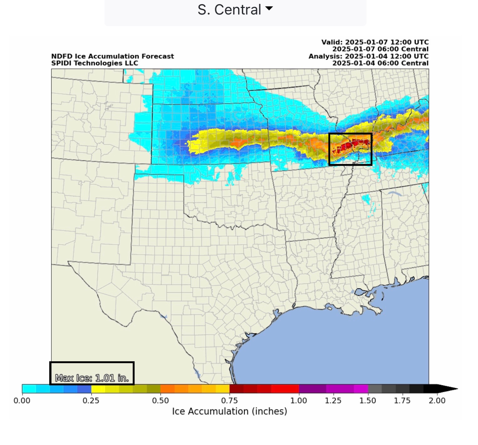
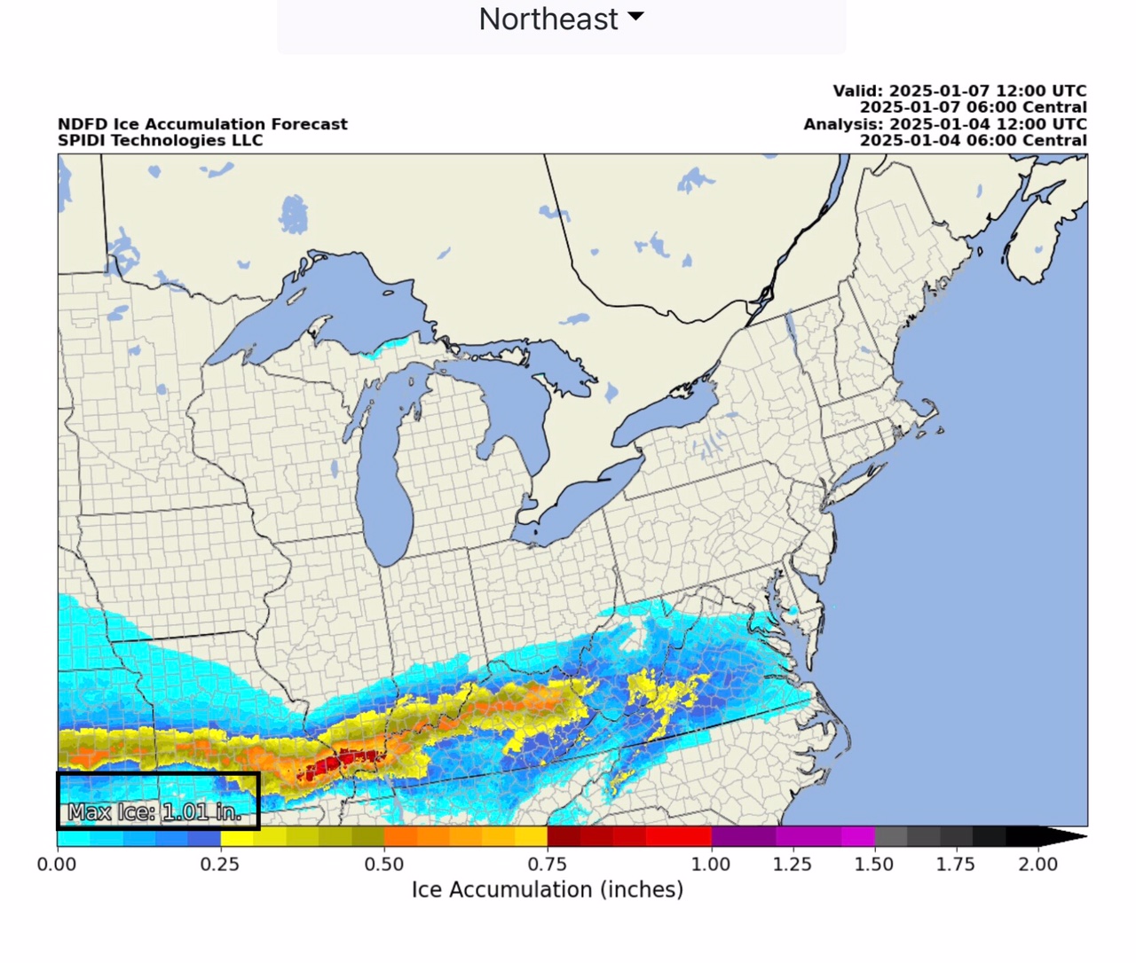
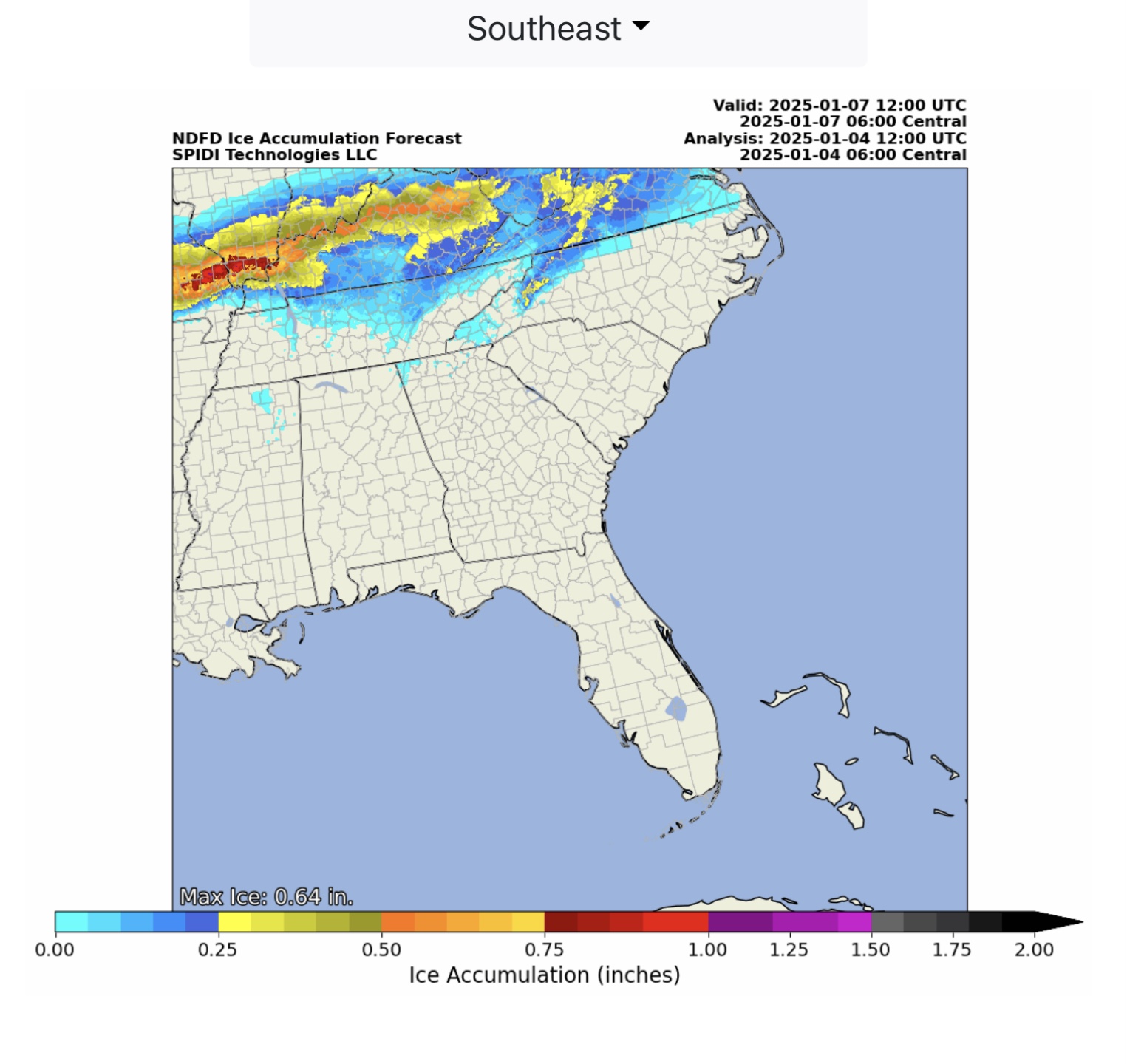
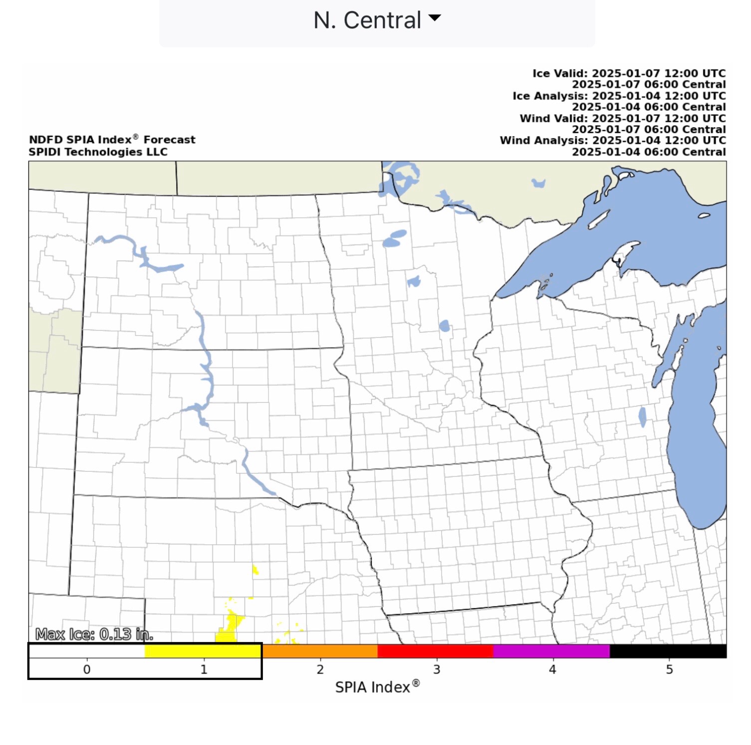
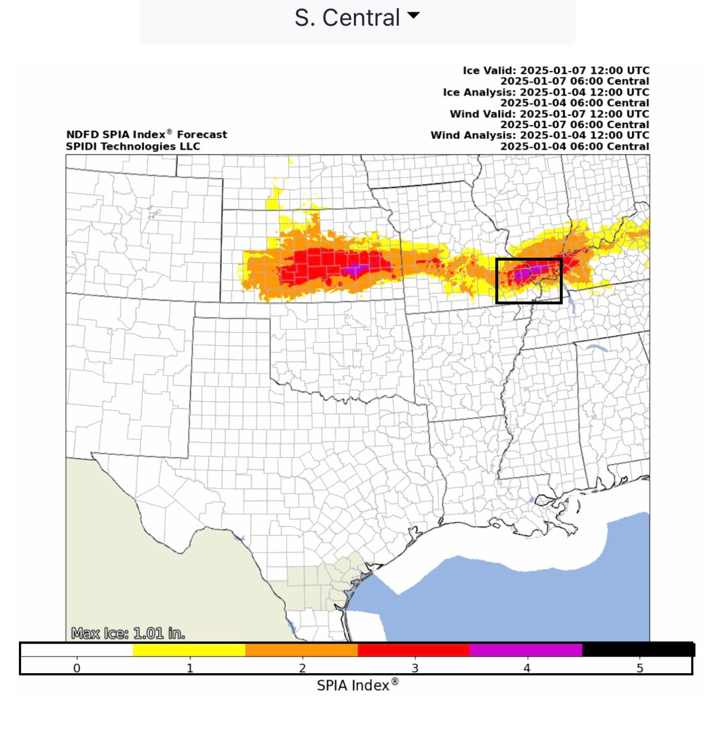
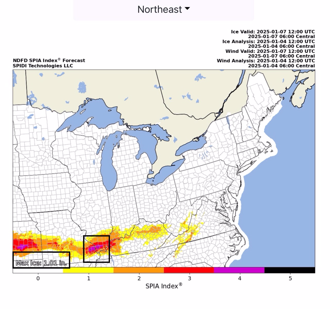
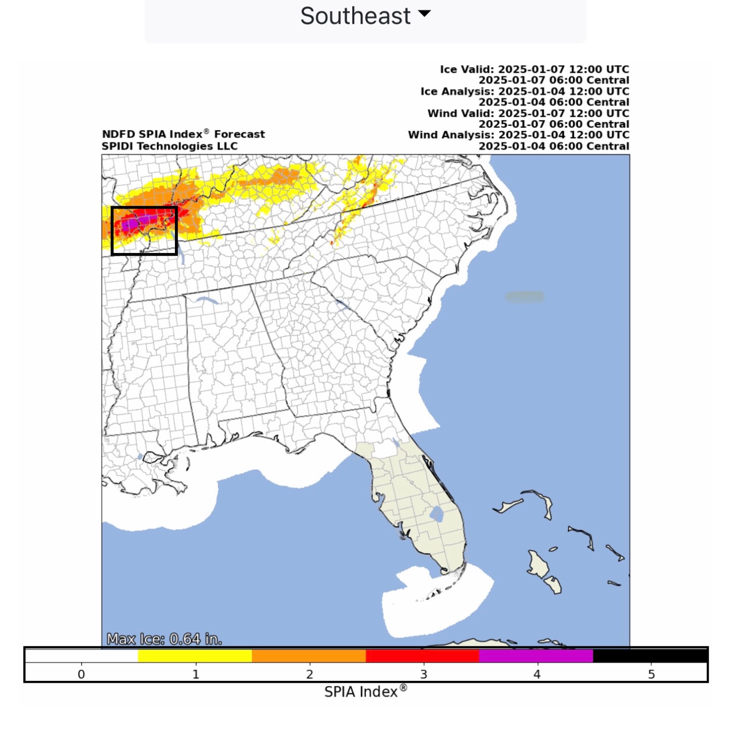
Max Ice in NWS forecast grids is now at 1.01” in parts southeastern MO and southern IL. The current SPIA Index is at Levels 1 thru 4 in KS, and at Levels 1 thru 5 in parts MO & IL.
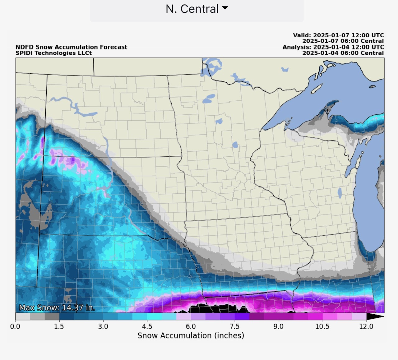
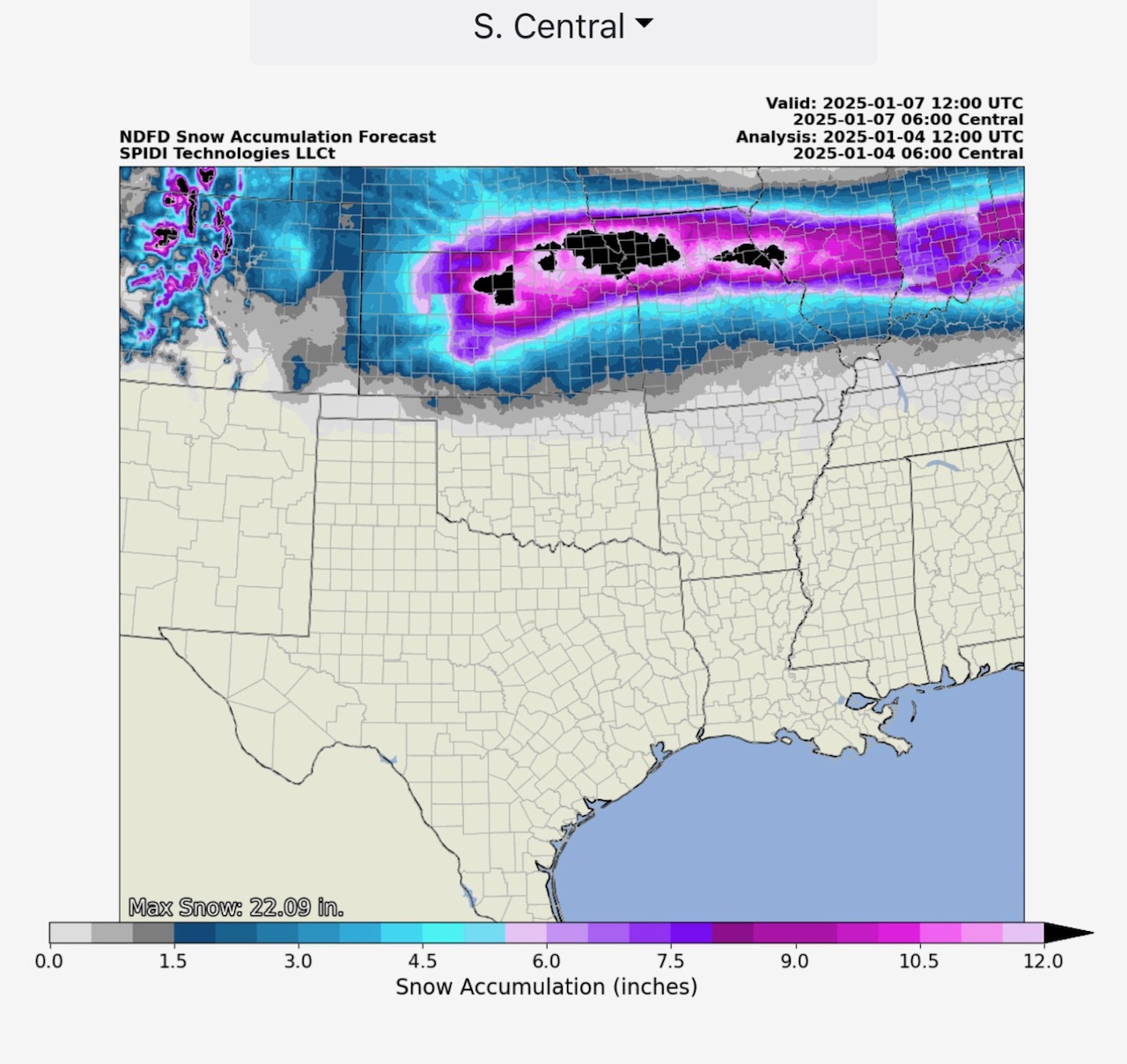
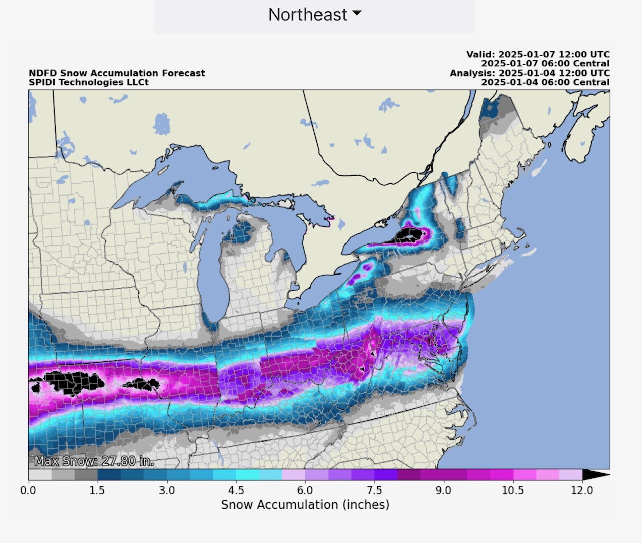
Snow & Sleet Totals over the next 72-hours range from 6” to 16” in parts of the North Central, South Central and Northeast Regions.
I will be sending individual state forecasts graphics out to each potentially impacted state in a few minutes. Freezing rain has already begun in parts of NE & KS. There are small areas of Level 5 SPIA Index forecast now in parts of southeastern MO and southern IL. Level 4 impacts forecast in parts of KS, MO & IL.
Sid Sperry

 Show/hide attachments