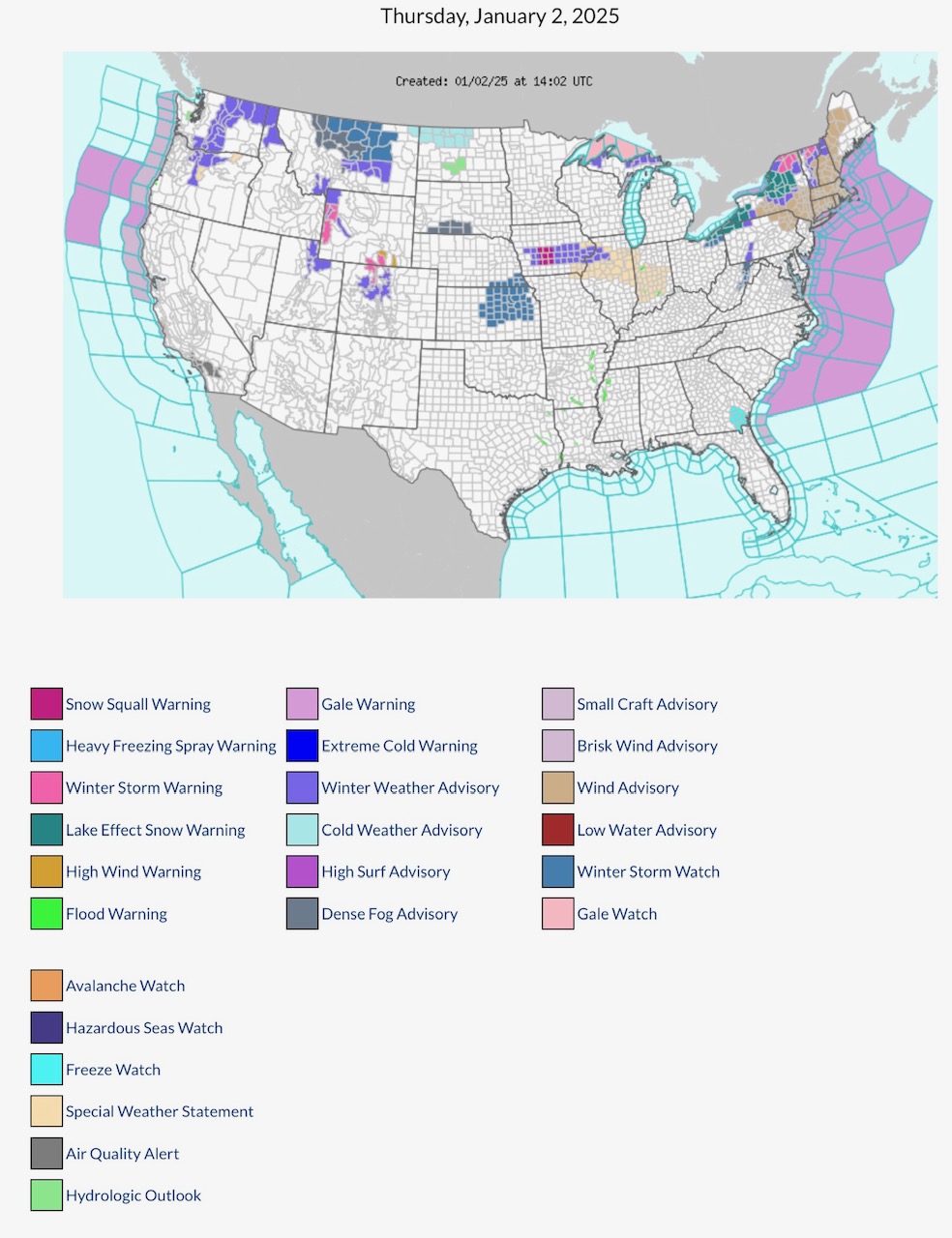
Latest NWS Watches, Warnings & Advisories for Thursday, 1/2/2025. Note SNOW SQUALL WARNING parts IA. Winter Storm Warnings parts WY, CO, NY & VT. Lake Effect Snow Warning parts OH, PA & NY. Cold weather Advisory parts MT & ND; Extreme Cold Warning parts MI Upper Peninsula. High Wind Warnings parts CO.
Sidney Sperry 02 Jan 2025 14:47 UTC
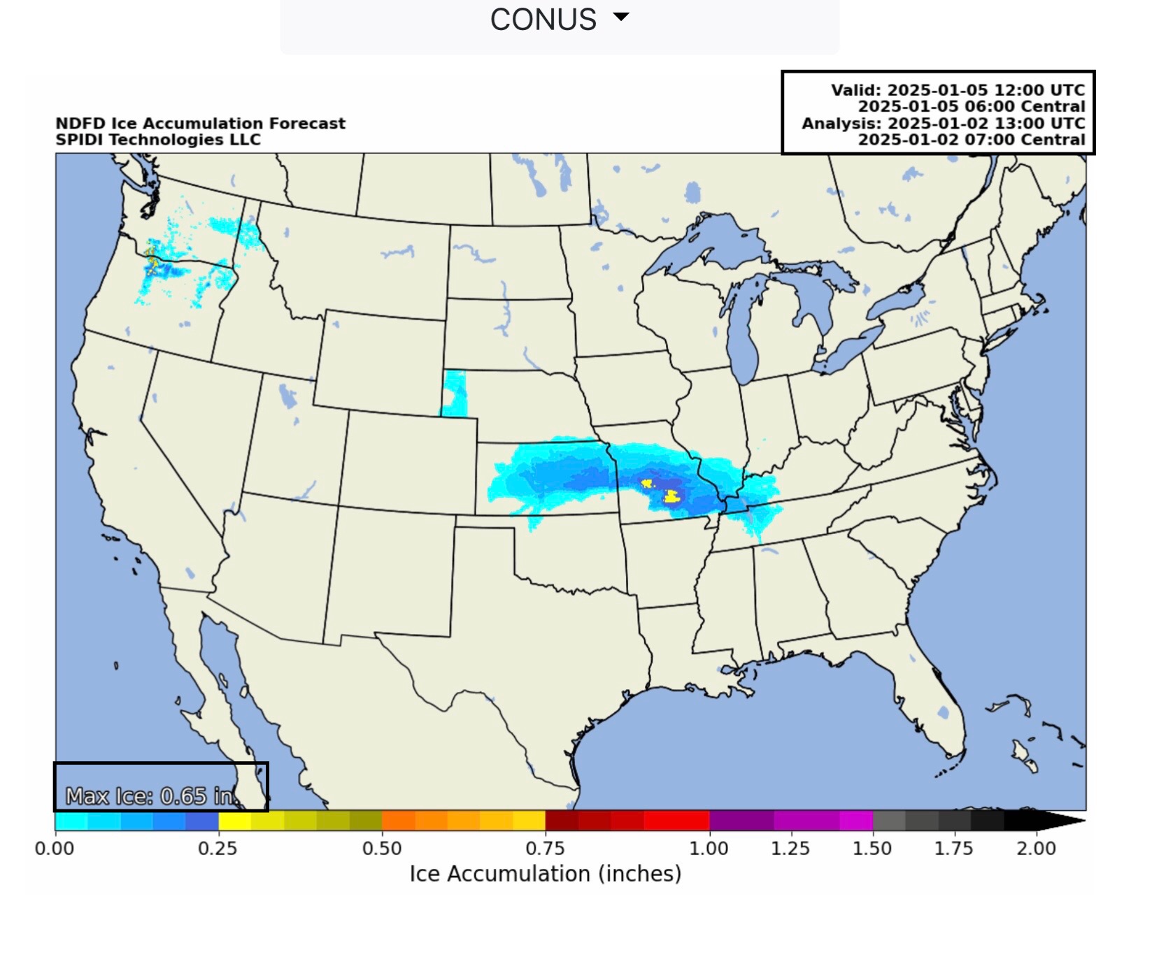
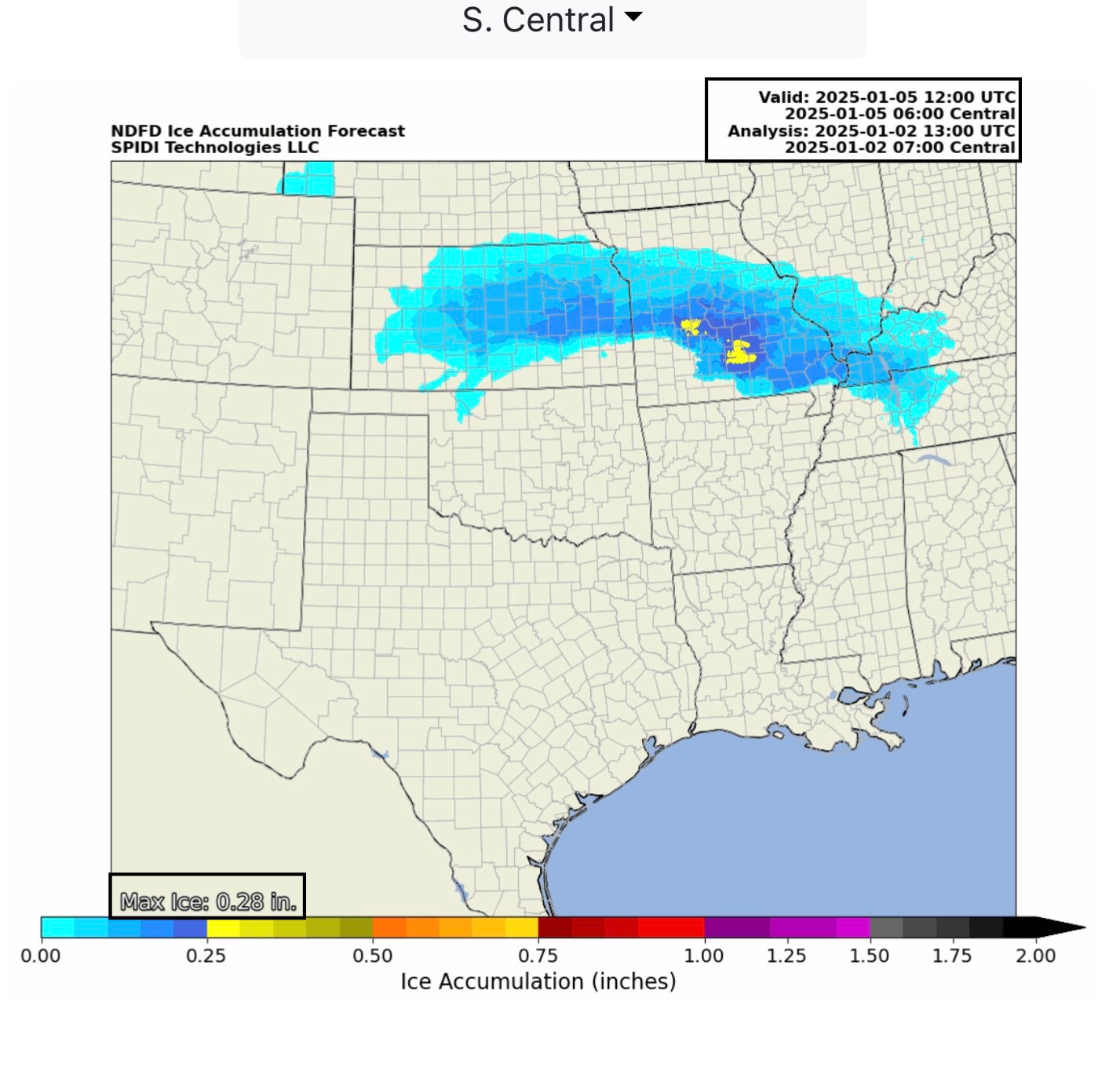
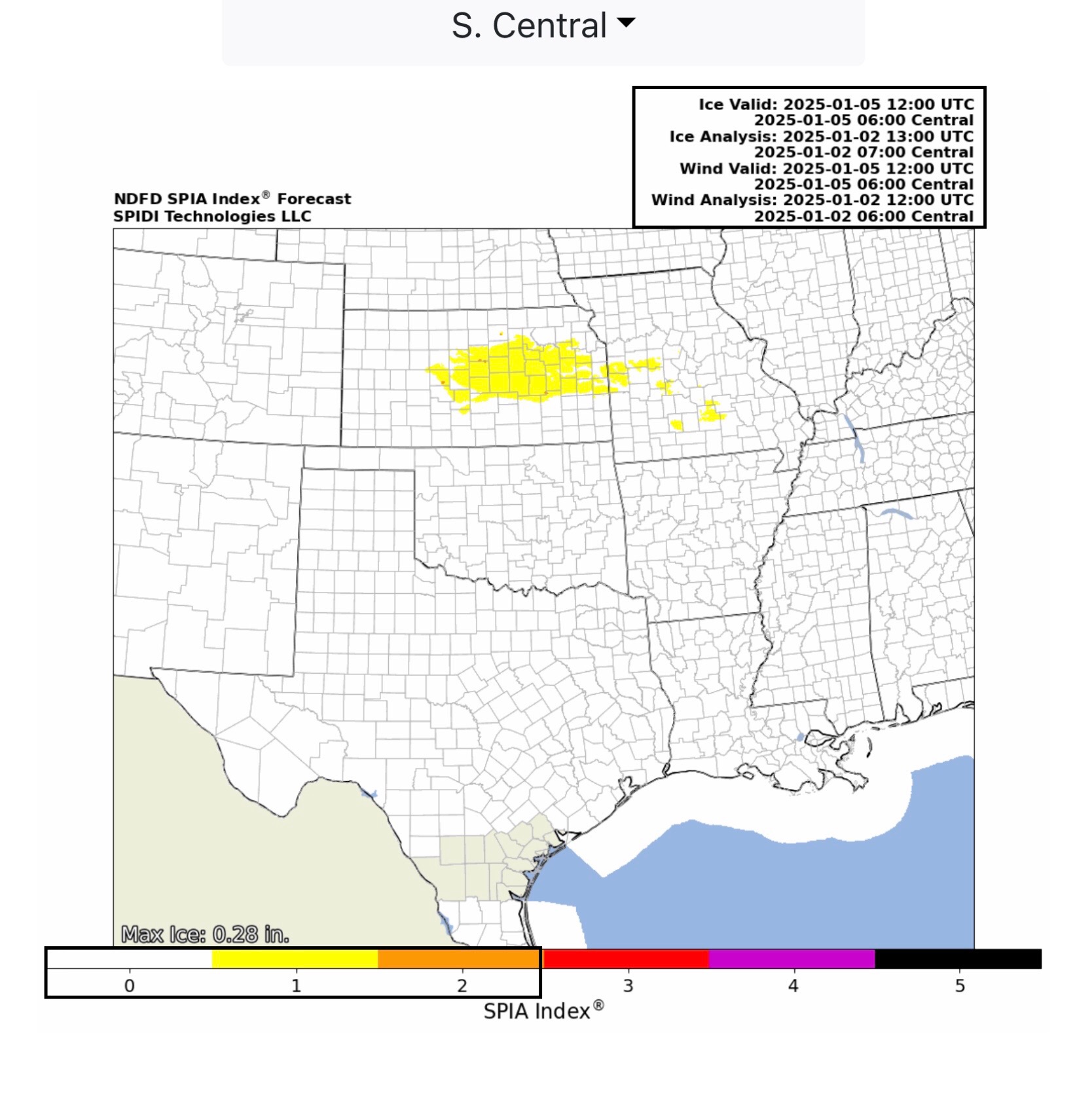
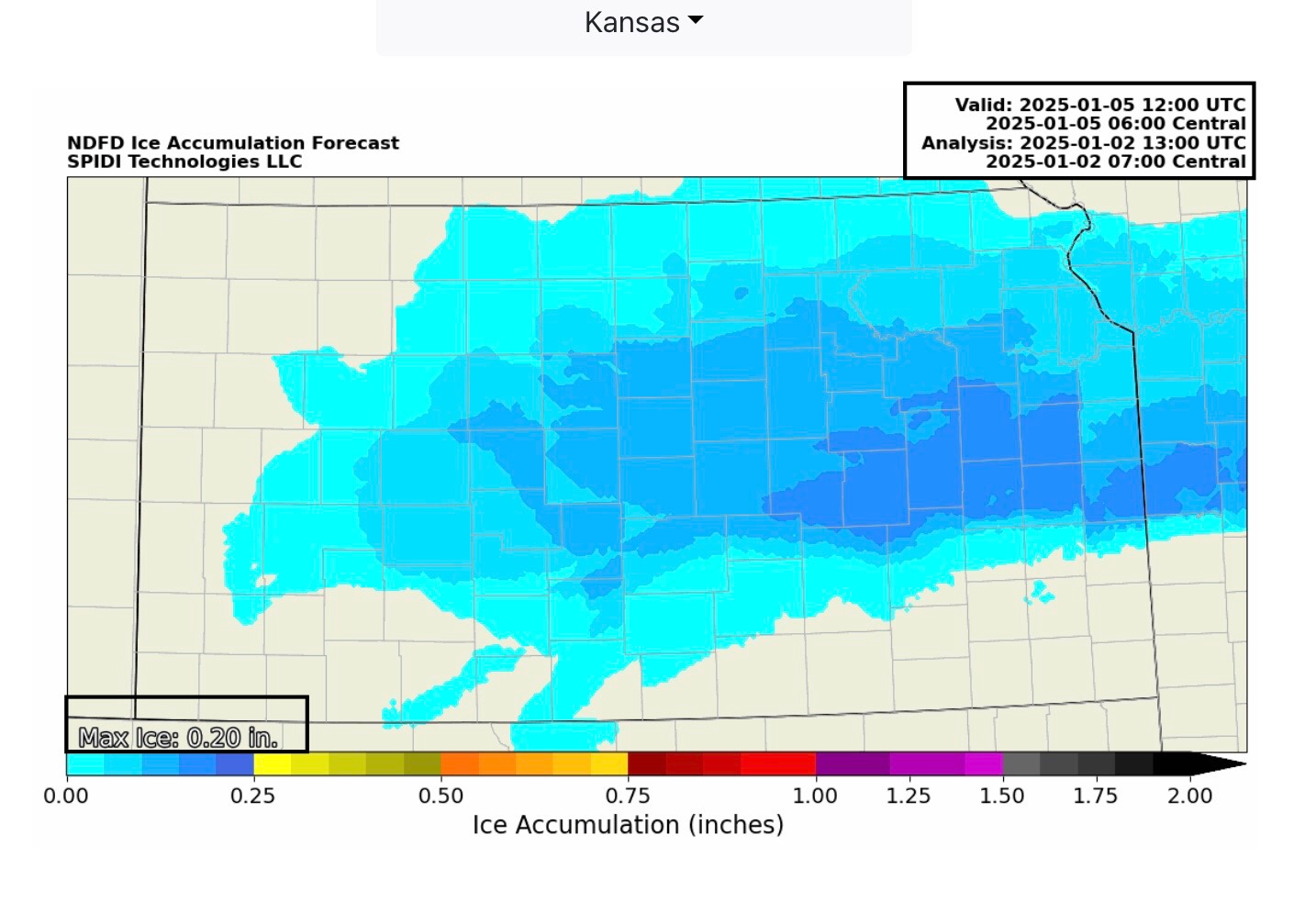
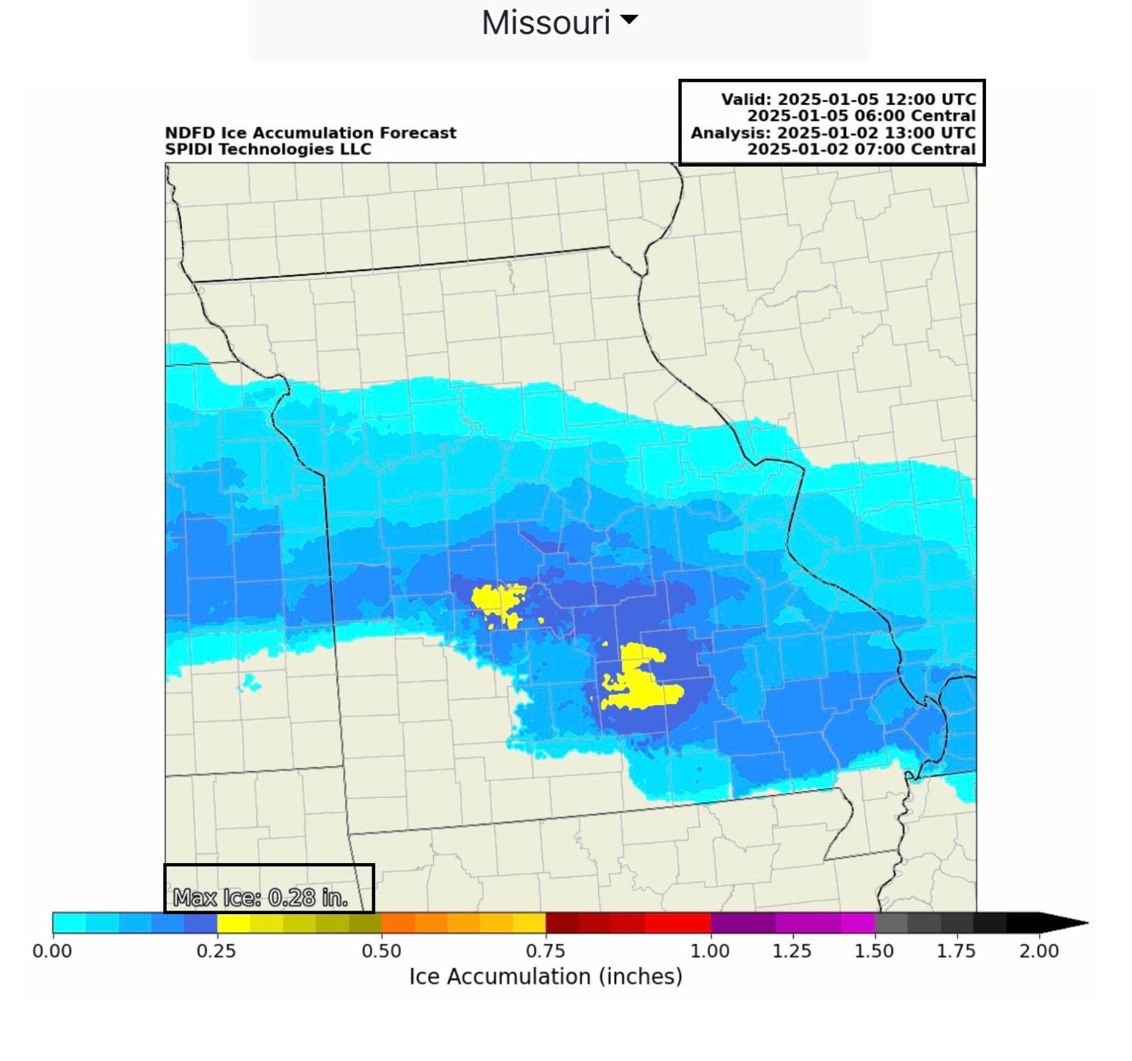
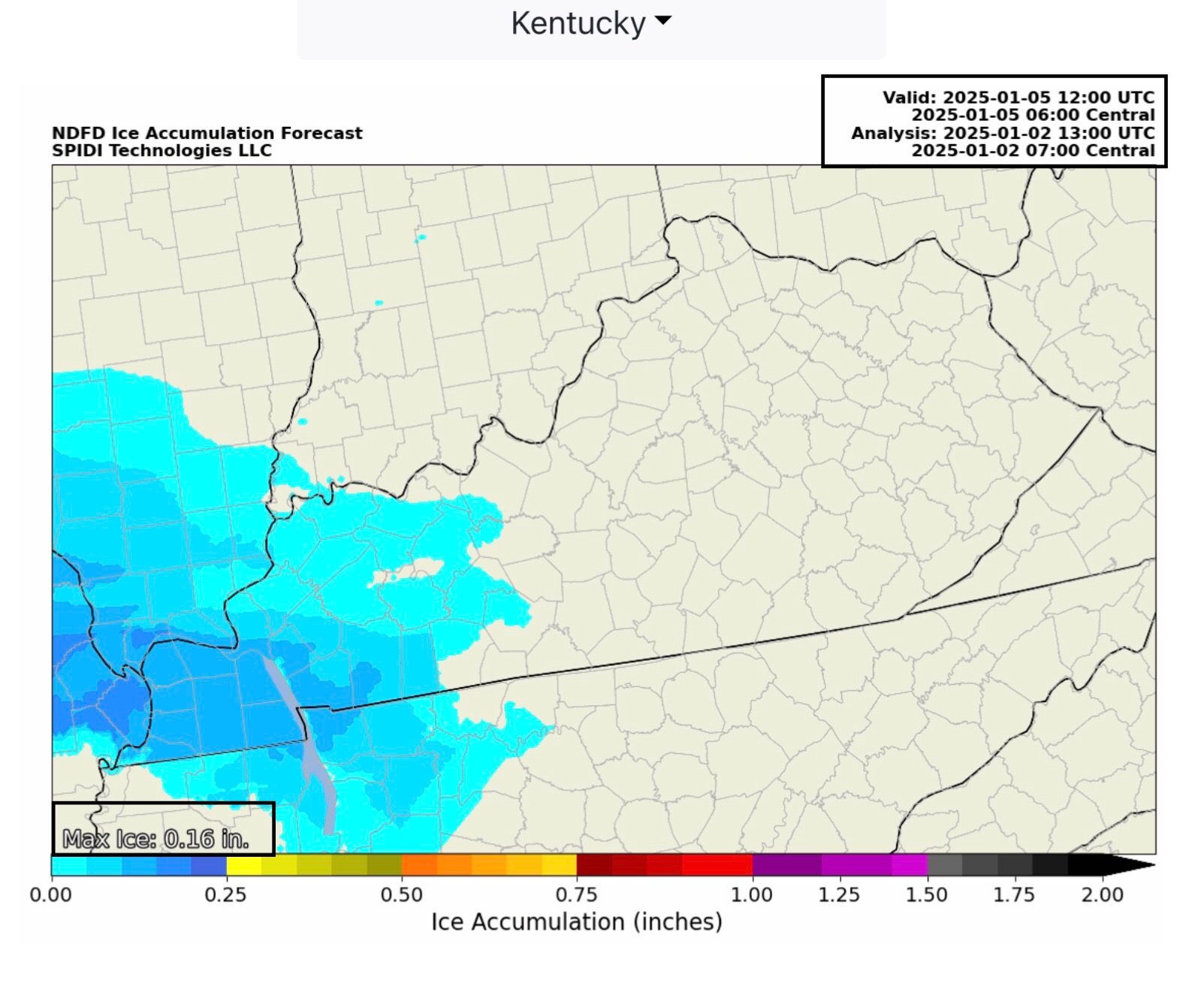
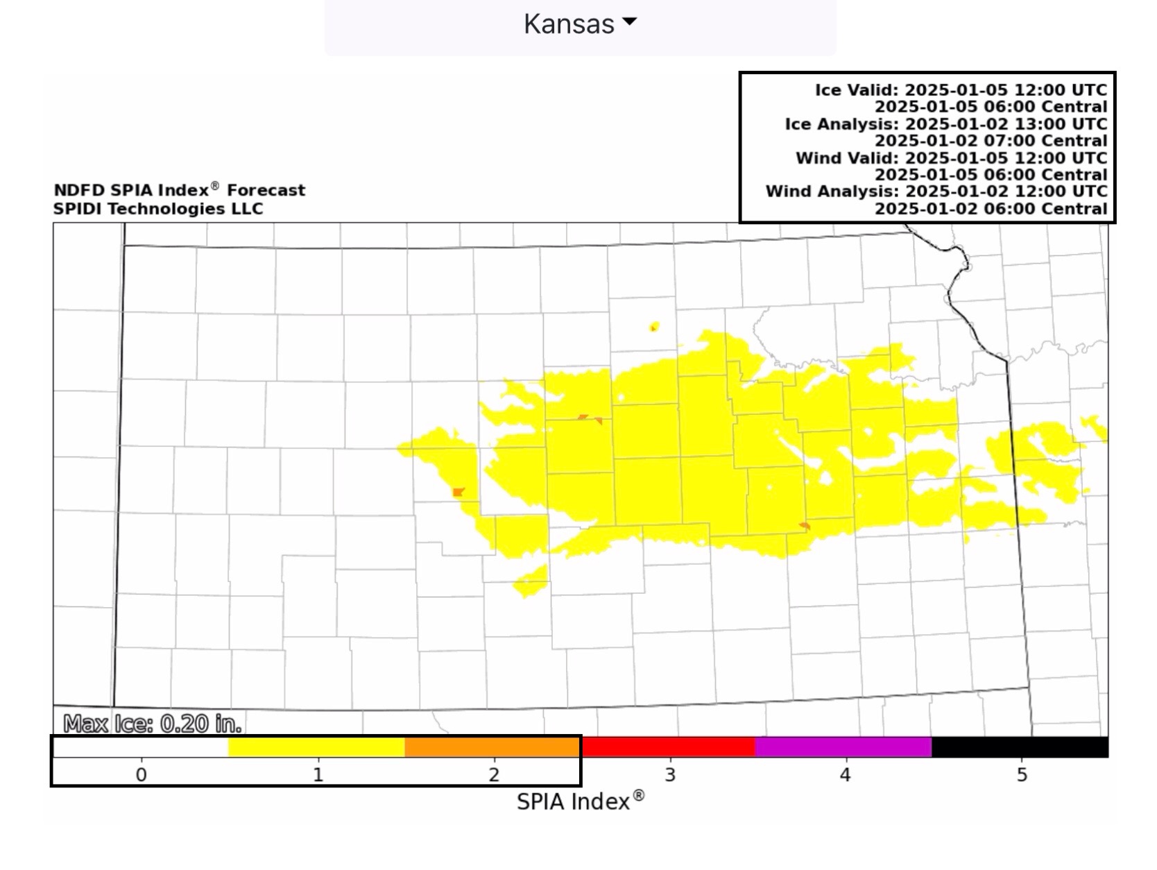
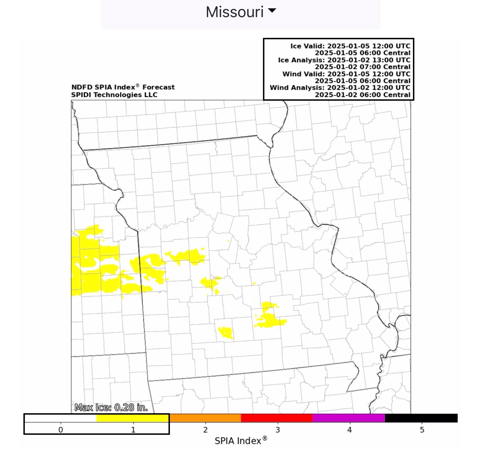
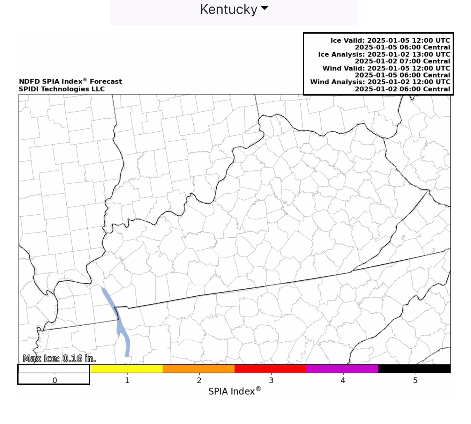
NWS Total Ice Forecasts through 6am on January 5th are now at 0.20” in KS, 0.28” in parts of MO, and 0.16” in parts of IL, KY & TN. The current SPIA Index Ice Impact Forecast for parts of KS is at Levels 1 & 2 (due to winds in some areas) and at Level 1 in MO (less wind initially, but this impact Level will likely increase with frontal passage on Sunday). The SPIA Index is at Level 0 in IL, KY & TN currently, but will also likely increase as stronger winds will occur with frontal passage. Remember, this system is moving east-southeast, and we are just seeing the “front end” of the forecast ice accretion.
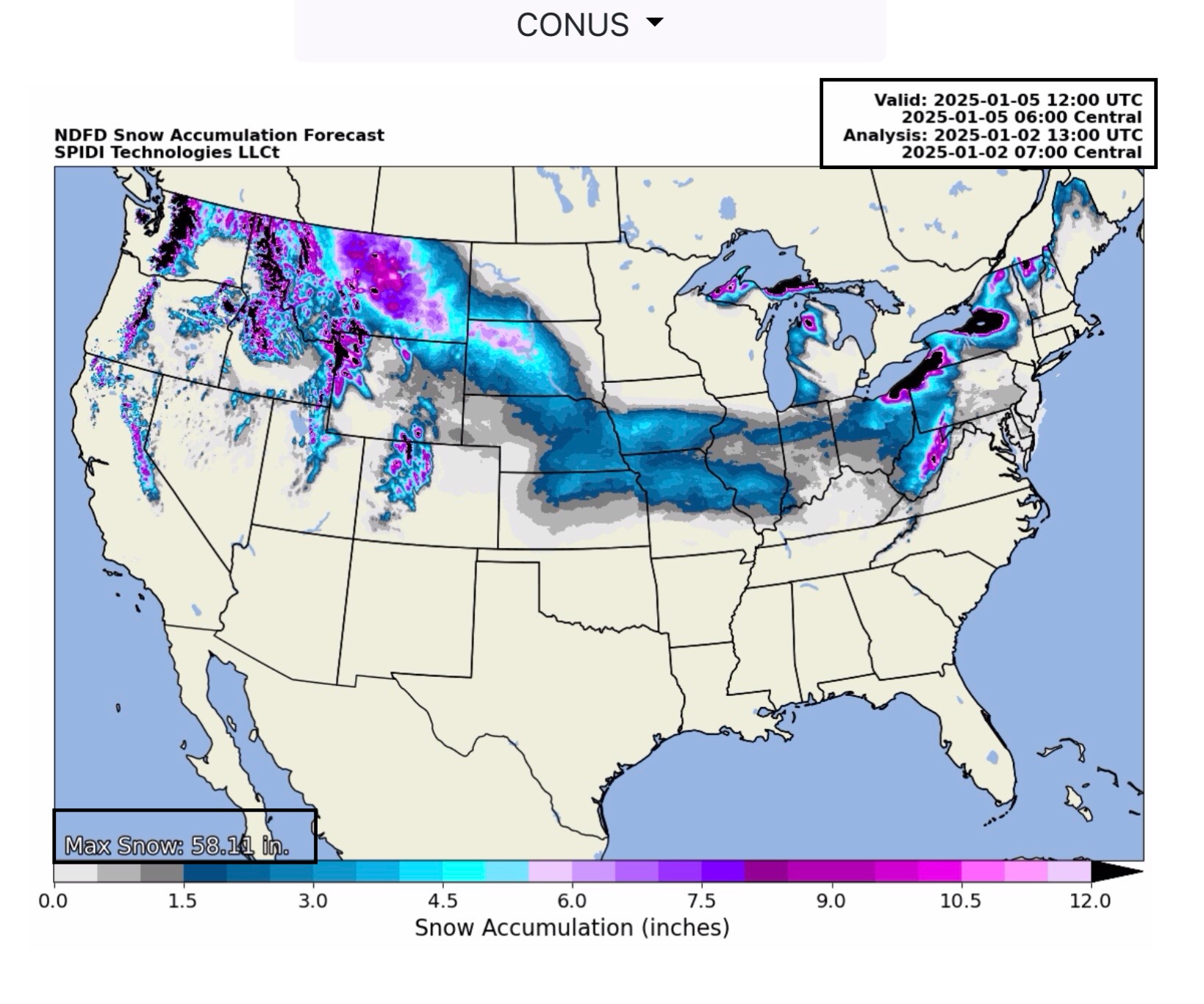
Snow from 1” to 4”+ likely in parts NE, KS, IA, MO, IL, IN & OH. Up to 8” in parts of SD. (Also just seeing the front end of the Snow Forecast; these amounts are likely to increase when subsequent forecast data is upgraded later today.)
Sid Sperry

 Show/hide attachments