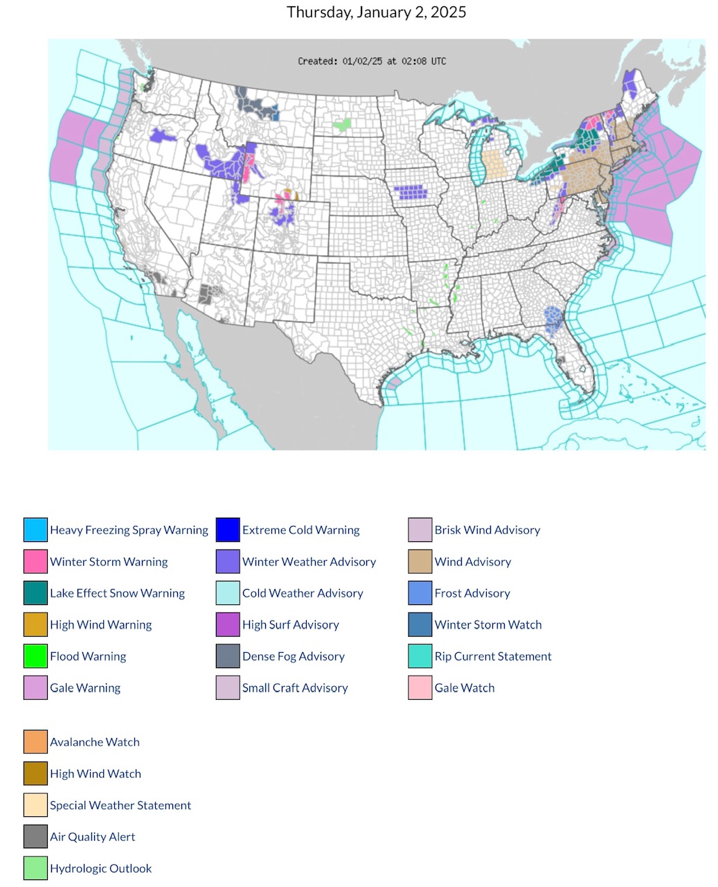
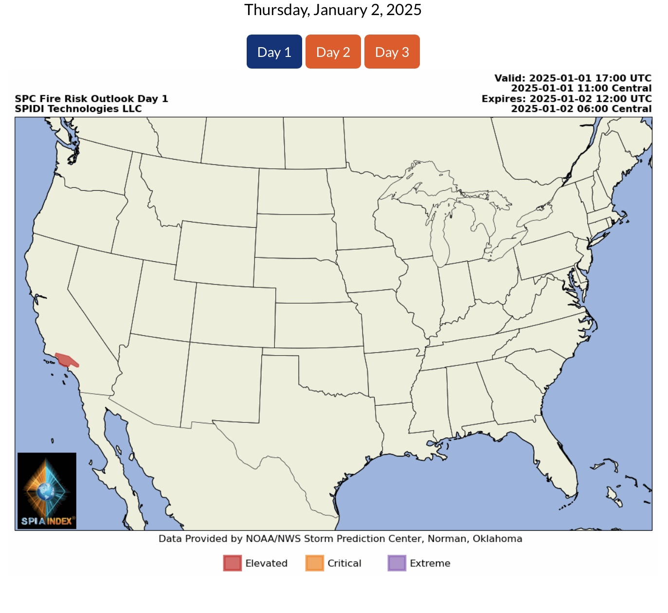
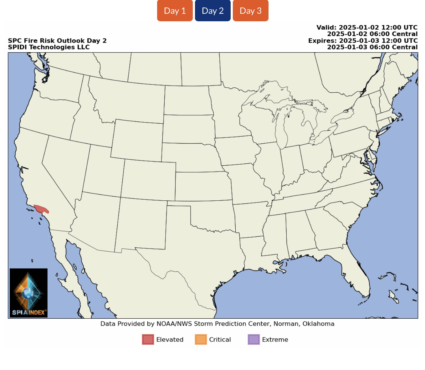
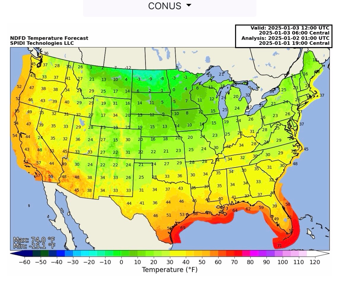
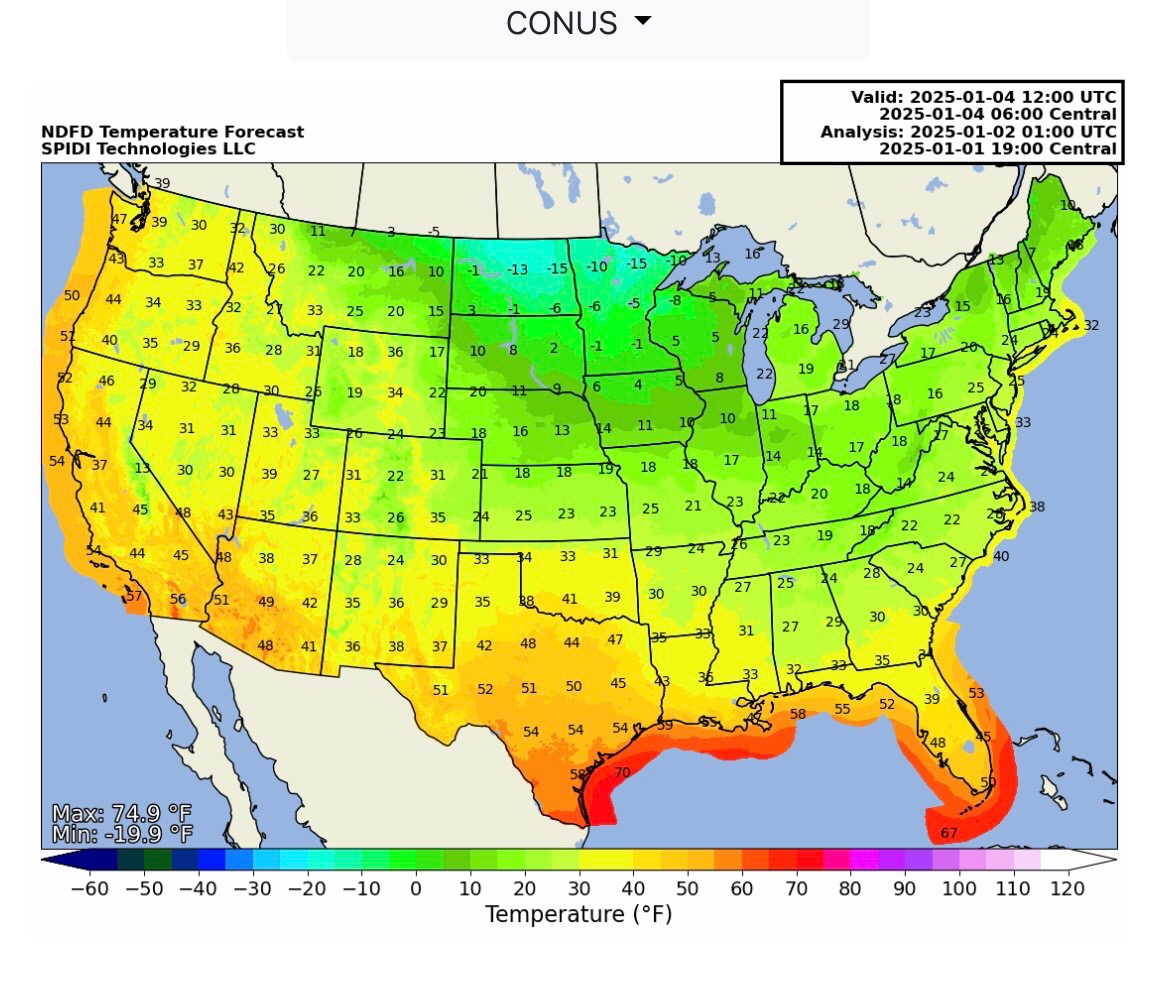
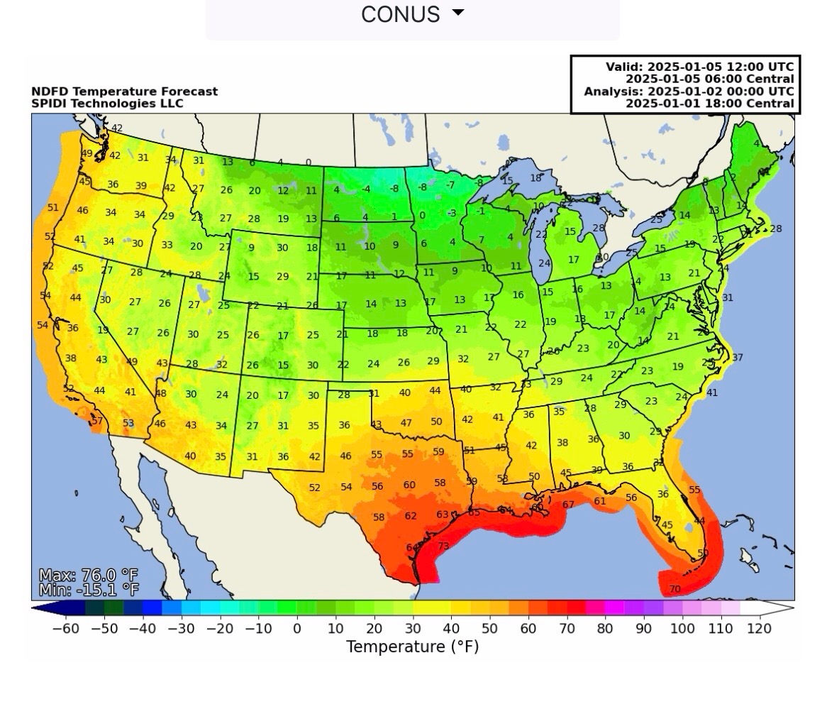
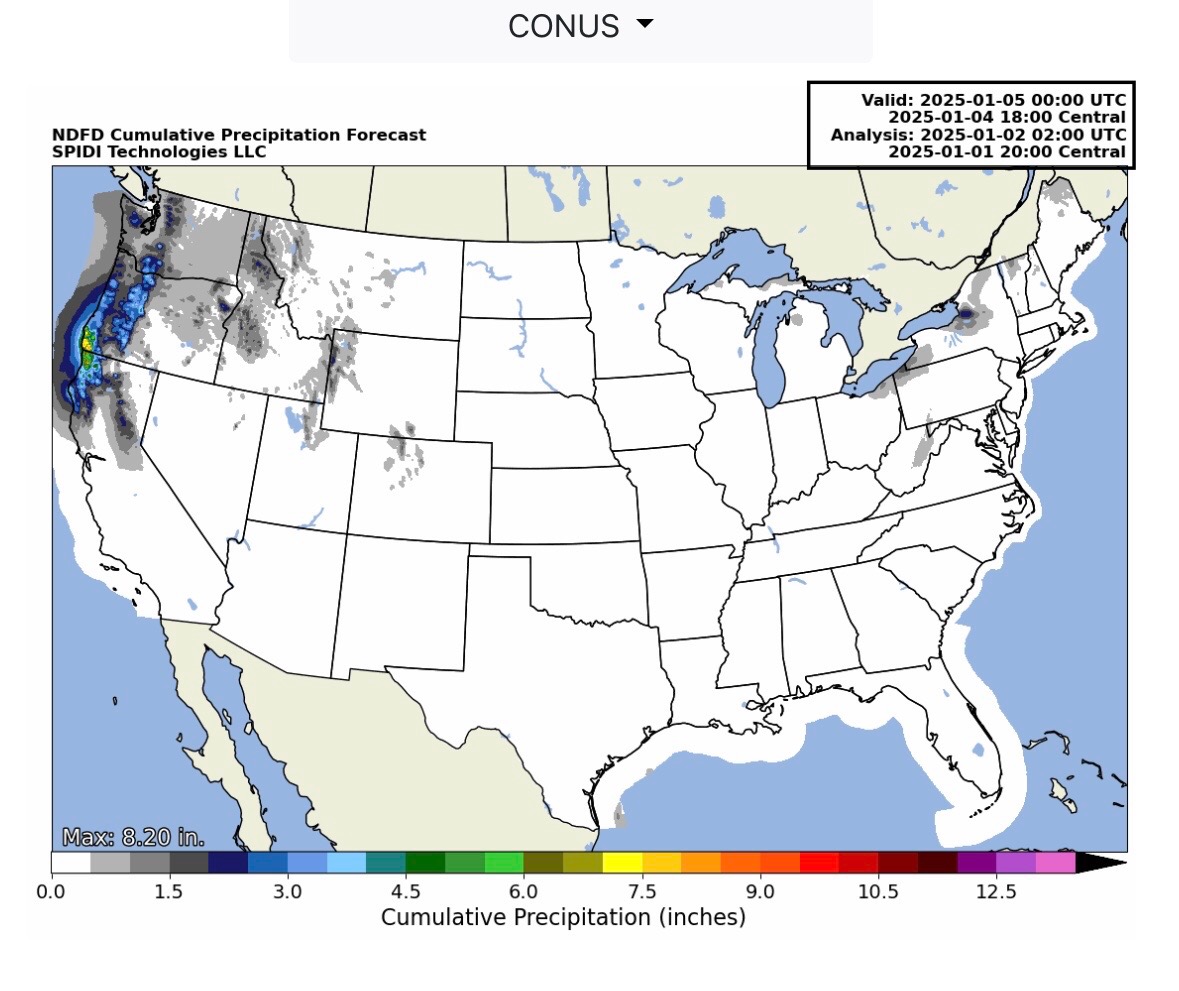
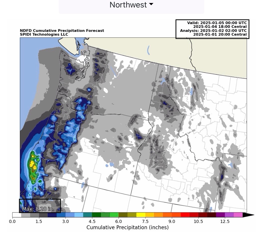
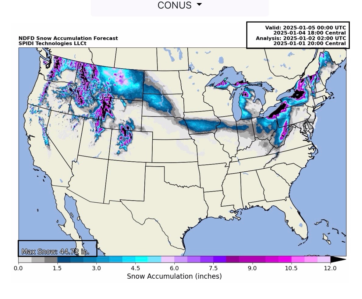
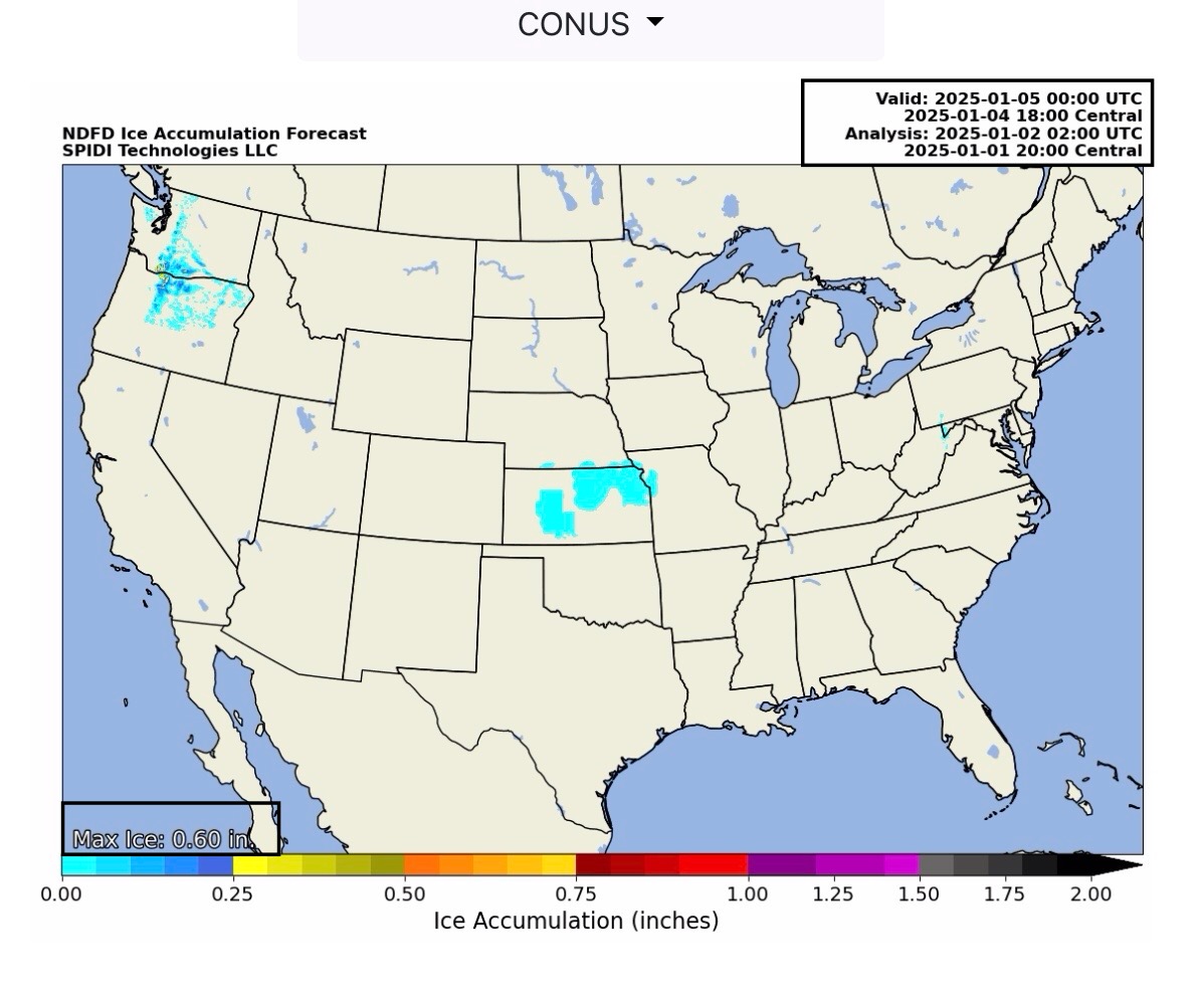
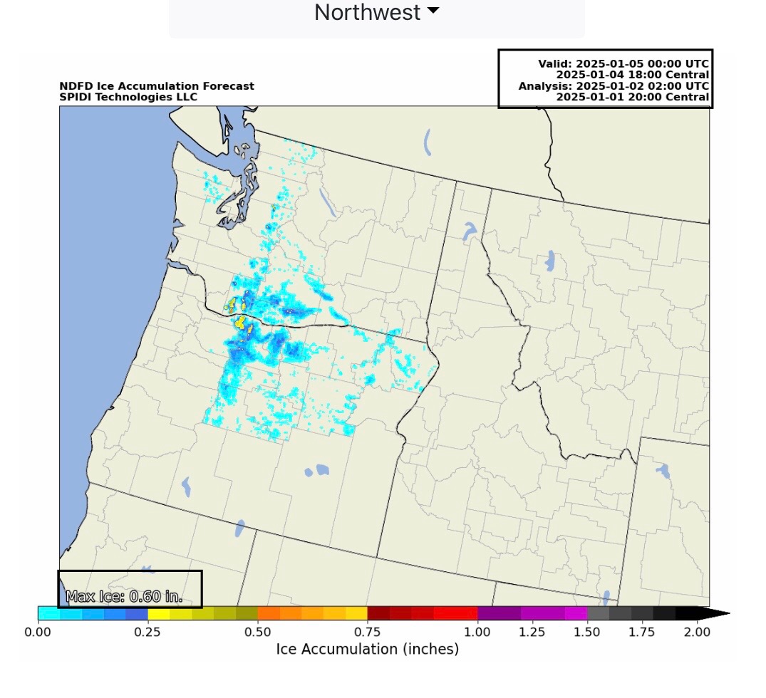
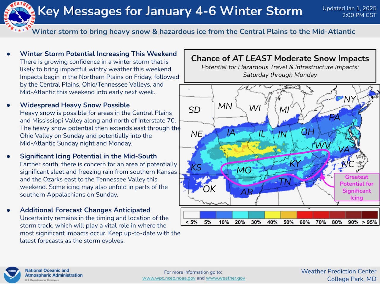
Arctic Air begins moving south-southeast from Canada and North Central Region over next several days. Morning (6am CT) low forecast temps shown below. Heavy rain over next 3 days in parts sw OR and nw CA. Front end of potentially significant ice and snow event beginning to show in Forecasts thru Saturday afternoon…
Sidney Sperry 02 Jan 2025 03:09 UTC
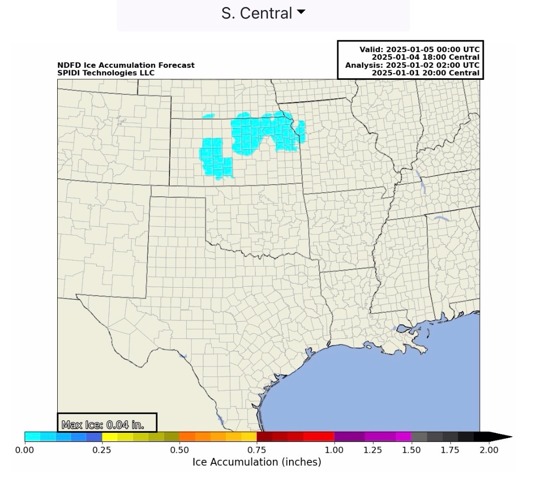
FYI… latest forecast updates from NWS. Beginnings of potentially significant ice and snow event starting to show up in the Saturday evening, January 4 forecasts.

Sid Sperry
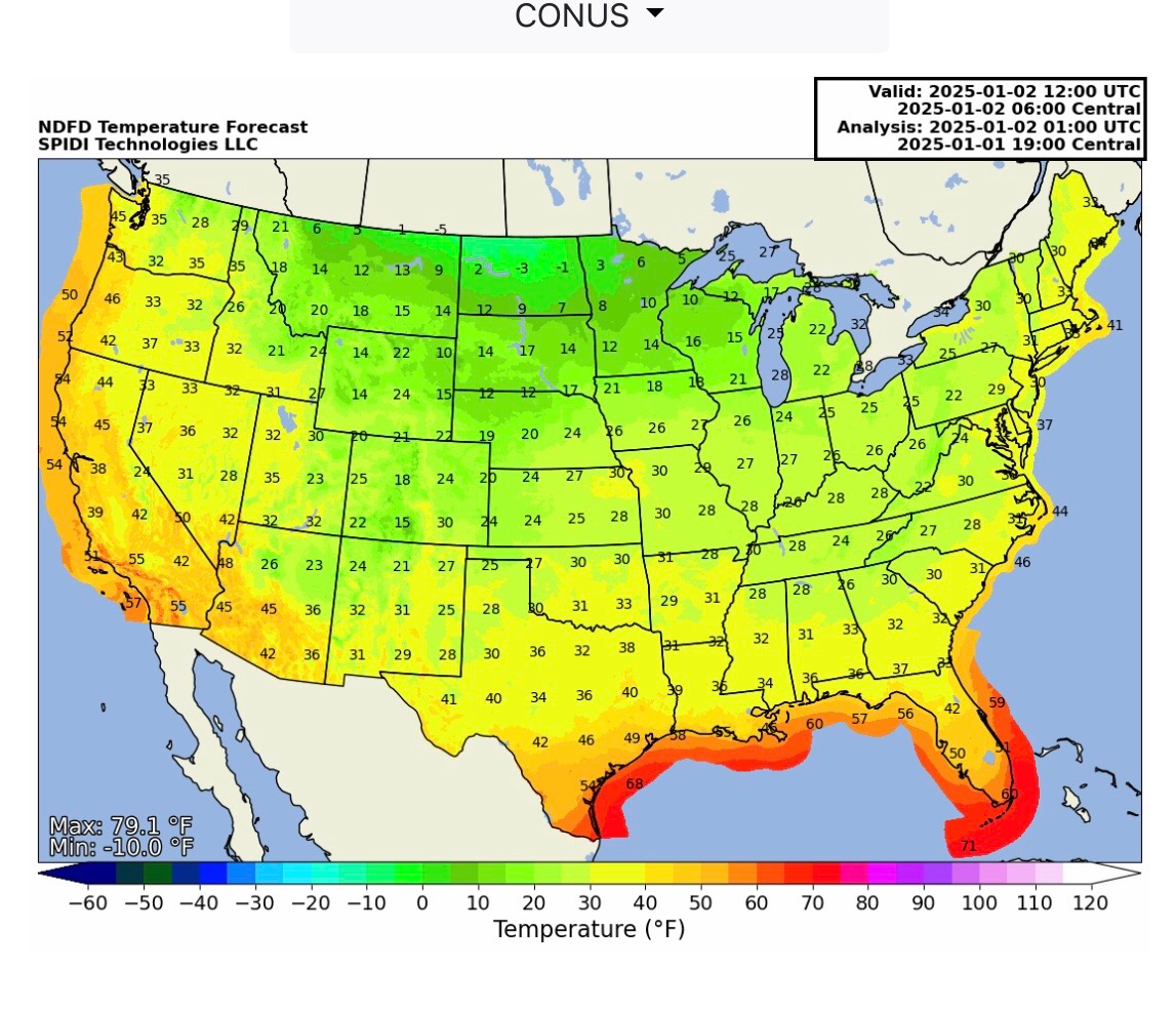
Forecast Temperatures shown below are at 6am CT for Thursday, Friday, Saturday and Sunday, January 2 thru 5.
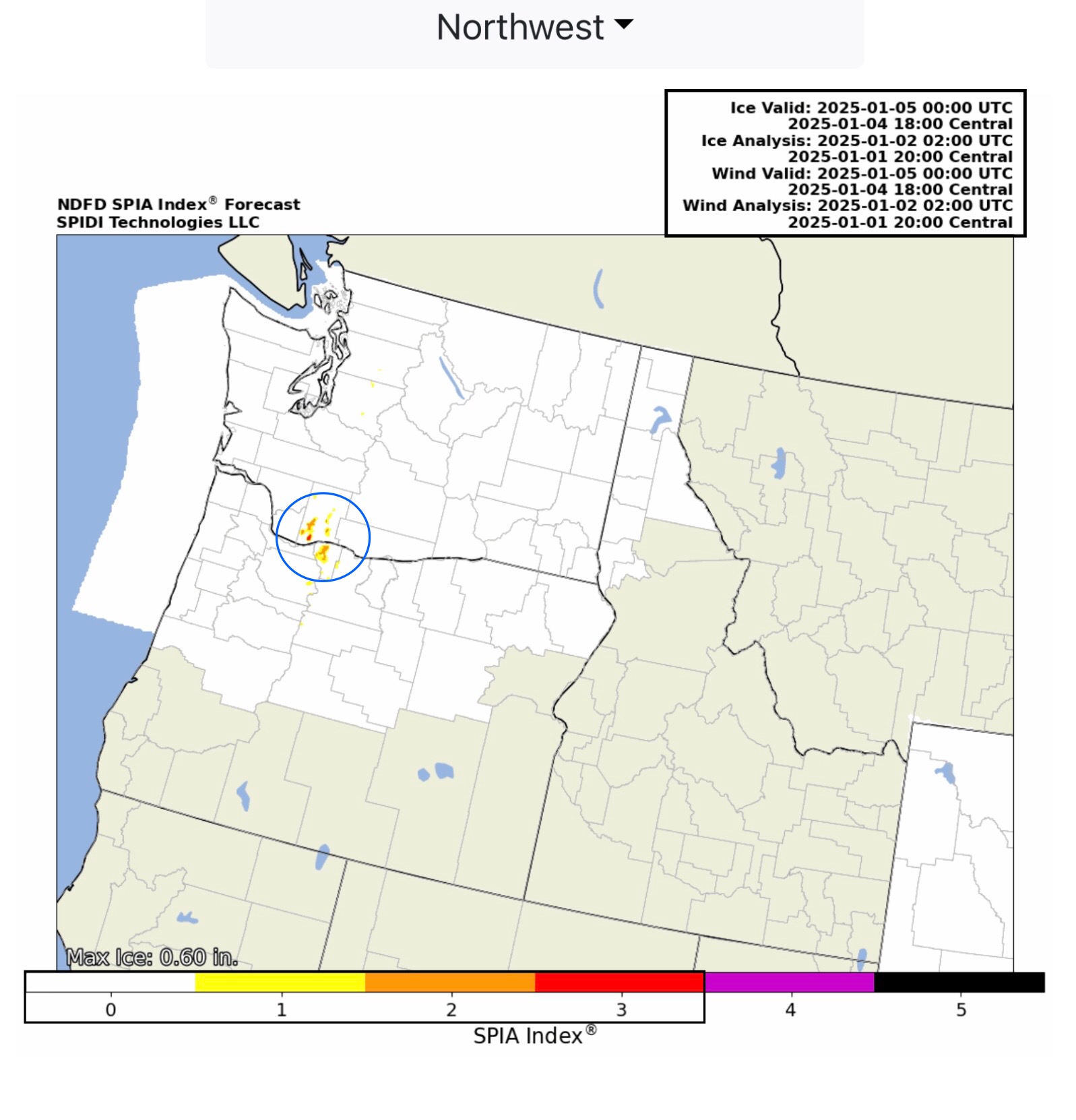
Front end of freezing rain event now showing in NWS Forecasts, Saturday, 6pm CT.
Sid Sperry
President & CEO
SPIDI Technologies, LLC
Website/Subscriptions: SPIDItech.com
Cell Phone: (405) 627-7754
Email(s): SidSperry@gmail.com  OR  Sid.Sperry@spidiweather.com
URL(s):  SPIDItech.com
               SPIA-Index.com
               NationalOutages.com  (Partnership w/Global Reach Internet Productions)

Sent from my iPad

 Show/hide attachments