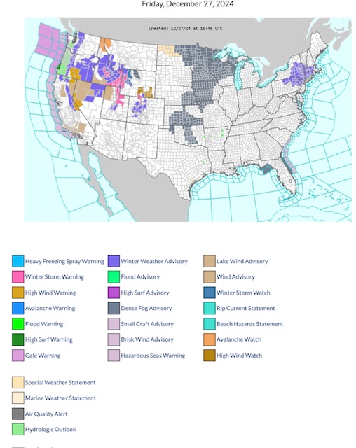
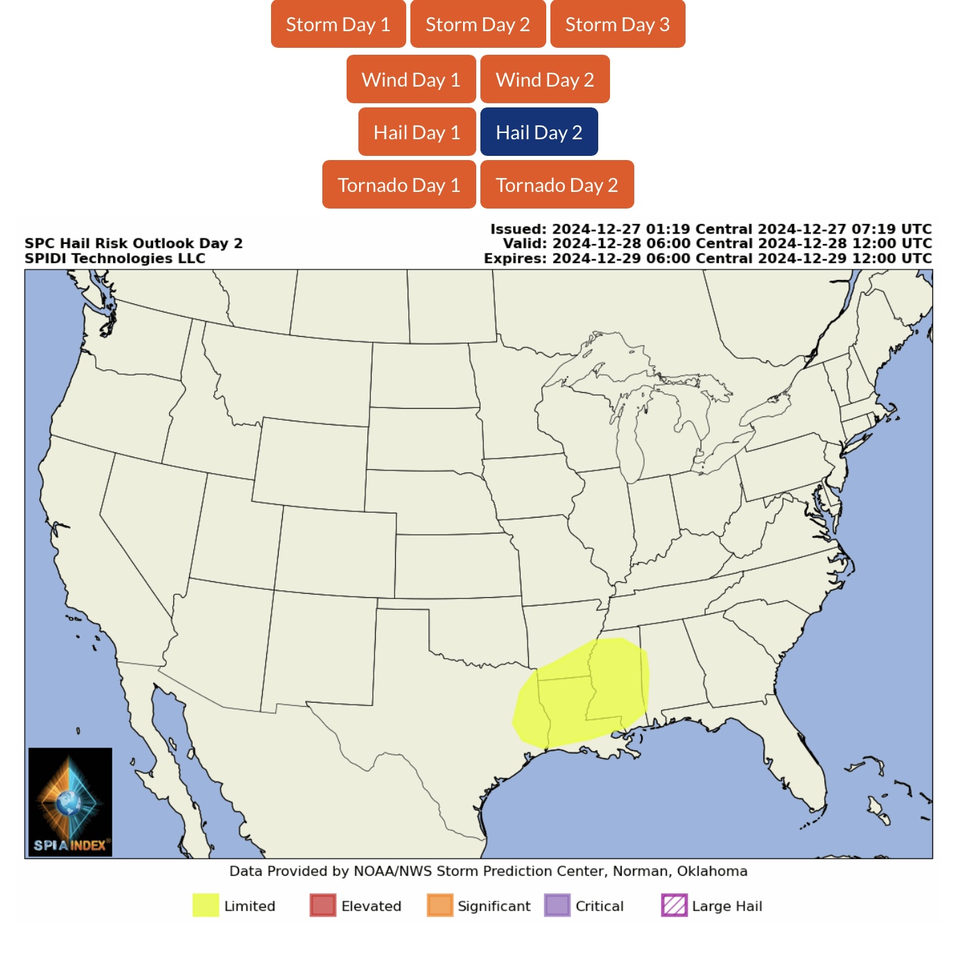
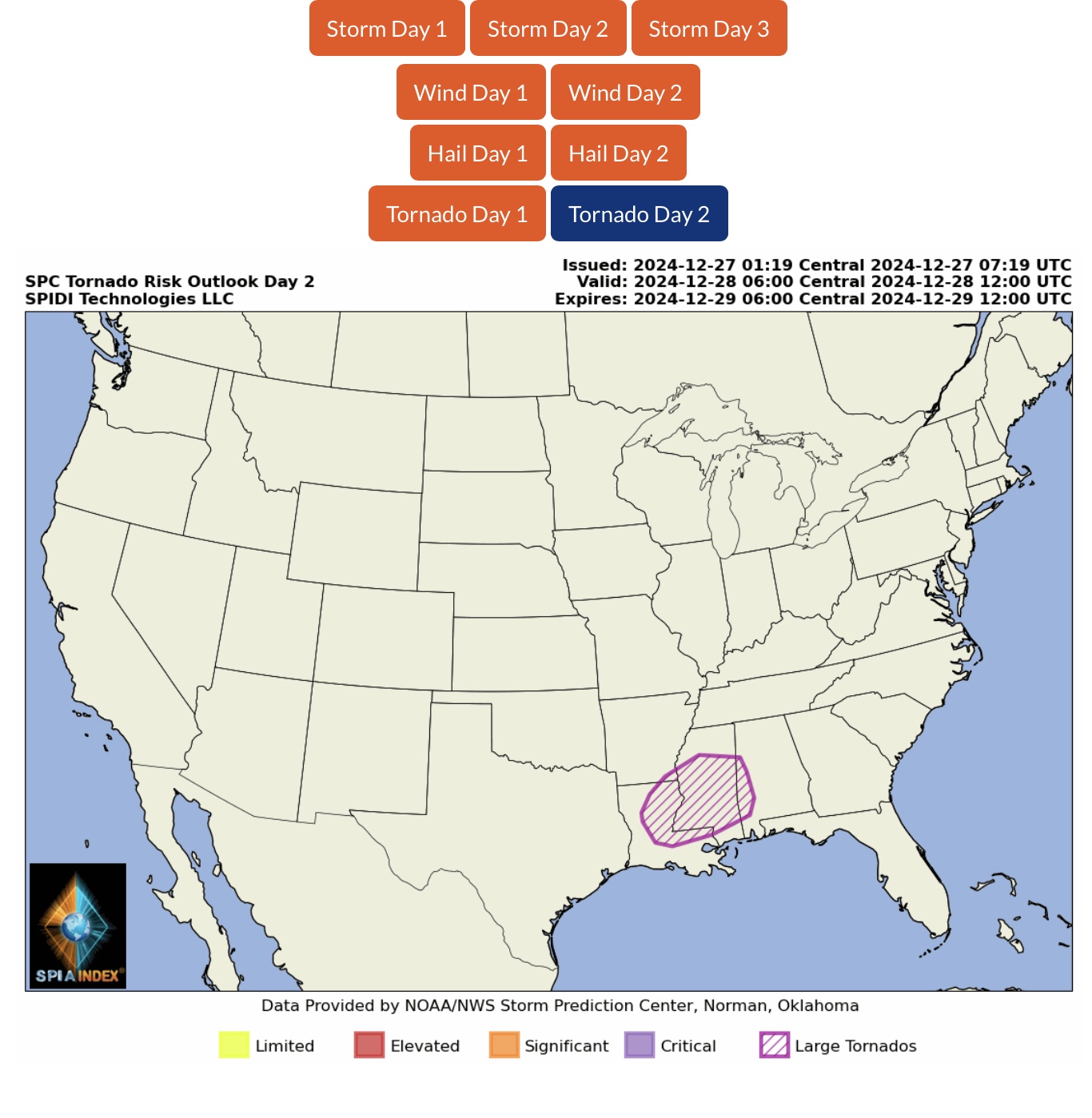
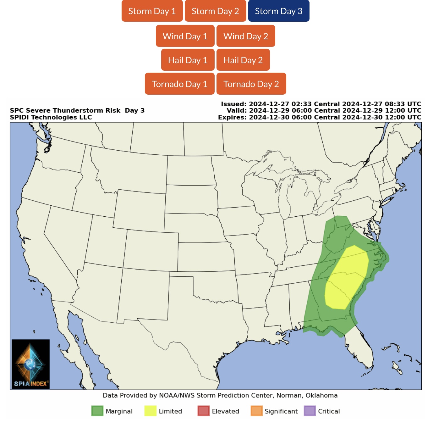
Latest NWS Watches, Warnings & Advisories. Winter Storm Warnings parts ID, WY, UT & CO. High Wind Warnings parts ID, MT, OR, CA, NV, WY & CO. Winter Weather Advisories parts WA, OR, CA, ID, MT, NV, WY, UT, CO, NY, PA, VT, MA, CT & NJ. ELEVATED Severe Thunderstorm Risk, Day 2 (Saturday) parts AR, LA, MS & AL…
Sidney Sperry 27 Dec 2024 17:28 UTC
FYI…
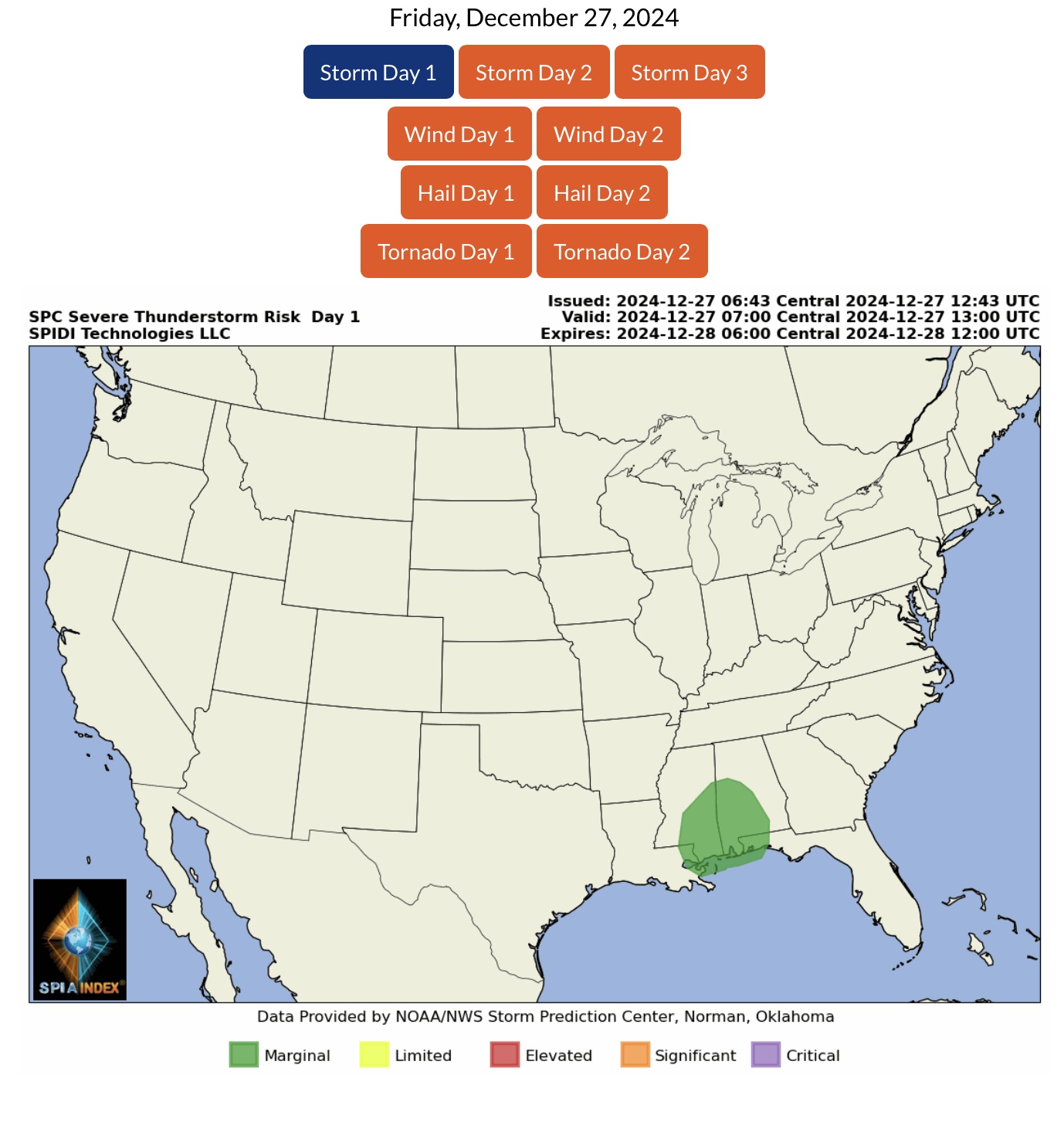
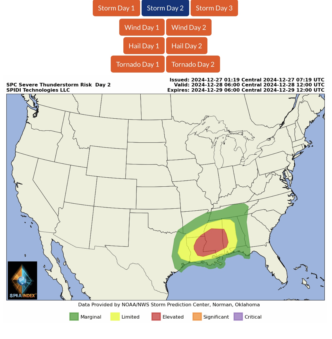
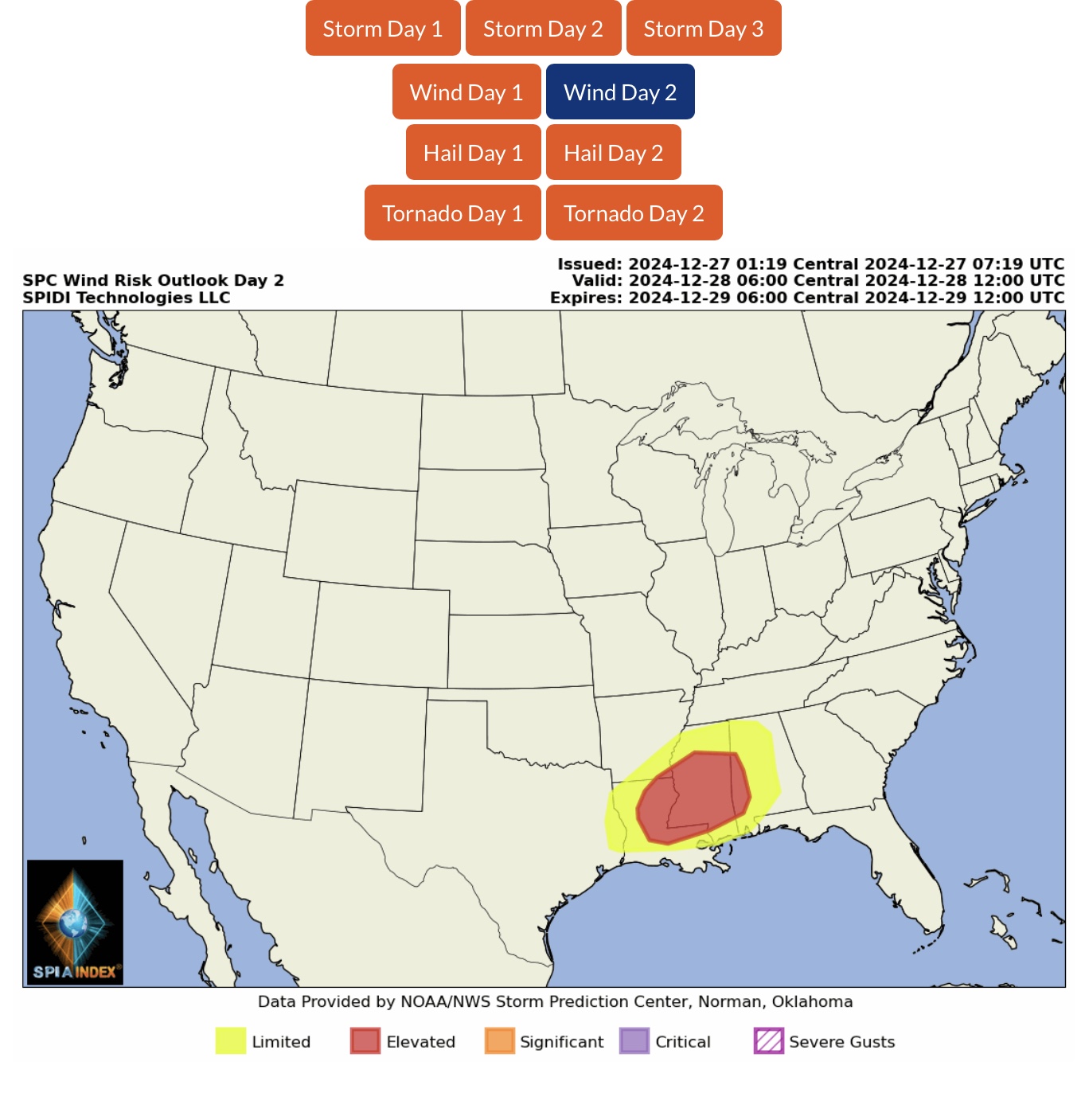
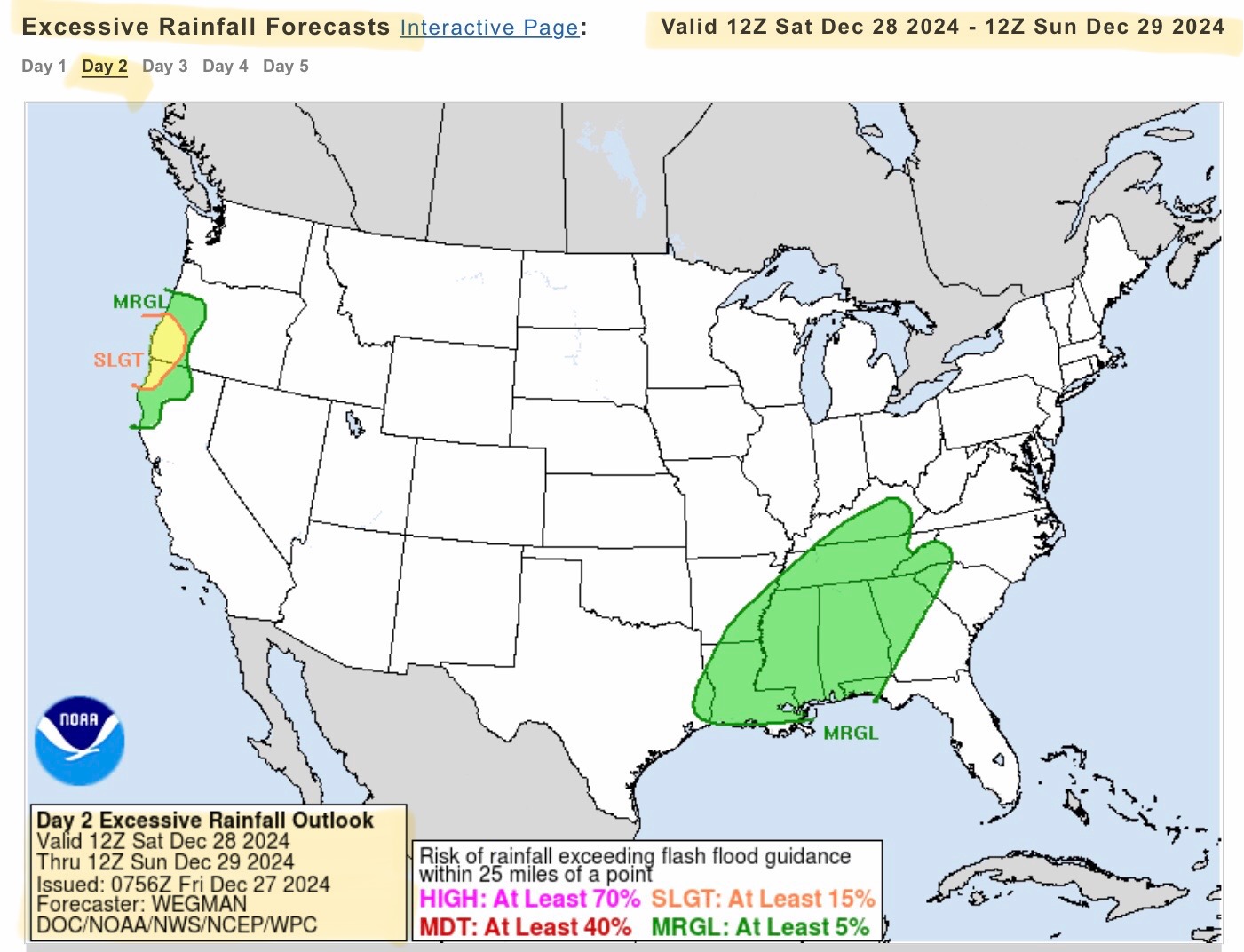
ELEVATED Severe Thunderstorm Risk, Day 2 (Saturday, 12/28/2024), parts AR, LA, MS & AL. Includes ELEVATED High Winds Risk, LIMITED Hail Risk, and LARGE TORNADOES Risk, parts AR, LA, MS & AL.
LIMITED Severe Thunderstorm Risk, Day 3 (Sunday, 12/29/2024), parts VA, NC, SC & GA.
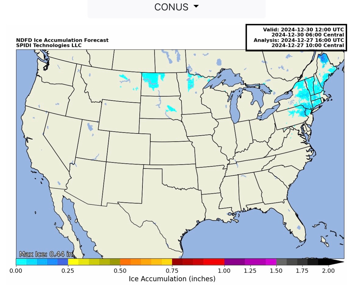
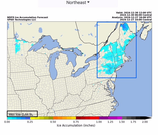
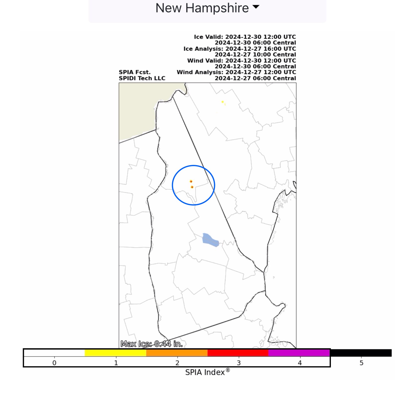
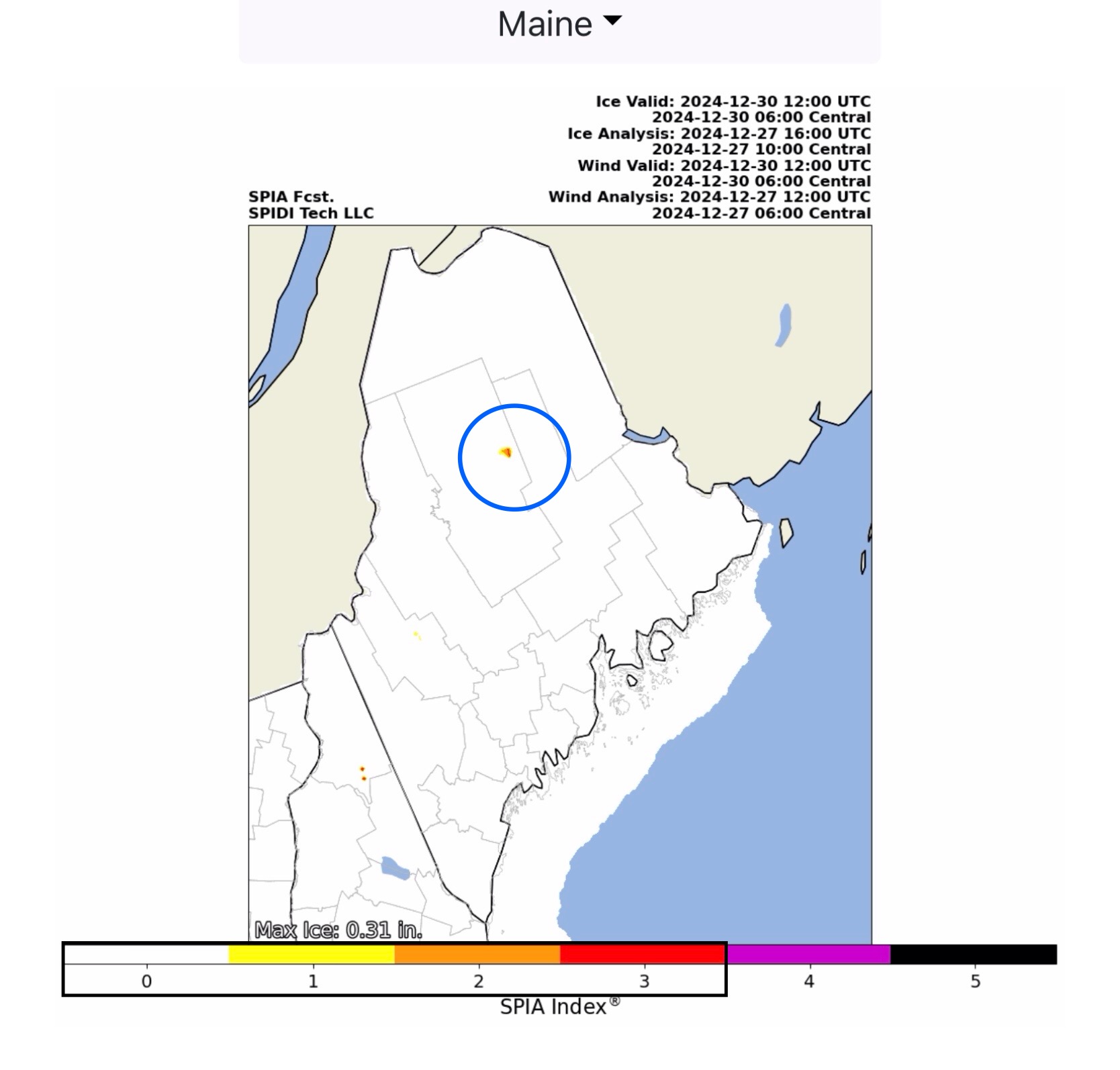
Max ICE in NWS grids forecast: 0.44” parts northern NH (Mount Washington area). SPIA Index Ice Impact Forecast currently at Levels 1 thru 3 in northern ME, Levels 1 thru 4 in northern NH.
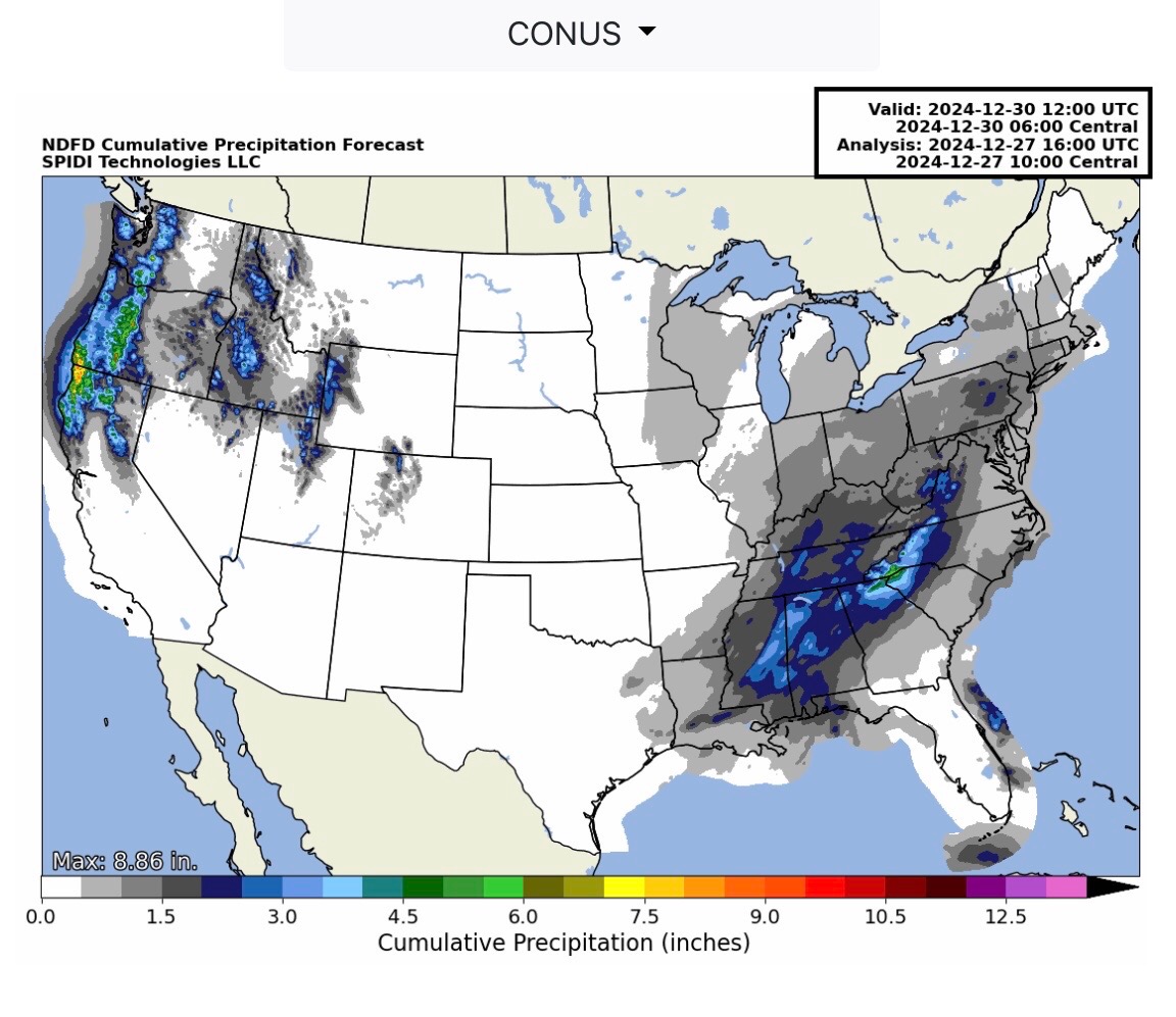
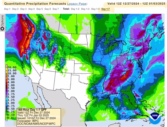
Heavy Rainfall - from 2” up to 5” - possible across parts of the Southeast Region over next 24-72 hours.
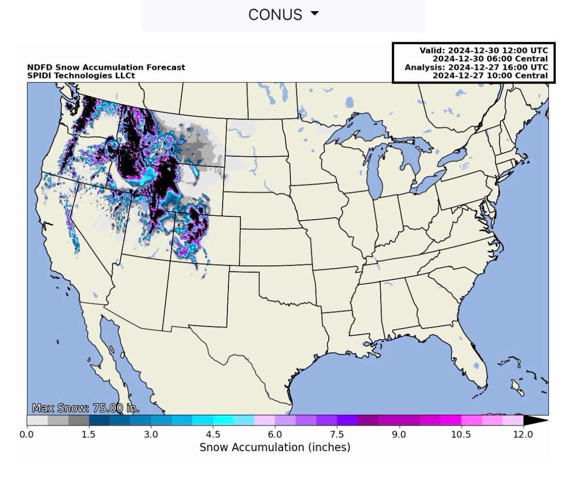
Heavy Rainfall - from 2” up to 9” - possible across parts of the Northwest Region.
Sid Sperry

Sent from my iPad

 Show/hide attachments