Latest NHC Updates on Hurricane Milton…
Sidney Sperry 08 Oct 2024 19:01 UTC
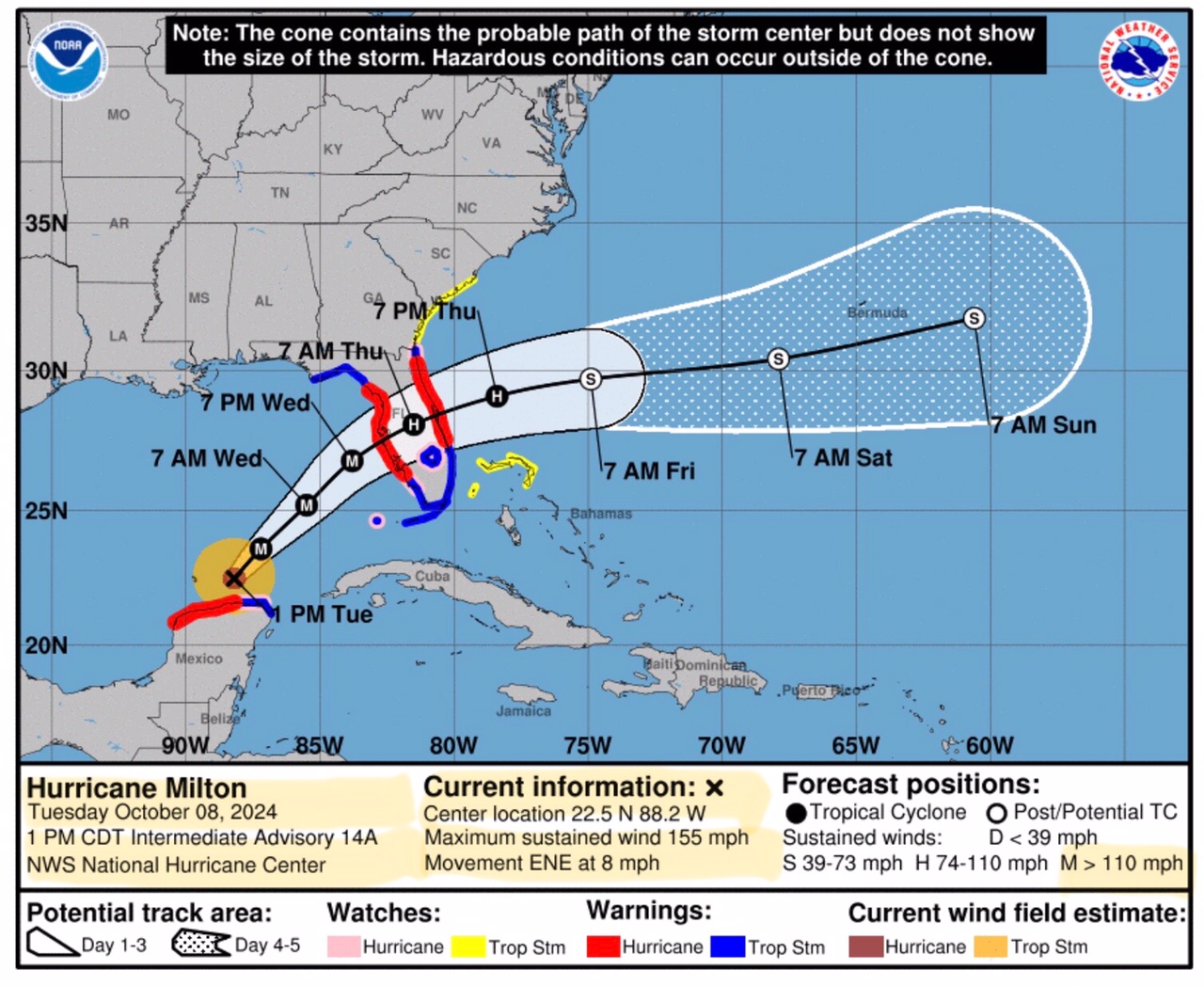
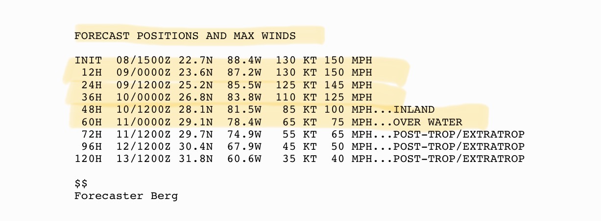
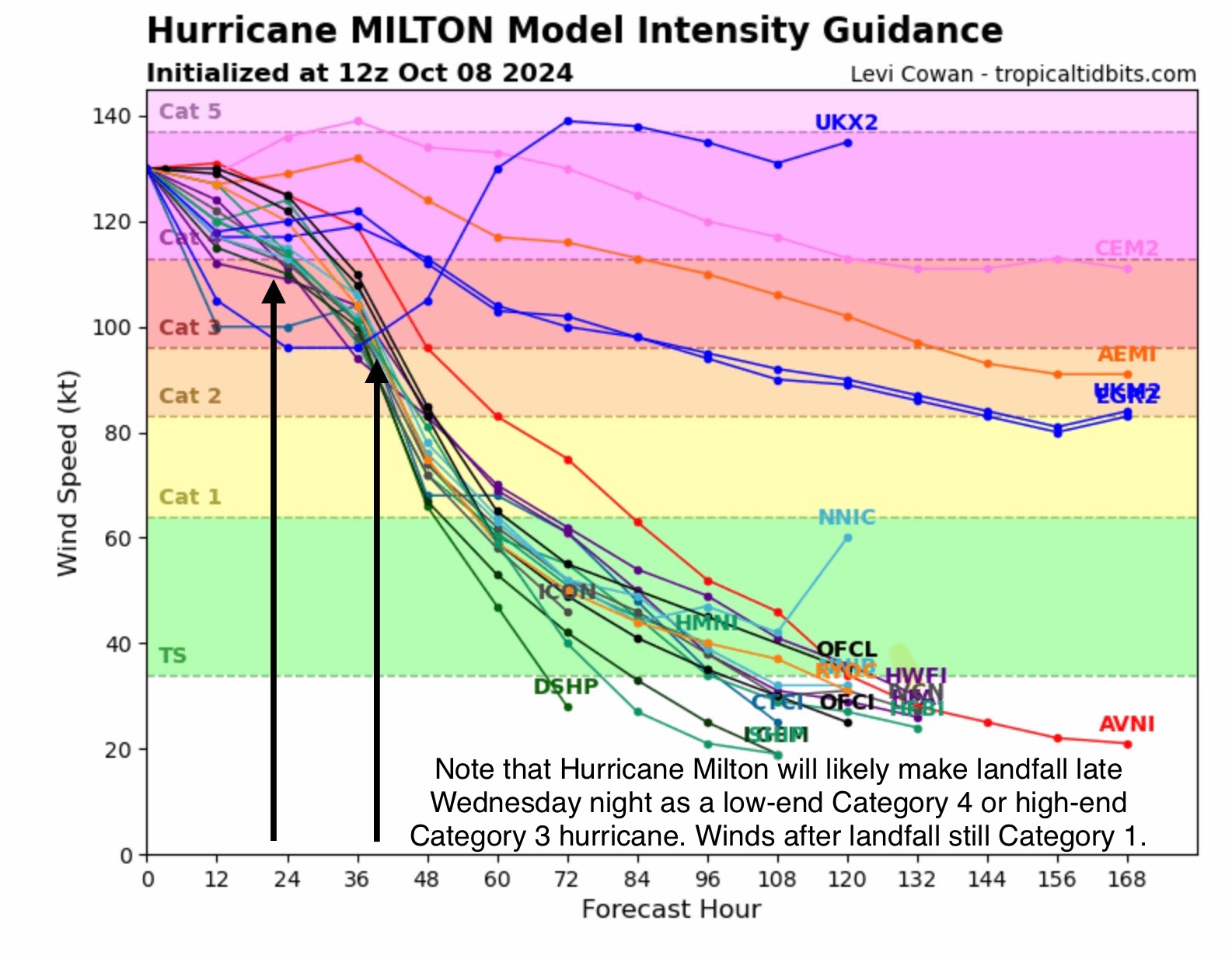
Max Sustained Winds now at 155 mph. Movement is east-northeast at 8 mph. Eyewall replacement cycle completed… it didn’t last long, and Milton’s intensity/wind speed has increased from 145 mph back to 155 mph in a matter of a few hours. Extremely warm sea surface temperatures are likely driving this shortened eyewall replacement and re-intensification.
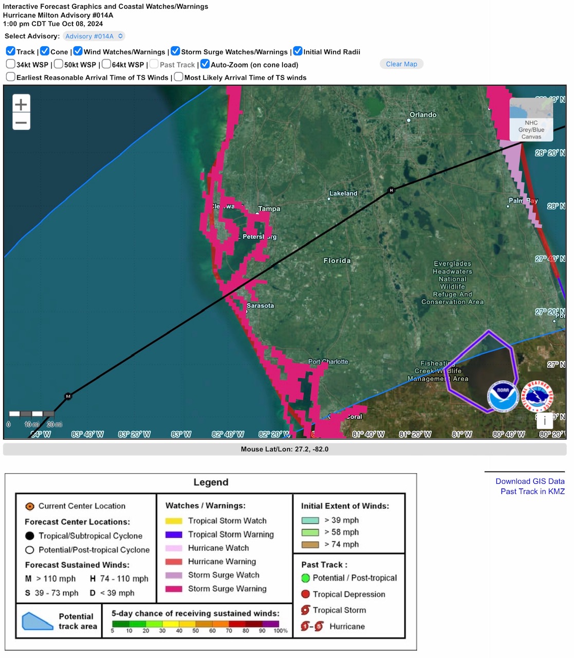
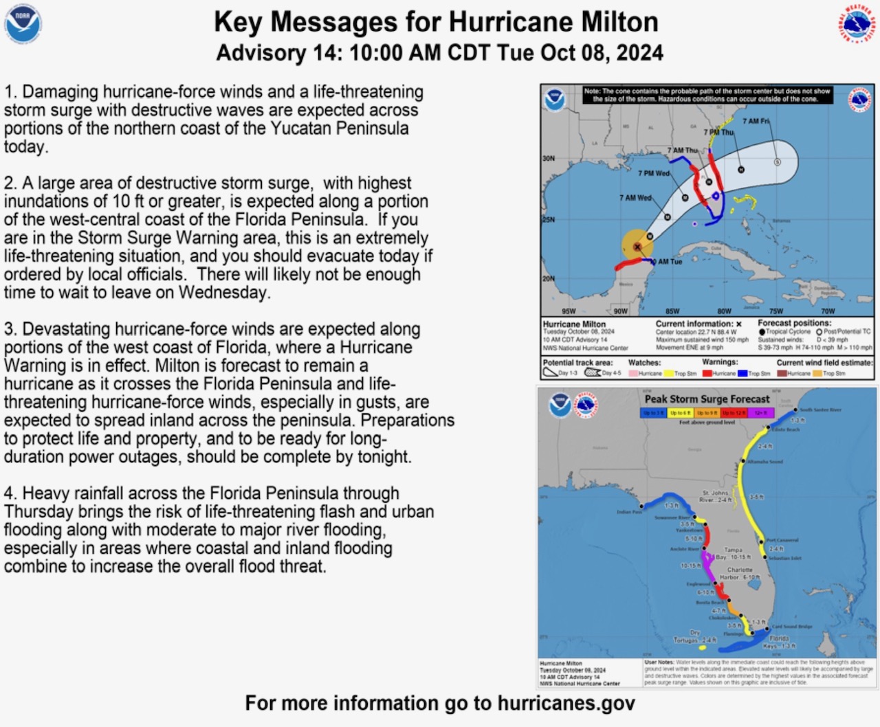
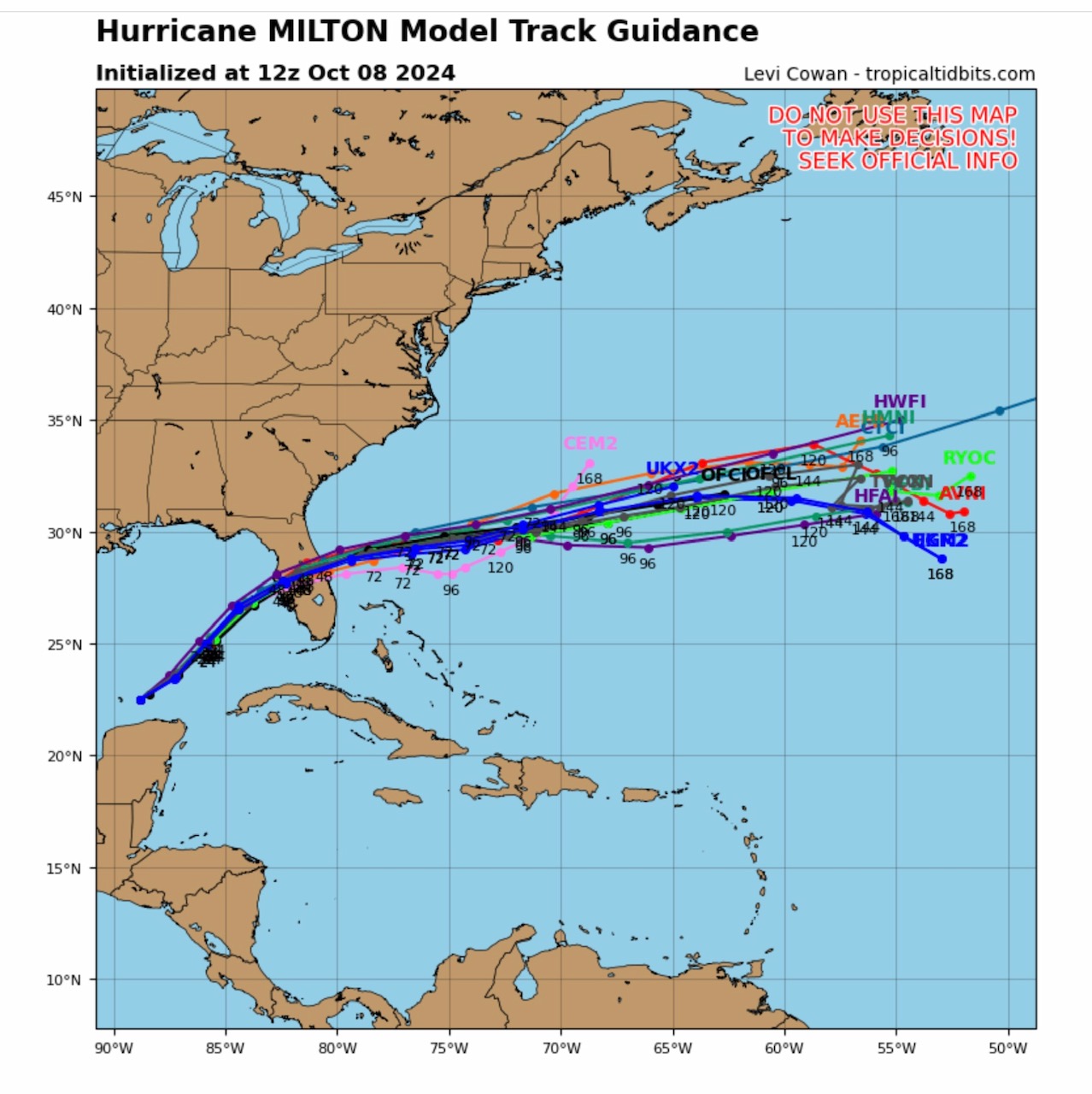
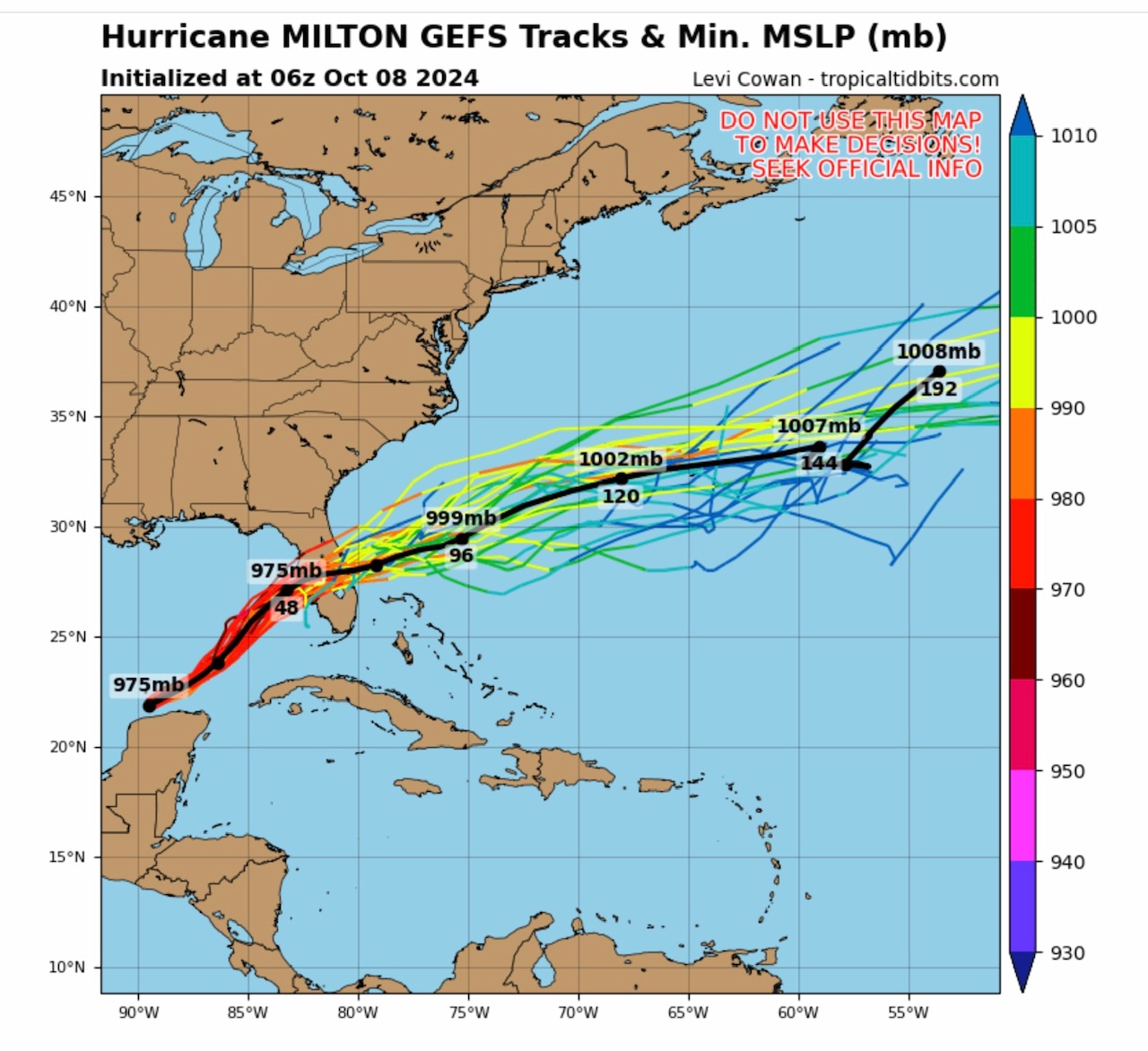
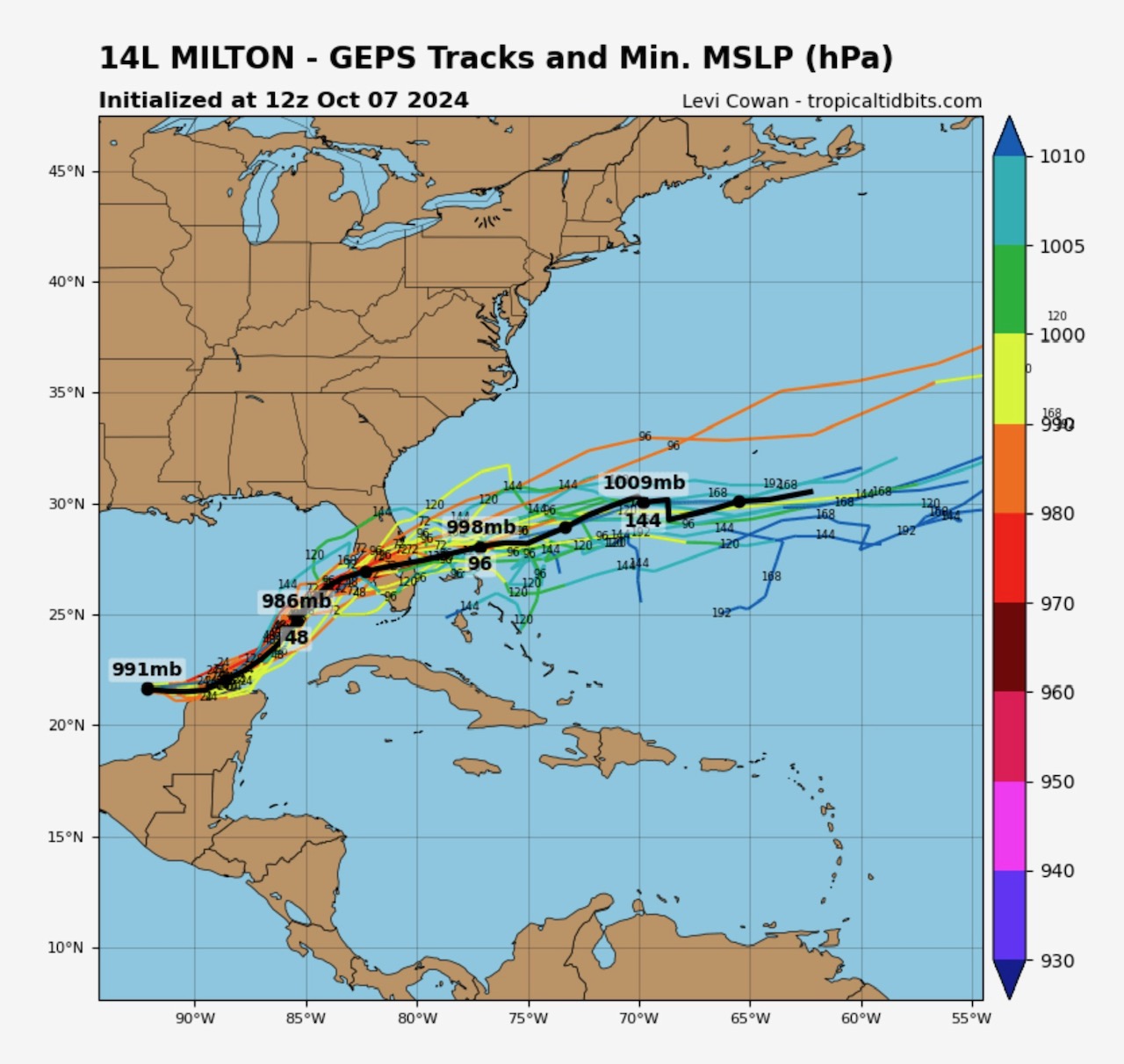
Landfall still looks to be late Wednesday night or early Thursday morning. Track has wobbled just a bit (about 20-25 miles) south in this latest model run. Still projecting a potential landfall between St. Petersburg and Sarasota at this time. Some “wobbles” in the track are common, even up to the time of landfall. Note that “…damaging winds, life-threatening storm surge, and heavy rainfall will extend well outside the forecast cone,” per NHC forecasters in their forecast discussion below.
After landfall, max sustained winds over the FL peninsula are forecast to be in the 75 to 100 mph range, only decreasing after Milton exits the eastern FL coast and enters Atlantic. - Sid Sperry
Sid Sperry
President & CEO
SPIDI Technologies, LLC
Website/Subscriptions: SPIDItech.com
Cell Phone: (405) 627-7754
Email(s): SidSperry@gmail.com  OR  Sid.Sperry@spidiweather.com
URL(s):  SPIDItech.com
               SPIA-Index.com
               NationalOutages.com  (Partnership with/Global Reach)

Sent from my iPad

 Show/hide attachments