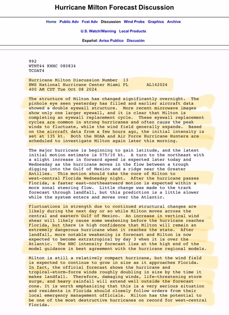
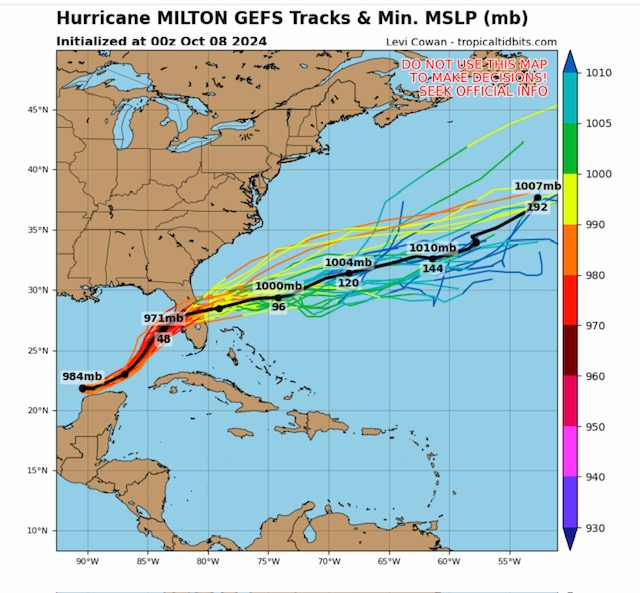
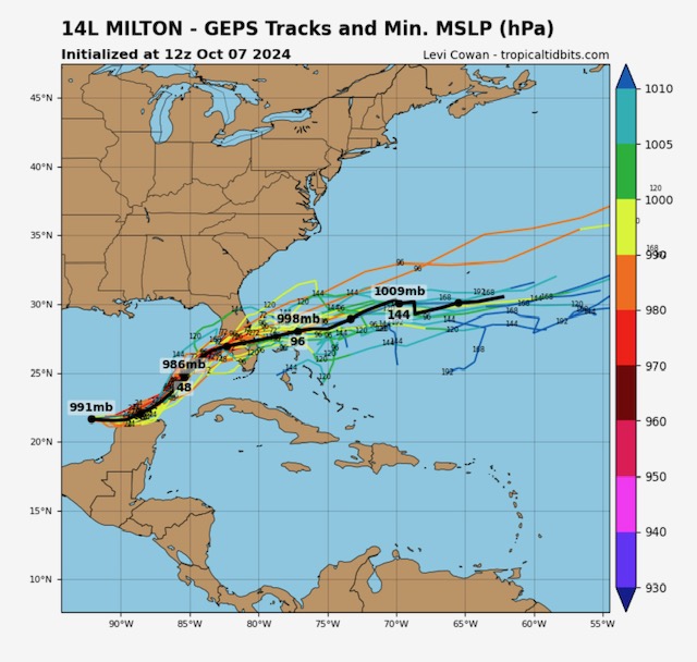
Hurricane Milton going through an expected eyewall replacement overnight; still a very dangerous major hurricane… landfall now expected late Wednesday night or early Thursday morning.
Sidney Sperry 08 Oct 2024 11:06 UTC
FYI…
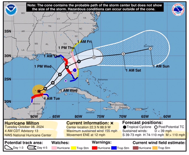
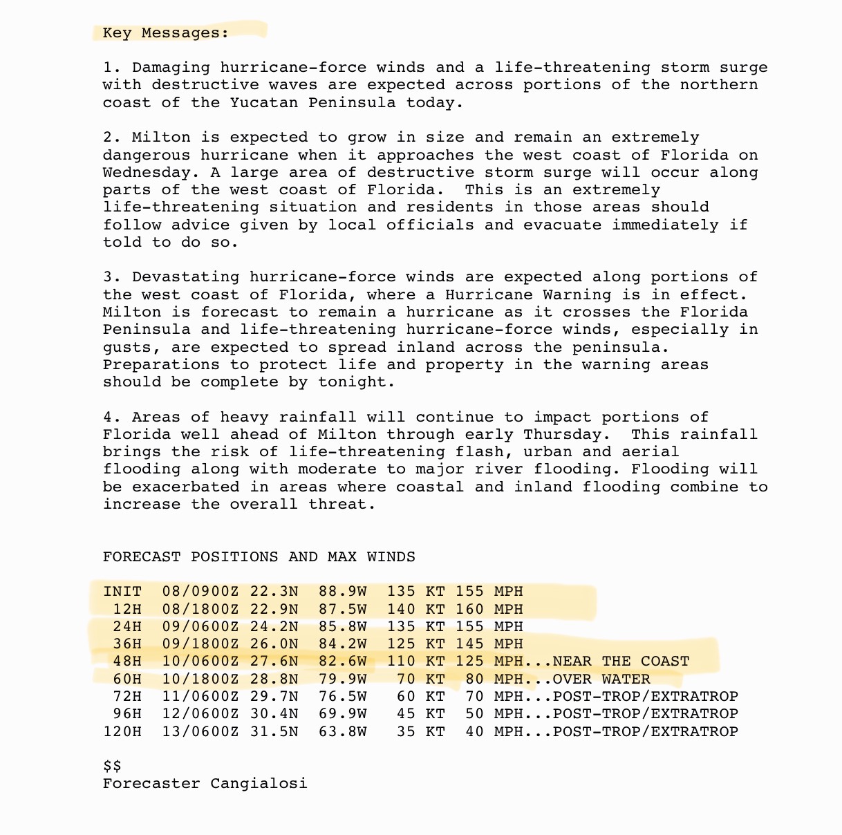
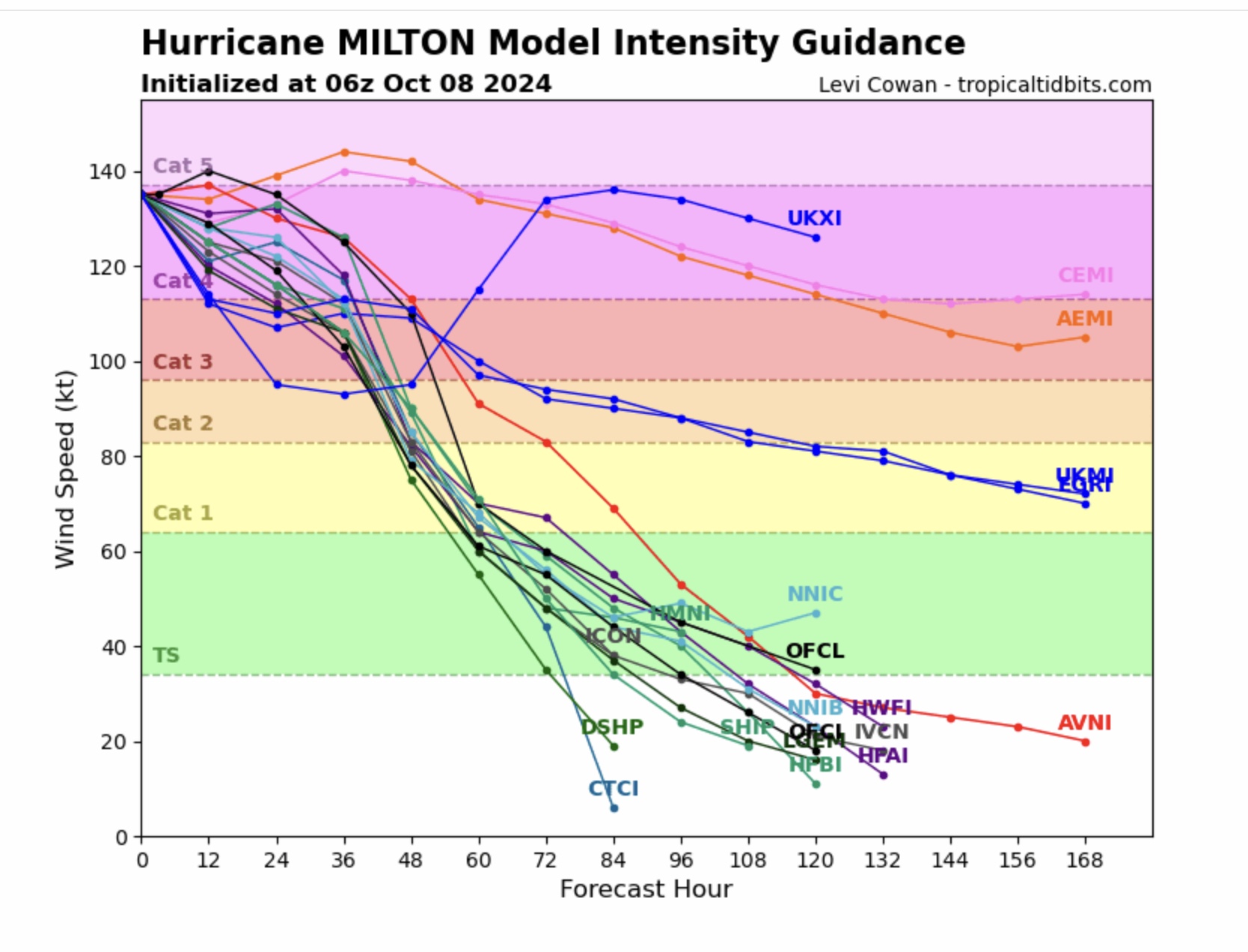
Max Sustained Winds this morning are 155 mph. Movement is east-northeast at 12 mph. Milton should complete its eyewall replacement cycle later this morning and begin to pick up some forward speed as it moves toward the west coast of Florida. Its wind field will likely expand due to this replacement cycle, as it becomes better organized into a larger, more expansive hurricane.
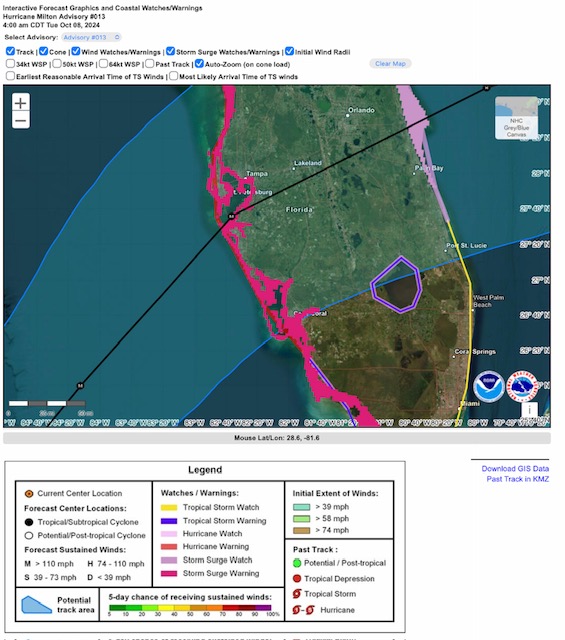
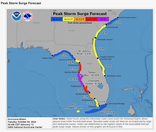
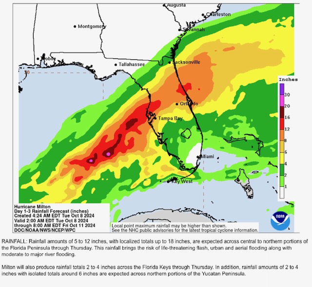
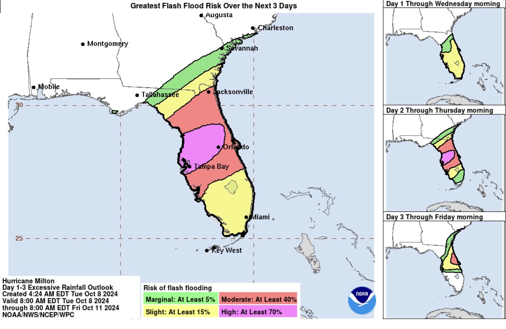
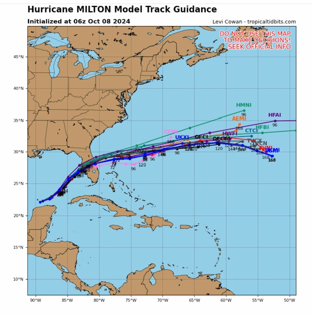
Forecast track has shifted slightly to the south, just south of St. Petersburg and just north of Sarasota. Storm surge in Tampa Bay area still expected to be in the 10’ to 15’ range. Storm total rainfall forecast to be from 2” up to 16” across Florida peninsula.
Still likely to be a Category 3 or Category 4 at landfall, however some weakening is forecast to occur due to high wind shear and dry air entrainment into Milton several hours before landfall. - Sid Sperry

 Show/hide attachments