4AM NHC Update on Tropical Storm Helene…
Sidney Sperry 25 Sep 2024 11:53 UTC
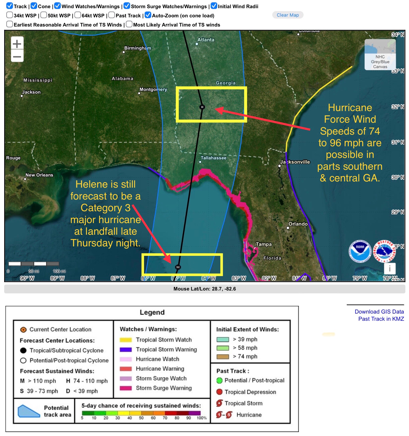
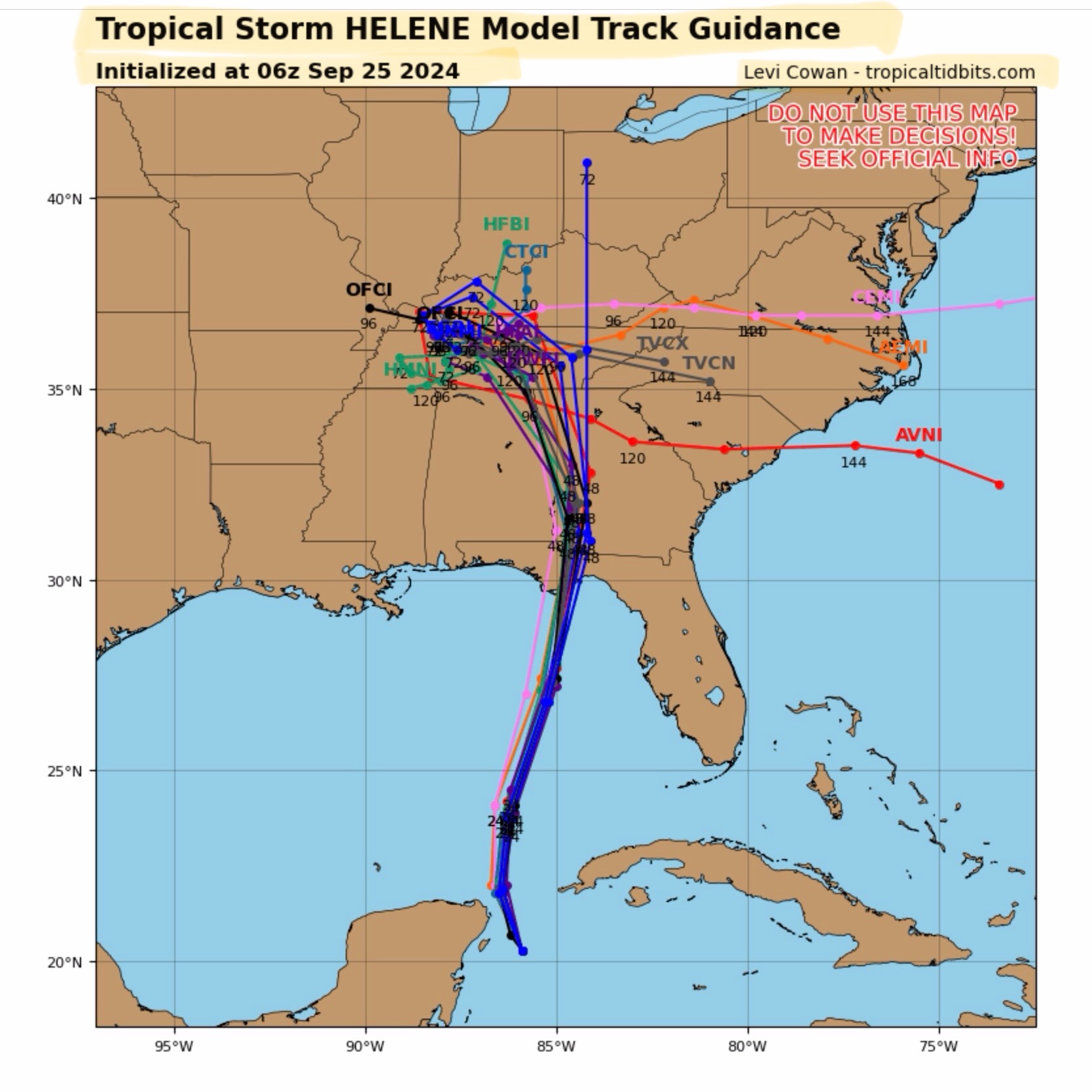
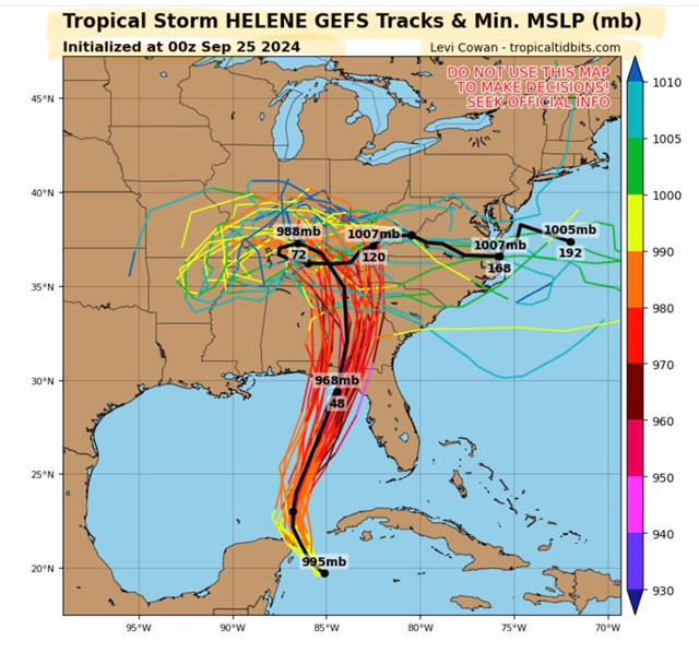
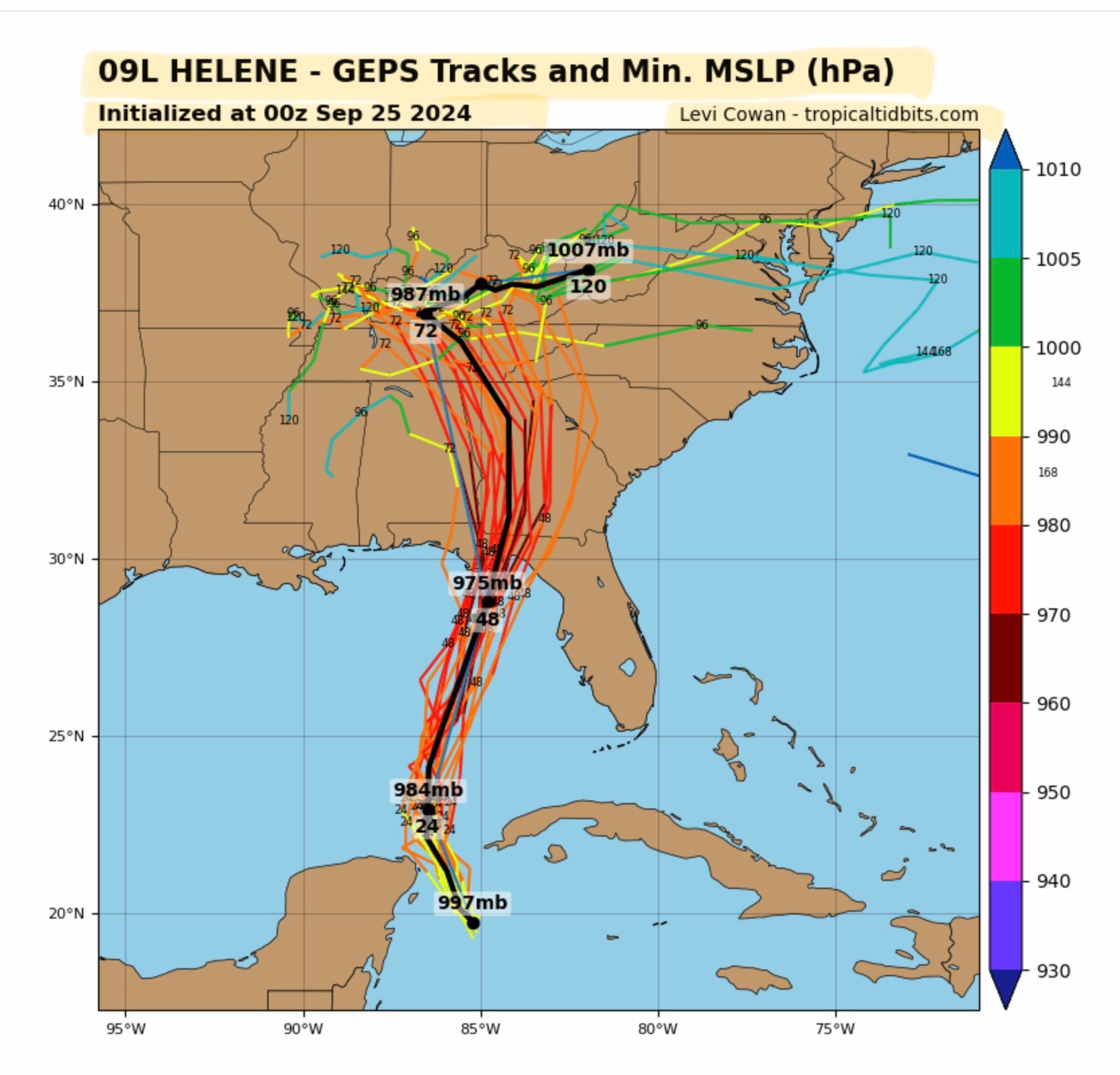
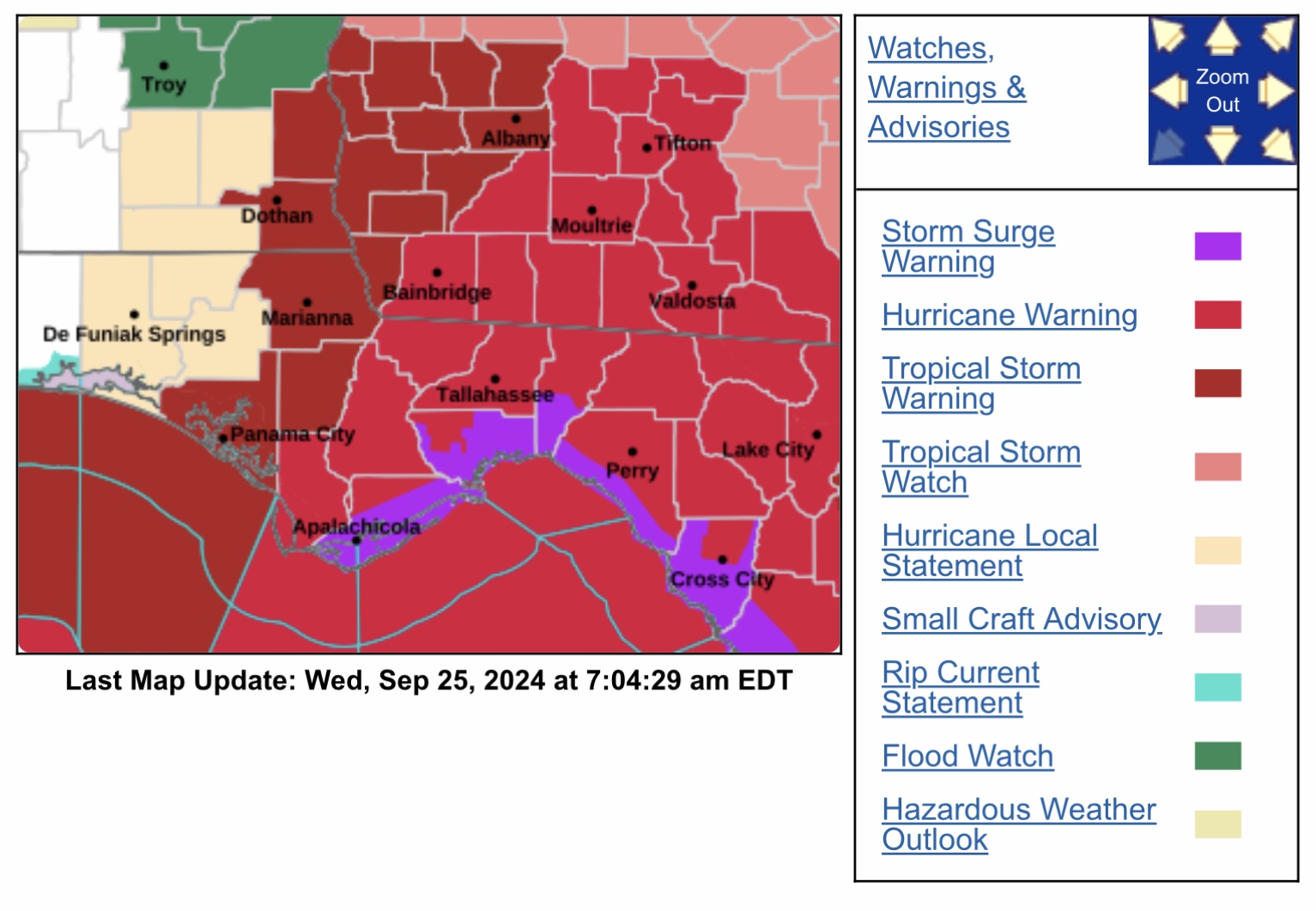
Latest NHC forecast shows the projected track of soon-to-be Hurricane Helene has shifted slightly to the west. If this forecast track were to hold, it would put Tallahassee, FL, on the right or east side of Helene’s eyewall, and in an area of higher winds.
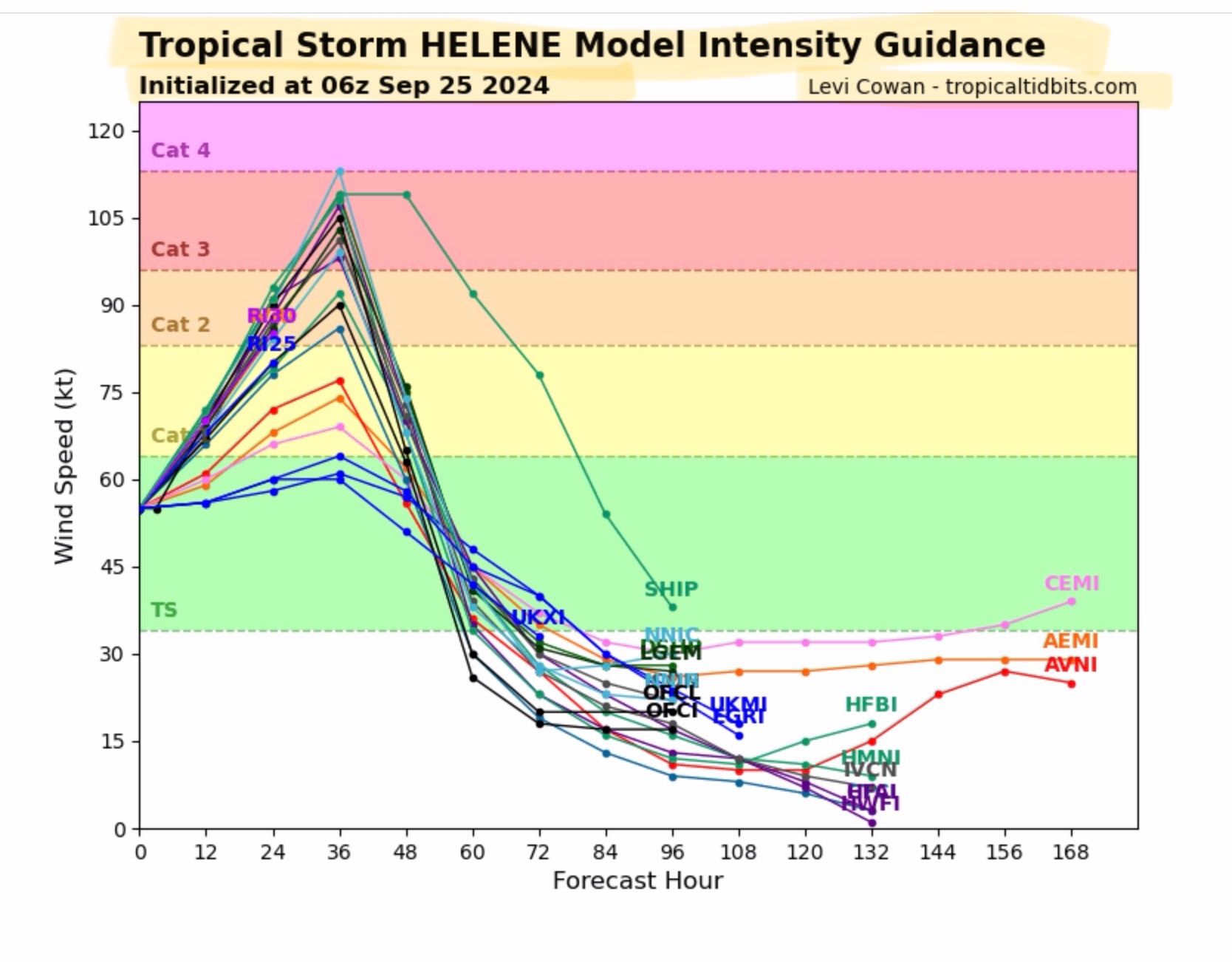
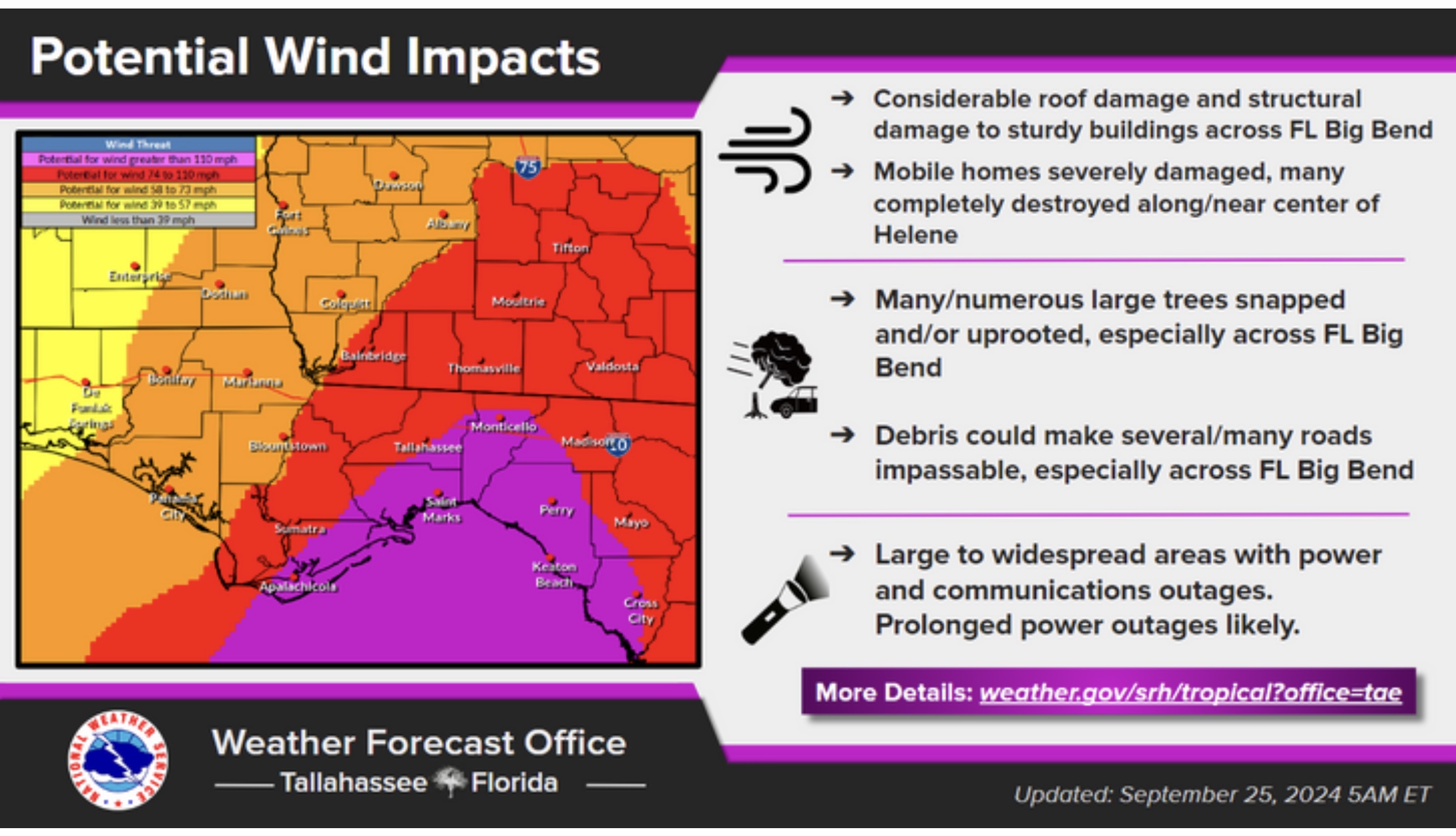
Current NHC forecast Sustained Wind Speeds are in the 110 to 120 mph range at landfall in the western part of the Big Bend area, and hurricane force winds of 74 to 96 mph several miles inland into south-central and central GA.
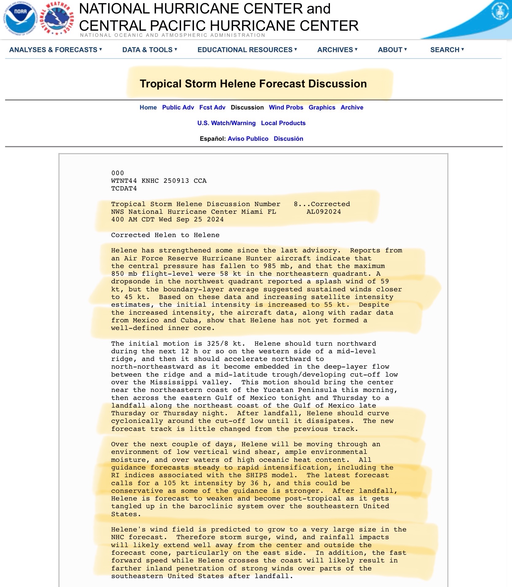
Helene could brush the very northeast tip of the Yucatán Peninsula this morning before its core becomes more well defined as it enters the extremely warm waters of the Gulf of Mexico and reaches hurricane status. This is NOT expected to cause a shift in its track or lower its intensity at landfall late Thursday night.
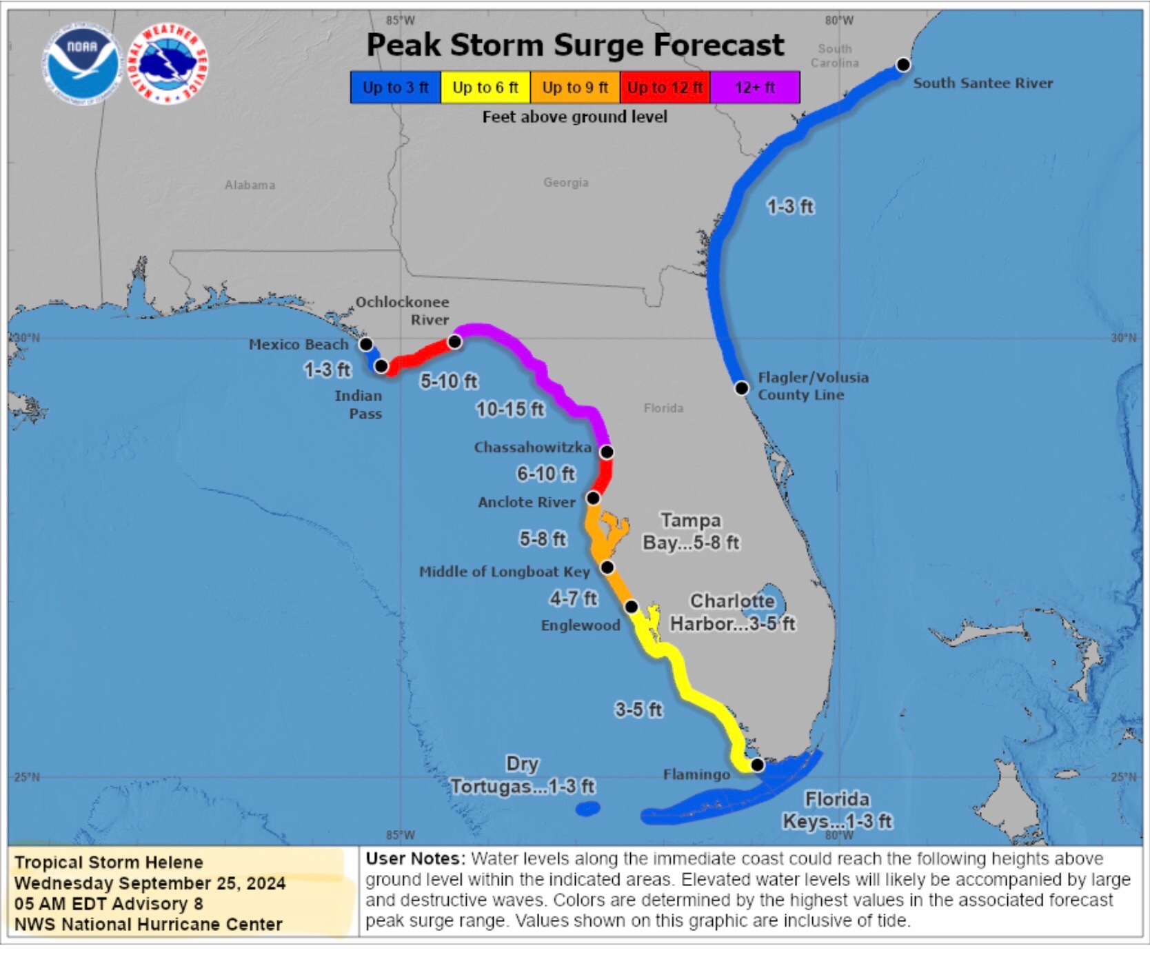
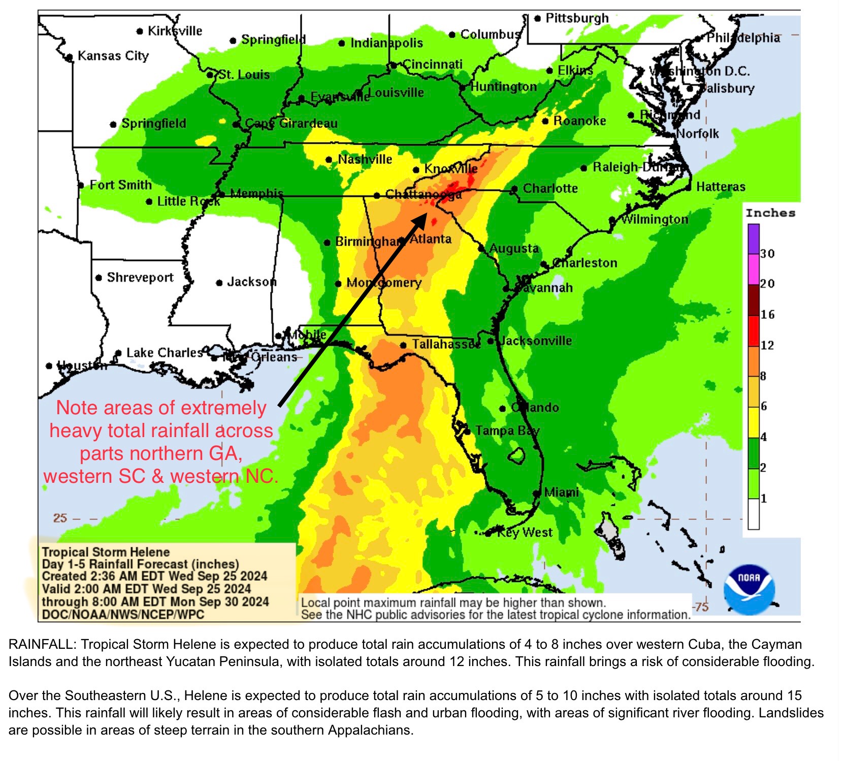
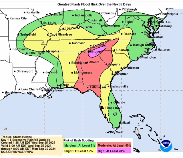
Note the increasing Total Rainfall amounts in parts eastern AL, central & northern GA, western SC, and far western NC. Rainfall totals there are forecast to be in the 8” to 16” range. Also note the area of greatest risk for extensive Flash Flooding in northern GA, western SC and western NC.
Sid Sperry
President & CEO
SPIDI Technologies, LLC
Website/Subscriptions: SPIDItech.com
Cell Phone: (405) 627-7754
Email(s): SidSperry@gmail.com  OR  Sid.Sperry@spidiweather.com
URL(s):  SPIDItech.com
               SPIA-Index.com
               NationalOutages.com  (Partnership with/Global Reach)

Sent from my iPad

 Show/hide attachments
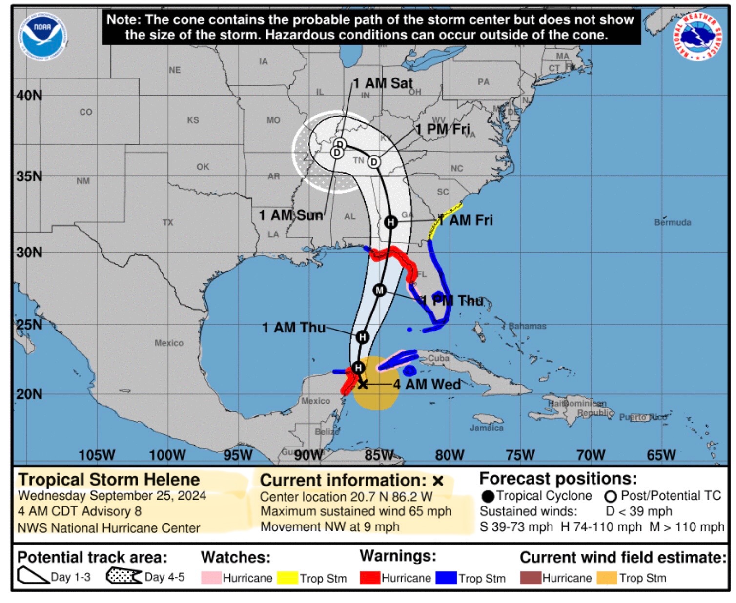