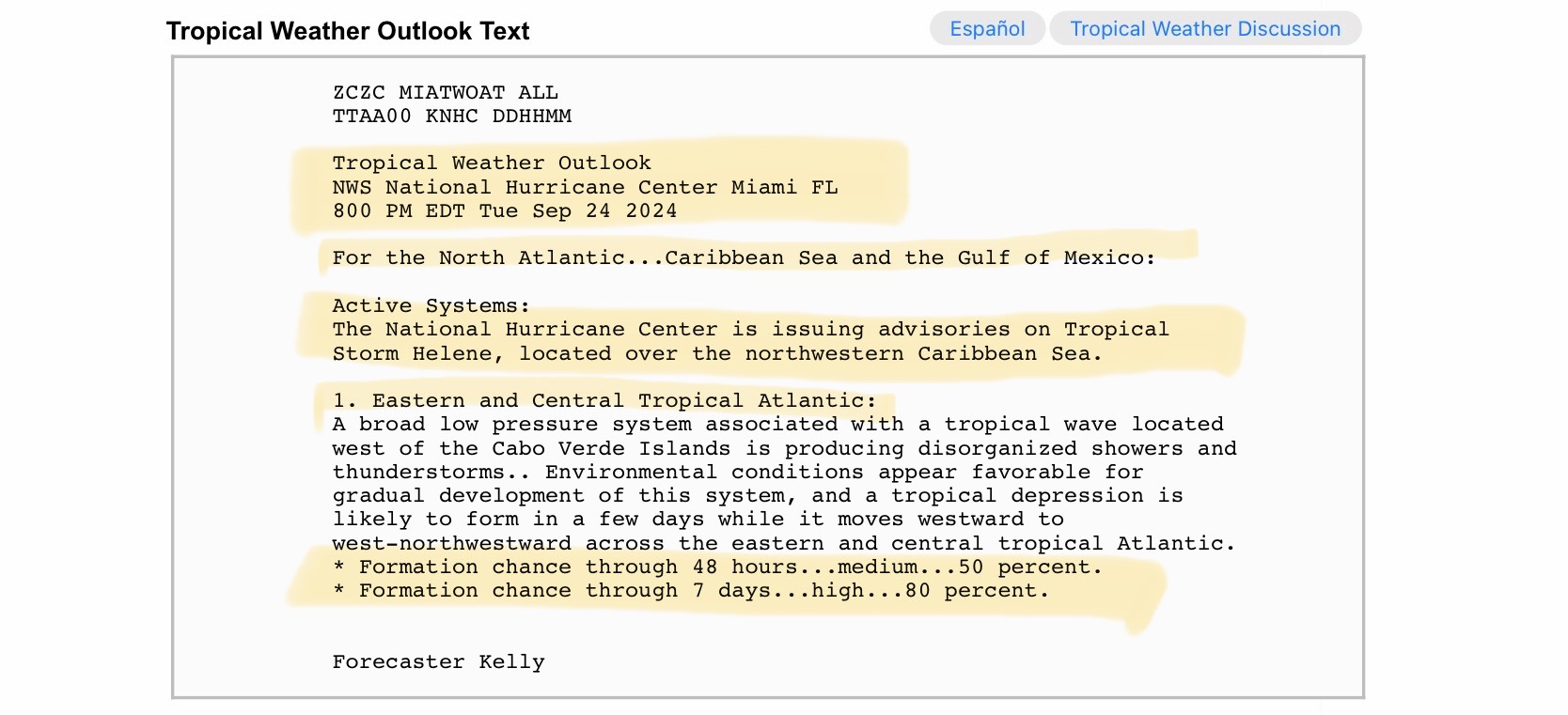
8pm EDT Updates and Forecast Discussion from NHC, and forecast graphics from NWS Tallahassee, FL. Also, don’t look now, but another potentially strong disturbance is developing off the western coast of Africa, moving into the central Atlantic. Further development chances are at 80% over next 7 days…
Sidney Sperry 25 Sep 2024 01:34 UTC
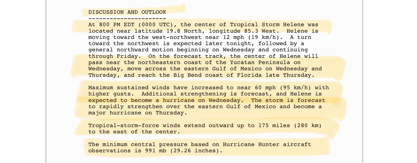
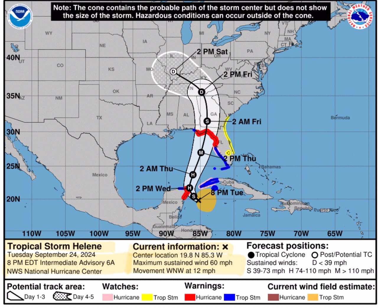
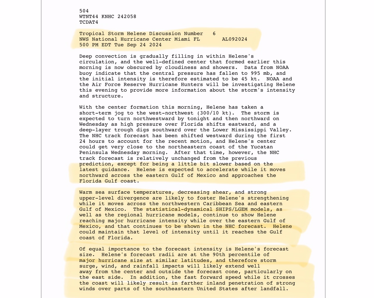
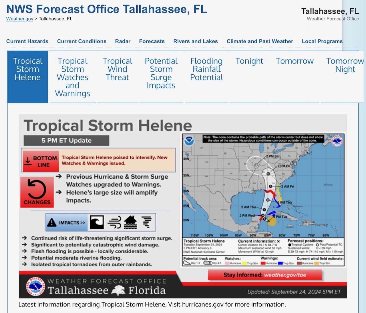
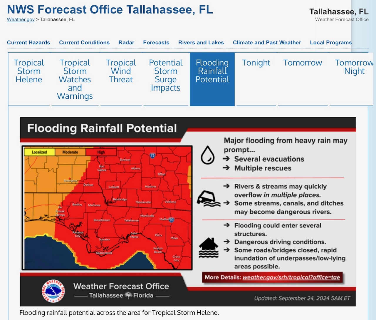
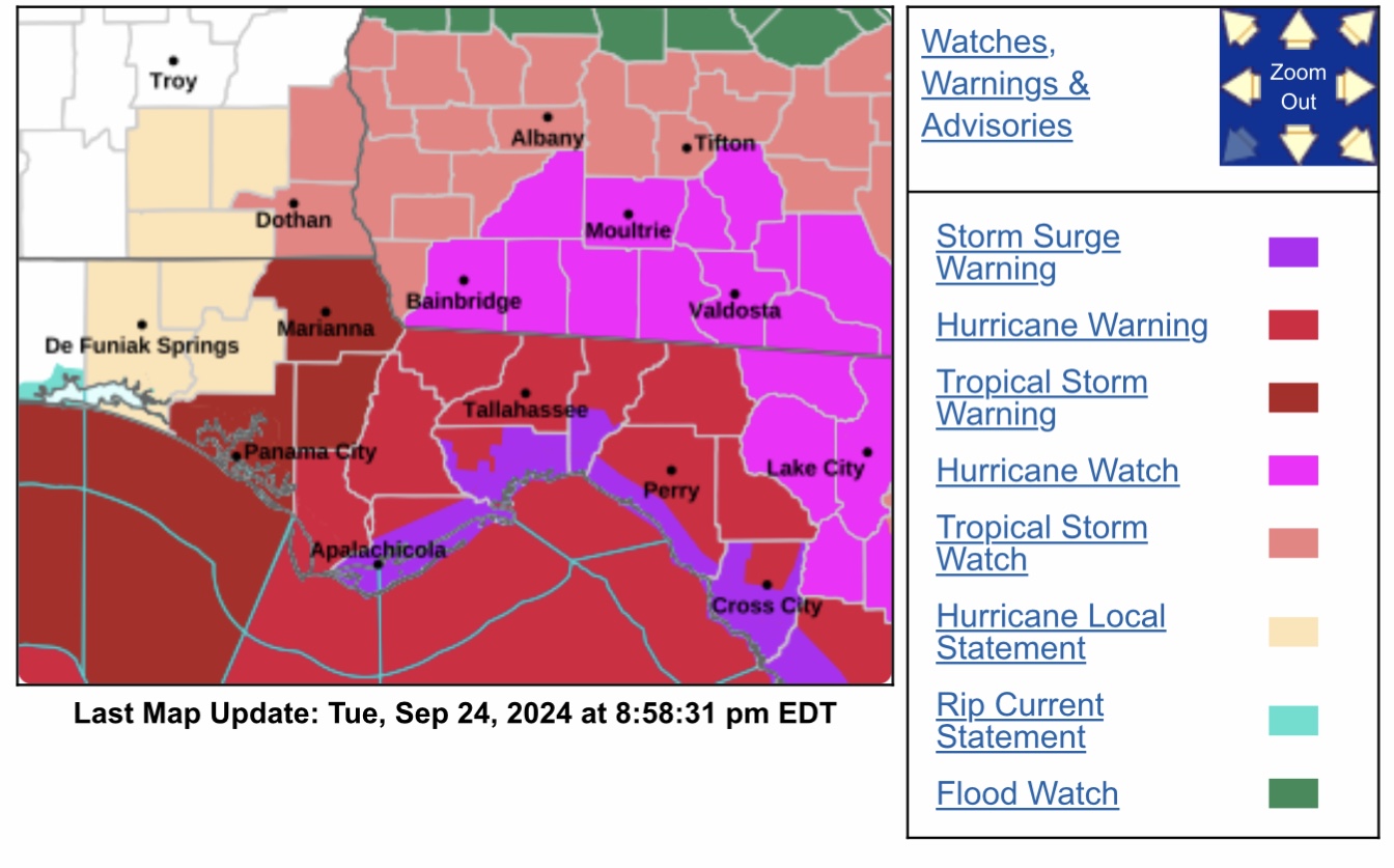
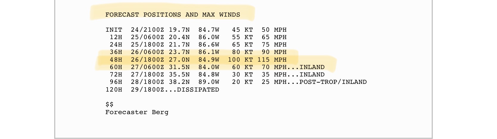
8pm EDT update, 9/24/2024 on Tropical Storm Helene.
Forecast track has not changed much since the 2pm NHC forecast update. Landfall may be a little later on Thursday night, perhaps in the 10pm to midnight range.
Helene’s sustained winds have increased by 15 mph since the 2pm forecast update, to 60 mph. It may reach hurricane strength overnight tonight.
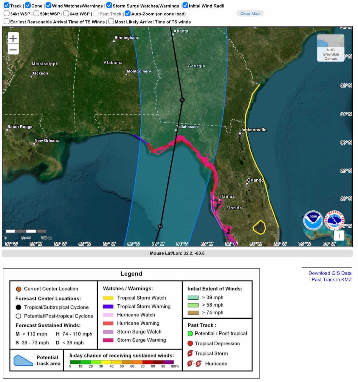
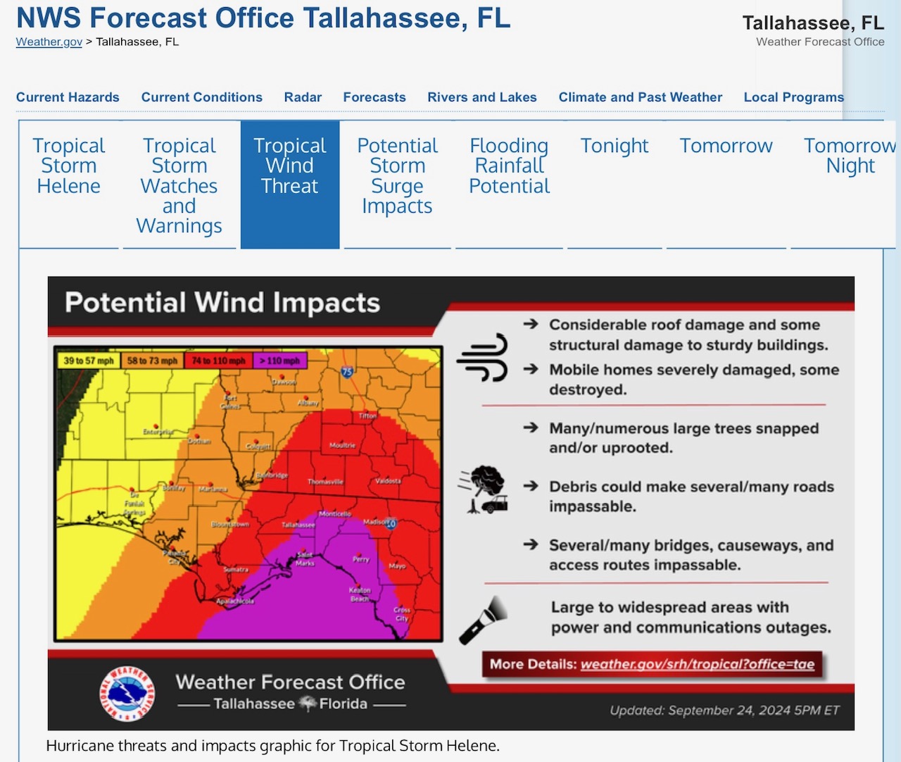
Helene will likely be a Category 3 major hurricane at landfall, between Apalachicola and Cedar Key, in the Big Bend area. Sustained wind speeds at landfall could be in the 110 to 115 mph range. Winds across portions of south GA will likely be in the 74 to 110 mph range. Atlanta and western parts of GA, eastern & southeastern parts of AL could have sustained winds in 50 to 60 mph range, with higher gusts. Western peninsula of FL, southeastern GA, western SC could have sustained winds of 65 to 90 mph in some areas, with higher gusts. Storm surge in Big Bend area of 10’ to 15’; 6’ to 8’ in Tampa Bay area possible.
- Sid Sperry

 Show/hide attachments
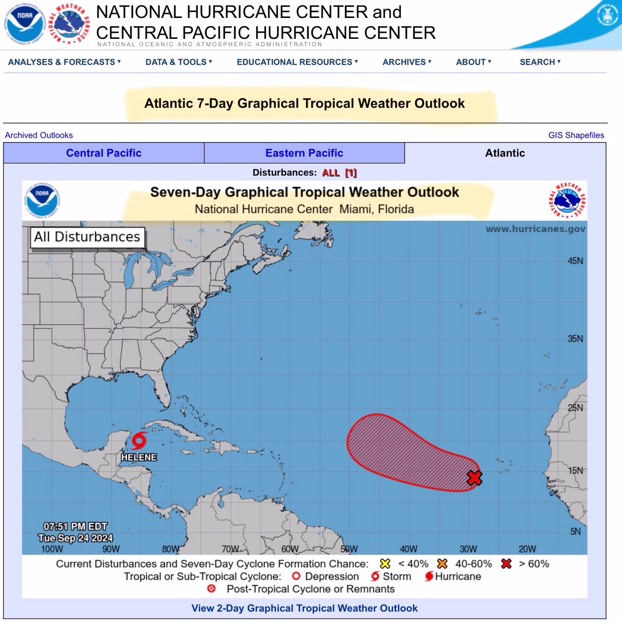