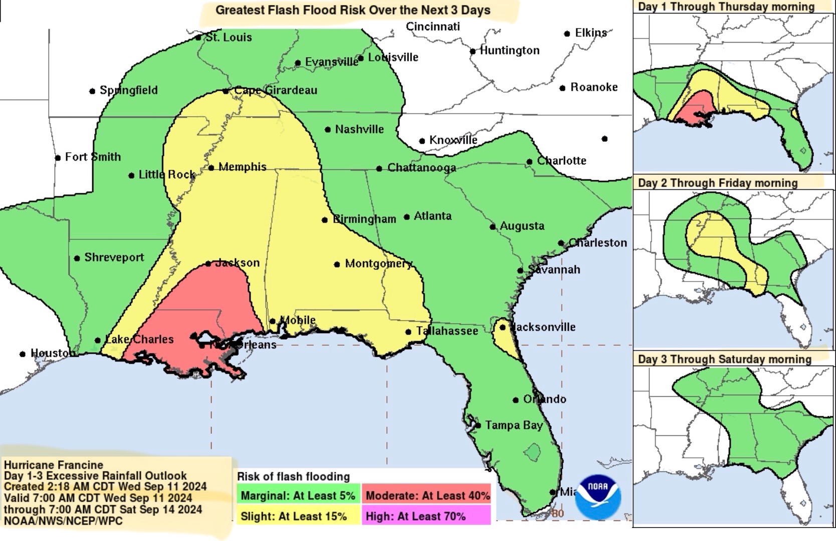
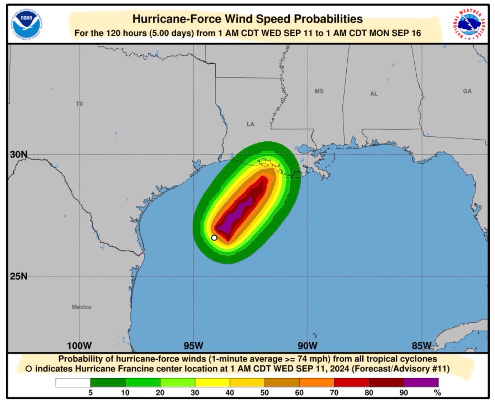
Latest (4am 9/11/24) Forecast Updates from the National Hurricane Center…
Sidney Sperry 11 Sep 2024 11:29 UTC
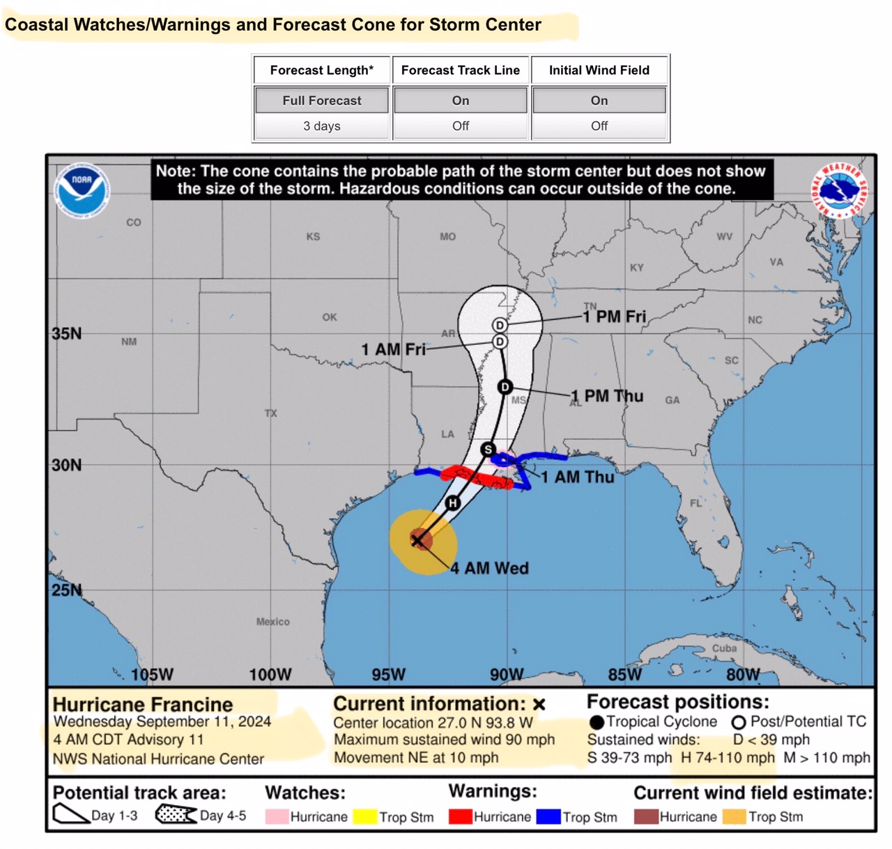
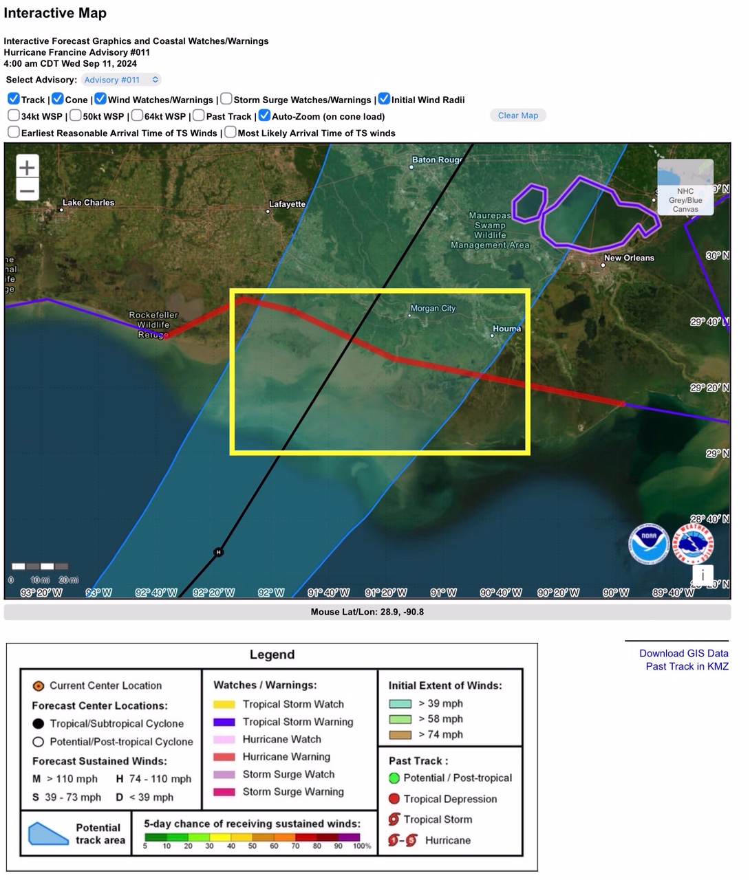
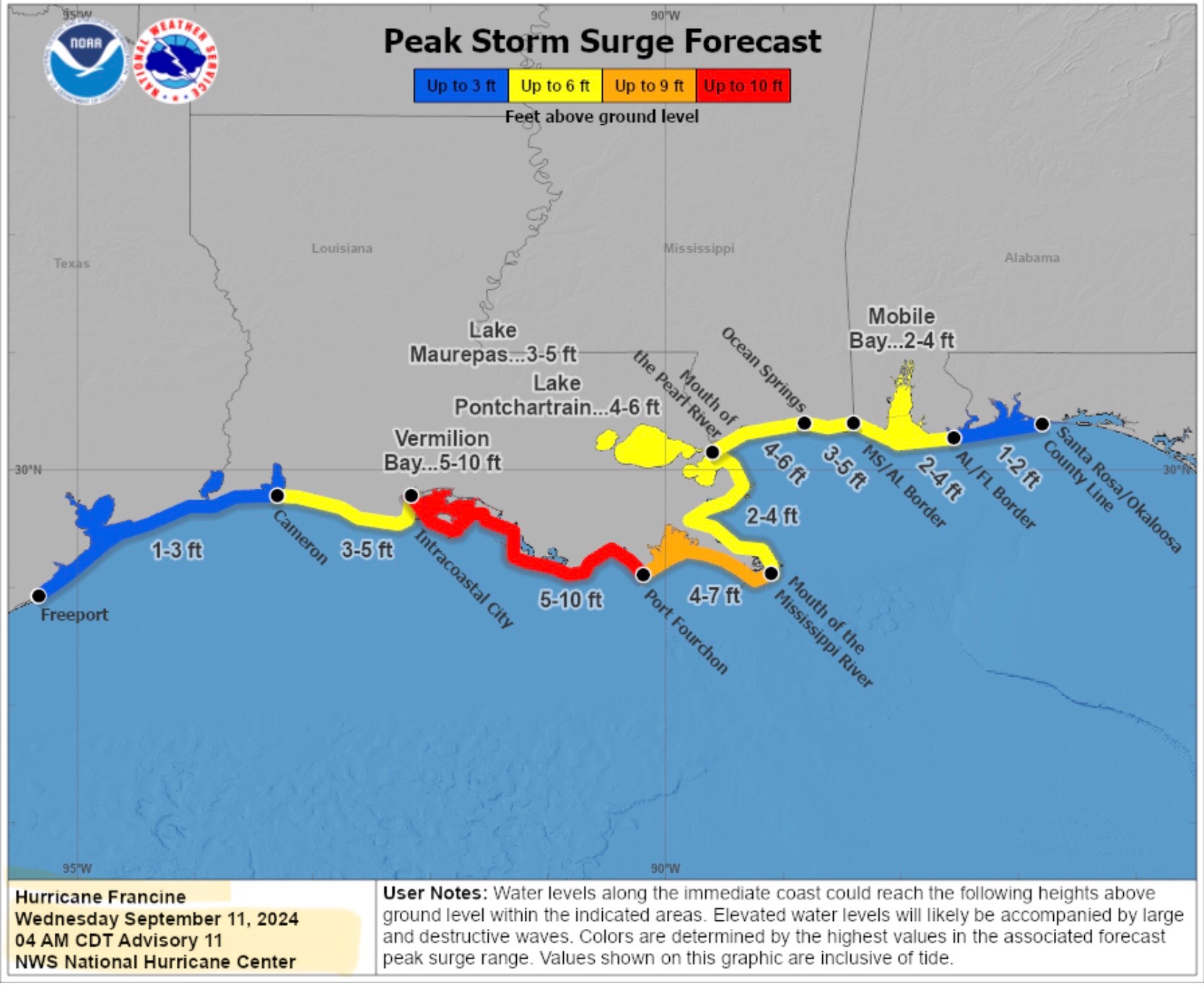
Hurricane Francine now has max sustained winds of 90 mph. Its movement is northeast at 10 mph. The forecast track for Hurricane Francine has not changed much from yesterday evening. It is estimated that Francine will make landfall between Franklin and Morgan City, LA, between 1pm and 6pm CDT today, most likely as a high-end Category 1 hurricane with max sustained winds in the 90 to 95 mph range, which should reduce to 65 to 70 mph within 3 to 4 hours after landfall. Storm Surge estimates still in the 5’ to 10’ range from Intracoastal City to Port Fourchon, LA.

- Sid Sperry

 Show/hide attachments