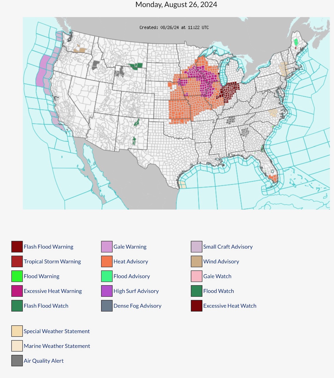
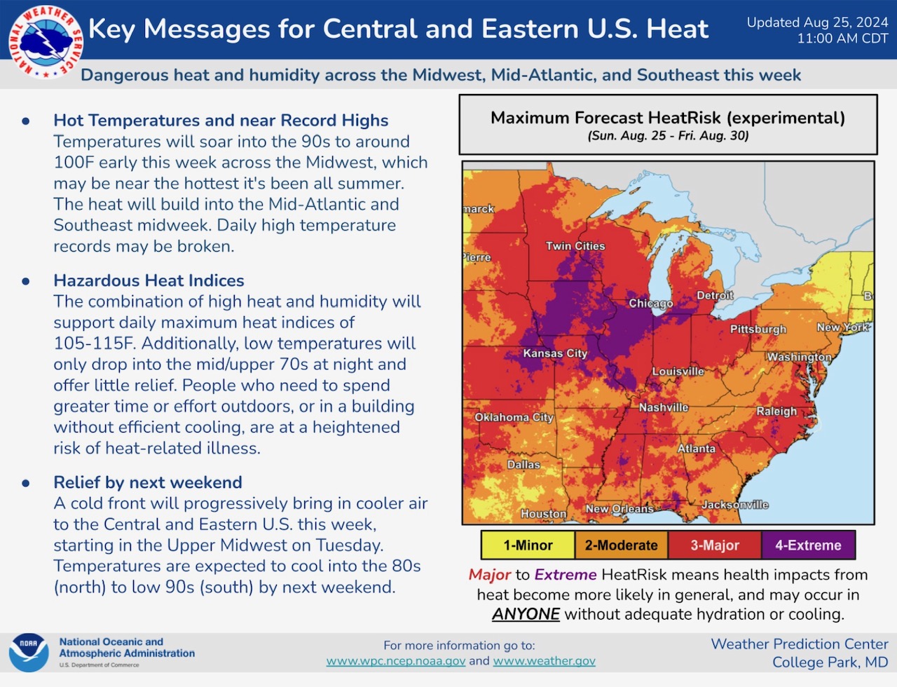
Dangerous Heat & Humidity across parts of the North Central, South Central, Mid Atlantic and Southeast Region states continues today. Excessive Heat Warning parts MN, WI, SD, IA, NE, MO & IL. Excessive Heat Watch parts IL, MI, IN & OH. Heat Advisories parts SD, NE, KS, OK, MN, IA, MO, WI, IL & FL. Flood Watch parts MT, WY, NM & ME. Flash Flood Warning parts ME. Air Quality Alerts parts ID, WY, TN, GA
Sidney Sperry 26 Aug 2024 11:56 UTC
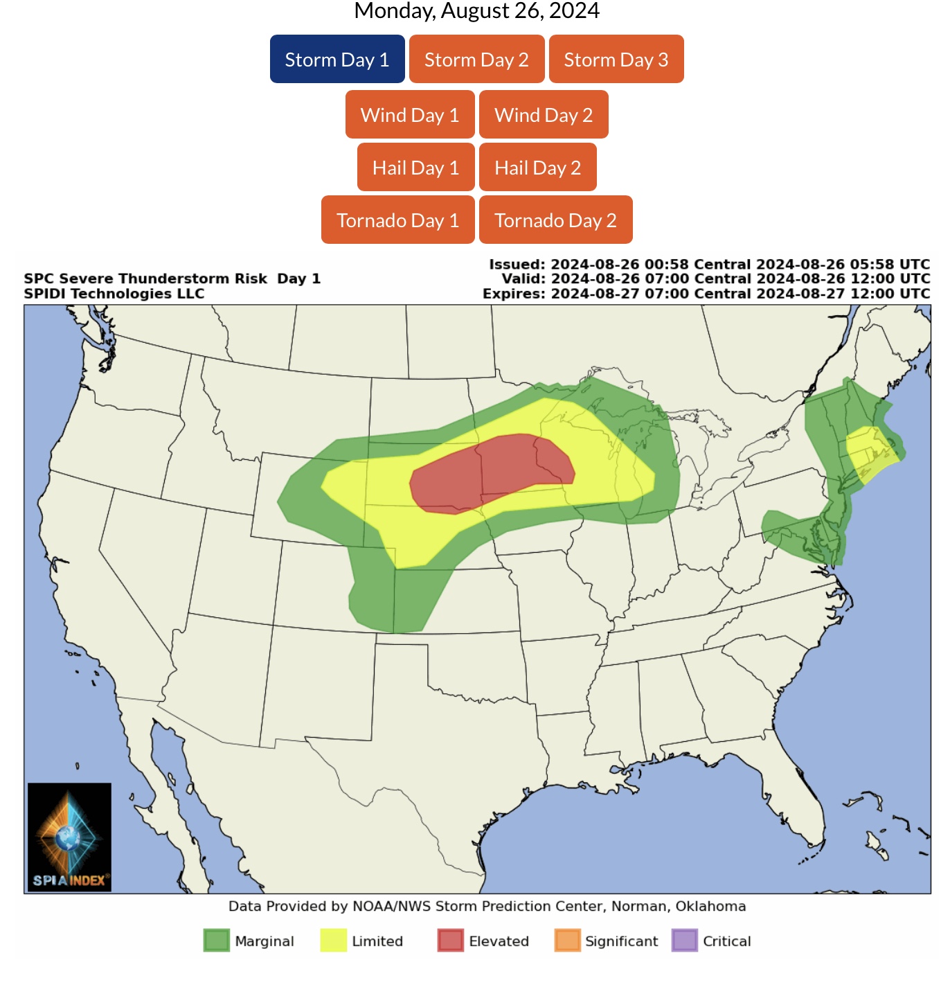
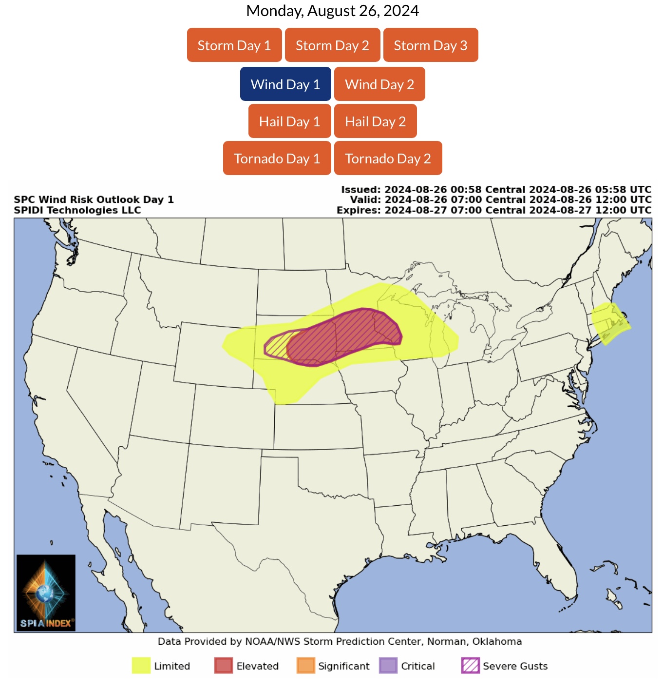
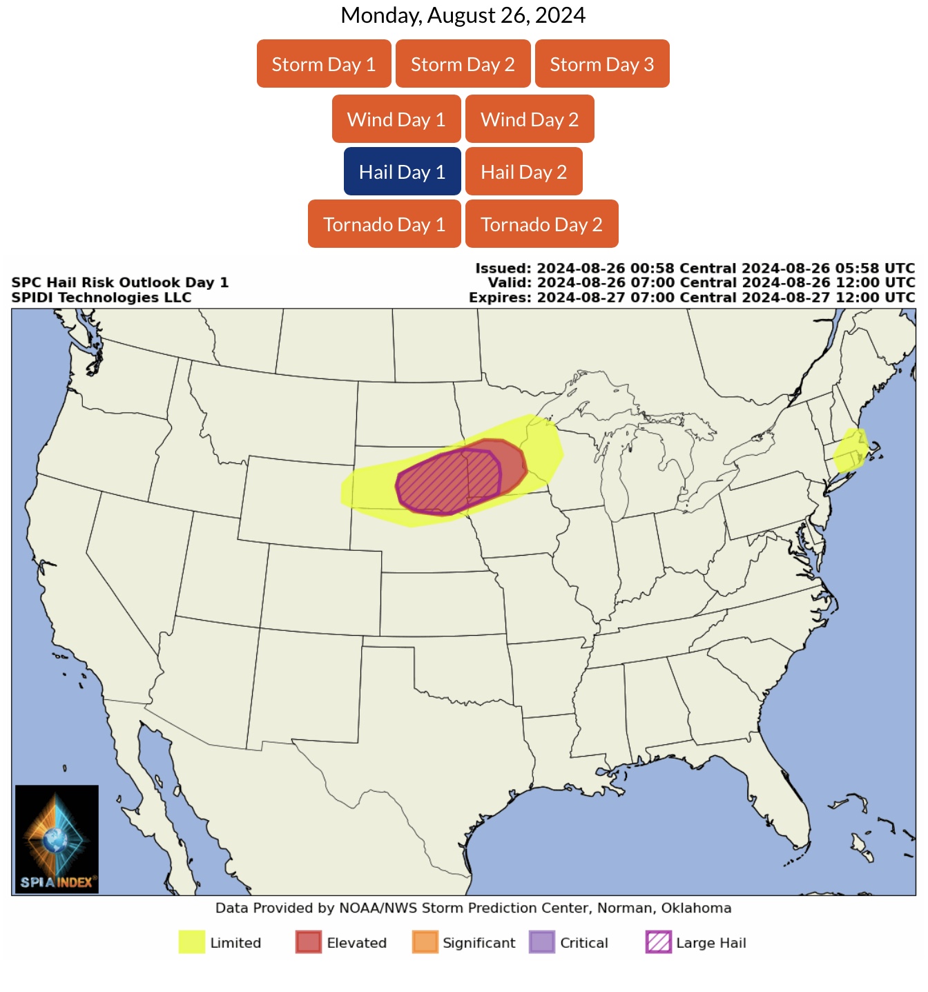
ELEVATED Severe Thunderstorm Risk, Day 1 (Monday, 8/26/24), parts SD, NE, MN, IA & WI. Includes ELEVATED High Winds and Severe Gusts Risk, ELEVATED Hail Risk, and ELEVATED LARGE HAIL Risk.
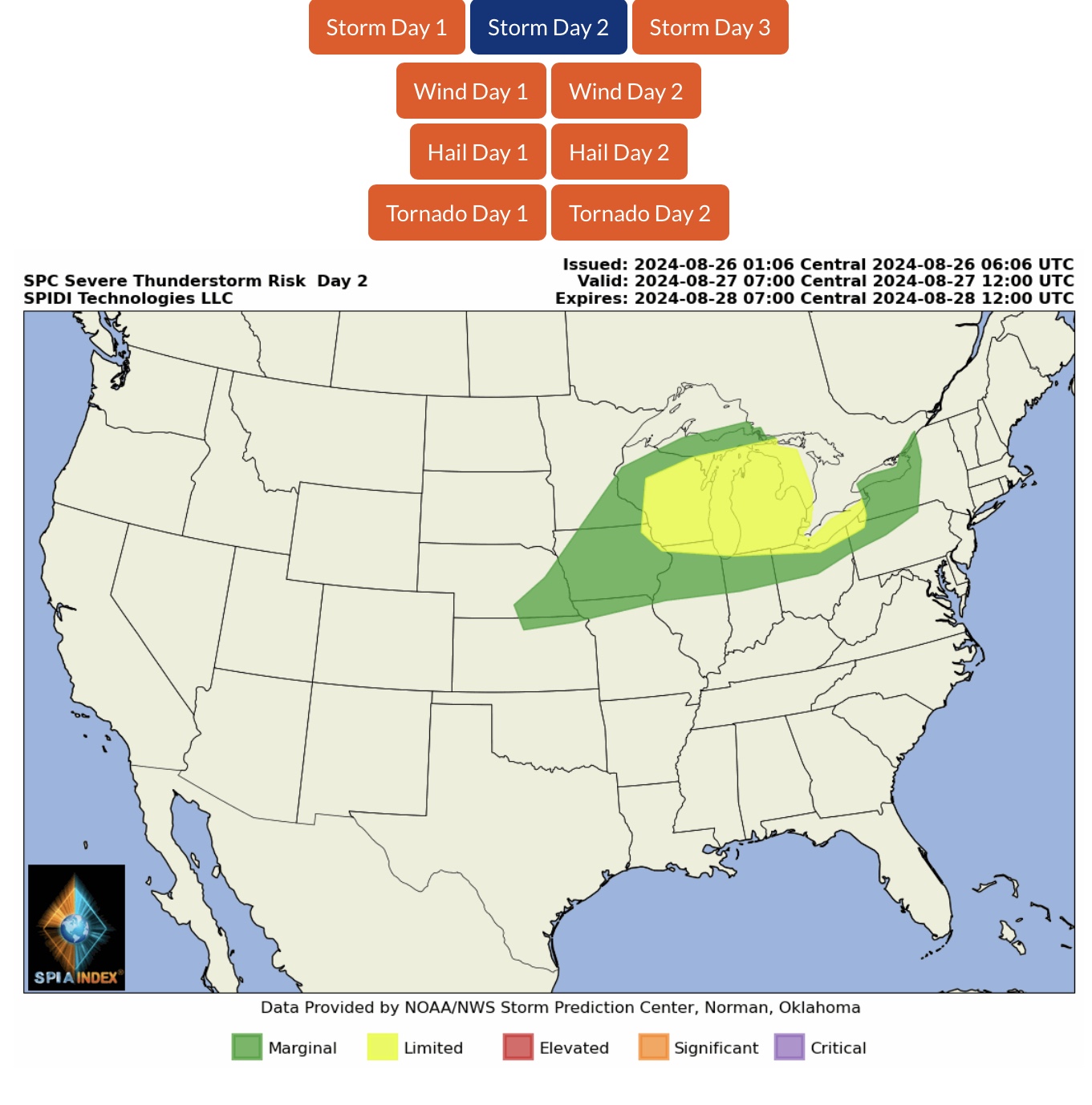
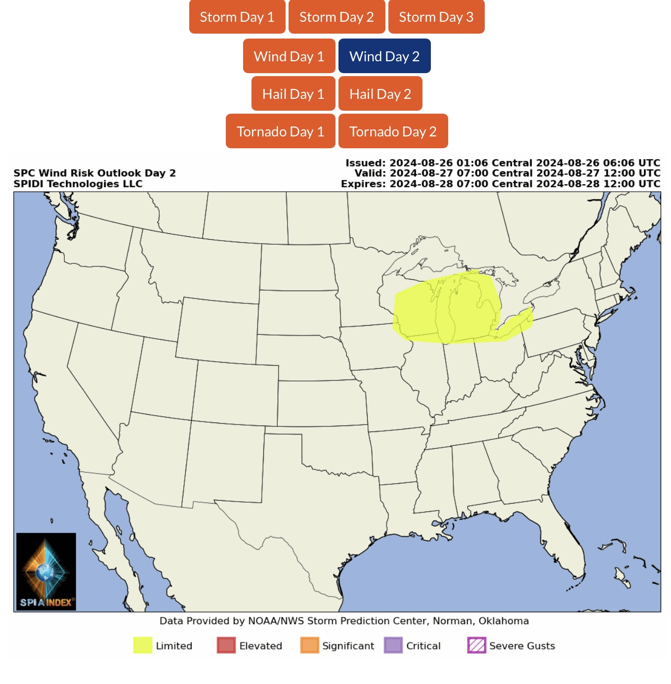
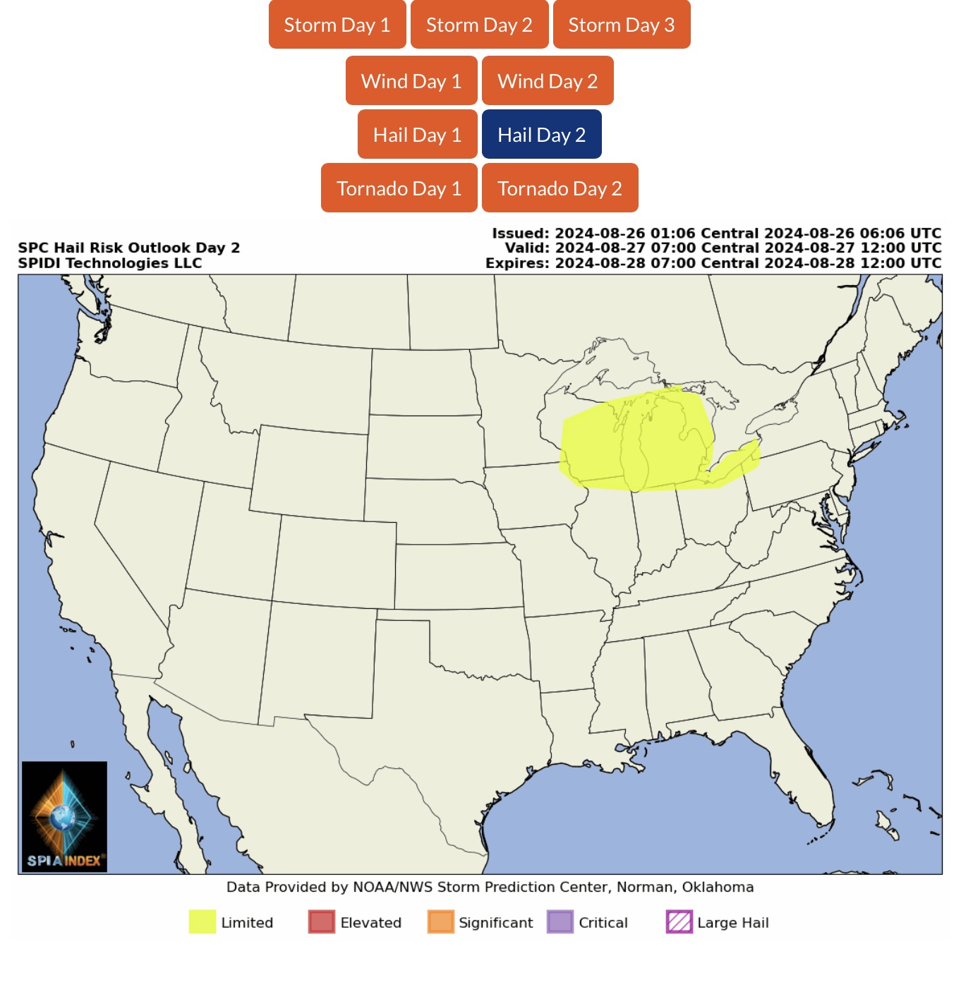
LIMITED Severe Thunderstorm Risk, Day 2 (Tuesday, 8/27/24), parts IA, WI, IL, IN, MI, OH, PA & NY. Includes LIMITED High Winds Risk and LIMITED Hail Risk.
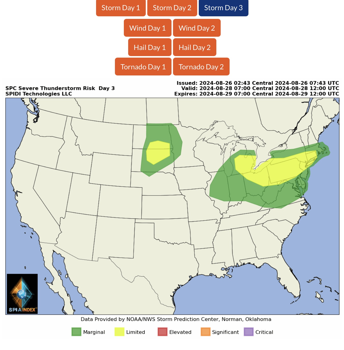
LIMITED Severe Thunderstorm Risk, Day 3 (Wednesday, 8/28/24), parts ND, SD, MI, IN, OH, WV, MD, PA, NY, NJ, CT & MA.
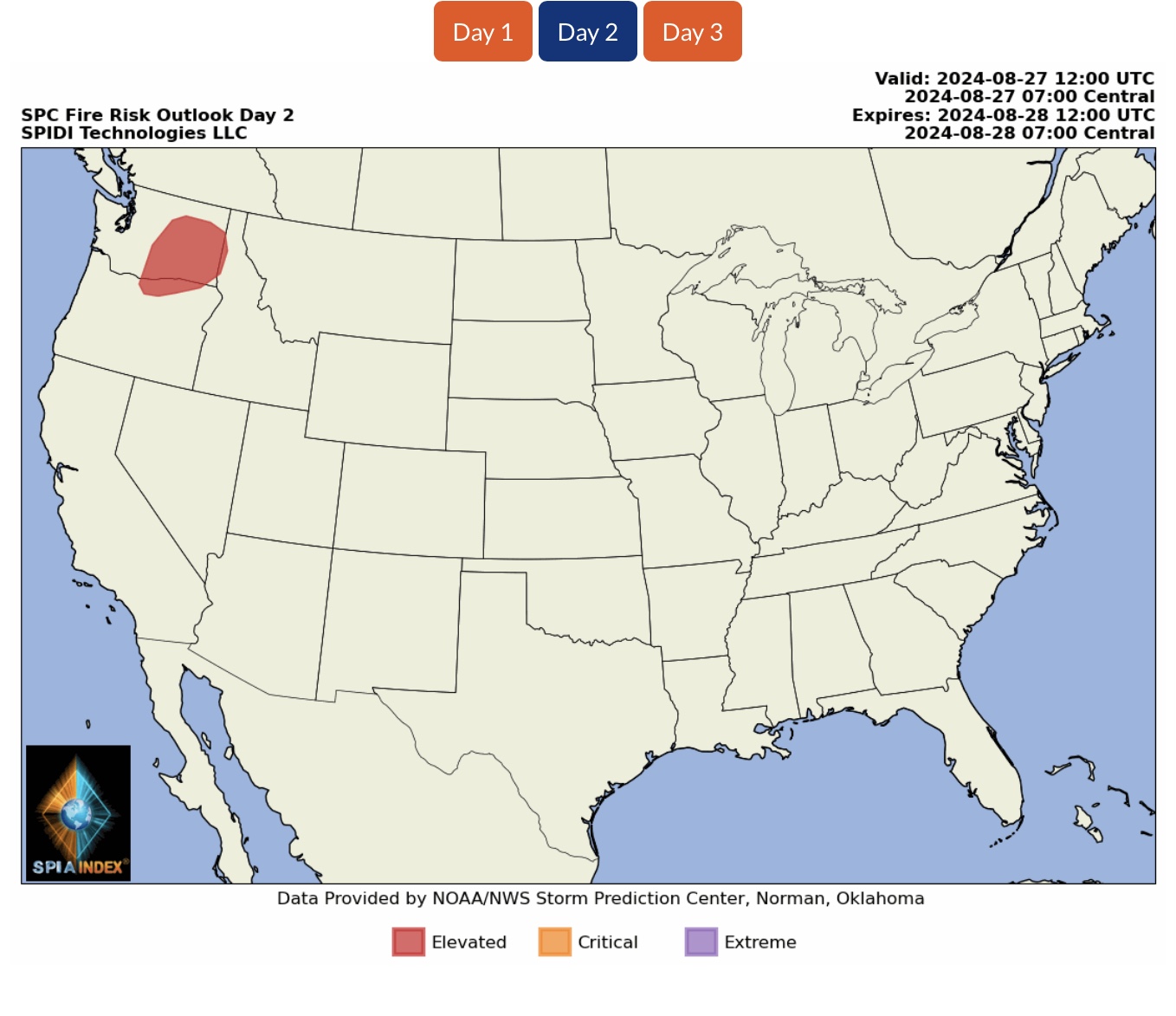
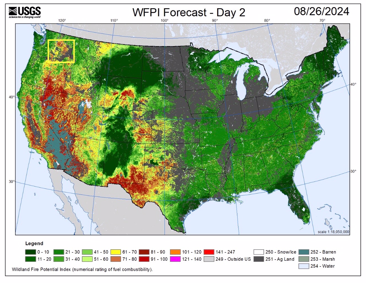
ELEVATED Wildfire Risk, Day 2 (Tuesday, 8/27/24), parts WA, OR & ID. USGS Wildland Fire Potential Index is “HIGH” in parts of southeastern WA.
Sid Sperry
President & CEO
SPIDI Technologies, LLC
Website/Subscriptions: SPIDItech.com
Cell Phone: (405) 627-7754
Email(s): SidSperry@gmail.com  OR  Sid.Sperry@spidiweather.com
URL(s): SPIDItech.com
              SPIA-Index.com
              NationalOutages.com  (Partnership)

Sent from my iPad

 Show/hide attachments