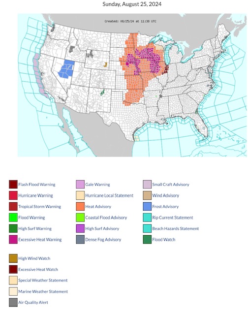
Excessive Heat Warnings today parts SD, NE, MN, WI, IA, IL, & MO. Excessive Heat Watch parts IL & IN. Heat Advisory much of North Central & South Central Regions. FROST Advisory parts NV. Flood Watch parts NM, GA & FL. High Wind Watch in WY.
Sidney Sperry 25 Aug 2024 12:23 UTC
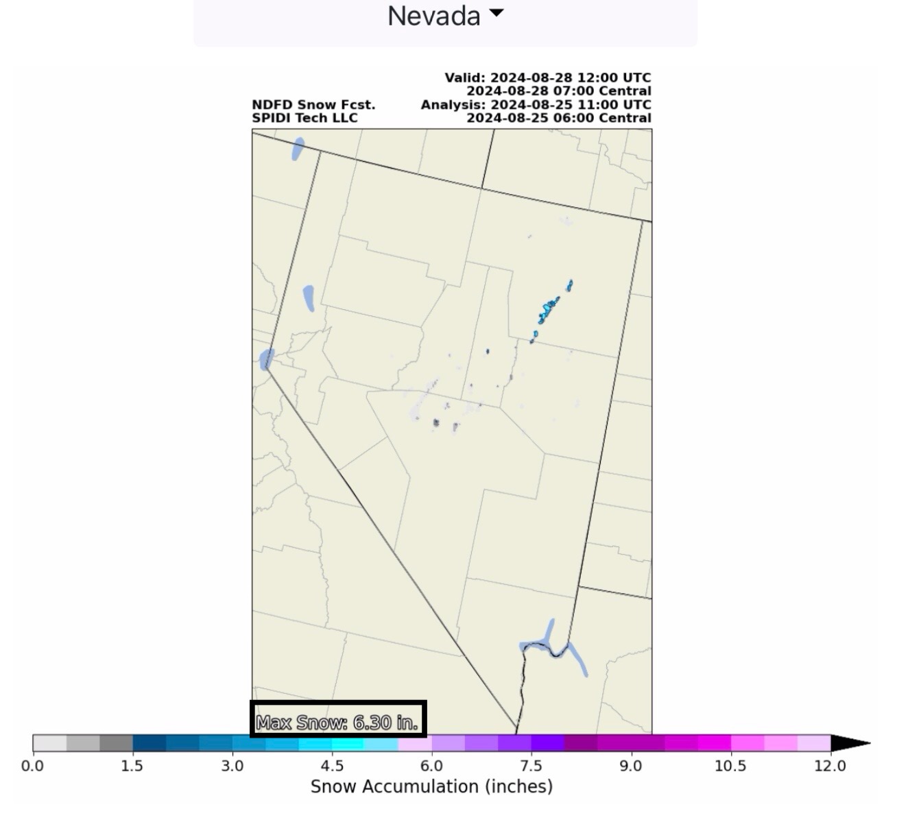
FYI… and yes, that’s SNOW in the forecast for higher elevation areas of eastern NV! (Some SNOW in the higher elevations of northwestern WY & southwestern MT, too.)
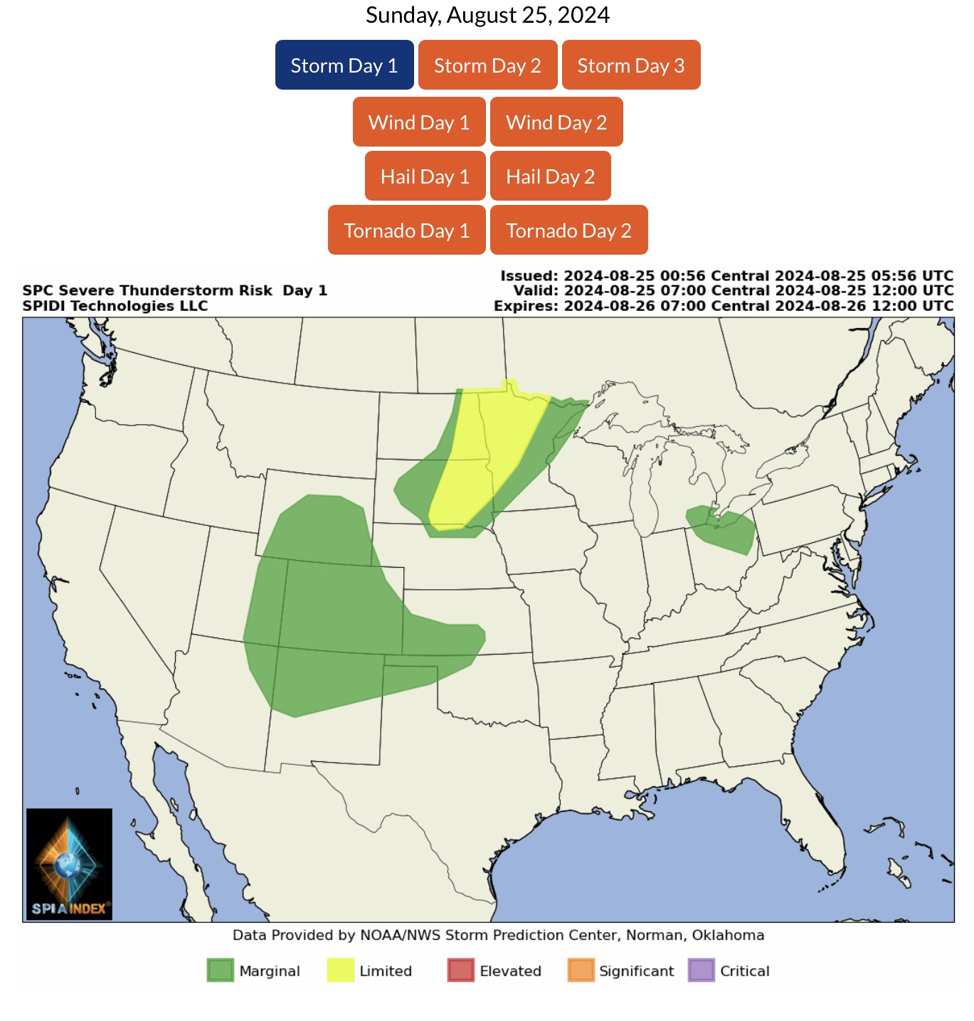
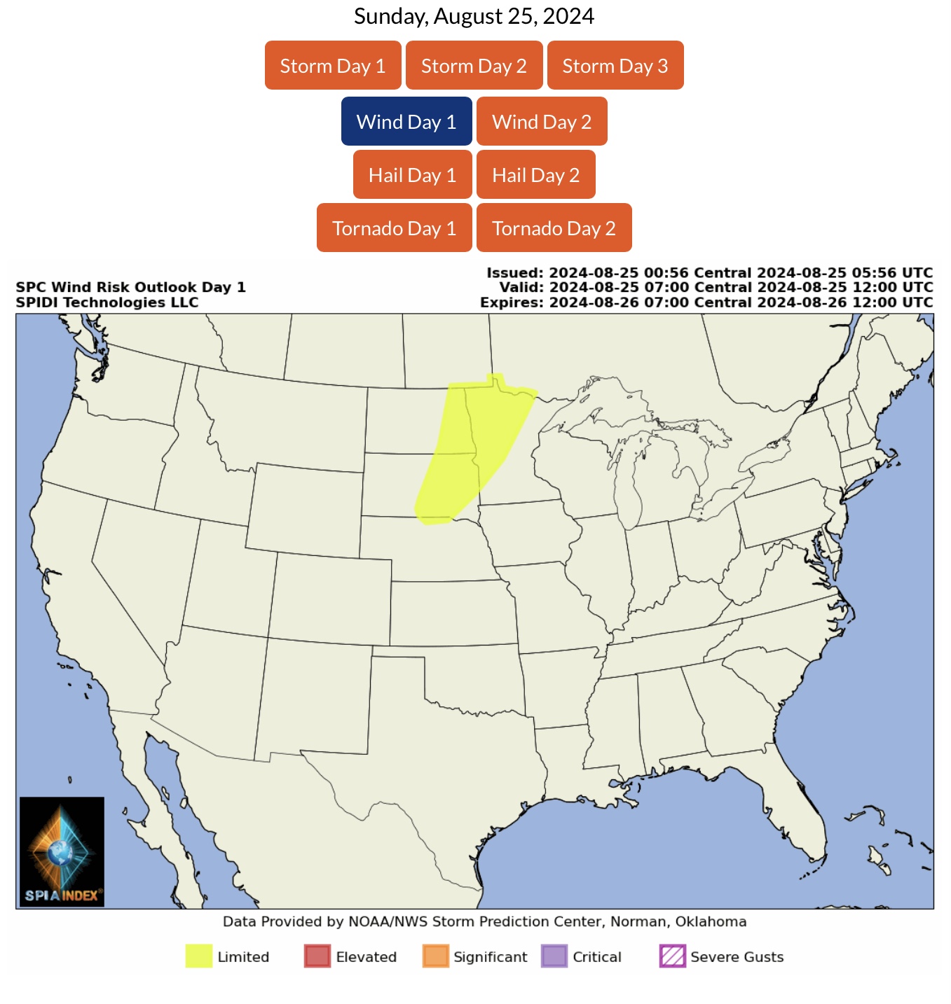
LIMITED Severe Thunderstorm Risk, Day 1 (Sunday, 8/25/24), parts ND, SD, NE & MN. Includes LIMITED High Winds Risk and LIMITED Hail Risk.
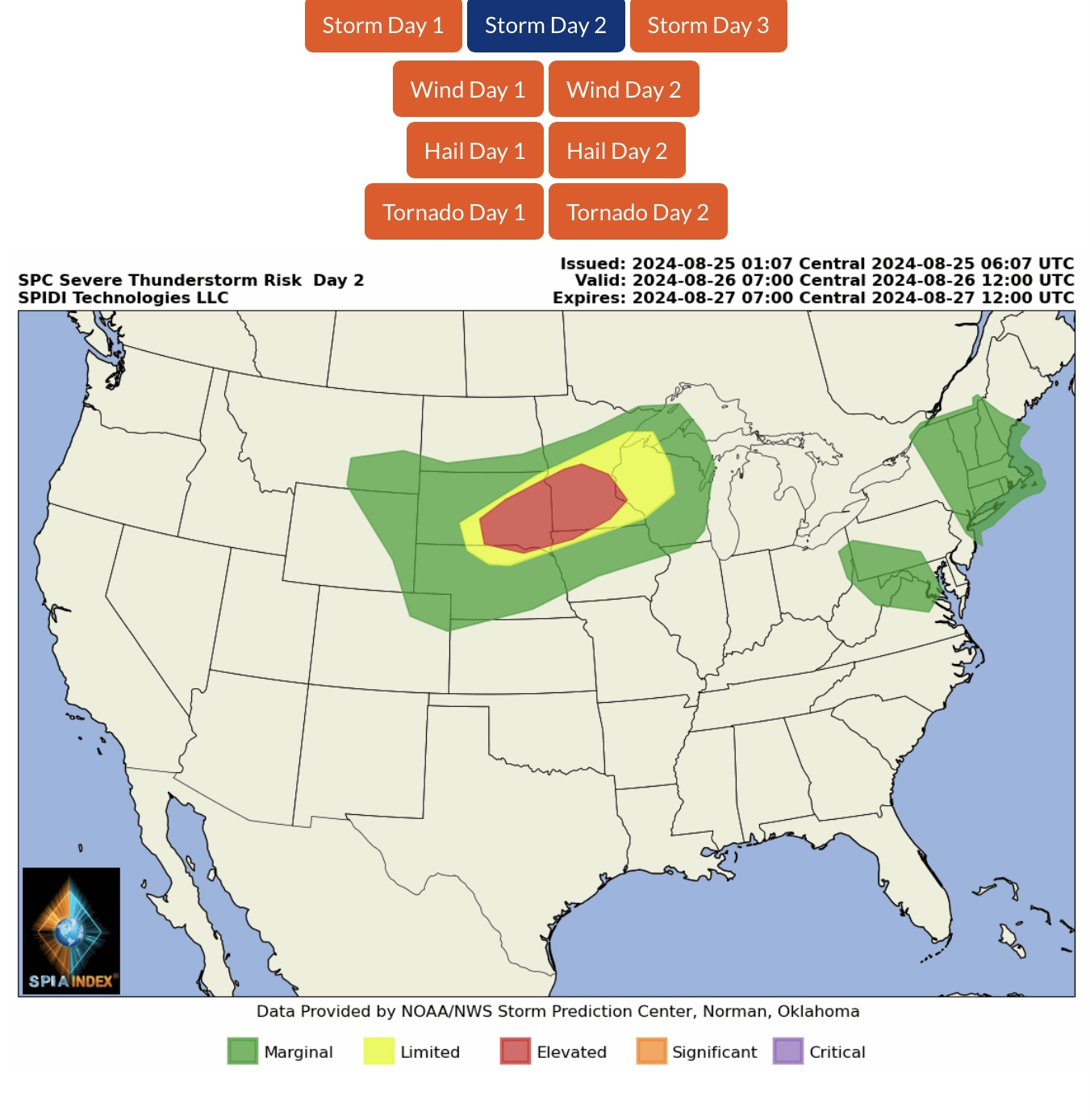
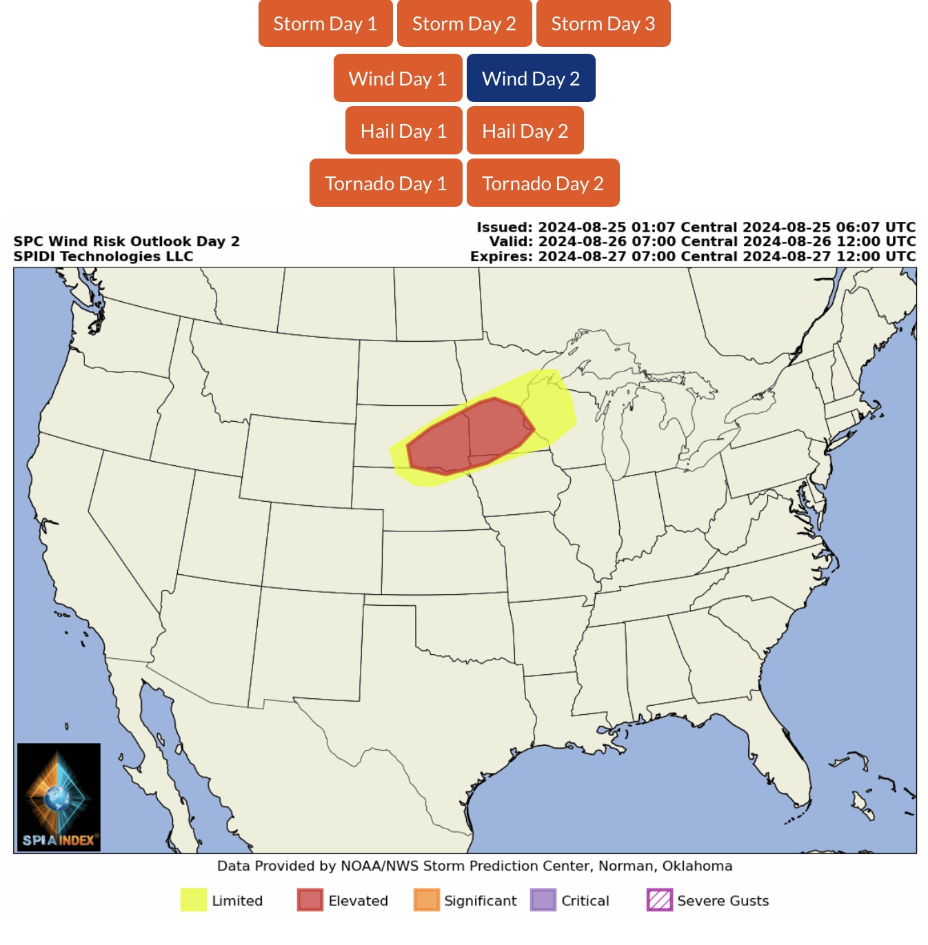
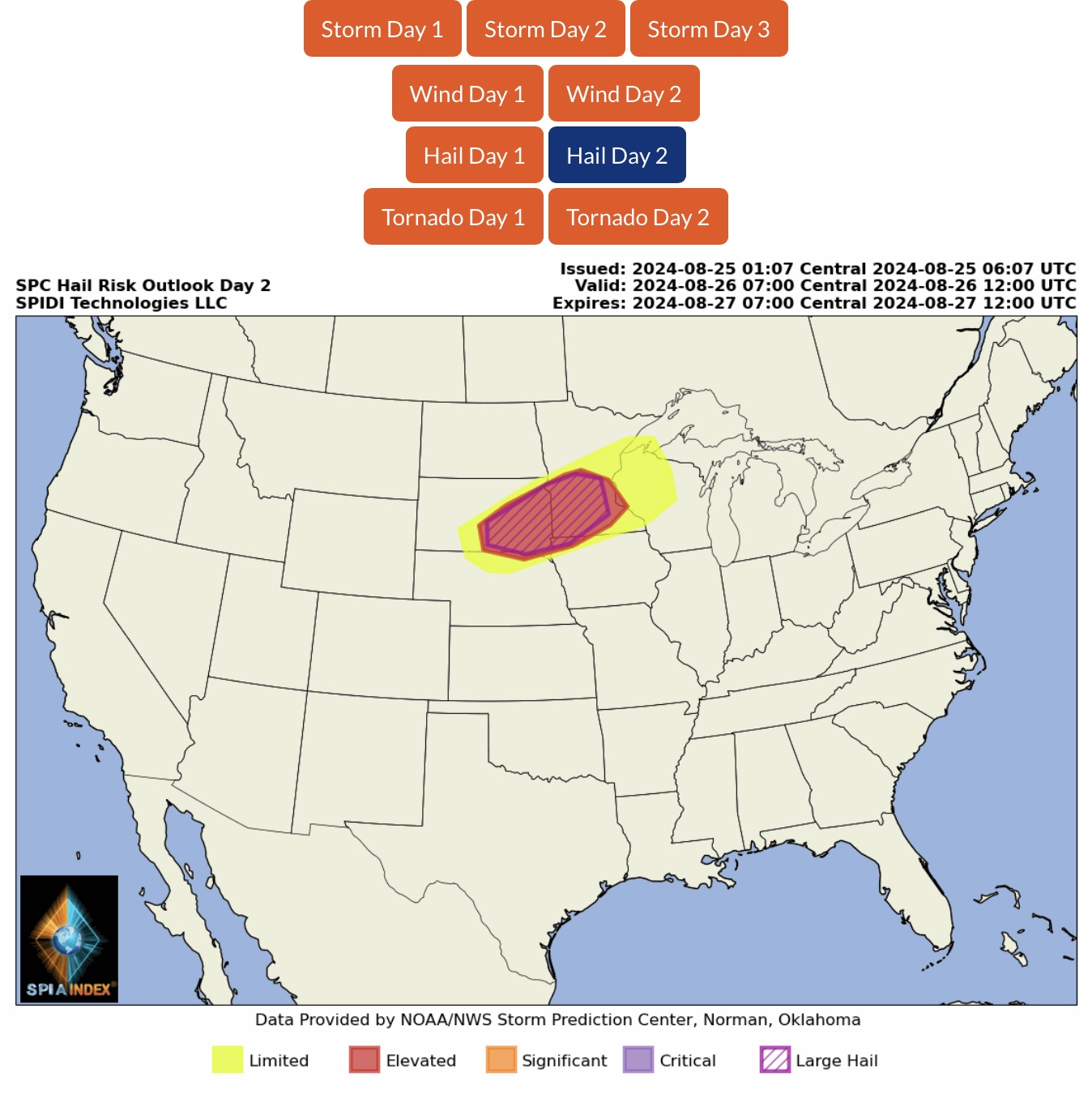
ELEVATED Severe Thunderstorm Risk, Day 2 (Monday, 8/26/24), parts SD, NE, MN, IA & WI. Includes ELEVATED High Winds Risk, ELEVATED Hail Risk and LARGE HAIL Risk.
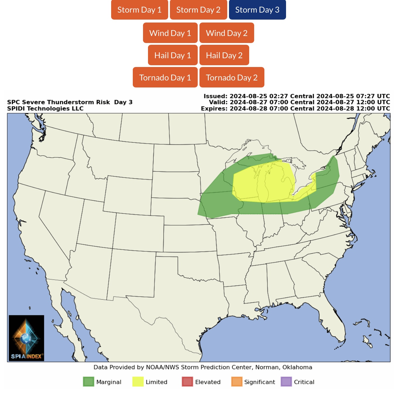
LIMITED Severe Thunderstorm Risk, Day 3 (Tuesday, 8/27/24), parts MN, WI, IA, IL, IN, MI, OH, PA & western NY.
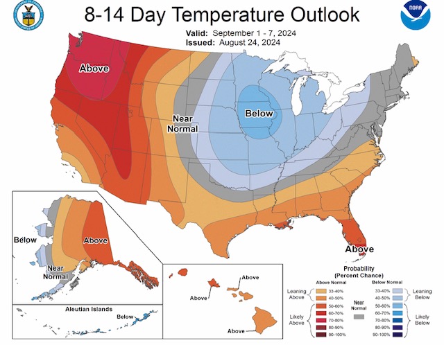
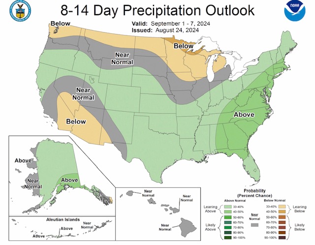
Climate Prediction Center Outlooks for Temperatures and Precipitation for 1st full week of September included below.
Sid Sperry
President & CEO
SPIDI Technologies, LLC
Website/Subscriptions: SPIDItech.com
Cell Phone: (405) 627-7754
Email(s): SidSperry@gmail.com  OR  Sid.Sperry@spidiweather.com
URL(s):  SPIDItech.com
               SPIA-Index.com
               NationalOutages.com  (Partnership)

Sent from my iPad

 Show/hide attachments