FYI…
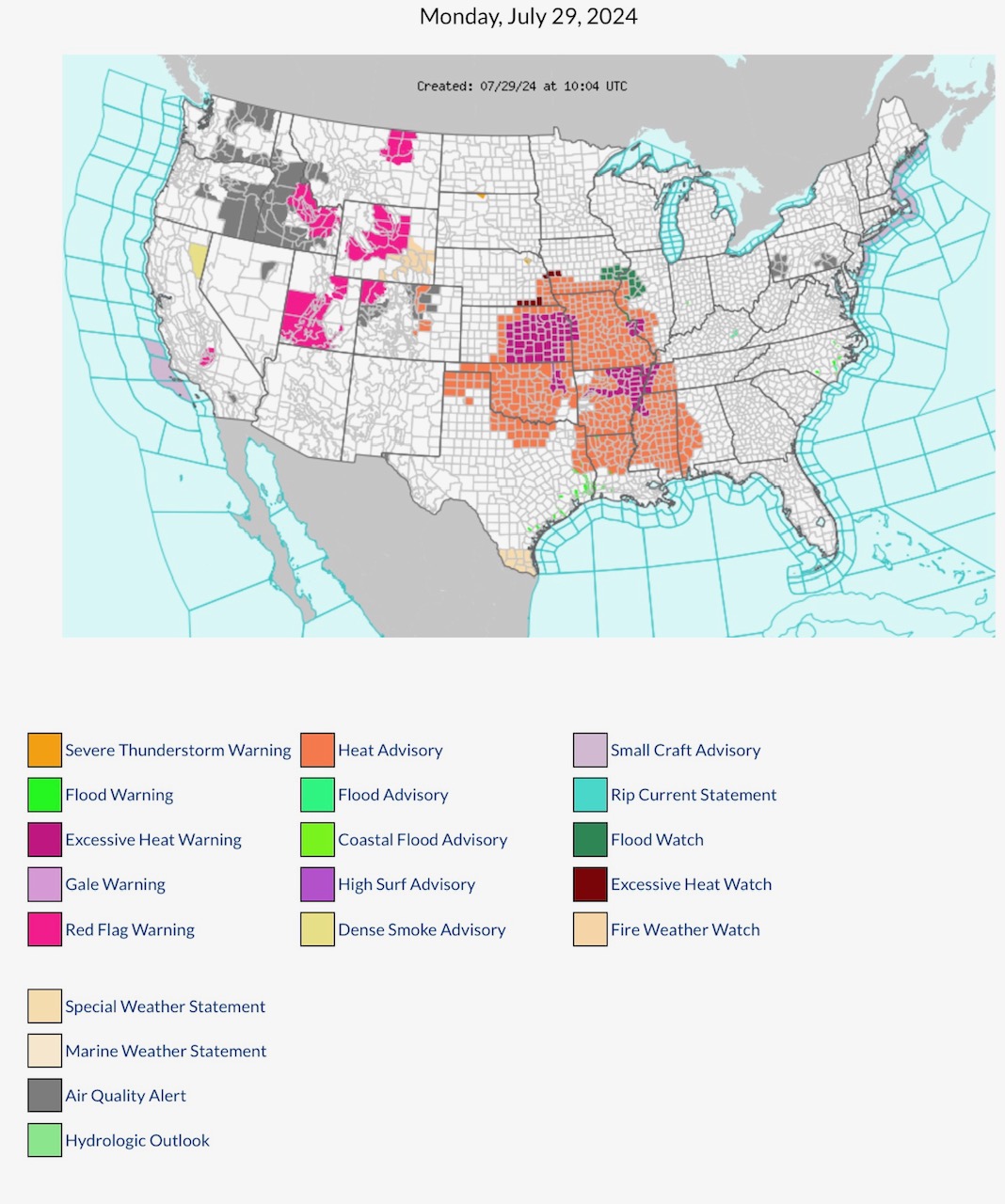
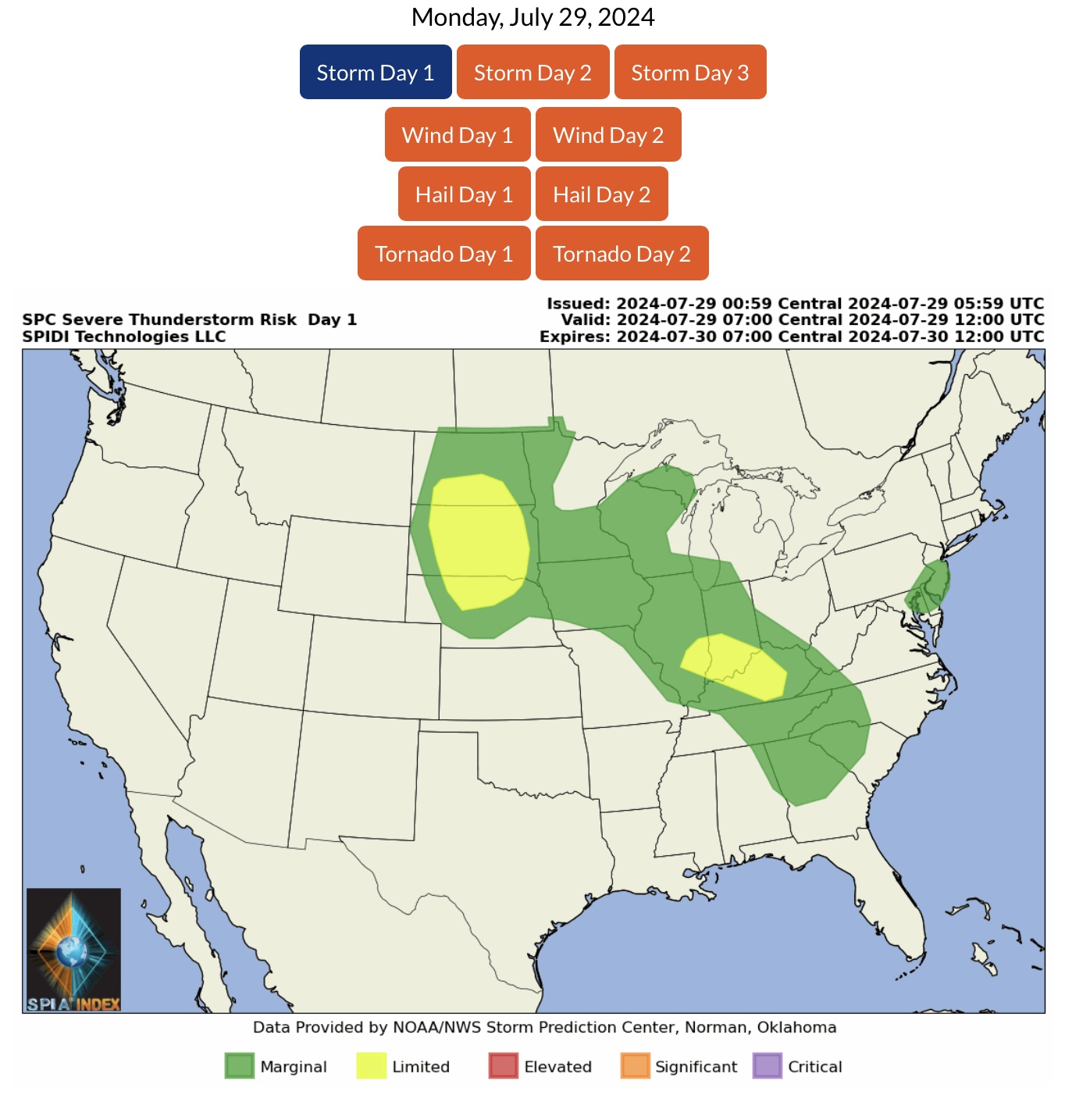
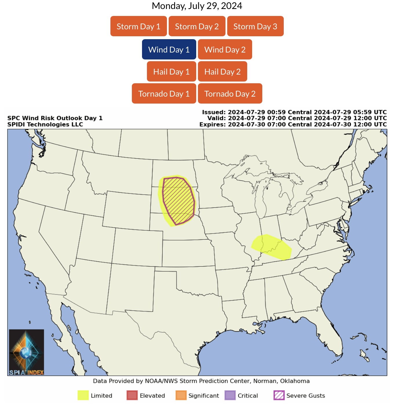
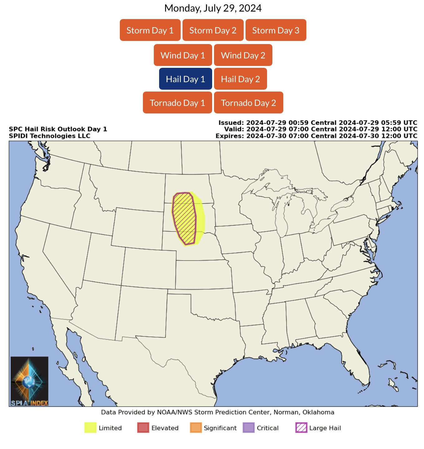
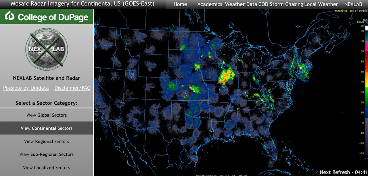
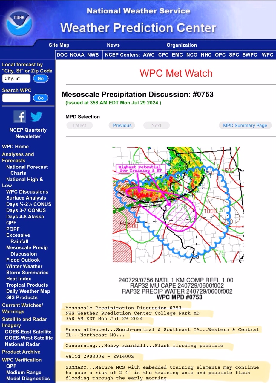
LIMITED Severe Thunderstorm Risk, Day 1 (Monday, 7/29/24), parts ND, SD, NE and IL, IN & KY. Includes LIMITED High Winds Risk and LIMITED Severe Gusts Risk (latter in parts ND, SD & NE). Also includes LIMITED Hail & Large Hail Risk, parts ND, SD & NE.
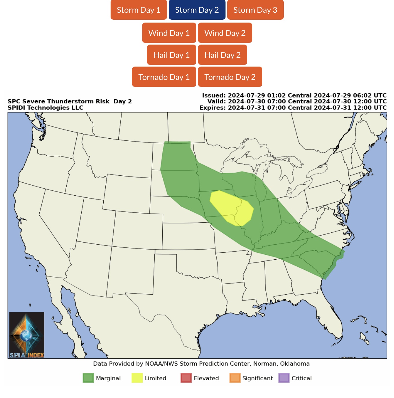
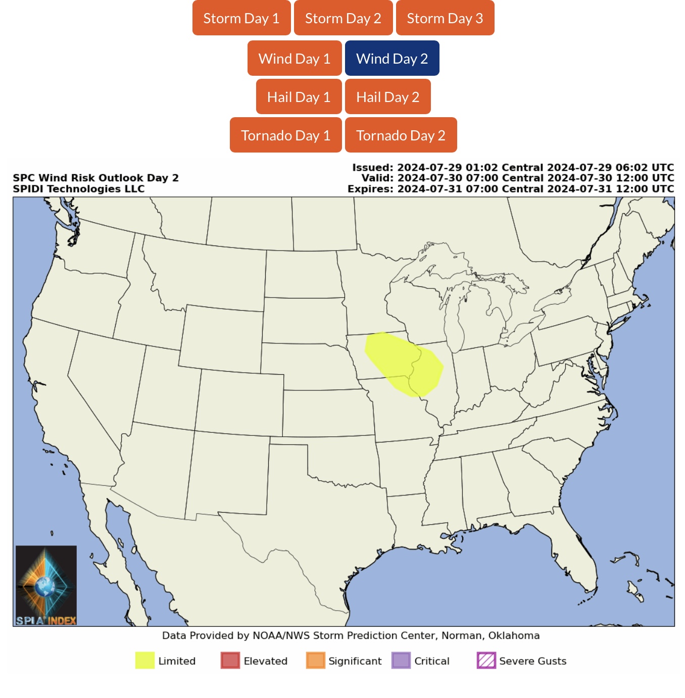
LIMITED Severe Thunderstorm Risk, Day 2 (Tuesday, 7/30/24), parts IA, IL & MO. Includes LIMITED High Winds Risk.
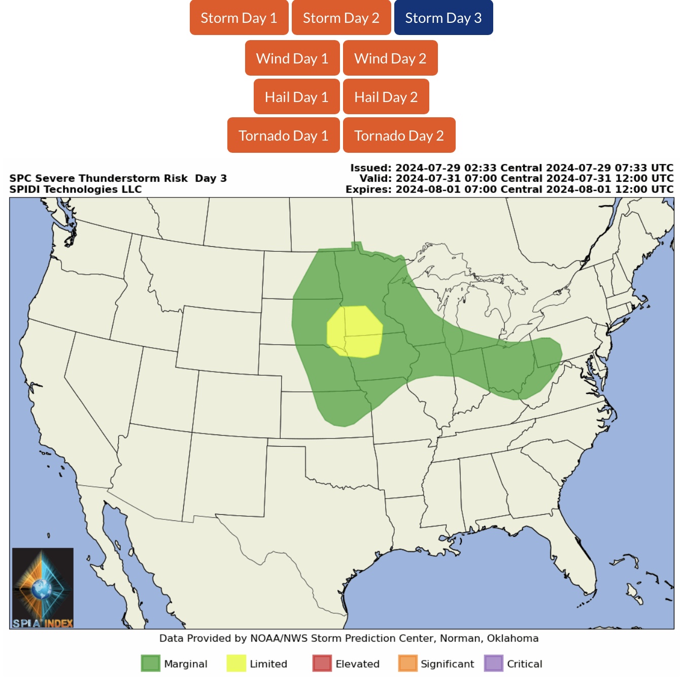
LIMITED Severe Thunderstorm Risk, Day 3 (Wednesday, 7/31/24), parts SD, MN, NE, IA.
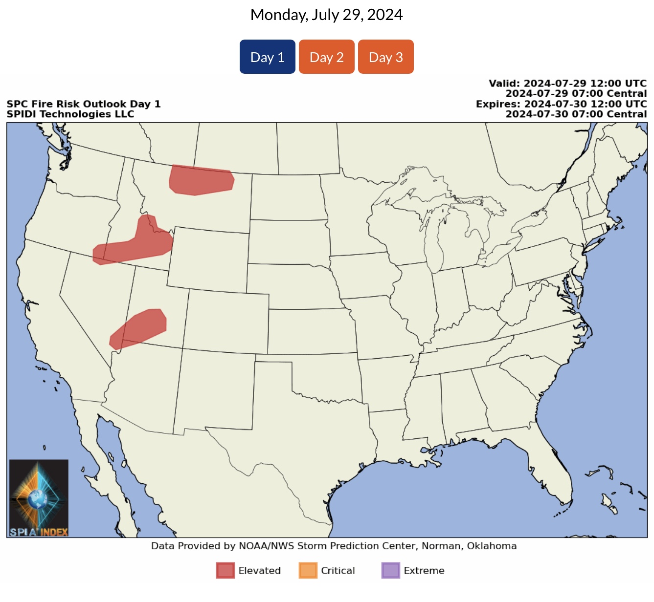
ELEVATED Wildfire Risk, Day 1 (Monday, 7/29/24), parts MT, ID, OR, NV, UT & AZ.
Air Quality Alerts in parts WA, OR, ID, MT, NV, CO and western Canada due to ongoing & uncontrolled wildfires.
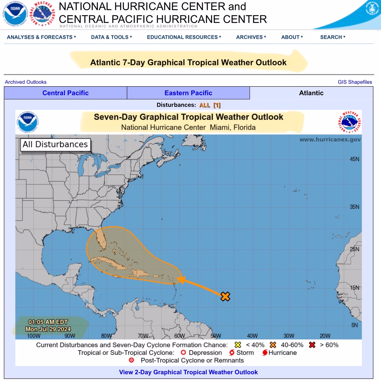
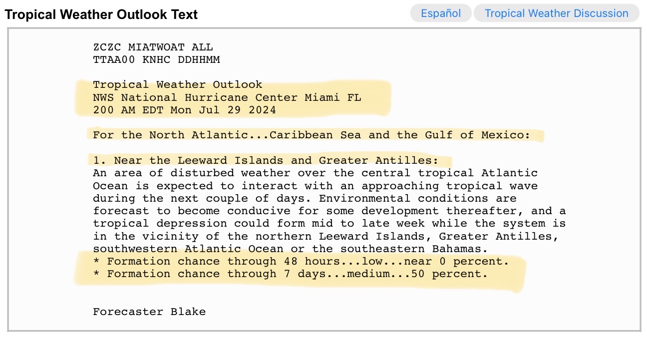
National Hurricane Center (NHC) forecasters now give a disturbance in the southwestern Atlantic a 50% chance of development into a Tropical Depression over the next 5 to 7 days. “Cone of Uncertainty” shifts slightly north-northeast to include nearly all of the Florida Peninsula. Should this trend continue, areas of concern could include parts of coastal Georgia, coastal South Carolina, and coastal North Carolina.
Sid Sperry
President & CEO
SPIDI Technologies, LLC
Website/Subscriptions: SPIDItech.com
Cell Phone: (405) 627-7754
Email(s): SidSperry@gmail.com  OR  Sid.Sperry@spidiweather.com
URL(s):  SPIDItech.com
               SPIA-Index.com
               NationalOutages.com  (Partnership)

Sent from my iPad

 Show/hide attachments