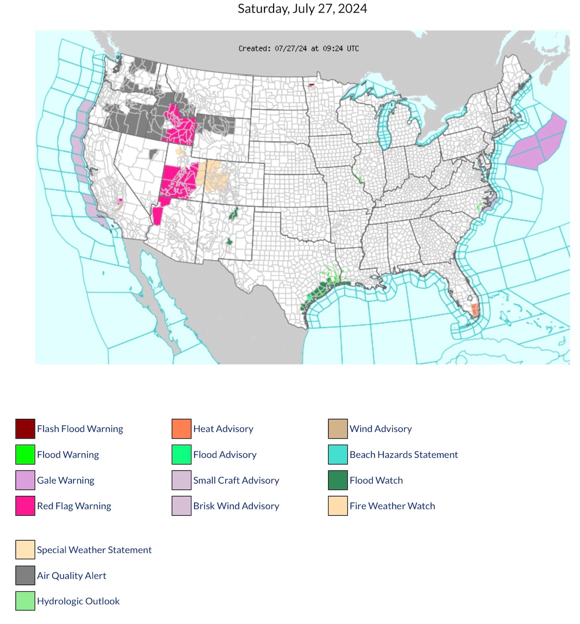
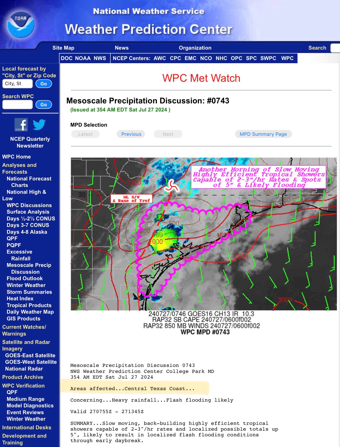
RED FLAG FIRE WARNINGS parts ID, UT & AZ; Fire Weather Watch parts UT & CO as parts CA, OR, WA & western Canada continue to burn w/uncontrolled Wildfires. Air Quality Alerts parts WA, OR, ID, MT, WY & NV. Flood Watch & Warnings, TX & LA
Sidney Sperry 27 Jul 2024 10:14 UTC
FYI…
Temperatures will be increasing into the upper 90s and low 100s over next 7 days across parts of the South Rockies, South Central & North Central Regions of the U.S.; Heat Index Temperatures could be in the 105 F to 115 F range by middle of next week.
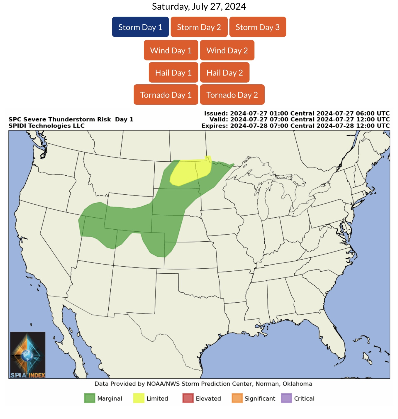
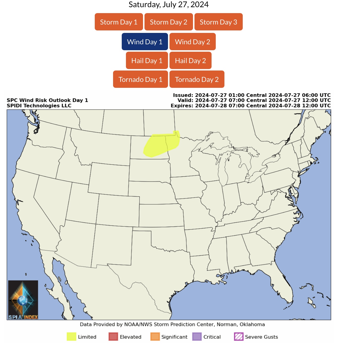
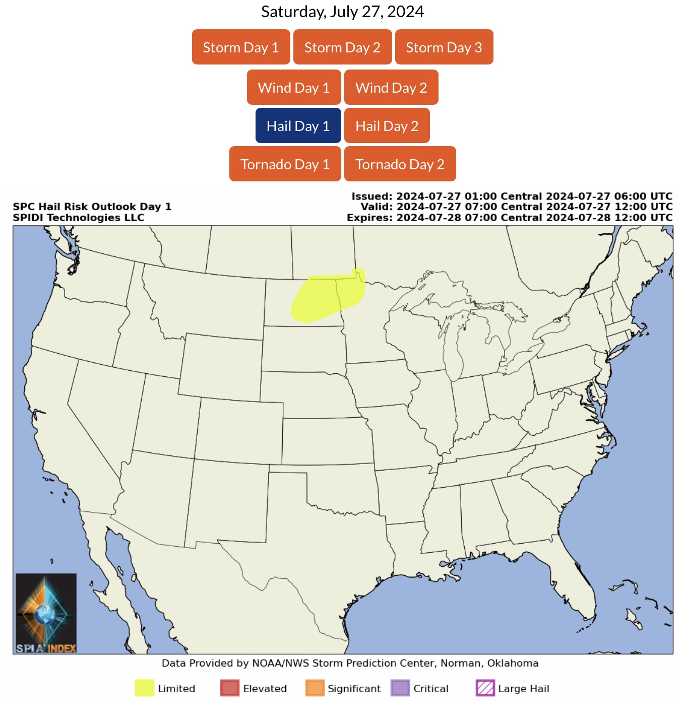
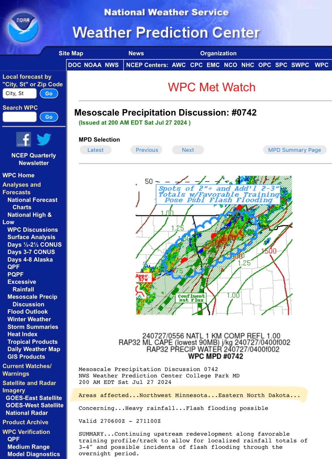
LIMITED Severe Thunderstorm Risk, Day 1 (Saturday, 7/27/24), parts ND & MN. Includes LIMITED High Winds Risk and LIMITED Hail Risk.
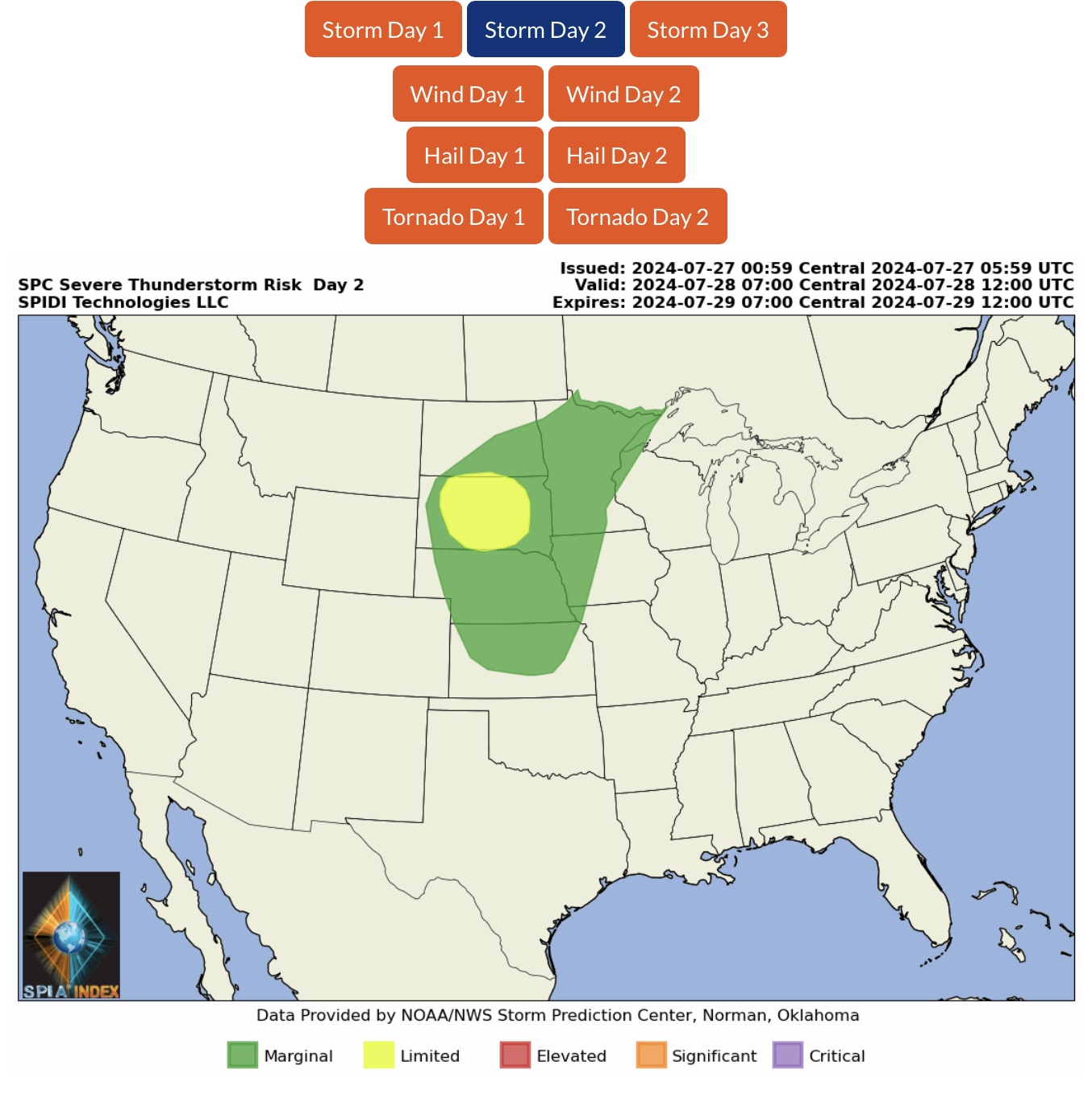
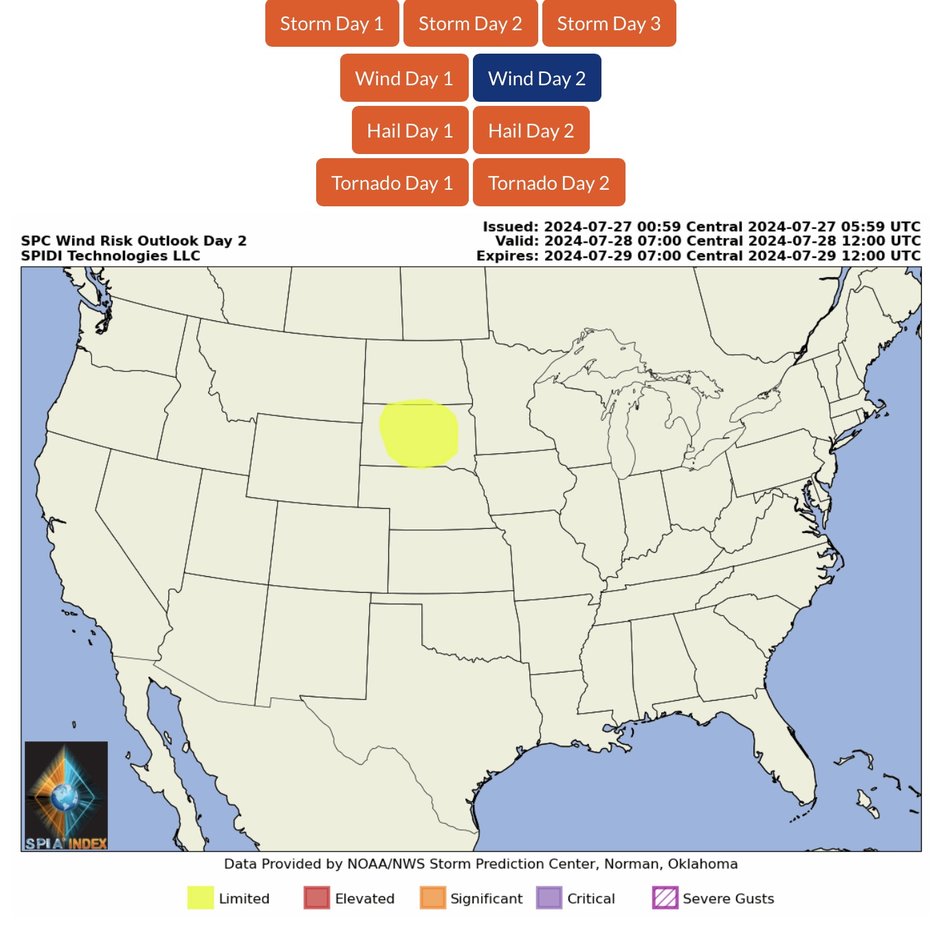
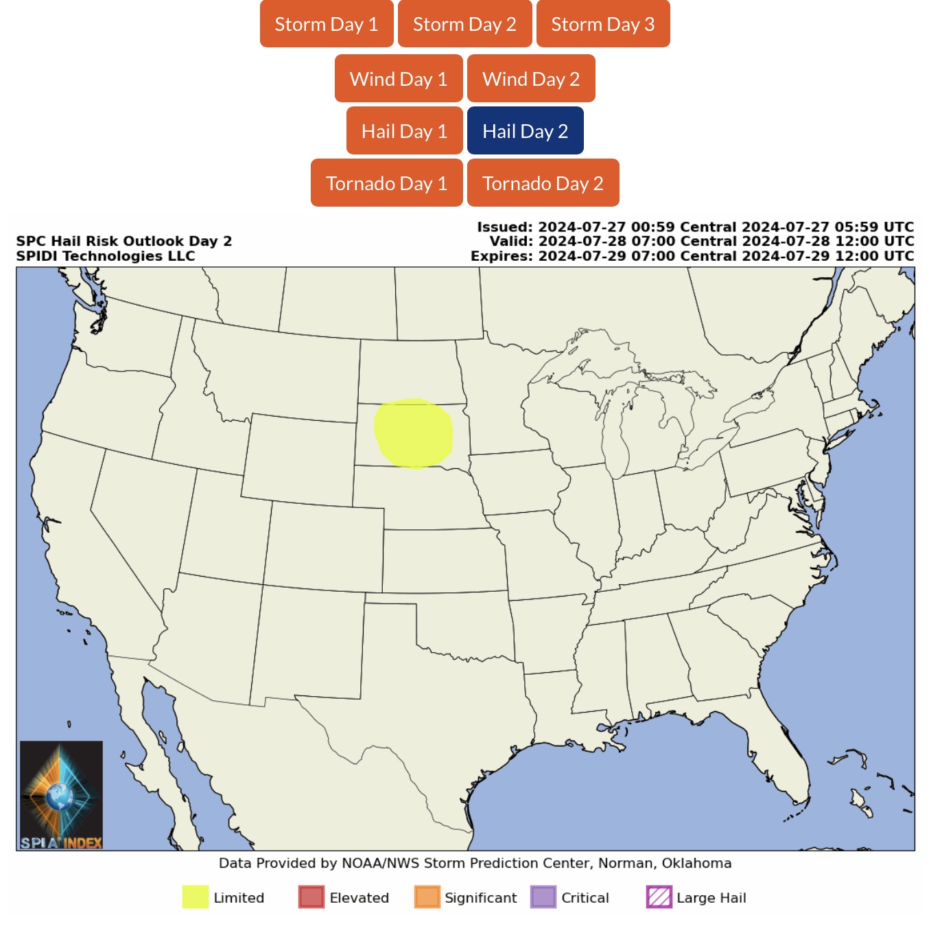
LIMITED Severe Thunderstorm Risk, Day 2 (Sunday, 7/28/24), parts ND & SD. Includes LIMITED High Winds Risk and LIMITED Hail Risk.
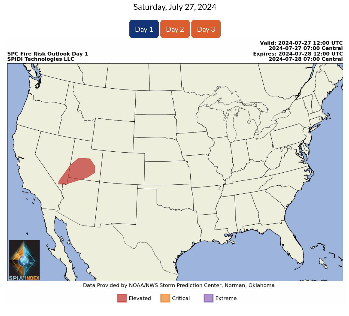
ELEVATED Wildfire Risk, Day 1 (Saturday, 7/27/24), parts NV, UT & AZ.
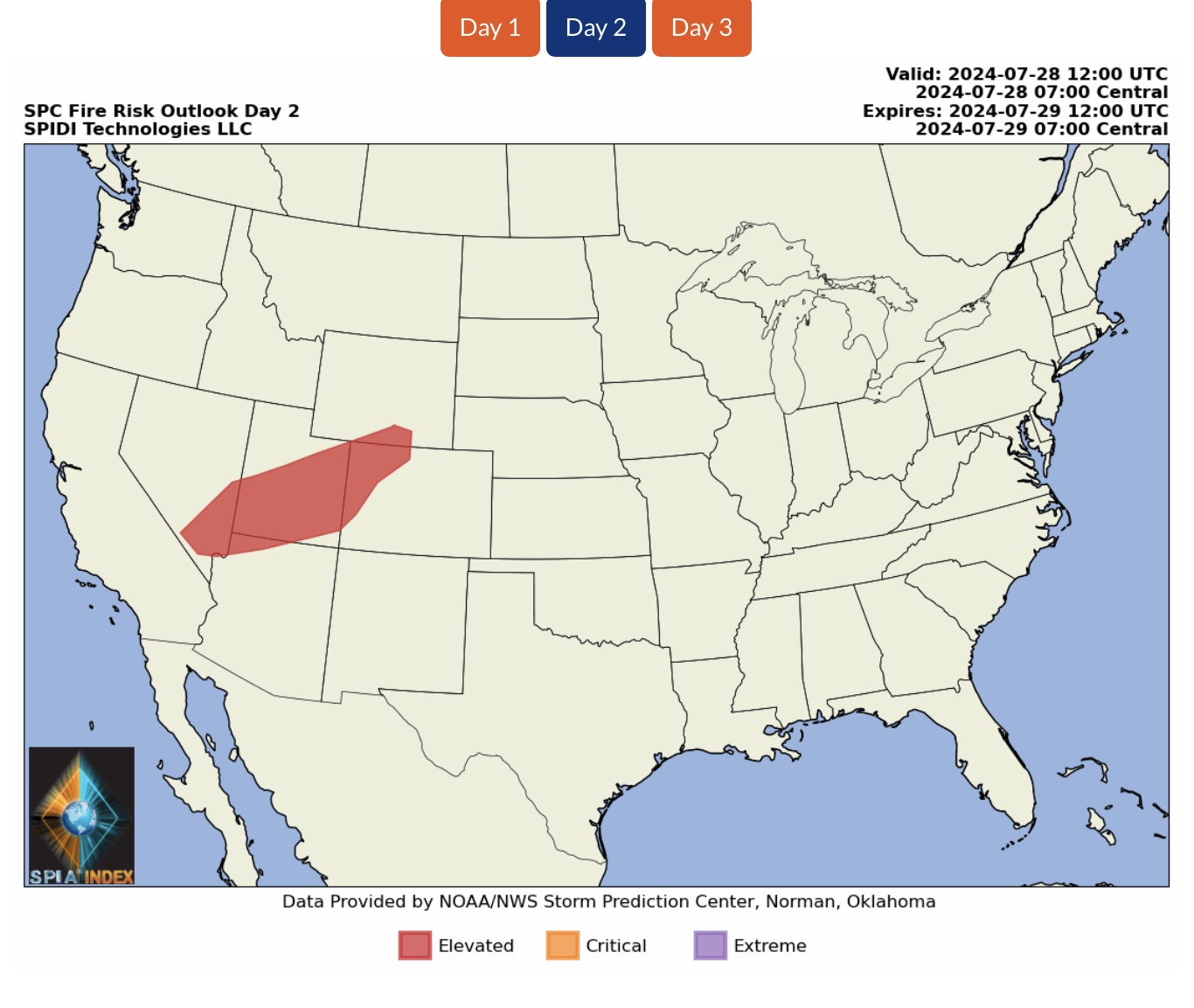
ELEVATED Wildfire Risk, Day 2 (Sunday, 7/28/24), parts NV, UT, AZ, WY & CO.
Increasing Wind Speeds and Low Humidity Levels are increasing Wildfire ignition risks.
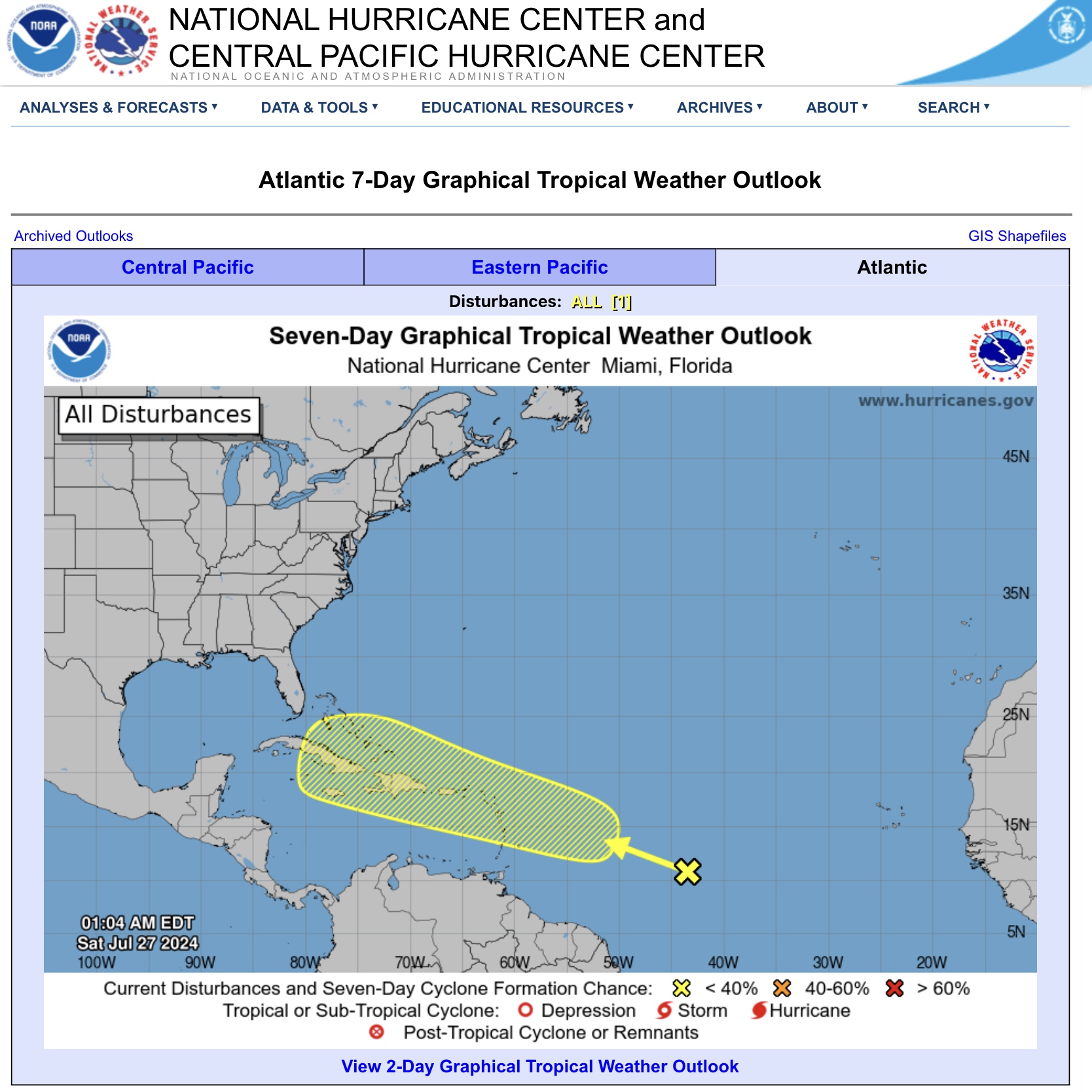
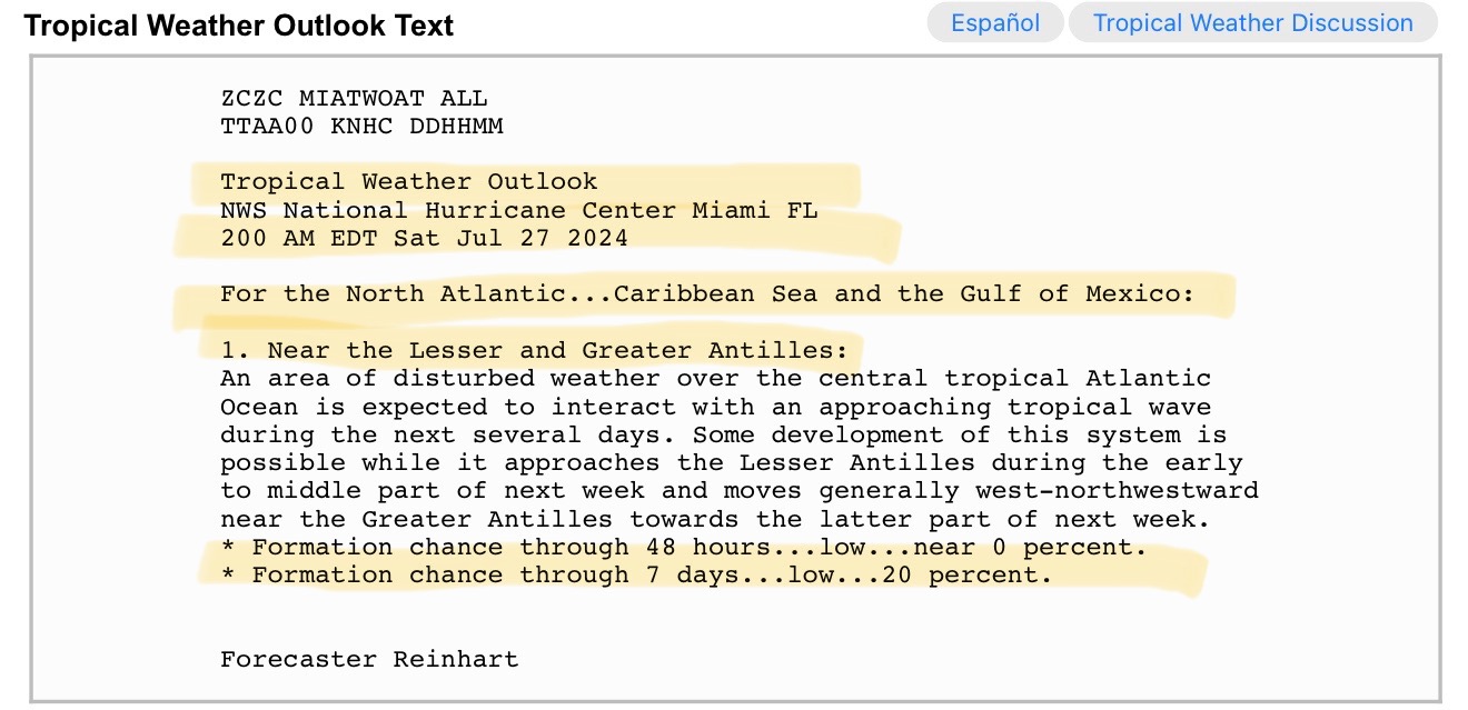
TROPICAL DISTURBANCE currently over east-central Atlantic now given a 20% chance of further development over next 7 days by forecasters at the National Hurricane Center (NHC). Movement to the west-northwest is expected over next several days. This is a “wave” to keep an eye on to see if it further develops.
Sid Sperry
President & CEO
SPIDI Technologies, LLC
Website/Subscriptions: SPIDItech.com
Cell Phone: (405) 627-7754
Email(s): SidSperry@gmail.com  OR  Sid.Sperry@spidiweather.com
URL(s):  SPIDItech.com
               SPIA-Index.com
               NationalOutages.com  (Partnership)

Sent from my iPad

 Show/hide attachments