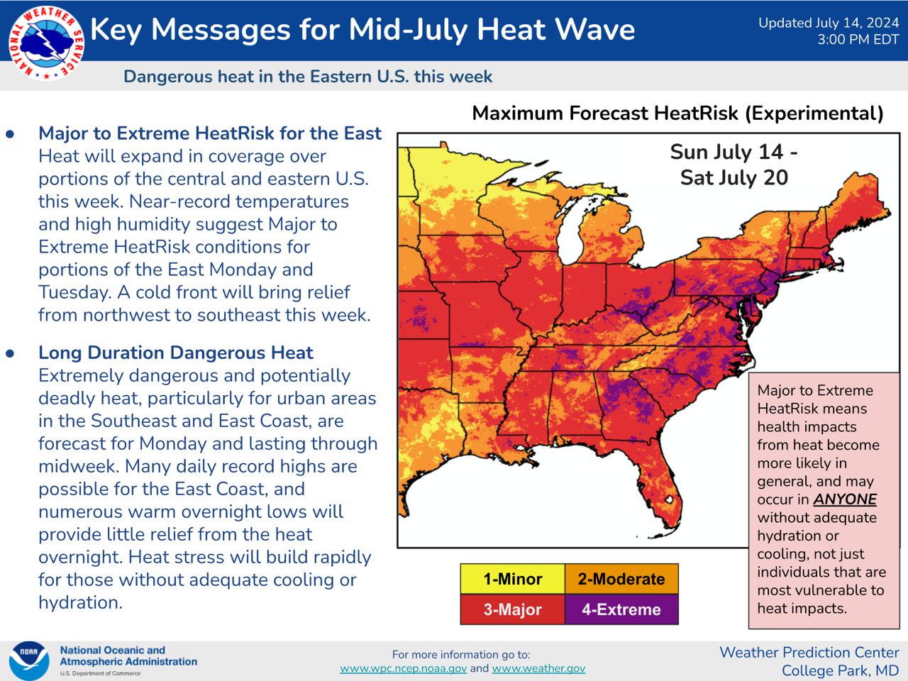
Excessive Heat Warnings today parts NE, IA, OK, PA, NJ, MD, VA & NC. Heat Advisories parts CO, NM, NE, KS, OK, TX, IA, MO, AR, LA, IL, IN, KY, TN, MS, AL, FL, GA, SC, NC, VA, WV, MD, DE, PA, NJ, NY, CT, RI, MA, VT, NH & ME. Severe T-Storm Watch parts SD & MN. Red Flag Fire Warnings parts OR, ID & CA…
Sidney Sperry 15 Jul 2024 12:17 UTC
ELEVATED Severe Thunderstorm Risk, Day 1 (Monday, July 15, 2024), parts IA, IL & IN. Includes ELEVATED High Winds Risk and Severe Gusts Risk.

LIMITED Severe Thunderstorm Risk, Day 2 (Tuesday, July 16, 2024), parts CO, NE, KS, OK, TX and OH, WV, PA, NY & VT. Includes LIMITED High Winds Risk.

EXCESSIVE HEAT WARNINGS and HEAT ADVISORIES continue today and tomorrow for much of the North Central, South Central, Northeast and Southeast Regions of the U.S. A Cold Front will begin to spread across the eastern 2/3 of the U.S. beginning Tuesday and will continue to spread southward on Wednesday, bringing cooler temperatures and increased chances of rainfall to all but the western states.

RED FLAG FIRE WARNINGS today, parts OR, CA & ID.
Sid Sperry
President & CEO
SPIDI Technologies, LLC
Website/Subscriptions: SPIDItech.com
Cell Phone: (405) 627-7754
Email(s): SidSperry@gmail.com  OR  Sid.Sperry@spidiweather.com

Sent from my iPad

 Show/hide attachments