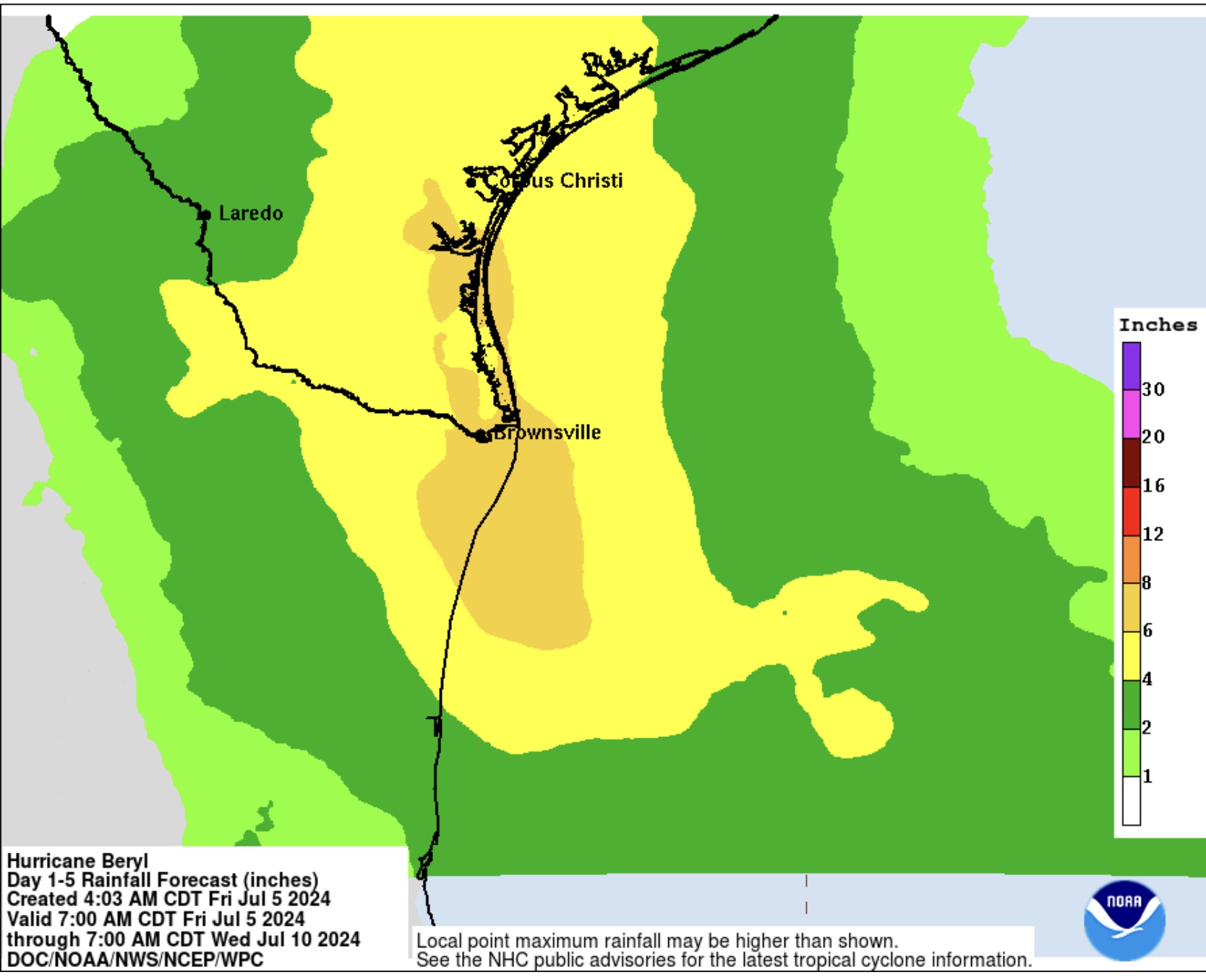
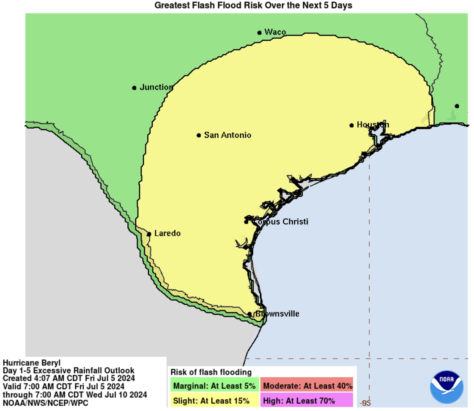
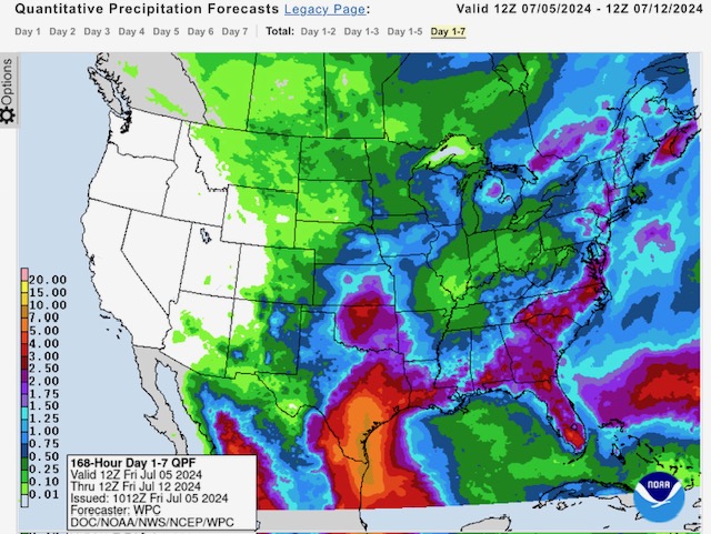
A resilient Hurricane Beryl, now impacting the Yucatan Peninsula in Mexico as a Category 3 hurricane with sustained winds of 110 mph, is expected to enter the southwest Gulf of Mexico tomorrow as a Tropical Storm. However, NHC forecasters estimate Beryl will re-strengthen into a potential Category 2 hurricane and make landfall late Sunday night or early Monday morning near Brownsville, TX. Potential impacts in south Texas include sustained winds from 75 to 90 mph and heavy rainfall amounts of from 4” to 8” with some localized amounts up to 10”+ over the next 5 days. Flooding and flash flooding is likely across southern & central TX and western and southwestern LA over the next 5 to 7 days as Beryl moves inland and becomes a Tropical Depression.
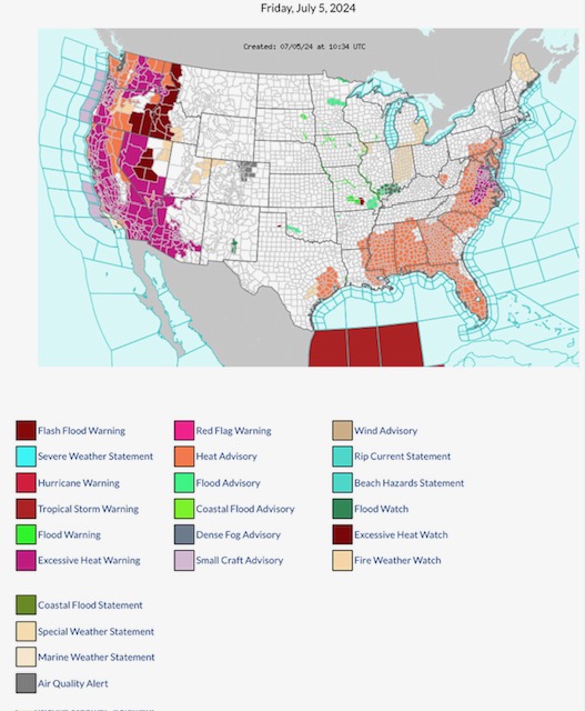
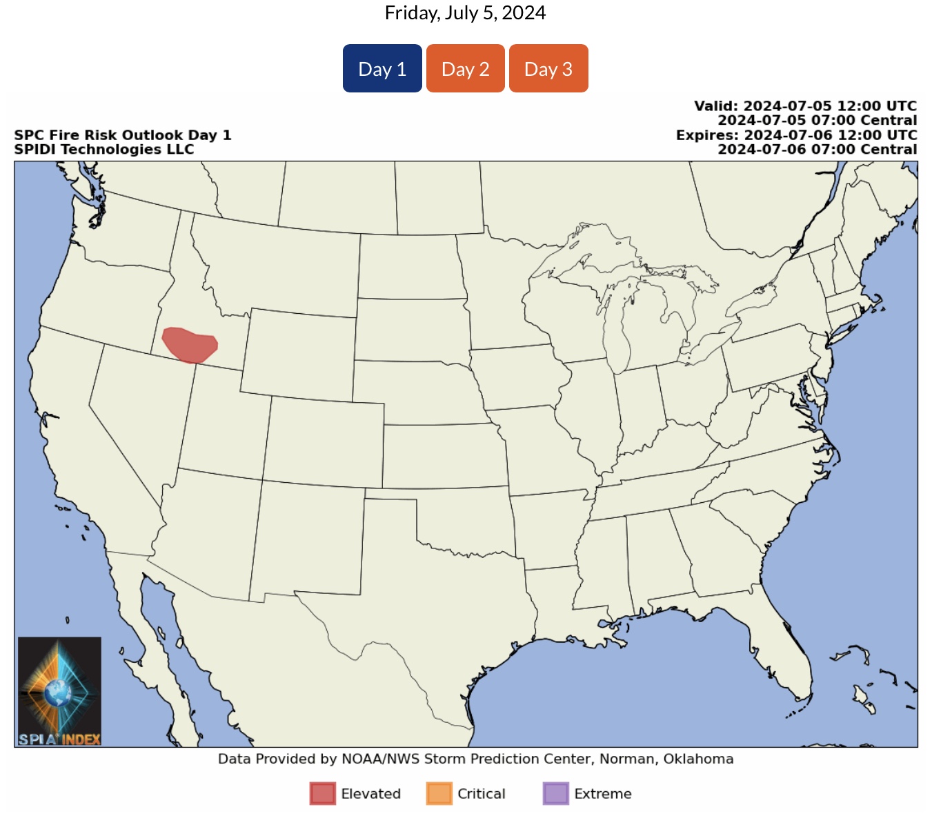
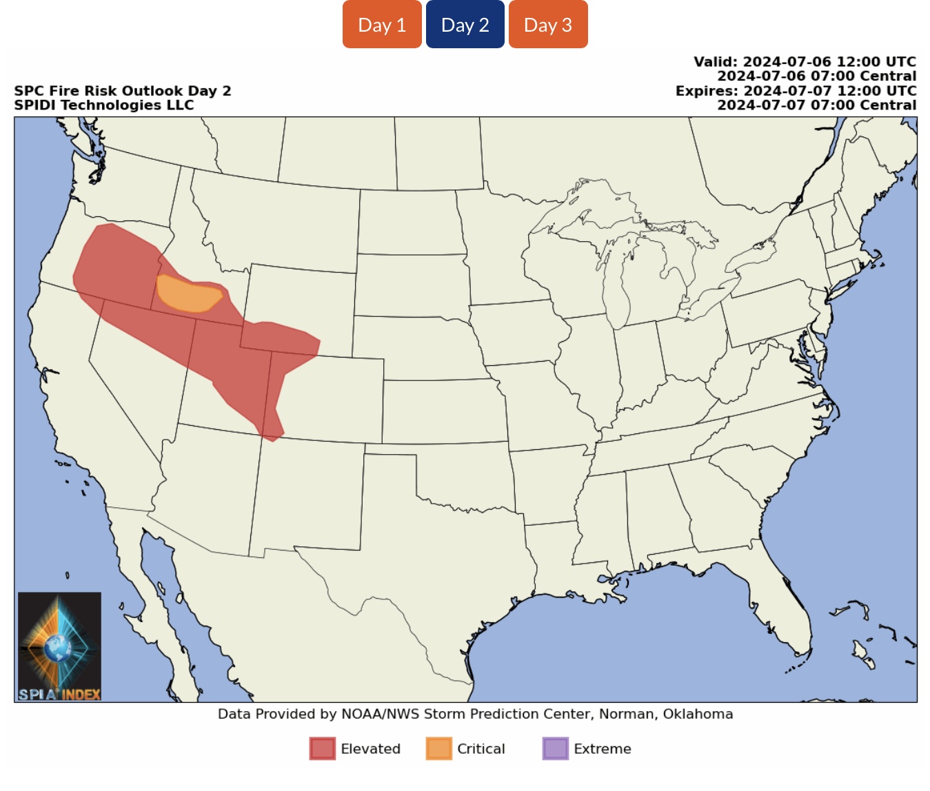
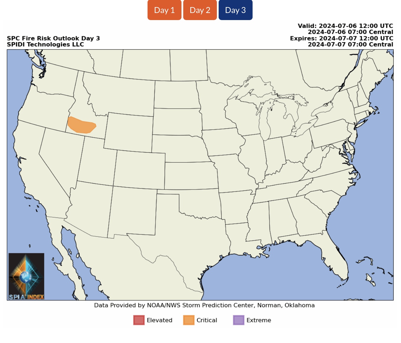
ELEVATED to CRITICAL Wildfire Risk, Days 1, 2 & 3, parts ID, OR, CA, NV, WY, UT, CO & NM.
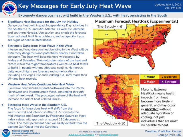
EXCESSIVE HEAT WARNINGS, EXCESSIVE HEAT WATCHES, and HEAT ADVISORIES parts WA, MT, OR, ID, CA, NV, AZ, UT, TX, AR, LA, TN, MS, AL, FL, GA, SC, NC, WV, VA, MD, DE, PA & NJ.
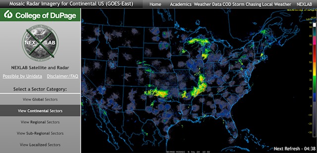
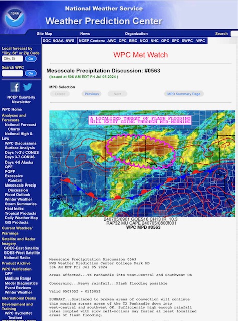
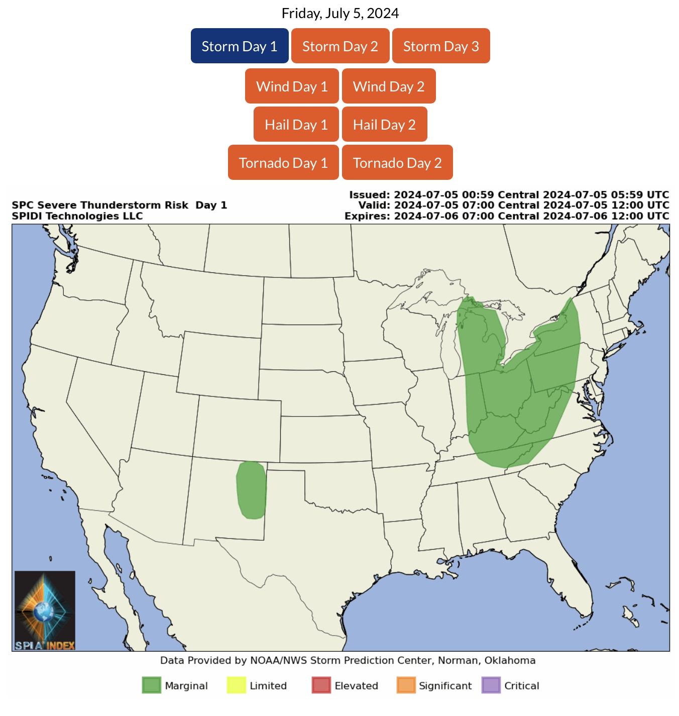
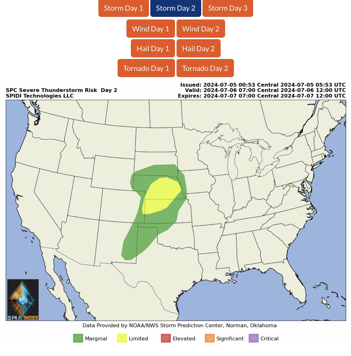
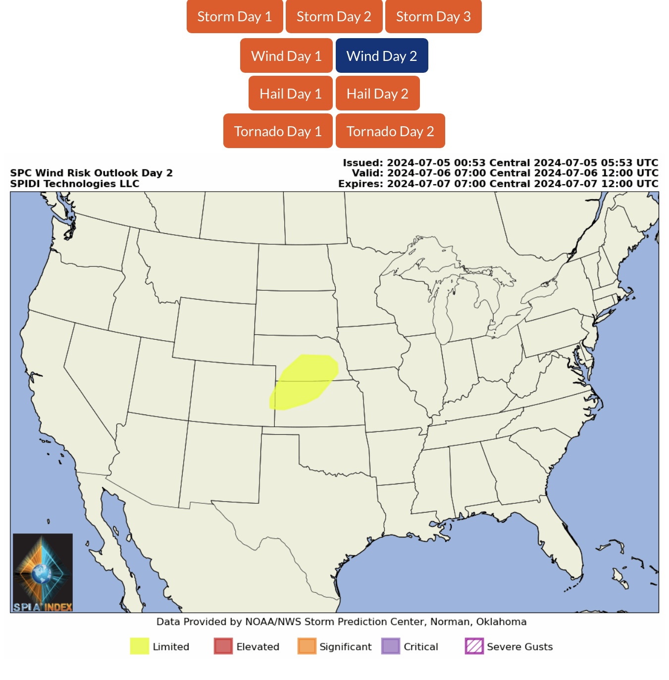
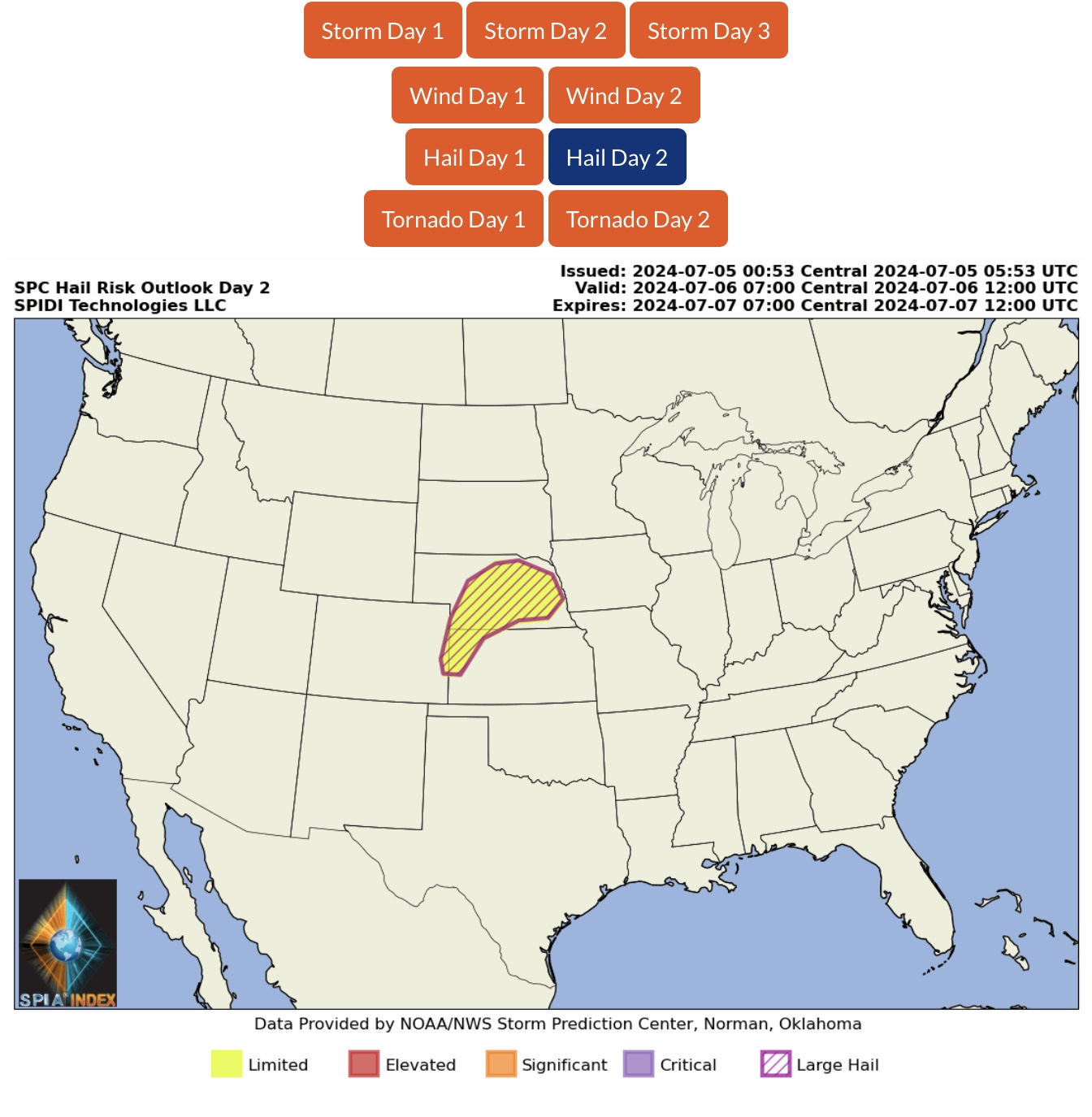
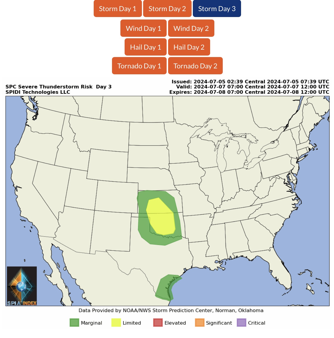
Severe Thunderstorms ongoing this AM parts TX, OK, AR, MO, IL, KY, TN, IN, WI & MI.

 Show/hide attachments