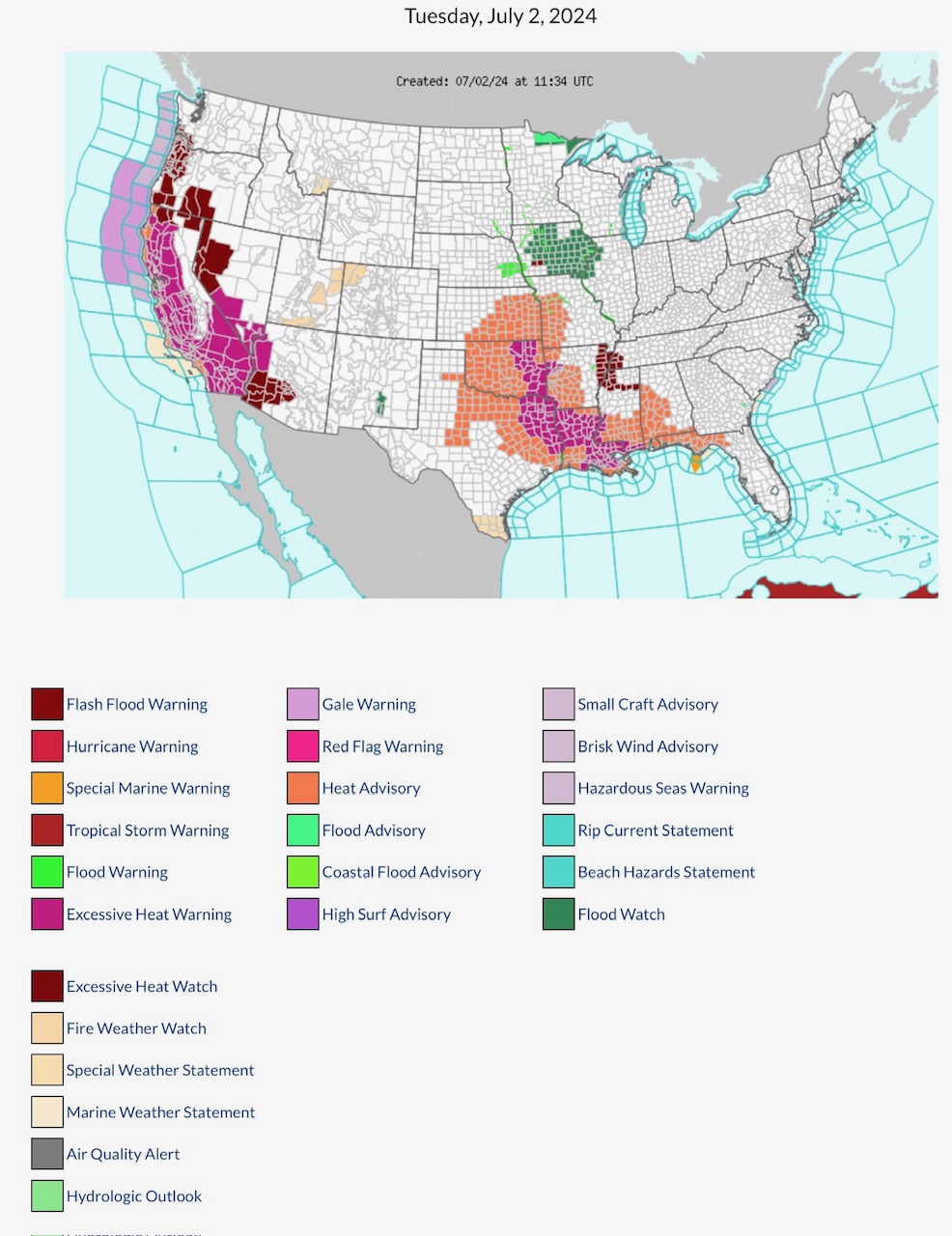
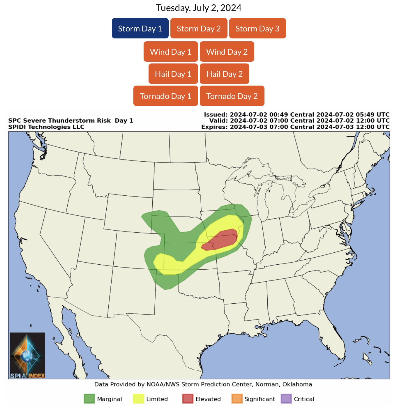
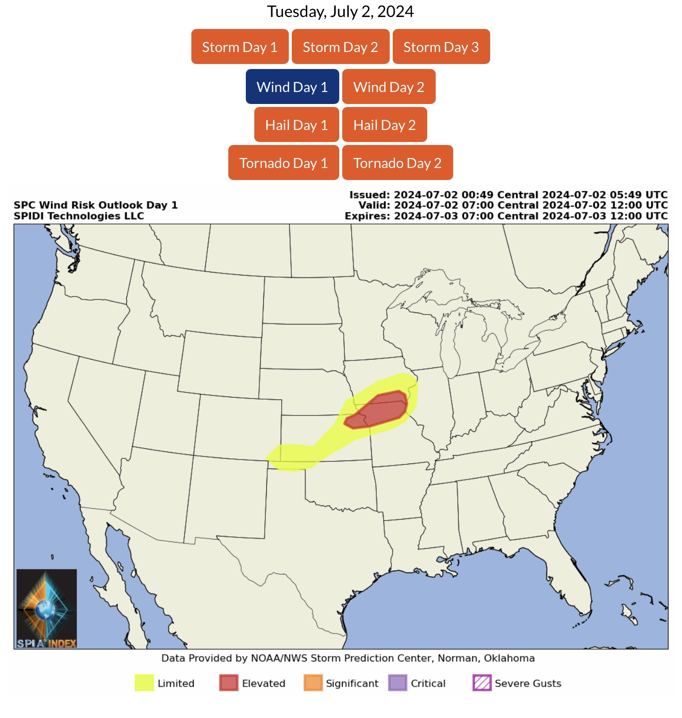
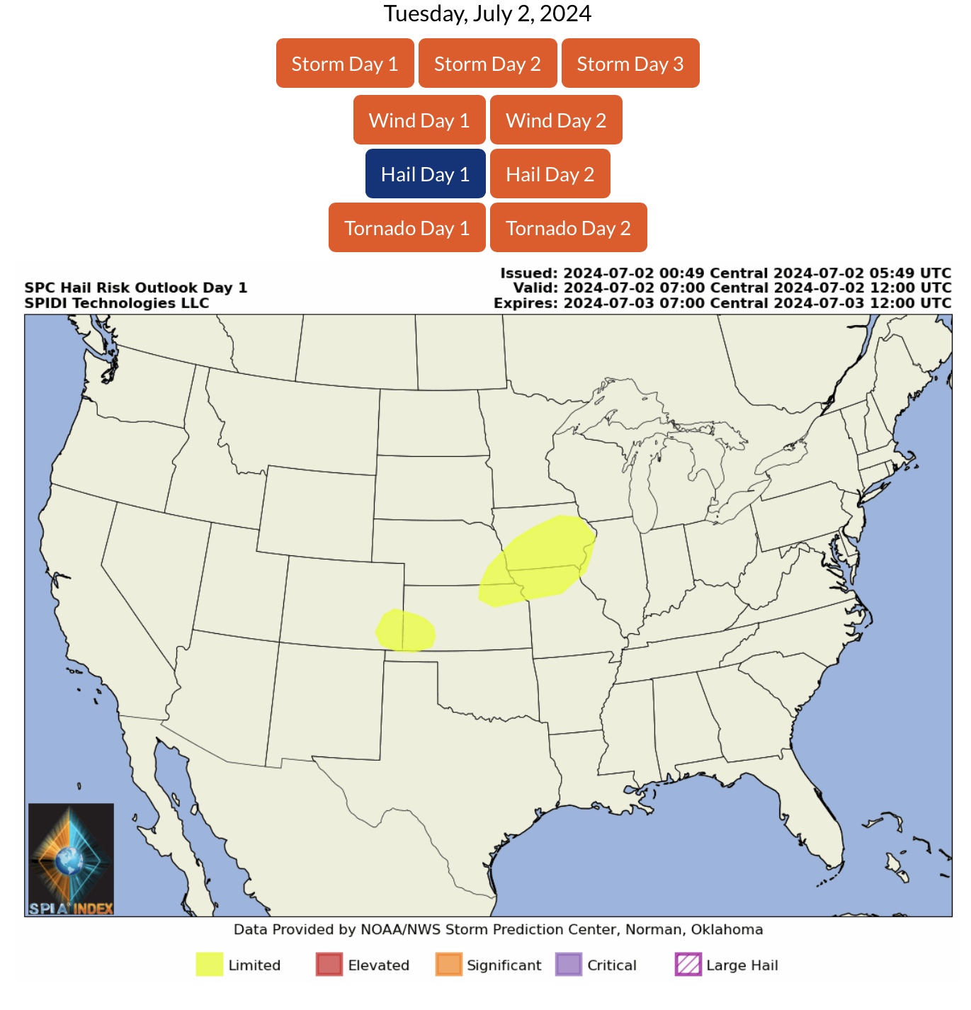
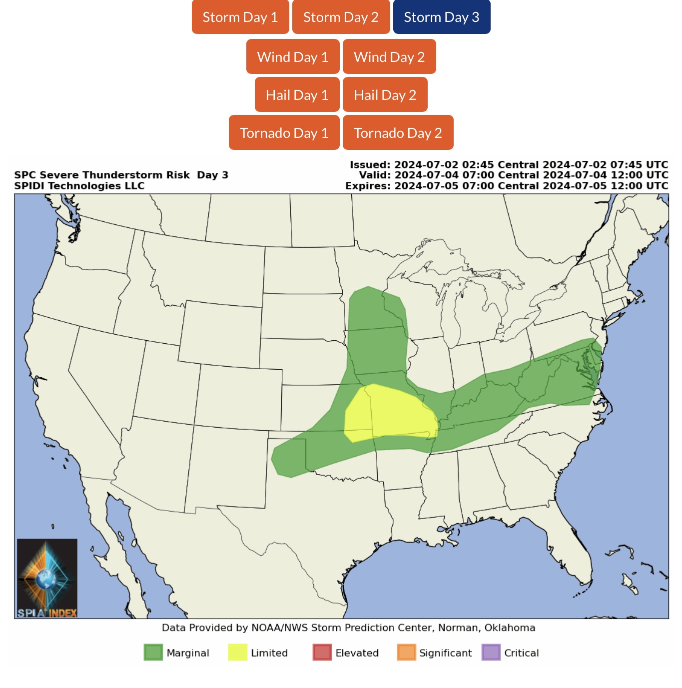
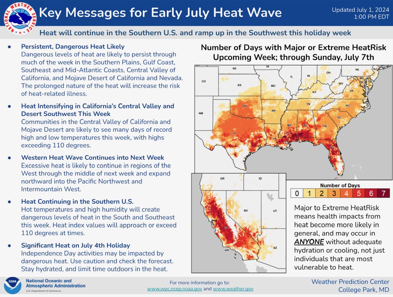
Today’s NWS Watches, Warnings & Advisories. Flash Flood Warnings parts IA. Flood Watch parts NM, IA, MO & IL. Excessive Heat Warnings parts CA, NV, AZ, OK, TX, AR, LA & MS. Heat Advisories parts CA, KS, MO, OK, TX, AR, LA, MS, AL & FL. Excessive Heat Watch parts OR, NV, AZ, AR, TN & MS. ELEVATED Severe T-Storm Risk, Day 1 (Tuesday, 7/2/24), parts IA, KS & MO. Includes ELEVATED High Wind Risk
Sidney Sperry 02 Jul 2024 12:13 UTC
FYI…
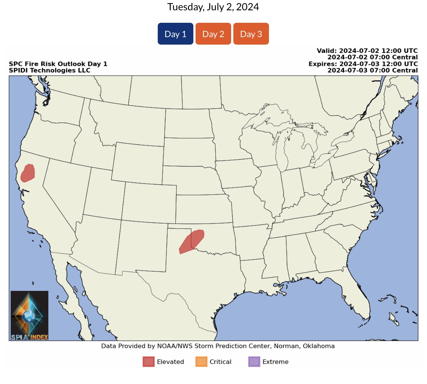
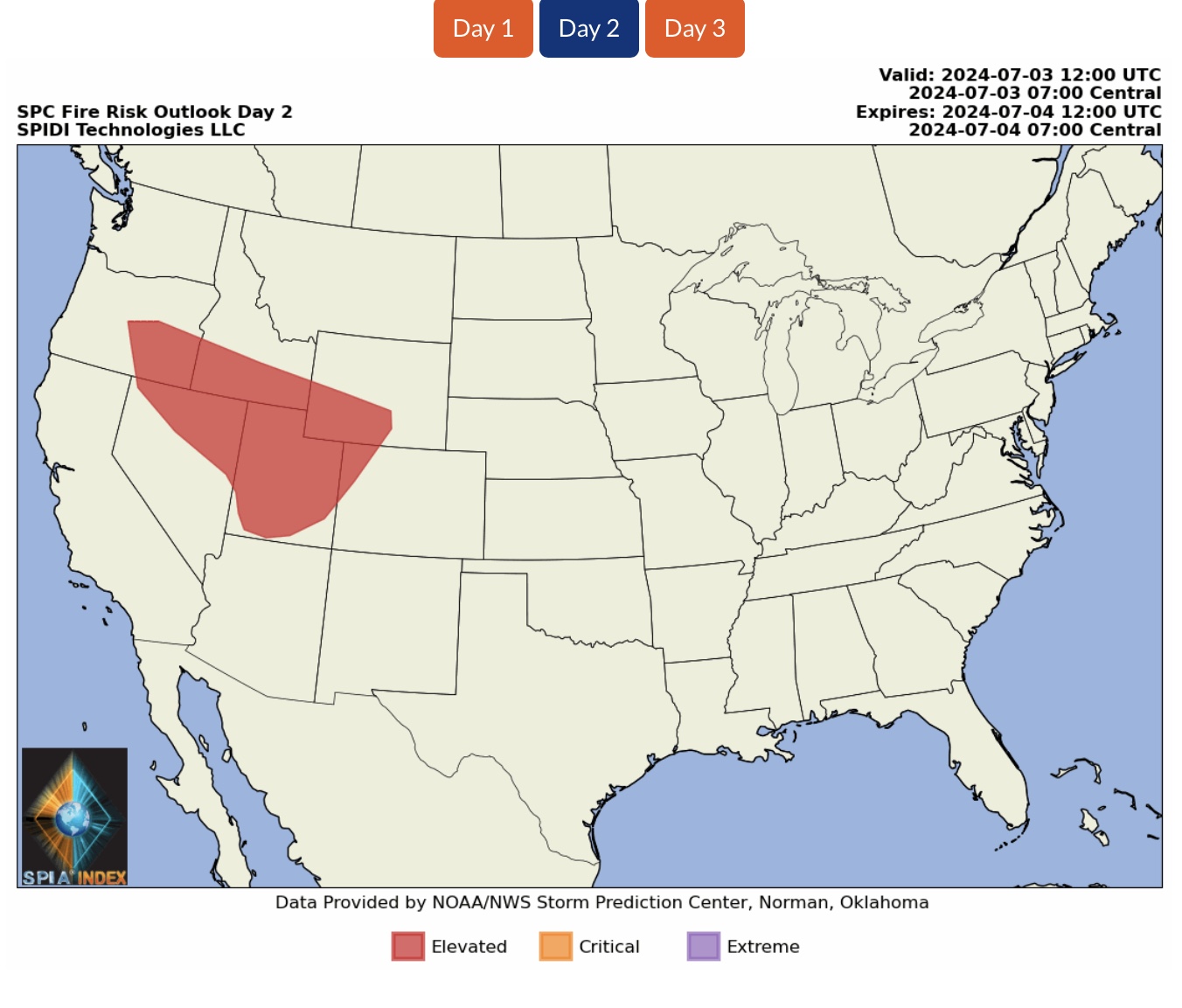
Note ELEVATED Wildfire Risk, Days 1 & 2 (Tuesday and Wednesday), parts CA, OK, TX (Day 1), and parts OR, ID, NV, UT, WY & CO (Day 2).
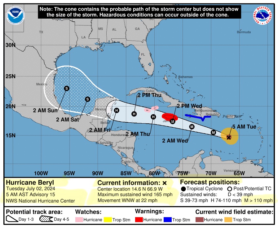
Hurricane Beryl is now a Category 5 major hurricane in the Caribbean Sea, with maximum sustained winds of 165 mph. Movement is west-northwest at 22 mph. Jamaica will likely be impacted by tomorrow early afternoon. Beryl is forecast to move through the Caribbean Sea and cross the Yucatan Peninsula on Friday, then enter the southwest Gulf of Mexico on Saturday. Forecast track at that point is still uncertain, with some forecast models still including the possibility of impacts from Beryl in south Texas or southern Louisiana by early next week.
Sid Sperry

Sent from my iPad

 Show/hide attachments