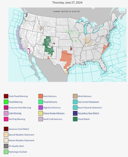
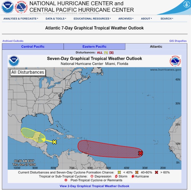
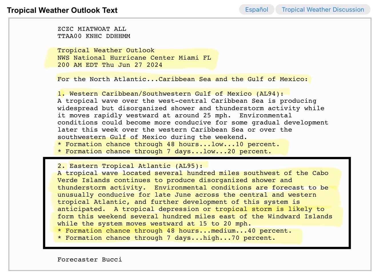
Latest NWS Watches, Warnings & Advisories: Flash Flood Warning parts FL panhandle. Flood Warnings parts SD, IA, WI & MO. Flood Watch parts UT, CO & NM. Excessive Heat Warnings parts OK & CA; Heat Advisories parts NM, OK, TX, SC & NC. Latest NHC Updates on Invest AL95 in the Atlantic - 70% chance it could develop into a Tropical Depression or Tropical Storm this weekend…
Sidney Sperry 27 Jun 2024 11:47 UTC
FYI…
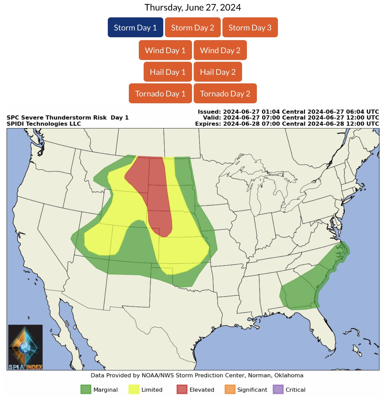
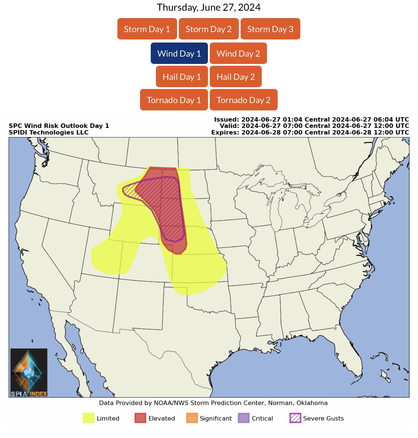
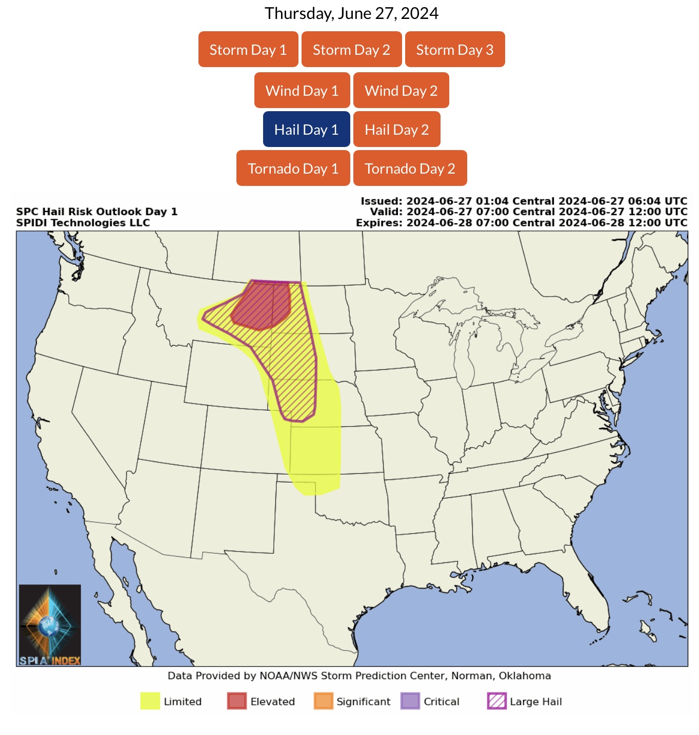
ELEVATED Severe Thunderstorm Risk, Day 1 (Thursday, 6/27/24), parts MT, ND, SD, WY, NE & CO. Includes ELEVATED High Winds Risk and ELEVATED Severe Gusts Risk. Also includes ELEVATED Hail & Large Hail Risk.
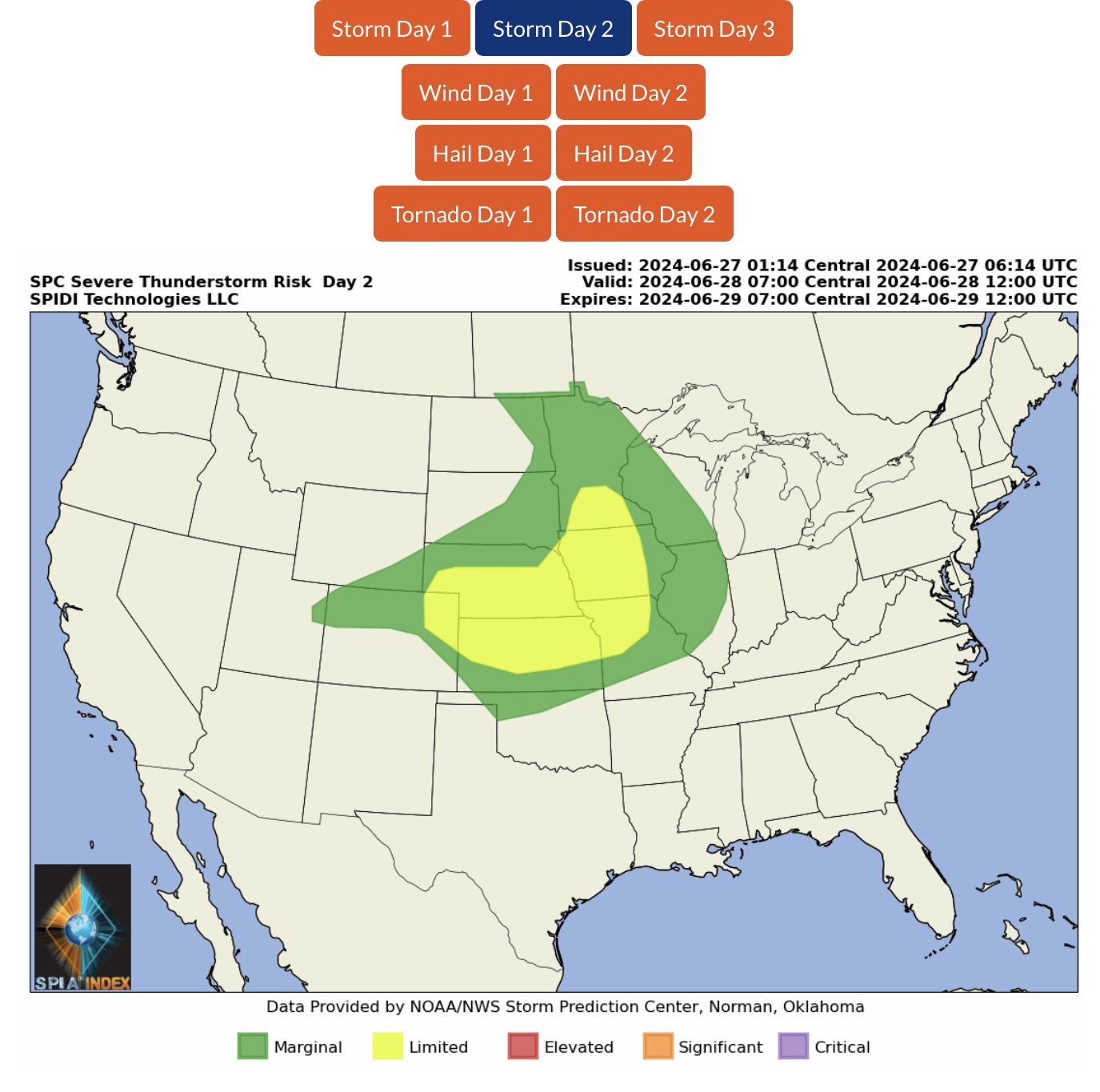
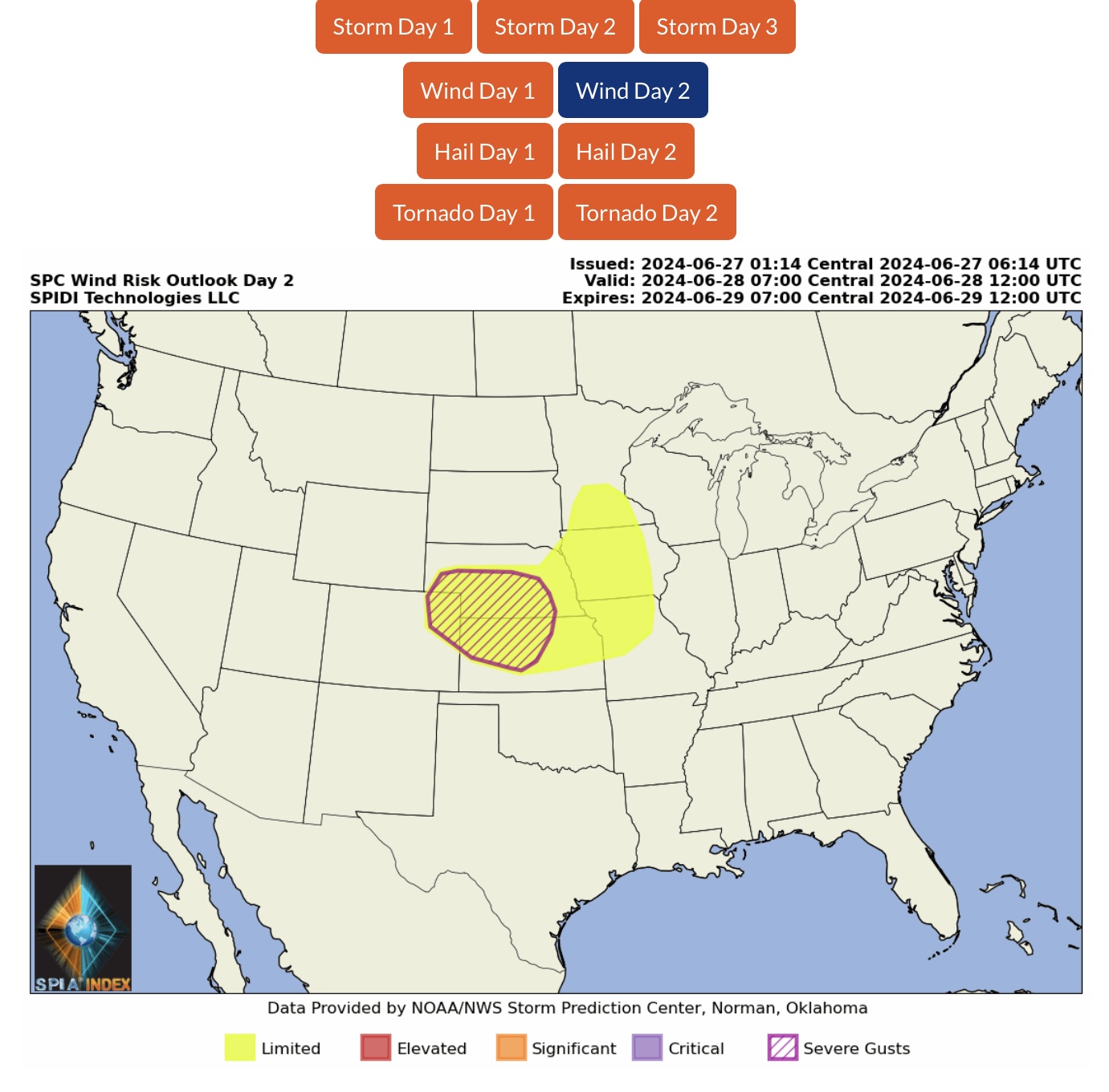
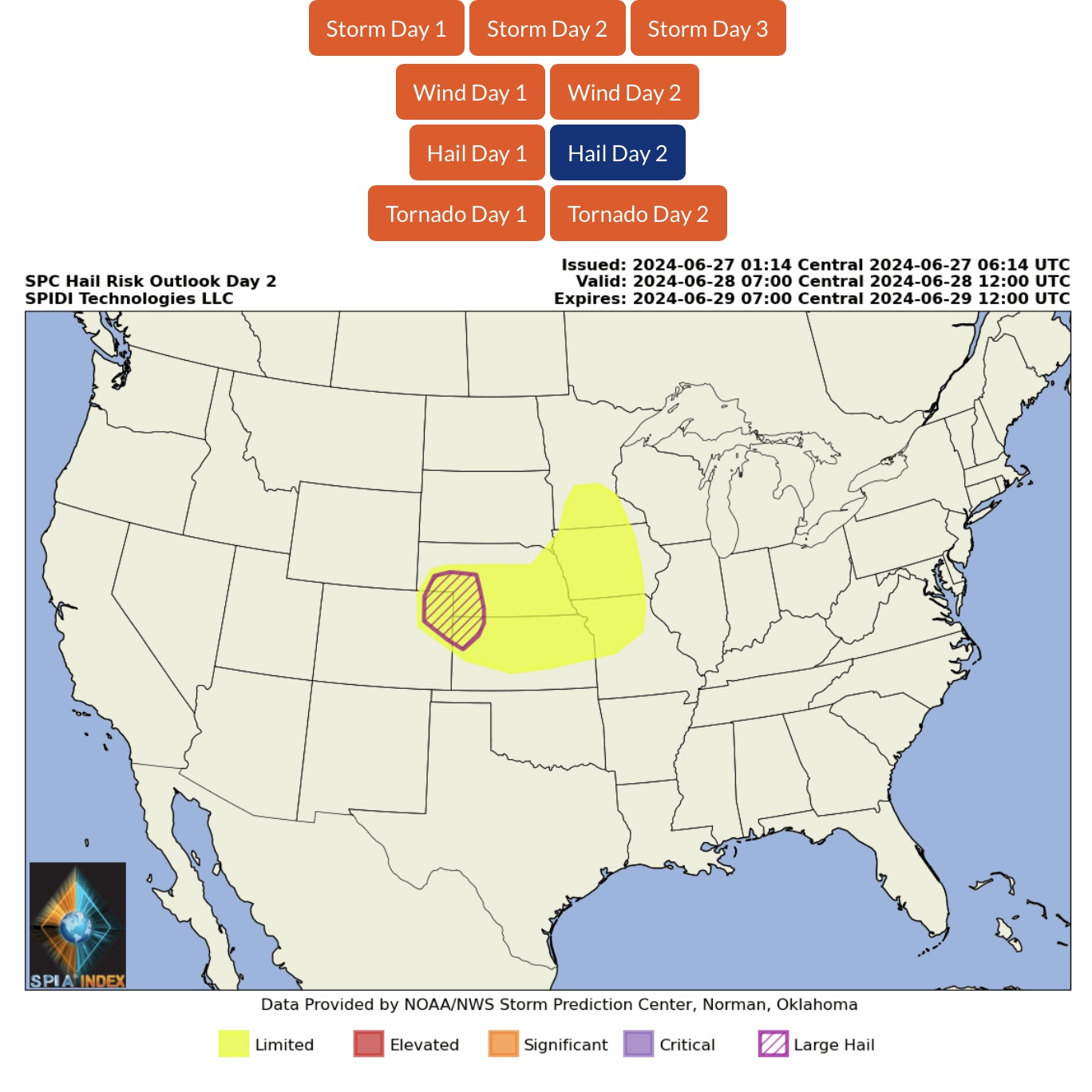
LIMITED Severe Thunderstorm Risk, Day 2 (Friday, 6/28/24), parts CO, NE, KS, MN, IA & MO. Includes LIMITED High Winds Risk and LIMITED Severe Gusts Risk. Also includes LIMITED Hail & Large Hail Risk.
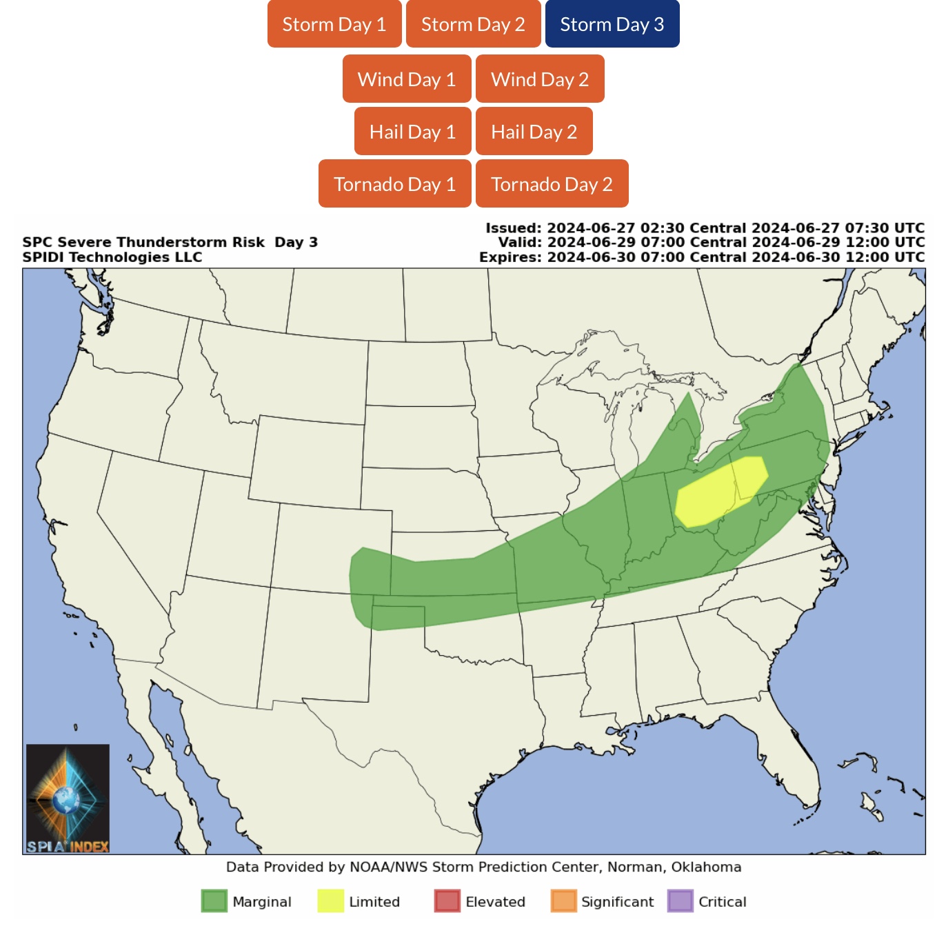
LIMITED Severe Thunderstorm Risk, Day 3 (Saturday, 6/29/24), parts OH, WV & PA.
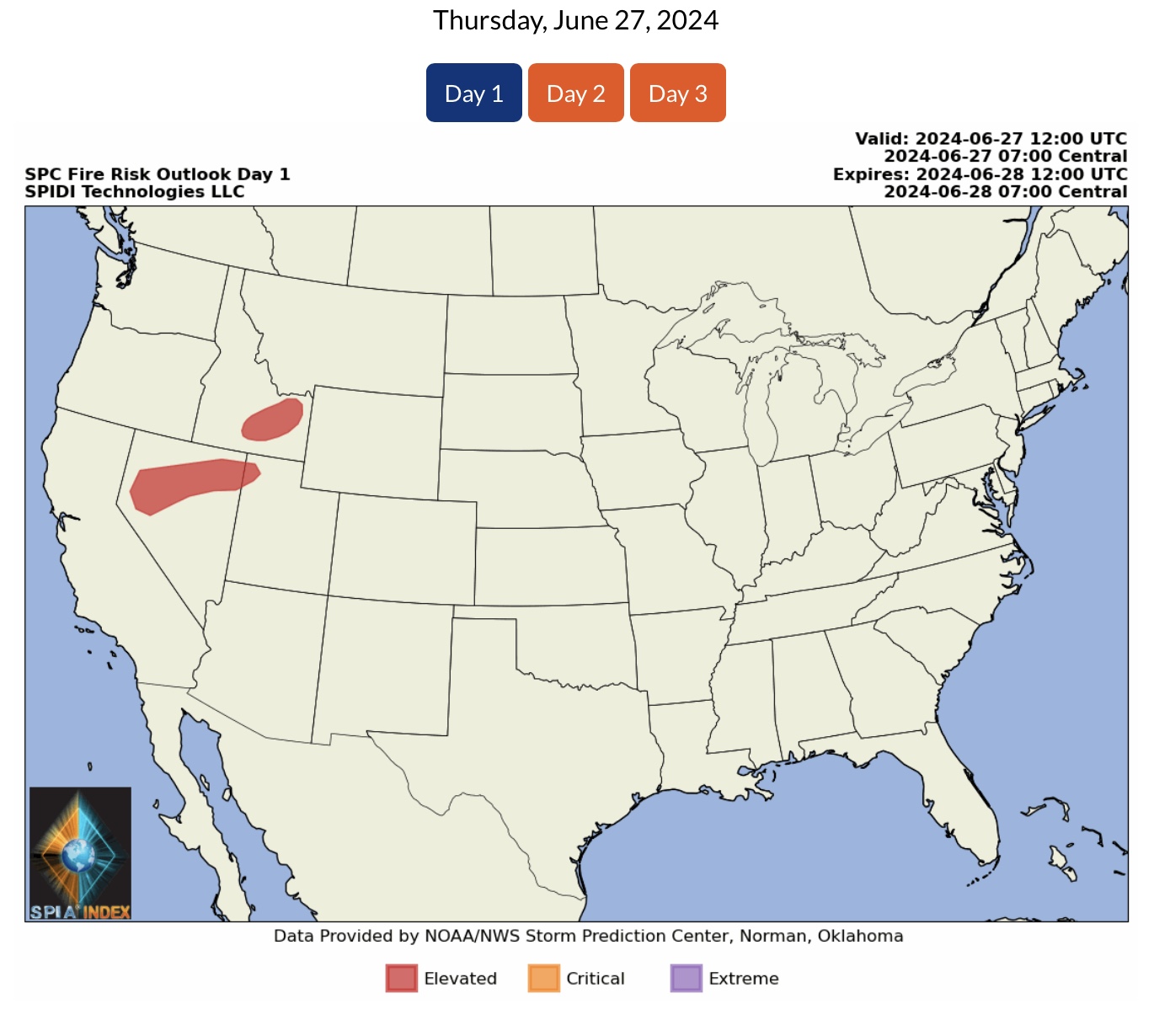
ELEVATED Wildfire Risk, Day 1 (Thursday, 6/27/24), parts ID, NV & UT.
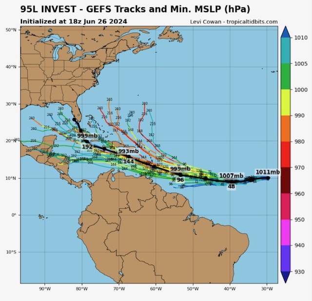
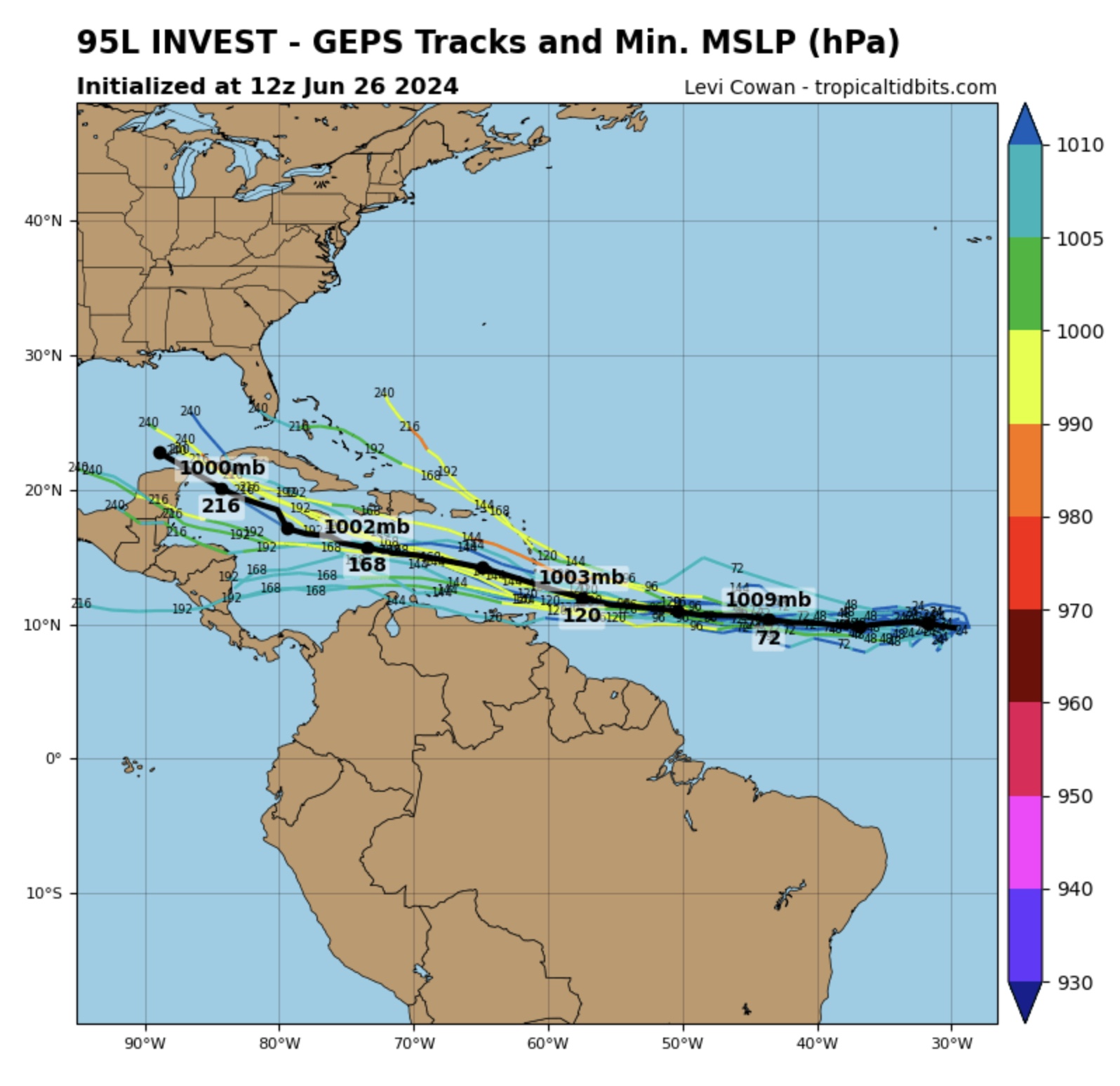
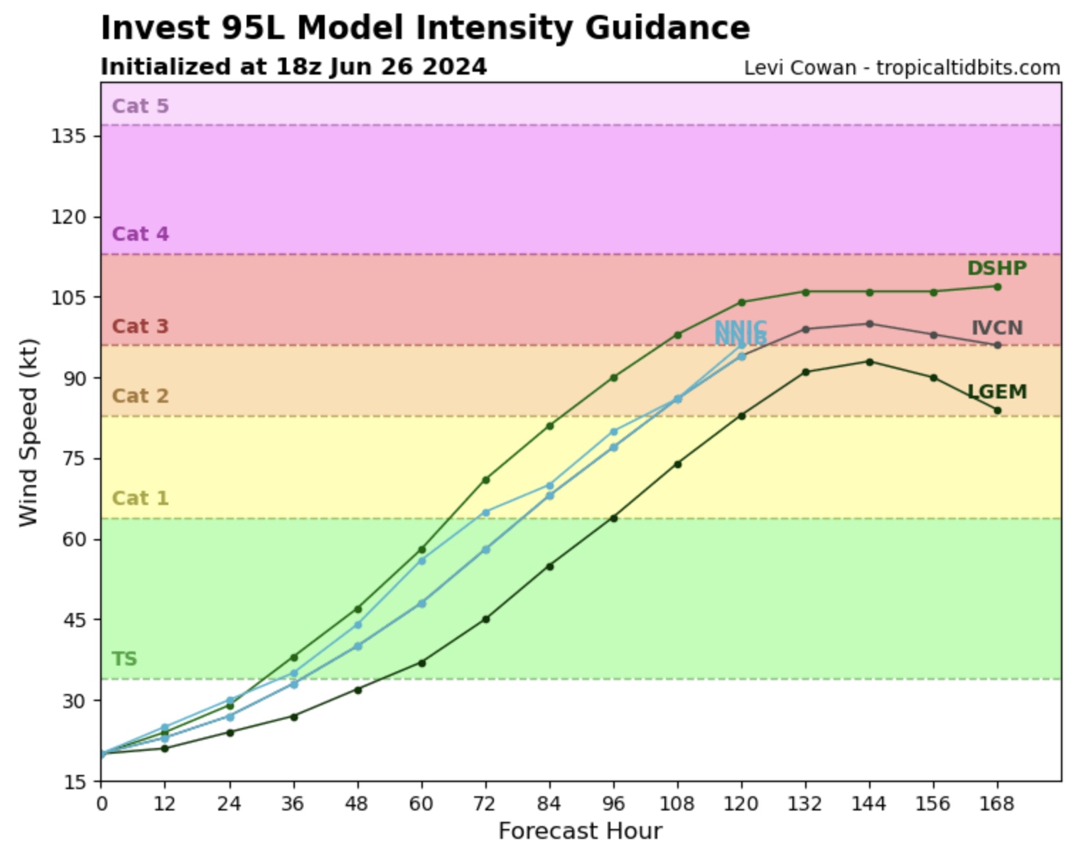
The National Hurricane Center (NHC) has raised to 70% the possibility that Invest AL95, currently several hundred miles southwest of the Cabo Verde Island off the west coast of Africa, will develop into a Tropical Depression or Tropical Storm over this weekend. Preliminary Forecast Model Tracks and Forecast Model Intensity has been included from Dr. Levi Cowan, a hurricaneologist from TropicalTidbits.com.
Sid Sperry
President & CEO
SPIDI Technologies, LLC
Website/Subscriptions: SPIDItech.com
Cell Phone: (405) 627-7754
Email(s): SidSperry@gmail.com  OR  Sid.Sperry@spidiweather.com

Sent from my iPad

 Show/hide attachments