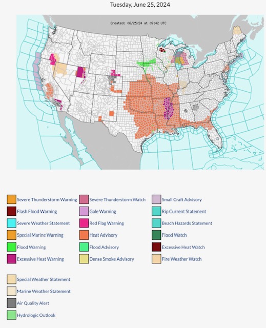
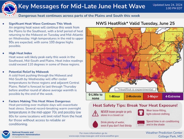
Latest NWS Watches, Warnings & Advisories. NOTE: Flash Flood Warning parts WI. Severe T-Storm Warning parts MI; Severe T-Storm Watch parts WI & MI. Flood Warnings parts SD, MN & IA. Excessive Heat Warnings parts UT, AR, TN, LA & MS. Heat Advisories parts CA, CO, NM, NE, KS, OK, TX, IA, MO, AR, LA, IL, KY, TN, MS, AL, GA, FL, SC, PA & NJ. Red Flag Fire Warnings parts OR, CA, WY & NE…
Sidney Sperry 25 Jun 2024 10:35 UTC
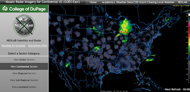
Severe Thunderstorms this AM (Tuesday, 6/25/24) parts WI, MI, IL, IN & KS.
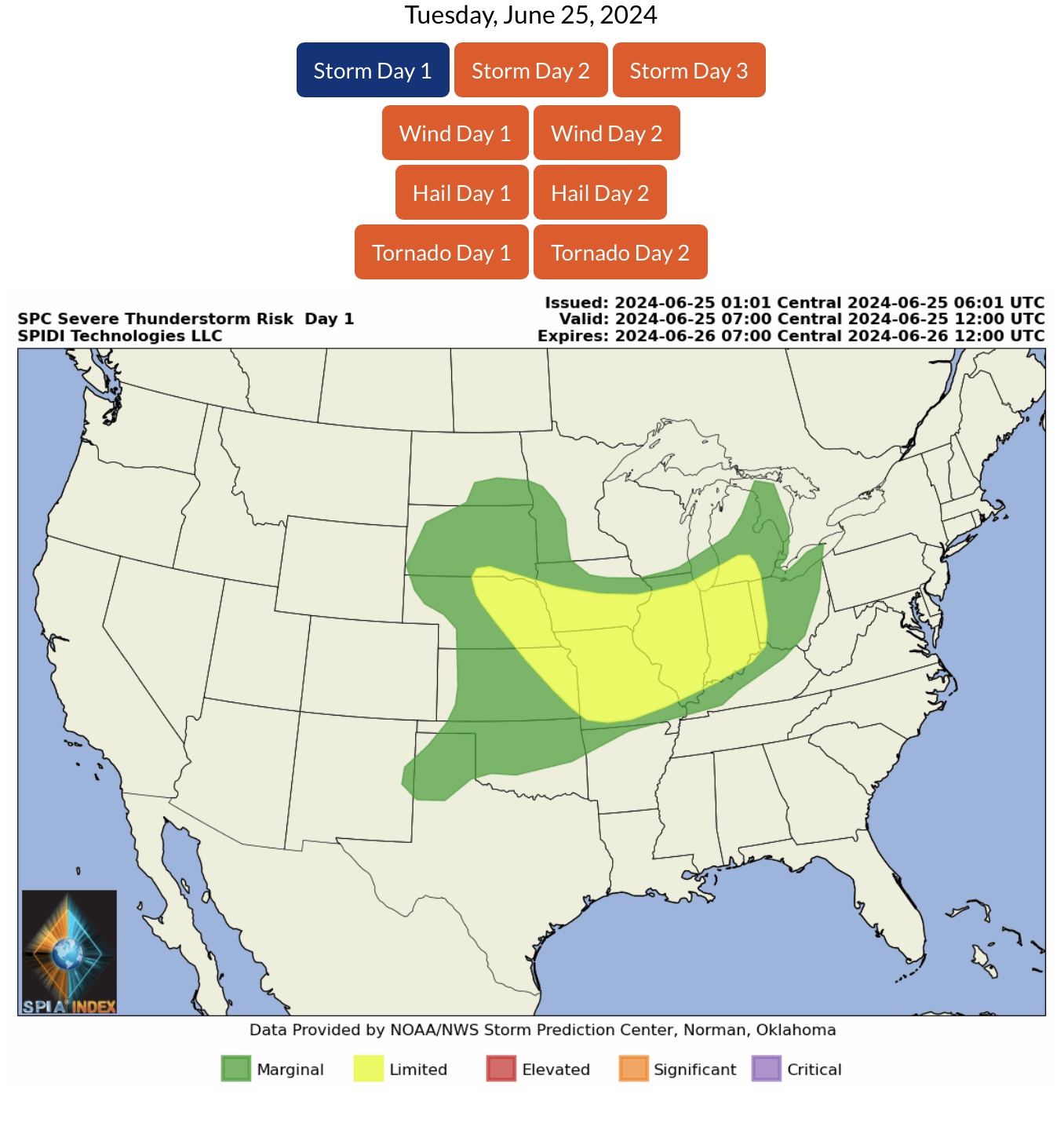
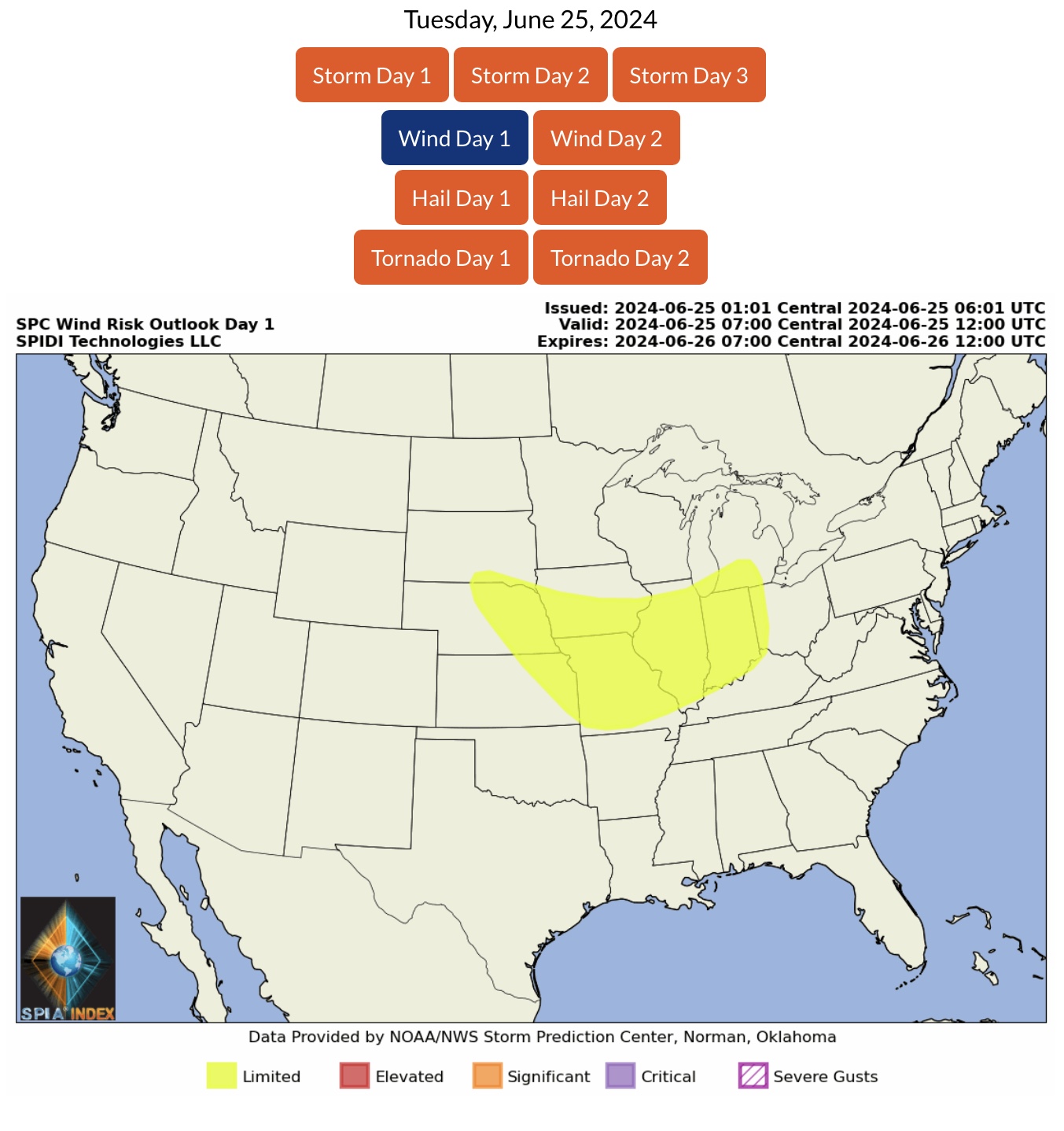
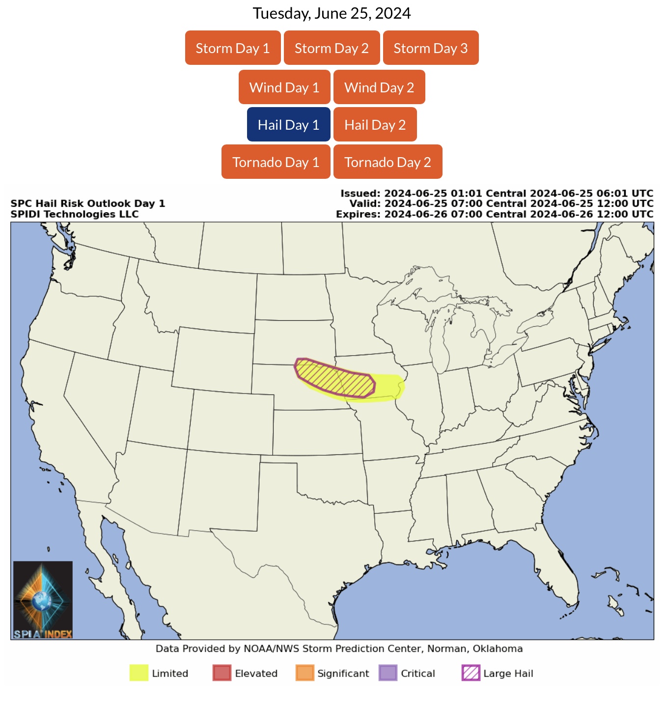
LIMITED Severe Thunderstorm Risk, Day 1 (Tuesday), parts SD, NE, KS, IA, MO, IL, MI, IN & OH. Includes LIMITED High Winds Risk. Also includes LIMITED Hail & Large Hail Risk parts SD, NE & IA.
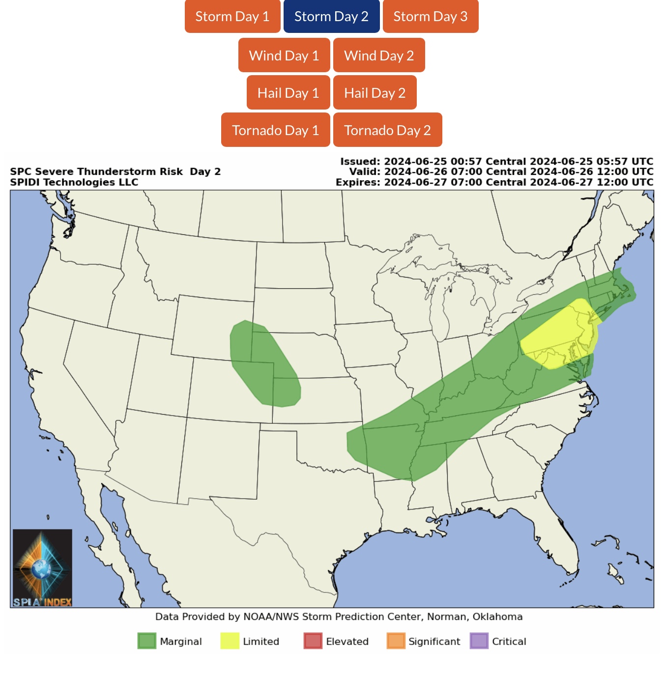
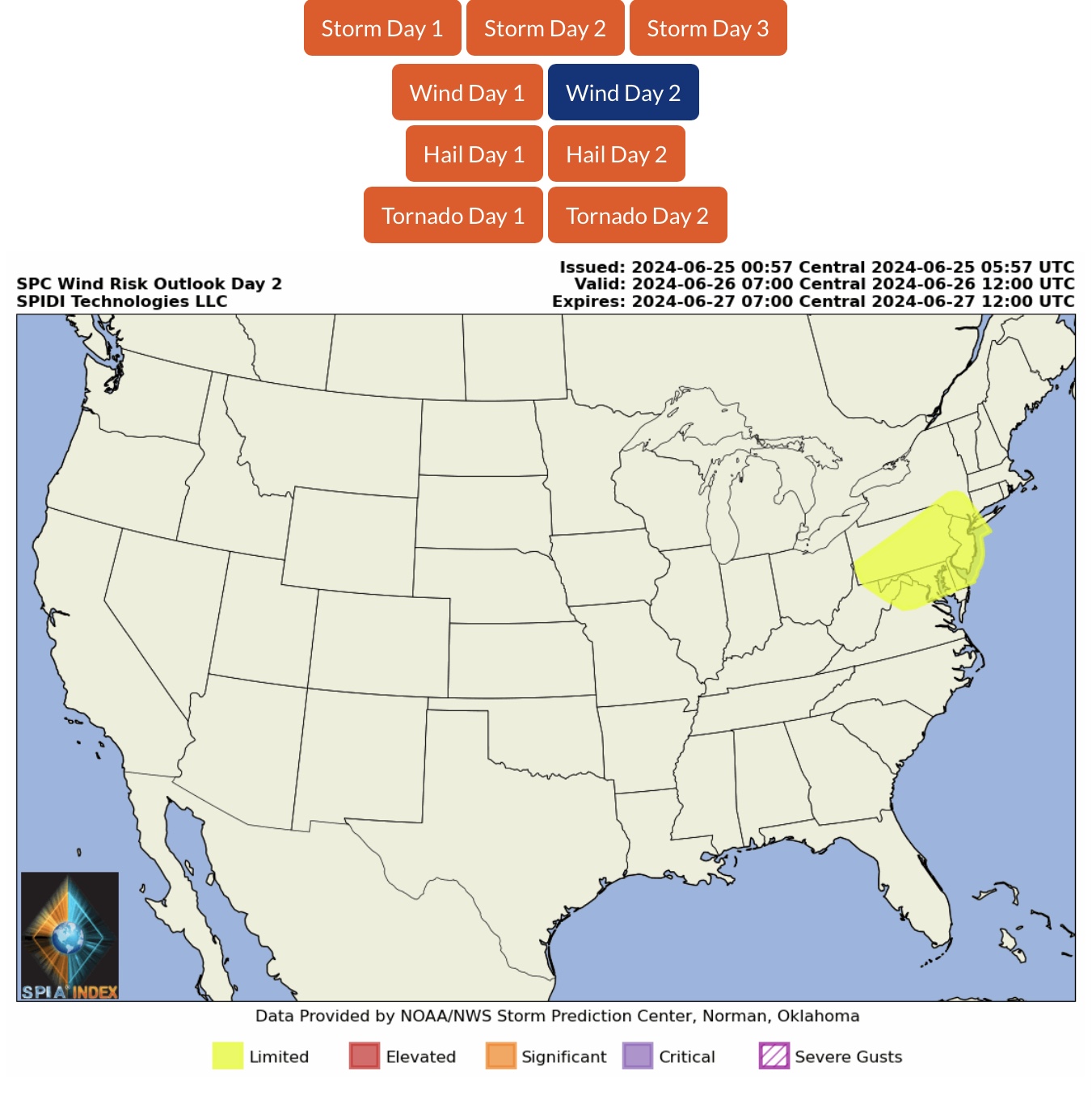
LIMITED Severe Thunderstorm Risk, Day 2 (Wednesday), parts WV, VA, MD, DE, PA, NY & NJ. Includes LIMITED High Winds Risk.
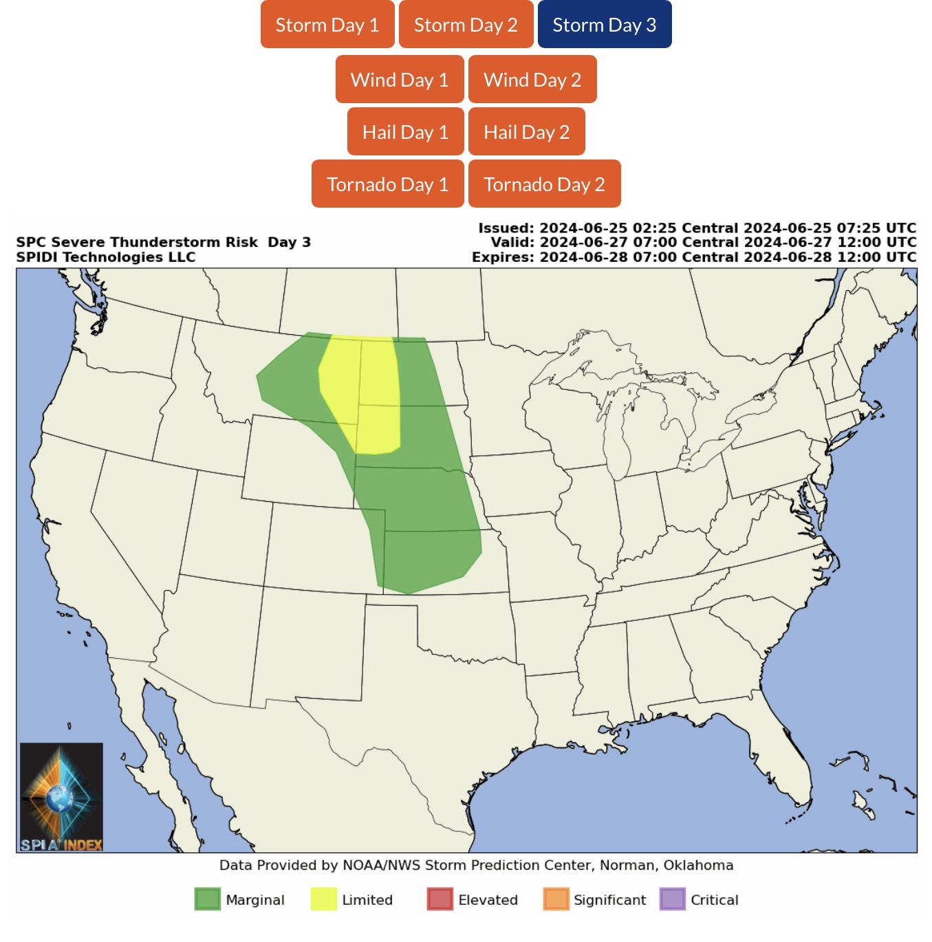
LIMITED Severe Thunderstorm Risk, Day 3 (Thursday), parts MT, WY, ND & SD.
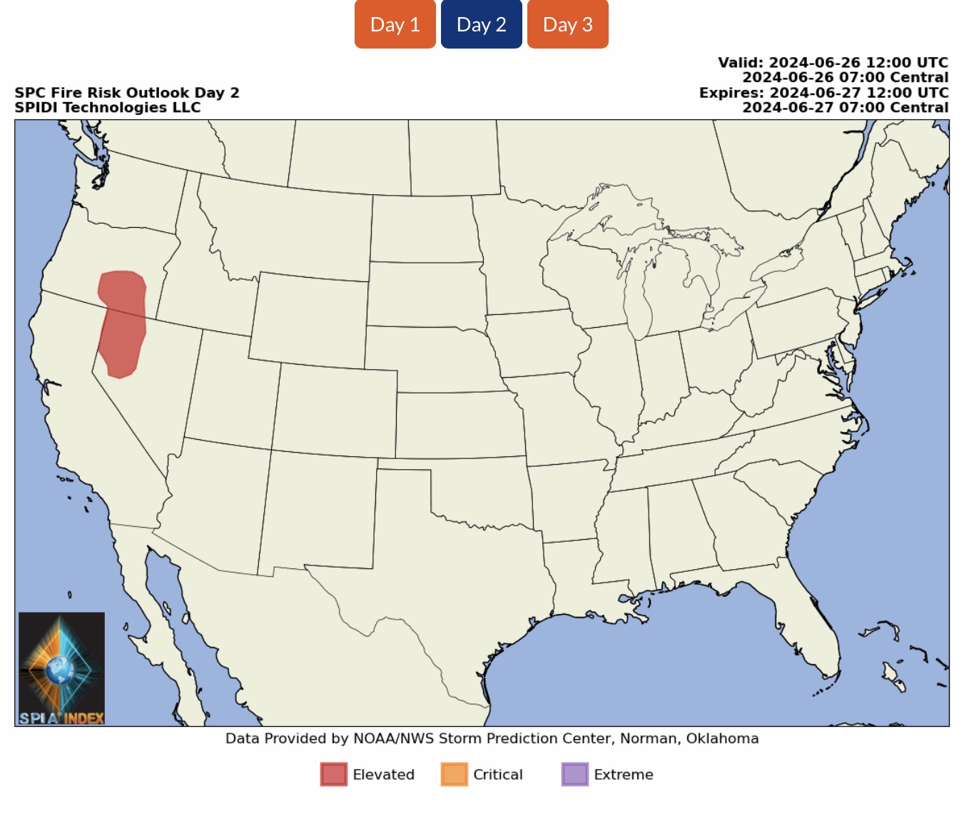
ELEVATED Wildfire Risk, Day 2 (Wednesday), parts OR & NV.
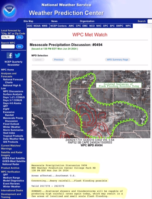
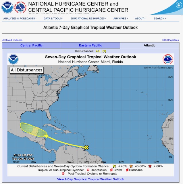
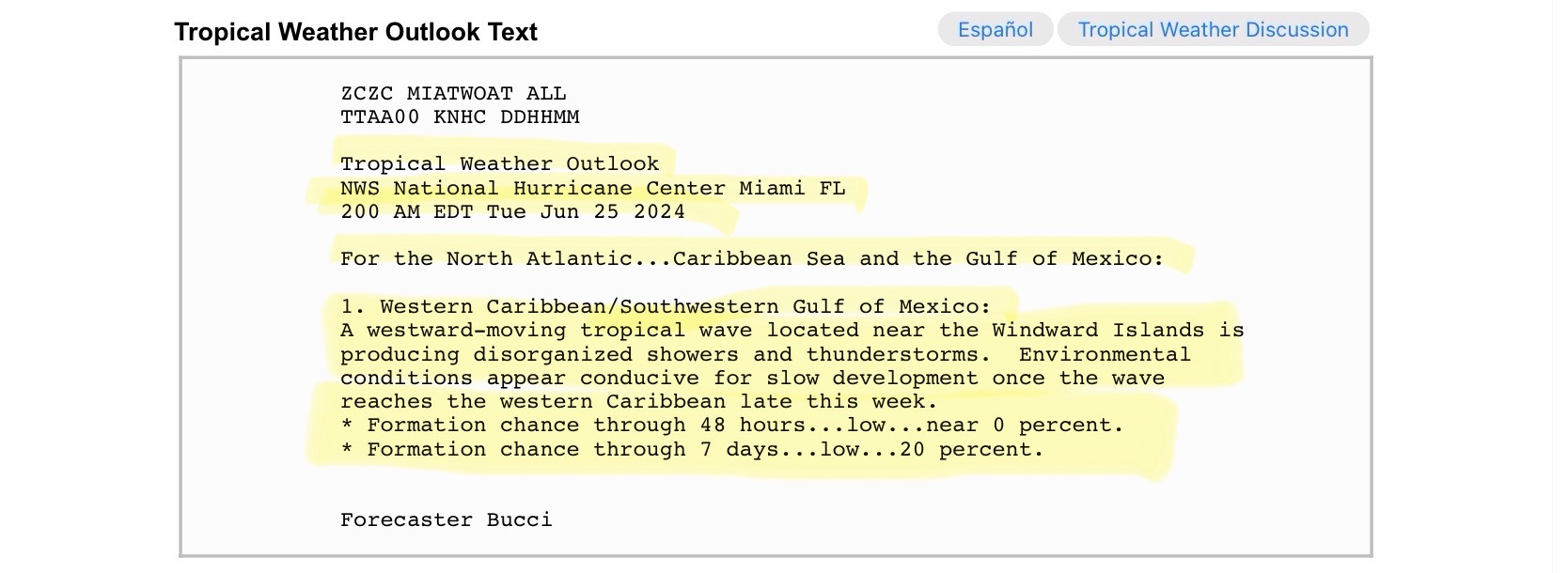
Latest 7-Day Tropical Weather Outlook from the National Hurricane Center (NHC) shows a Tropical Wave near the Windward Islands moving northwest toward the Yucatan Peninsula over the next 5-7 days. Currently has a 20% chance of further development.
Sid Sperry
President & CEO
SPIDI Technologies, LLC
Website/Subscriptions: SPIDItech.com
Cell Phone: (405) 627-7754
Email(s): SidSperry@gmail.com  OR  Sid.Sperry@spidiweather.com

Sent from my iPad

 Show/hide attachments