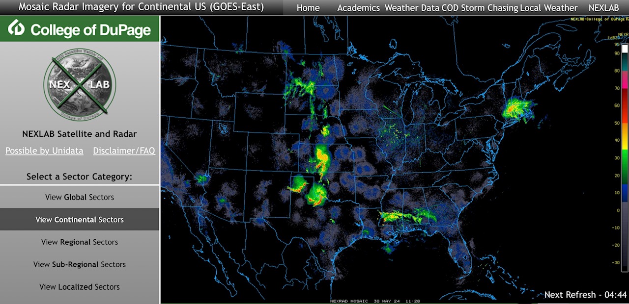
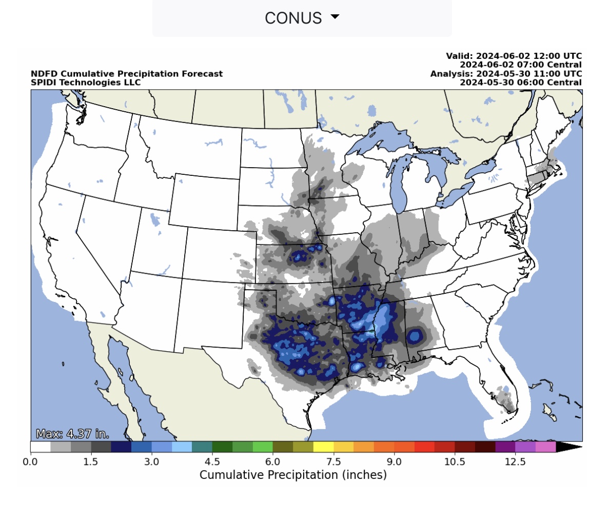
Current COD Mosaic Radar as of 6:30am CT 5/30/24. Thunderstorms continue across North Central, South Central, Southeast and Northeast Regions this morning. Some storms in the TX panhandle and north TX, western OK, could become severe later today. Flooding & Flash flooding possible in some areas.
Sidney Sperry 30 May 2024 11:57 UTC
FYI…
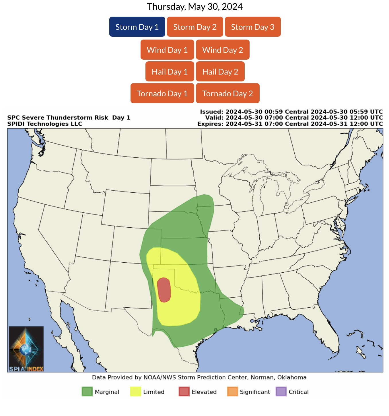
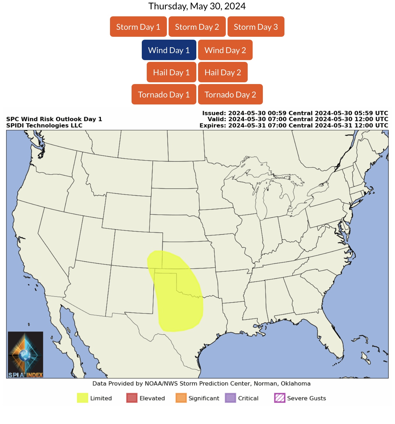
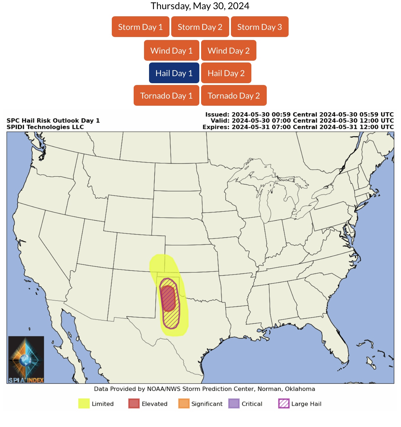
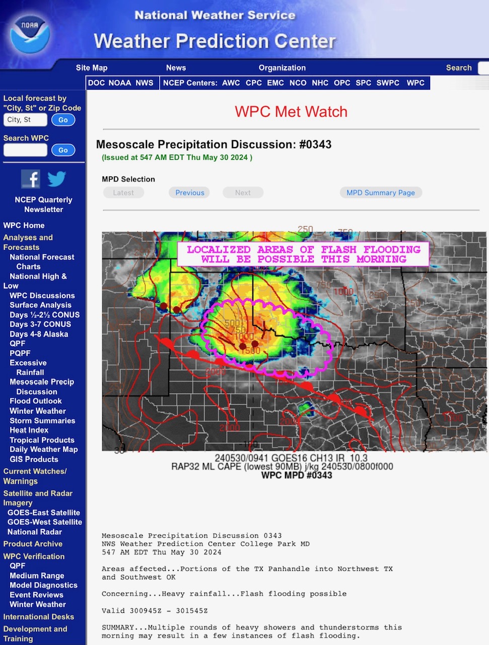
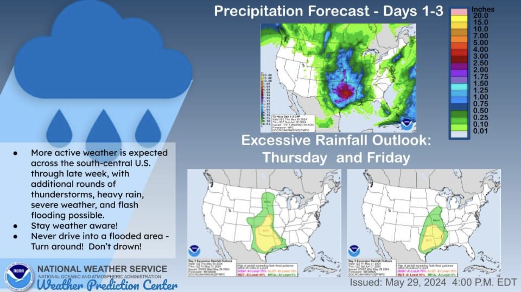
ELEVATED Severe Thunderstorm Risk, Day 1 (Thursday, 5/30/24), parts TX panhandle & north TX. Includes LIMITED High Winds Risk and ELEVATED Hail & Large Hail Risk. The risk of Tornadoes is low, but not zero.
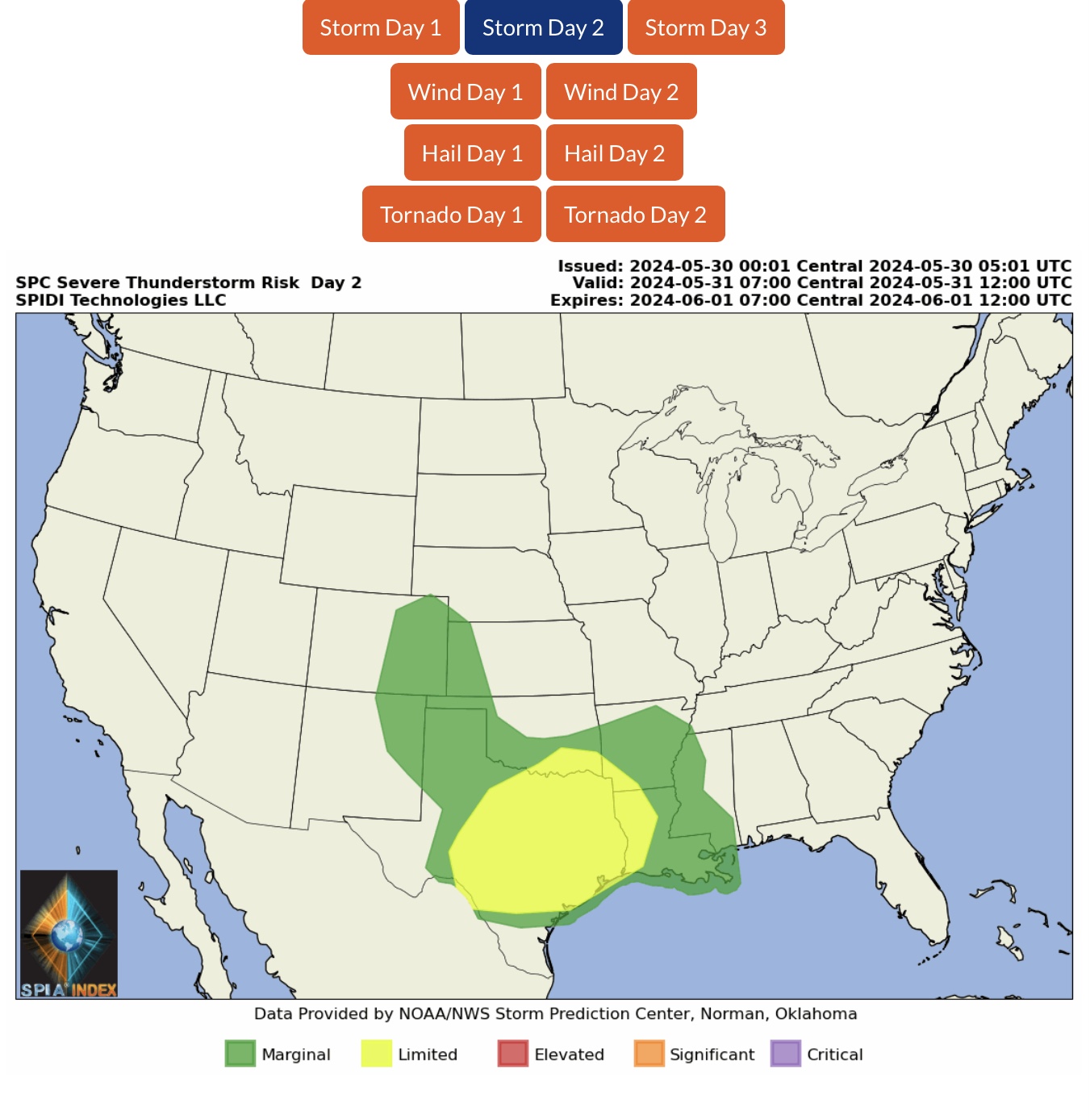
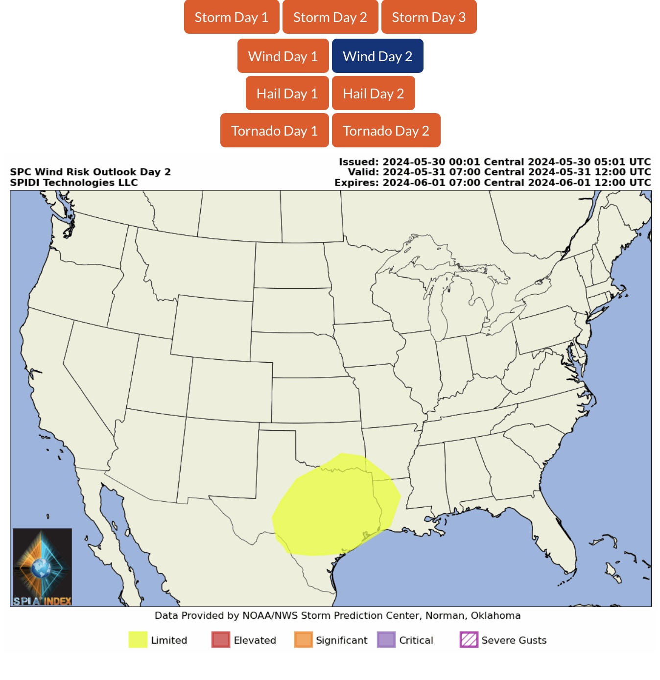
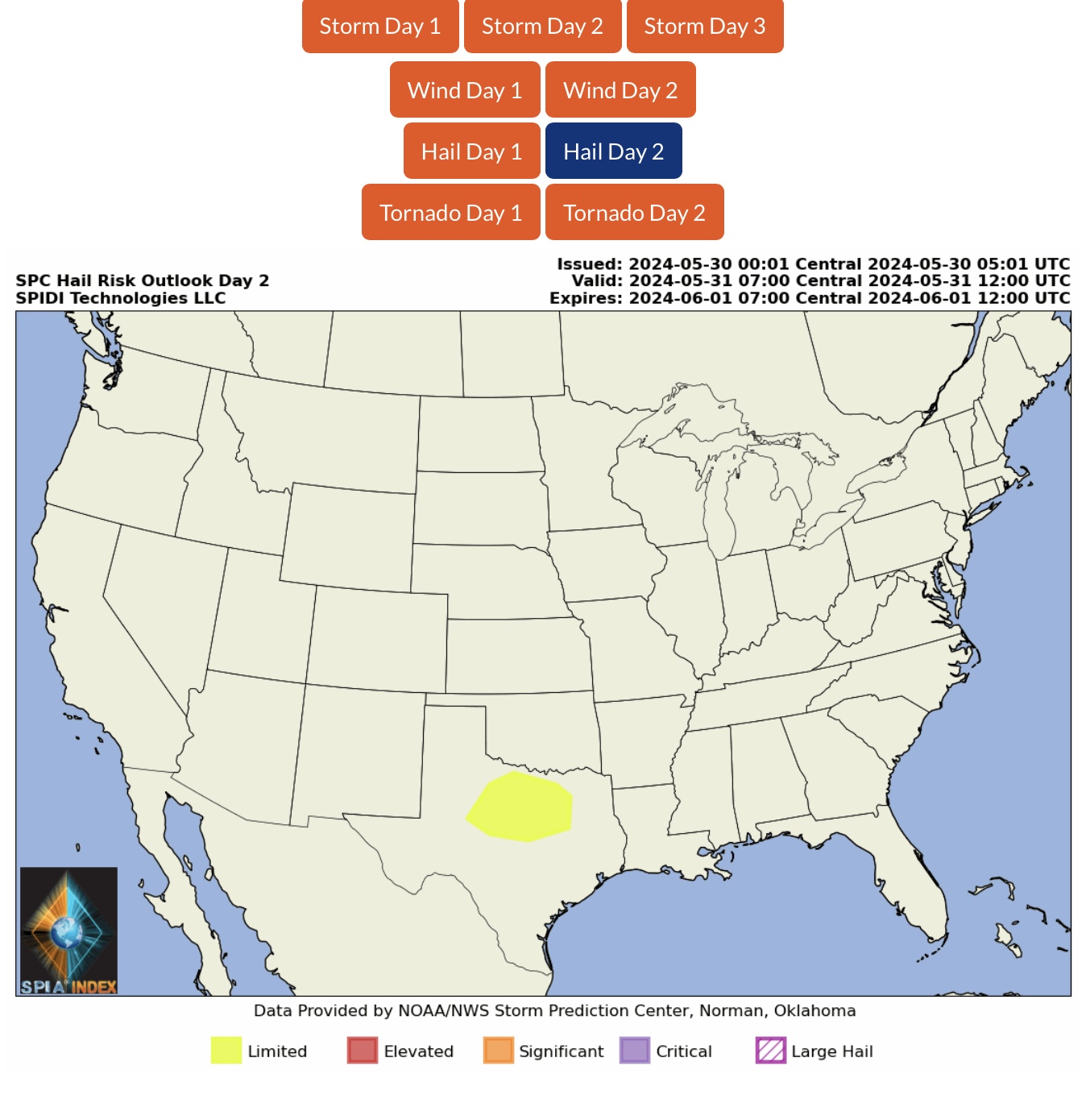
LIMITED Severe Thunderstorm Risk, Day 2 (Friday, 5/31/24), parts OK, AR, TX & LA. Includes LIMITED High Winds Risk and LIMITED Hail Risk.
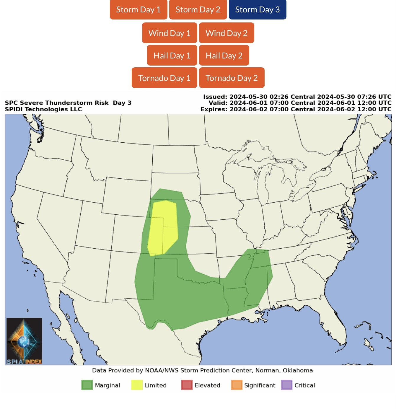
LIMITED Severe Thunderstorm Risk, Day 3 (Saturday, 6/1/24), parts NE, CO, KS & NM.
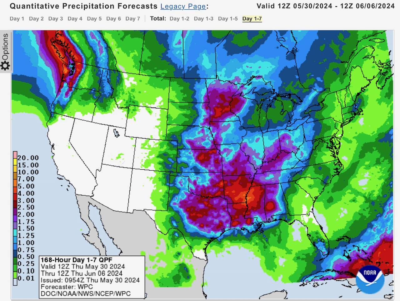
Next 7 days rainfall forecast from NOAA’s Weather Prediction Center (WPC).
Sid Sperry
President & CEO
SPIDI Technologies, LLC
Website/Subscriptions: SPIDItech.com
Cell Phone: (405) 627-7754
Email(s): SidSperry@gmail.com  OR  Sid.Sperry@spidiweather.com

Sent from my iPad

 Show/hide attachments