Severe Thunderstorms continue this morning across parts SD, NE, MN, IA & WI. Tornado Warnings parts eastern NE; Severe Thunderstorm Warnings parts eastern NE, western IA. Flash Flood Warnings parts parts central IA. Flood Watch parts MN, IA & NE. Wind Advisories parts ND, SD, MN, IA, MO, IL, IN & KY. Heat Advisory parts south TX. Winter Storm Warning parts north-central WY… Sidney Sperry (21 May 2024 11:04 UTC)

Severe Thunderstorms continue this morning across parts SD, NE, MN, IA & WI. Tornado Warnings parts eastern NE; Severe Thunderstorm Warnings parts eastern NE, western IA. Flash Flood Warnings parts parts central IA. Flood Watch parts MN, IA & NE. Wind Advisories parts ND, SD, MN, IA, MO, IL, IN & KY. Heat Advisory parts south TX. Winter Storm Warning parts north-central WY… Sidney Sperry 21 May 2024 11:04 UTC
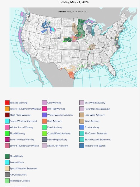
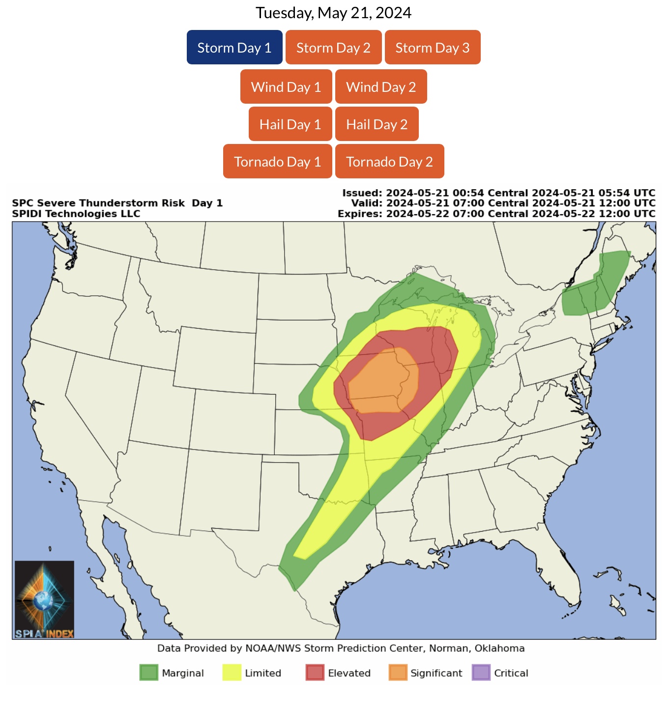
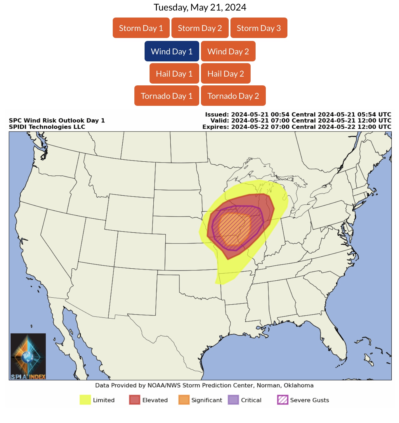
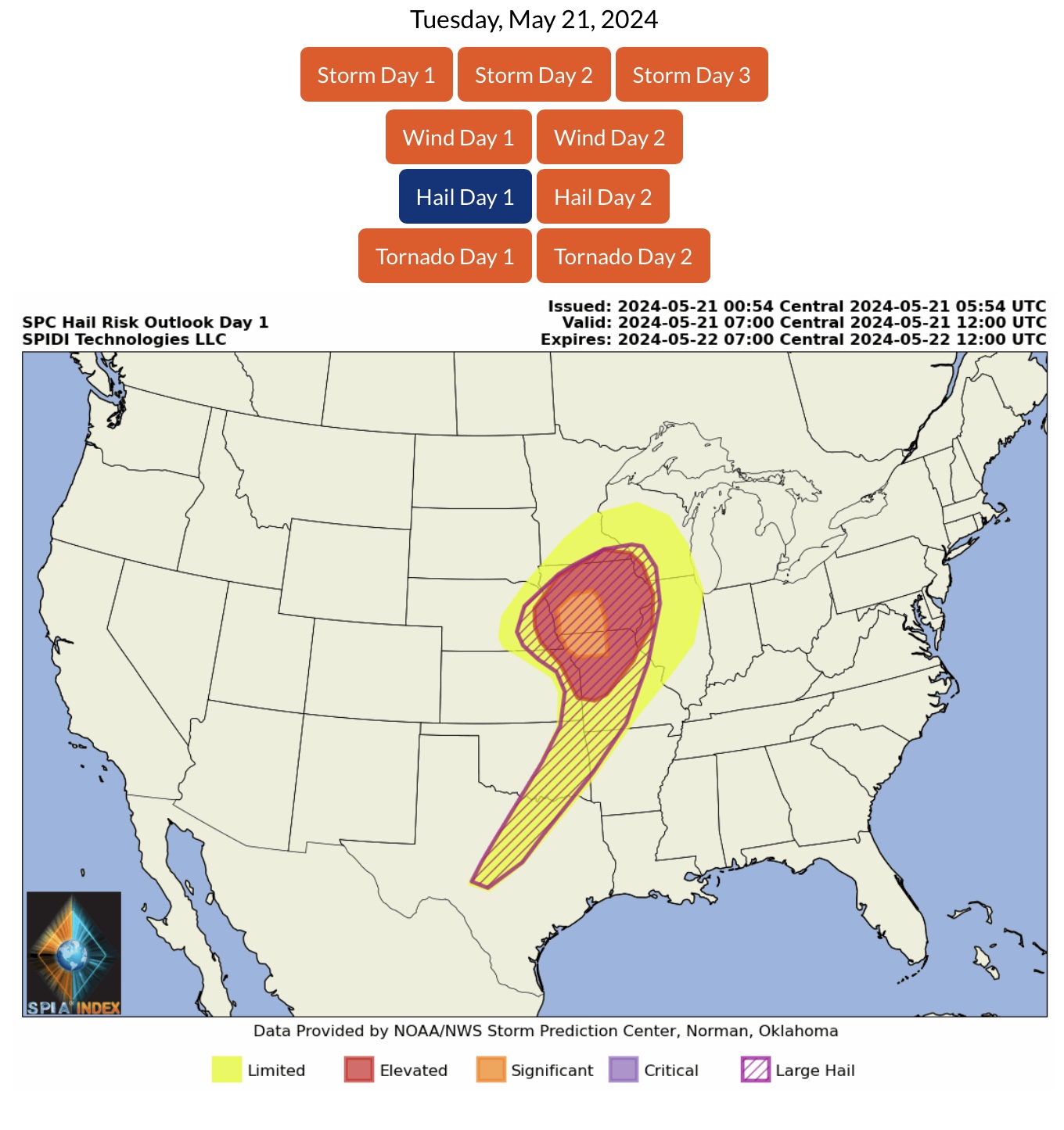
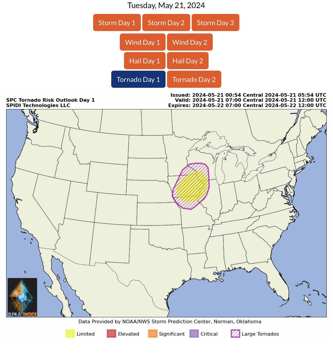
ELEVATED to SIGNIFICANT Severe Thunderstorm Risk, Day 1 (today, Tuesday, 5/21/24), parts MN, WI, MI, NE, IA, KS, MO, IL & IN. Includes ELEVATED to SIGNIFICANT High Wind Risk and SEVERE GUSTS Risk, ELEVATED to SIGNIFICANT Hail & Large Hail Risk, and a LIMITED Risk for Tornadoes, with some Large Tornadoes possible today.

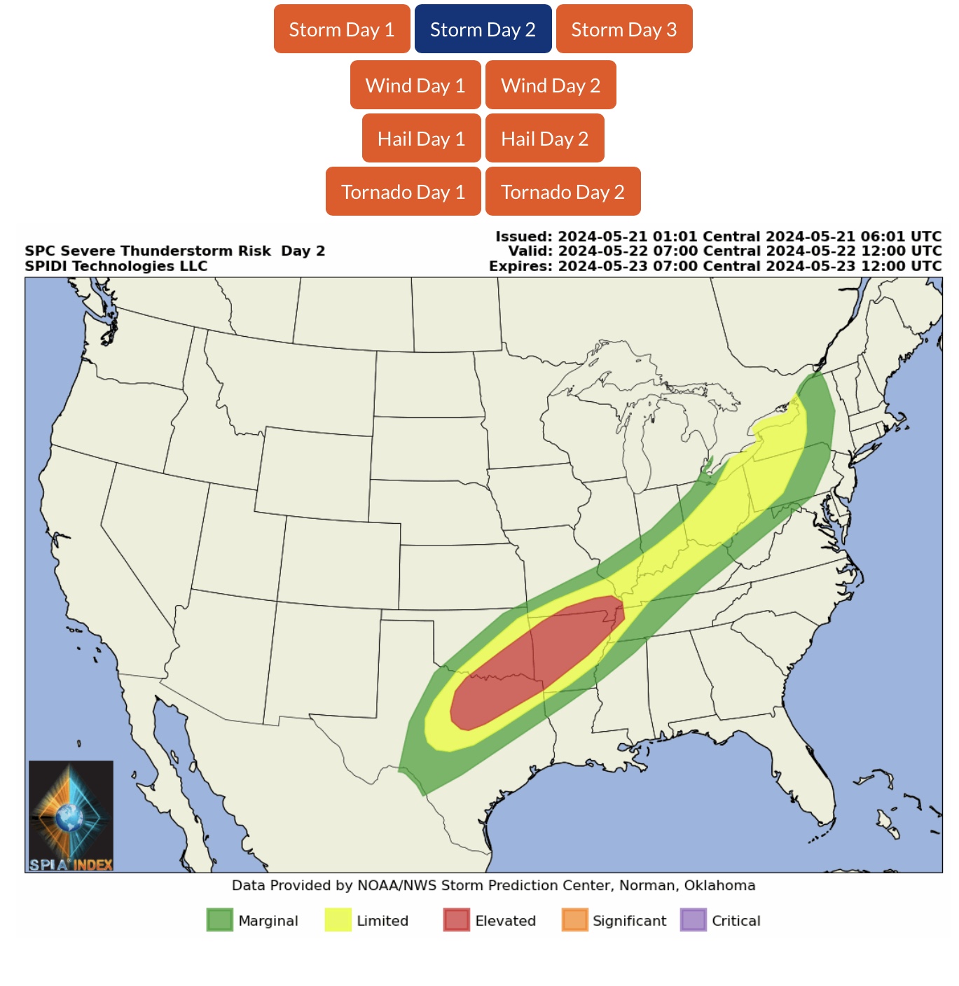
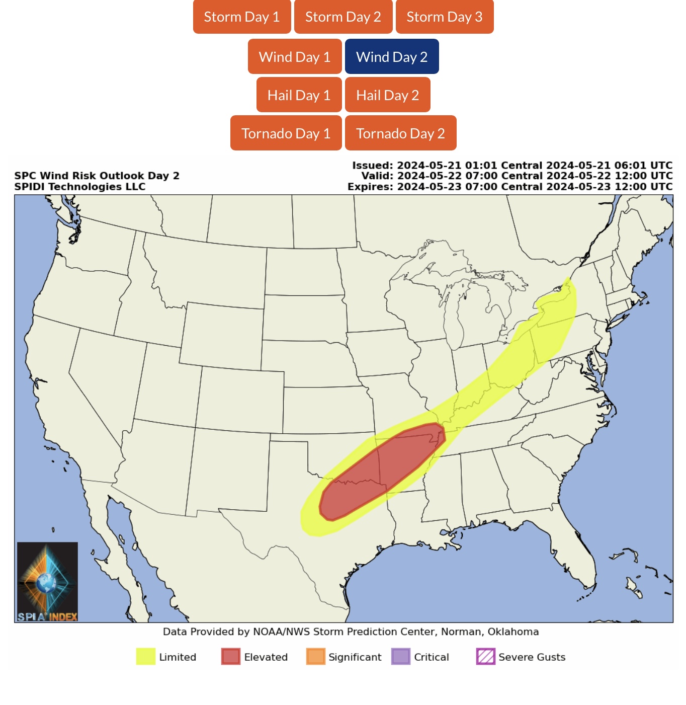
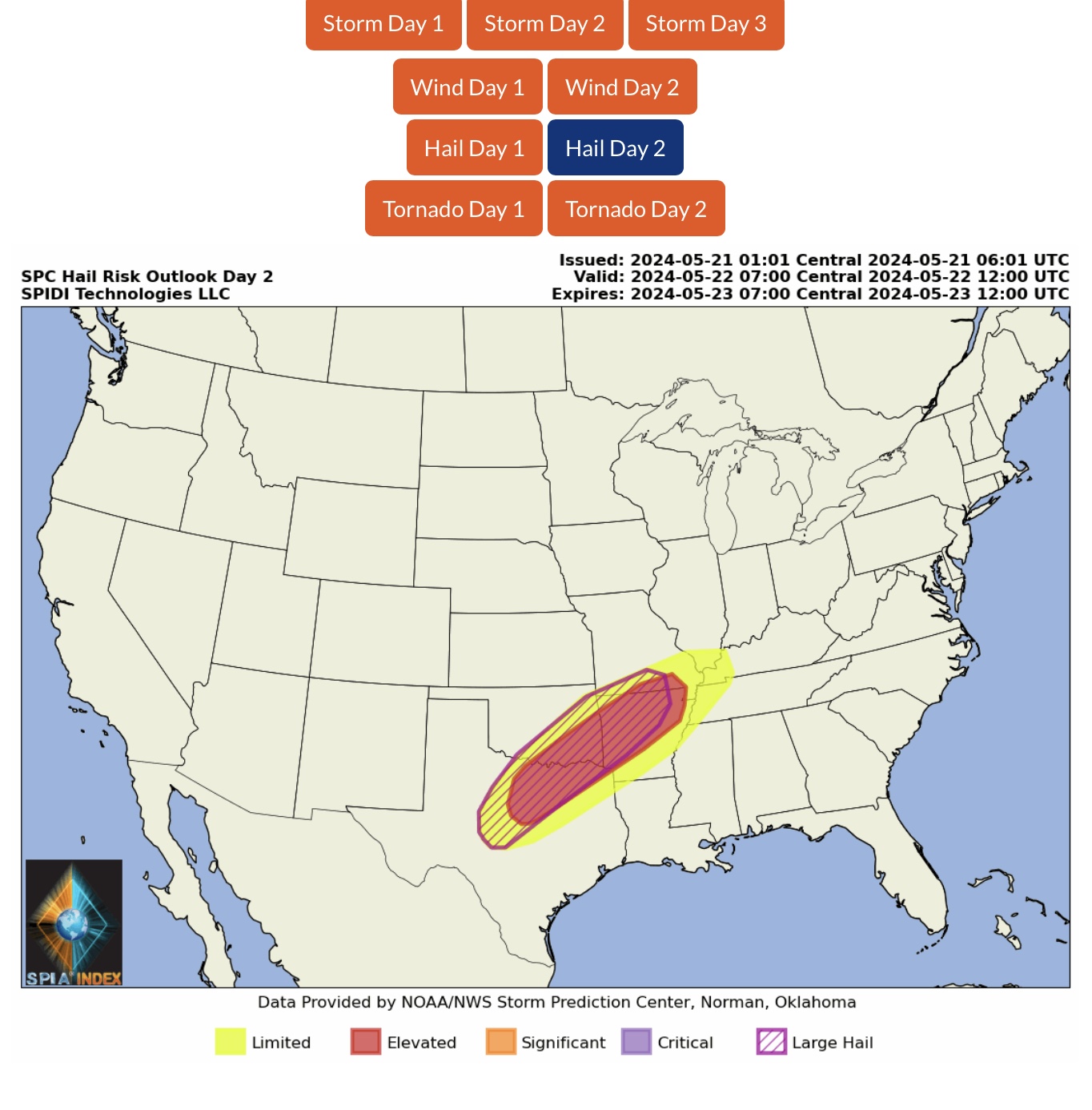
ELEVATED Severe Thunderstorm Risk, Day 2 (Wednesday, 5/22/24), parts TX, OK, AR, MO & TN. Includes ELEVATED High Wind Risk and ELEVATED Hail & Large Hail Risk.

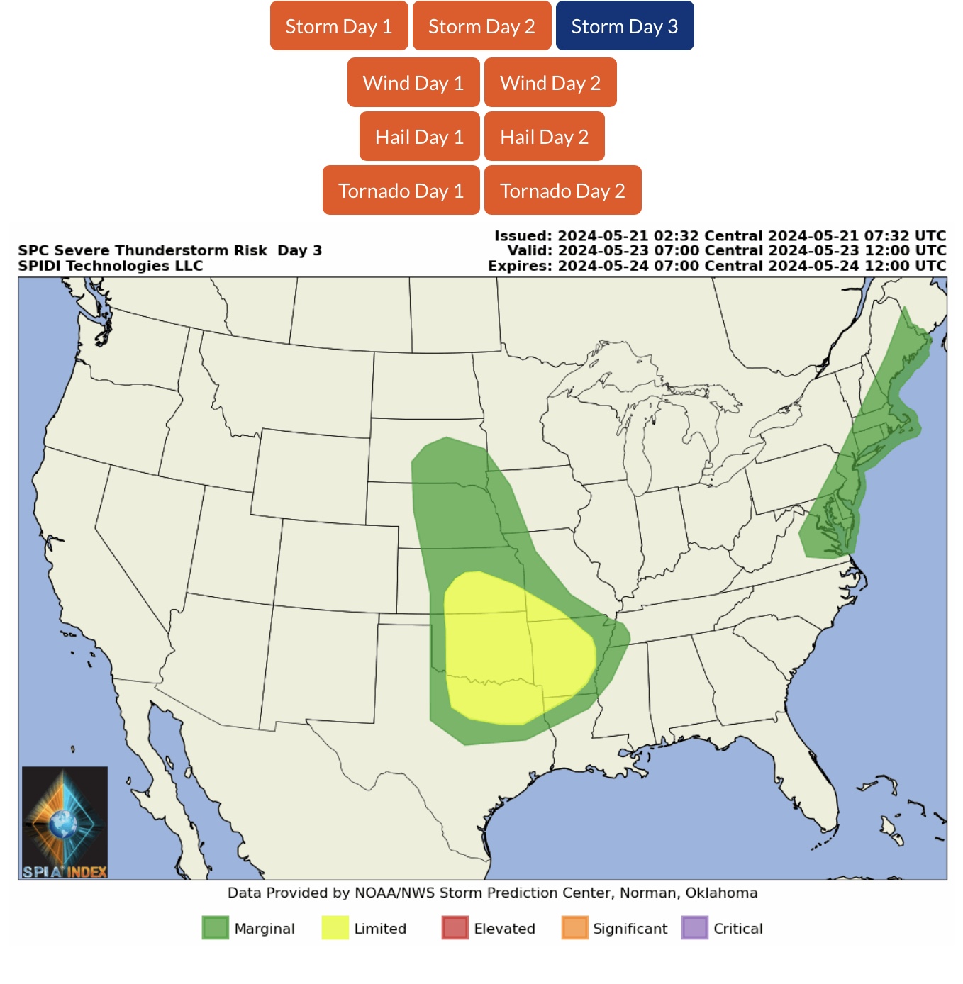
LIMITED Severe Thunderstorm Risk, Day 3 (Thursday, 5/23/34), parts KS, OK, TX, MO, AR & LA.

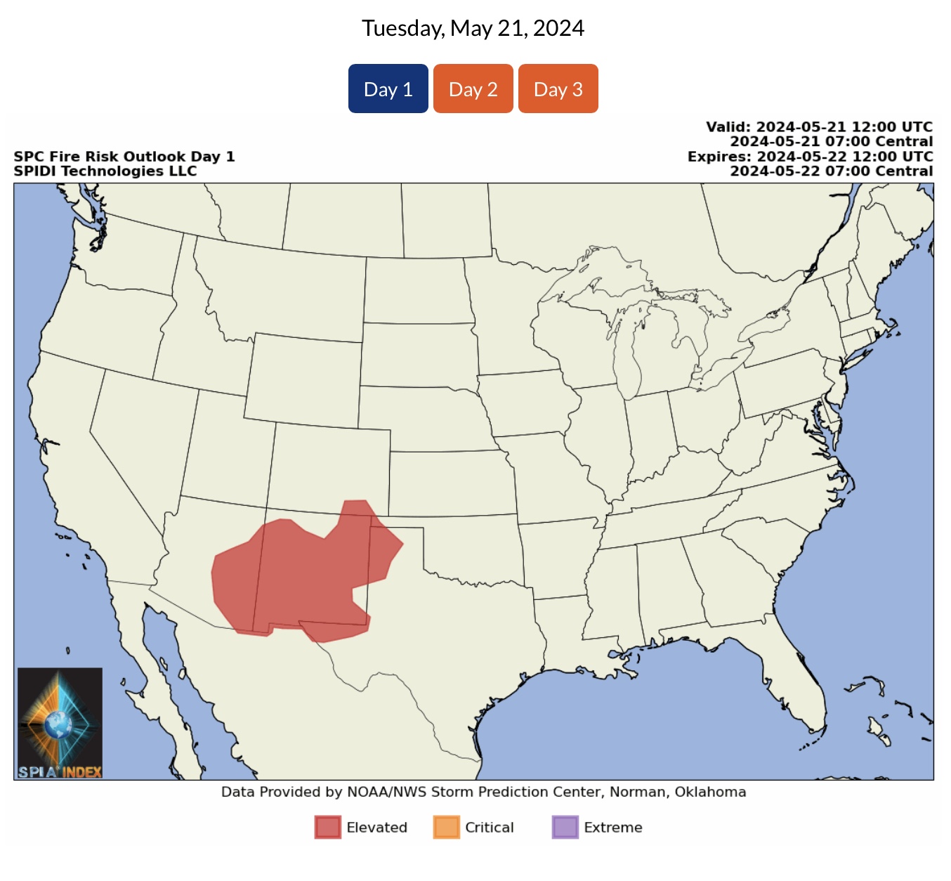
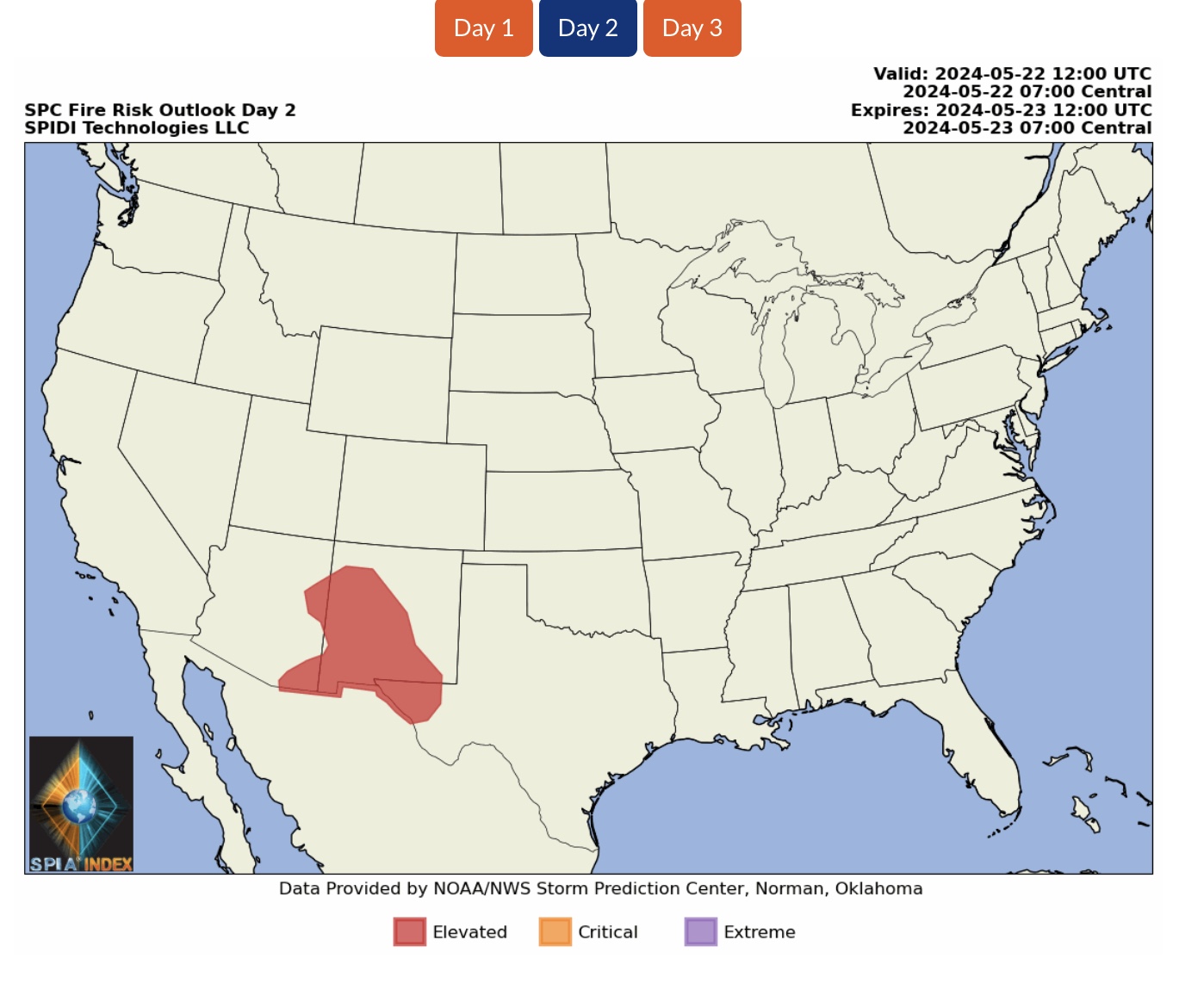
ELEVATED Wildfire Risk, Days 1 & 2 (Tuesday/Wednesday), parts AZ, NM, CO, OK & TX.

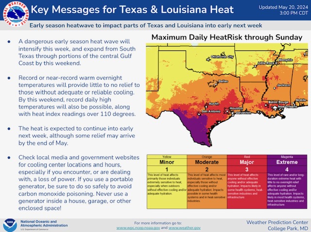
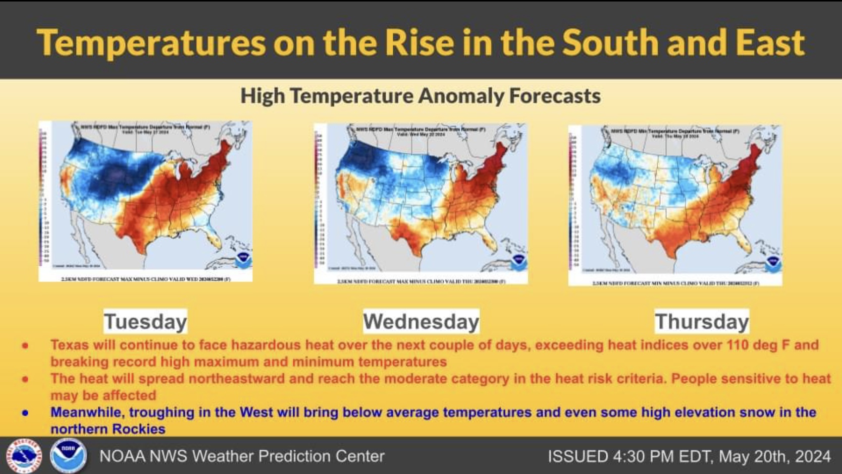
MAJOR to EXTREME Heat Risks for Outdoor Workers today across parts TX, AR, LA & MS. High Temperatures & High Humidity Levels will persist across the South Central & Southeast Regions the rest of this week and into next week.


Sid Sperry
President & CEO
SPIDI Technologies, LLC
Website/Subscriptions: SPIDItech.com
Cell Phone: (405) 627-7754
Email(s): SidSperry@gmail.com  OR  Sid.Sperry@spidiweather.com

Sent from my iPad