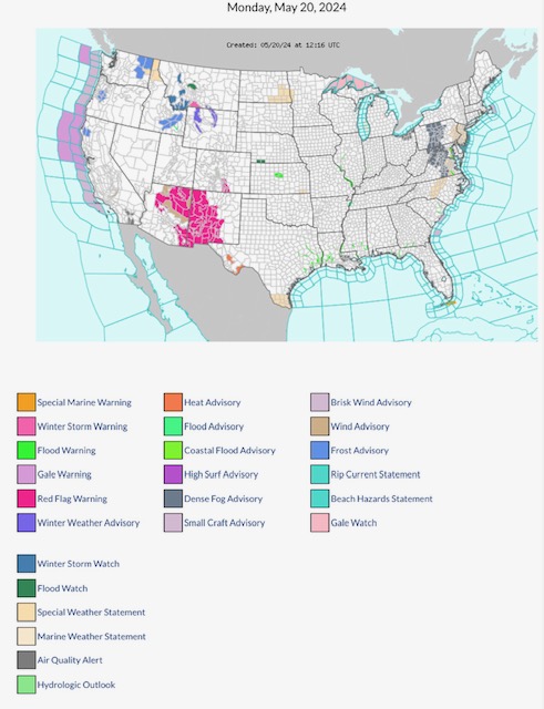
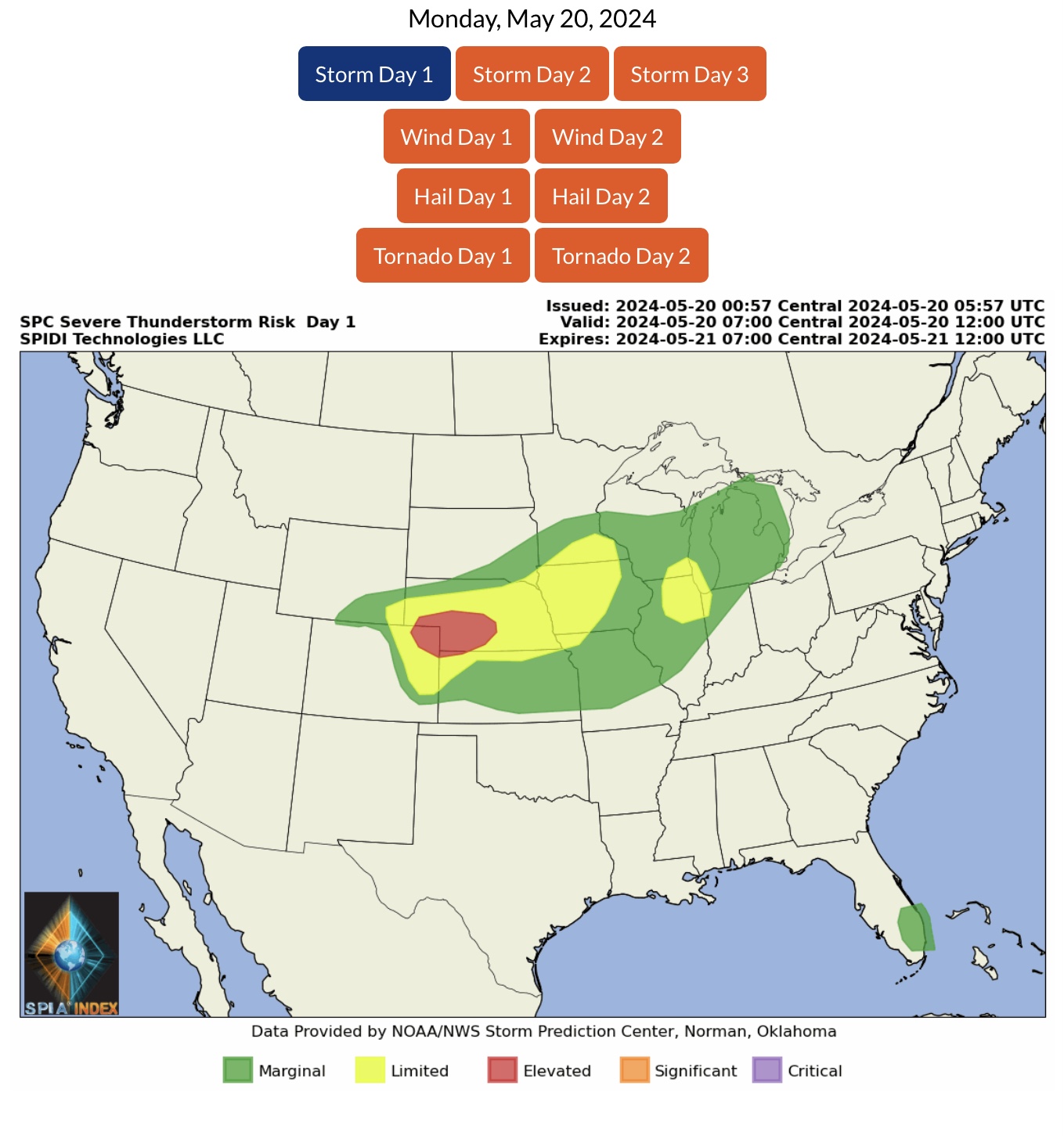
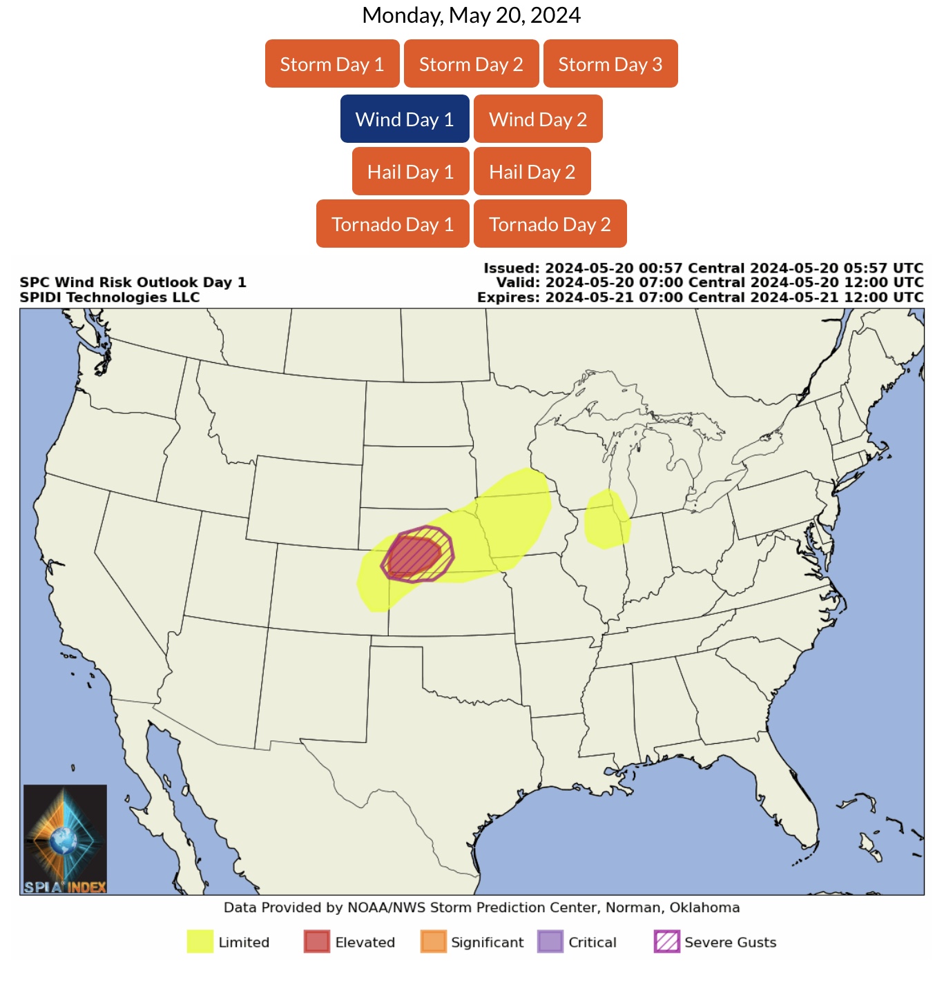
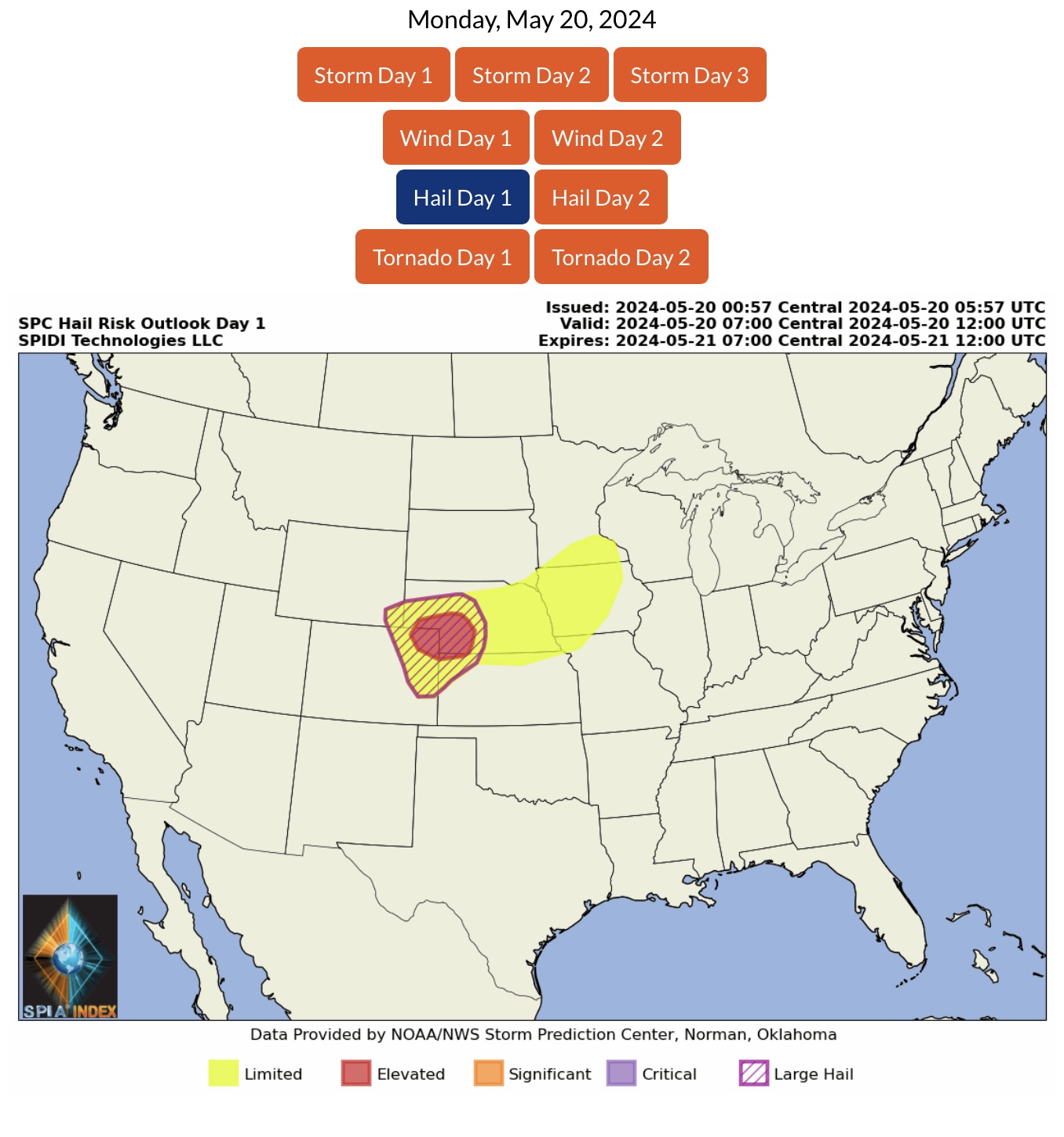
ELEVATED Severe Thunderstorm Risk, Day 1 (today, Monday May 20, 2024), parts NE, CO & far northwest KS. Includes ELEVATED High Winds Risk, ELEVATED Hail and Large Hail Risk.
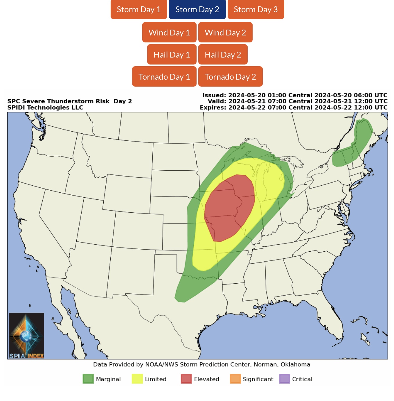
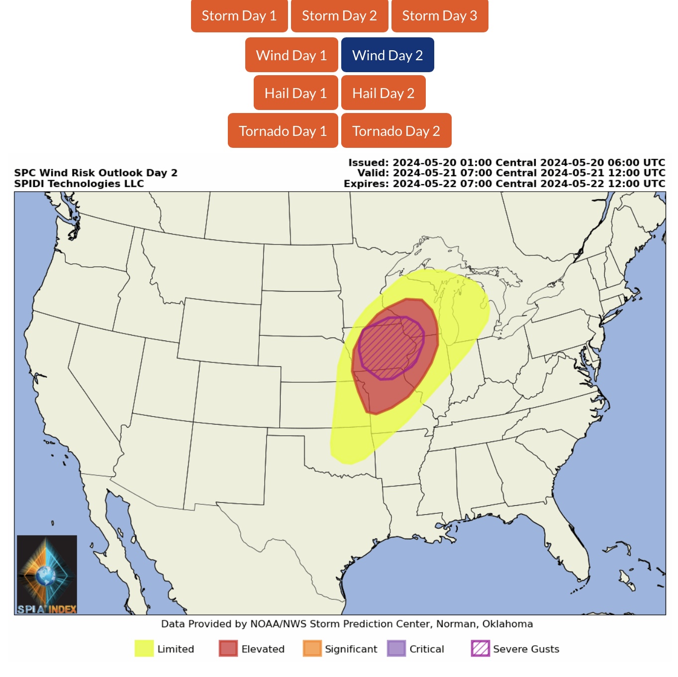
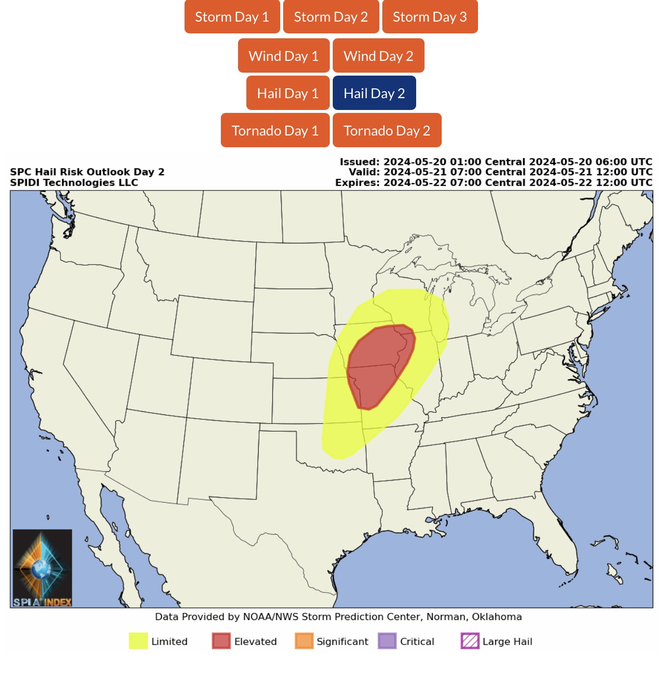
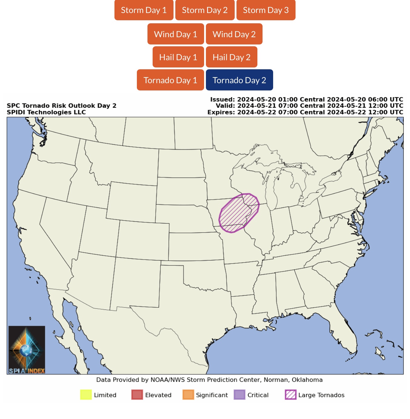
ELEVATED Severe Thunderstorm Risk, Day 2 (Tuesday, May 21, 2024), parts MN, WI, IA, IL, NE, KS & MO. Includes ELEVATED High Winds Risk, ELEVATED Severe Gusts Risk, ELEVATED Hail Risk, and Large Tornadoes Risk.
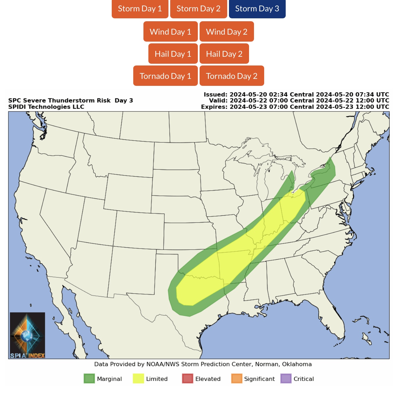
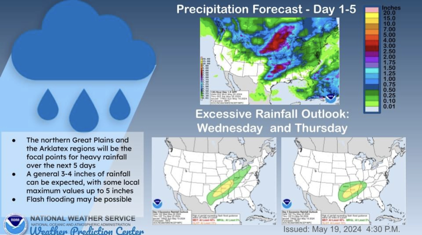
LIMITED Severe Thunderstorm Risk, Day 3 (Wednesday, May 22, 2024), parts TX, AR, LA, OK, MO, TN, IL, KY, IN & OH.
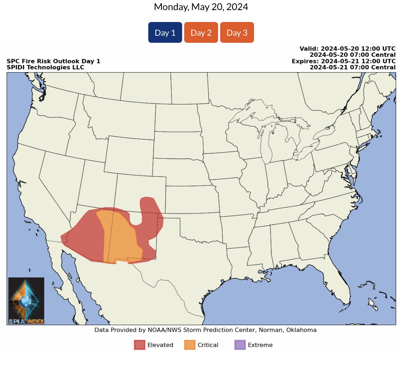
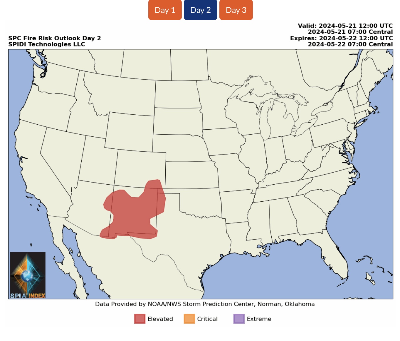
ELEVATED to CRITICAL Wildfire Risk, Days 1 & 2, parts CA, AZ, UT, NM, CO, OK & TX.
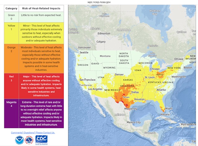
MAJOR to EXTREME Heat Impacts Risk for Outdoor Workers parts TX and NM as temperatures reach the low 100s and humidity levels remain high in parts of the South Central Region today.

 Show/hide attachments