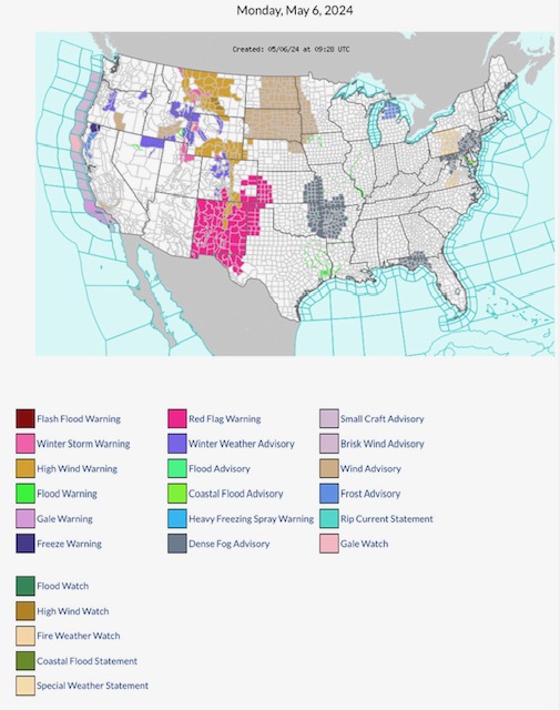
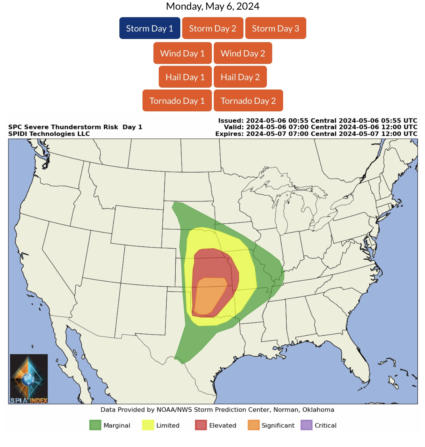
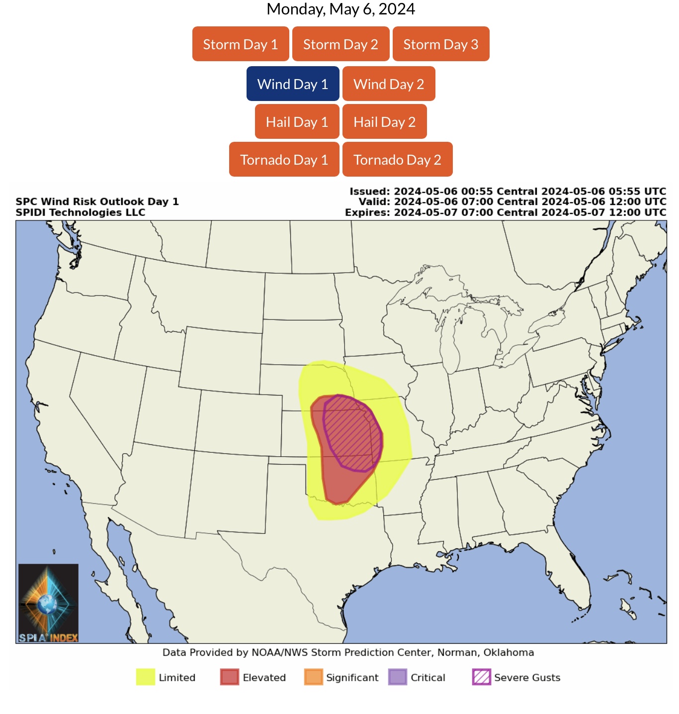
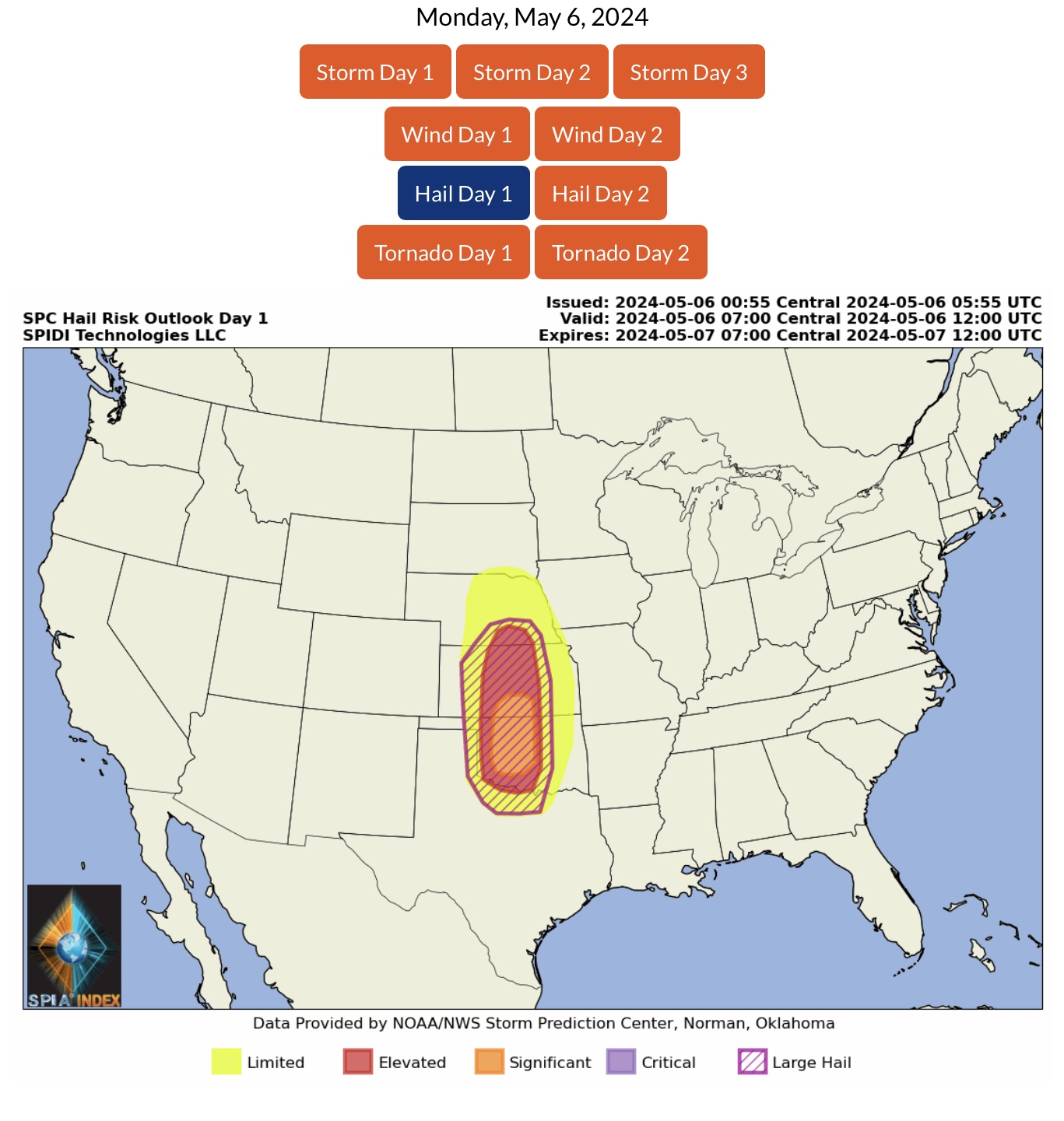
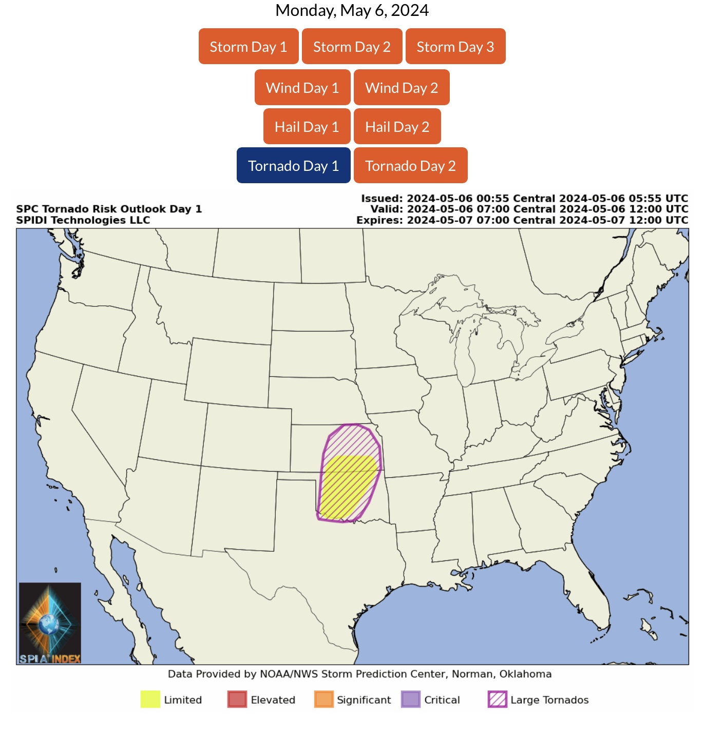
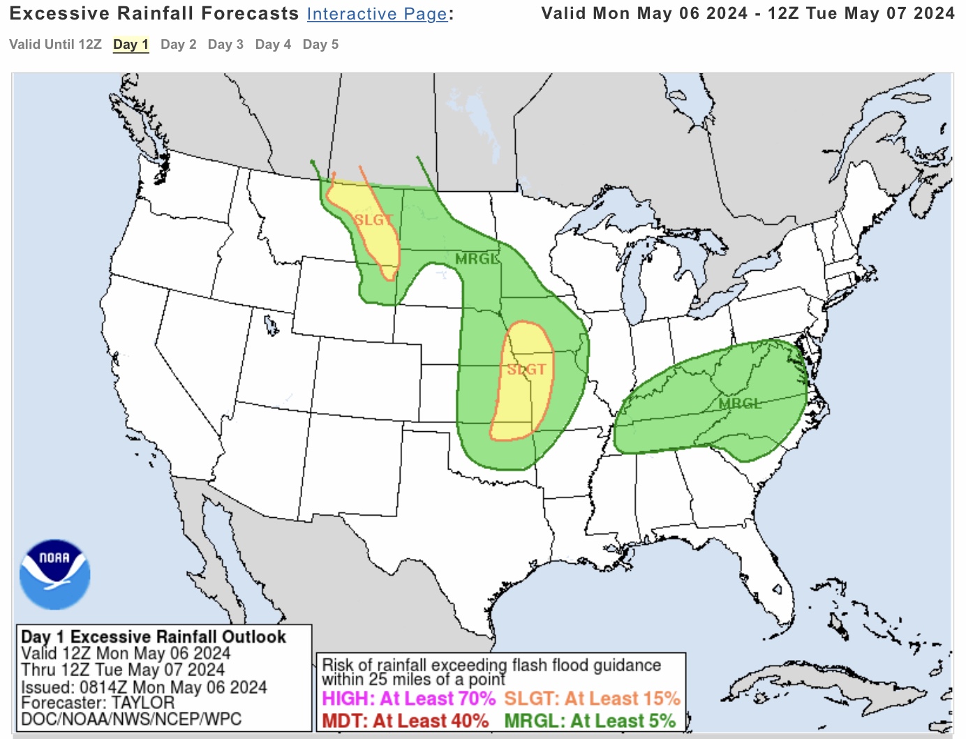
ELEVATED to SIGNIFICANT Severe Thunderstorm Risk today (Monday, 5/6/24), parts NE, KS, MO, OK, AR & TX. Threats: Baseball to Softball-sized HAIL, Wind GUSTS from 75 to 80 mph, and the possibility of some Large, Long-Track TORNADOES. Be weather aware and have a SHELTER PLAN if you are in these projected impact areas today.
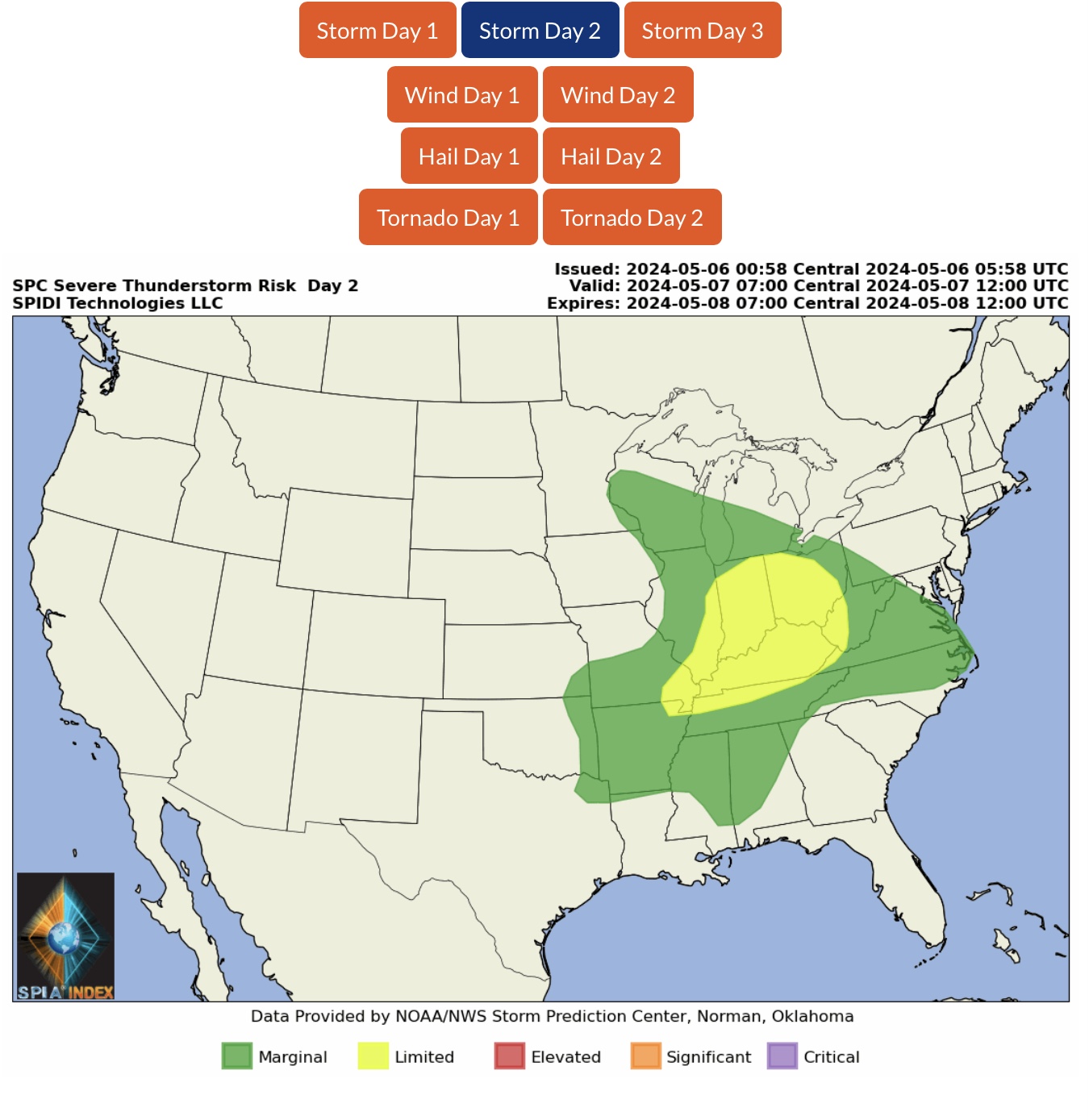
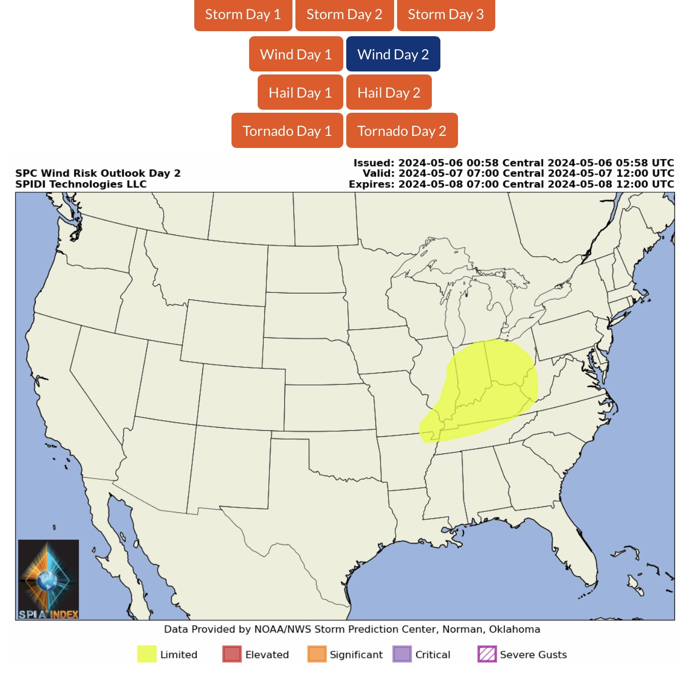
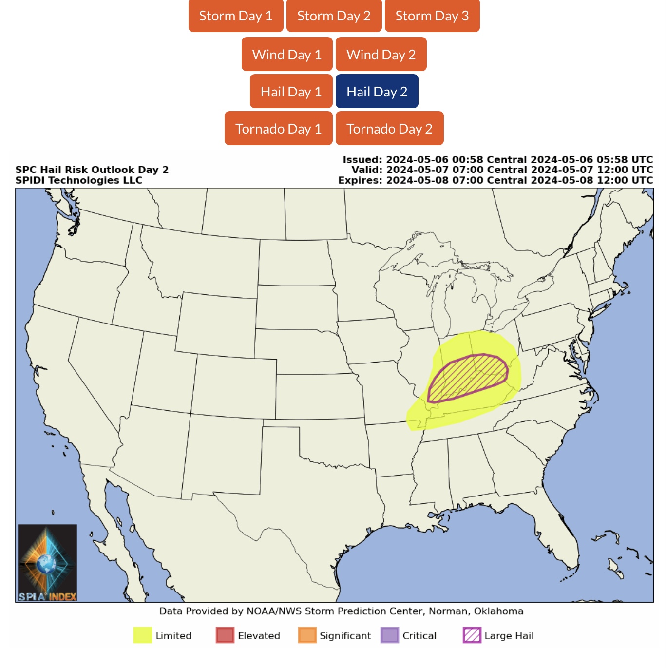
LIMITED SEVERE THUNDERSTORM RISK on Tuesday (5/7/24) for parts MO, AR, IL, IN, OH, KY, TN & WV. High Wind Gusts and Large Hail are greatest threats.
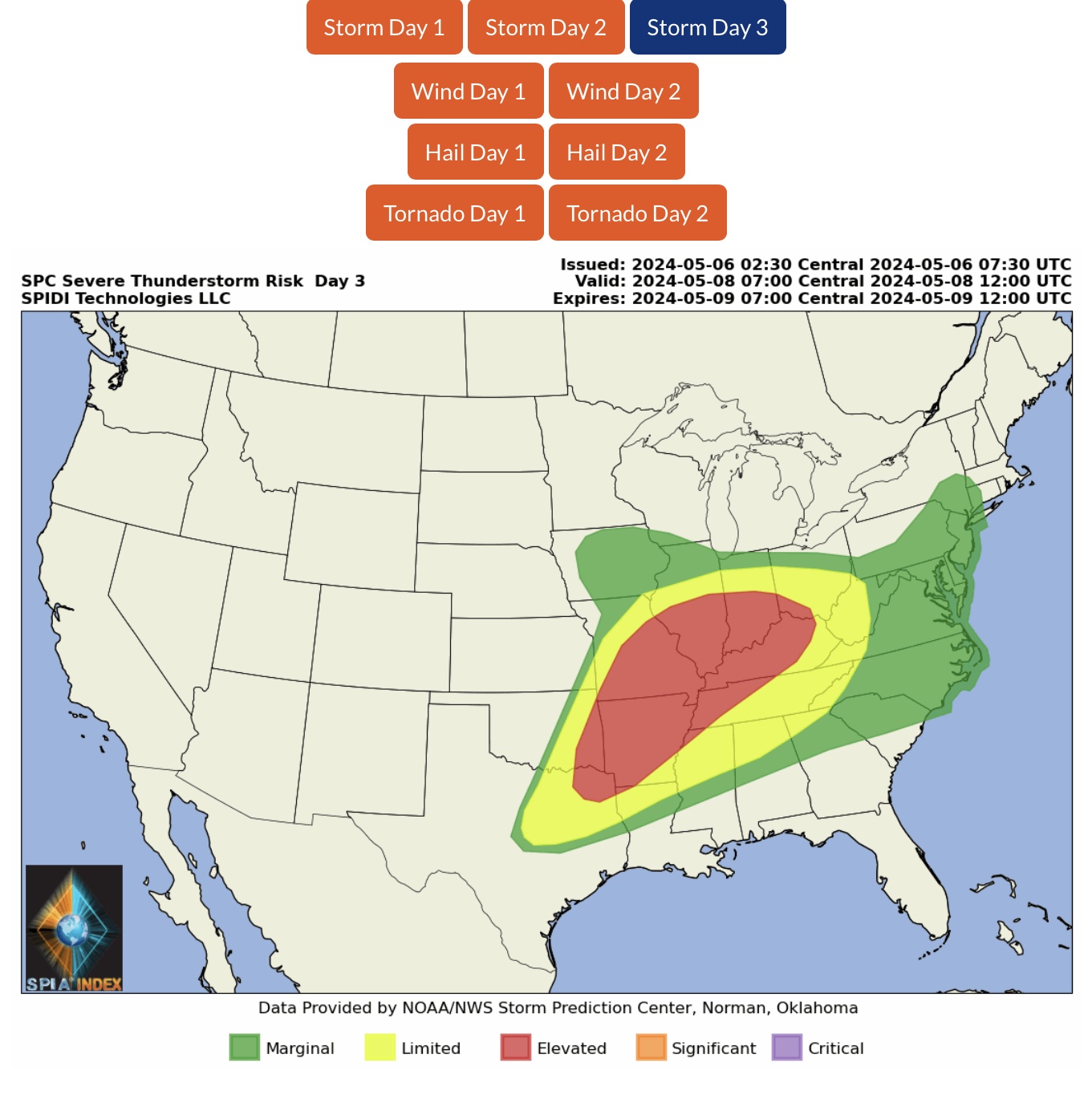
ELEVATED SEVERE THUNDERSTORM RISK on Wednesday (5/8/24) across parts OK, TX, AR, LA, MO, IL, IN, OH, KY, TN and MS. Large Hail, Damaging Wind Gusts, and some Tornadoes are possible.
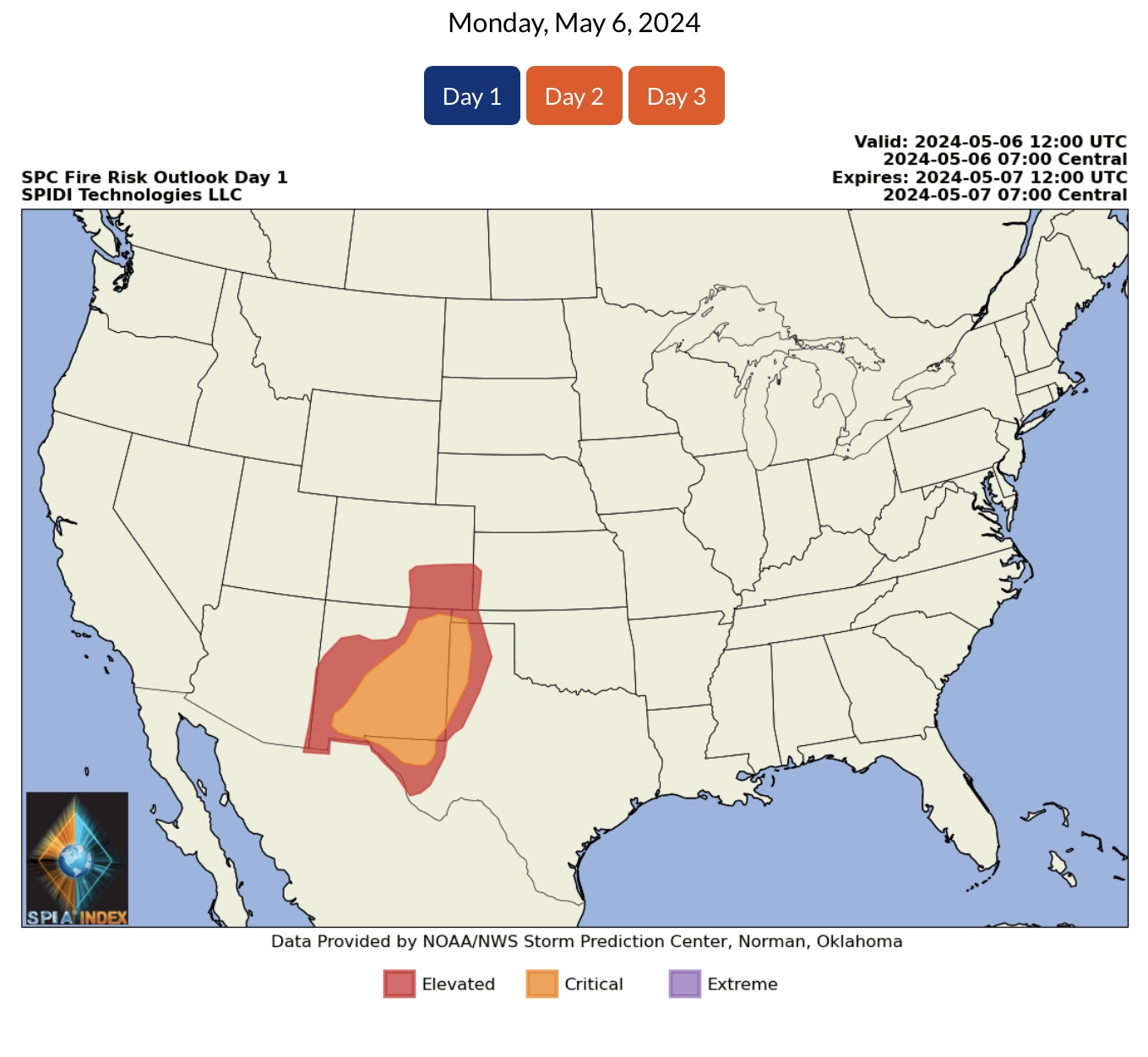
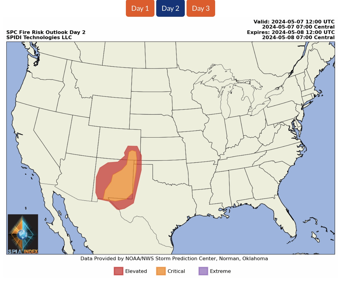
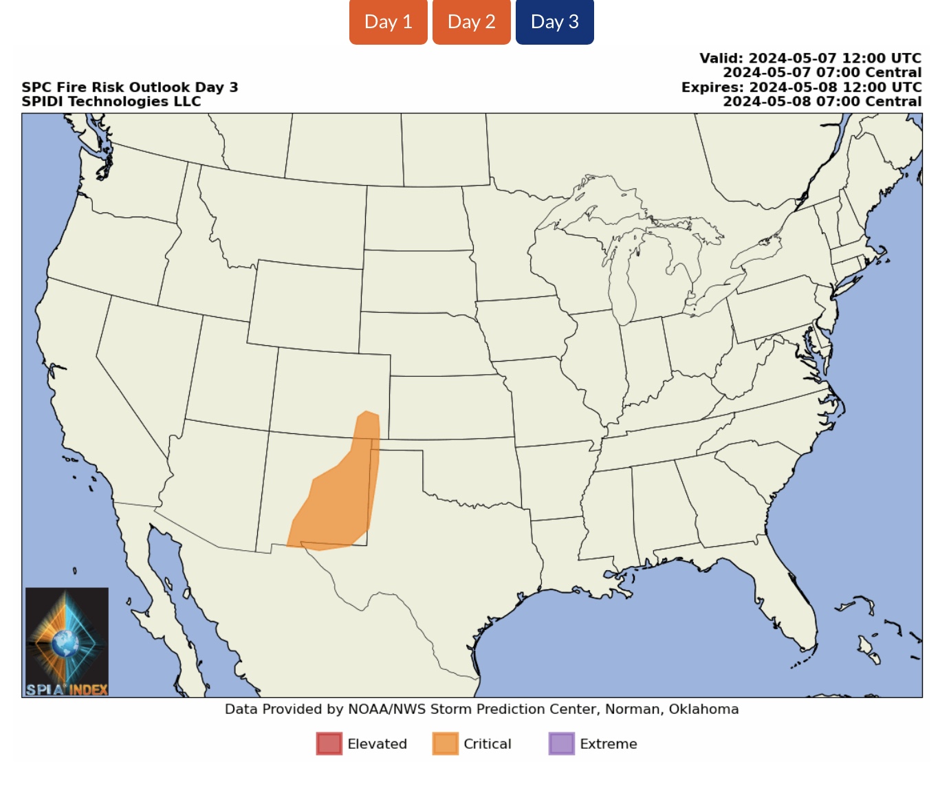
ELEVATED to CRITICAL WILDFIRE RISKS, Days 1 thru 3 (Monday, Tuesday, Wednesday, May 6-8, 2024), parts AZ, NM, CO, KS, OK & TX.

 Show/hide attachments