Possibilities for an “active” and “robust” Atlantic Hurricane Season…
Sidney Sperry 25 Feb 2024 14:35 UTC
All,
This past week, the private meteorology company AccuWeather released their early spring “Hurricane Season Outlook.” We all know that the “official” start to the Atlantic Hurricane Season isn’t until June 1, so the AccuWeather analysis is quite speculative, especially since it was released nearly 4 months ahead of the beginning of the season.
In summation, the AccuWeather report predicted an “active” and “robust” Atlantic Hurricane Season, even hinting that it could be as active as the 2020 season, which set records for the number of hurricanes that formed in the Atlantic.
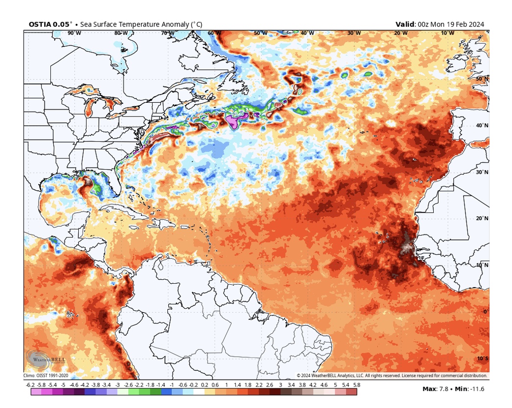
Part of their reasoning was based on the current Sea Surface Temperature Anomalys in the primary hurricane development area off the west coast of Africa, extending several hundred miles to the west-southwest. These current sea surface temperatures are well above the normal January sea surface temperatures, and, with El Niño likely winding down by April or May, the onset of more hurricane-favorable La Niña conditions could be an early indicator of an active hurricane season. NOAA climatologists suggest there could be more activity late in the season, however, meaning in October and November.
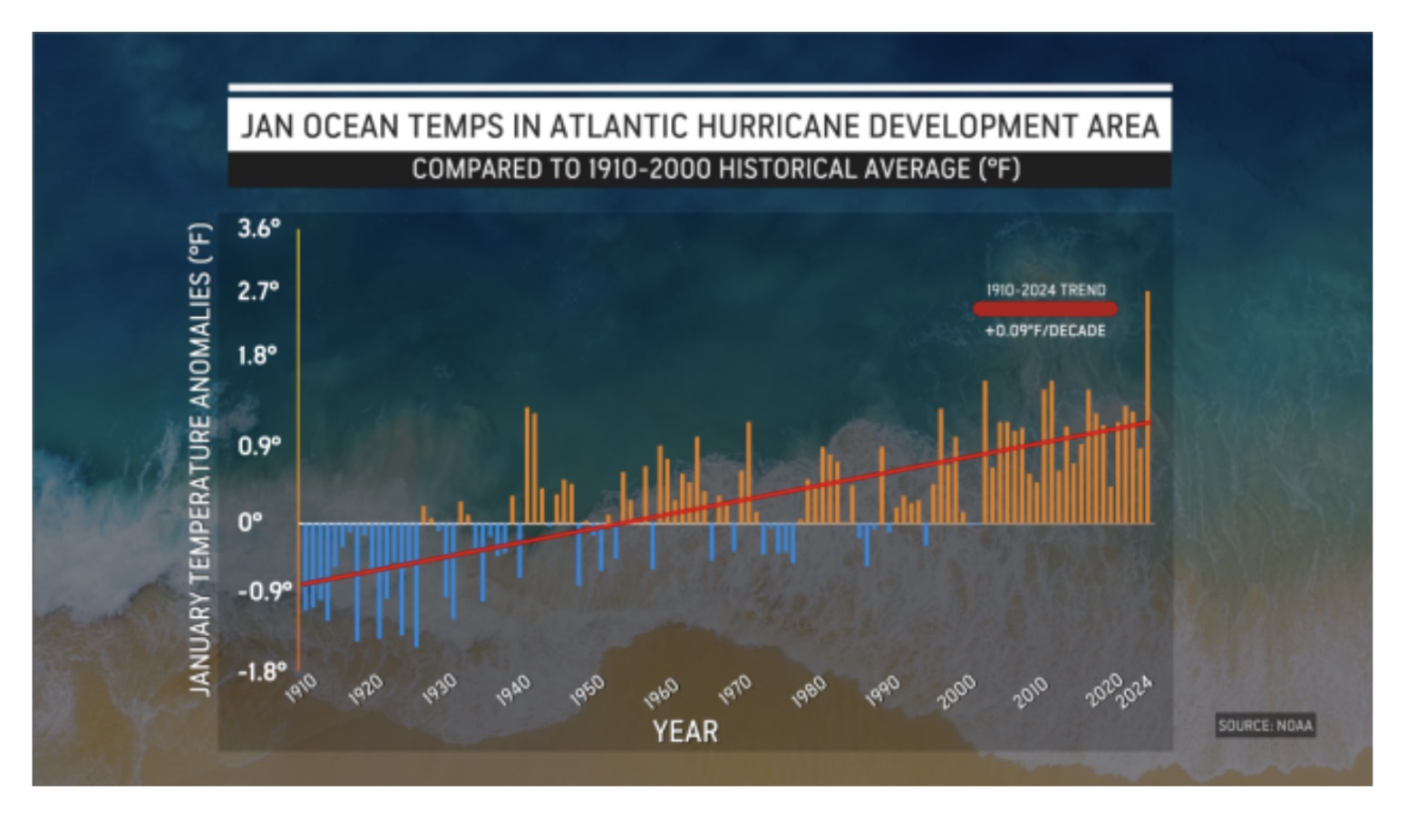
As you can see from the graphics below, the mid-February sea surface temperature anomalys were quite high off the west coast of Africa, typically the main hurricane development area during the Atlantic Hurricane Season. And, the early high temps continue to follow an increasing temperature trend compared to the 1910 to 2000 historical average. (Graphics per WeatherBELL and NOAA)
Just an early heads-up on what this year’s Atlantic Hurricane Season MIGHT be like.
Sid Sperry
President & CEO
SPIDI Technologies, LLC
Website/Subscriptions: SPIDItech.com
Cell Phone: (405) 627-7754
Email(s): SidSperry@gmail.com  OR  Sid.Sperry@spidiweather.com

Sent from my iPad

 Show/hide attachments