Potential freezing rain/ice accumulation event starting late Sunday night/early Monday morning and possibly continuing until Tuesday afternoon, impacting parts of TX, OK, AR, MO & IL…
Sidney Sperry 18 Jan 2024 02:58 UTC
All,
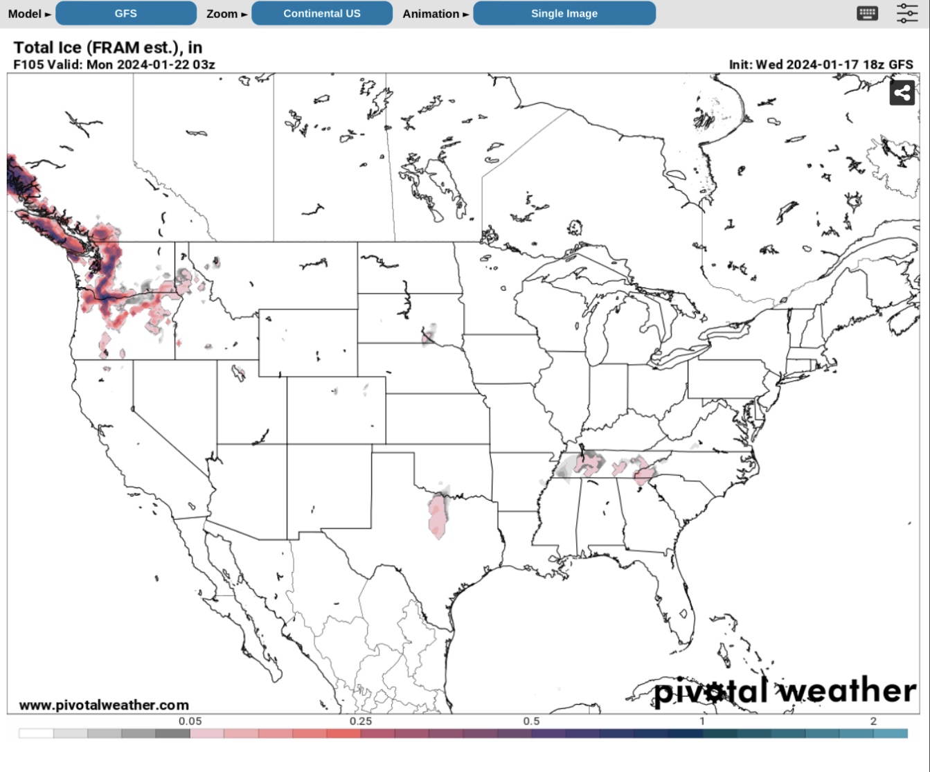
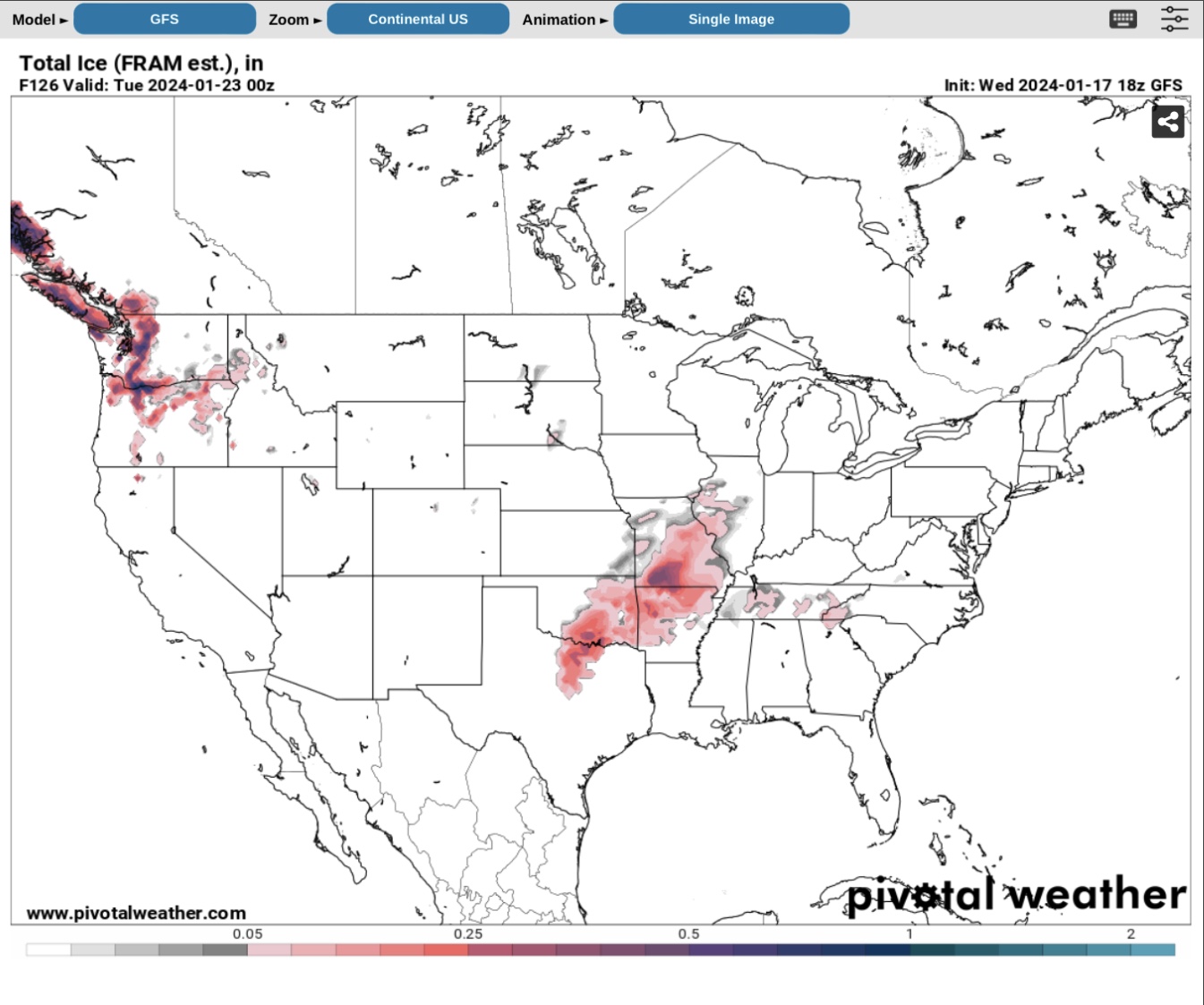
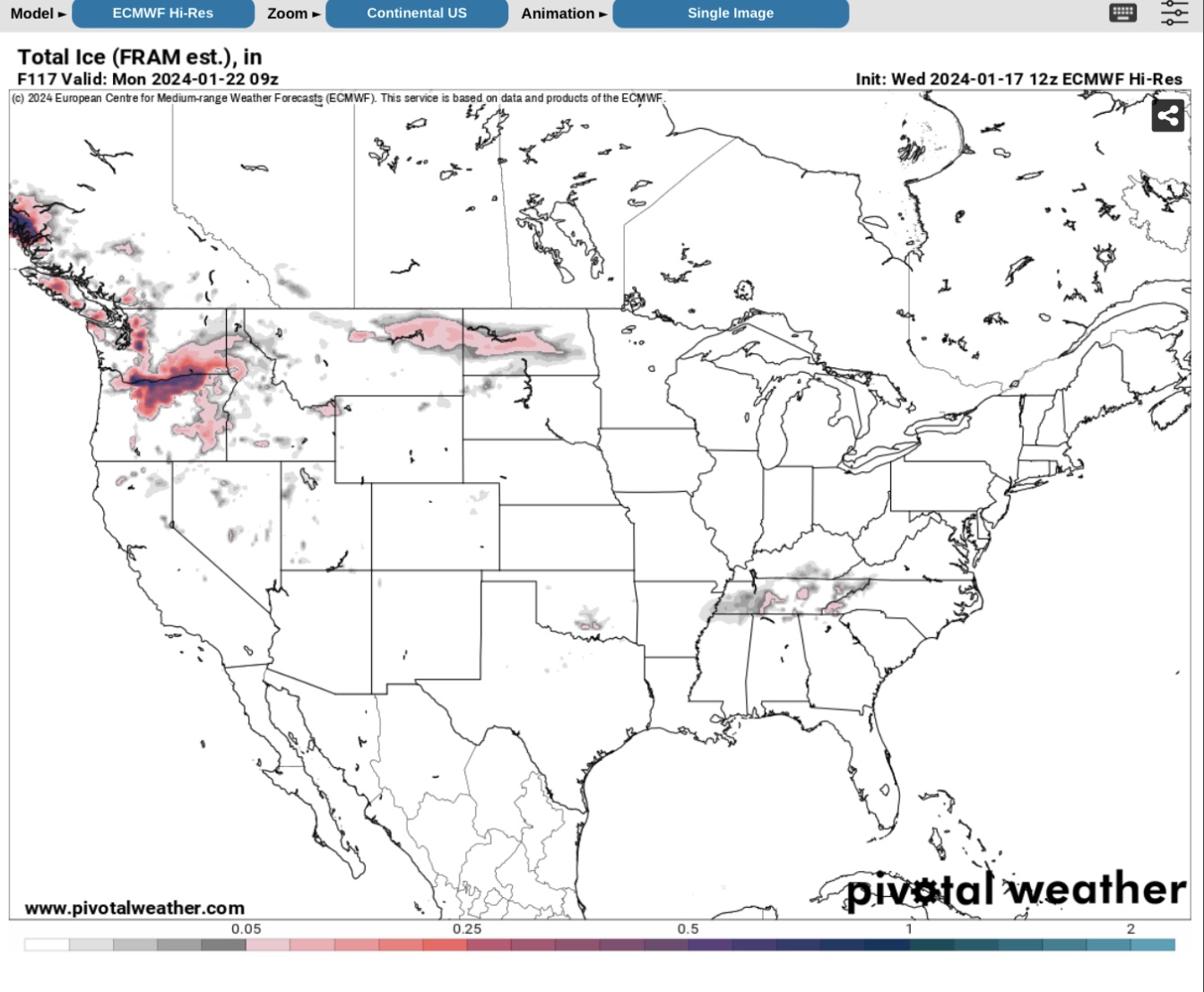
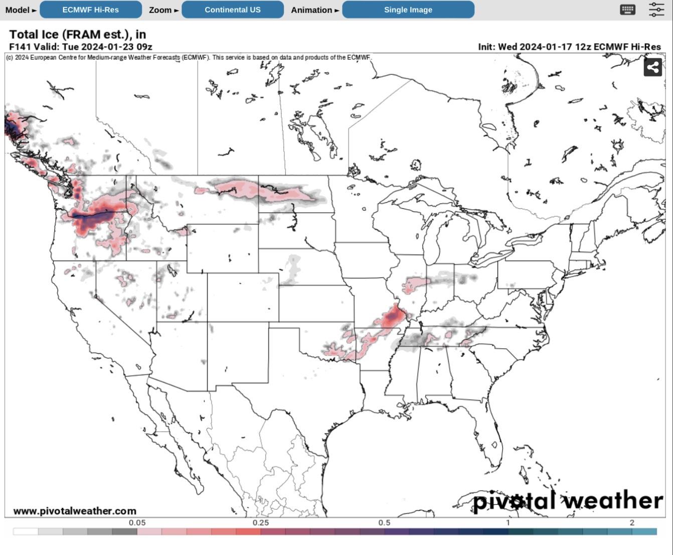
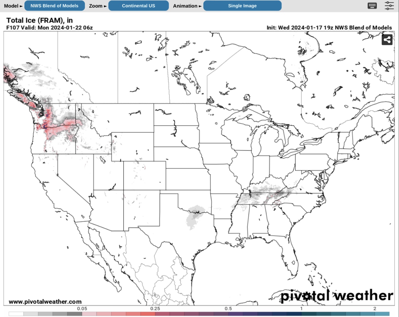
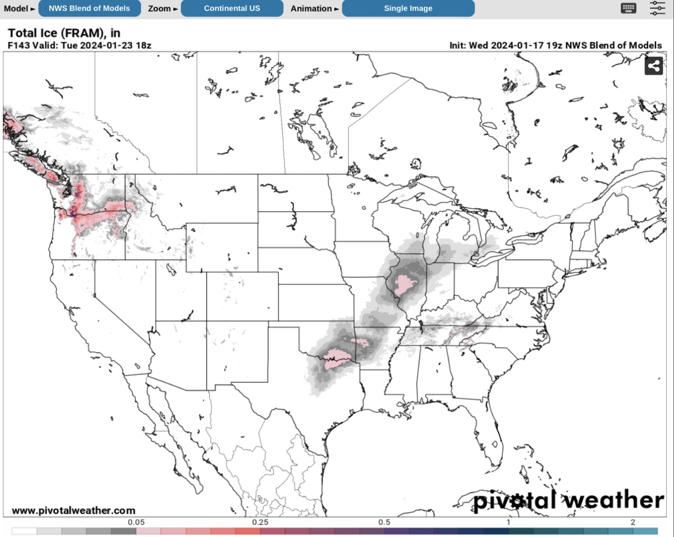
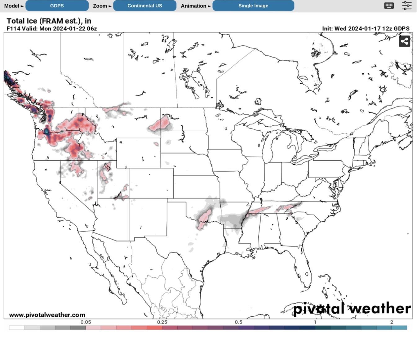
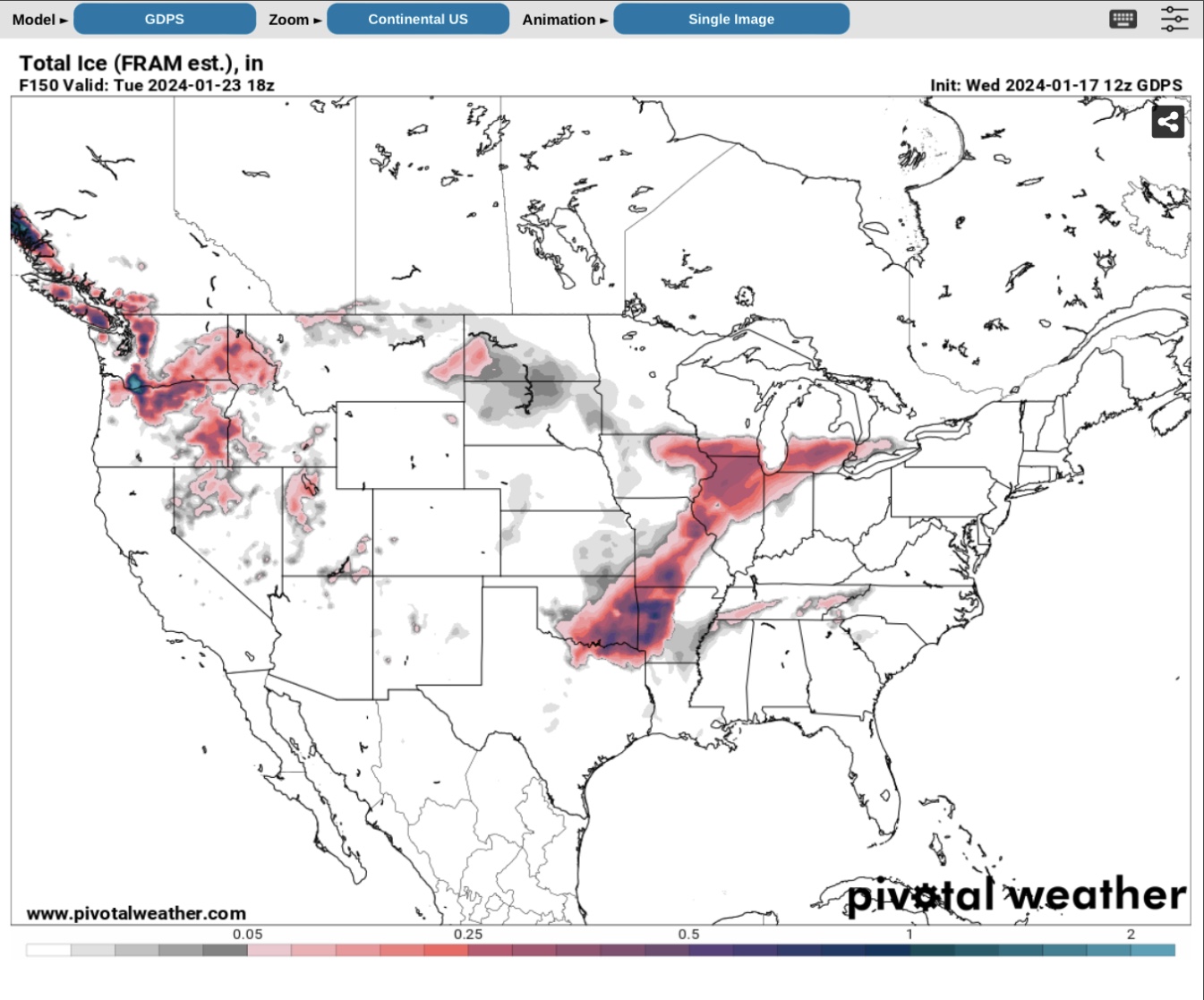
Shown below are the “beginning and ending” forecasts from 4 different long-range forecast models, all showing some freezing rain and ice accumulations of varying amounts for the period Sunday night (1/21/24) through Tuesday afternoon (1/23/24). The 4 models are: 1) the GFS; 2) the ECMWF or Euro Model; 3) the NWS National Blend of Models (NBM); and, 4) the GDPS or Canadian Model.
Note that all 4 models have varying amounts of ice during the event period Sunday night through Tuesday afternoon. The Euro Model (3rd and 4th graphics) shows the event starting early Monday morning rather than Sunday night, so it lags the other 3 models by about 6 hours. In all of these forecast models, the ice amounts vary from less than 1/10” to over 1/2”, potentially up to 7/10” in the Canadian Model, which has a tendency to over-forecast ice amounts (per NWS sources).
Our SPIDI Technologies website, SPIDItech.com, will begin picking up the NWS Total Ice Forecasts 72-hours ahead of the event, so images on that website should start showing the “beginning” of the event as early as Thursday night or first thing Friday morning for the Sunday-Monday beginning. A cold (not freezing) rain is expected right behind this event, so some of the accumulated ice may melt away in the rain fairly quickly, even if temps are in the mid 30s. If you have questions, please feel free to give me a call or send me an email. - Sid Sperry
Sid Sperry
President & CEO
SPIDI Technologies, LLC
Website/Subscriptions: SPIDItech.com
Cell Phone: (405) 627-7754
Email(s): SidSperry@gmail.com  OR  Sid.Sperry@spidiweather.com

Sent from my iPad

 Show/hide attachments