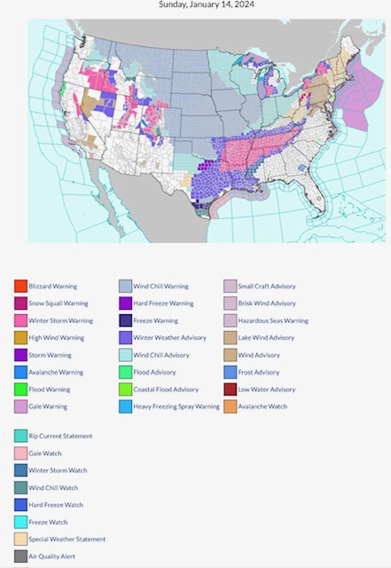
Latest NWS Watches, Warnings & Advisories. Wind Chill Warnings from WA to TX to IN. Winter Storm Warnings parts OR, ID, CA, UT, WY, CO, NM, OK, TX, AR, LA, TN, MS, AL, GA, NC, VA, MI & NY. Hard Freeze Warning & Freeze Warning parts north & south TX. Snow Squall Warning parts western PA.
Sidney Sperry 14 Jan 2024 12:54 UTC
FYI…
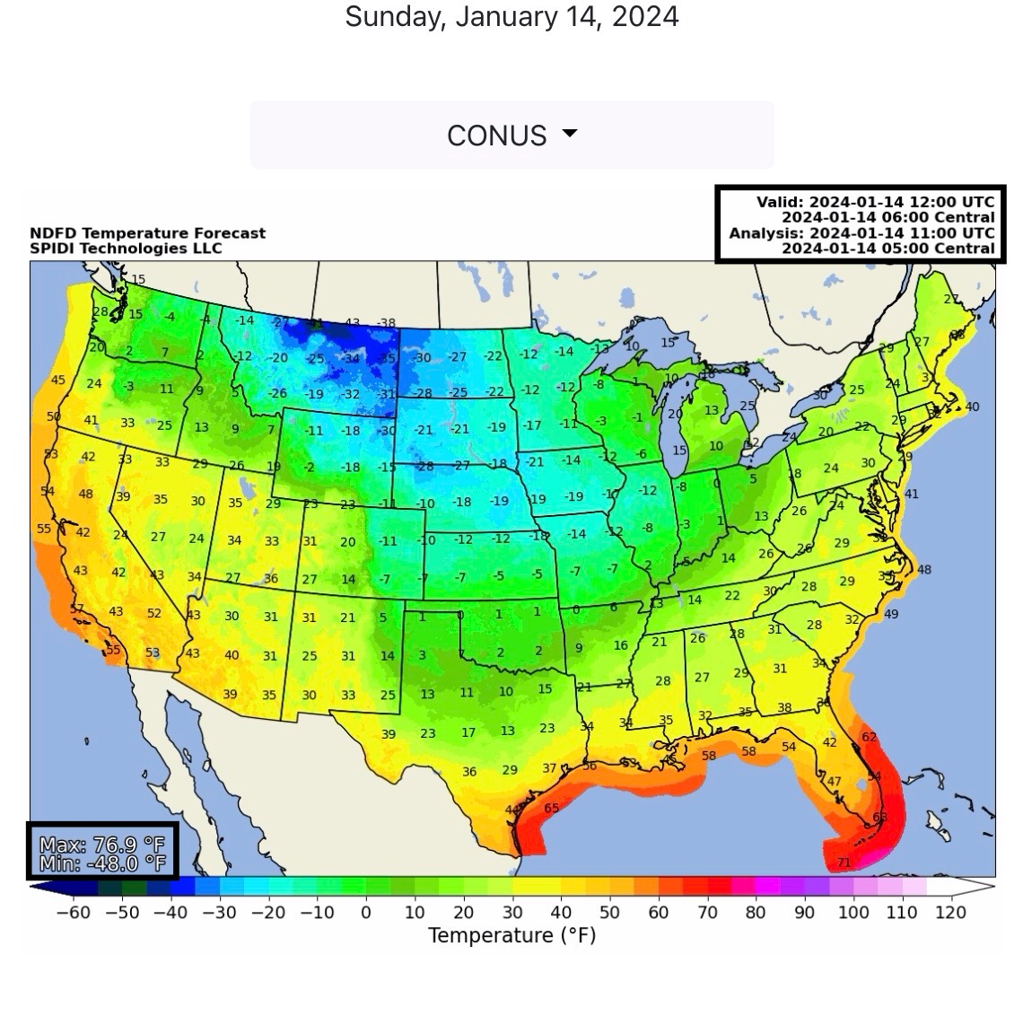
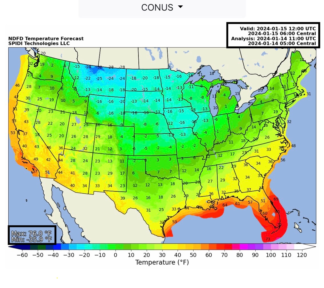
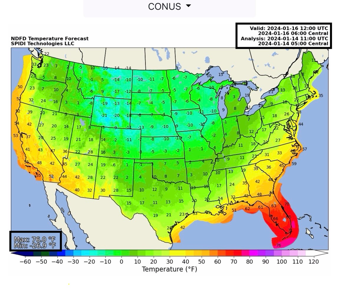
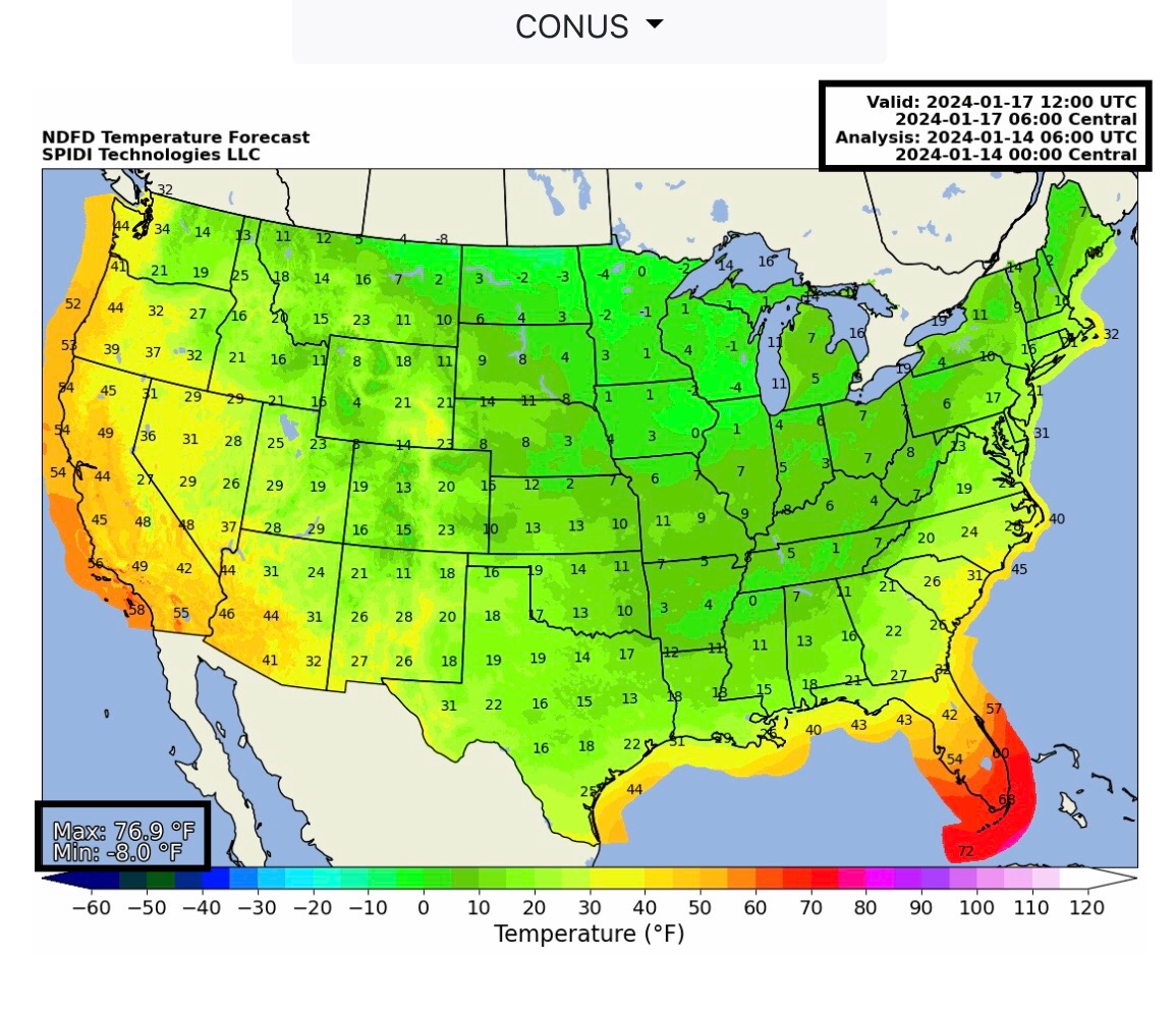
Temperature forecasts shown are for today (Sunday, 1/14/24) through Wednesday, 1/17/24, at 6am CT. Cold morning temps continue across much of U.S.
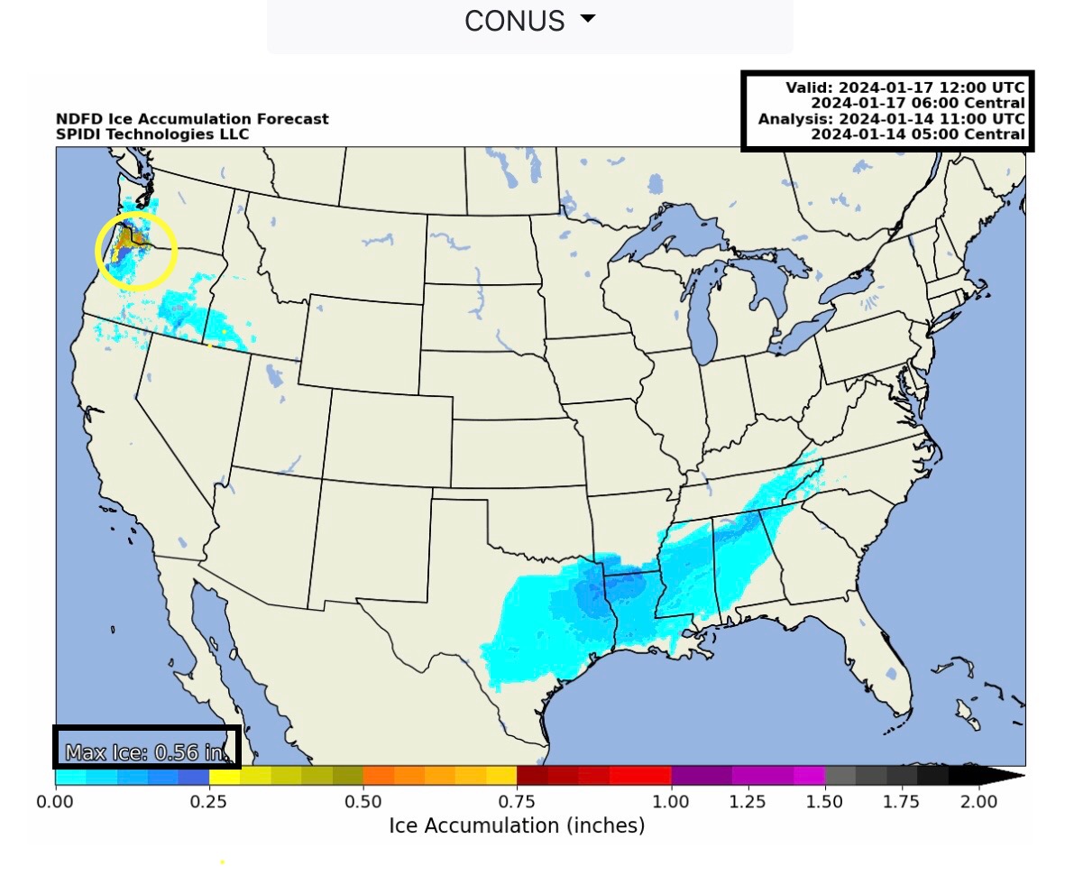
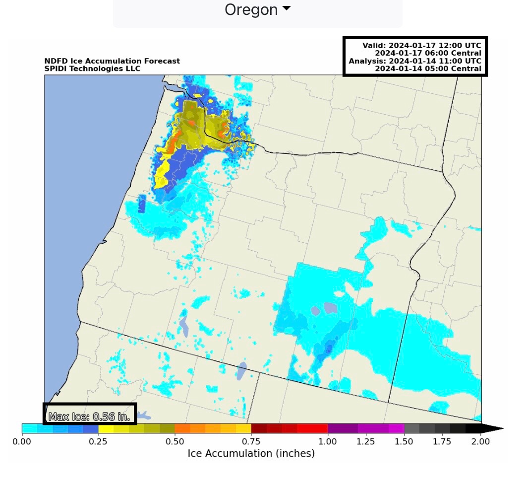
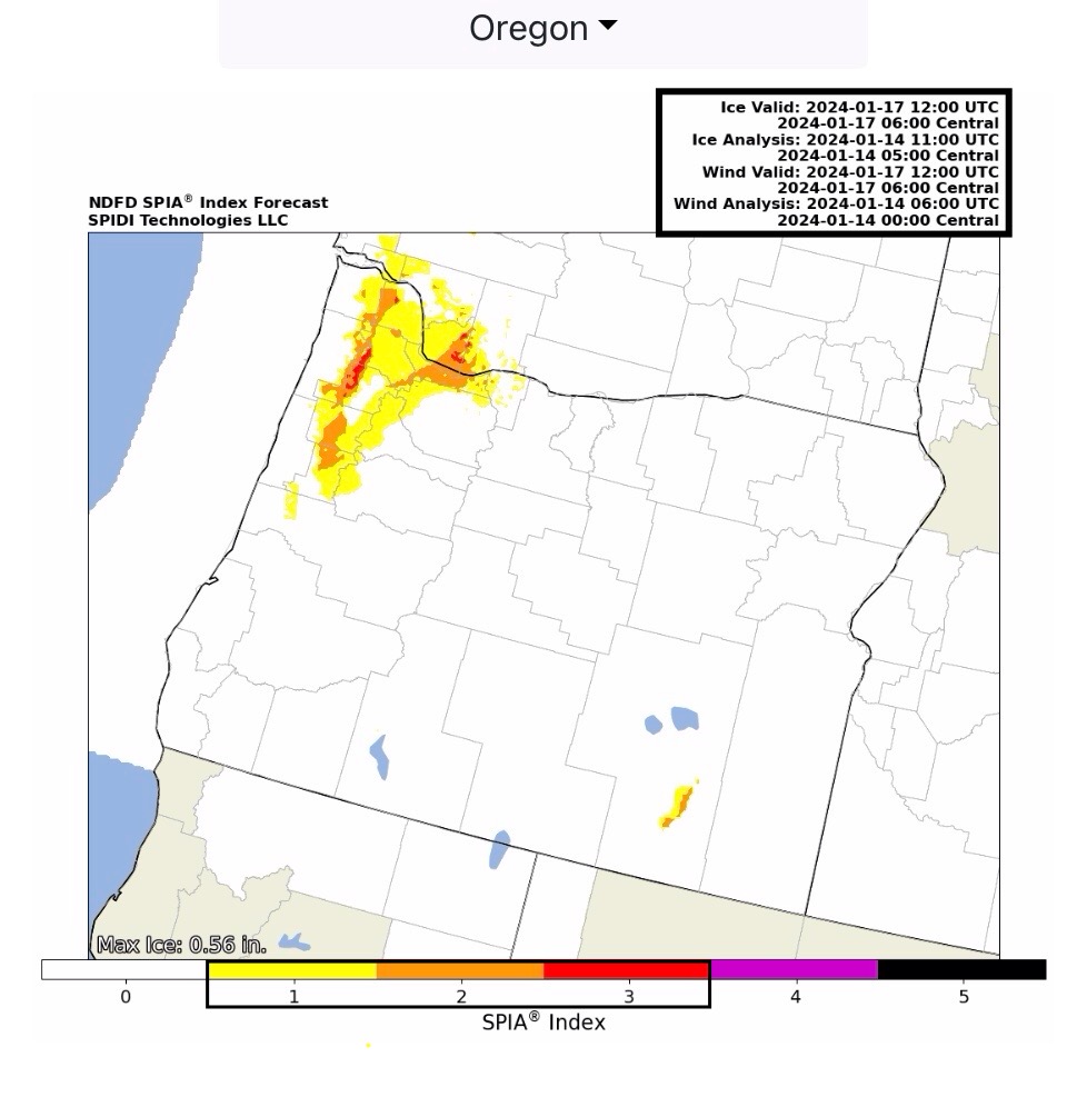
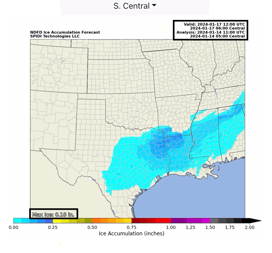
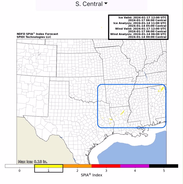
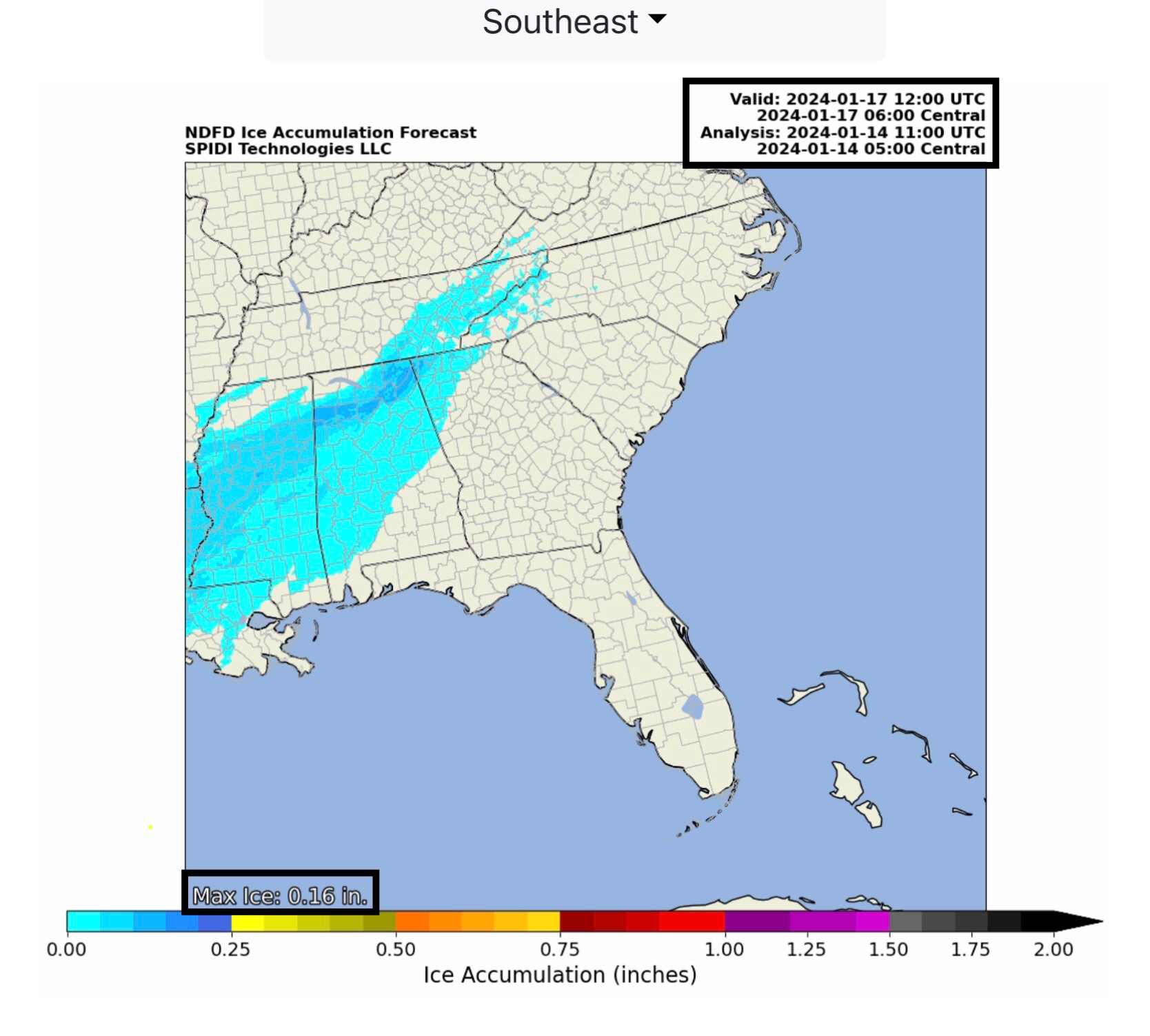
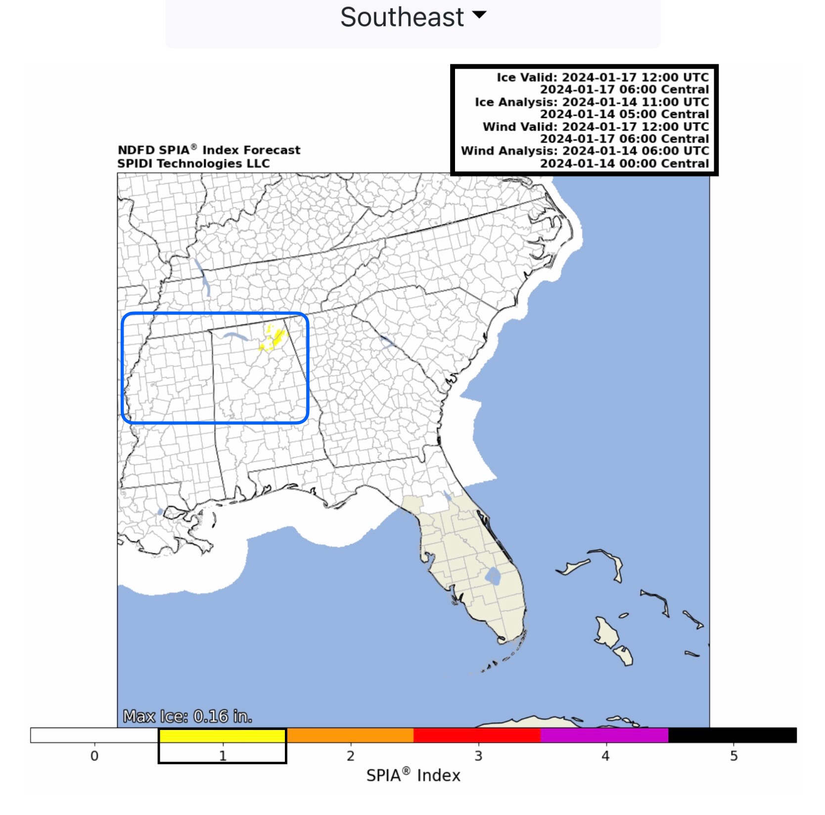
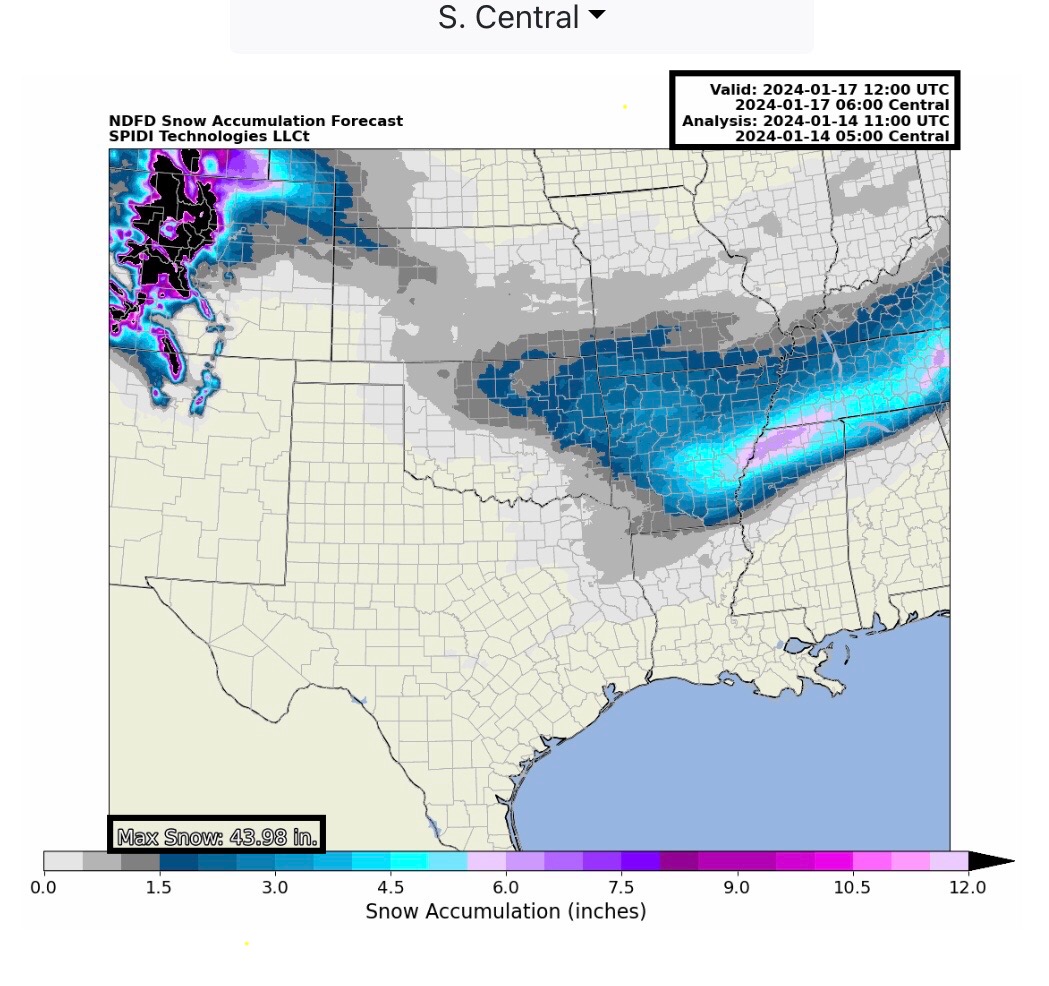
Max Ice in NWS grids: 0.56” parts northwest OR; SPIA Index Ice Impact Forecast for Utilities: Levels 1 thru 3 in OR. Max Ice in South Central & Southeast Regions: 0.18” parts northeast TX, northern LA & southern AR, extending into northern MS & AL. Current SPIA Index is at Levels 1 in parts TX, LA & AL.
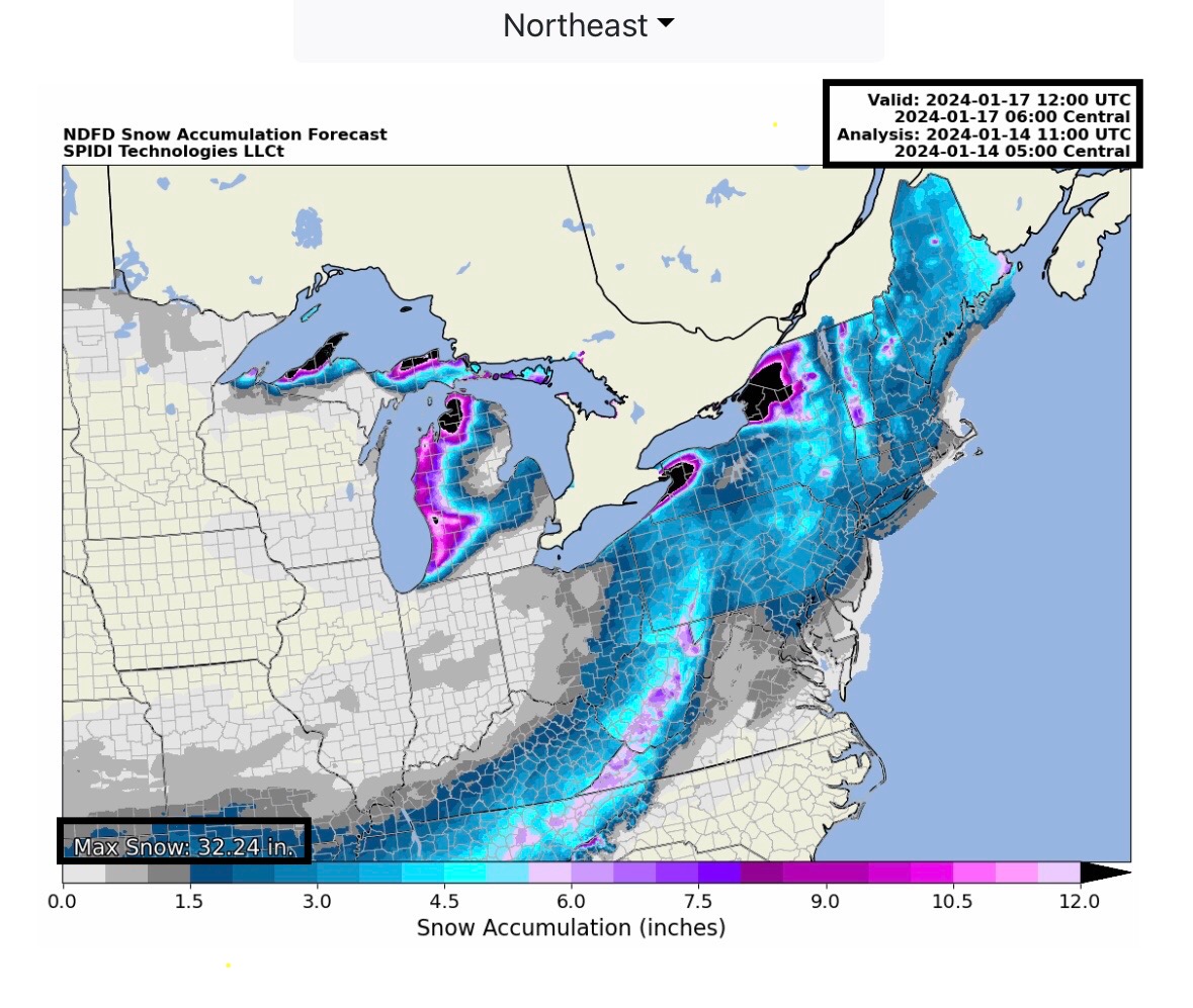
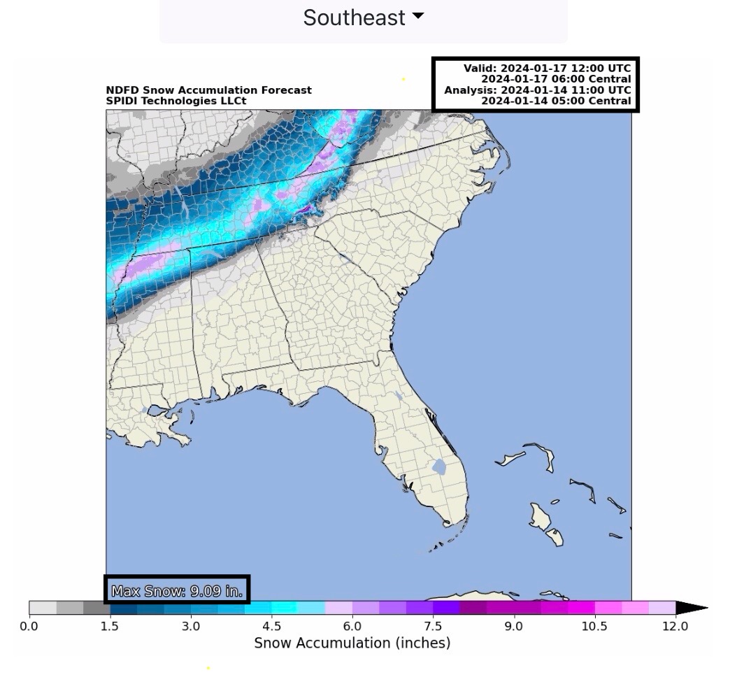
Up to 7” snow possible over next 72-hours parts AR, MS & TN. From 7” up to 25”+ parts MI and MI Upper Peninsula. Up to 9” snow in higher elevation areas of western VA and southern/eastern WV over next 72-hours.
Sid Sperry
President & CEO
SPIDI Technologies, LLC
Website/Subscriptions: SPIDItech.com
Cell Phone: (405) 627-7754
Email(s): SidSperry@gmail.com  OR  Sid.Sperry@spidiweather.com

Sent from my iPad

 Show/hide attachments