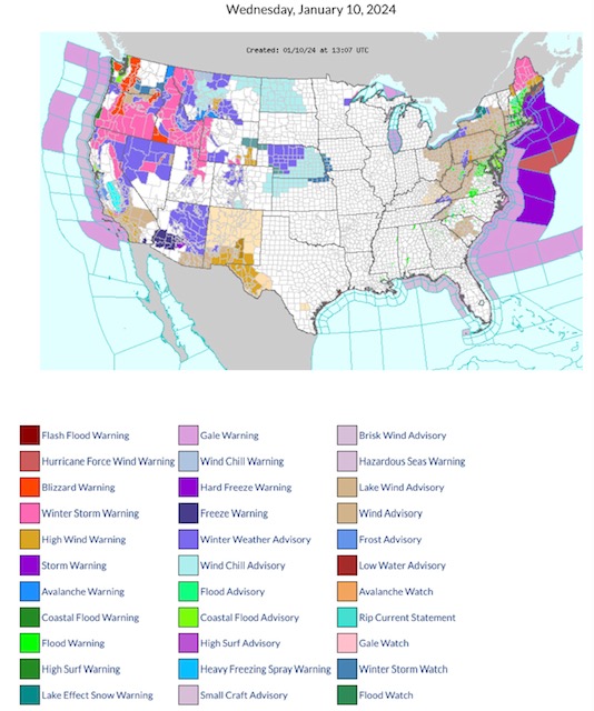
Latest NWS Watches, Warnings & Advisories: Blizzard Warnings parts WA, OR & ID. Winter Storm Warnings parts OR, CA, ID, NV, MT, WY, UT & ME. High Wind Warnings parts WY, NM, TX, PA, WV, MD, NH & ME. Wind Chill Advisories parts MT, ND, CO, NE & KS. Fire Weather Watch parts southwest TX.
Sidney Sperry 10 Jan 2024 14:00 UTC
FYI…
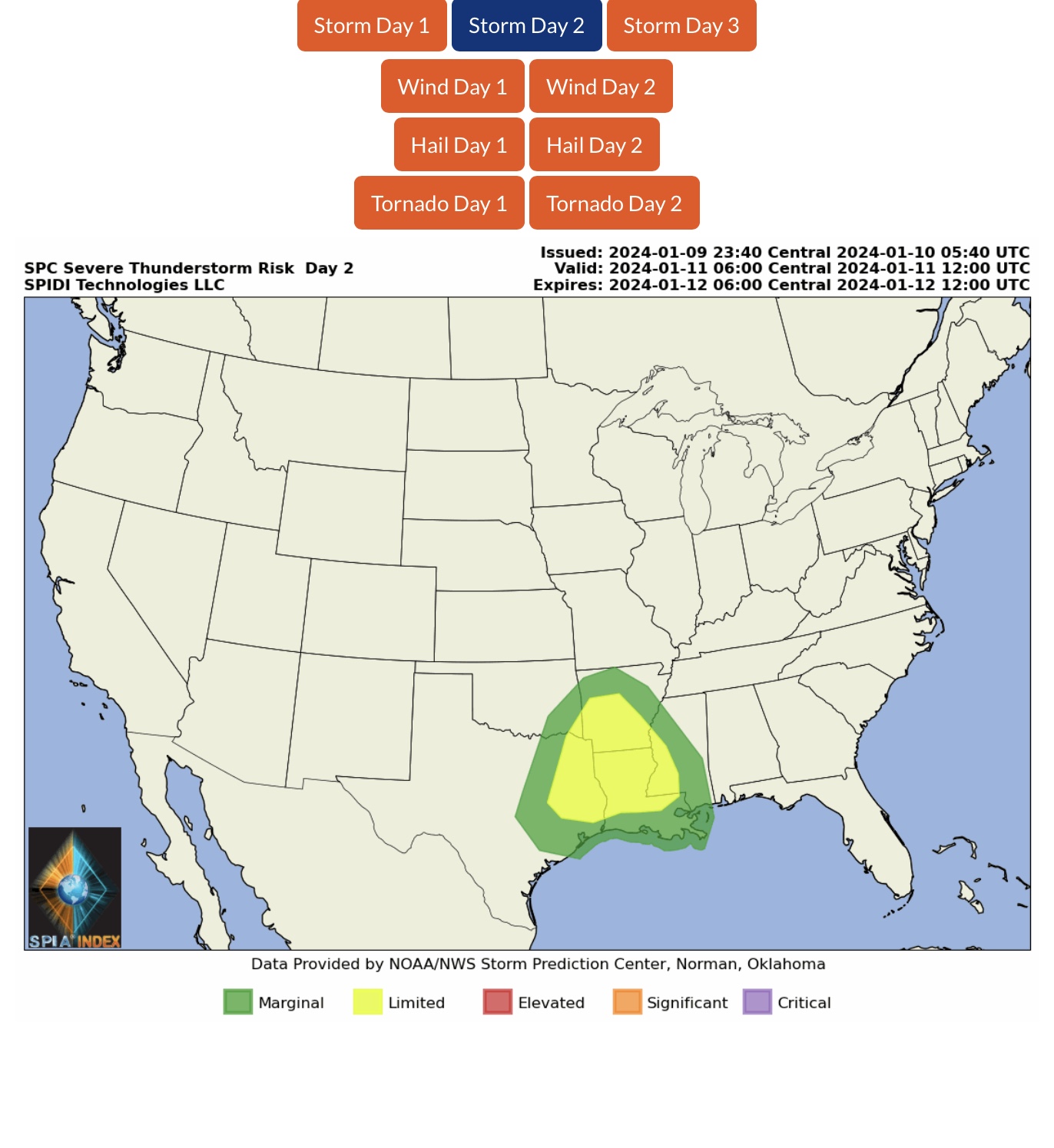
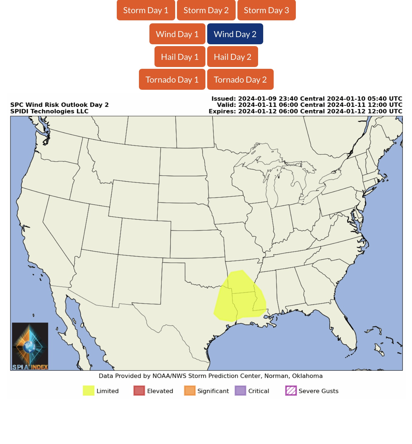
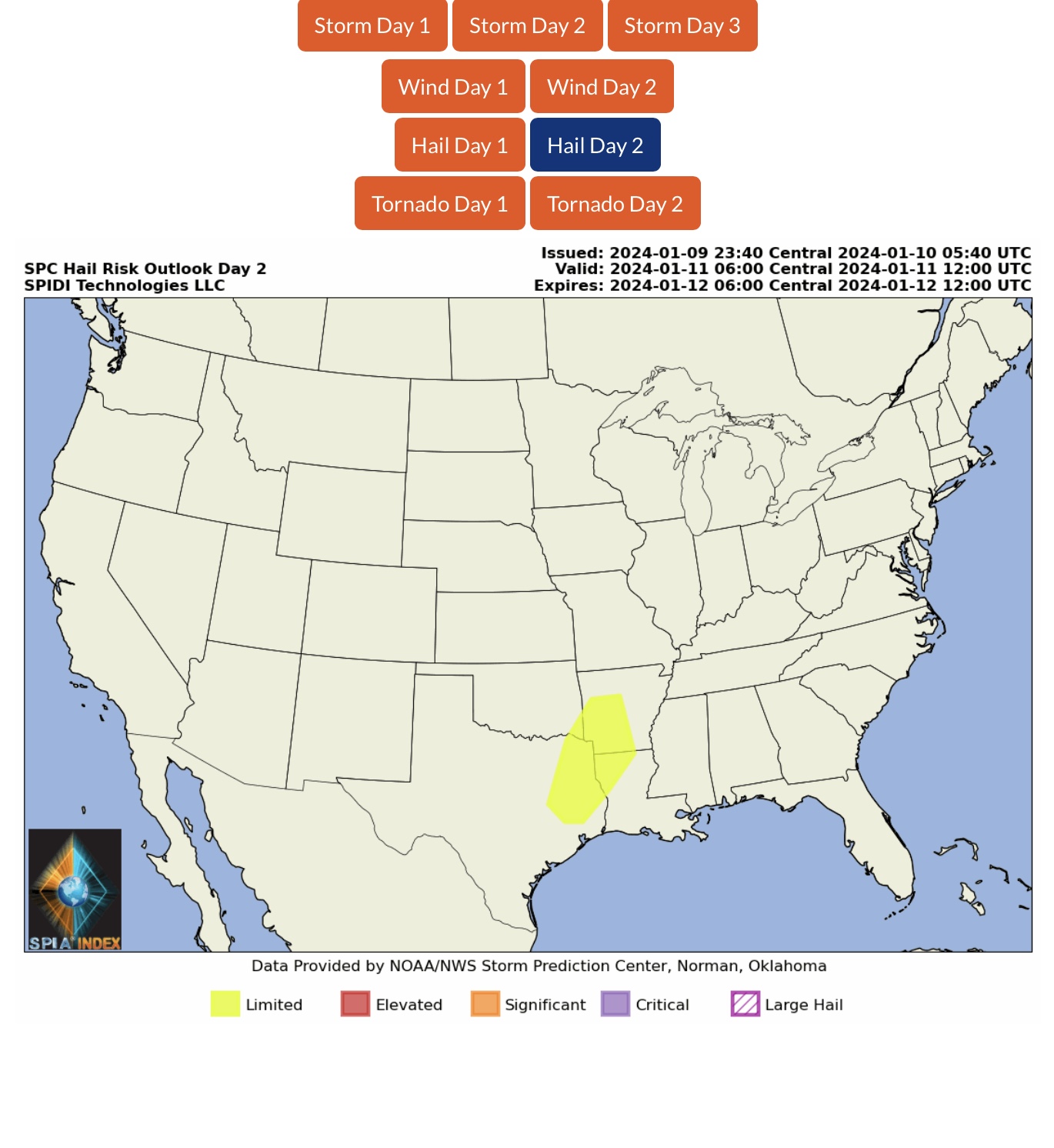
LIMITED Severe Thunderstorm Risk, Day 2 (Thursday), parts OK, AR, TX, LA & MS. Includes LIMITED High Wind Risk and LIMITED Hail Risk.
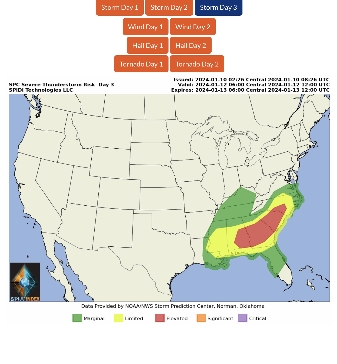
ELEVATED Severe Thunderstorm Risk, Day 3 (Friday), parts AL, GA, SC & NC.
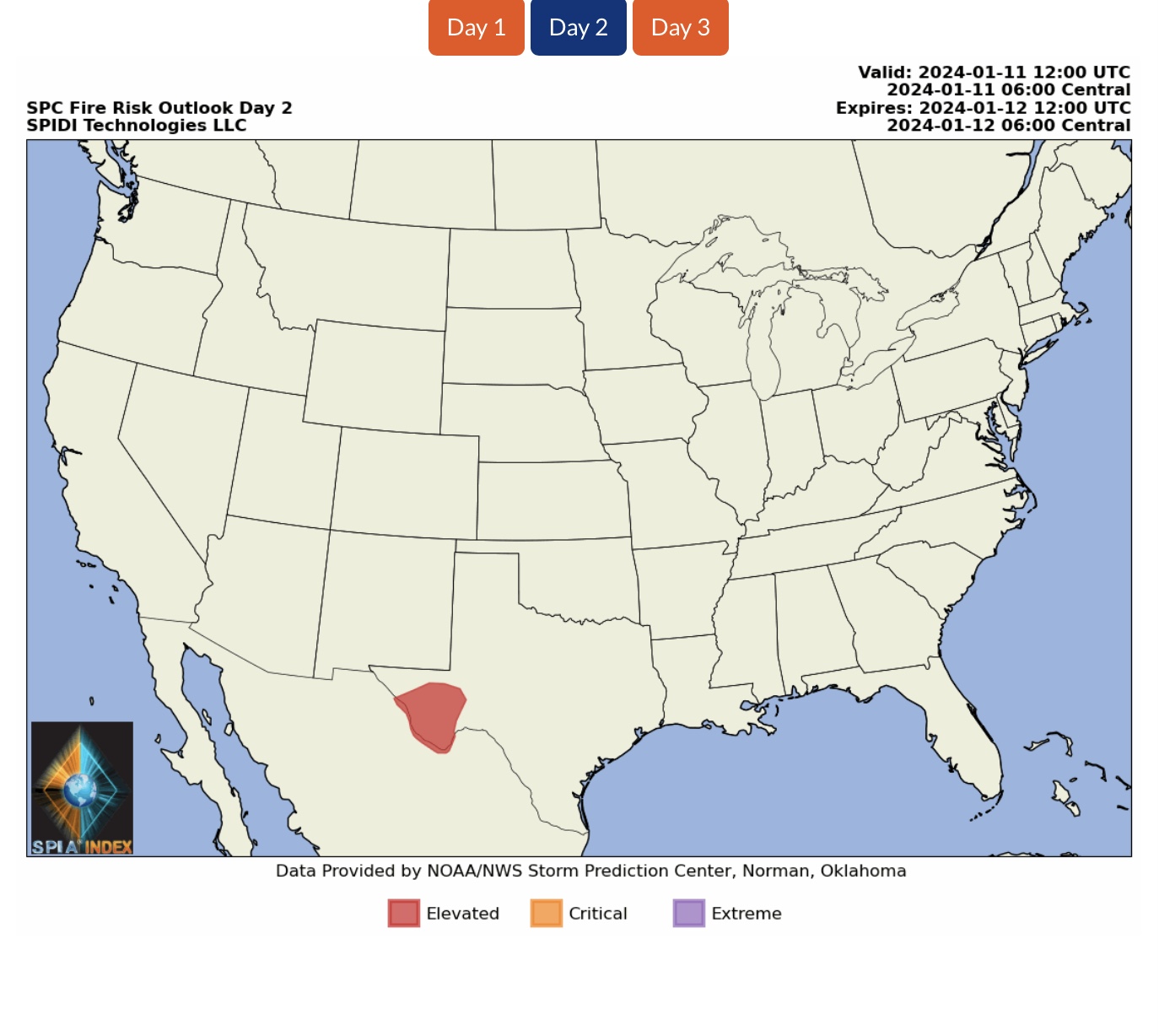
ELEVATED Fire Risk, Day 2 (Thursday), parts southwest TX.
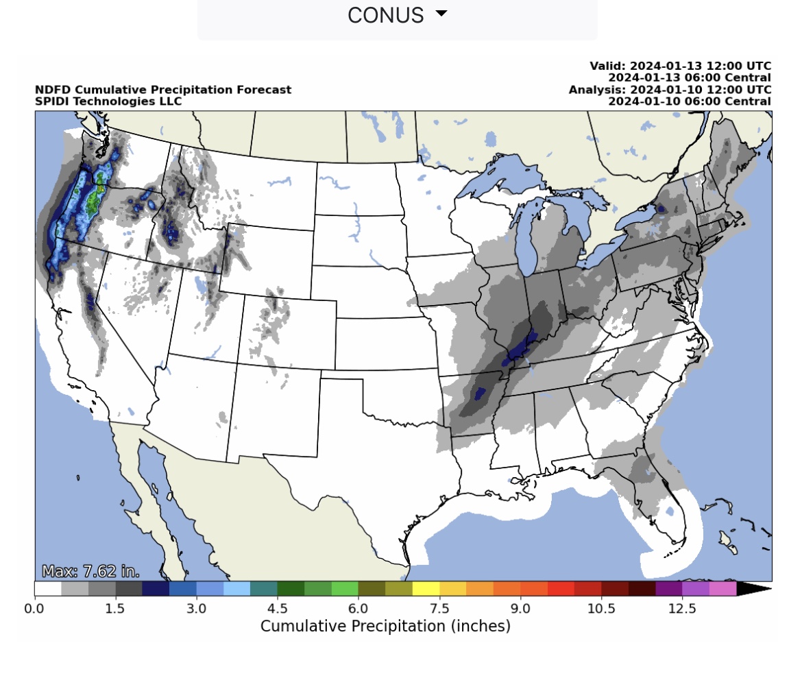
Heavy Rainfall over next 72-hours, parts WA, OR & northern CA. From 1” up to 7”+ likely.
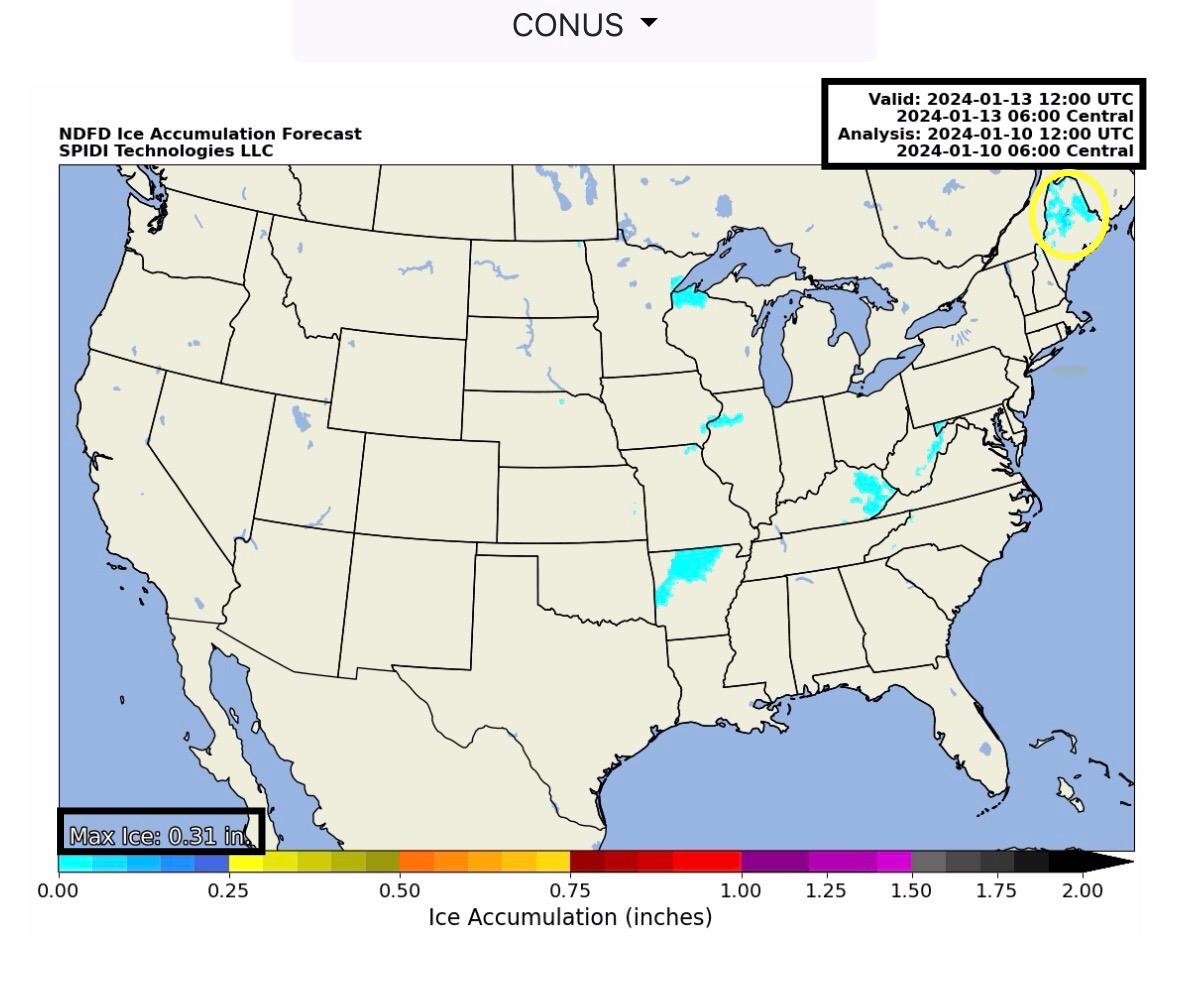
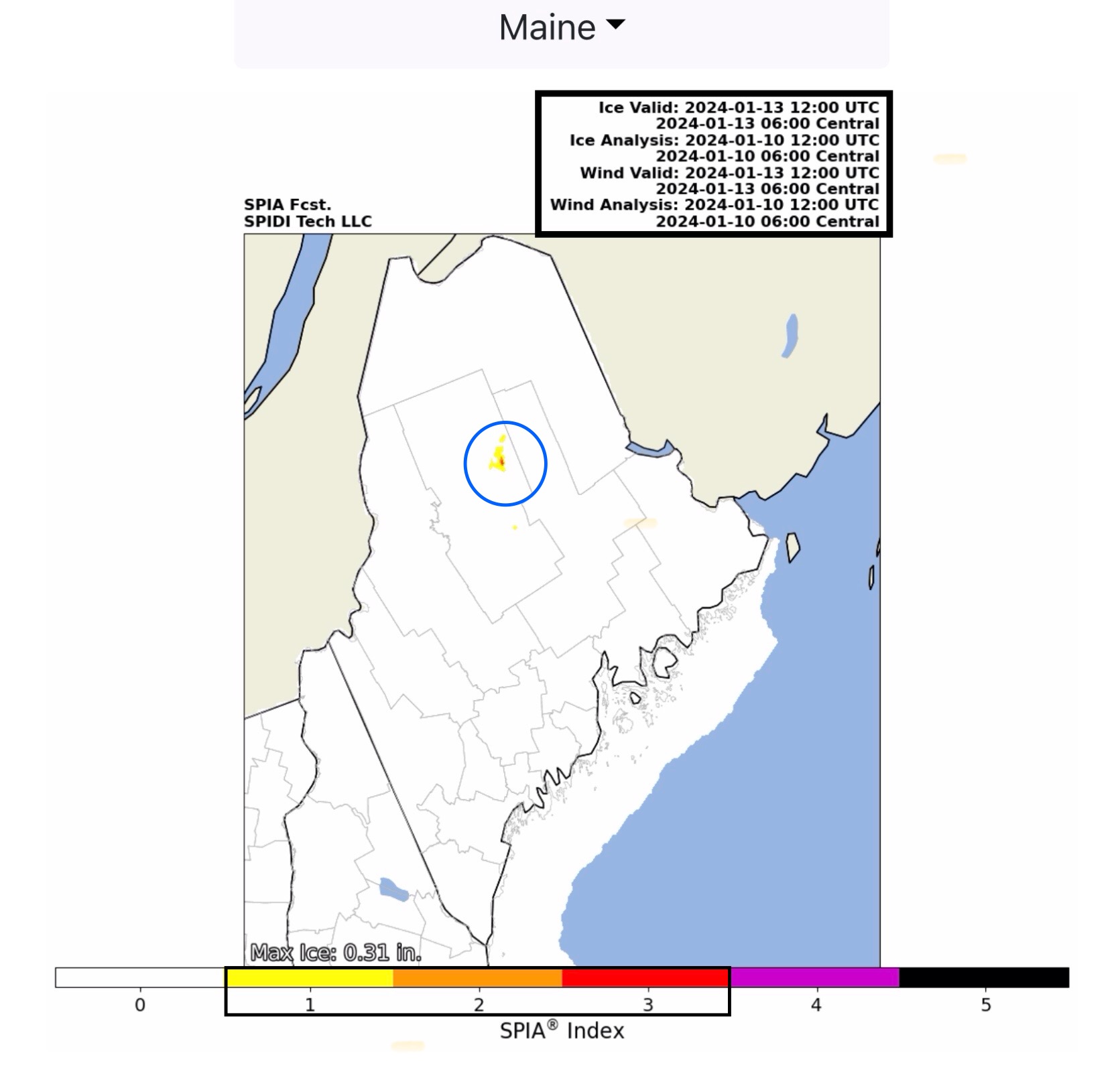
Max Ice in NWS grids: 0.31” parts north-central ME. SPIA Index Levels 1 through 3.
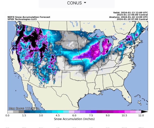
Heavy Snow next 72-hours parts Northwest Region, Southwest Region, North Rockies Region, South Rockies Region, North Central Region and Northeast Region.
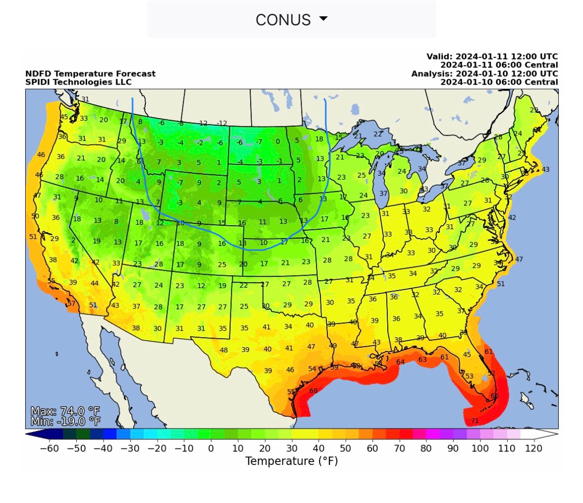
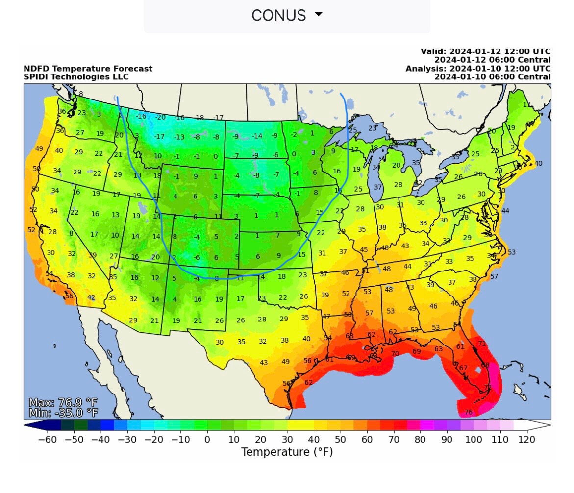
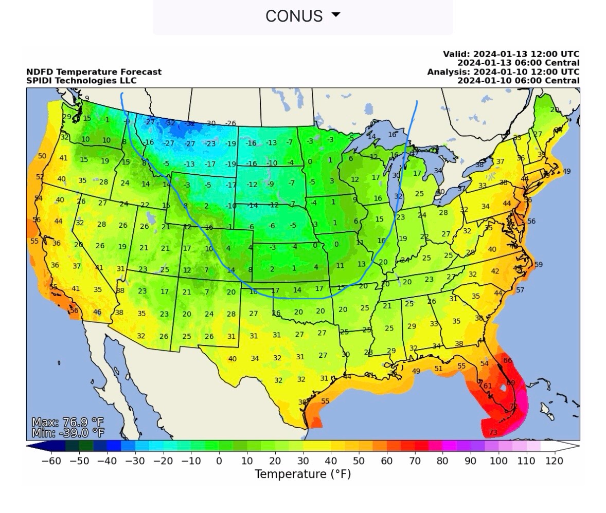
Extremely COLD Temperatures moving into northern U.S. beginning today and moving southeast into central and south-central states over next 7 days. (Temps @ 6am CT.)
Sid Sperry
President & CEO
SPIDI Technologies, LLC
Website/Subscriptions: SPIDItech.com
Cell Phone: (405) 627-7754
Email(s): SidSperry@gmail.com  OR  Sid.Sperry@spidiweather.com

Sent from my iPad

 Show/hide attachments