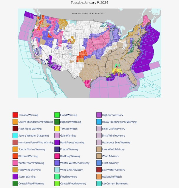
FYI…
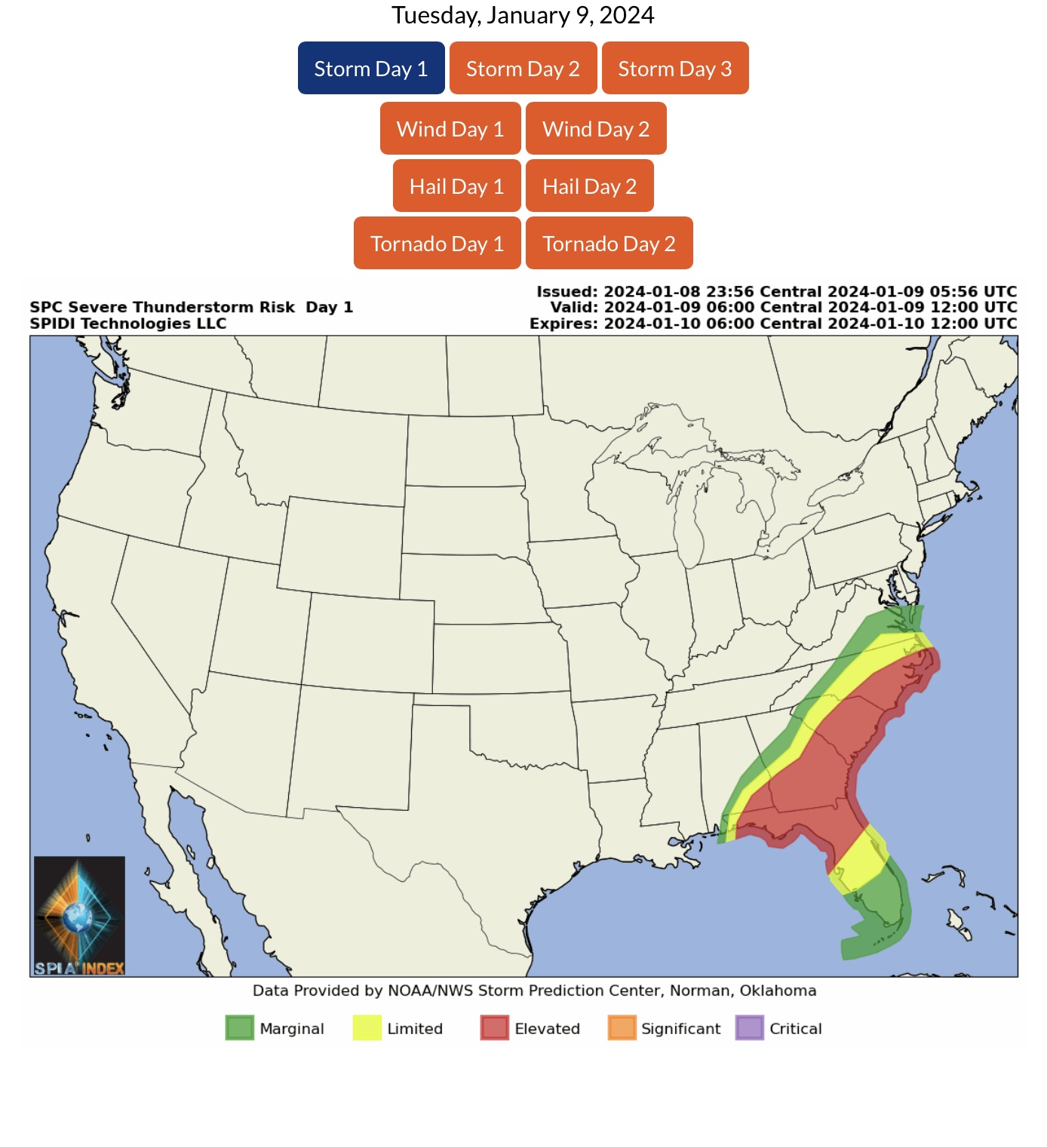
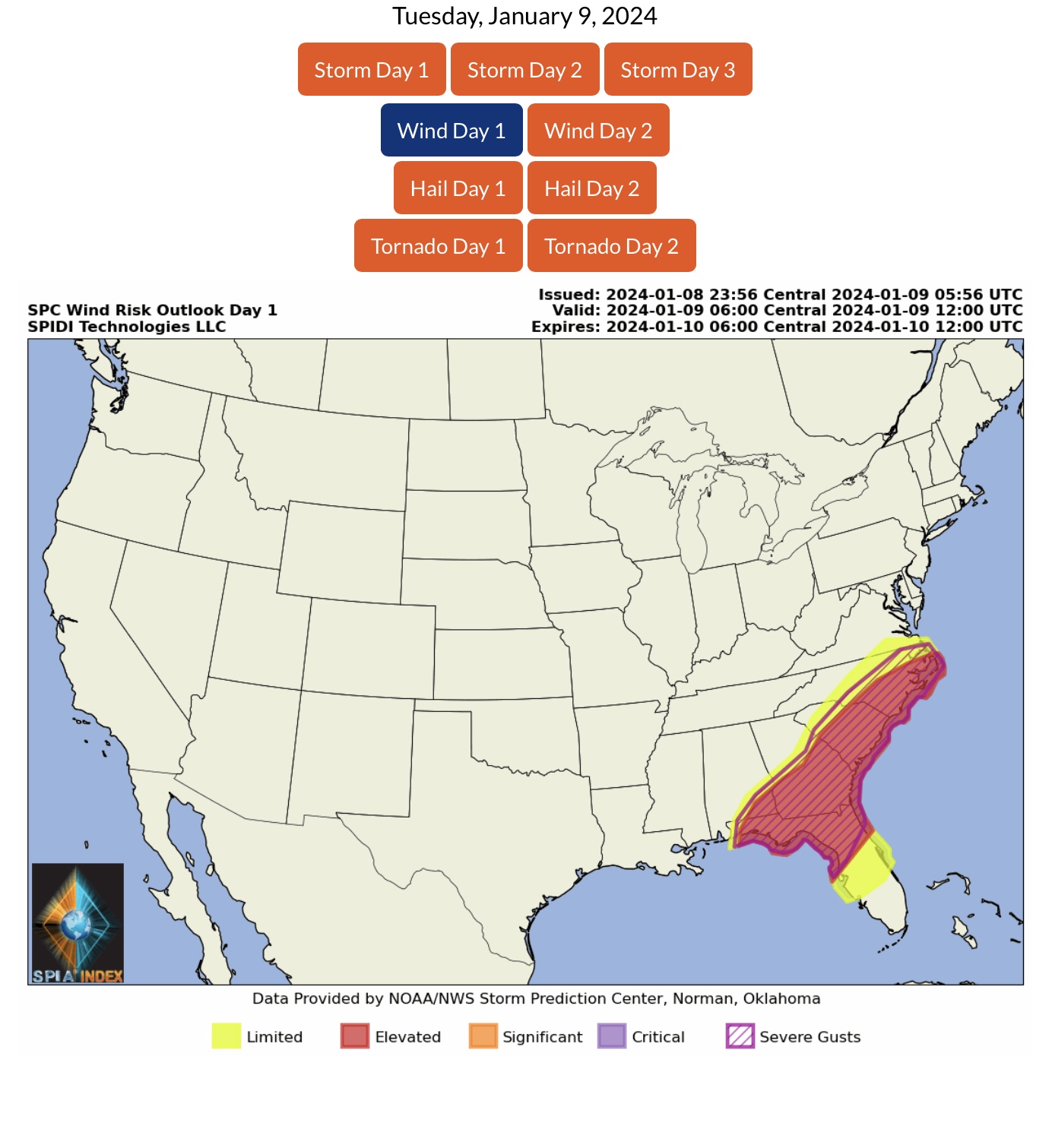
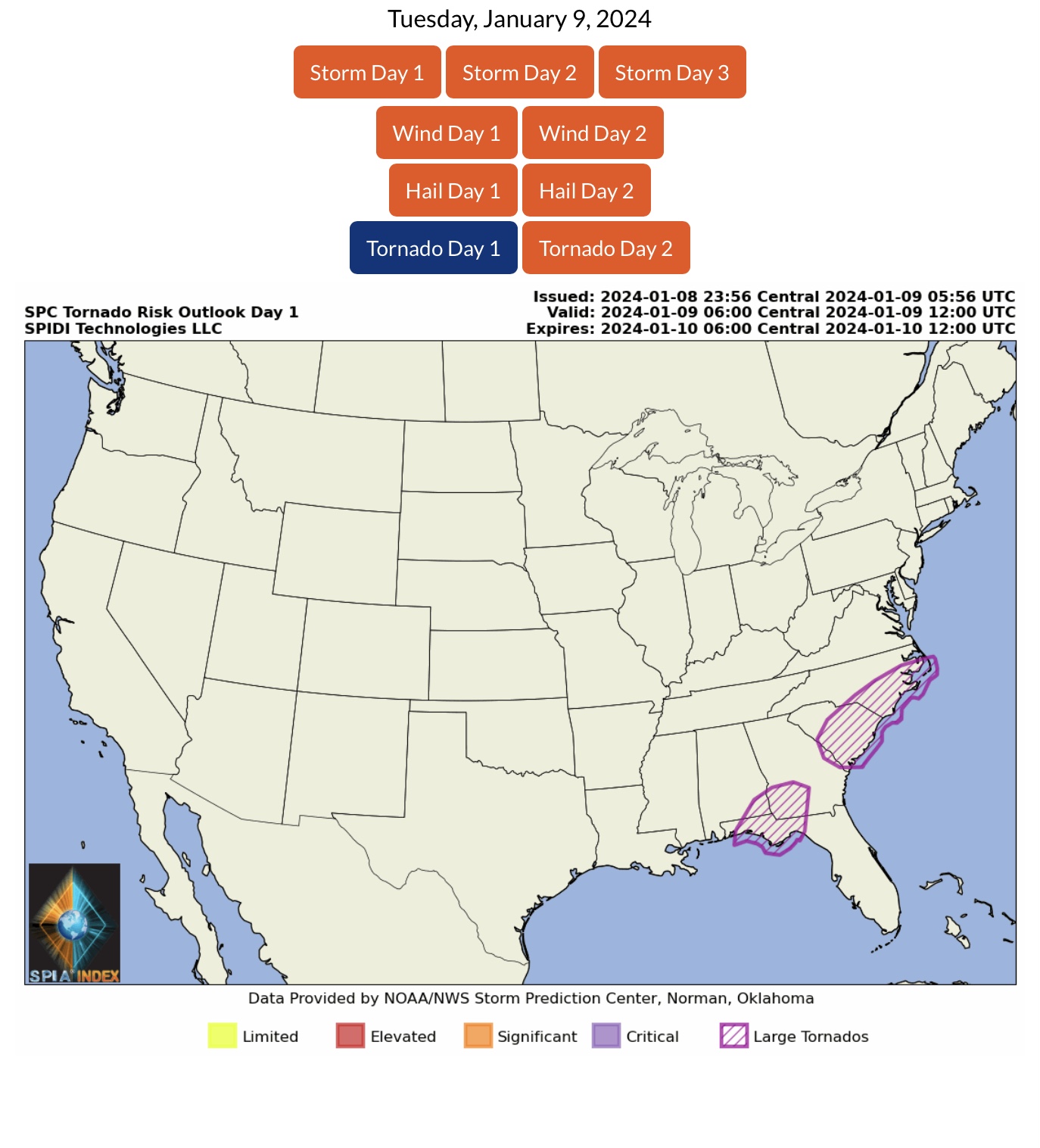
ELEVATED SEVERE THUNDERSTORM RISK, Day 1 (today, 1/9), parts AL, FL, GA, SC, NC
SEVERE WIND GUSTS possible, parts AL, FL, GA, SC & NC
LARGE TORNADOES possible parts AL, FL, GA, SC & NC
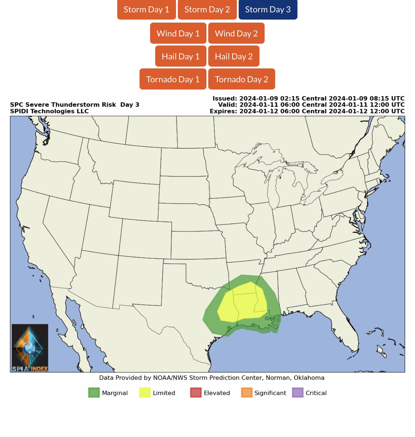
LIMITED SEVERE THUNDERSTORM RISK, Day 3 (Thursday, 1/11) parts TX, AR, LA, MS
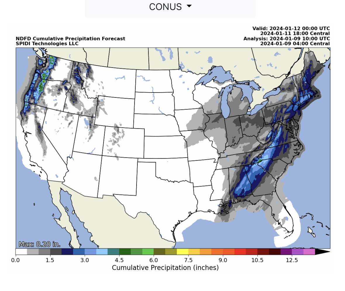
From 1” up to 4” rainfall next 72-hours in parts Southeast Region & Northeast Region; from 1” up to 8”+ rainfall across parts WA, OR & northern CA.
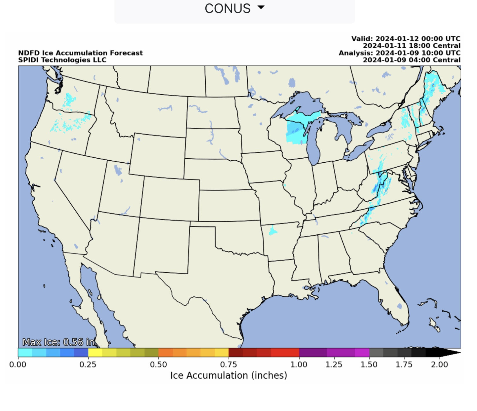
ICE ACCUMULATION in parts WA, OR, WI, MI, AR, NC, WV, VA, MD, PA, NY, VT, NH & ME
Heaviest ice accumulation is in NH at 0.56”; current SPIA Index is at Level 1 in WI, Levels 1 thru 3 in parts NC, WV, VA, MD, PA & ME; Levels 1 thru 4 in NH.
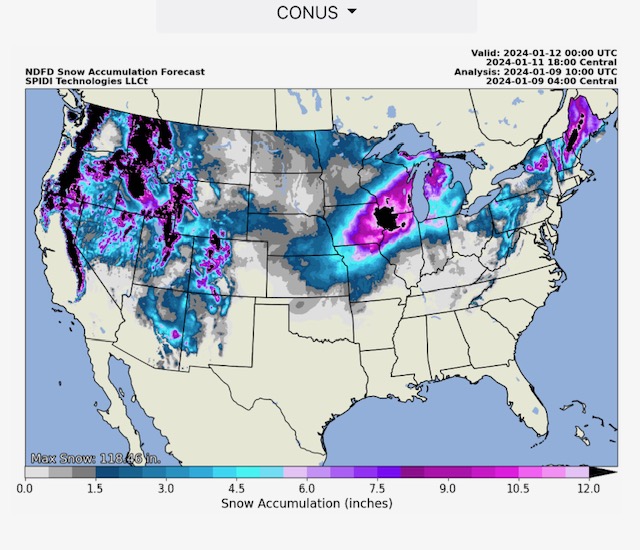
HEAVY SNOW across northern 2/3 of U.S. Amounts in higher elevation & mountainous regions of Northwest, Southwest, North Rockies & South Rockies from 80” to 118” over next 72-hours. Up to 20”+ across parts IA, WI, IL, NY, NH & ME.
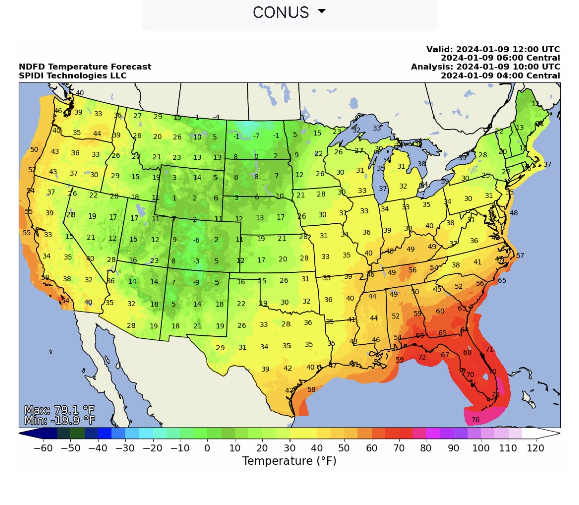
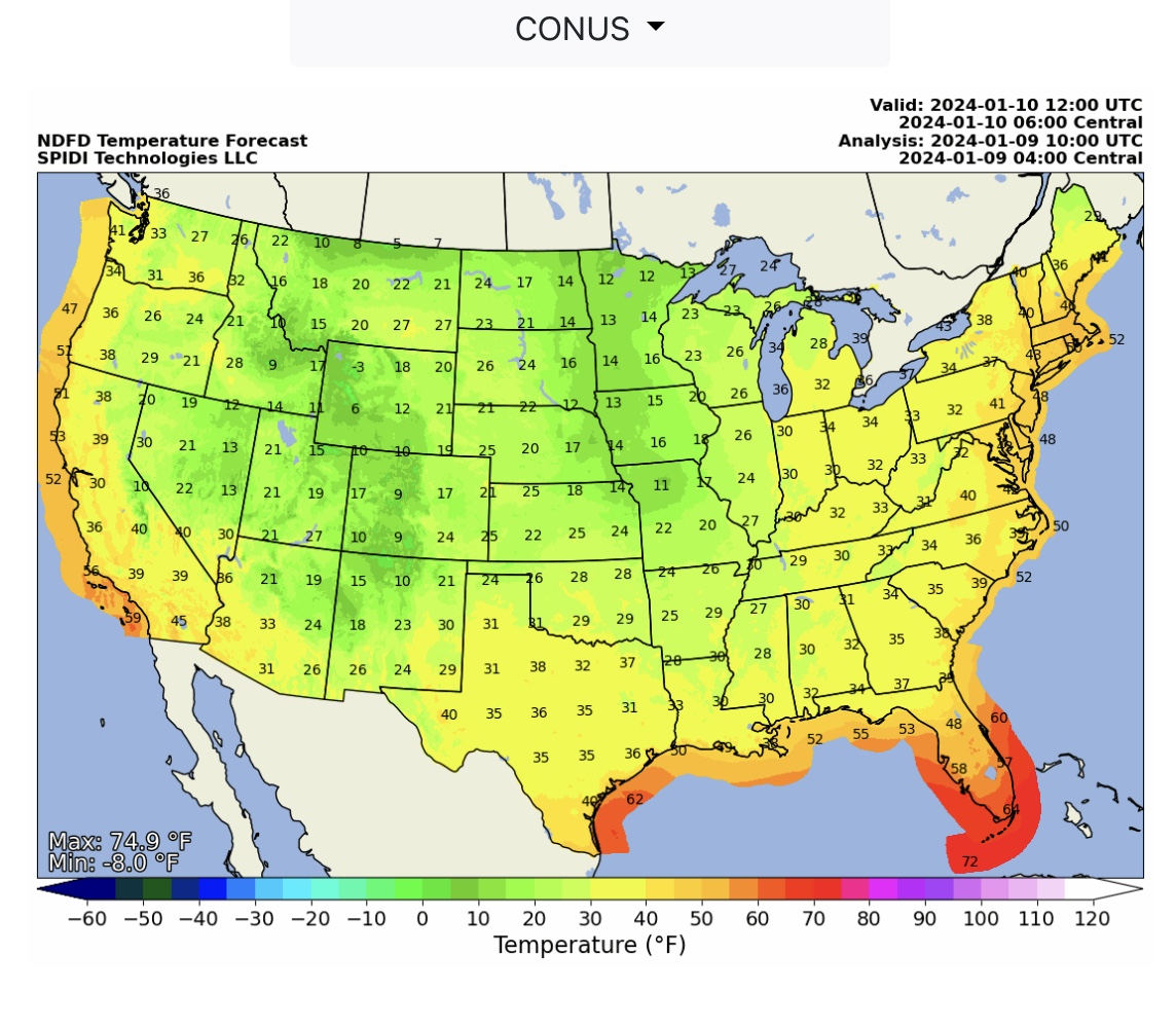
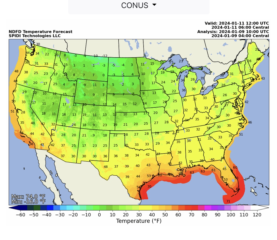
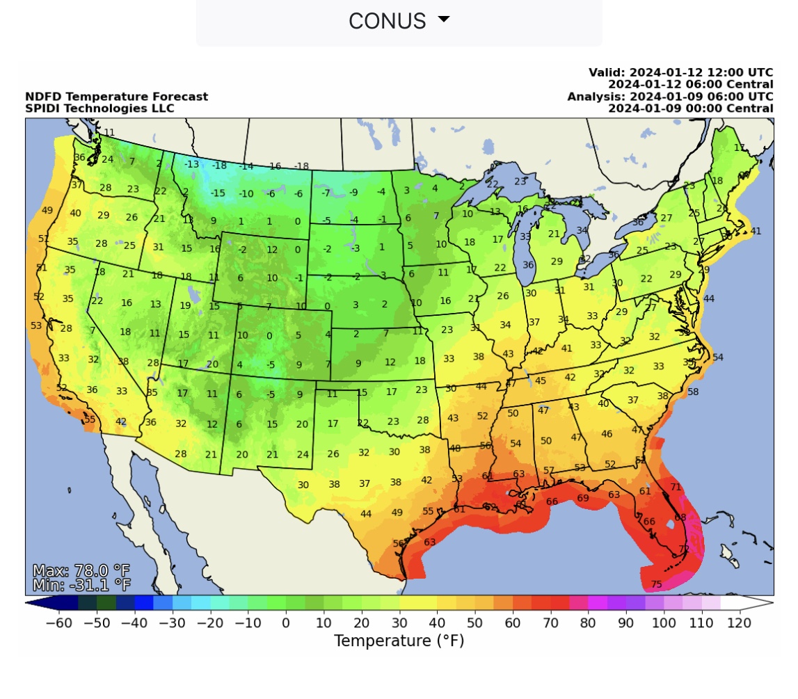
POLAR VORTEX COLD WAVE enters on Thursday into Northwest Region of U.S. Extreme cold temperatures and lower Wind Chill temperatures across Northwest Region, North Rockies Region, South Rockies Region, North Central Region, and South
Central Region from January 11 through January 17.

 Show/hide attachments