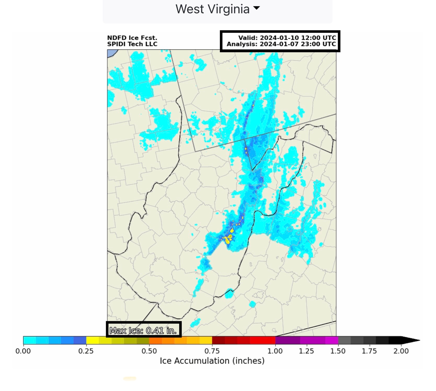
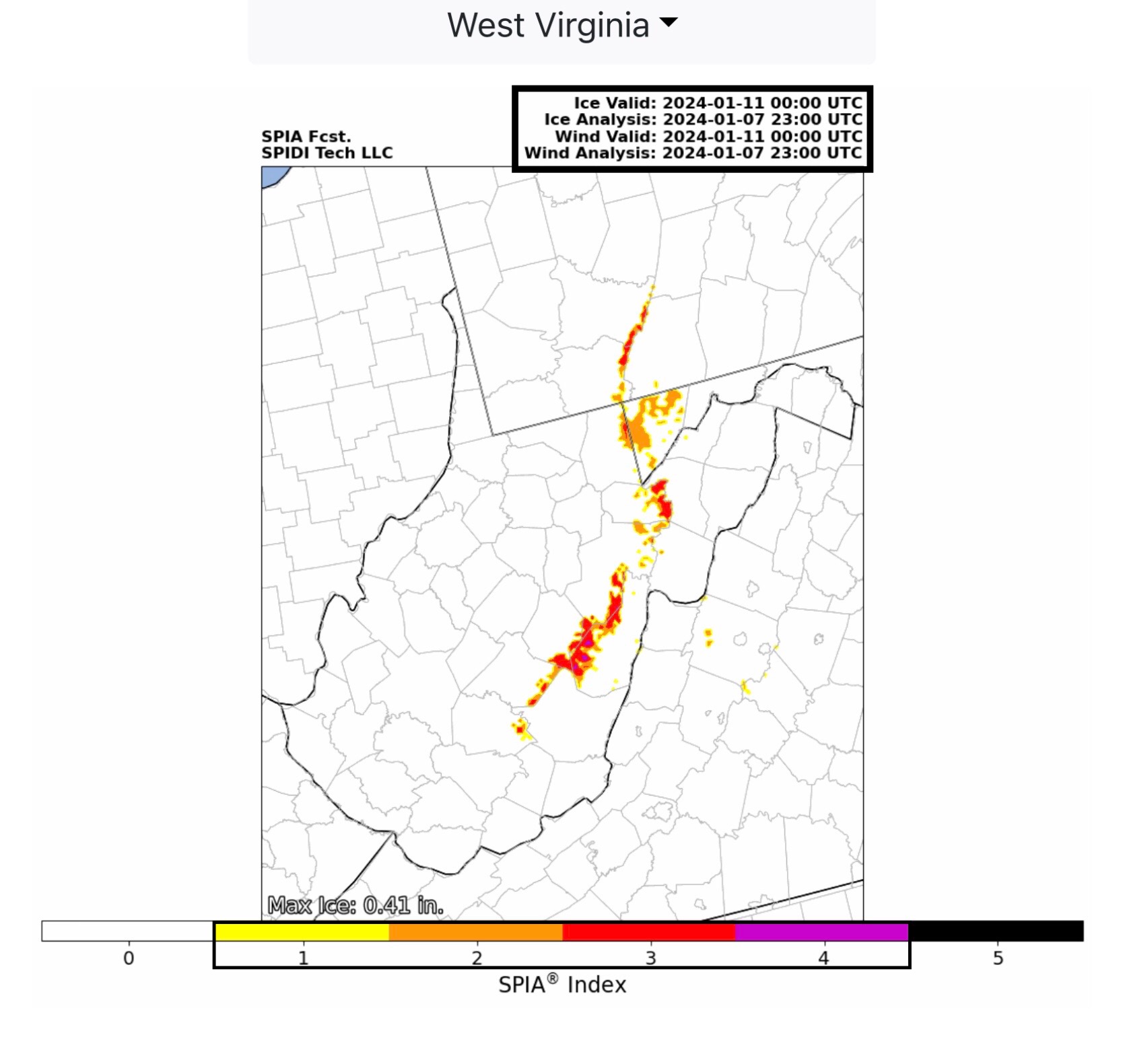
While the Southeast Region will be dealing with spring-like severe thunderstorms with the possibility of severe wind gusts, hail and some large tornadoes, the rest of the U.S. (excepting CA & NV) will be dealing with SNOW, and in some states, lots of it! And, in West Virginia, ICE accumulation totals (0.41”) and high winds in the eastern mountainous region are forecast to push the SPIA Index to Level 4 in some areas.
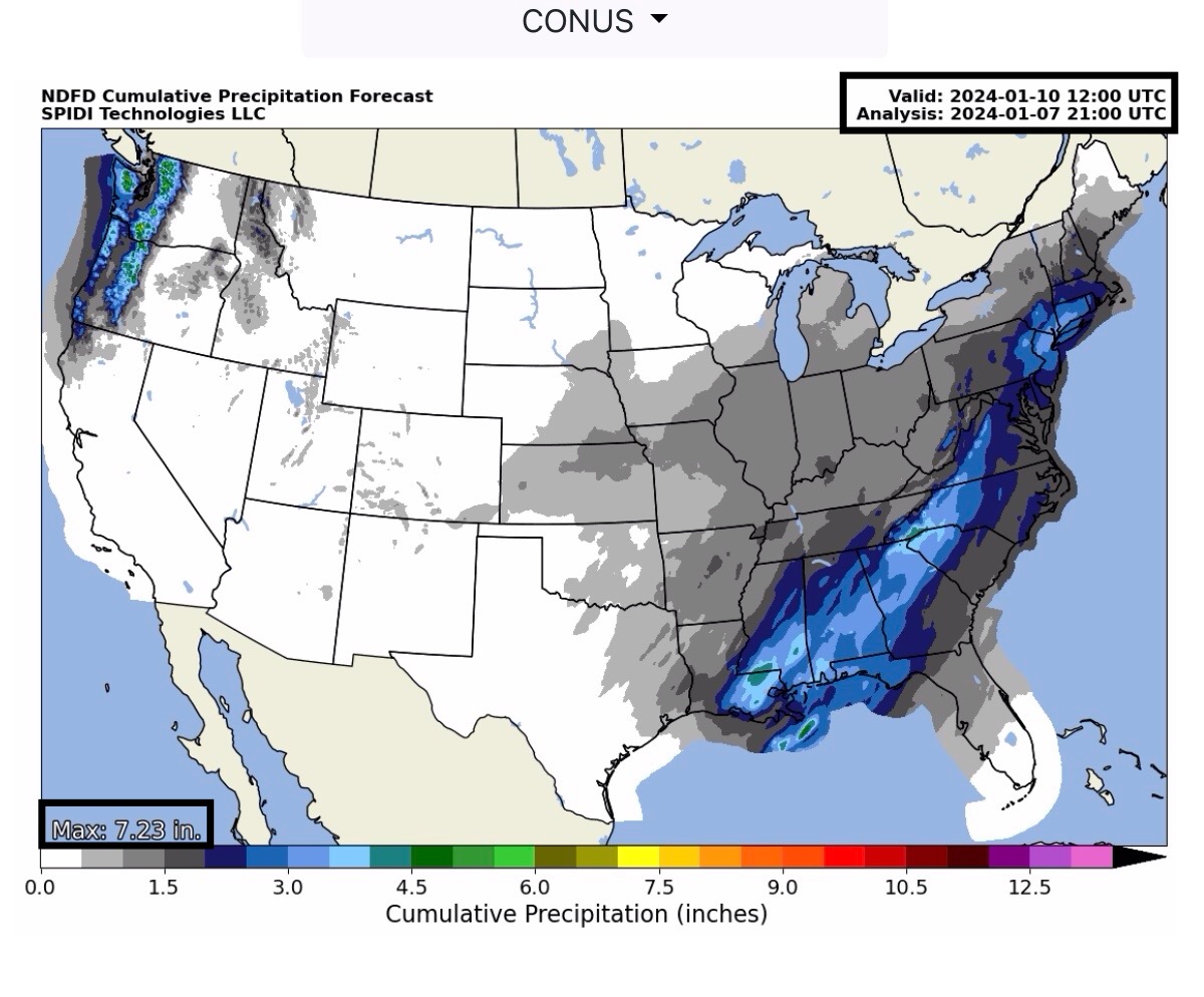
Heavy rains are possible across parts of LA, MS, AL, FL, GA, SC, NC, VA, PA, NJ, NY & CT over the next 72-hours. Rainfall amounts are forecast to be in the 1” up to 5” range.
Heavy rains are also in the forecast for parts WA & OR over the next 72-hours, with forecast totals estimated to be in the 2” to 7”+ range.
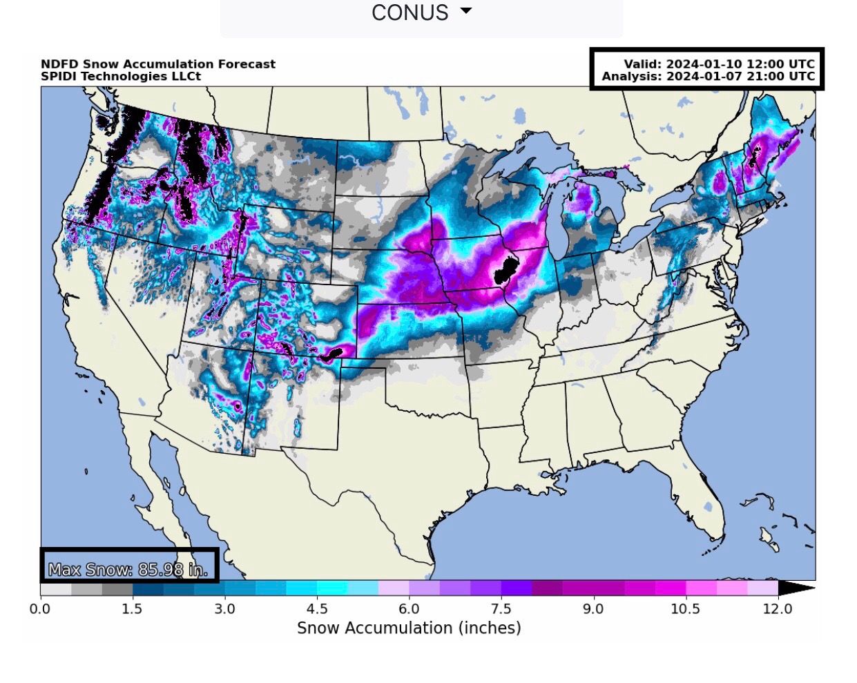
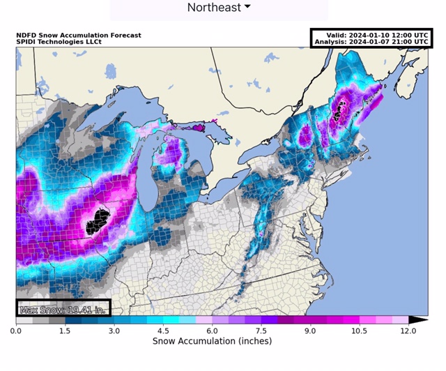
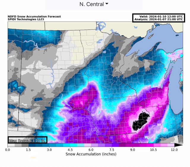
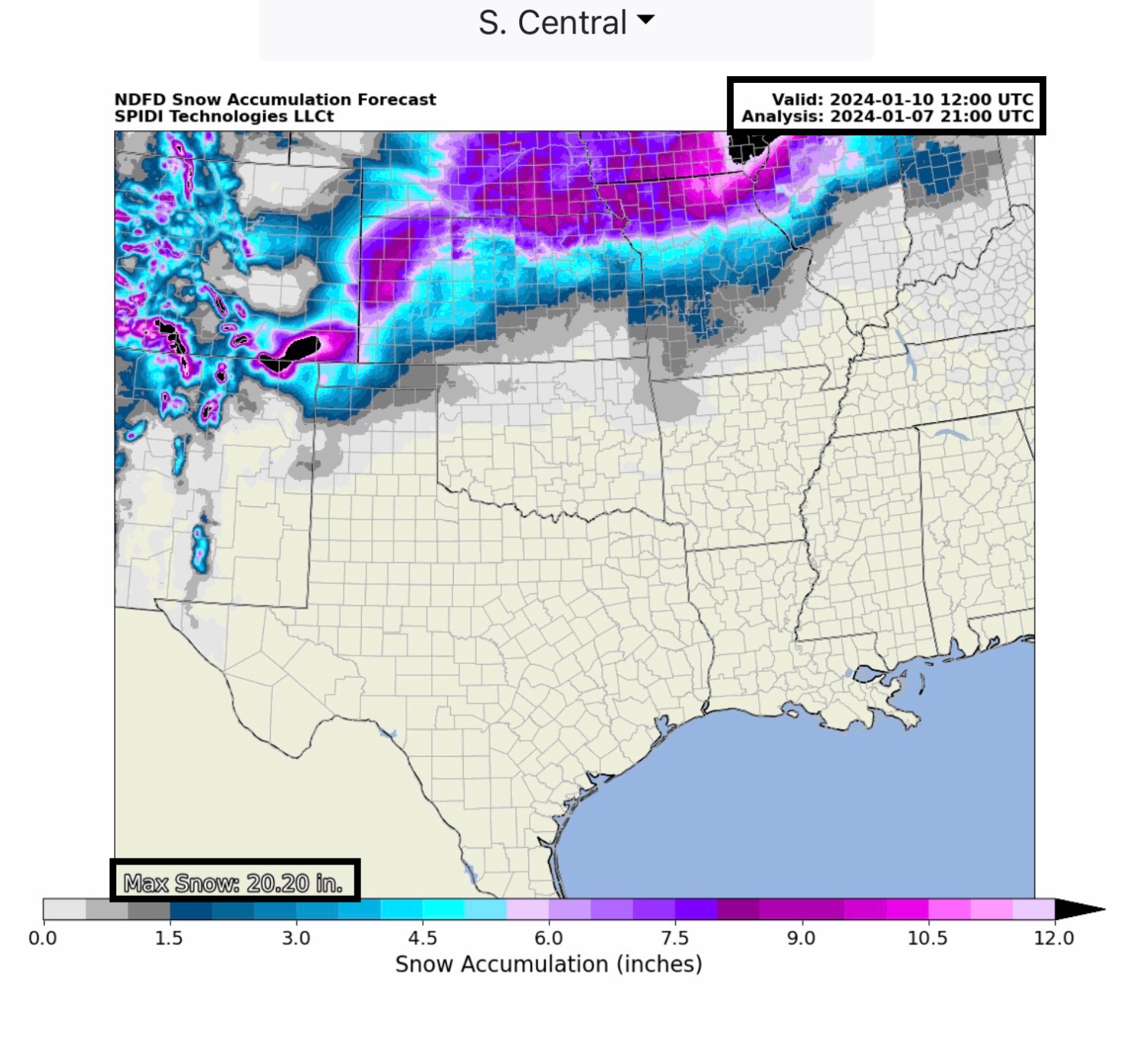
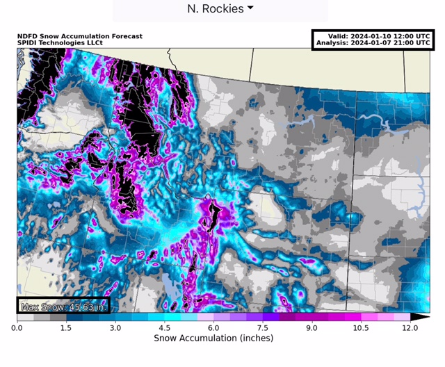
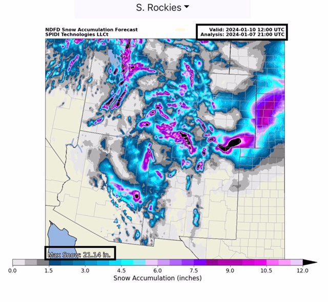
Heaviest Snow amounts over the next 72-hours are forecast to be in the Northeast Region (VT, NH, ME) with up to 19”+; the North Central Region (SD, NE, MN, IA, WI & IL) with up to 13”; the South Central Region (CO, KS, MO & OK) with from 3” up to 20”+; the North Rockies Region (WA, OR, MT, ID & WY) with up to 45”+; and the South Rockies Region (UT, CO, AZ & NM) with up to 21”+ over the next 72-hours, to 6am CT Wednesday, 1/10/24.
Max Ice amounts in the NWS grids for WV is currently at 0.41” & the current SPIA Index Ice Impact Forecast is at Levels 1 through 4 in parts eastern WV, Levels 1 thru 3 in parts southwest PA, and Levels 1 & 2 in parts western and northwestern VA.

 Show/hide attachments