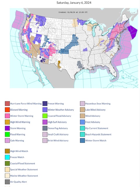
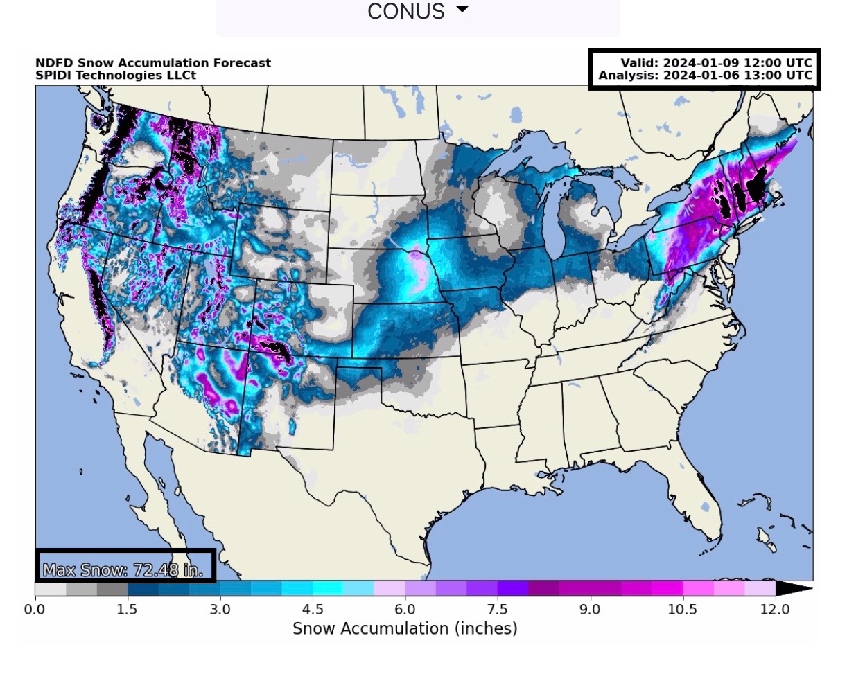
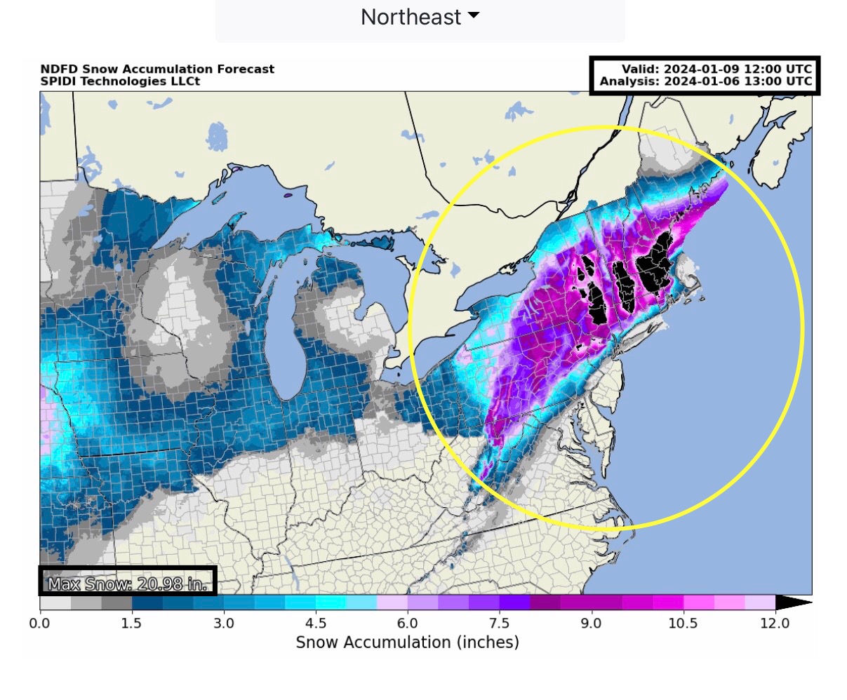
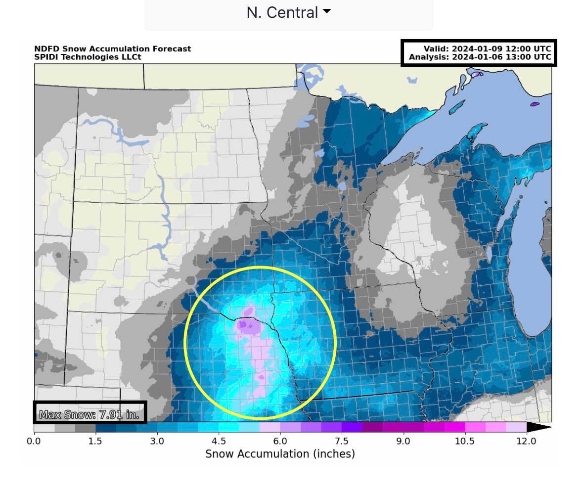
Latest NWS Watches, Warnings & Advisories. WINTER STORM WARNINGS across parts WA, OR, CA, UT, AZ, CO, NM, NC, VA, WV, MD, PA, NJ, CT, RI, NY, MA, VT, NH and ME.
Sidney Sperry 06 Jan 2024 14:17 UTC
FYI…
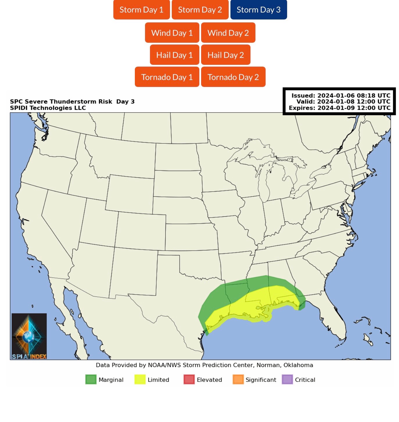
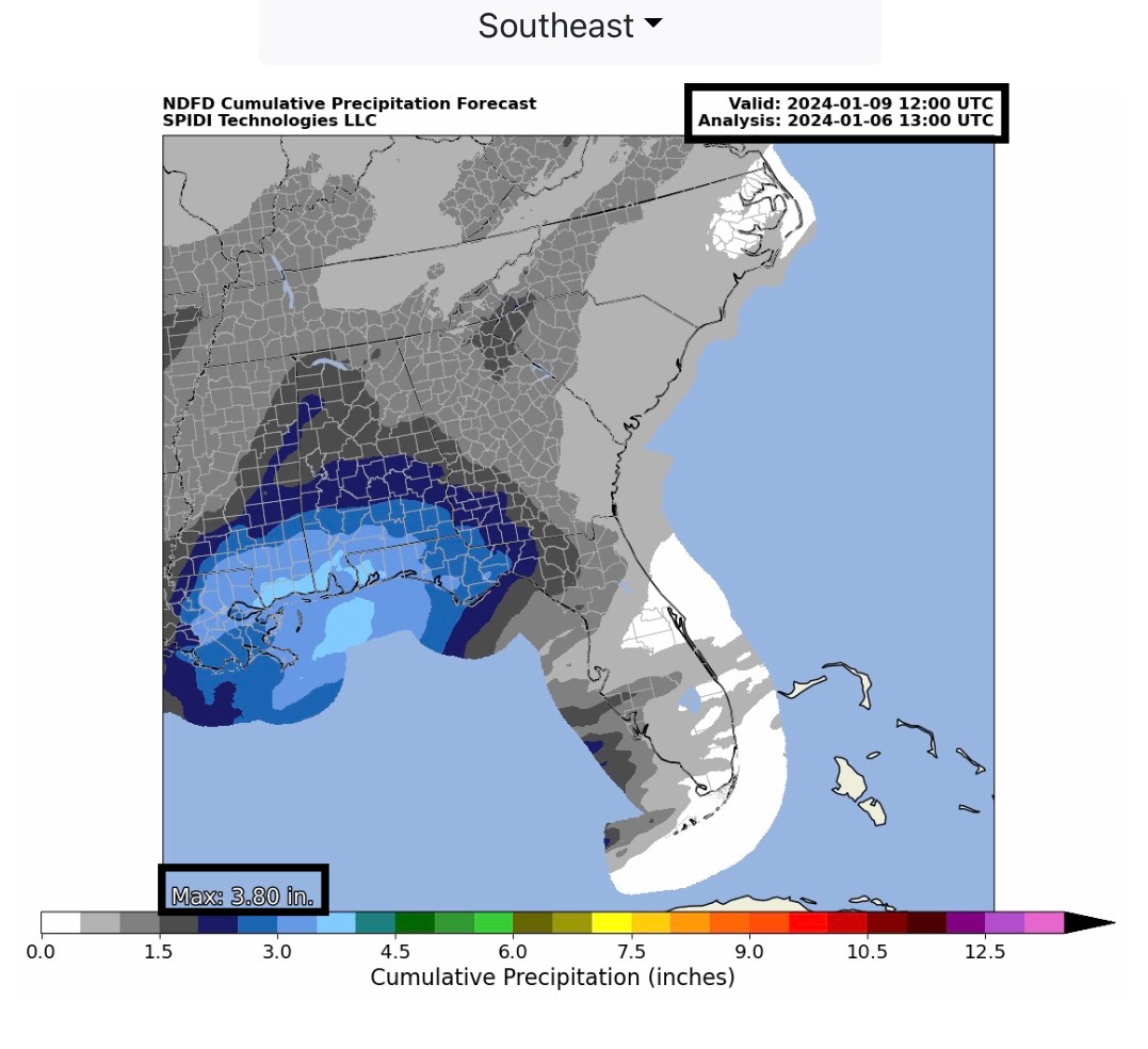
LIMITED Severe Thunderstorm Risk, Day 3, parts TX, LA, MS, AL & FL. Rainfall amounts from 2” up to 4” possible over next 72-hours in Southeast Region of U.S.
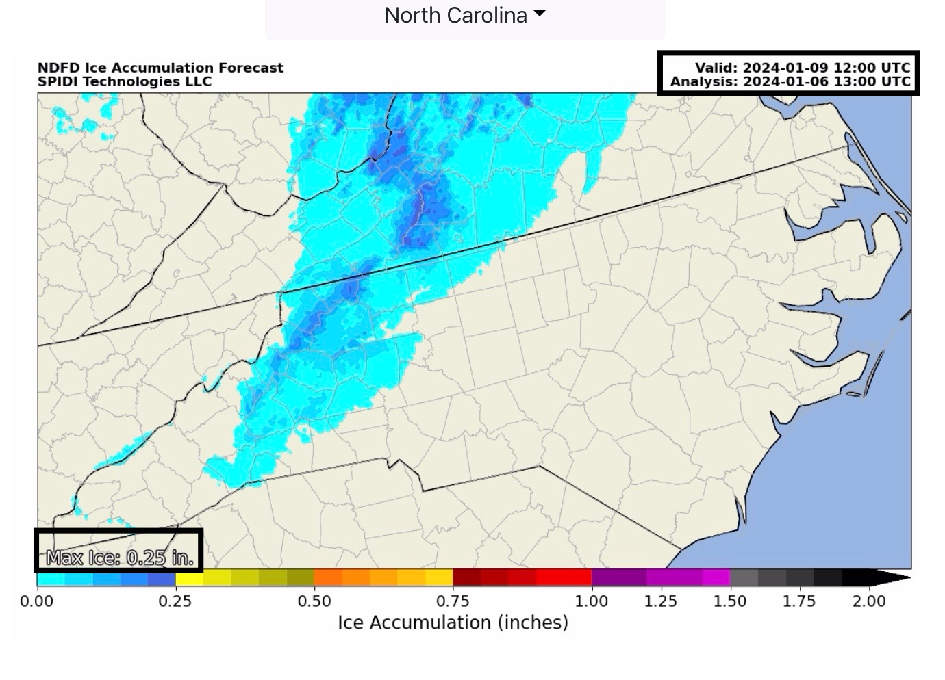
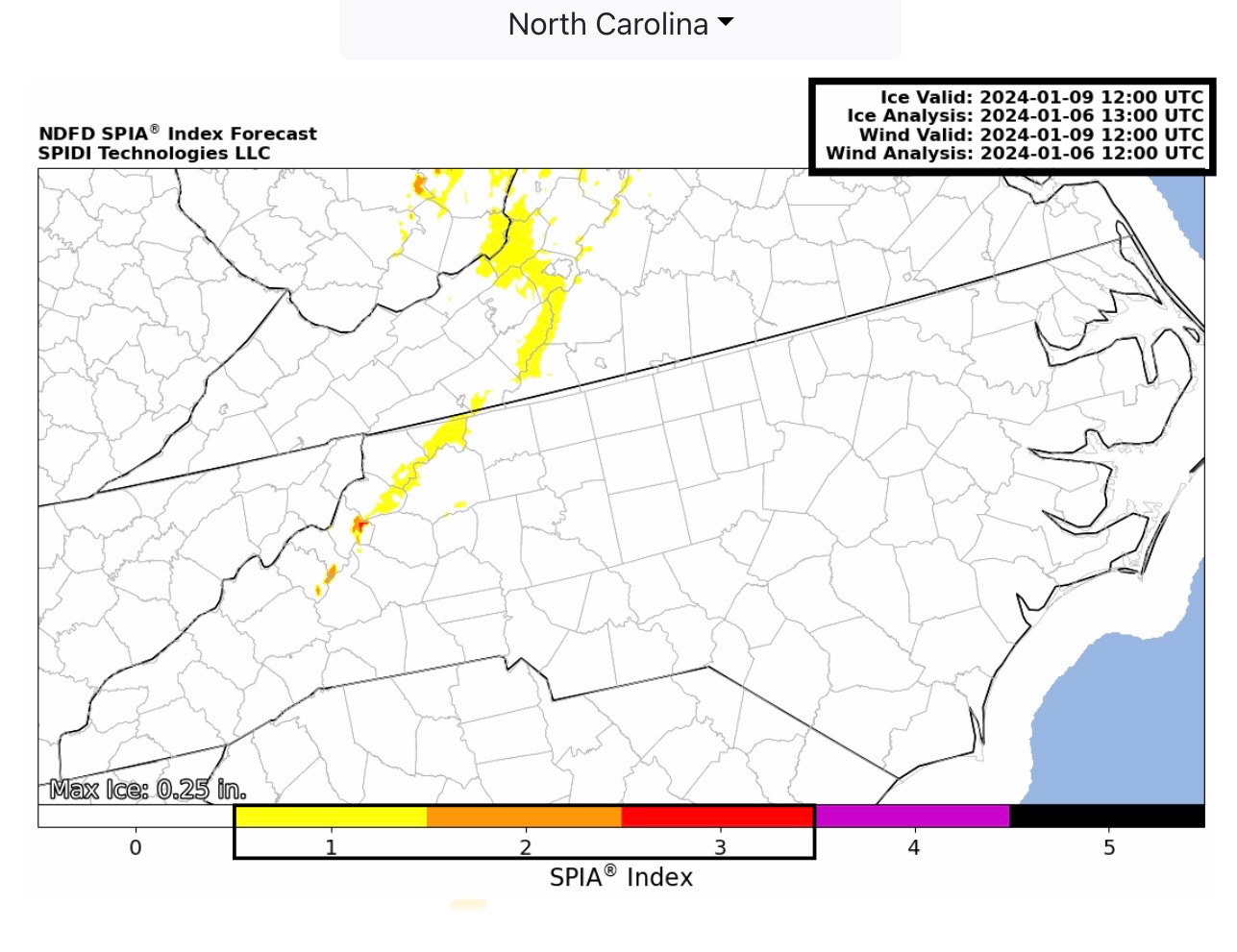
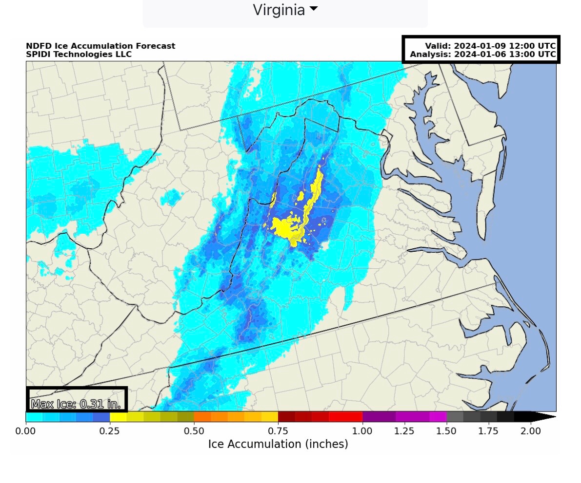
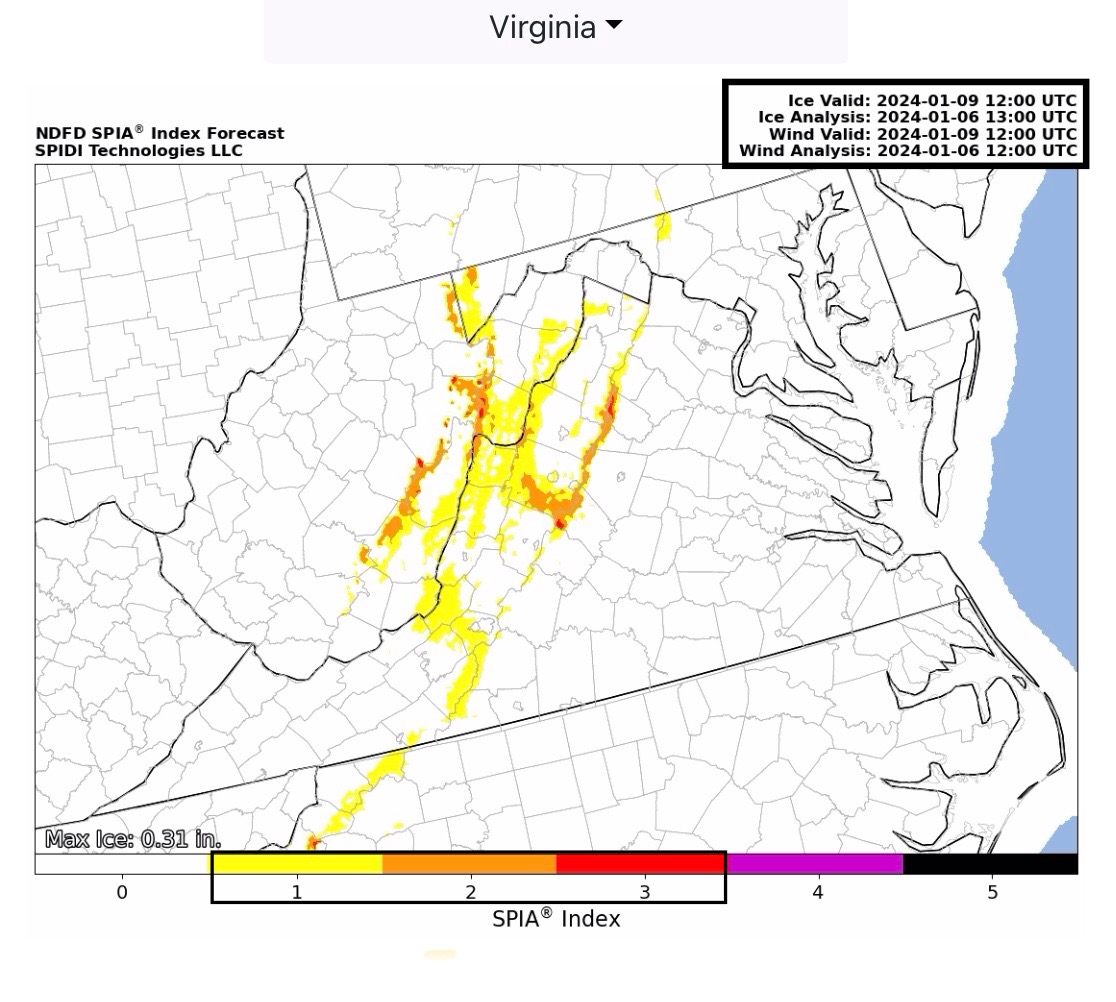
Max ICE in NWS Forecast Grids: 0.25” parts NC; 0.31” parts VA. Current SPIA Index Ice Impact Forecast for parts NC, VA and WV is at Levels 1 through 3.
SNOW amounts over next 72-hours in the Northeast Region (primarily New England states) could be in the 6” up to 20”+ range. Snow amounts in parts SD and NE could be in the 4” up to 8” range, next 72-hours.
Sid Sperry
President & CEO
SPIDI Technologies, LLC
Website/Subscriptions: SPIDItech.com
Cell Phone: (405) 627-7754
Email(s): SidSperry@gmail.com  OR  Sid.Sperry@spidiweather.com

Sent from my iPad

 Show/hide attachments