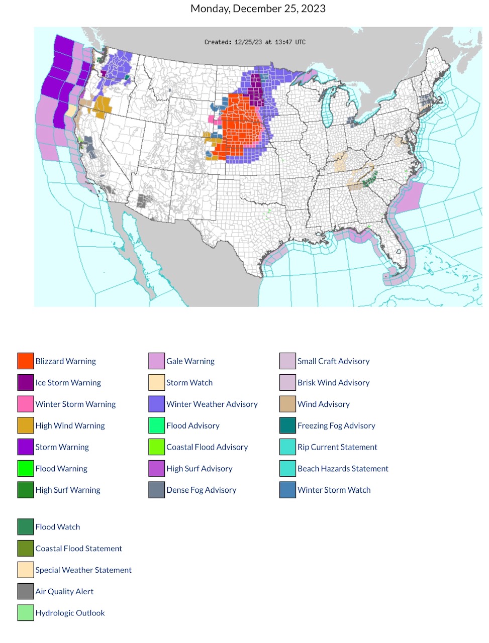
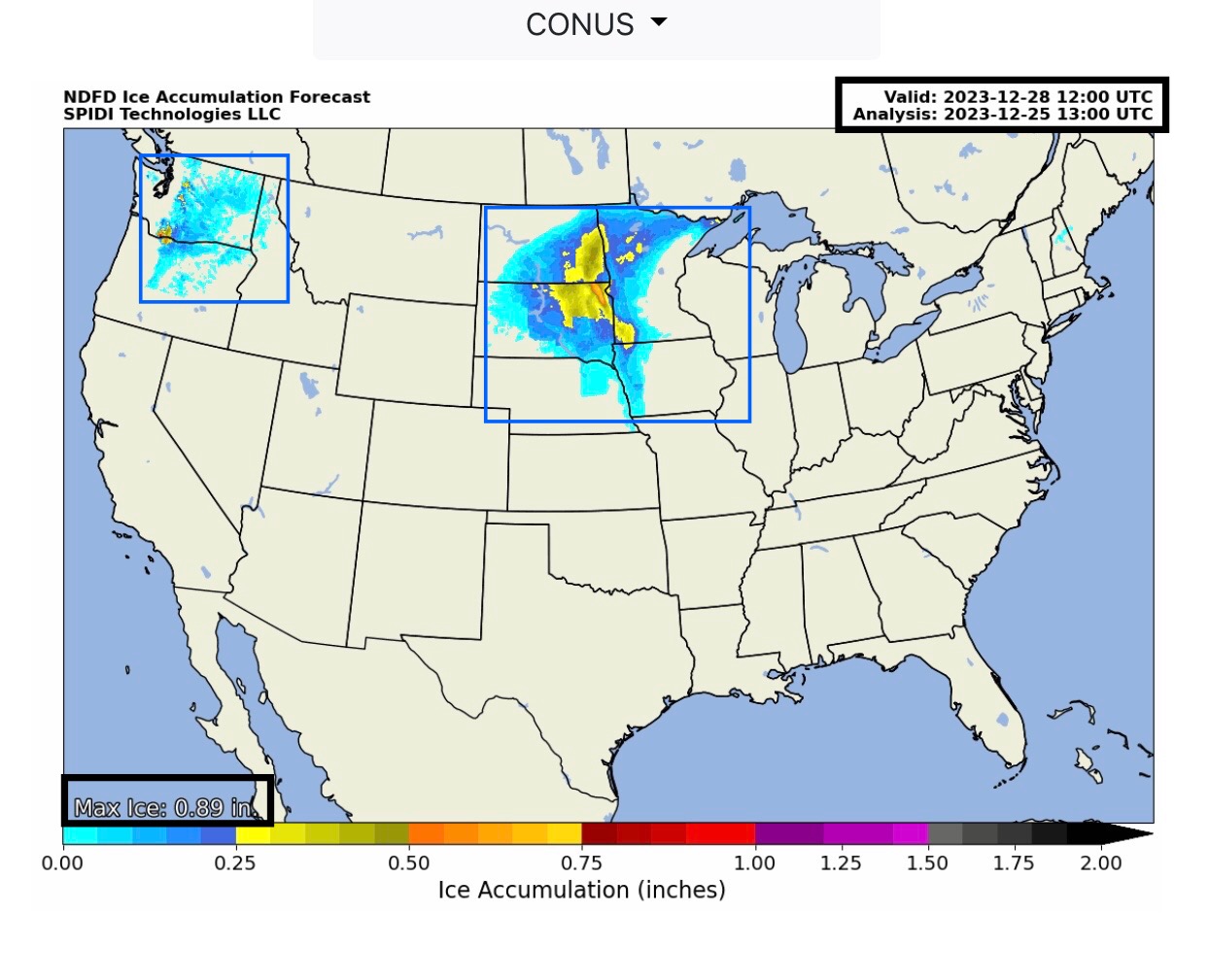
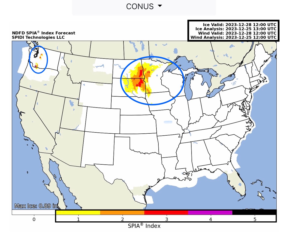
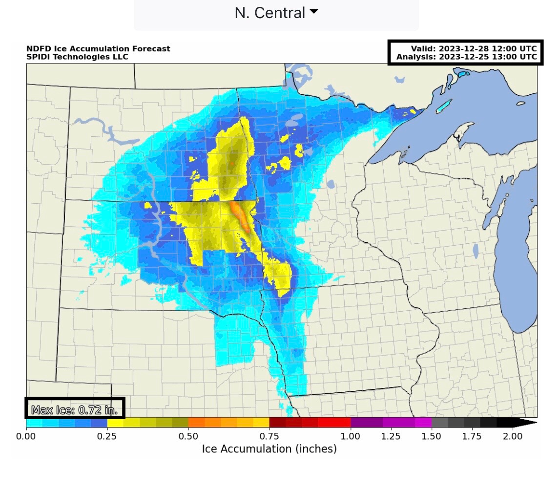
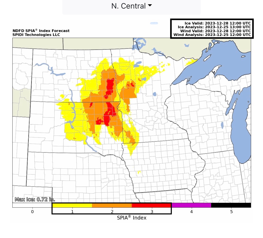
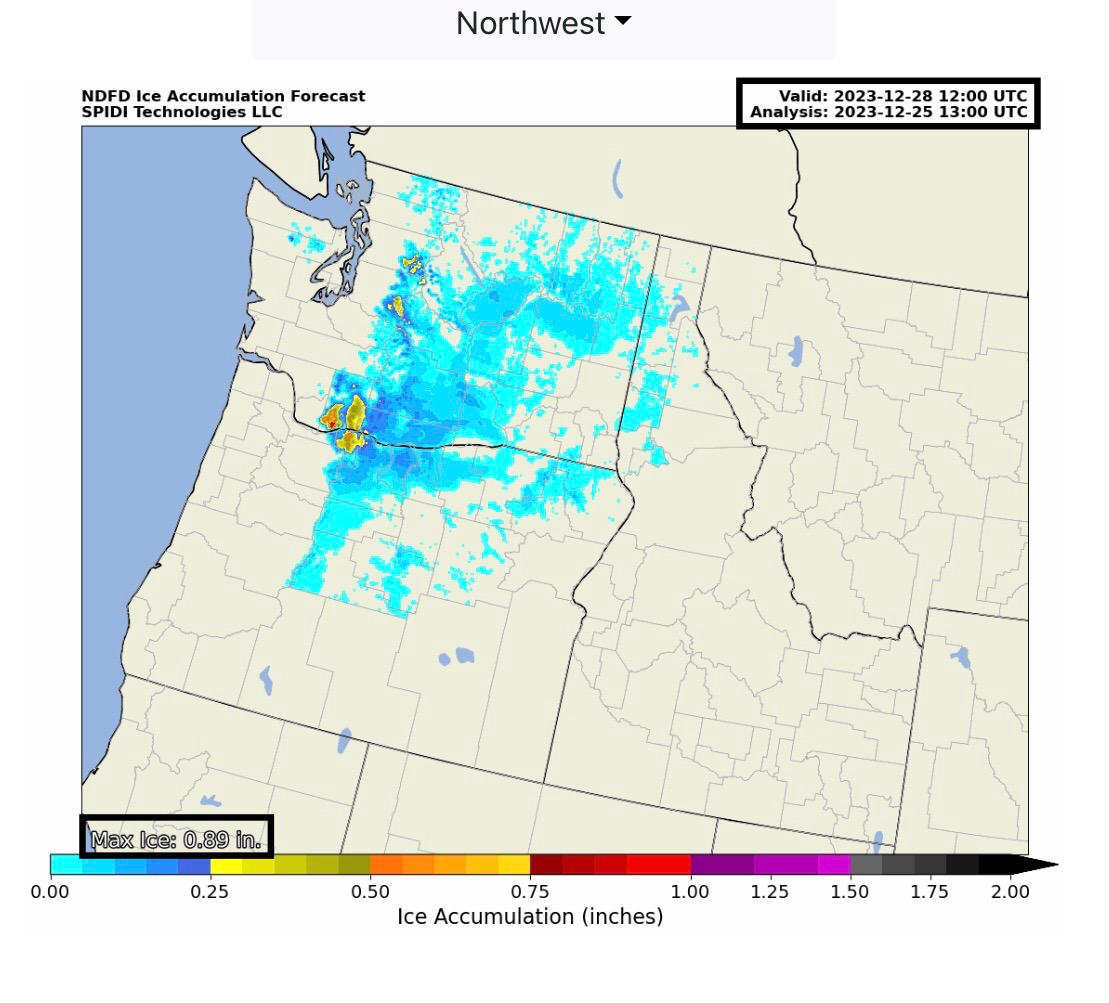
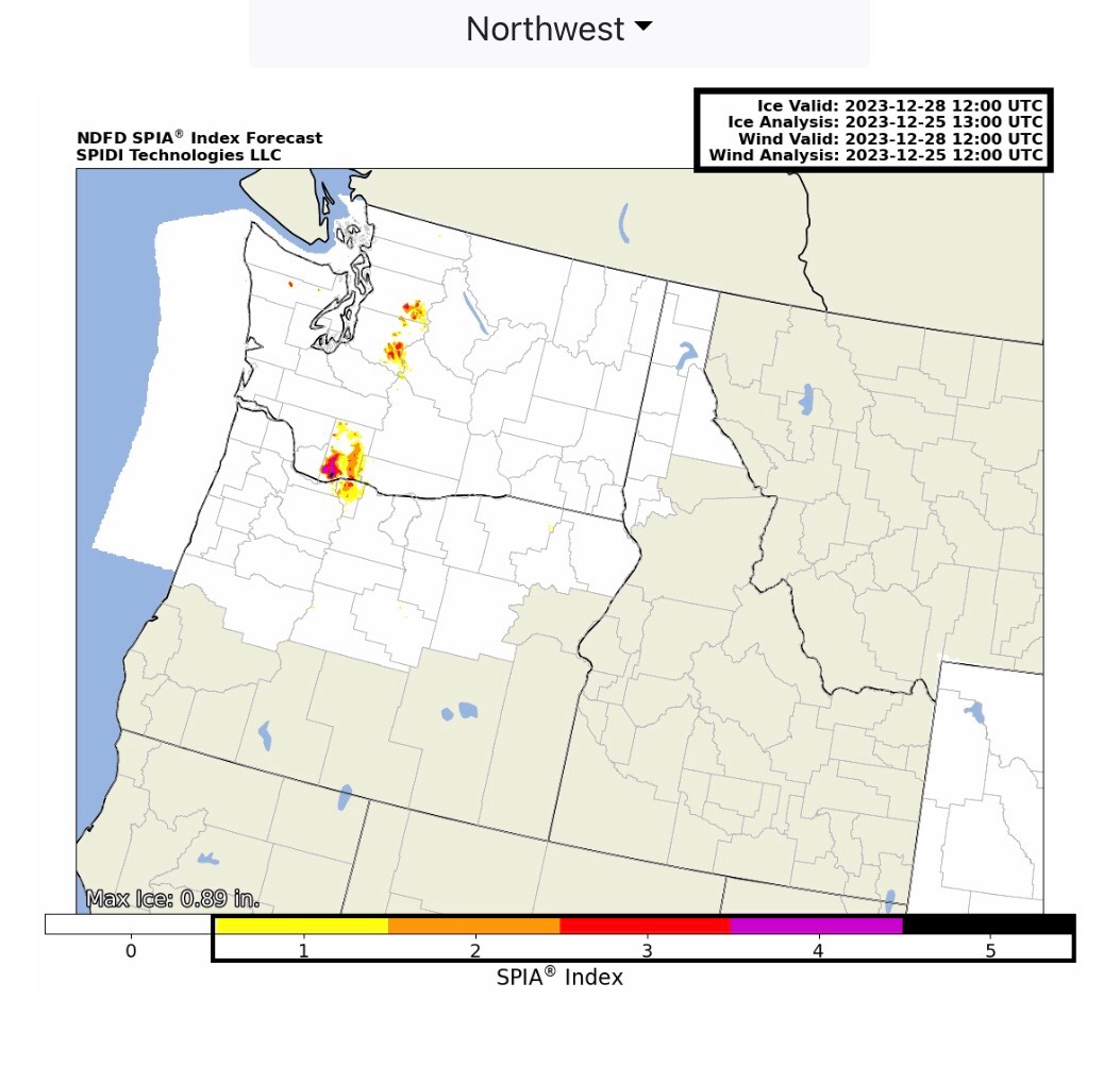
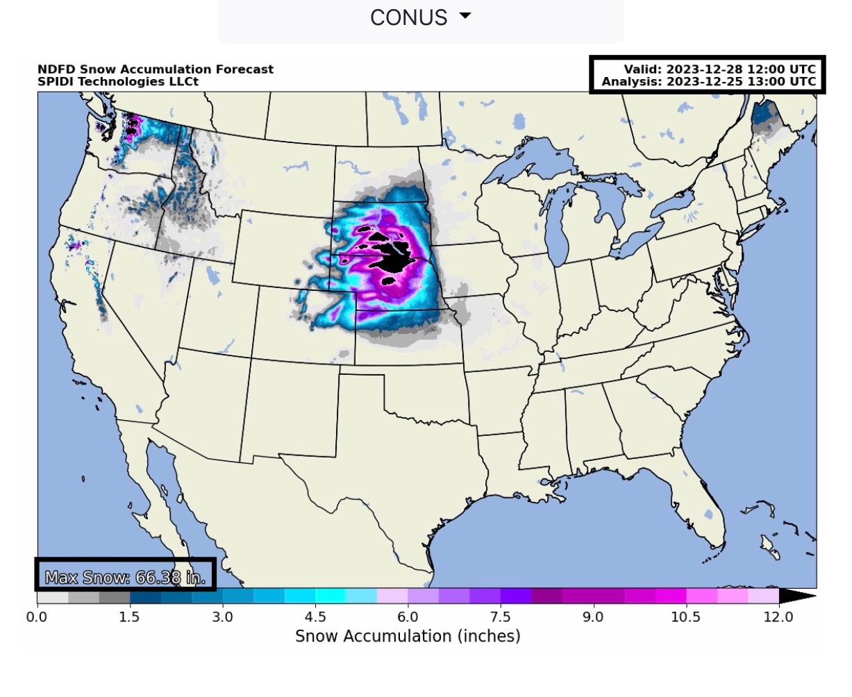
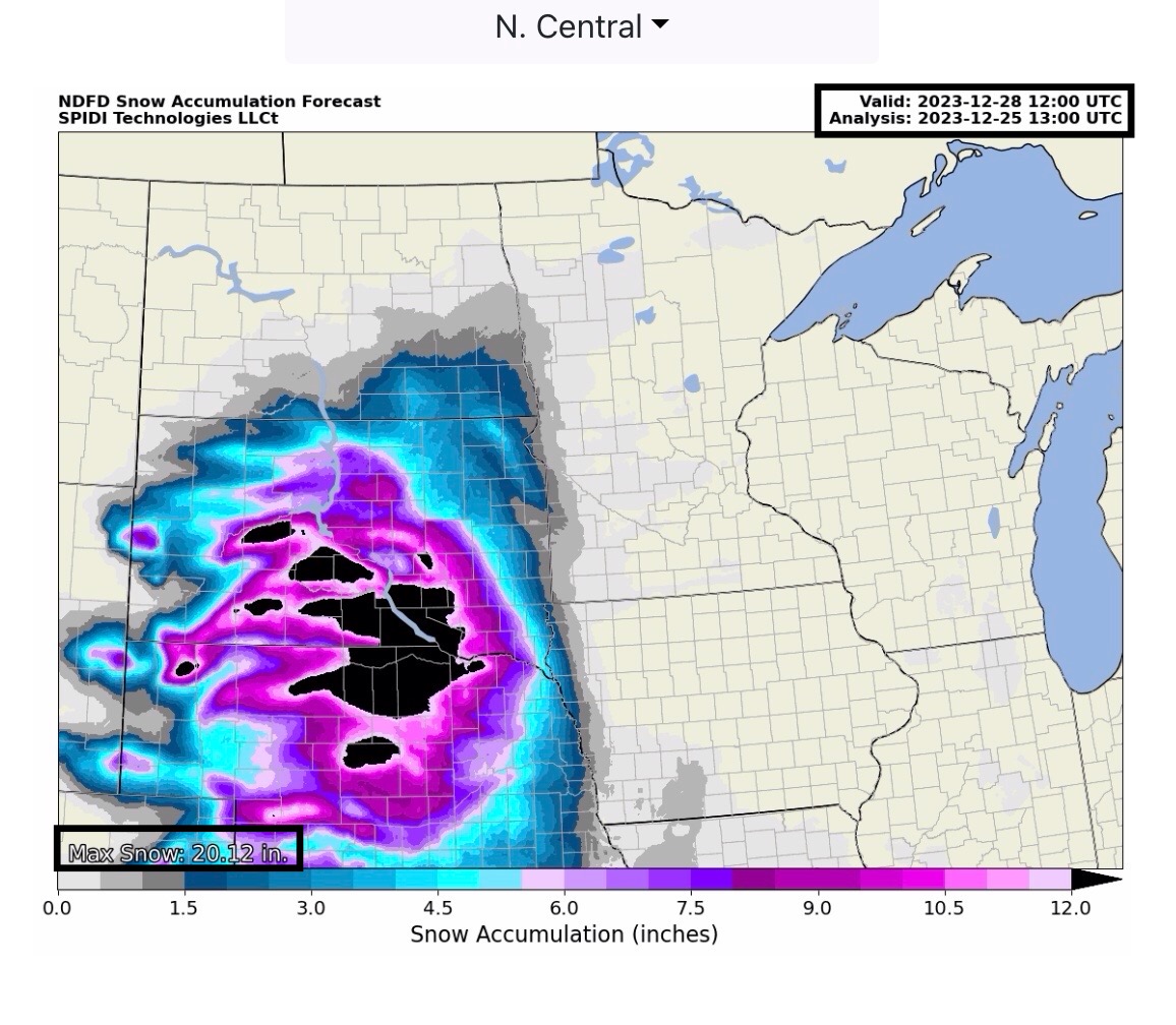
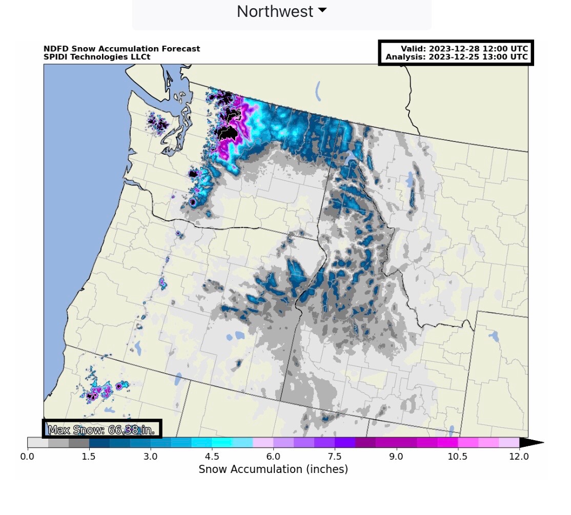
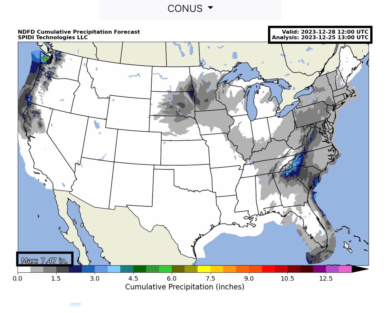
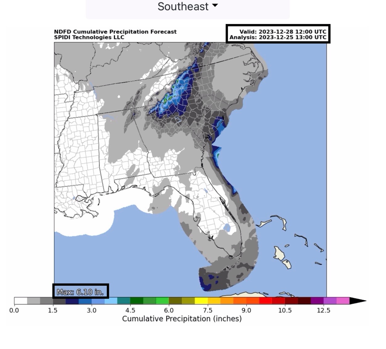
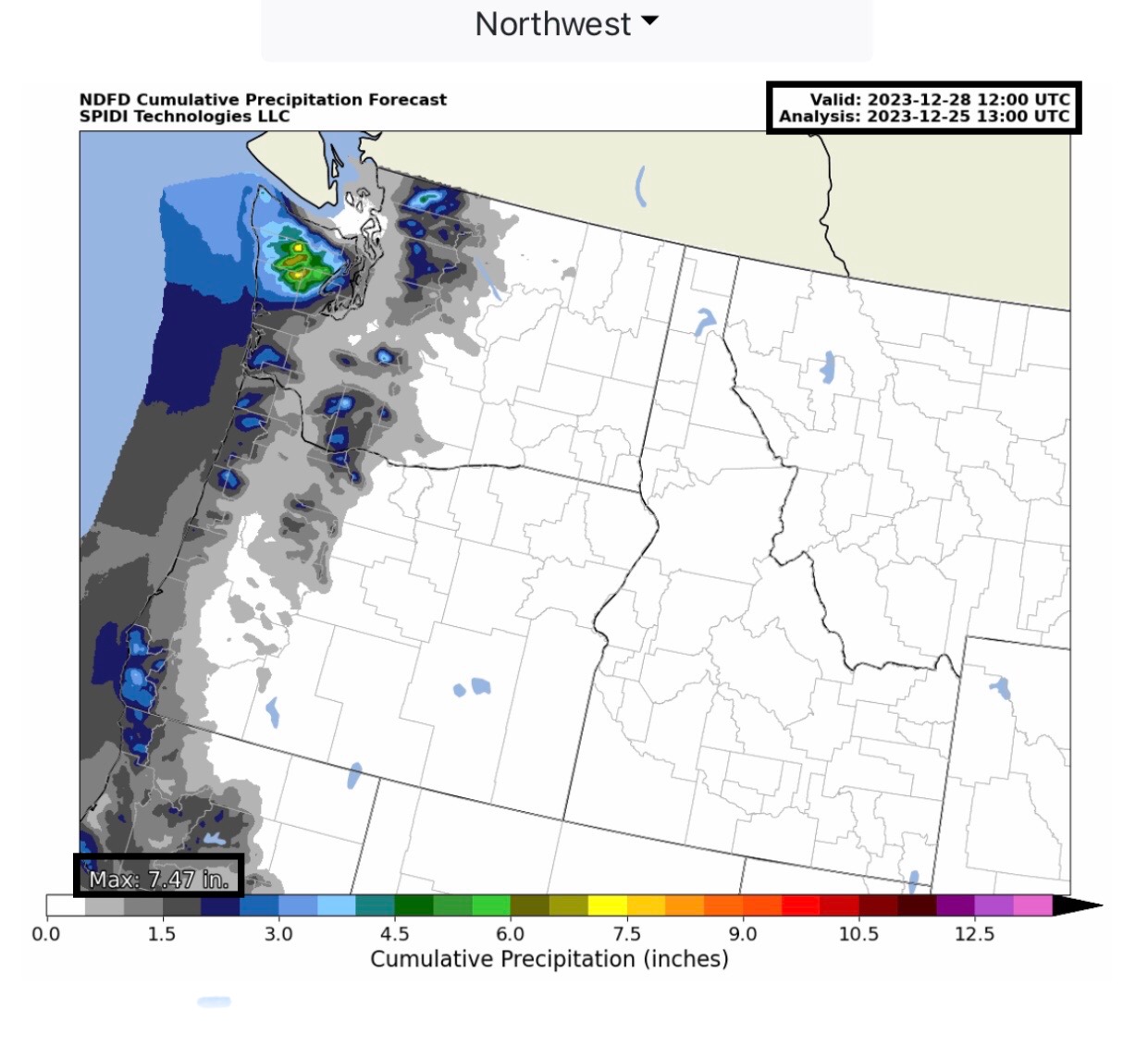
ICE STORM WARNING for today and tomorrow, parts ND, SD and MN. Max ice in NWS forecast grids: 0.72” in parts northeast SD. SPIA Index Levels 1 through 3 in parts ND, SD, MN & IA. Max Ice in NWS grids in WA: 0.89” higher elevations. SPIA Index Levels 1 through 5 parts southwestern WA. BLIZZARD WARNING across parts SD, NE & northern KS. Up to 20” snow possible over next 48 hours. HEAVY RAIN for parts of Southeast Region (6” +) and Northwest Region (7.5” +) next 72-hours…
Sidney Sperry 25 Dec 2023 14:51 UTC
FYI… Christmas Day Ice Storms in parts ND, SD, MN, IA, and WA. Heavy Snow across parts SD, NE and northern KS. Heavy Rain in forecast across parts IL, IN, KY, TN, AL, GA, SC & NC, and across parts WA & OR over next 12 to 72-hours.
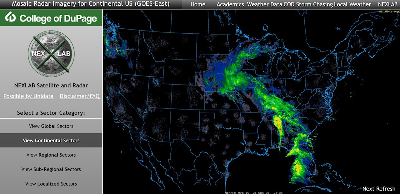
Current COD Mosaic Radar as of 8:30am Central Time.
Sid Sperry
President & CEO
SPIDI Technologies, LLC
Website/Subscriptions: SPIDItech.com
Cell Phone: (405) 627-7754
Email(s): SidSperry@gmail.com  OR  Sid.Sperry@spidiweather.com

Sent from my iPad

 Show/hide attachments