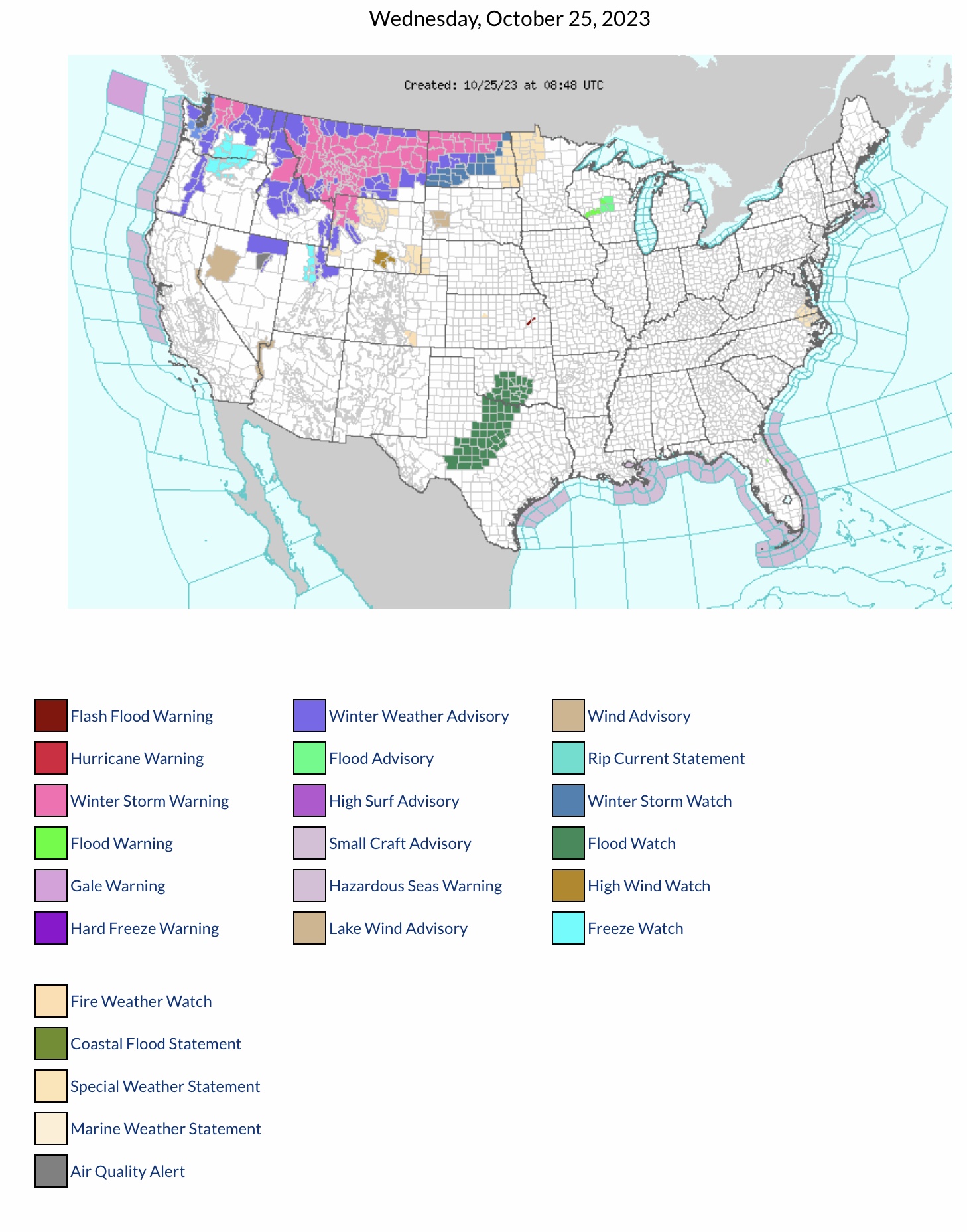
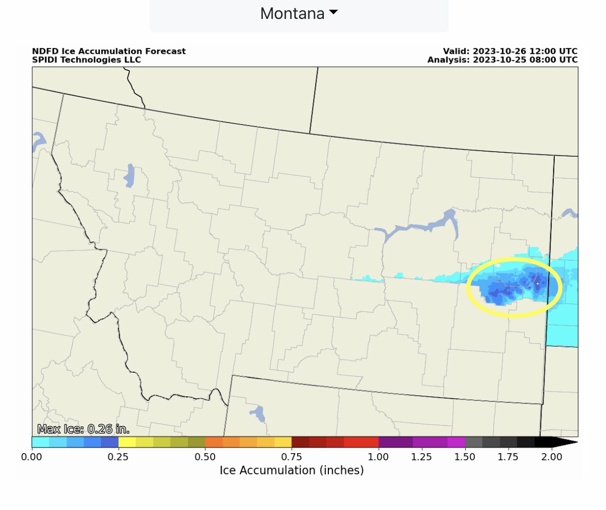
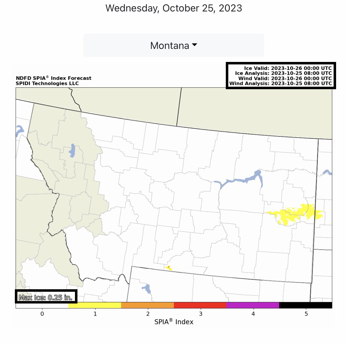
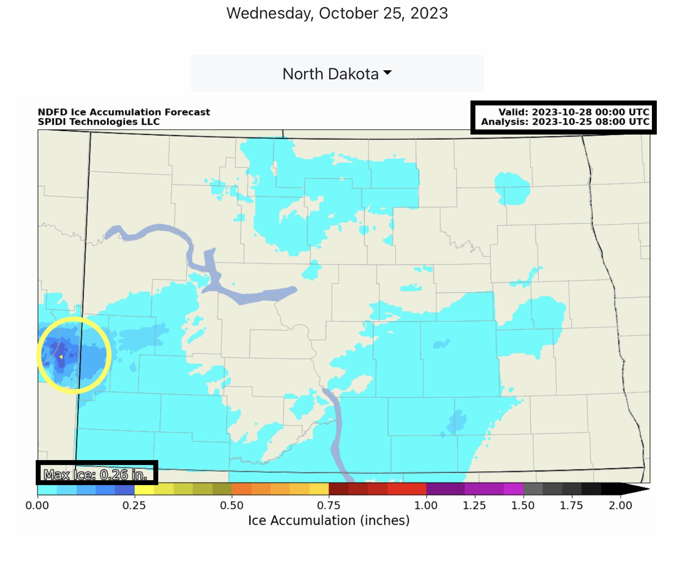
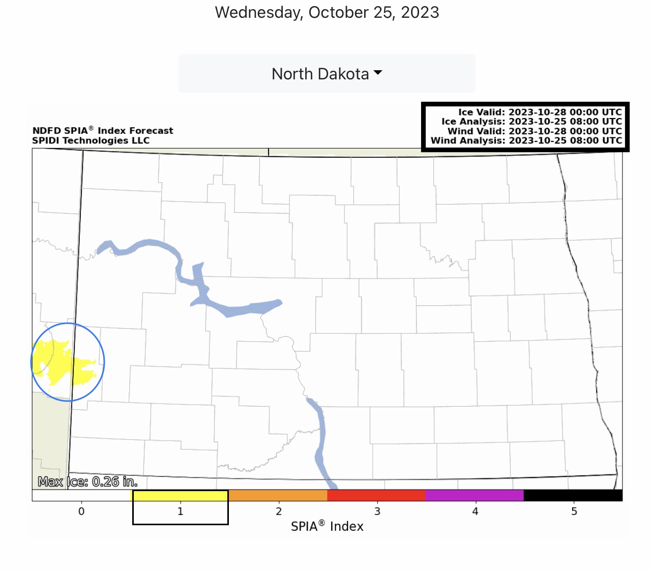
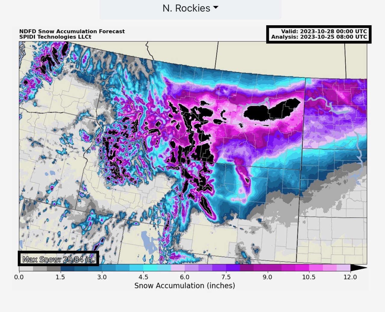
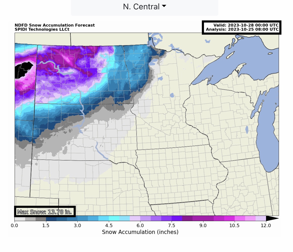
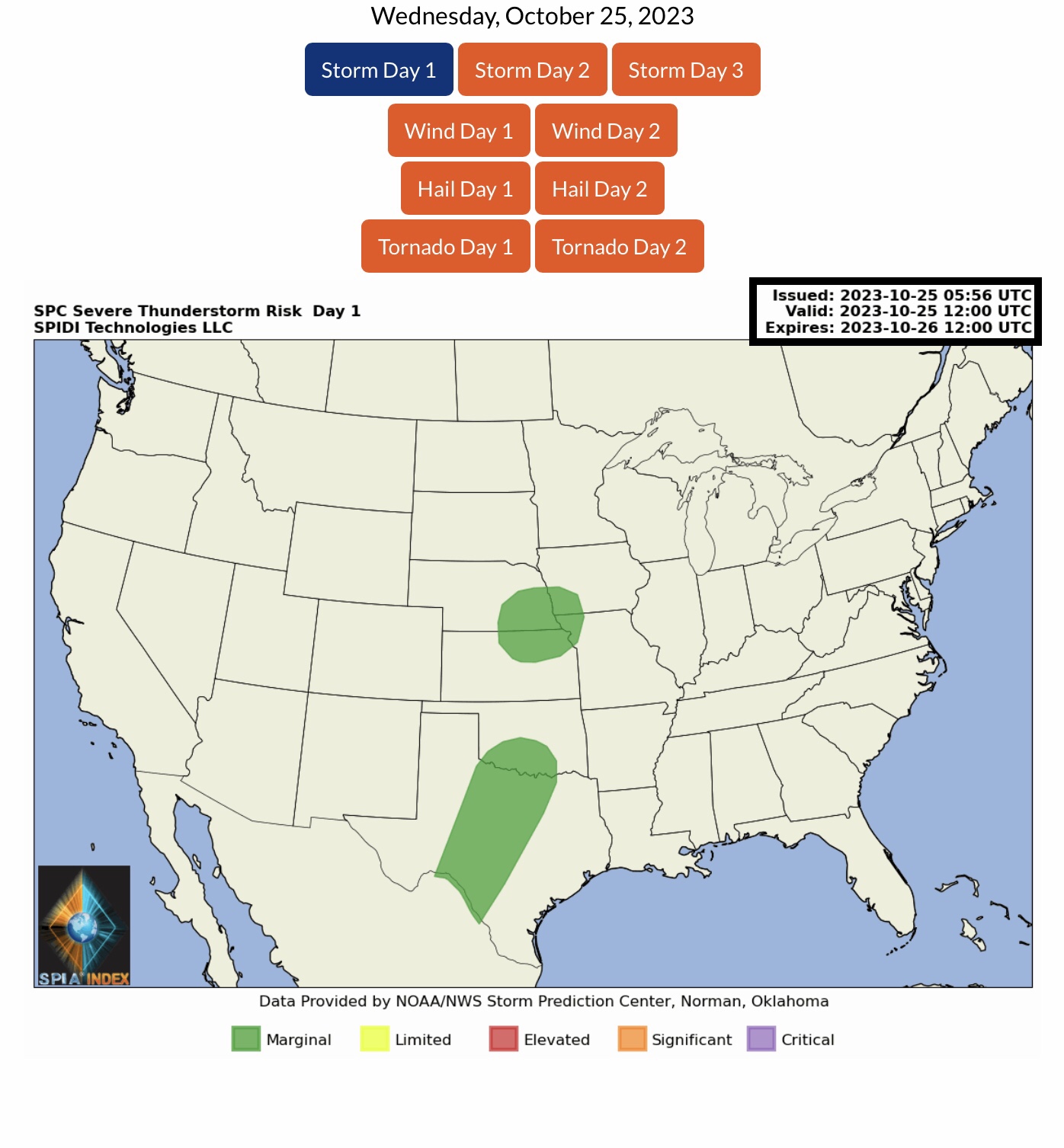
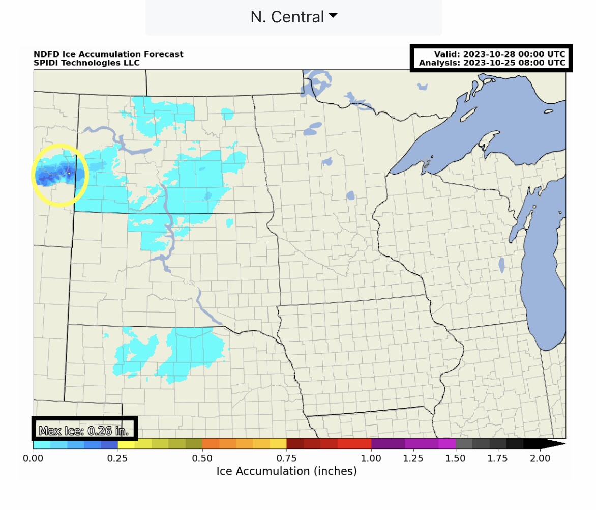
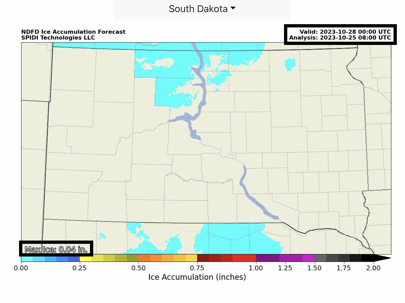
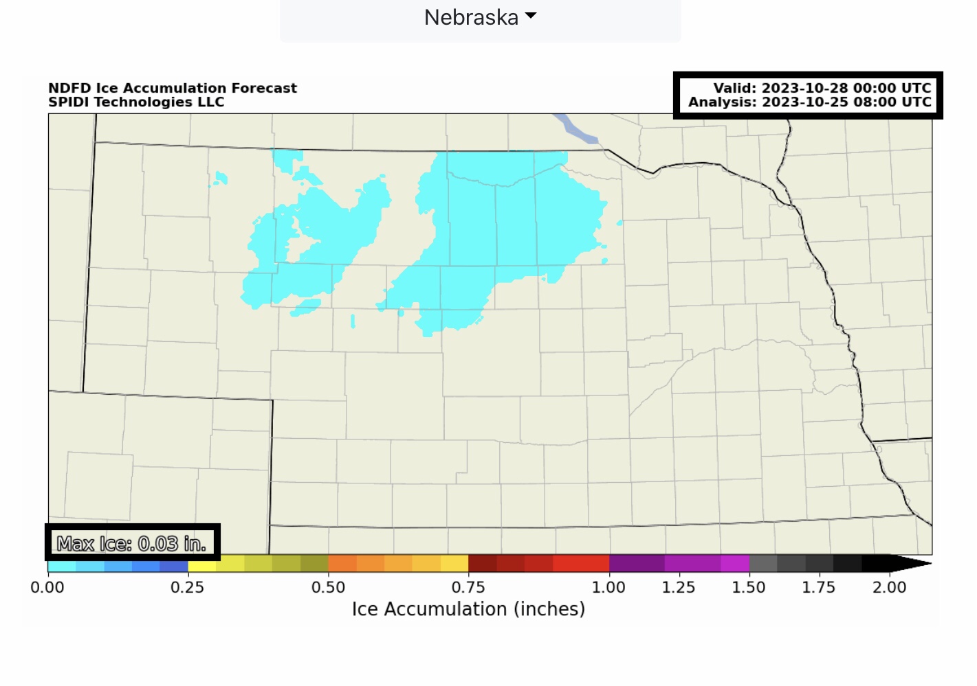
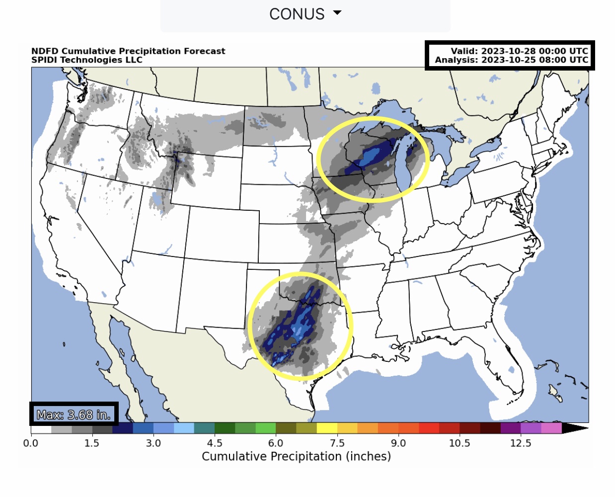
First major Winter Storm of season to impact parts Northwest, North Rockies & North Central Regions over next 12 to 72 hours. Up to 24”+ snow possible in higher elevation areas of WA, ID, MT & WY. Winter Storm WARNING parts WA, ID, MT, WY & ND. Wind Advisories parts NV, WY & SD. SPIA Index Ice Impact Forecast at Level 1 for parts eastern MT, far western ND. Max Ice in grids: 0.26”. Flood Watch parts TX & OK; Flash Flood WARNING parts eastern KS. Flood Advisory parts central WI.
Sidney Sperry 25 Oct 2023 09:45 UTC
FYI…
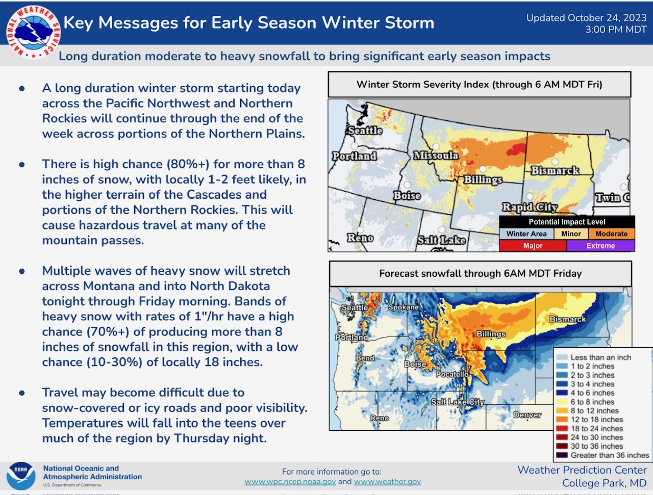
Heavy snow possible next 12 to 72 hours parts WA, ID, MT, WY, ND and in western MN by Friday.
Up to 0.26” of ice accumulation is forecast over next 24 hours in parts east-central MT and west-central ND. The current SPIA Index Ice Impact forecast for those areas is at Level 1, meaning the combination of ice accumulation and wind speeds could cause some scattered power outages in east-central MT and far west-central ND next 24-hrs.
Sid Sperry
President & CEO
SPIDI Technologies, LLC
Website/Subscriptions: SPIDItech.com
Cell Phone: (405) 627-7754
Email(s): SidSperry@gmail.com  OR  Sid.Sperry@spidiweather.com

Sent from my iPad

 Show/hide attachments