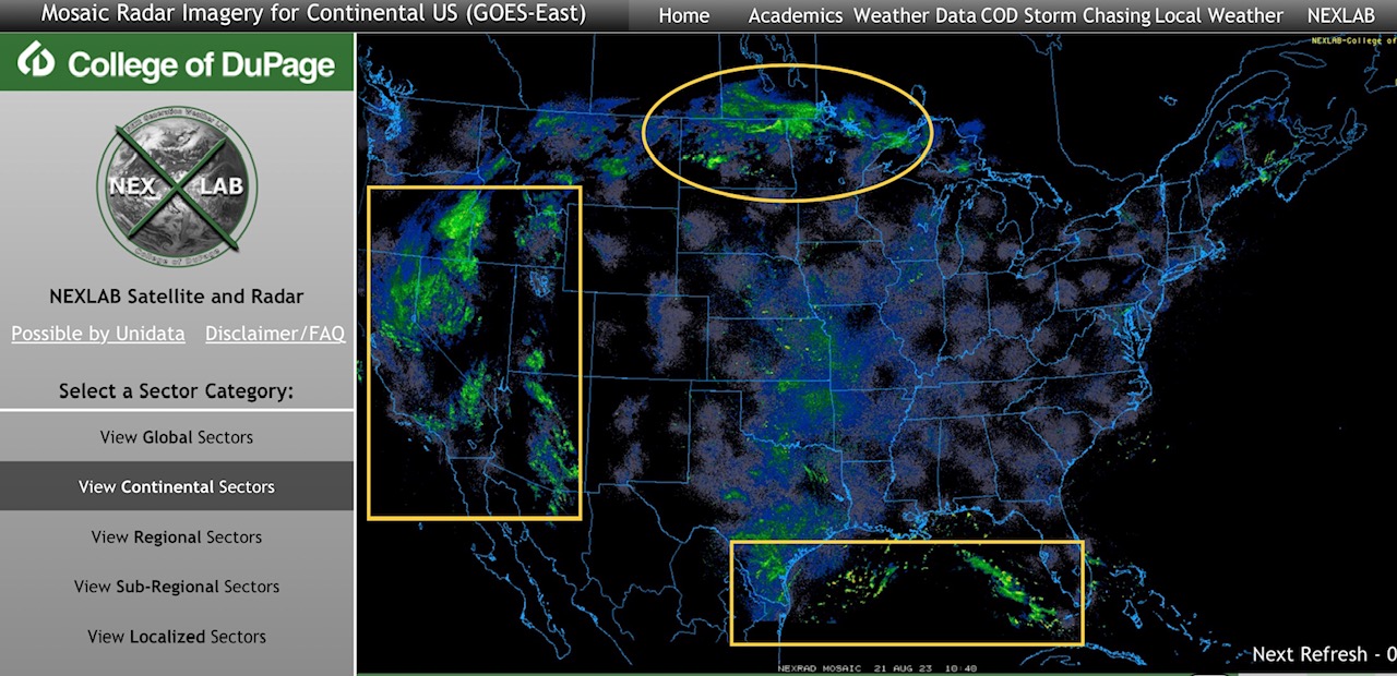
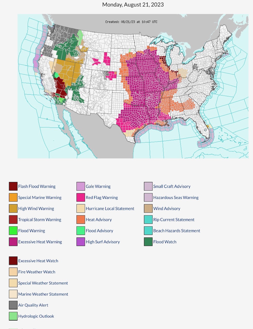
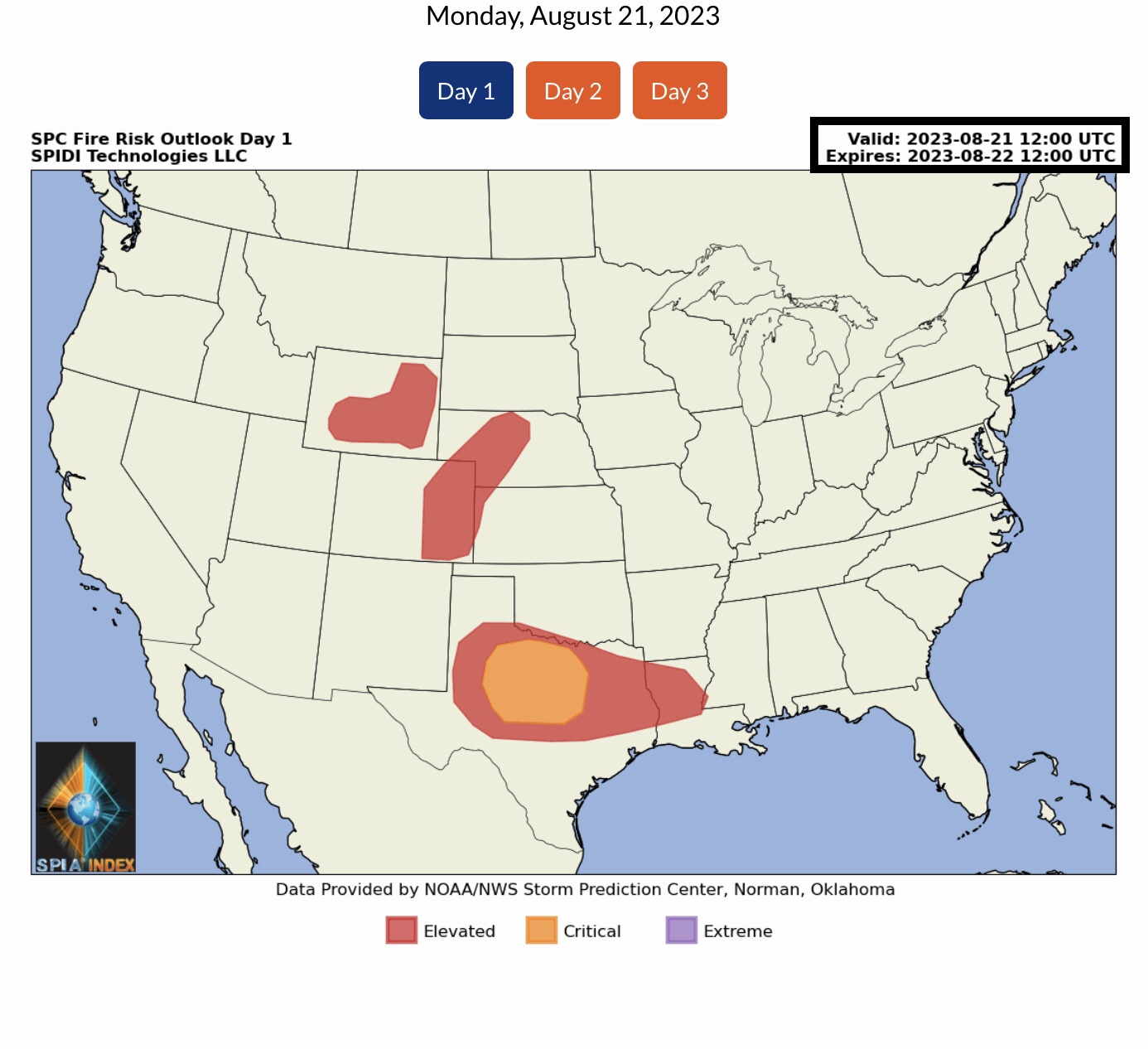
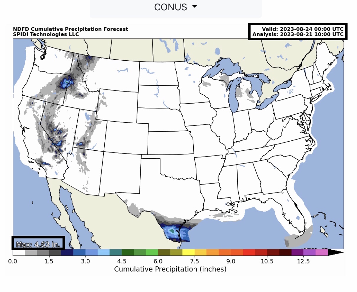
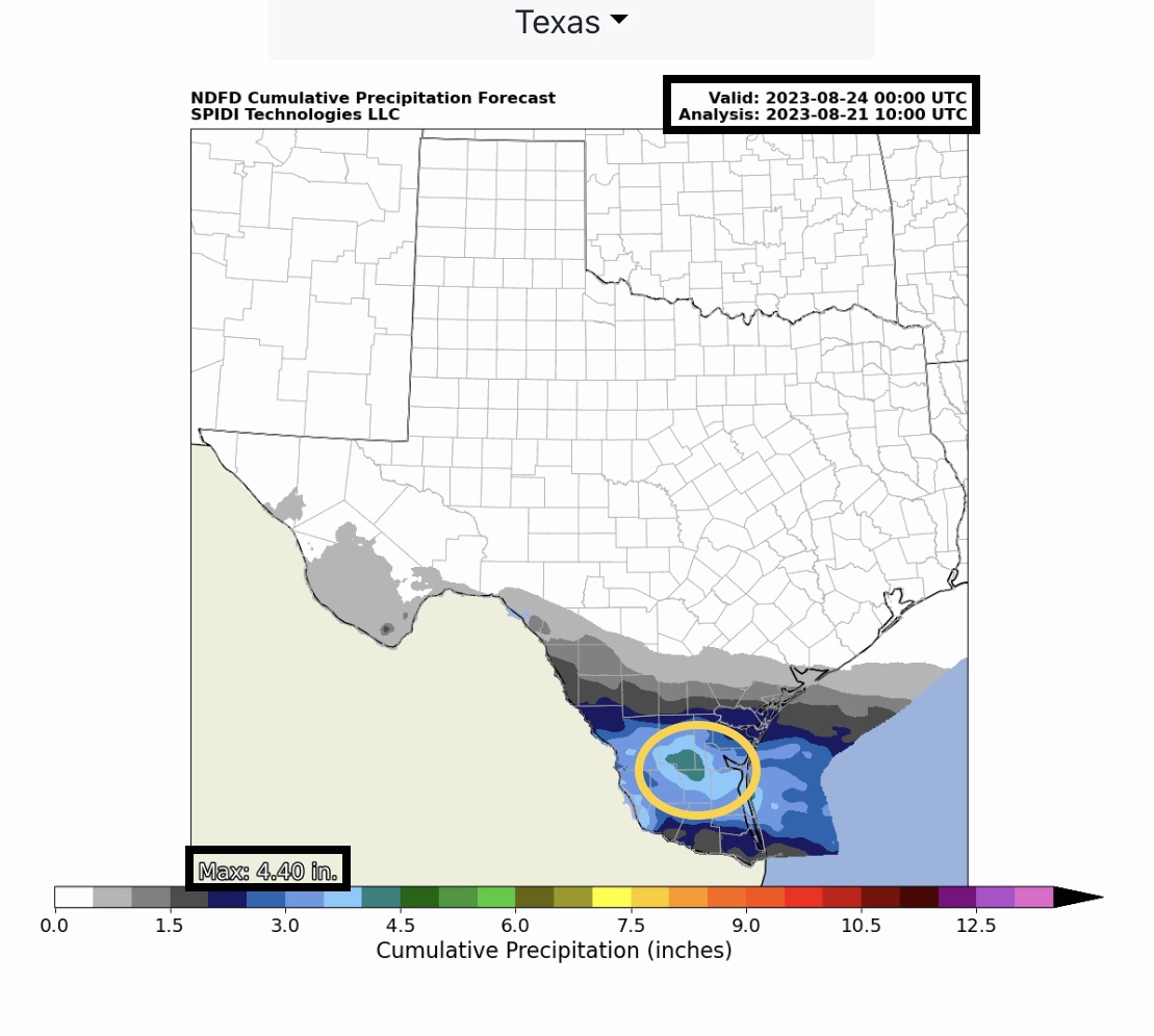
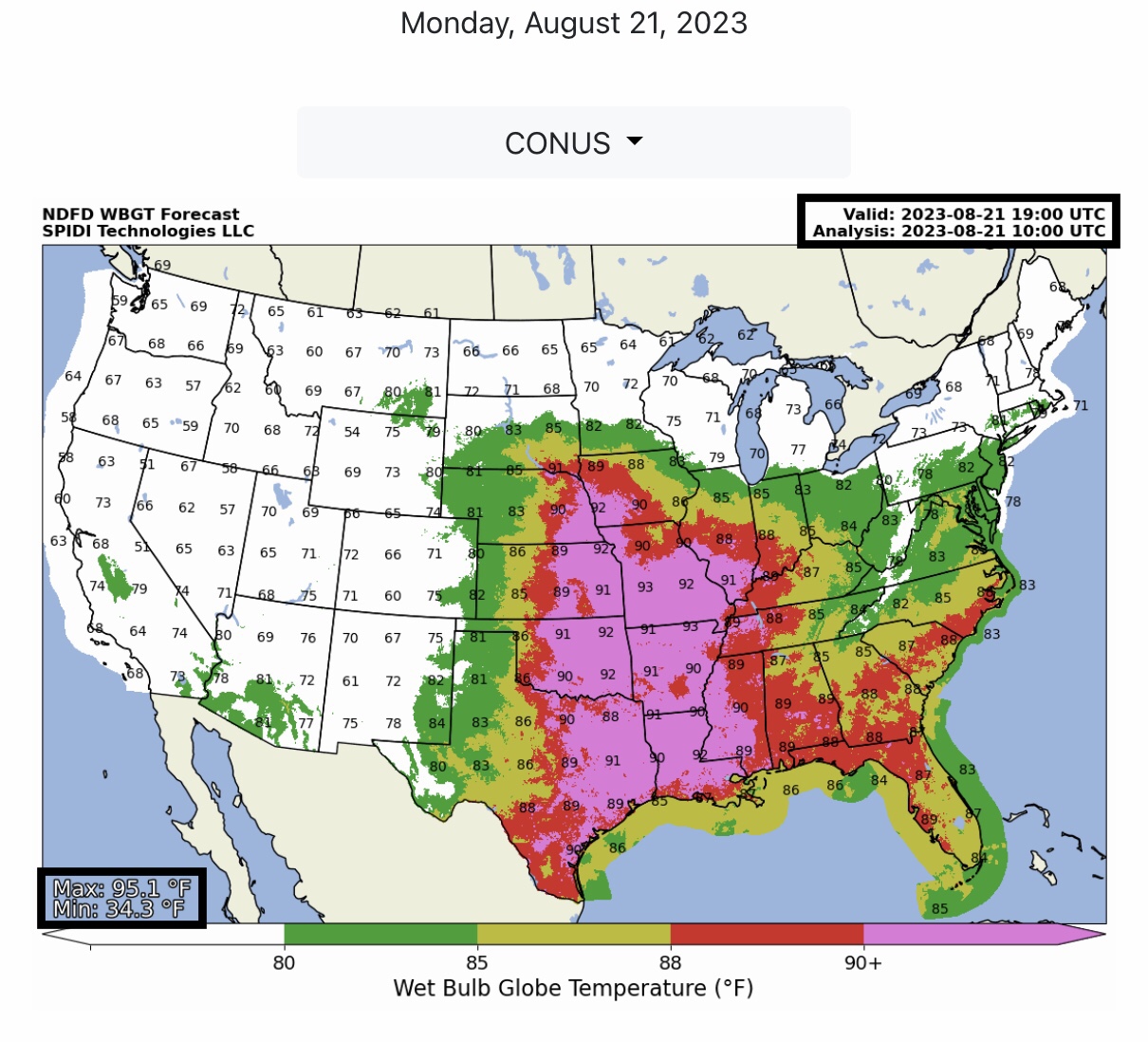
Current COD Mosaic Radar: heavy rainfall from now Tropical Depression Hilary causing flash flooding and flooding in parts CA, AZ, NV, UT, OR & ID. Parts of south TX could receive from 3” to 5” rain over next 3 to 5 days as Tropical System enters Gulf of Mexico & moves west. Red Flag Fire Warnings, Day 1, parts CA, WY, CO, NE, KS, OK, TX, LA & MS. Excessive Heat Watches, Excessive Heat Warnings and Heat Advisories continue for parts of the northern & southern Plains & Southeast Region.
Sidney Sperry 21 Aug 2023 11:40 UTC
FYI…
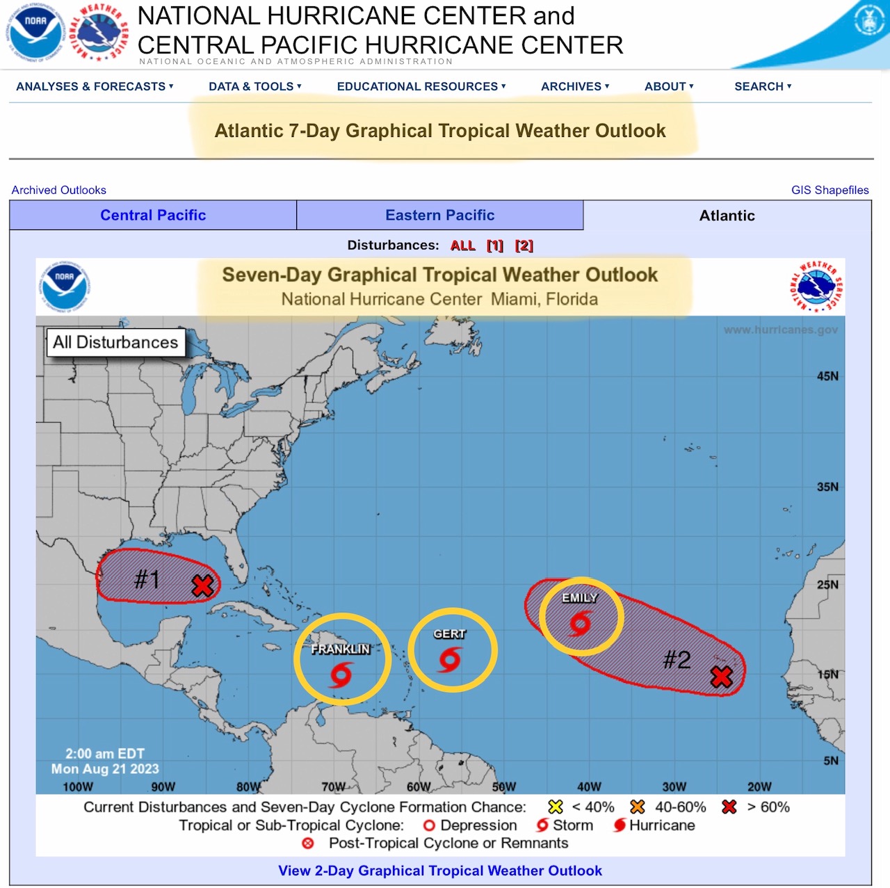
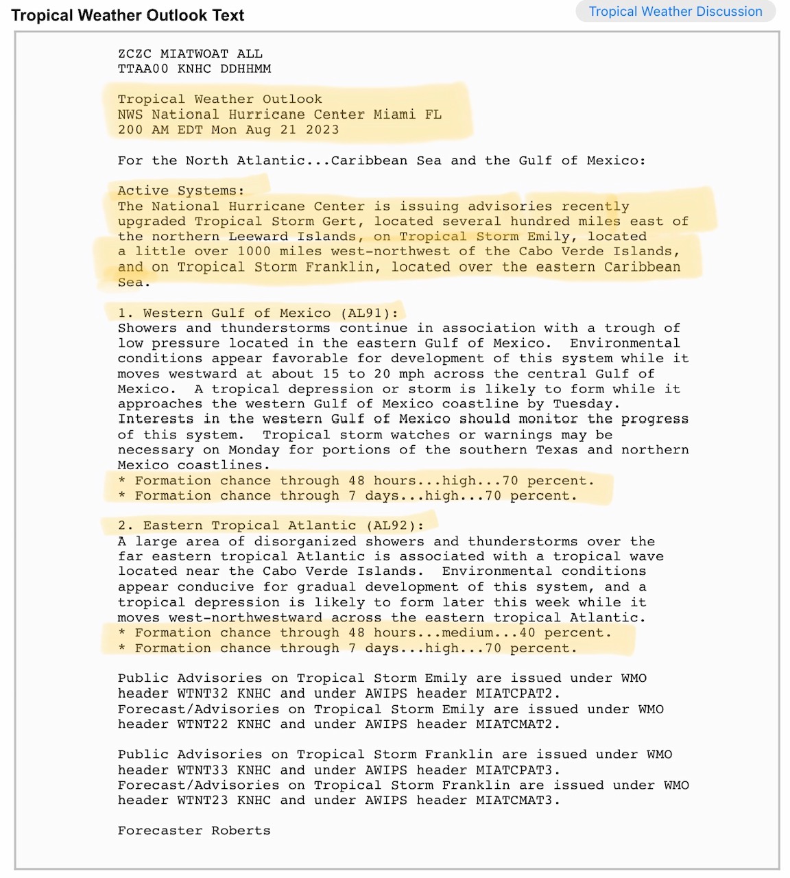
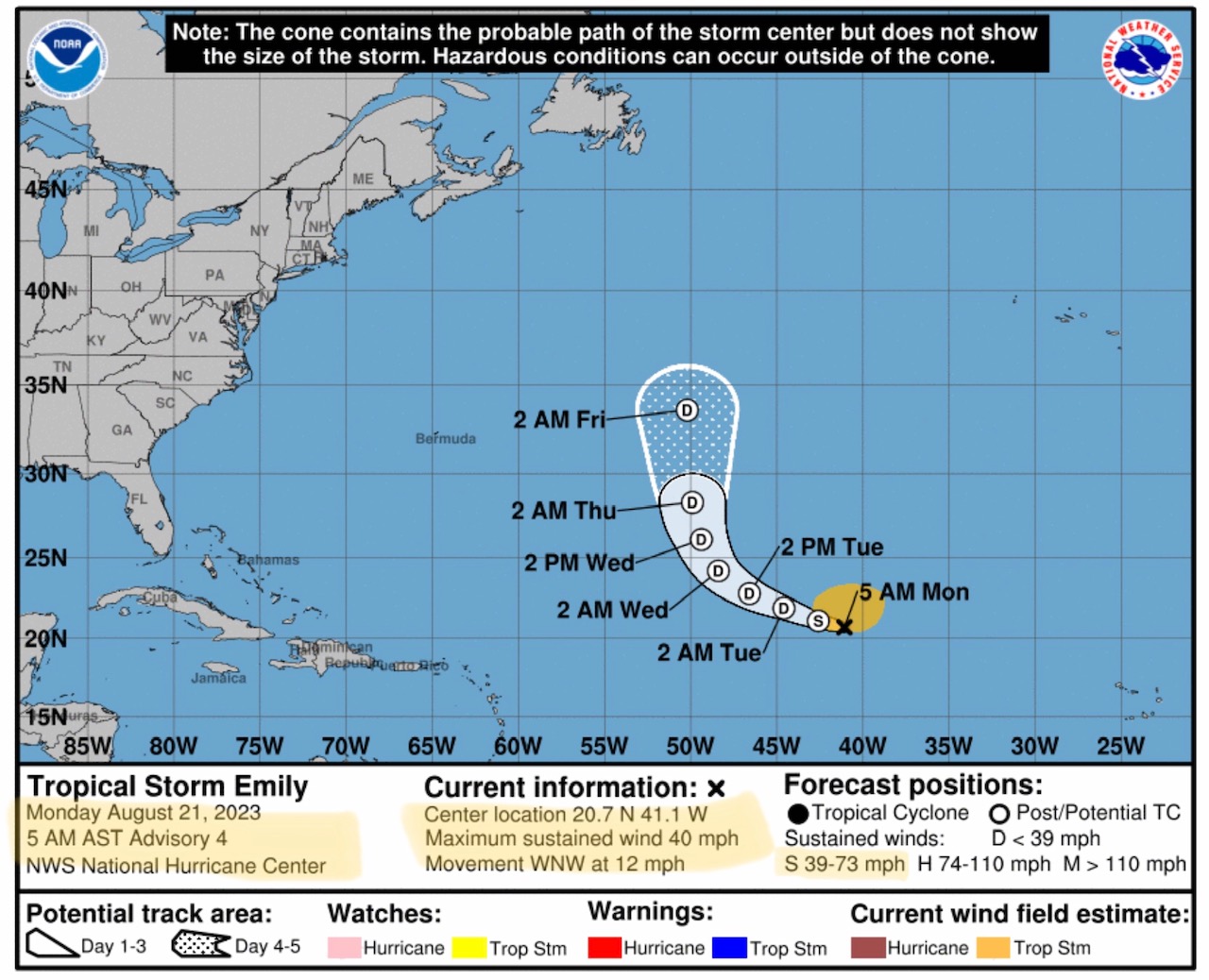
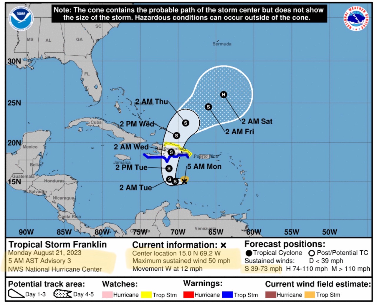
The Atlantic has come alive, with three, named Tropical Storms developing over the weekend: TS Emily, TS Franklin, and TS Gert. None of these are forecast to impact the Continental U.S. at this time. Two tropical systems are continuing to develop, one in the Gulf of Mexico which will impact parts of south Texas this week with some moderate to heavy rainfall; then a second system to watch is forming off the western coast of Africa. (The next 90 days are considered to be the “peak” period for Atlantic hurricanes.)
Sid Sperry
President & CEO
SPIDI Technologies, LLC
Website/Subscriptions: SPIDItech.com
Cell Phone: (405) 627-7754
Email(s): SidSperry@gmail.com  OR  Sid.Sperry@spidiweather.com

Sent from my iPad

 Show/hide attachments