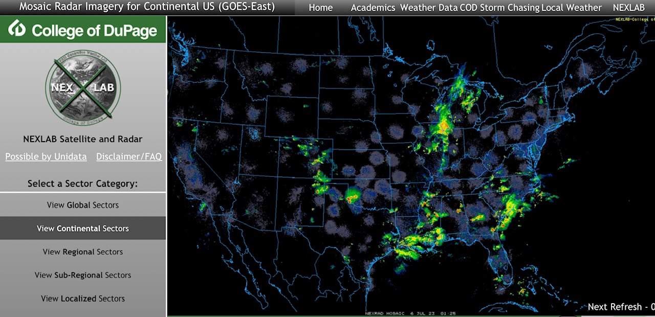
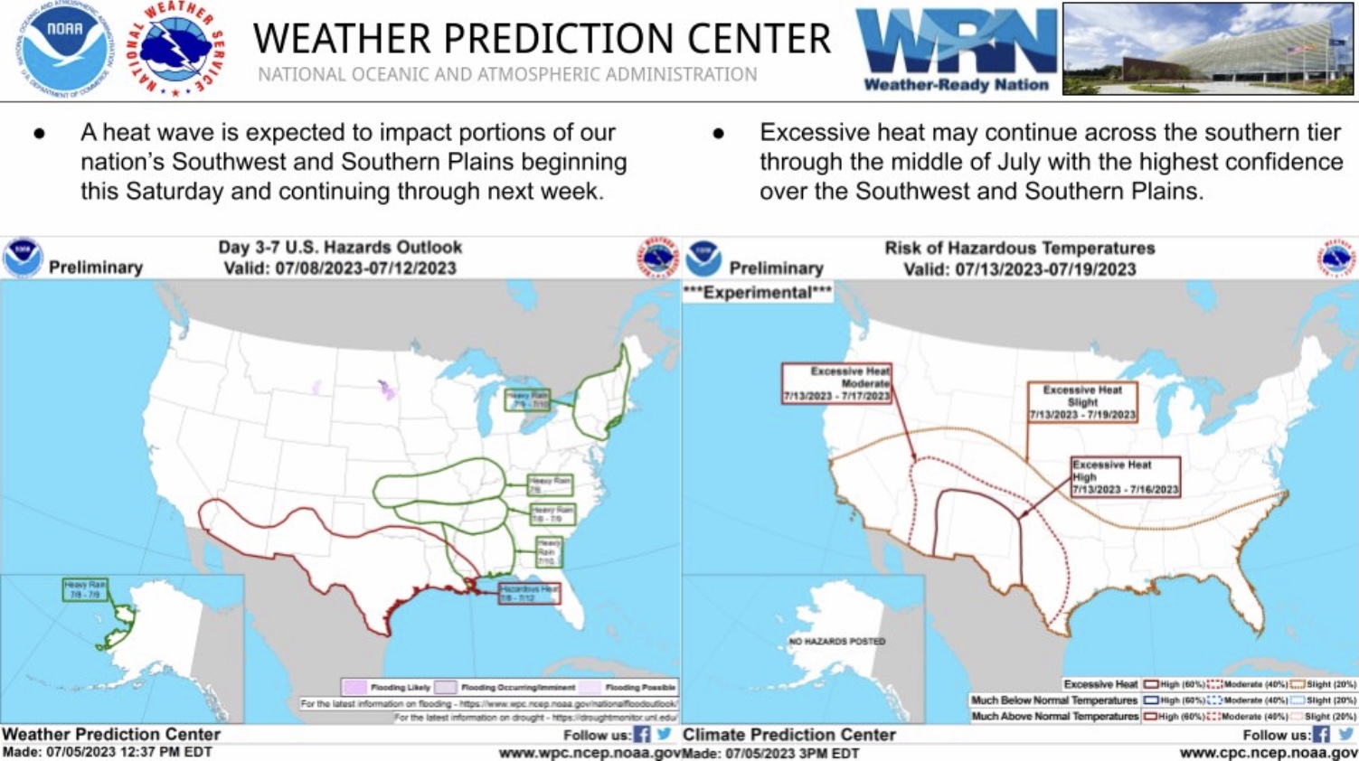
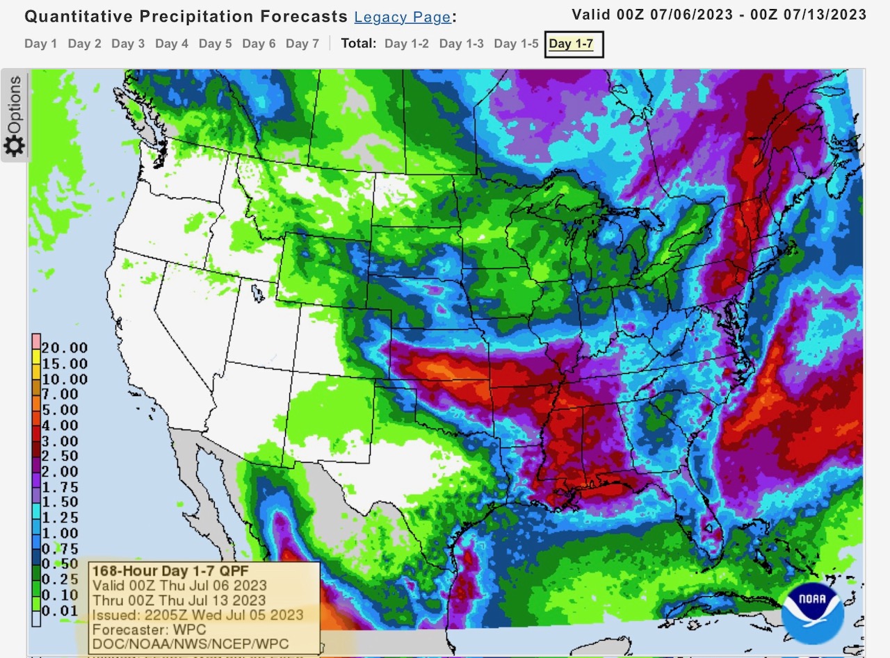
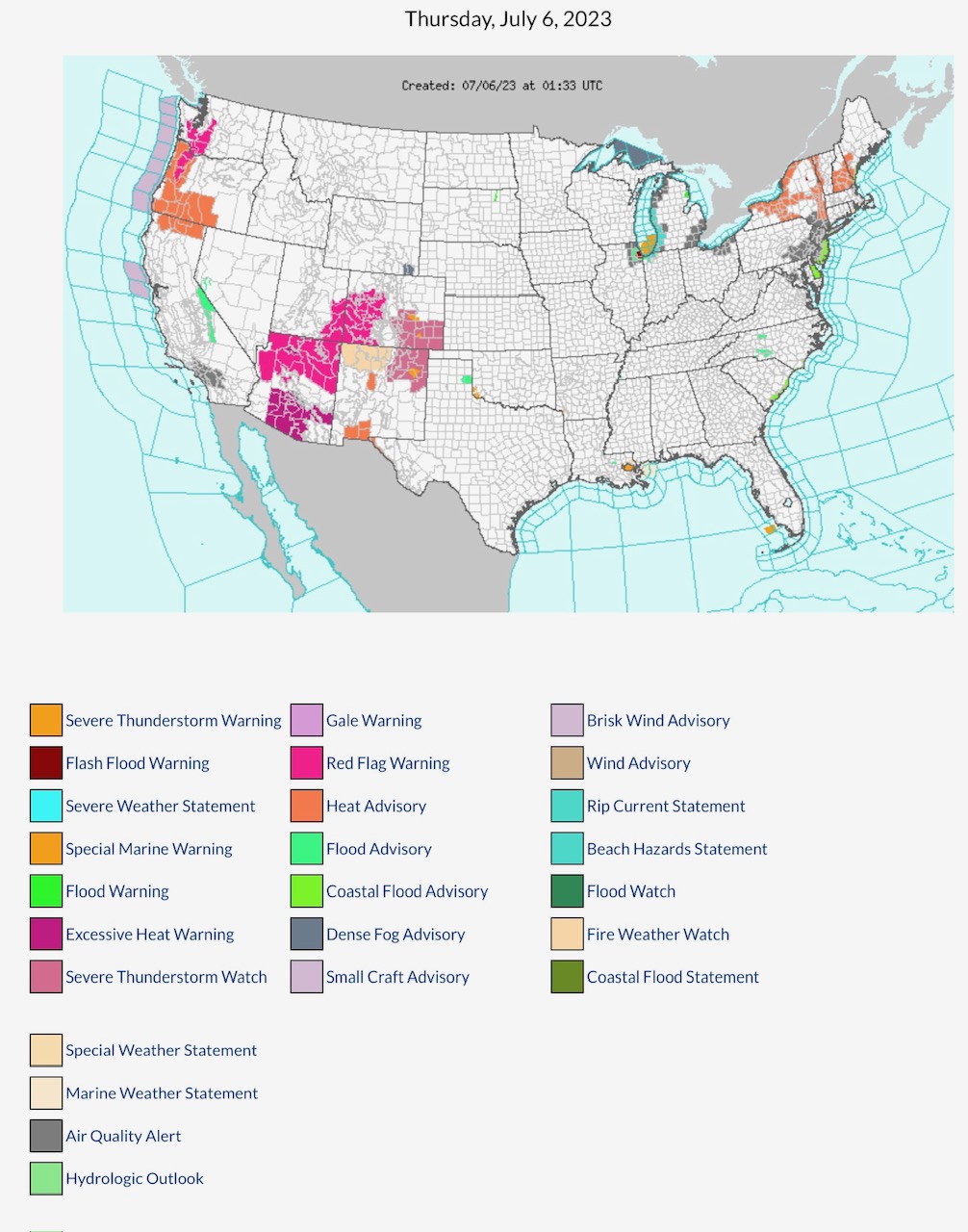
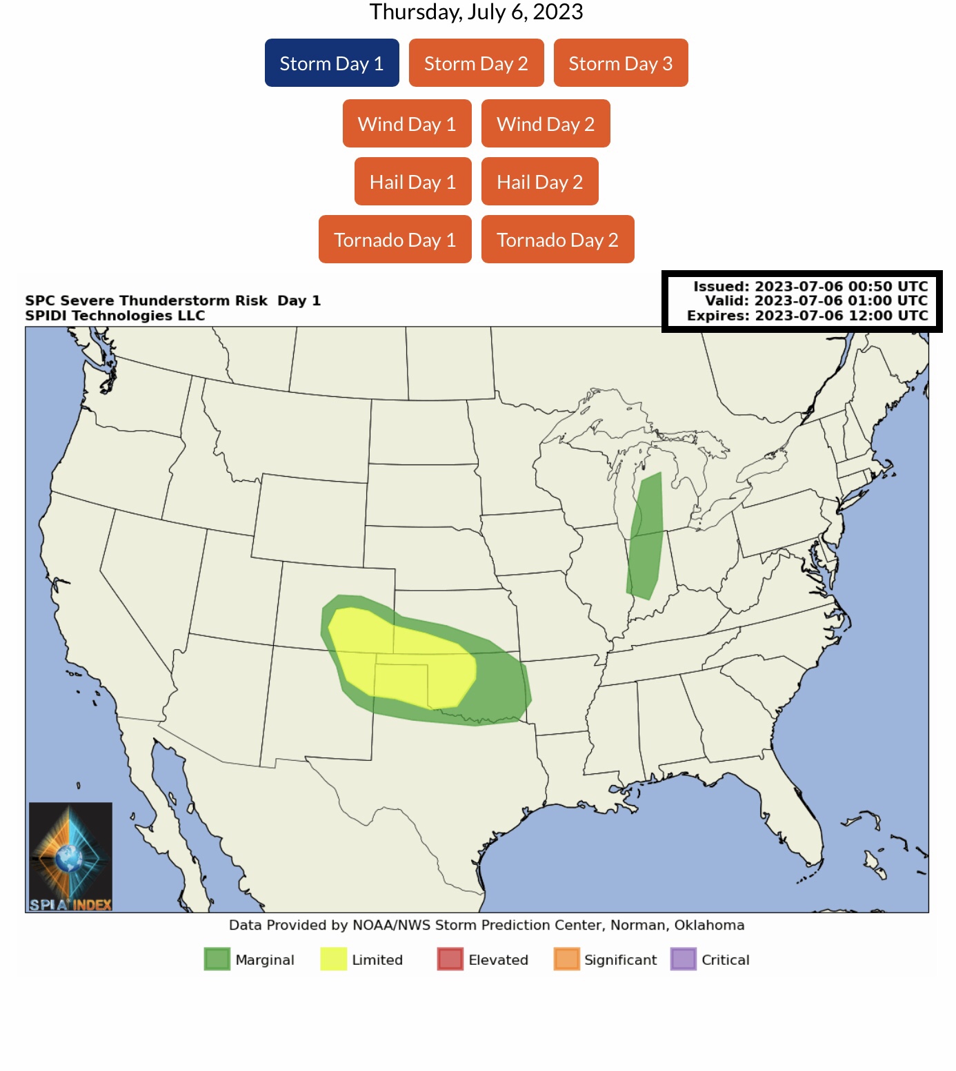
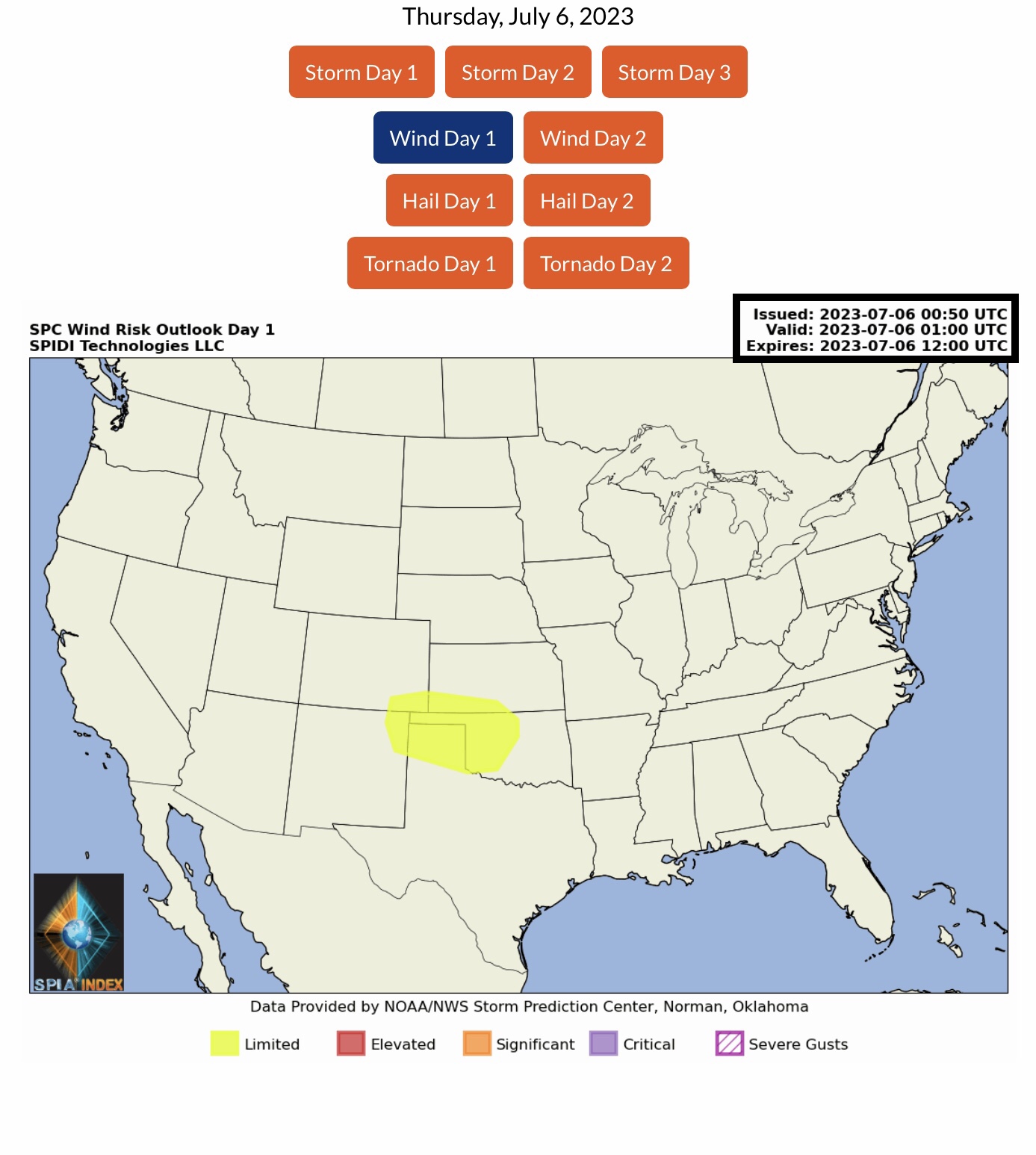
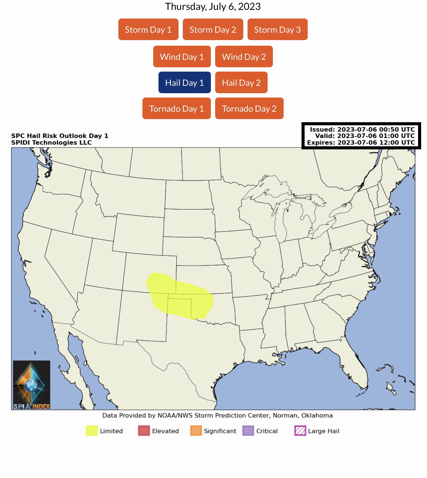
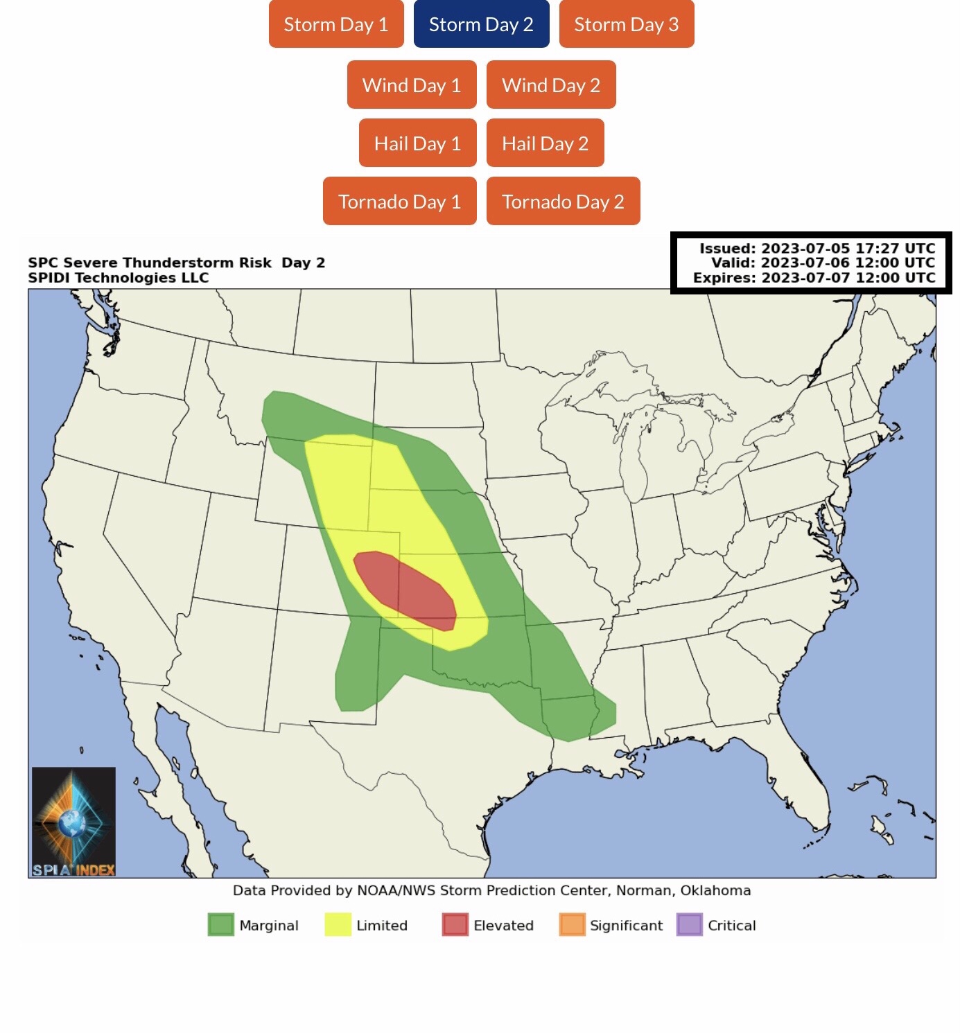
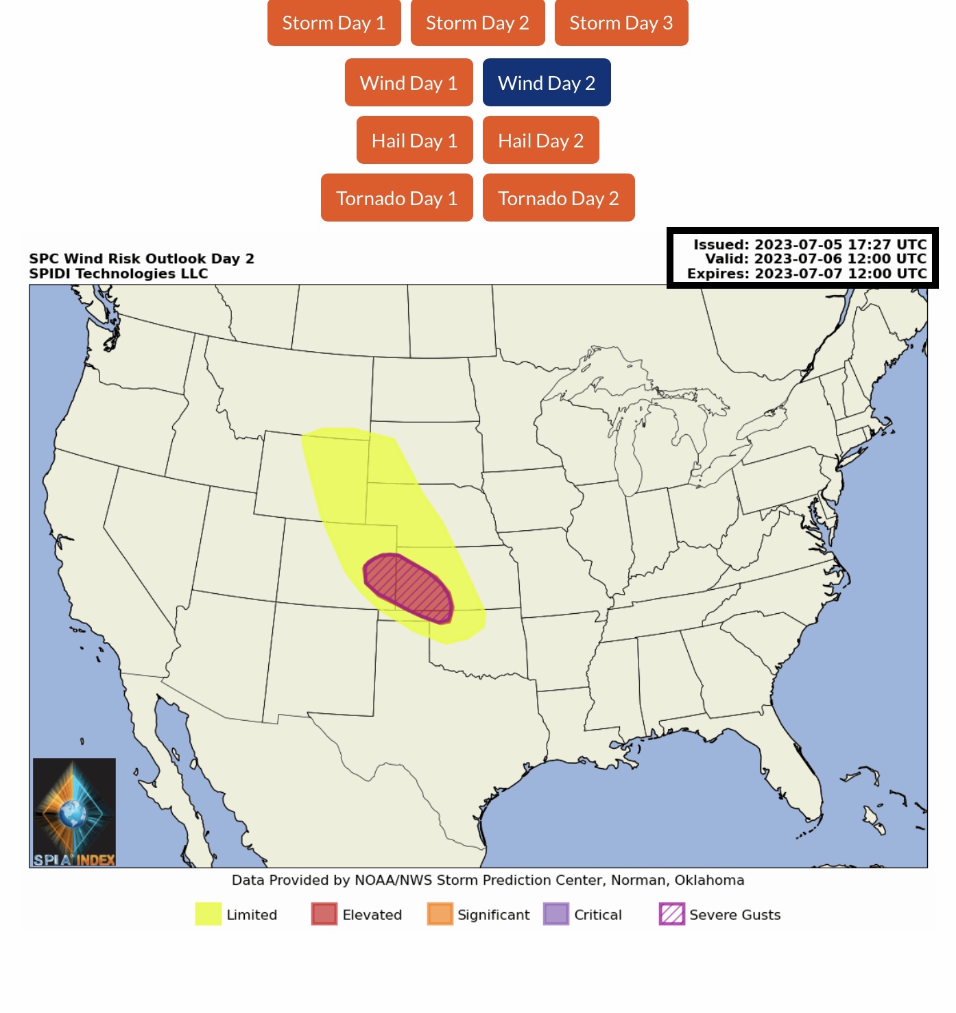
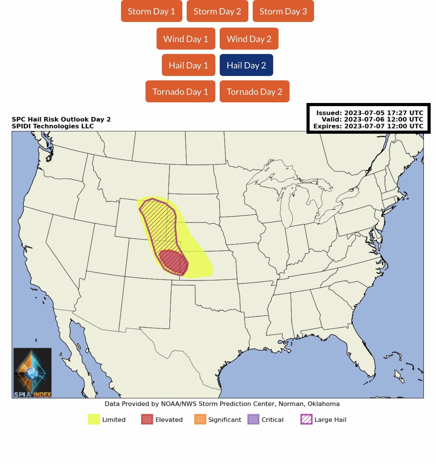
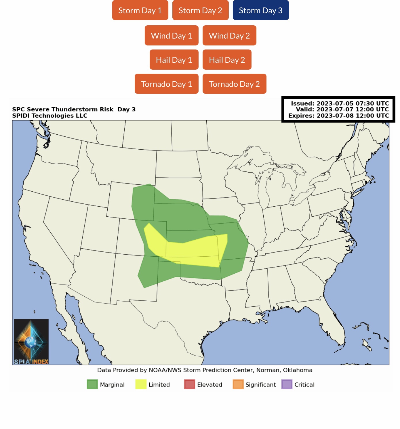
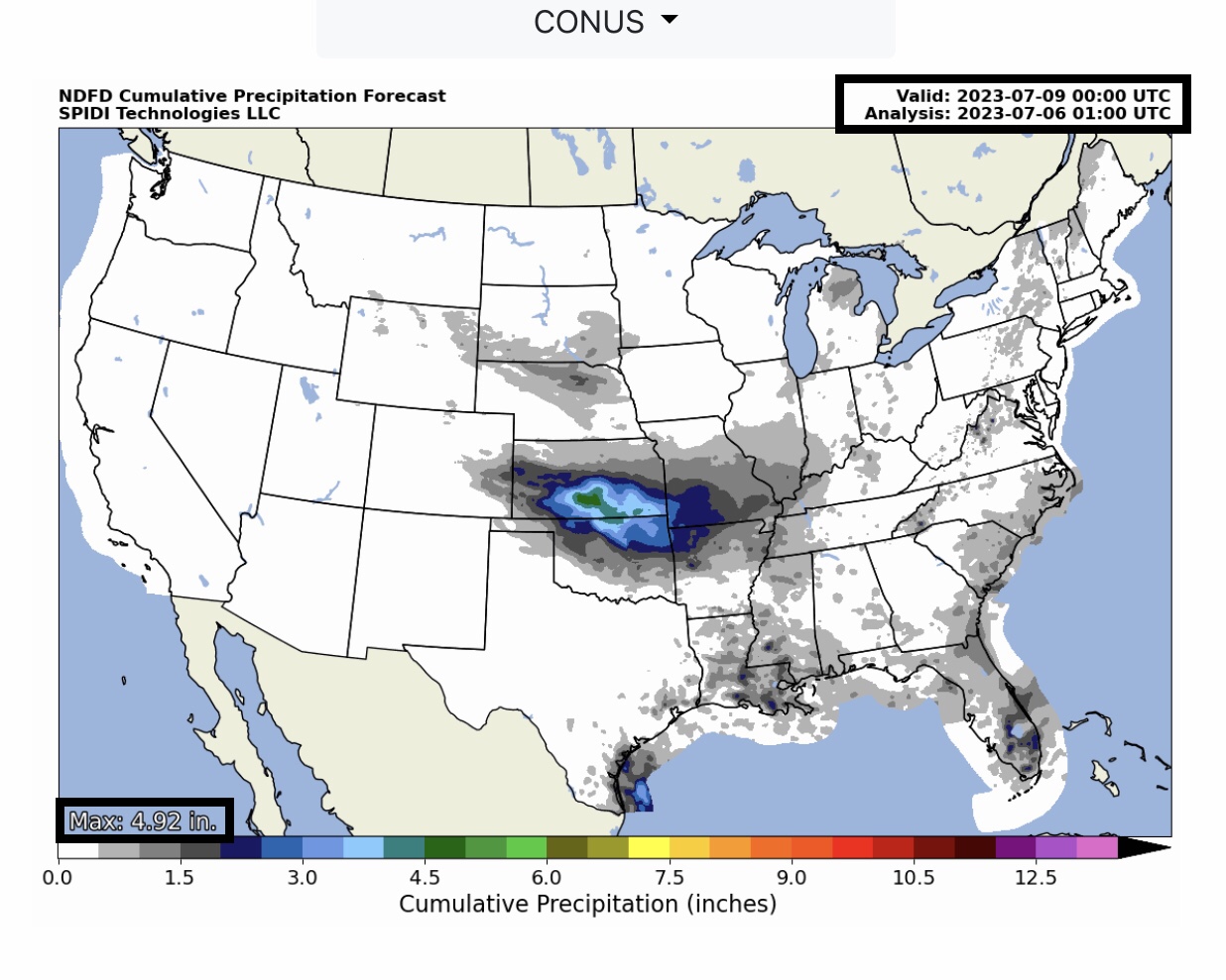
Current COD Mosaic Radar (8:30pm CDT 7/5/2023). Excessive Heat Update from NOAA’s Weather Prediction Center (WPC). WPC Quantitative Precipitation Forecast, next 7 days. Current NWS Watches, Warnings & Advisories. ELEVATED Severe Thunderstorm Risk, Day 2 (Thursday morning to Friday morning), parts CO, KS & OK. Includes ELEVATED High Wind & Severe Gusts Risk, and LIMITED to ELEVATED Hail & Large Hail Risk, extending into MT, WY, SD, NE, CO & KS.
Sidney Sperry 06 Jul 2023 02:08 UTC
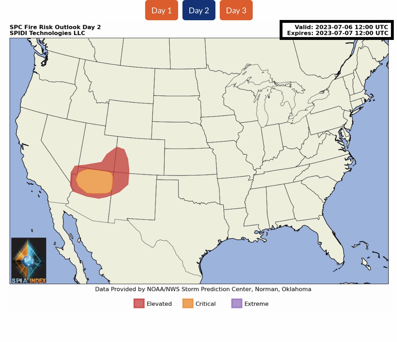
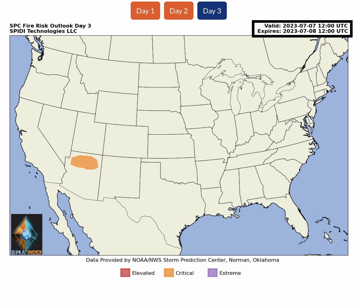
FYI… next 24 to 72-hour forecasts from NWS and the Storm Prediction Center (SPC).
Sid Sperry
President & CEO
SPIDI Technologies, LLC
Website/Subscriptions: SPIDItech.com
Cell Phone: (405) 627-7754
Email(s): SidSperry@gmail.com  OR  Sid.Sperry@spidiweather.com

Sent from my iPad

 Show/hide attachments