Good Thursday morning to everyone.
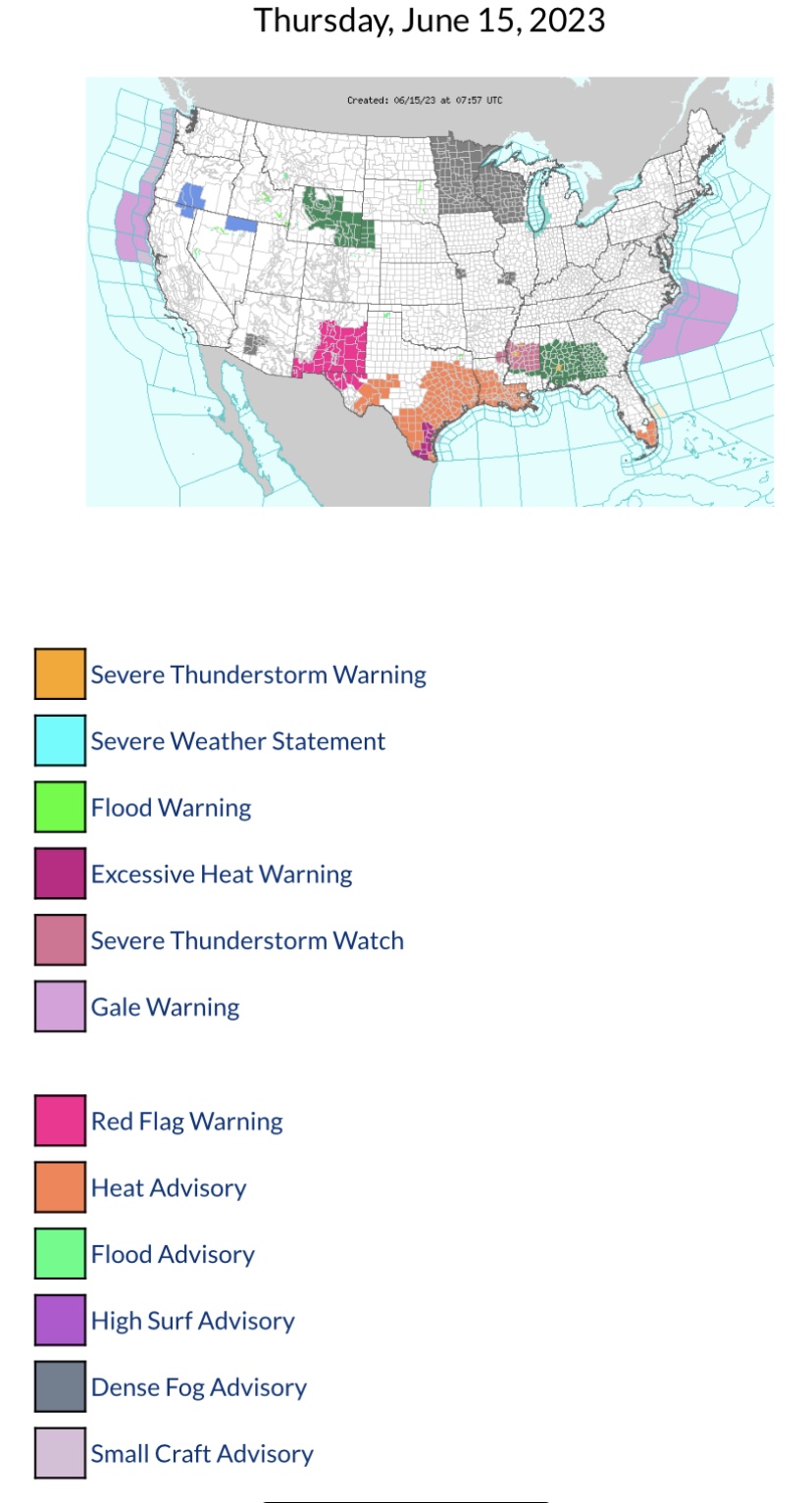
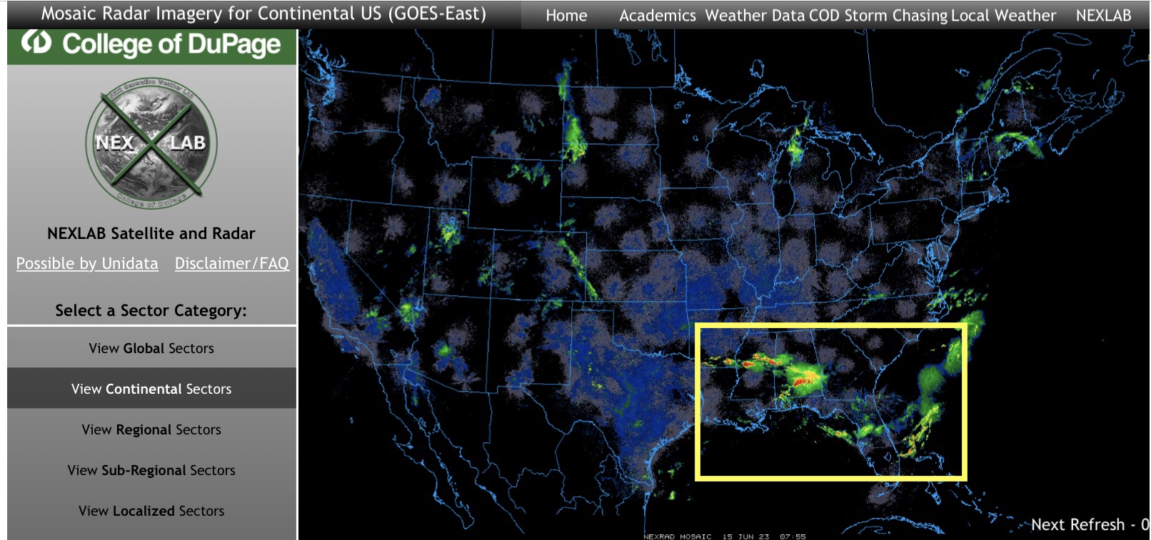
Severe Thunderstorms are ongoing in parts of AR, LA, MS, AL, GA & FL this morning. Several tornadoes have been reported in parts of the Southeast Region. These storms will likely continue through at least 8am EDT.
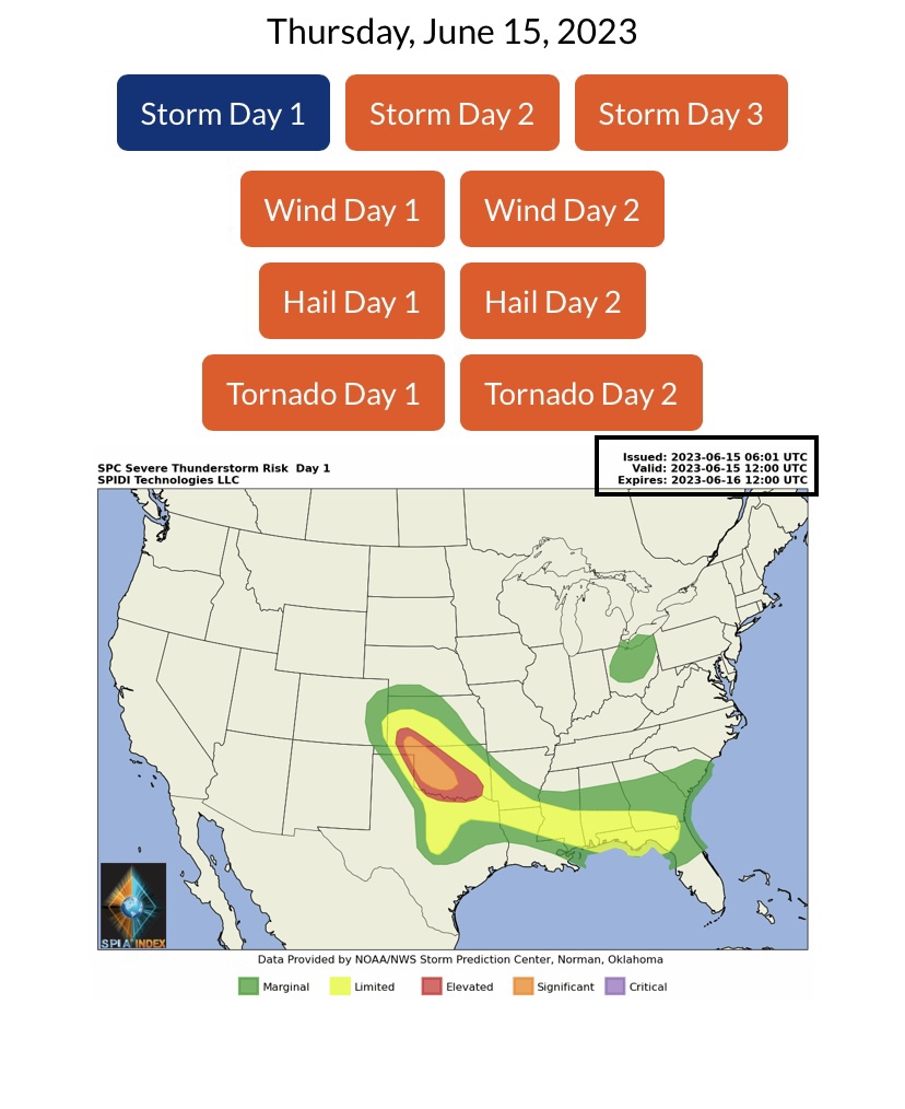
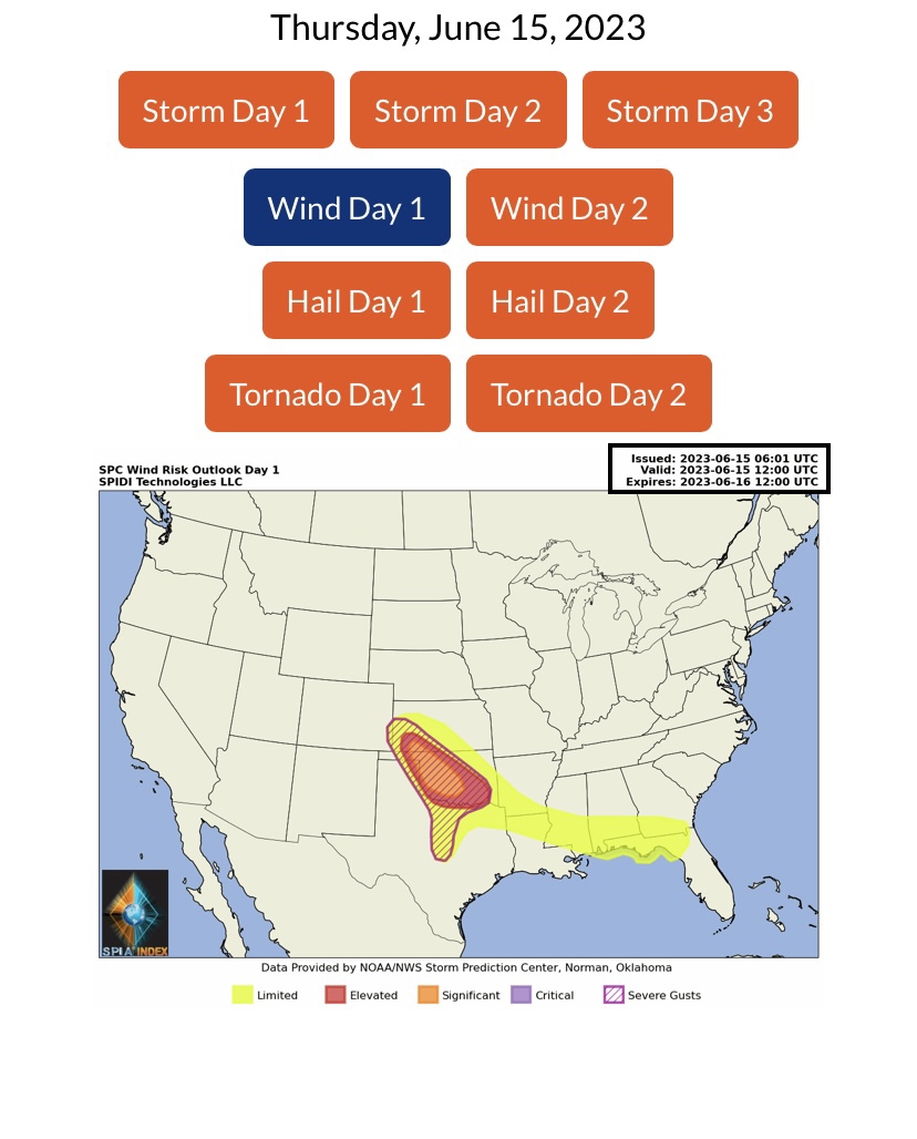
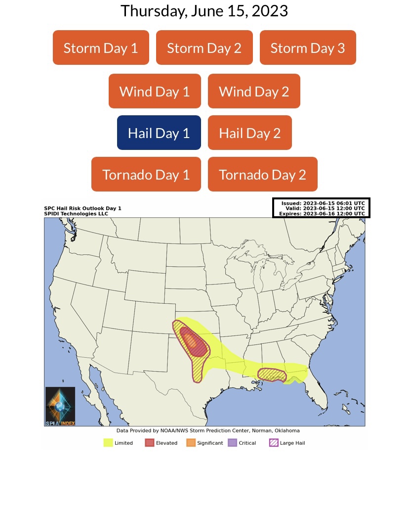
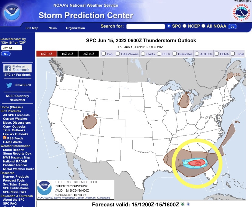
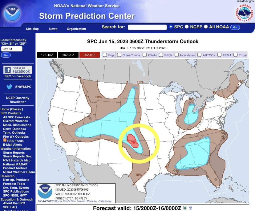
The next round of Severe Thunderstorms begins later this afternoon in parts southern KS, western OK and the OK & TX panhandles. Biggest concerns and threats:
High Winds and Severe Wind Gusts - from 60 to 85 mph; Hail and Large Hail, from Golf ball size to Baseball size; and the possibility of Tornadoes, with some Large Tornadoes possible during the late afternoon and evening hours across much of western and central Oklahoma.
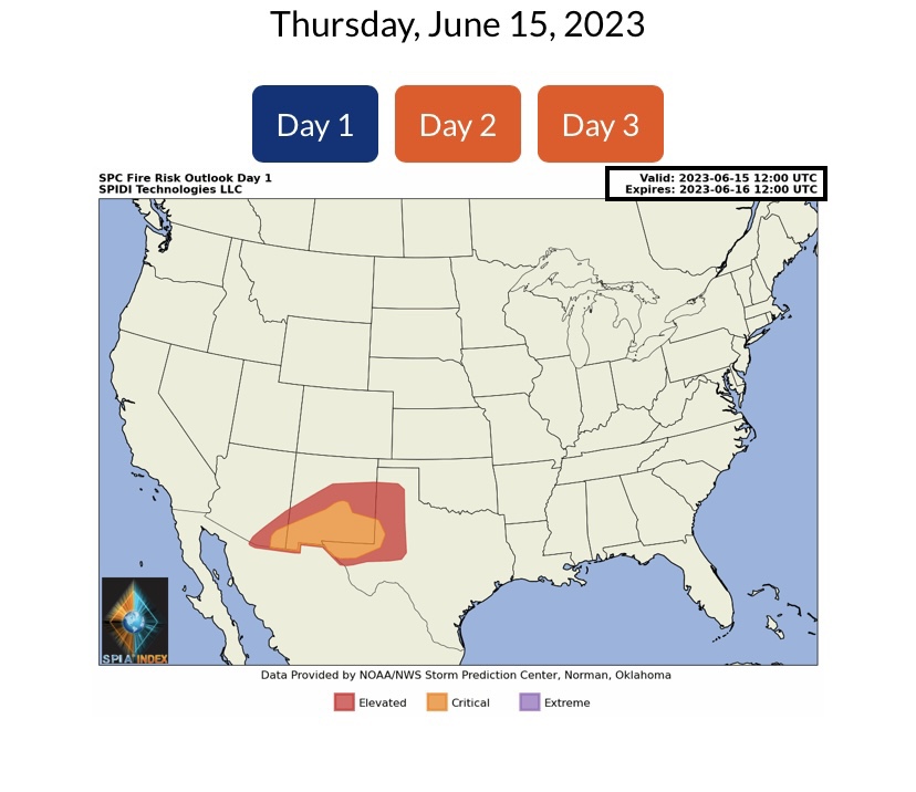
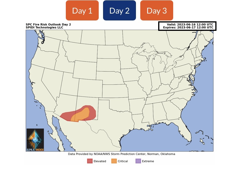
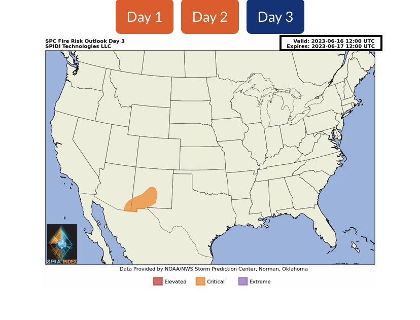
There is an ELEVATED to CRITICAL Risk of Wildfires in parts AZ, NM & Southwest TX. Red Flag Fire Warnings have been issued for most of NM, and for parts of southwest TX.
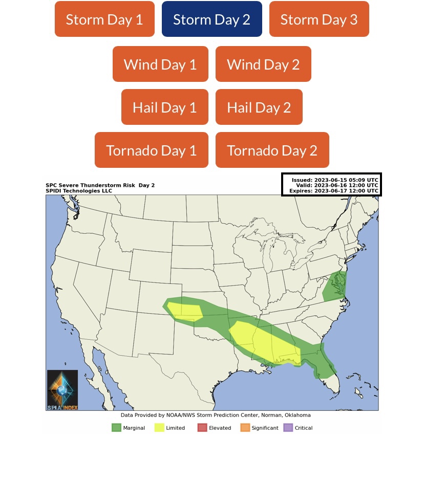
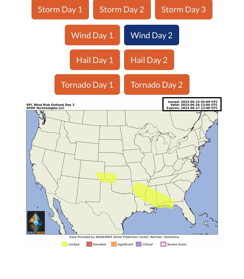
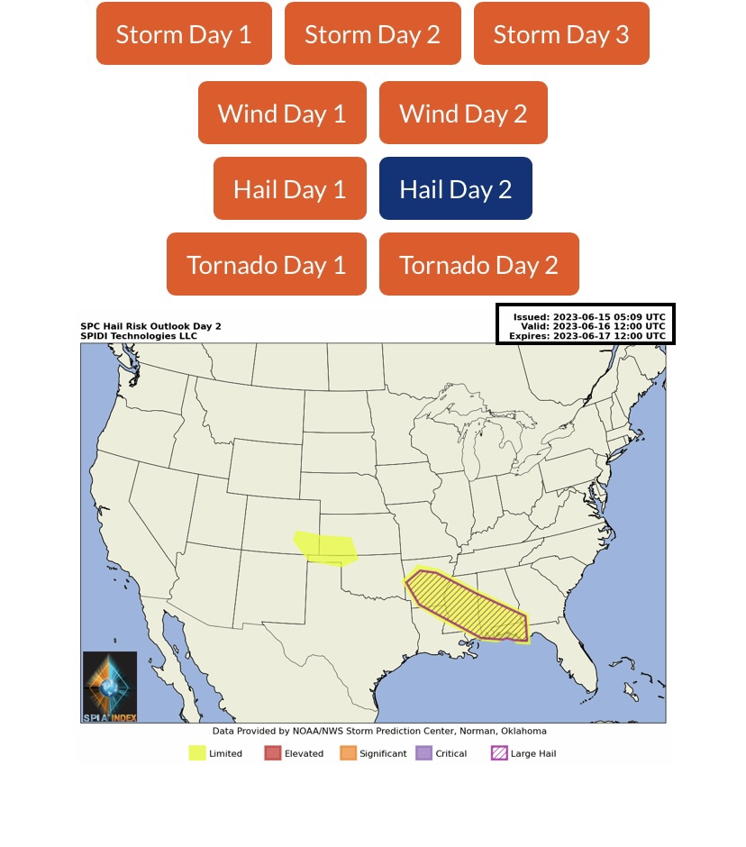
LIMITED Severe Thunderstorm Risks on Friday and Saturday across parts CO, KS, OK, TX and parts AR, LA, MS, AL & FL. This includes a LIMITED Risk for High Winds and Hail/Large Hail.
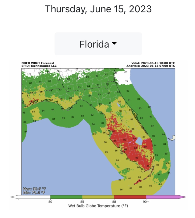
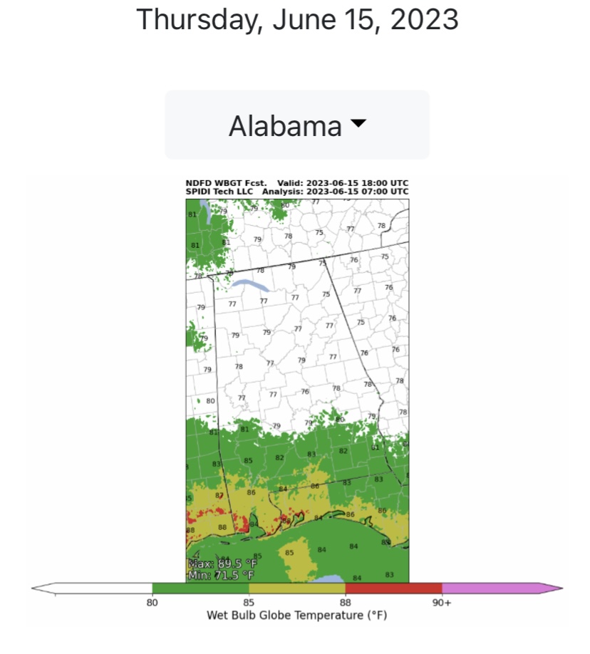
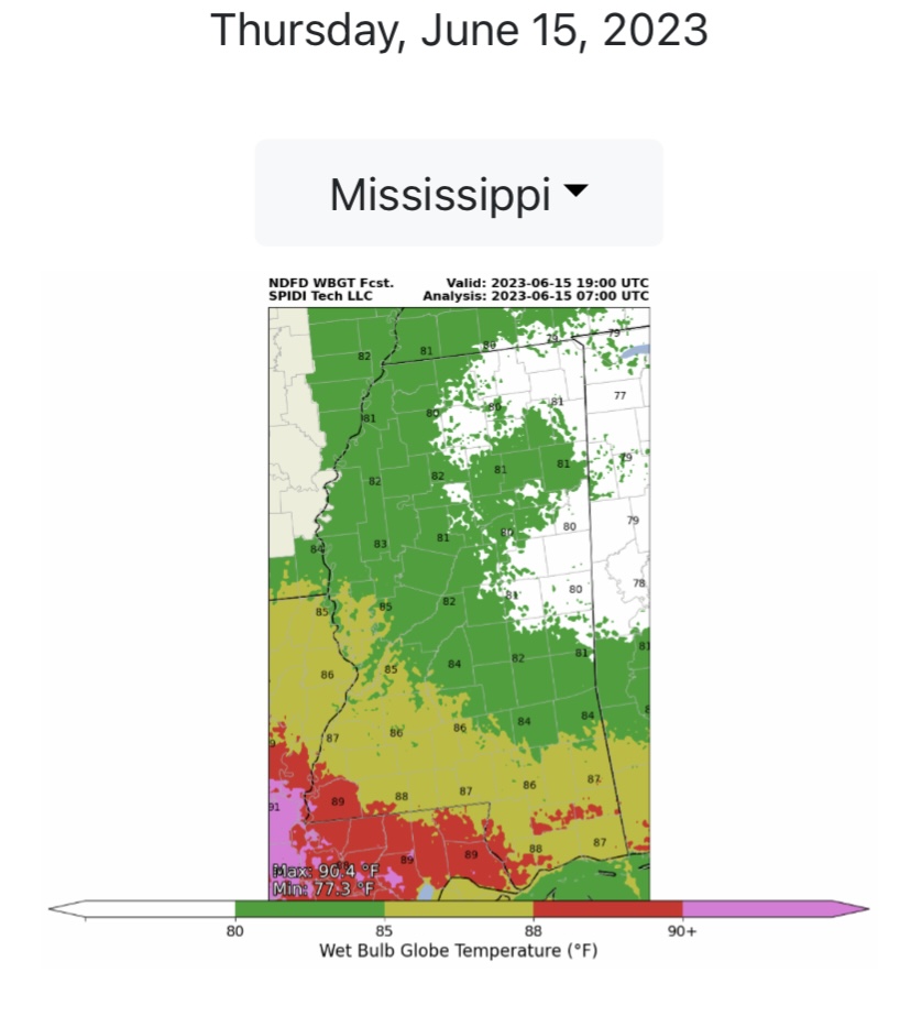
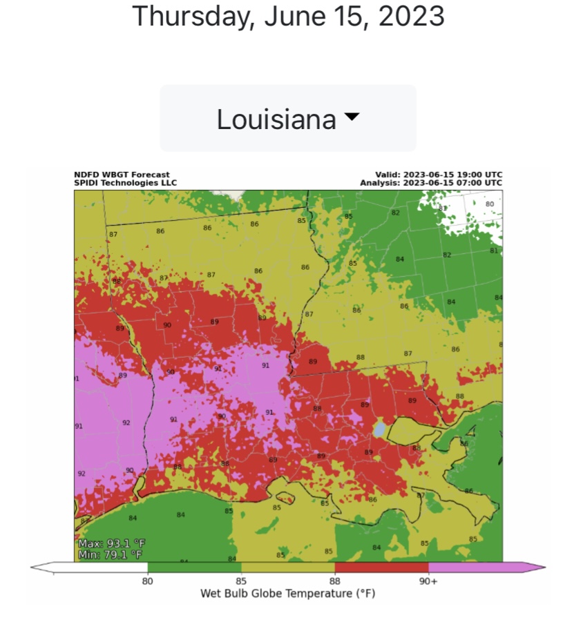
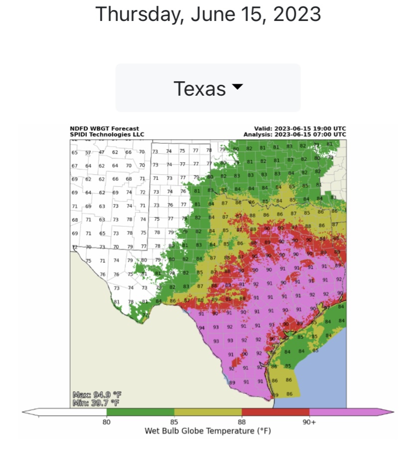
Wet Bulb Globe Temperatures (WBGT) will be in the HIGH to EXTREMELY HIGH range in parts FL, AL, MS, LA and TX by mid afternoon today. Extra heat precautions should be taken today by those who work outdoors in direct sunlight.
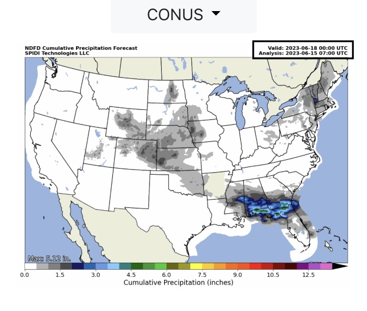
From 3” up to 5”+ Rainfall is forecast across parts of MS, AL, FL and GA over the next 72-hours. Some flooding and flash flooding is expected across parts of these states.

 Show/hide attachments