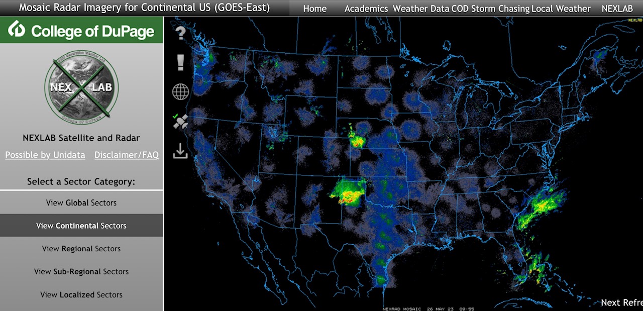
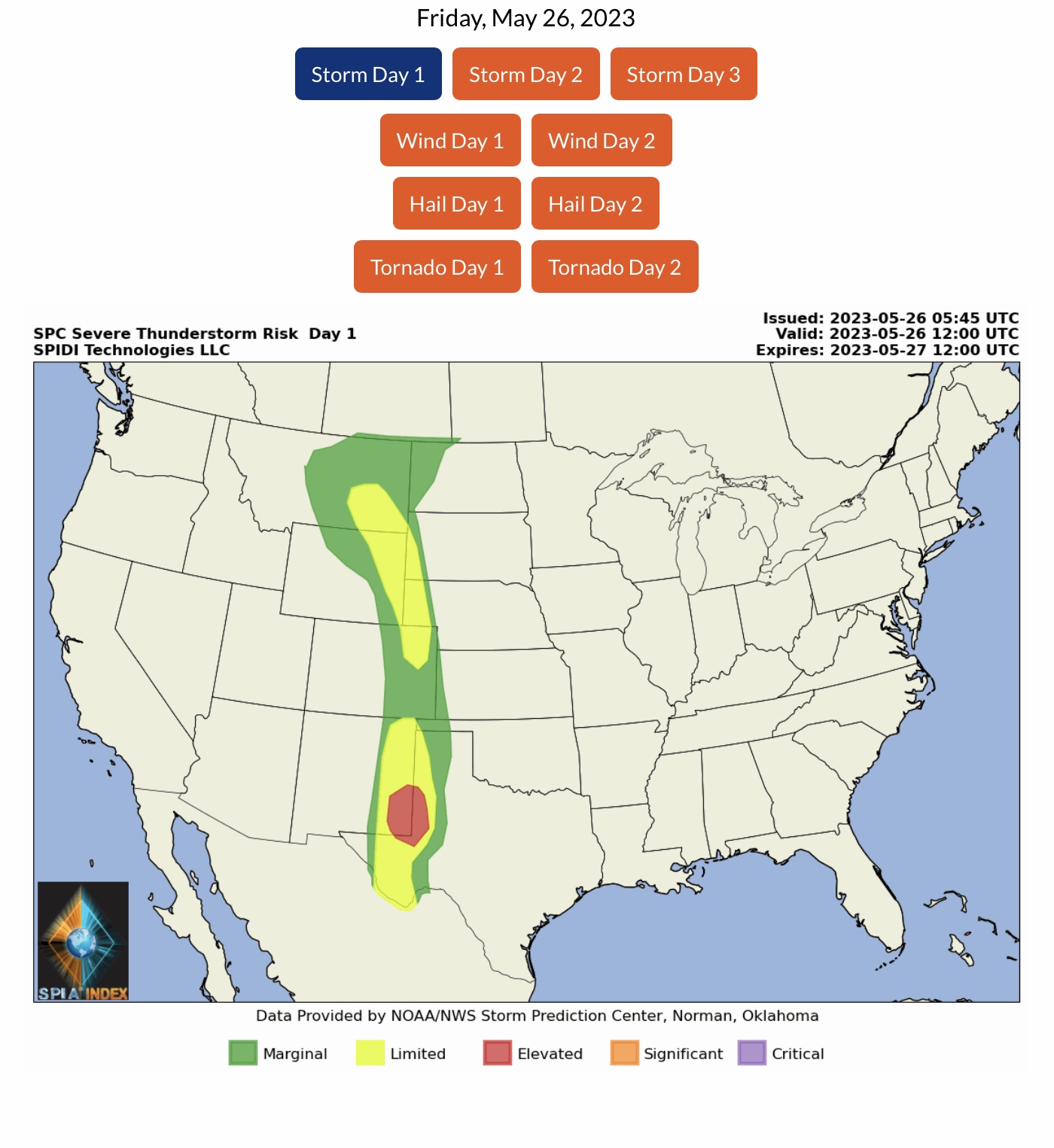
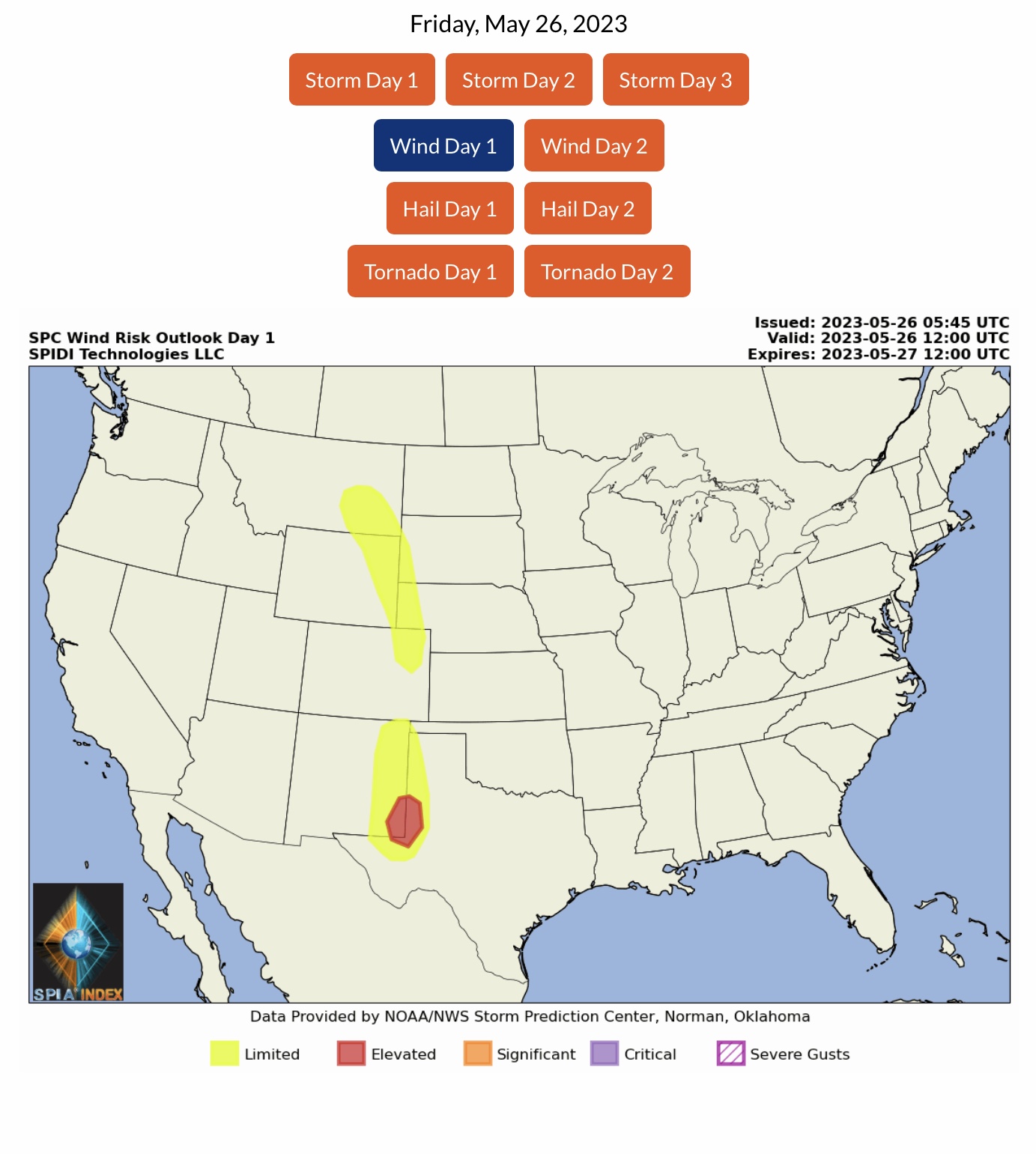
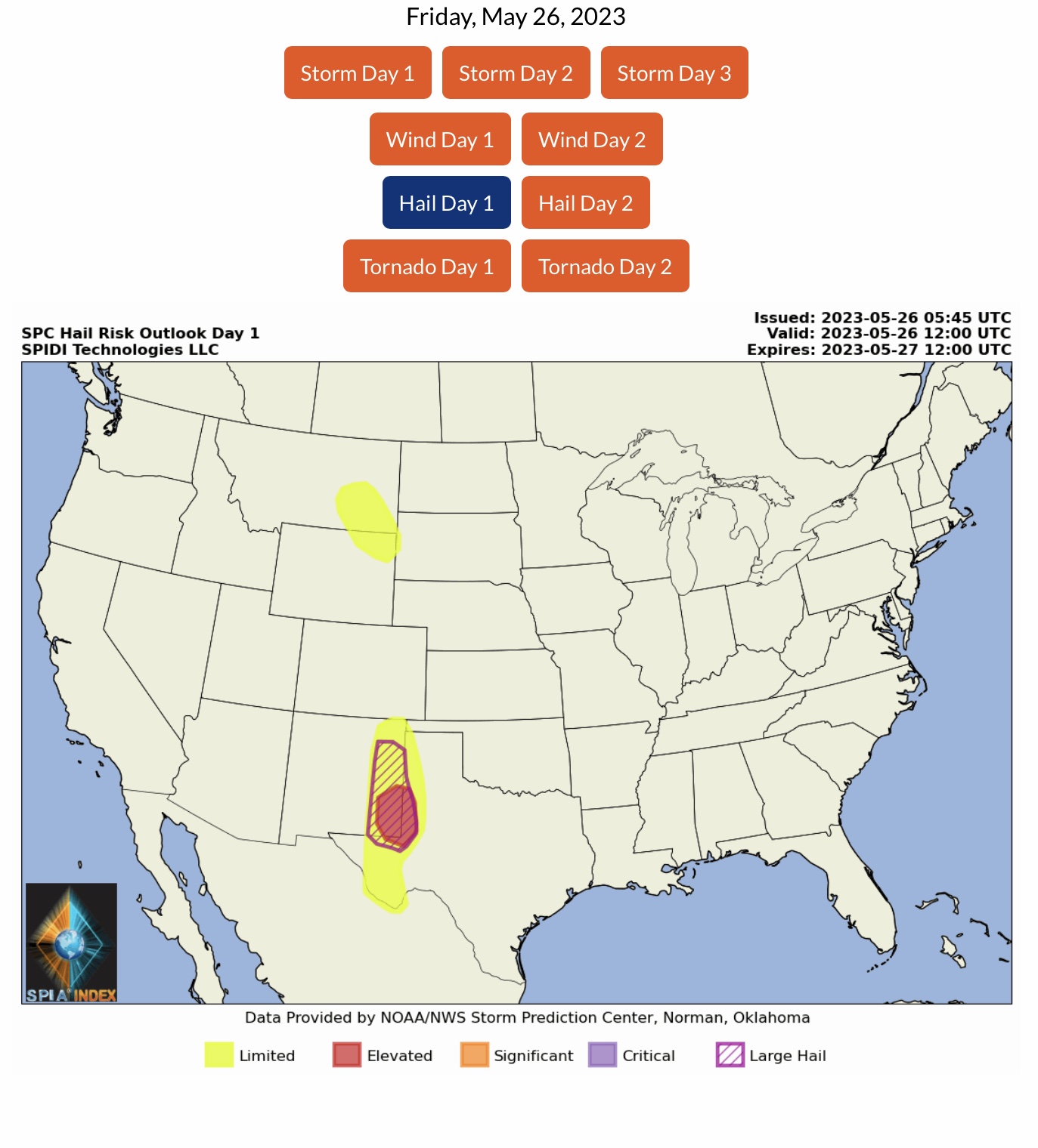
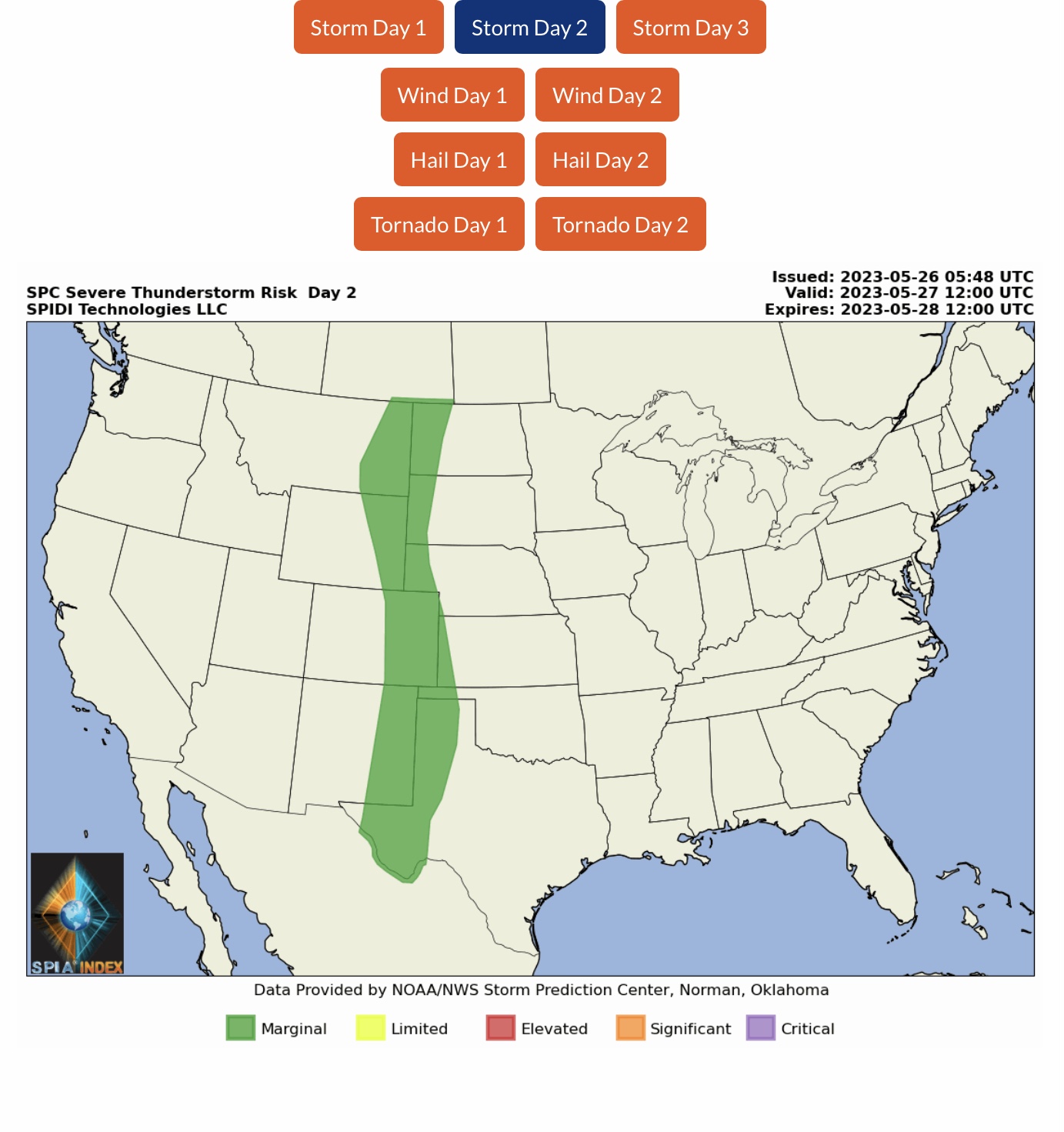
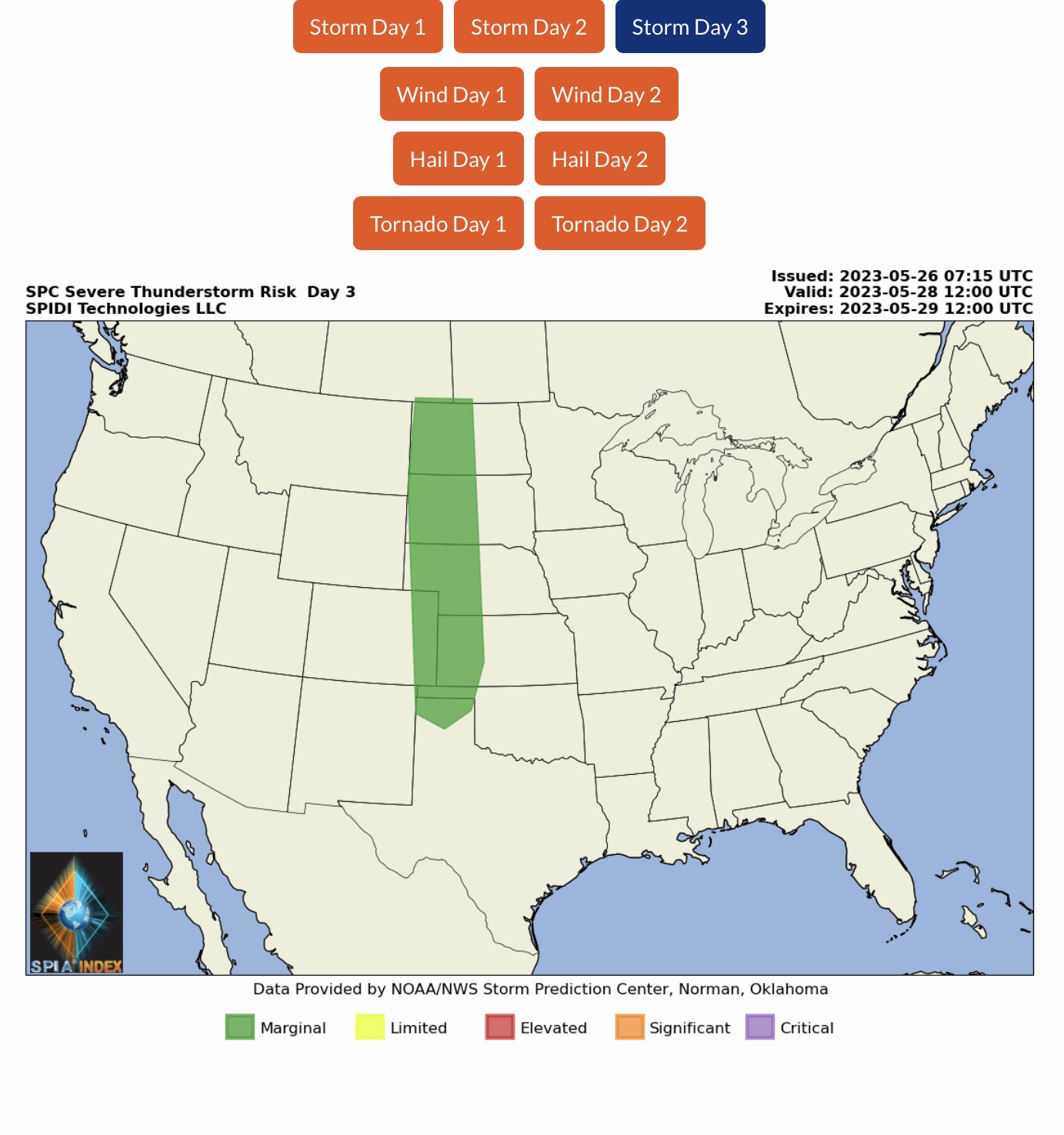
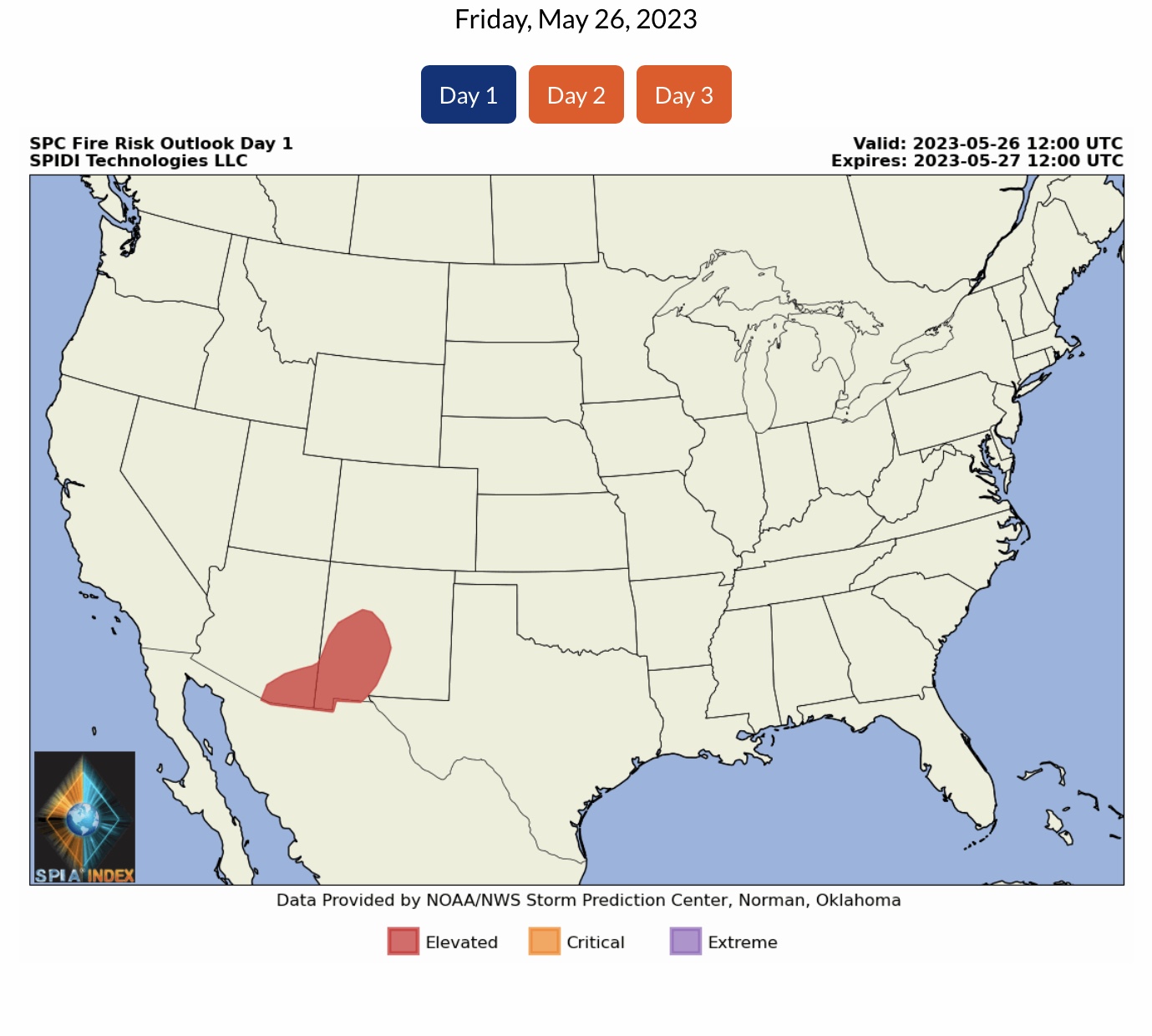
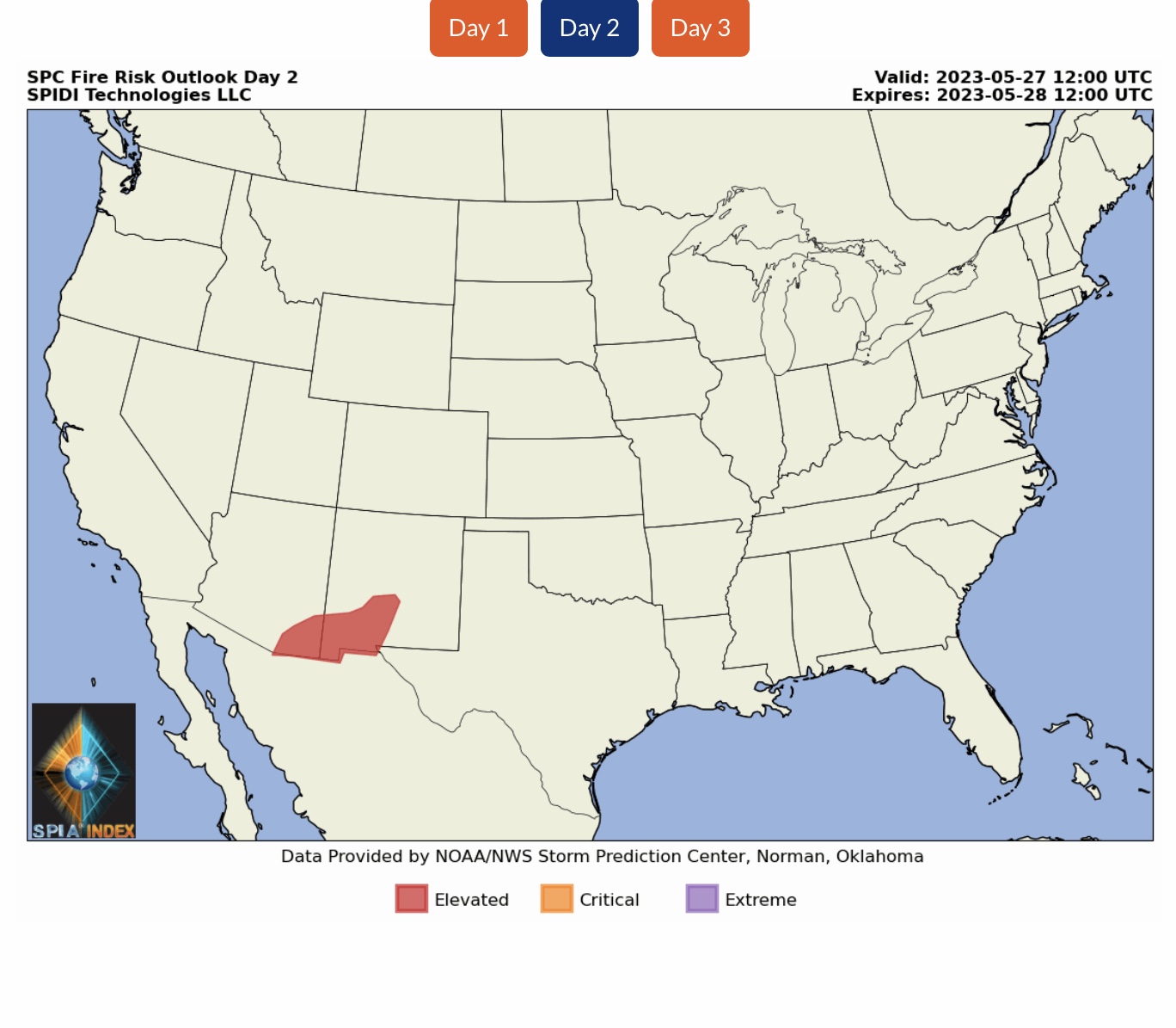
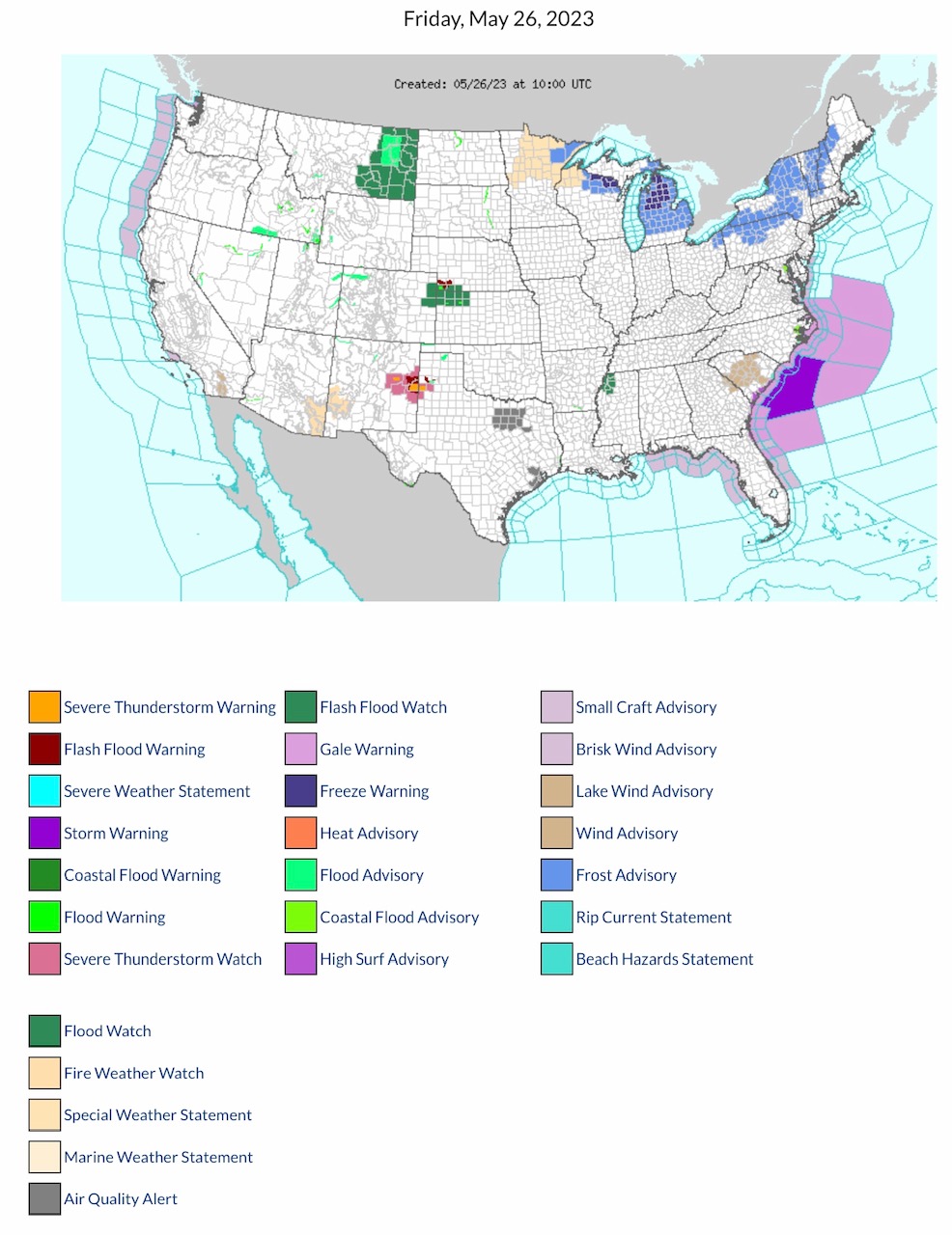
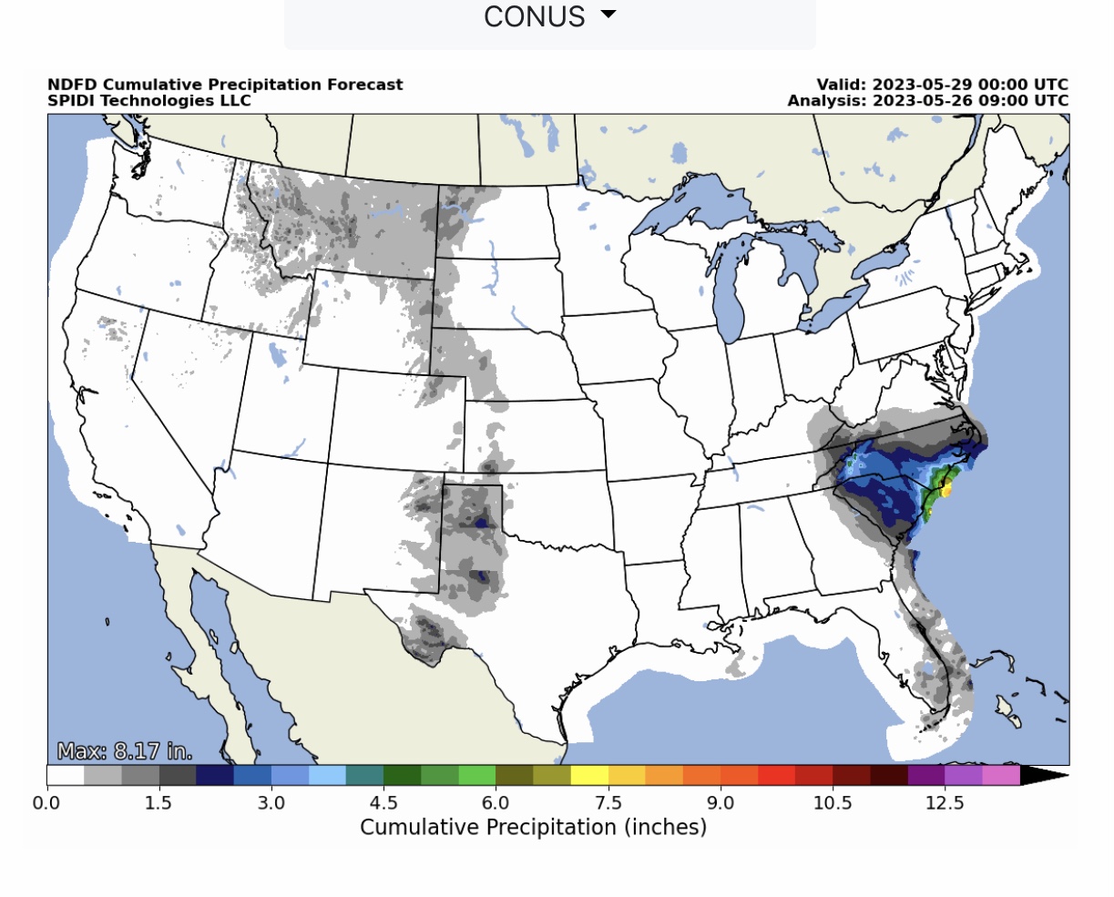
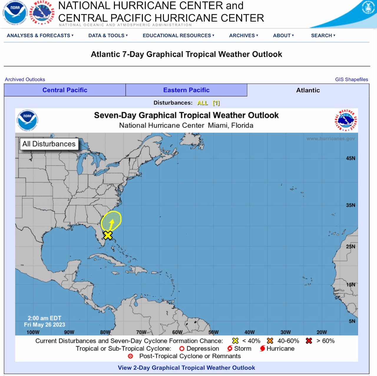
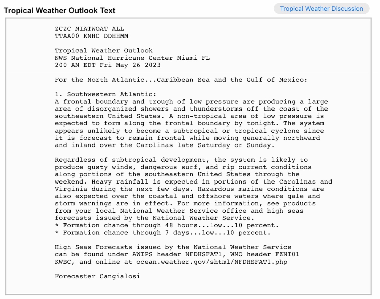
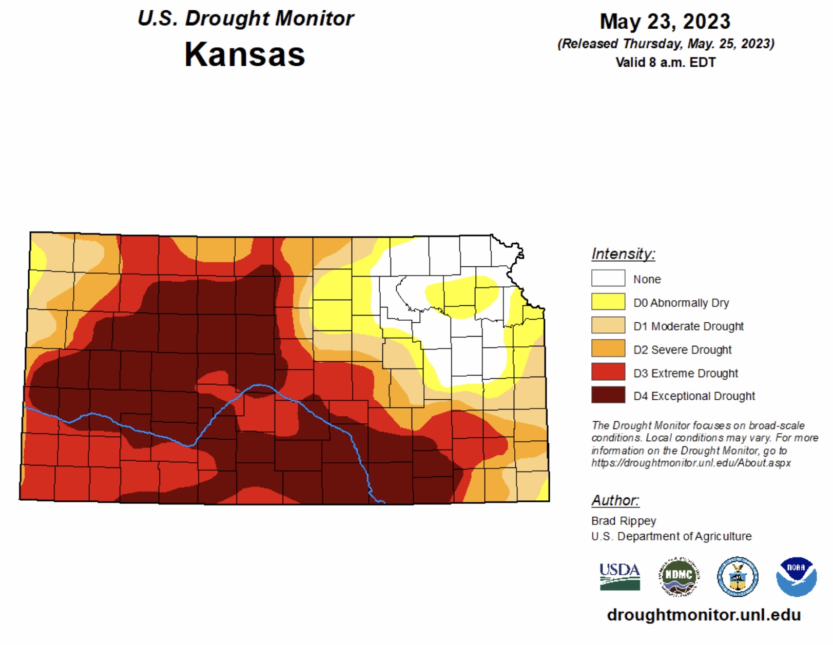
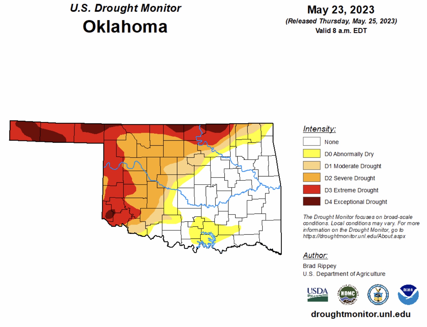
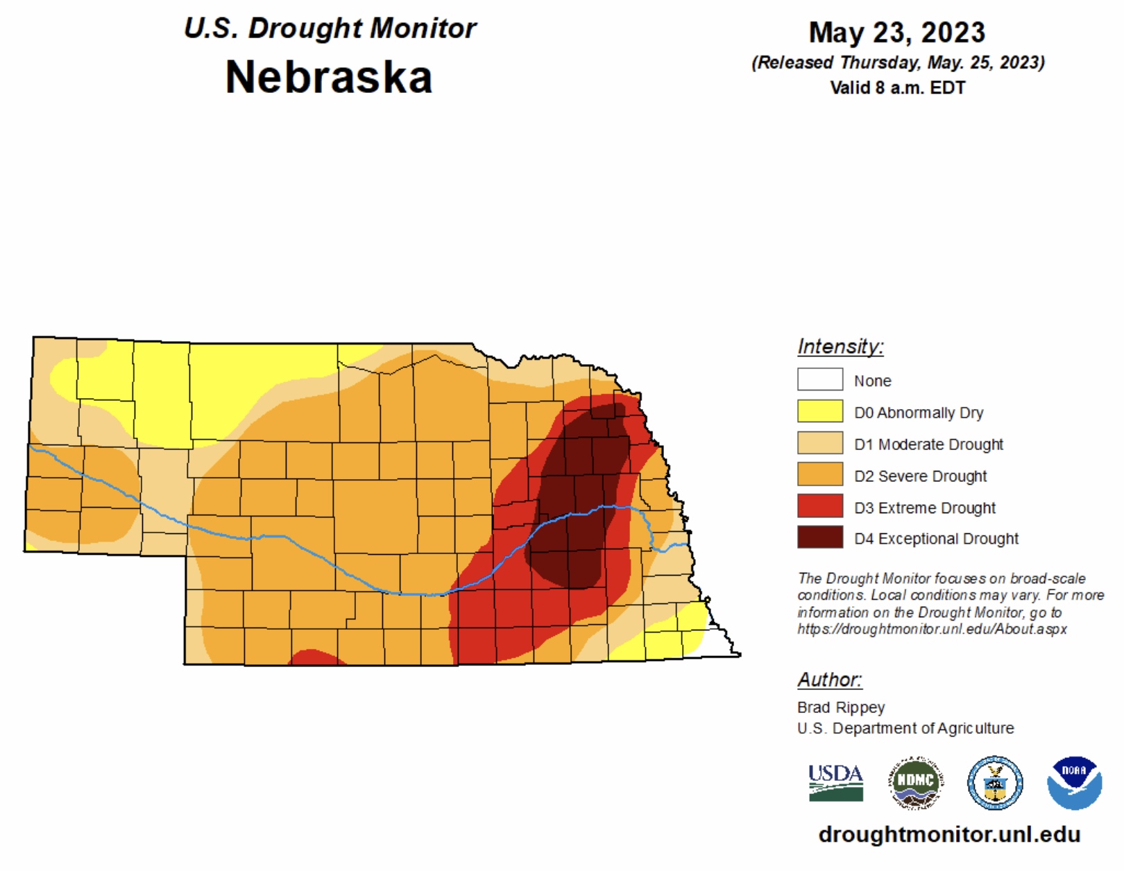
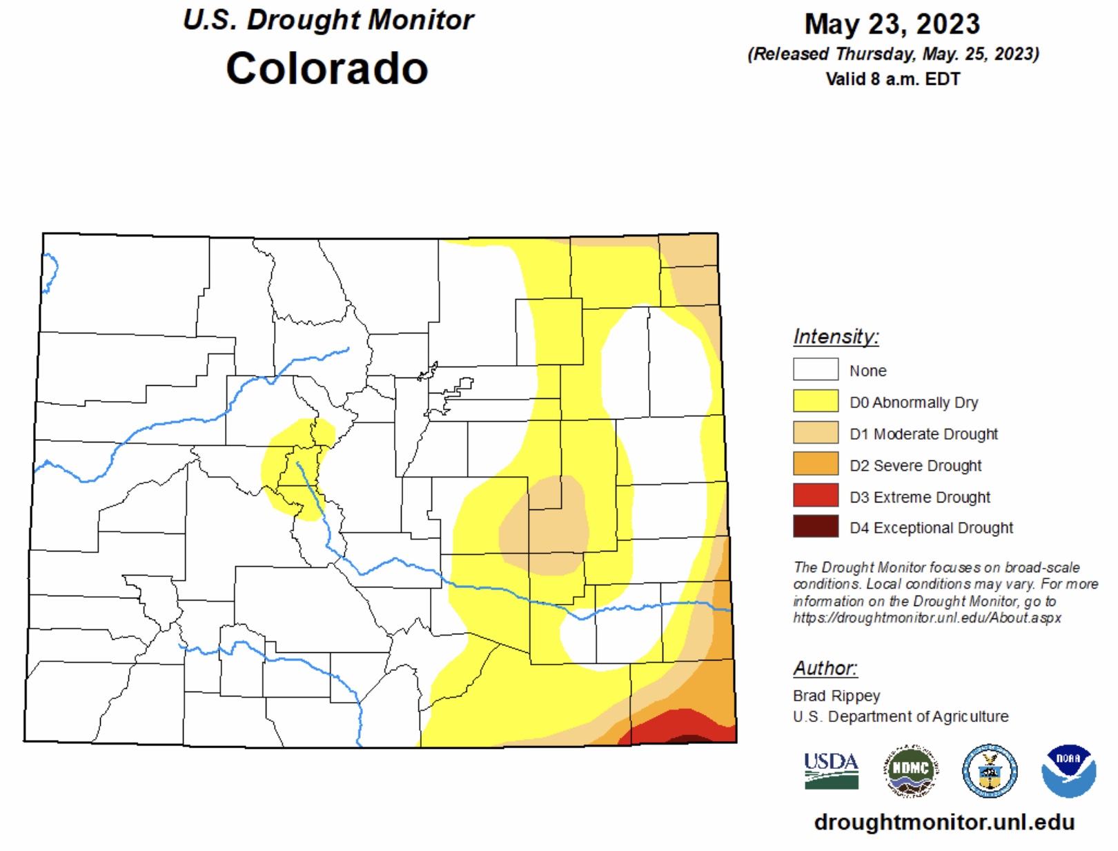
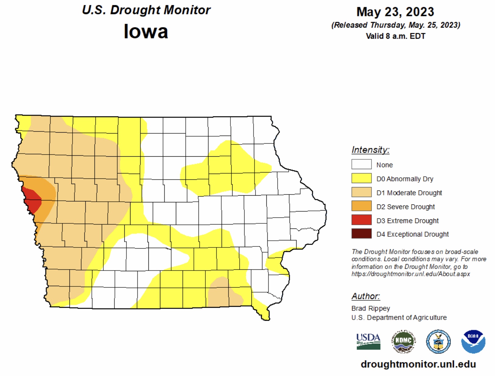
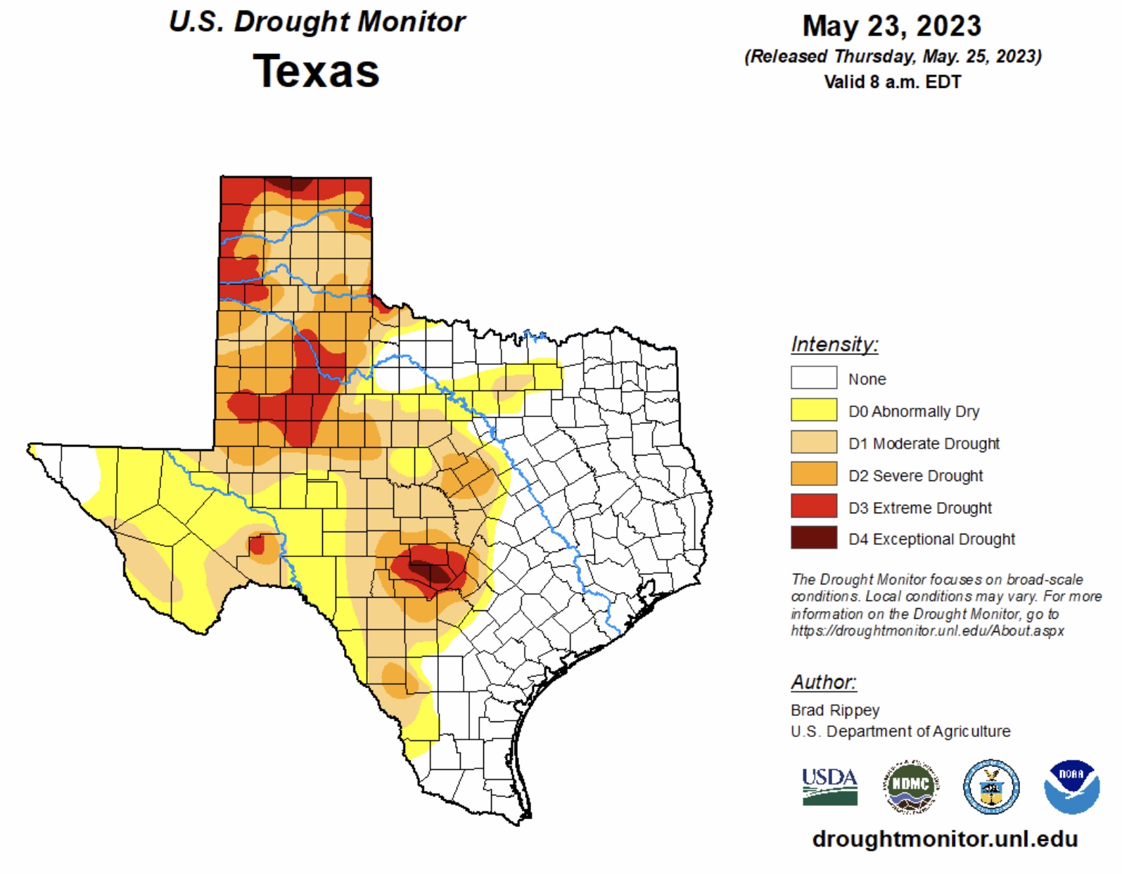
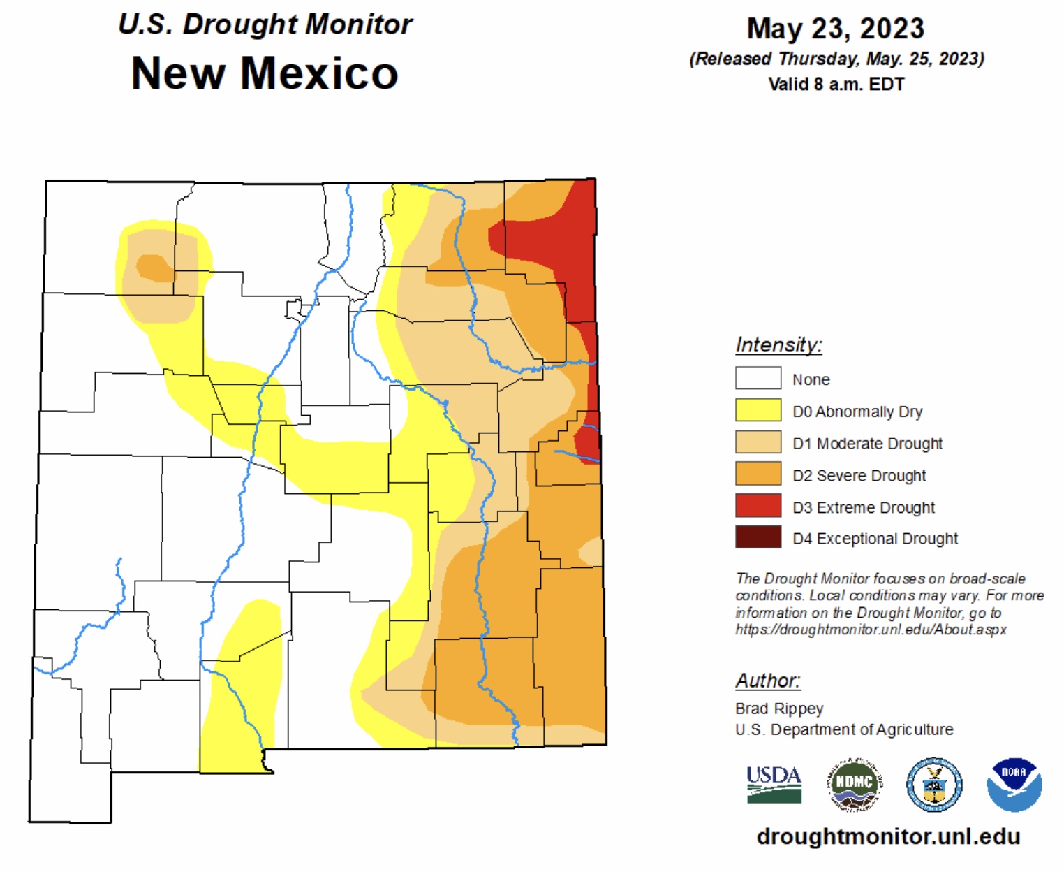
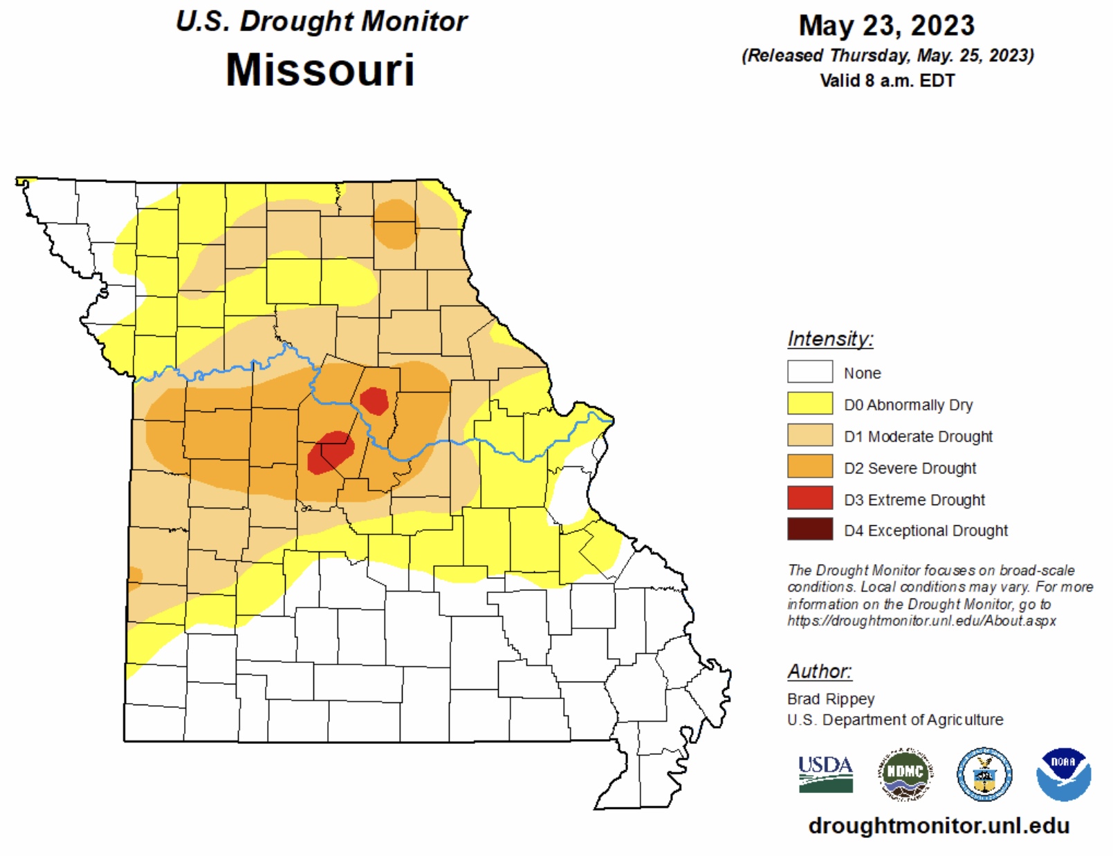
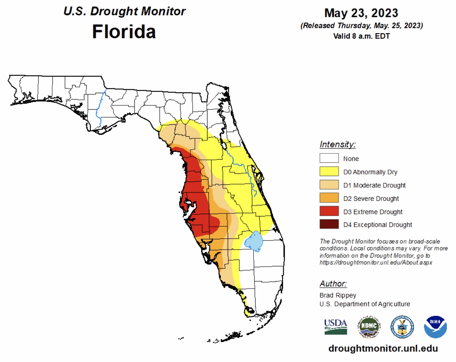
Current COD Mosaic Radar (5am CDT 5/26/23). LIMITED to ELEVATED Severe Thunderstorm Risk, Day 1 (Friday, 5/26/23), parts MT, WY, SD, NE, CO, NM, OK, TX. Includes LIMITED to ELEVATED High Winds Risk and LIMITED to ELEVATED Hail and Large Hail Risk. ELEVATED Fire Risk, Days 1 & 2, parts AZ & NM. From 2” up to 6” rainfall possible over next 72-hrs, parts NC & SC. Latest Drought Monitor Maps show 9 states (KS, OK, NE, CO, IA, TX, NM, MO & FL) with some areas of Extreme to Exceptional Drought as of May 23, 2023.
Sidney Sperry 26 May 2023 10:37 UTC
FYI…

Wishing you all a blessed and safe Memorial Day weekend, remembering those we love and honor. - Sid Sperry
Sid Sperry
President & CEO
SPIDI Technologies, LLC
SUBSCRIPTIONS: SPIDItech.com
Cell: (405) 627-7754
Email(s): SidSperry@gmail.com  OR  Sid.Sperry@spidiweather.com

Sent from my iPad

 Show/hide attachments