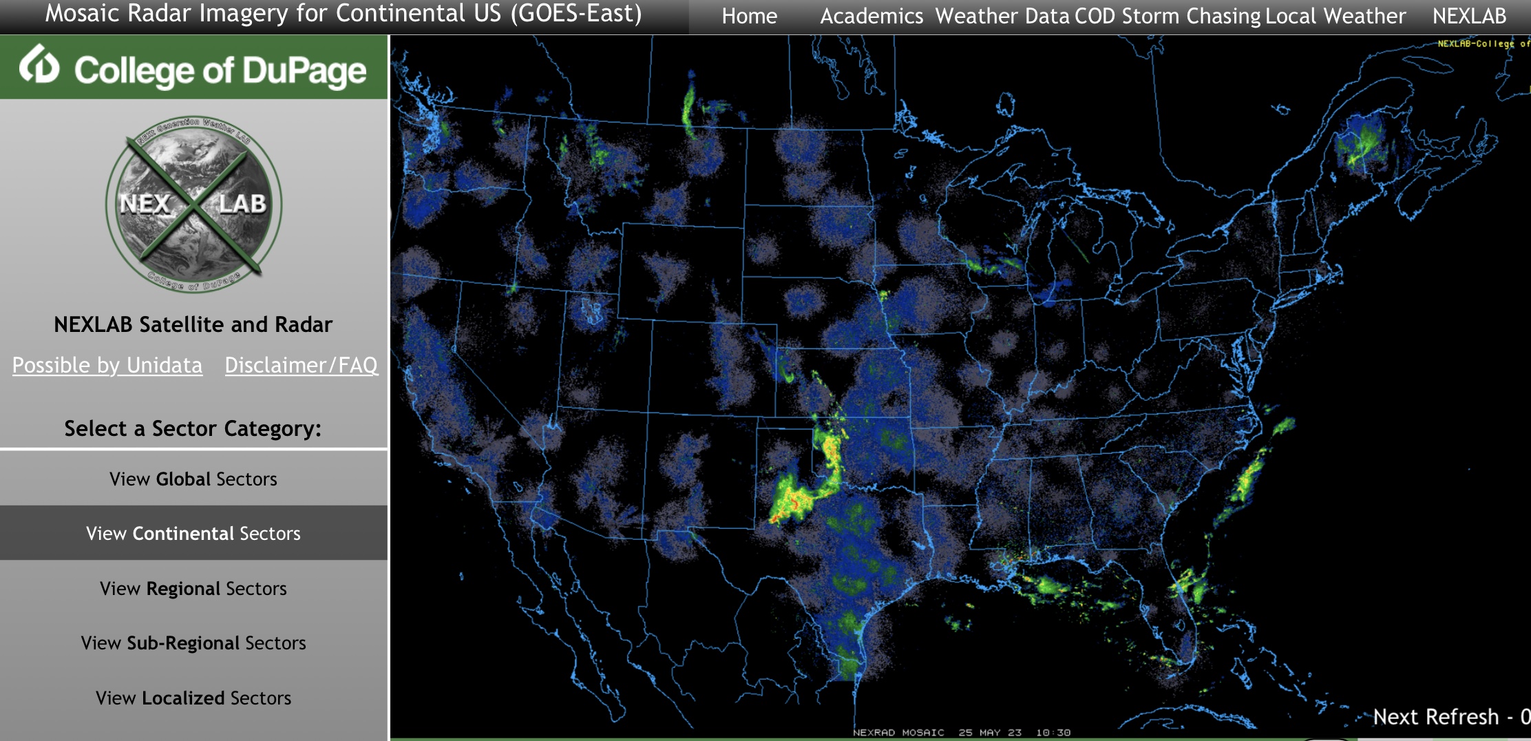
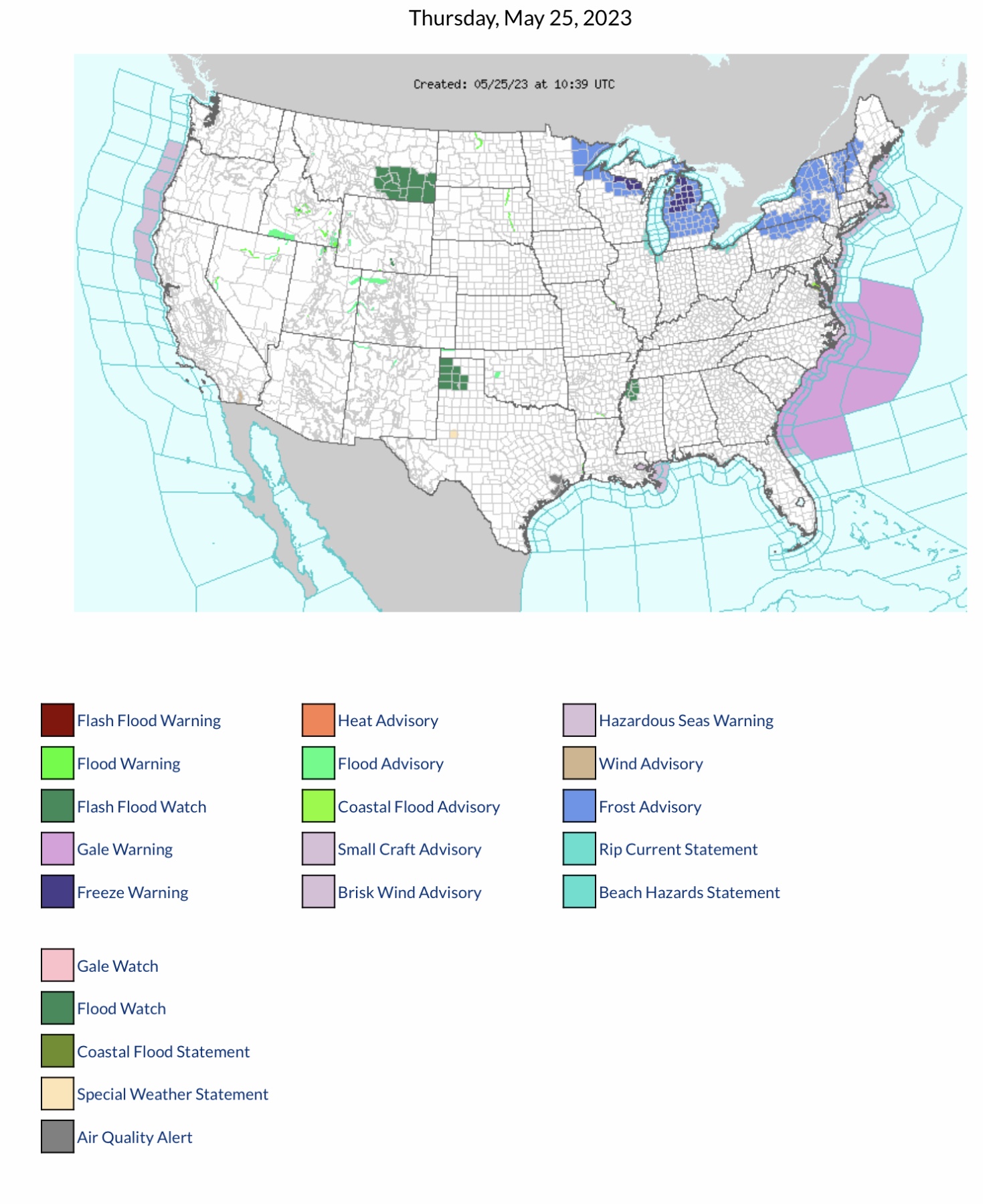
Current COD Mosaic Radar. Showers & T-Storms across parts KS, OK & TX this morning. Current NWS Watches, Warnings & Advisories. Note Flash Flood Warning in parts OK this AM. Flood Watches parts MT, TX & MS. Freeze Warnings parts WI & MI. Frost Advisories parts MN, WI, MI, PA, NY, MA, VT, NH & ME. Gale Warning parts coastal VA, NC, SC, GA & FL - see National Hurricane Center updates below.
Sidney Sperry 25 May 2023 11:29 UTC
FYI…
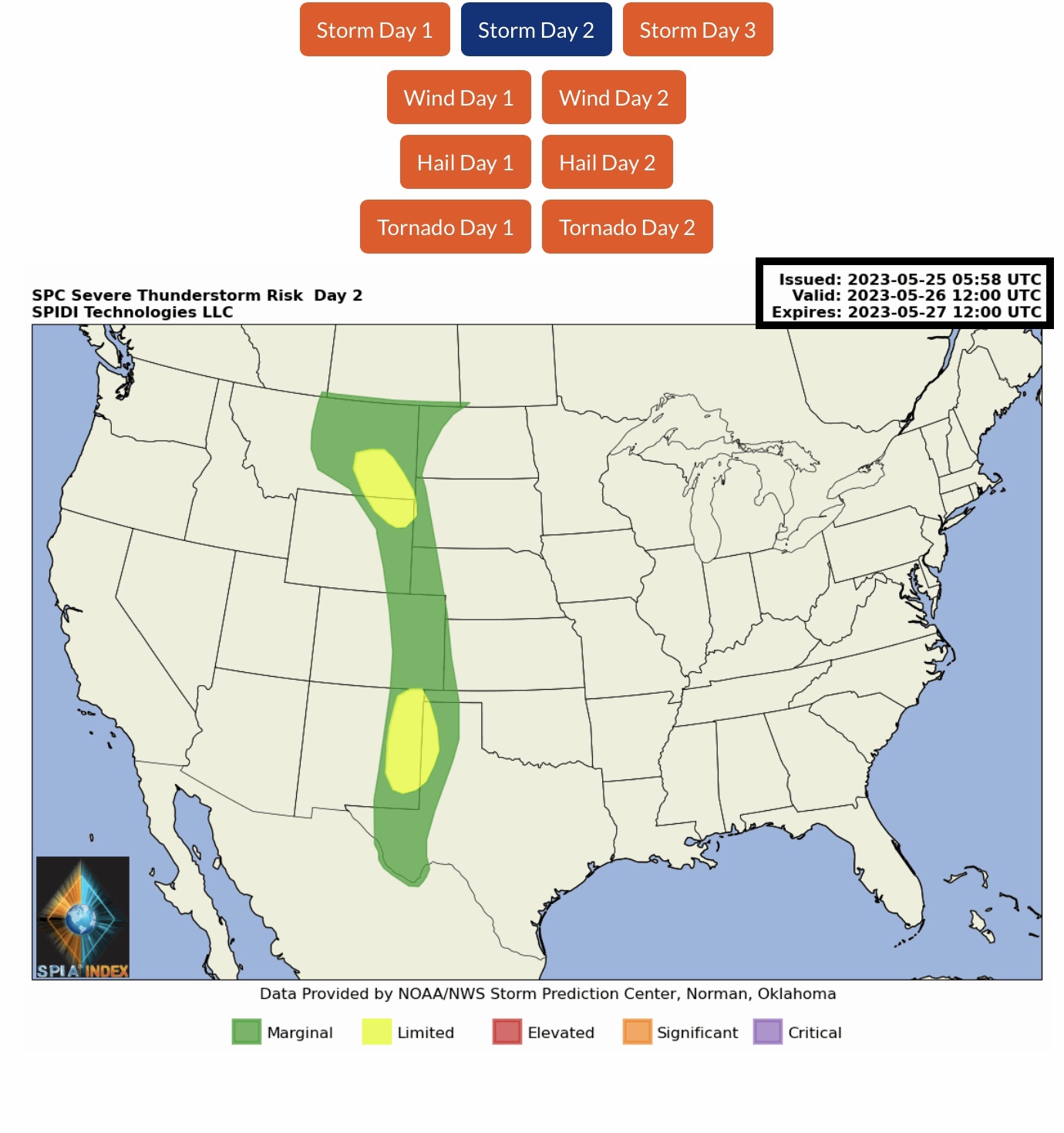
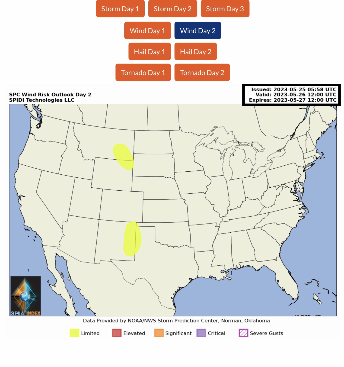
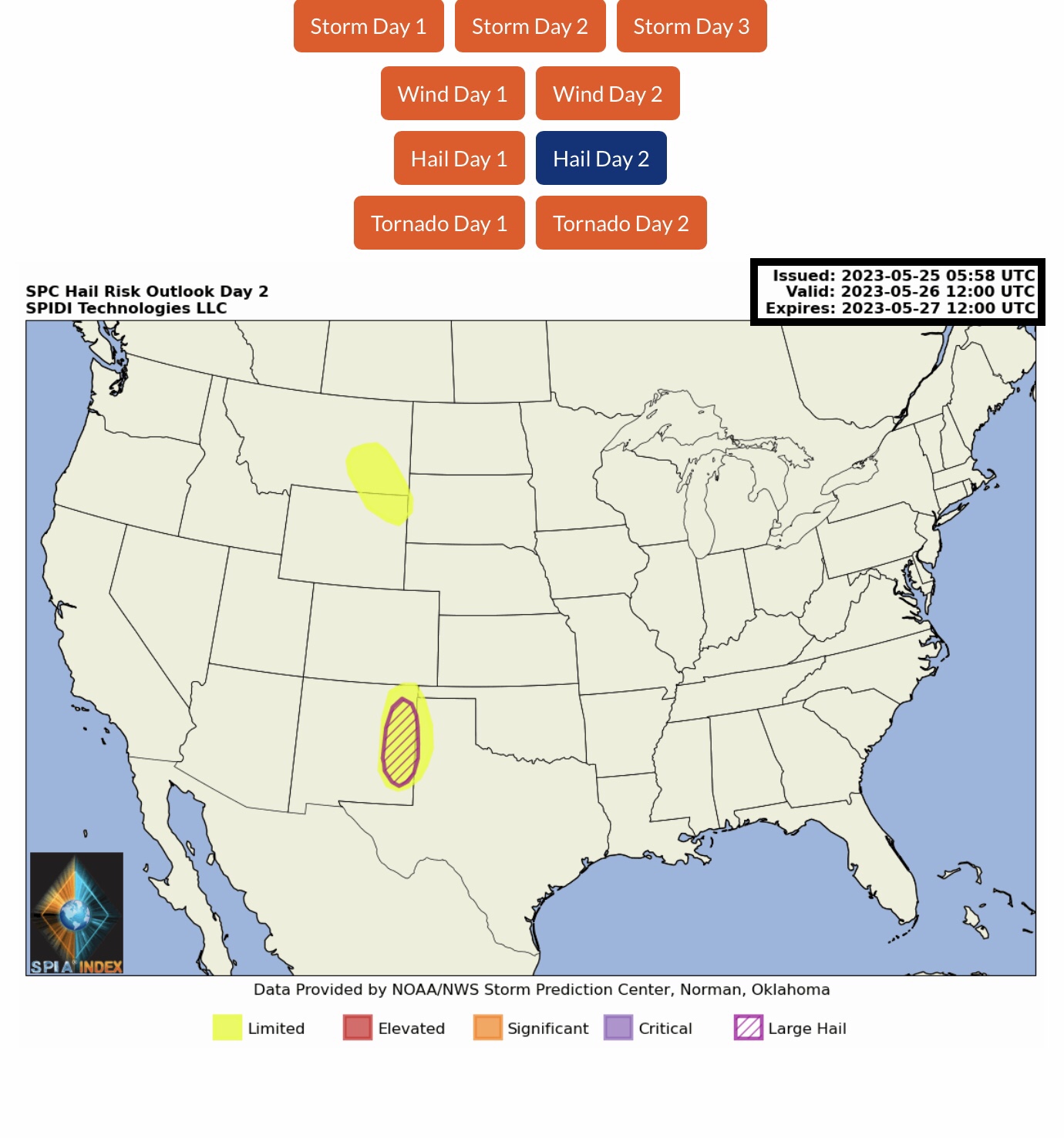
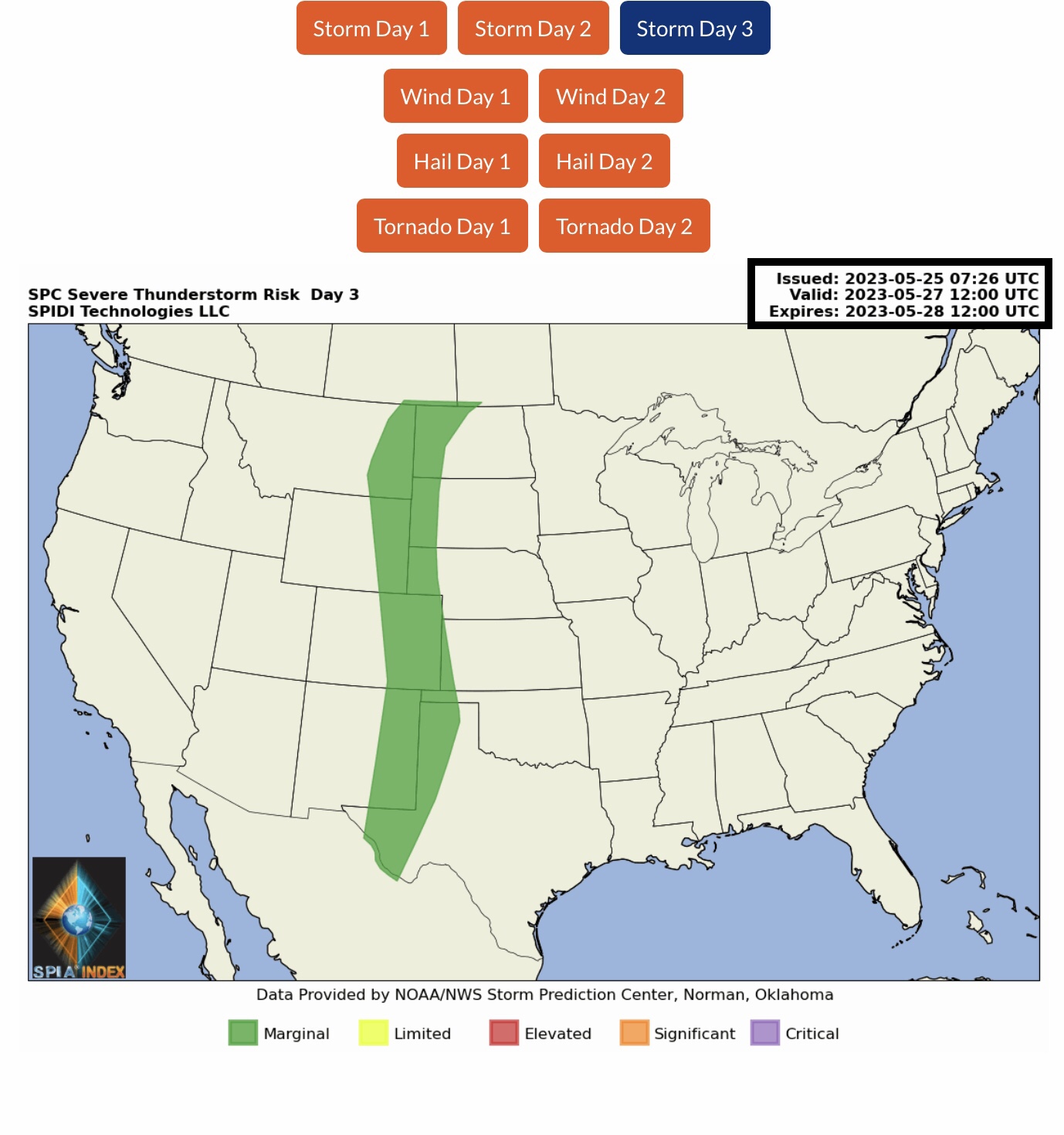
LIMITED Severe Thunderstorm Risk, Day 2 (Friday into Saturday AM), parts MT, WY, SD, NM, OK & TX. Includes LIMITED High Winds Risk and Limited Hail & Large Hail Risk.
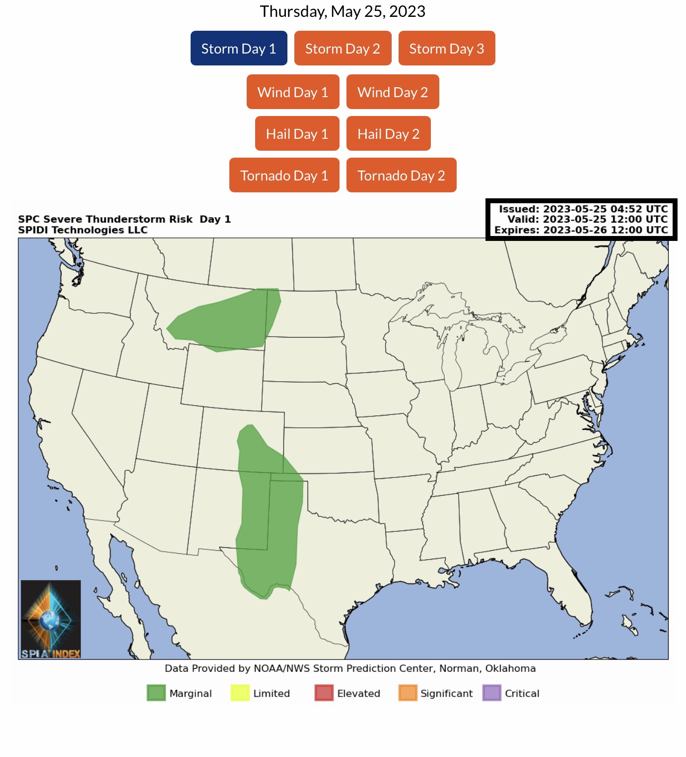
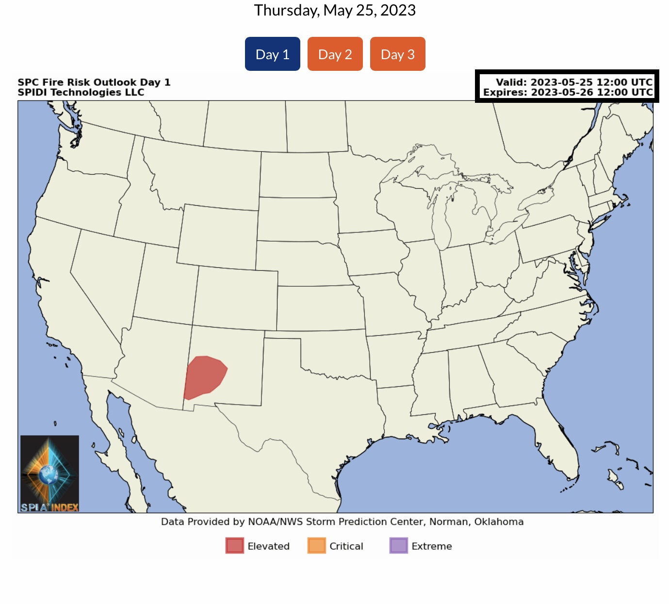
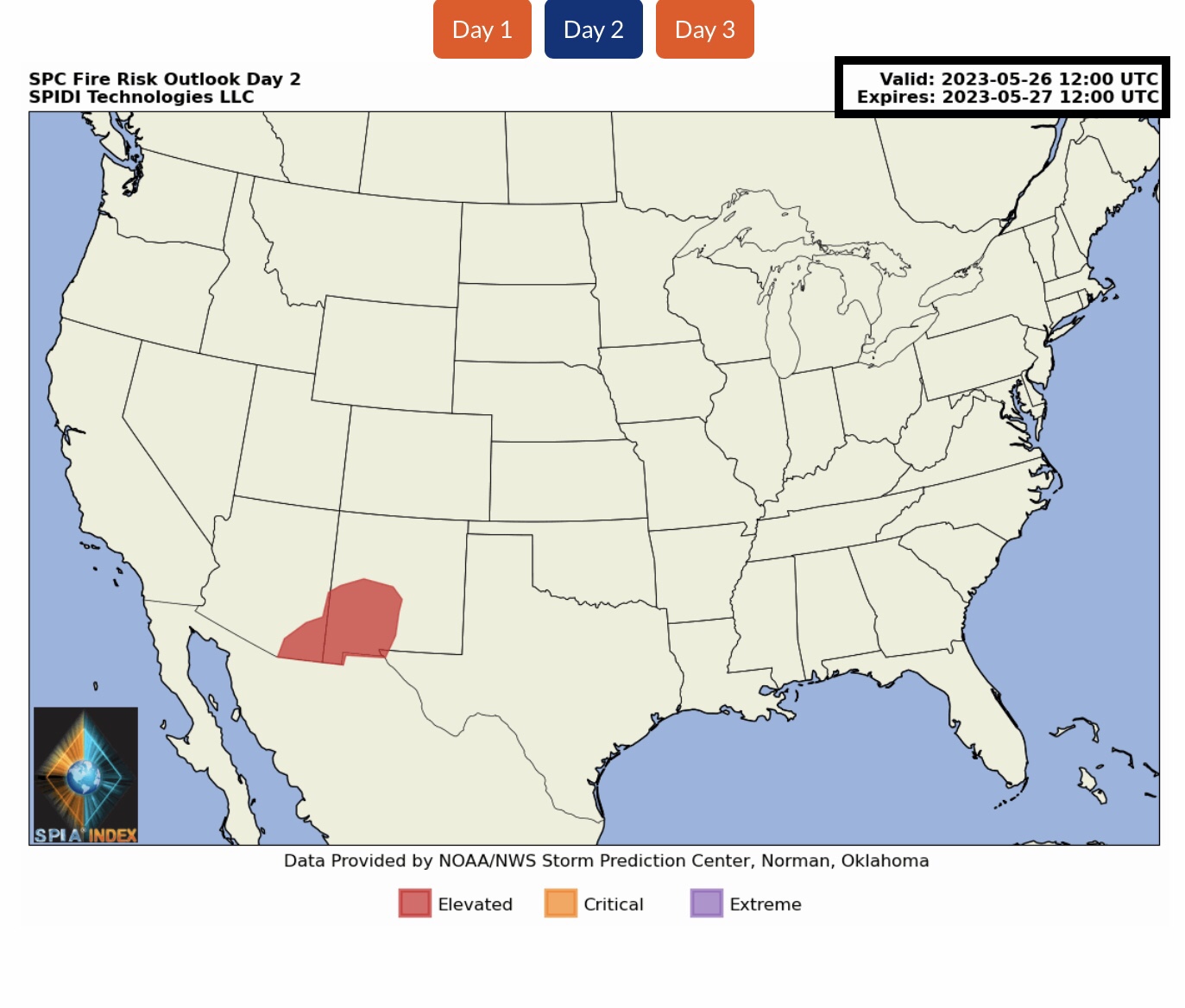
ELEVATED Fire Risk, Days 1 & 2 (today through Saturday AM), parts NM & AZ.
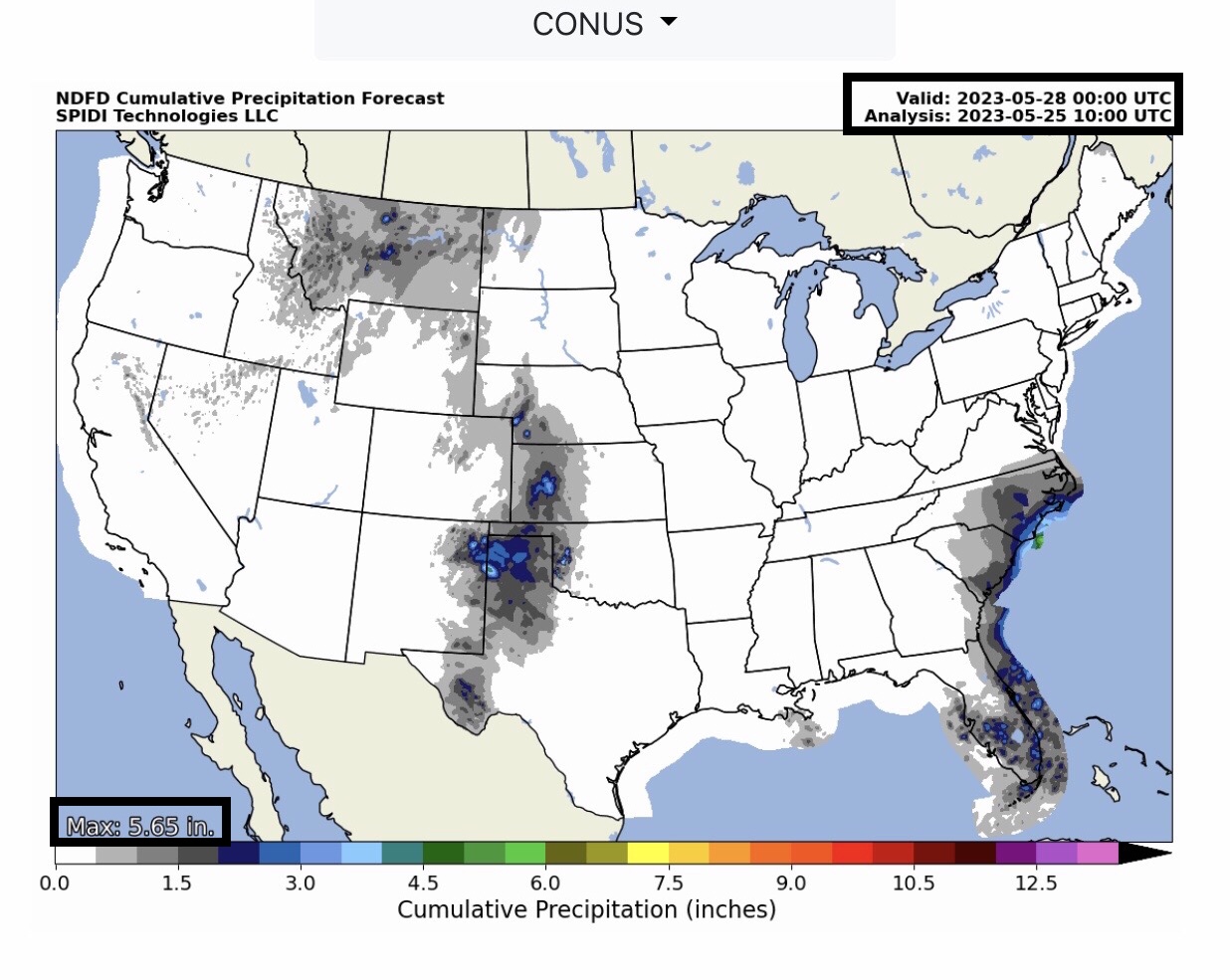
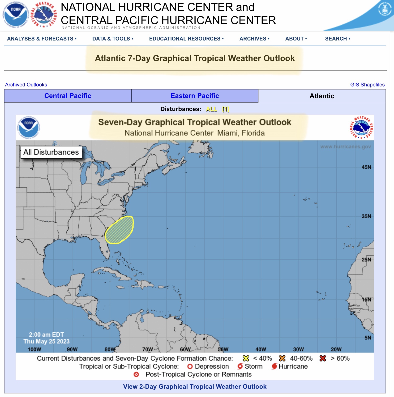
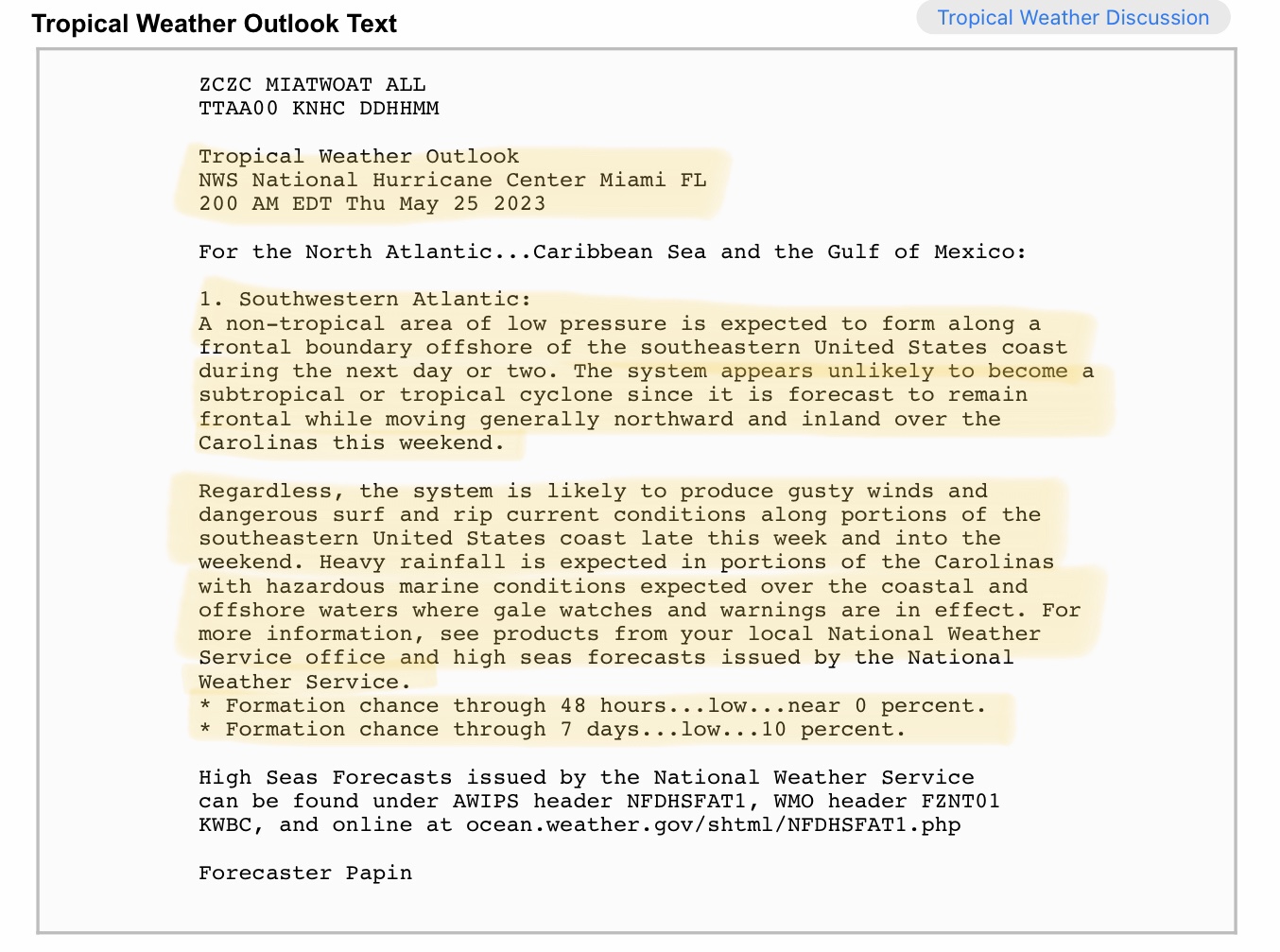
From 2.5” up to 6” rainfall possible over next 72-hrs parts KS, NM & TX panhandle. Also, heavy rainfall possible along Southeast Region coastal areas of NC, SC, GA & FL. Note NWS and NHC Gale Warnings for these areas as well over next 72-96 hours.
Sid Sperry
President & CEO
SPIDI Technologies, LLC
SUBSCRIPTIONS: SPIDItech.com
Cell: (405) 627-7754
Email(s): SidSperry@gmail.com  OR  Sid.Sperry@spidiweather.com

Sent from my iPad

 Show/hide attachments