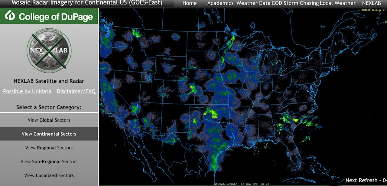
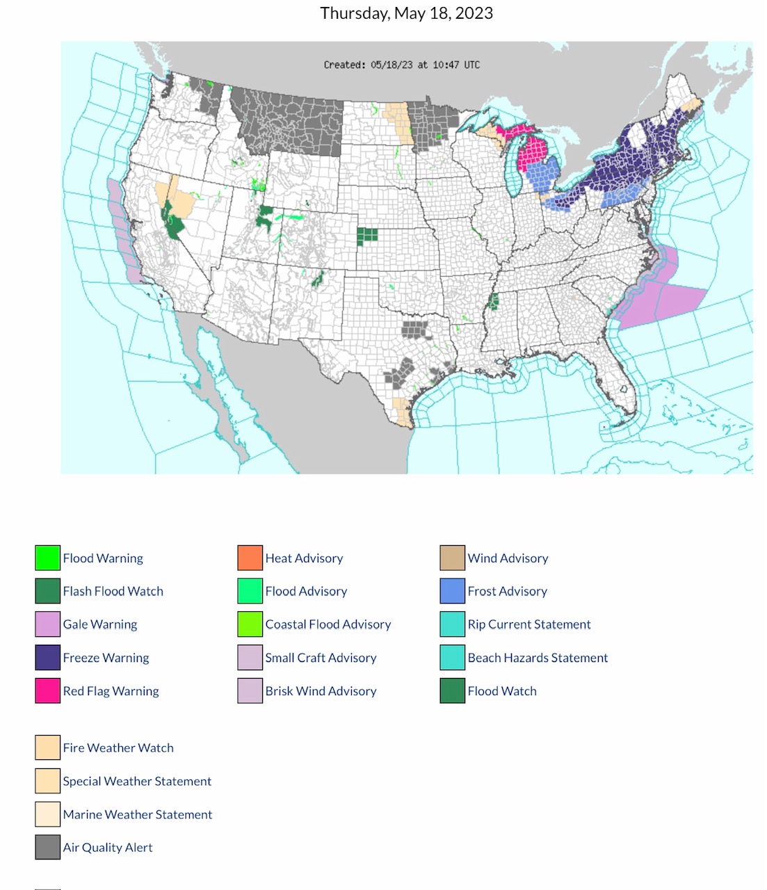
Current (5:30am CDT) COD Mosaic Radar. Scattered rain showers & some T-Storms across parts MT, CO, KS, TX, OK, GA & SC. Rain/Snow mix parts MN. Current NWS Watches, Warnings & Advisories. NOTE: Red Flag Fire Warnings parts MI & MI Upper Peninsula; Flash Flood & Flood Watches parts CA, NV, ID, UT, CO, KS, NM & MS. Air Quality Alerts parts WA, MT, MN & TX. Heavy Smoke alert eastern ND. Freeze Warnings & Frost Advisories across New England states this AM.
Sidney Sperry 18 May 2023 11:30 UTC
FYI…
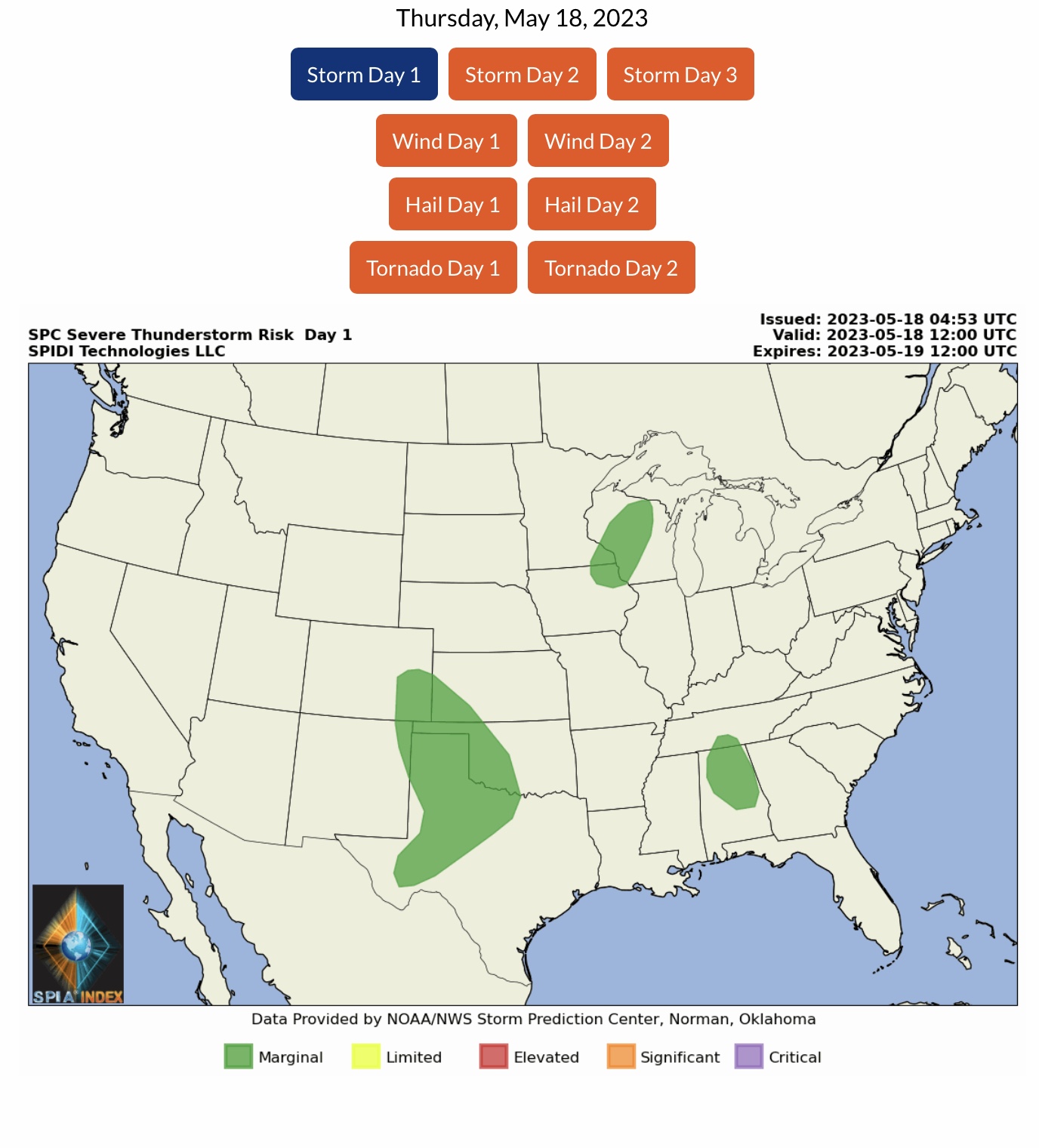
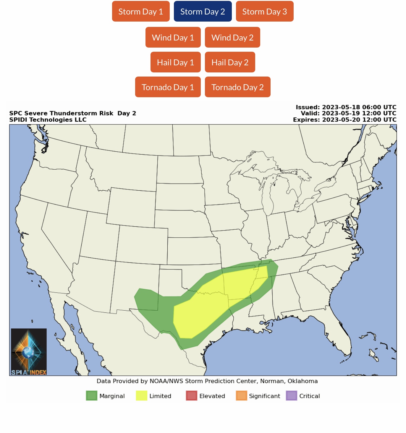
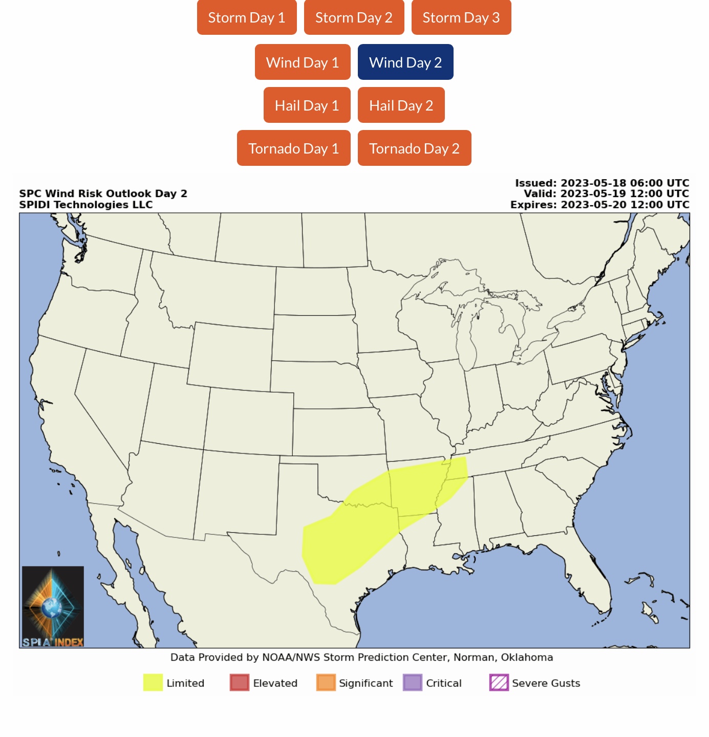
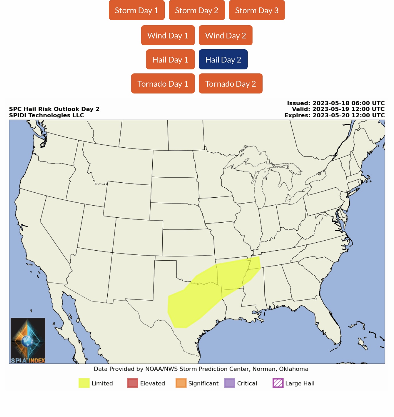
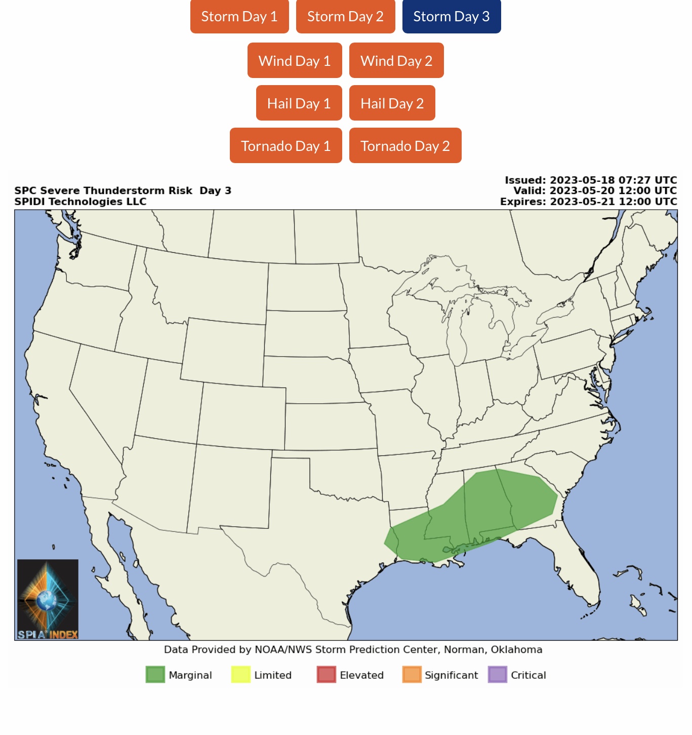
LIMITED Severe Thunderstorm Risk, Day 2 (Friday into Saturday AM), parts TX, OK, AR, LA, MO, TN & MS. Includes LIMITED High Winds Risk and LIMITED Hail Risk.
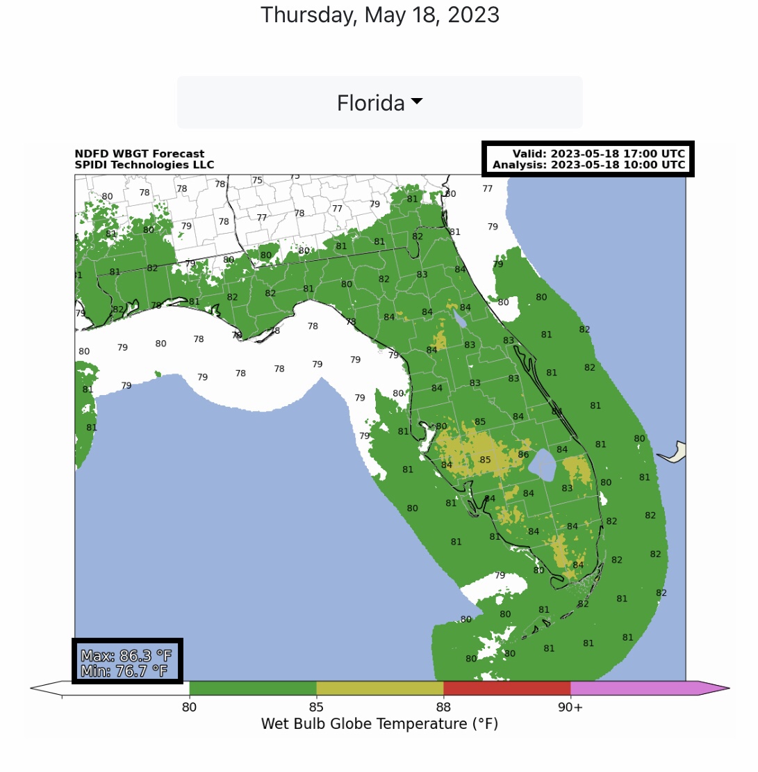
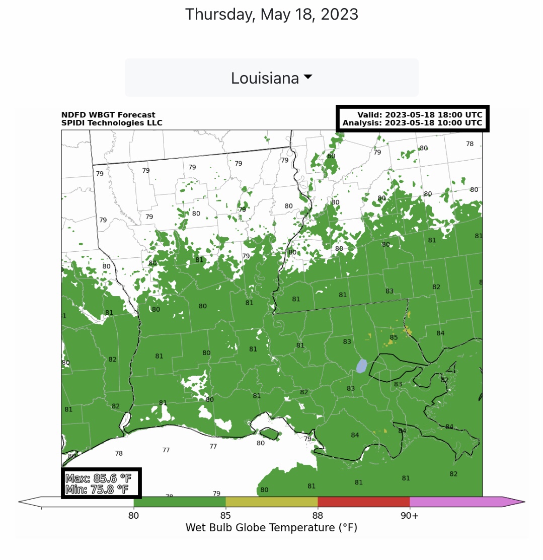
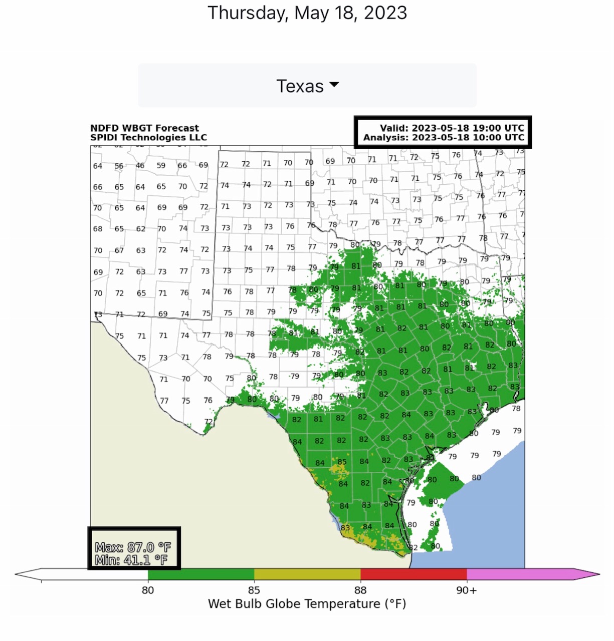
Wet Bulb Globe Temperatures into Moderate category for parts FL, LA & TX later today.
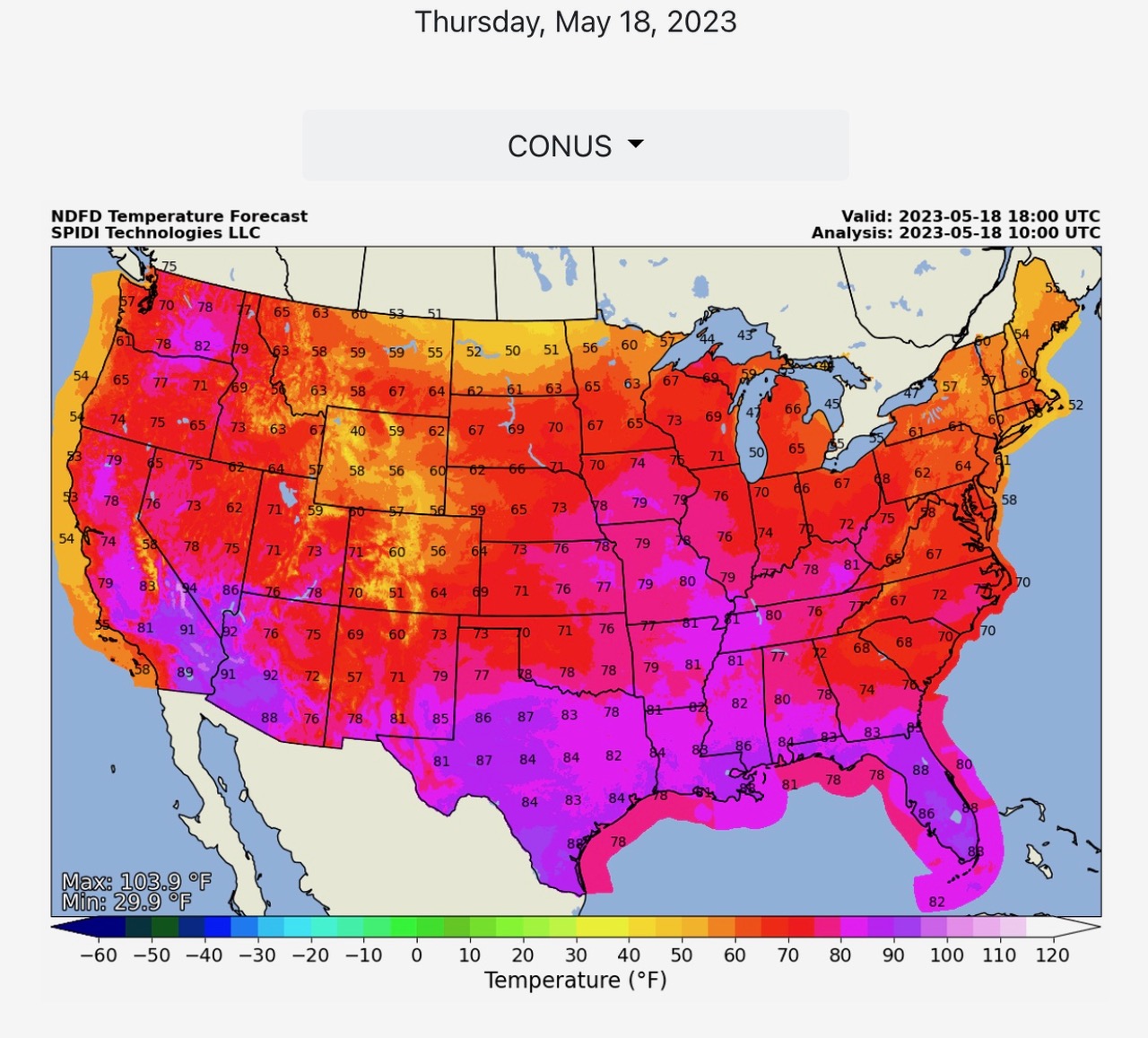
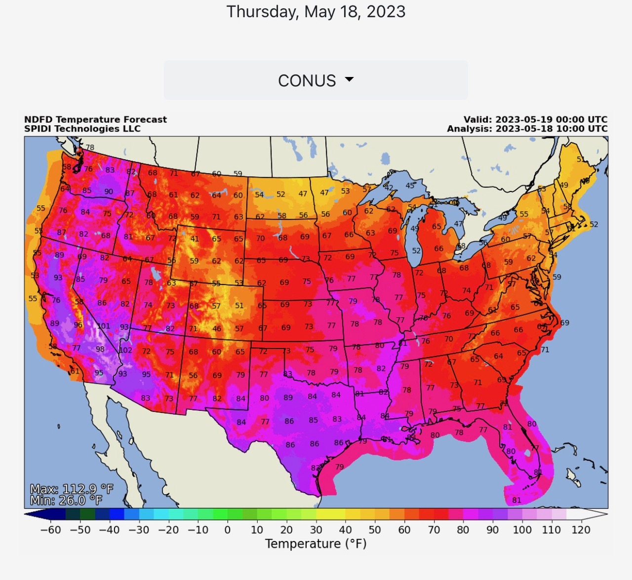
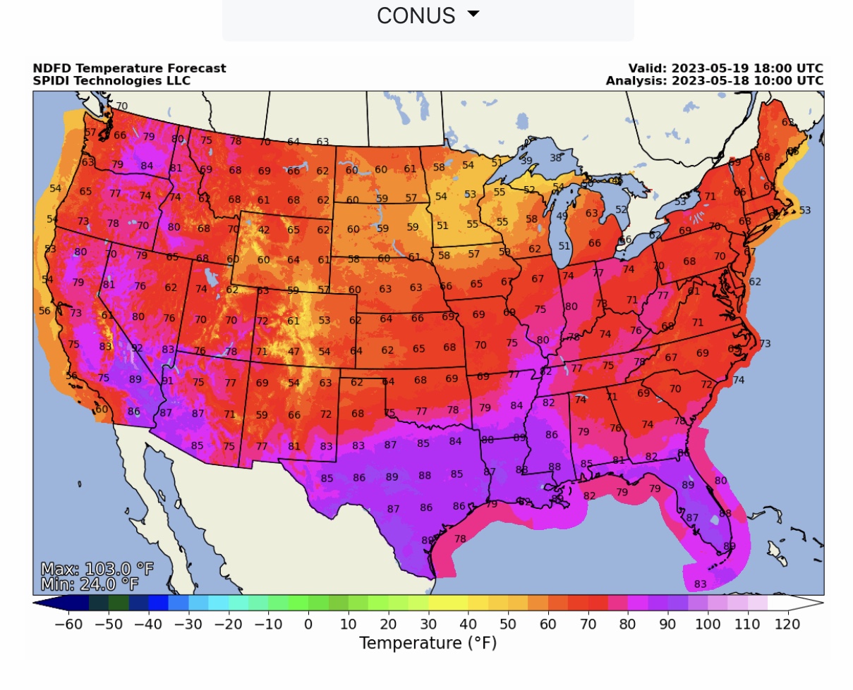
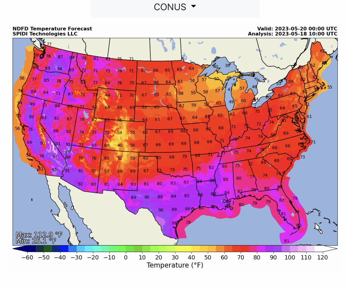
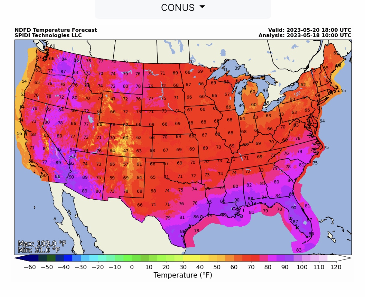
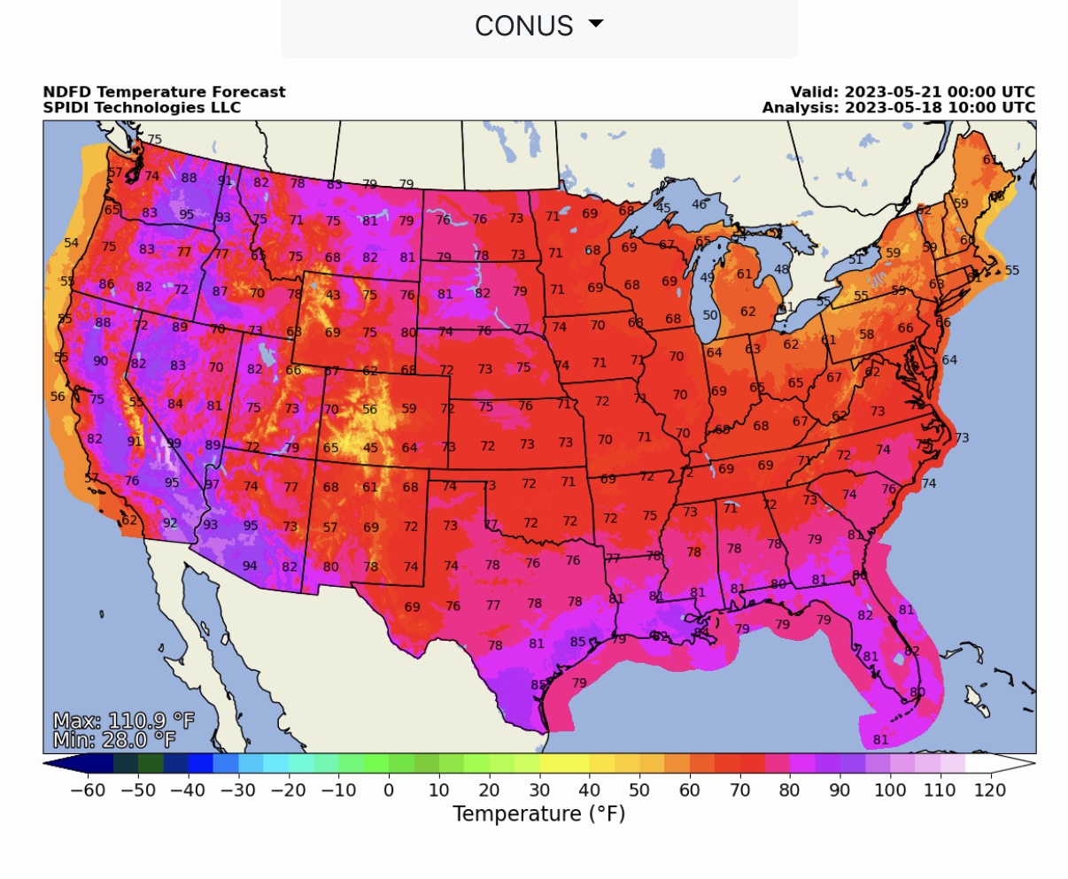
NWS Temperature Forecasts at 1pm and 7pm today (Thursday), Friday & Saturday. Note temperature drop as a cold front moves from northwest to southeast across the U.S. on Friday and Saturday, 5/19 and 5/20.
Sid Sperry
President & CEO
SPIDI Technologies, LLC
SUBSCRIPTIONS: SPIDItech.com
Cell: (405) 627-7754
Email(s): SidSperry@gmail.com  OR  Sid.Sperry@spidiweather.com

Sent from my iPad

 Show/hide attachments