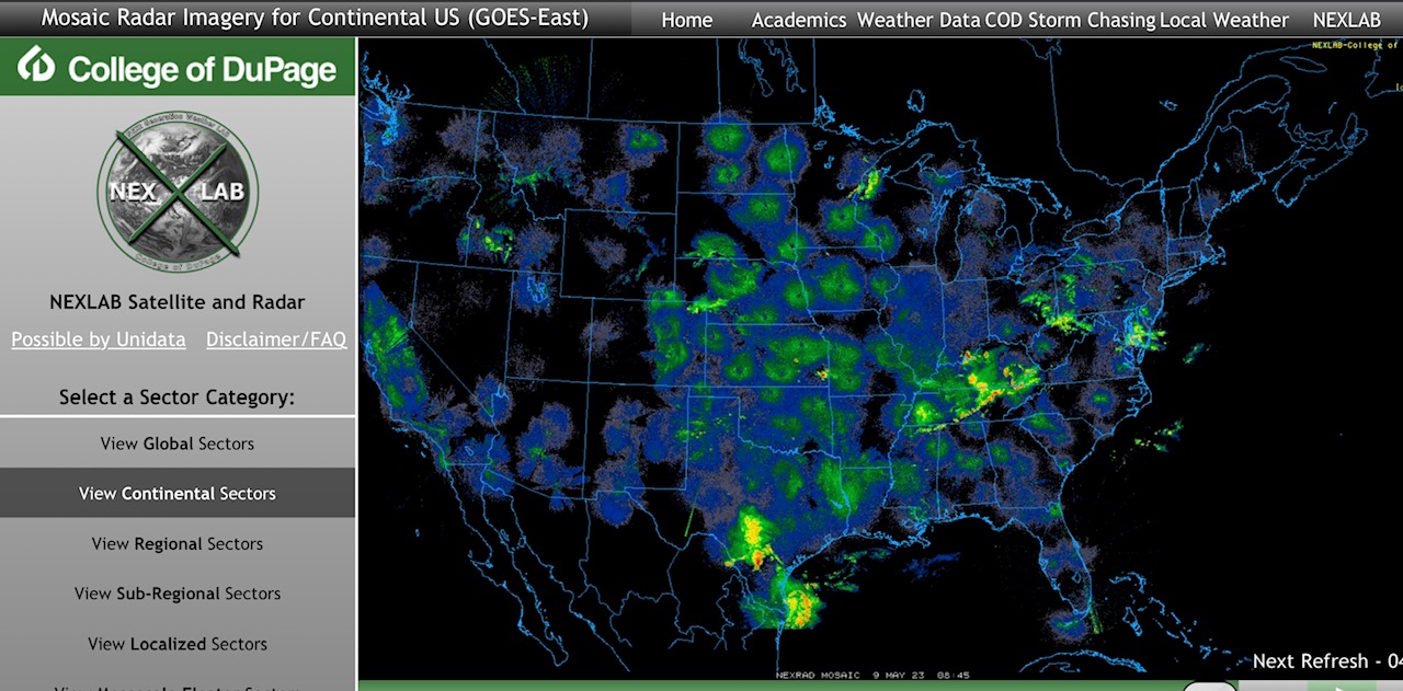
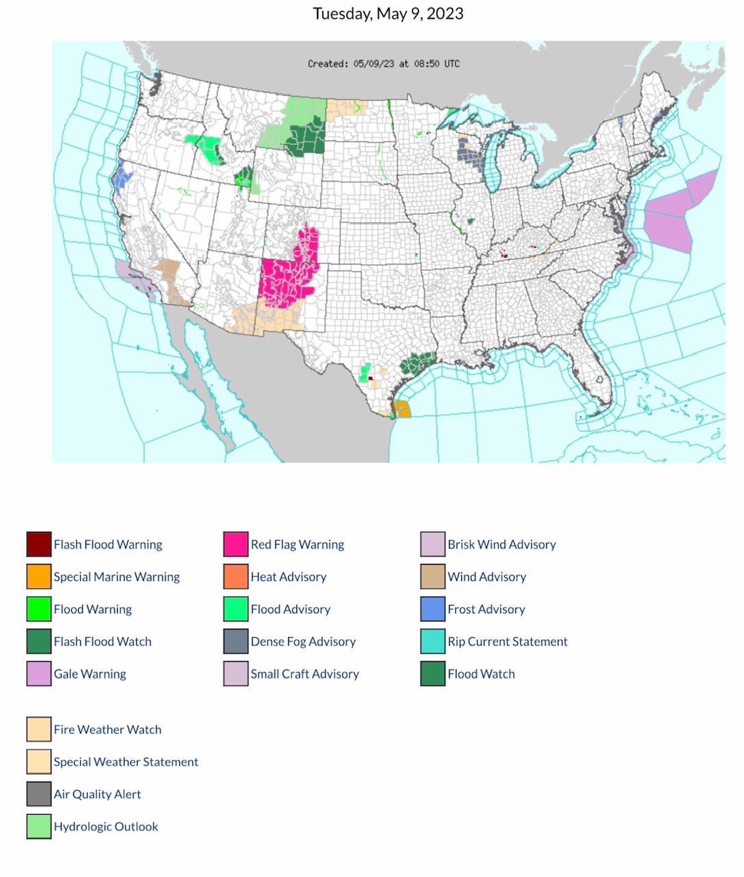
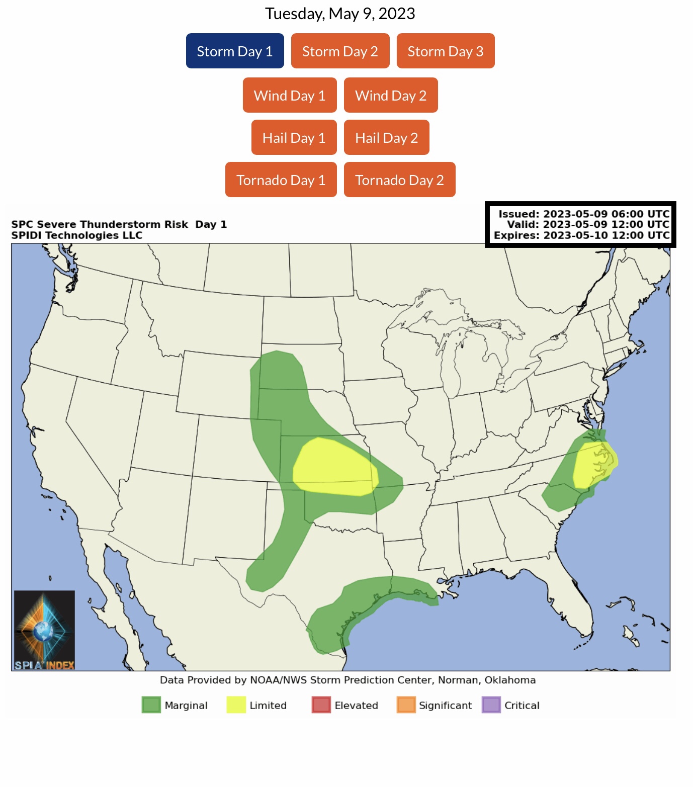
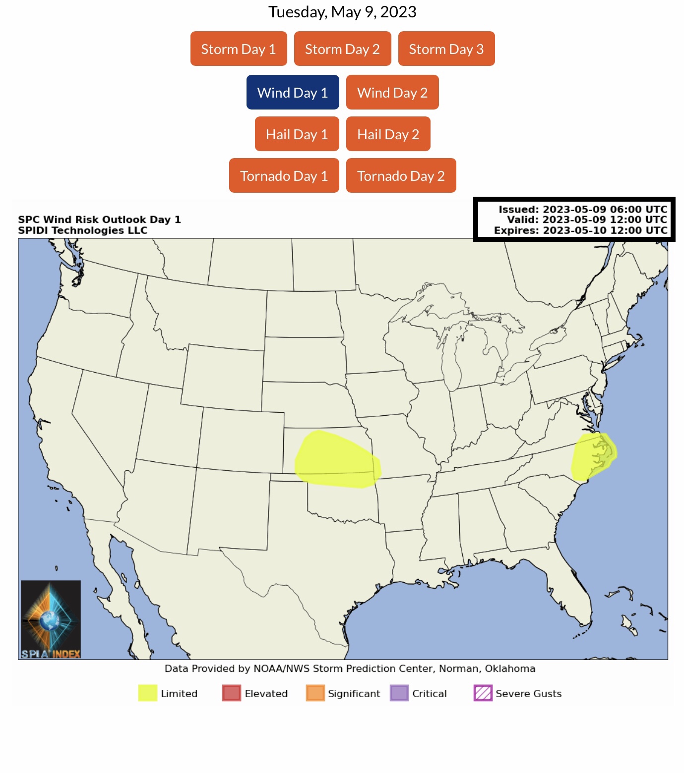
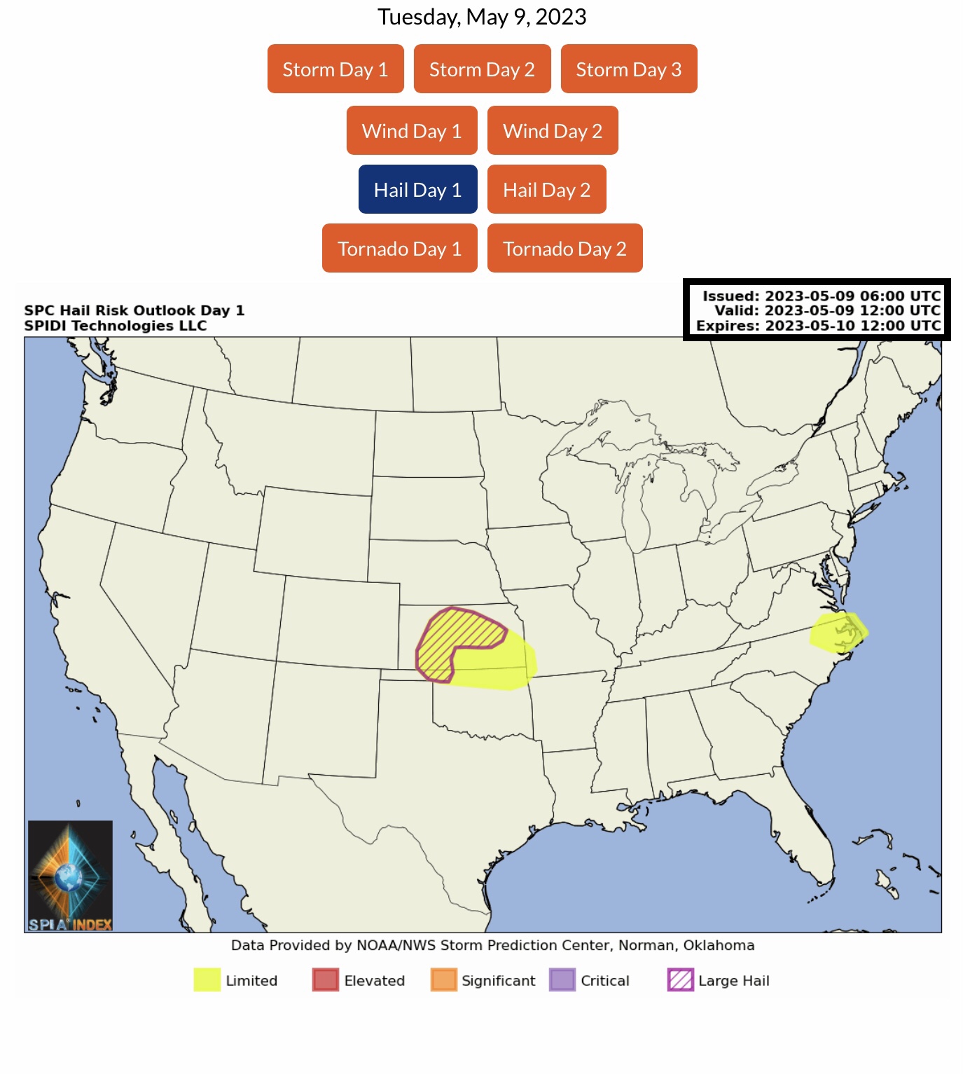
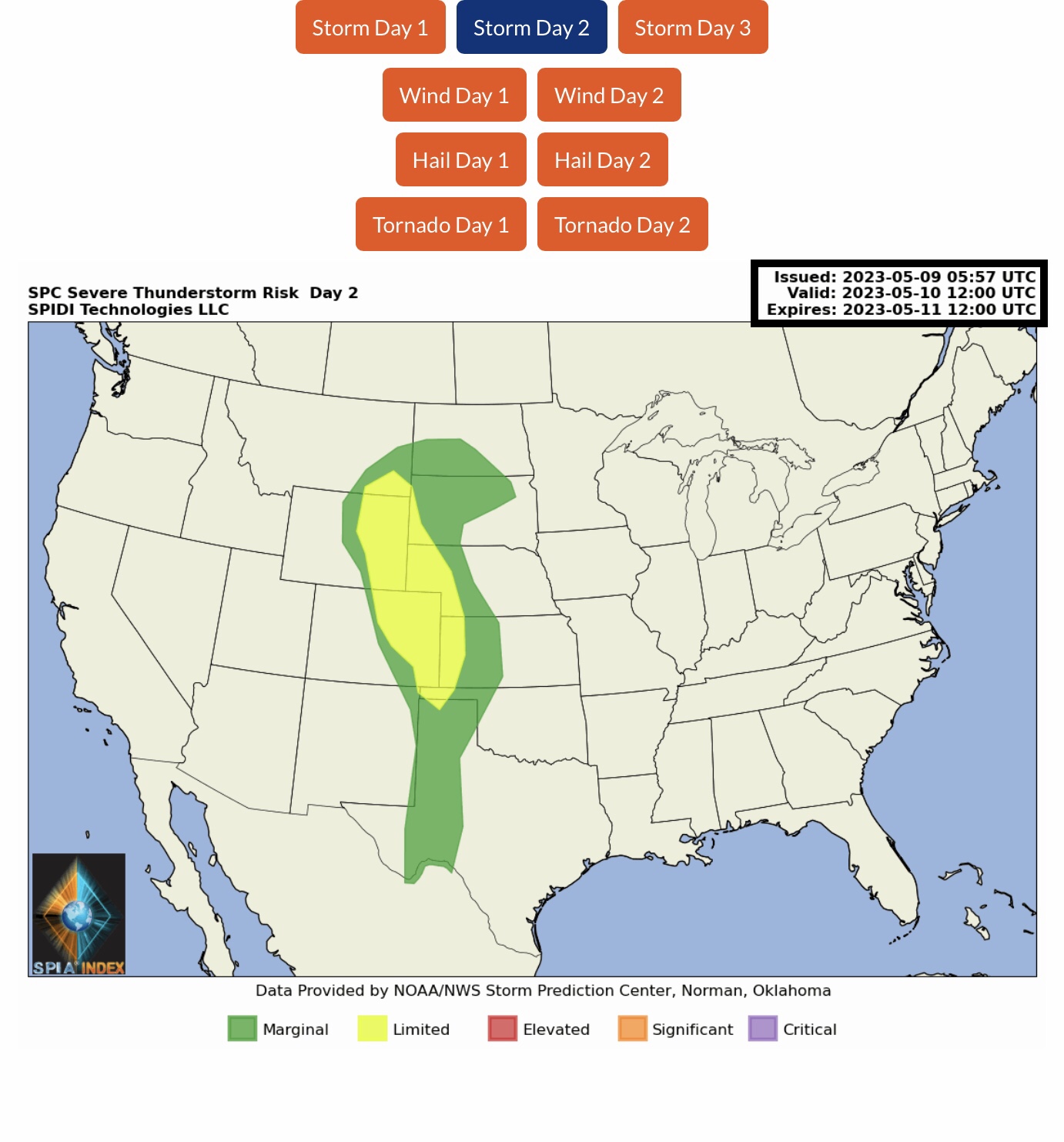
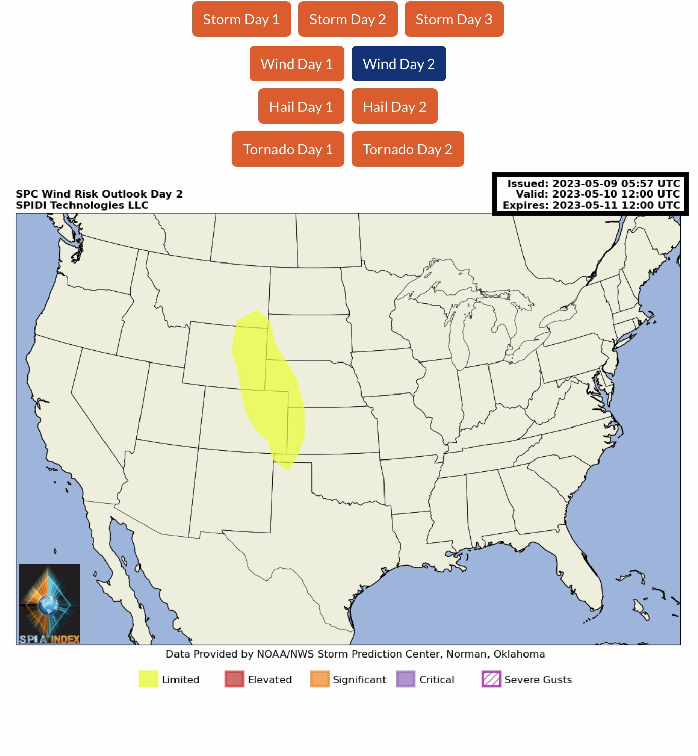
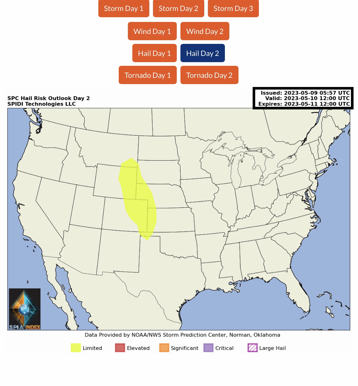
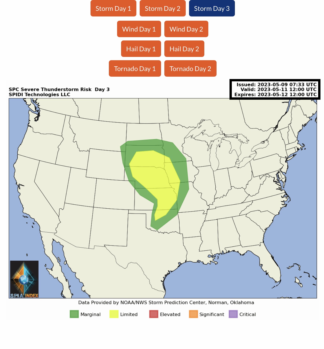
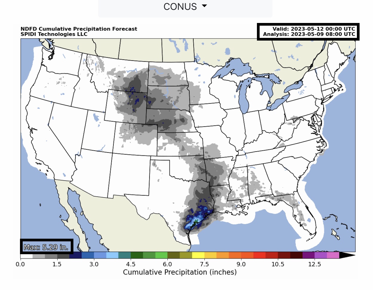
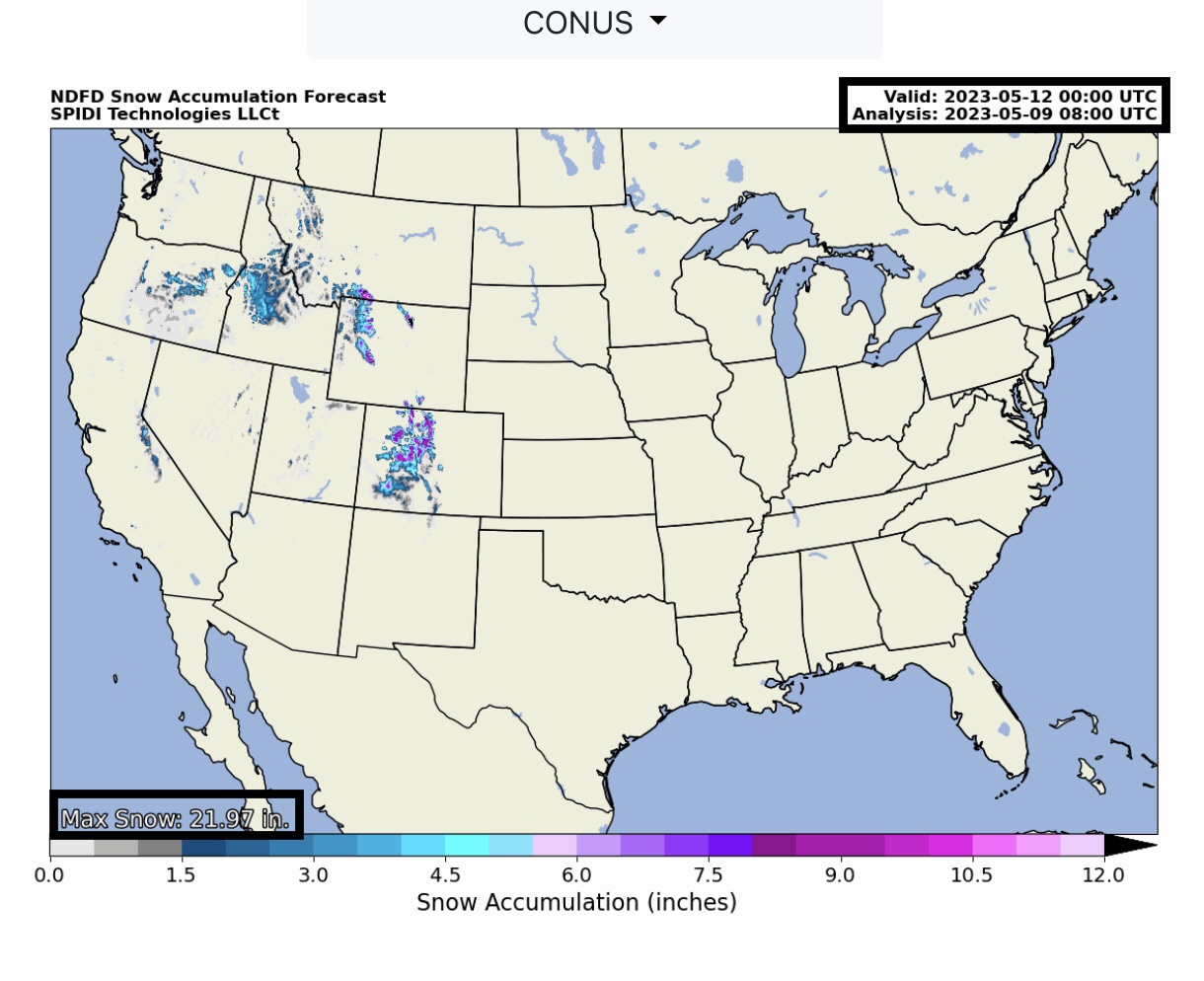
Current COD Mosaic Radar (4am CDT 5/9/23). Current NWS Watches, Warnings & Advisories. Note Flash Flood Warnings parts MN, KS, TX & KY. Note Flood Watches parts ID, UT, MT, WY, TX & IL. Flood Warnings parts OR, ID, TX & MN. Red Flag Fire Warnings parts CO & NM. Wind Advisories southern CA. LIMITED Severe T-Storm Risk, Day 1, parts KS, OK, MO, NC & VA. Includes High Winds & Hail/Large Hail Risk. LIMITED Severe T-Storm Risk, Day 2, parts MT, WY, SD, NE, CO, KS, OK & TX. Includes High Winds & Hail Risk. Day 3: parts SD, MN, NE, IA, KS, MO & OK.
Sidney Sperry 09 May 2023 09:34 UTC
FYI…
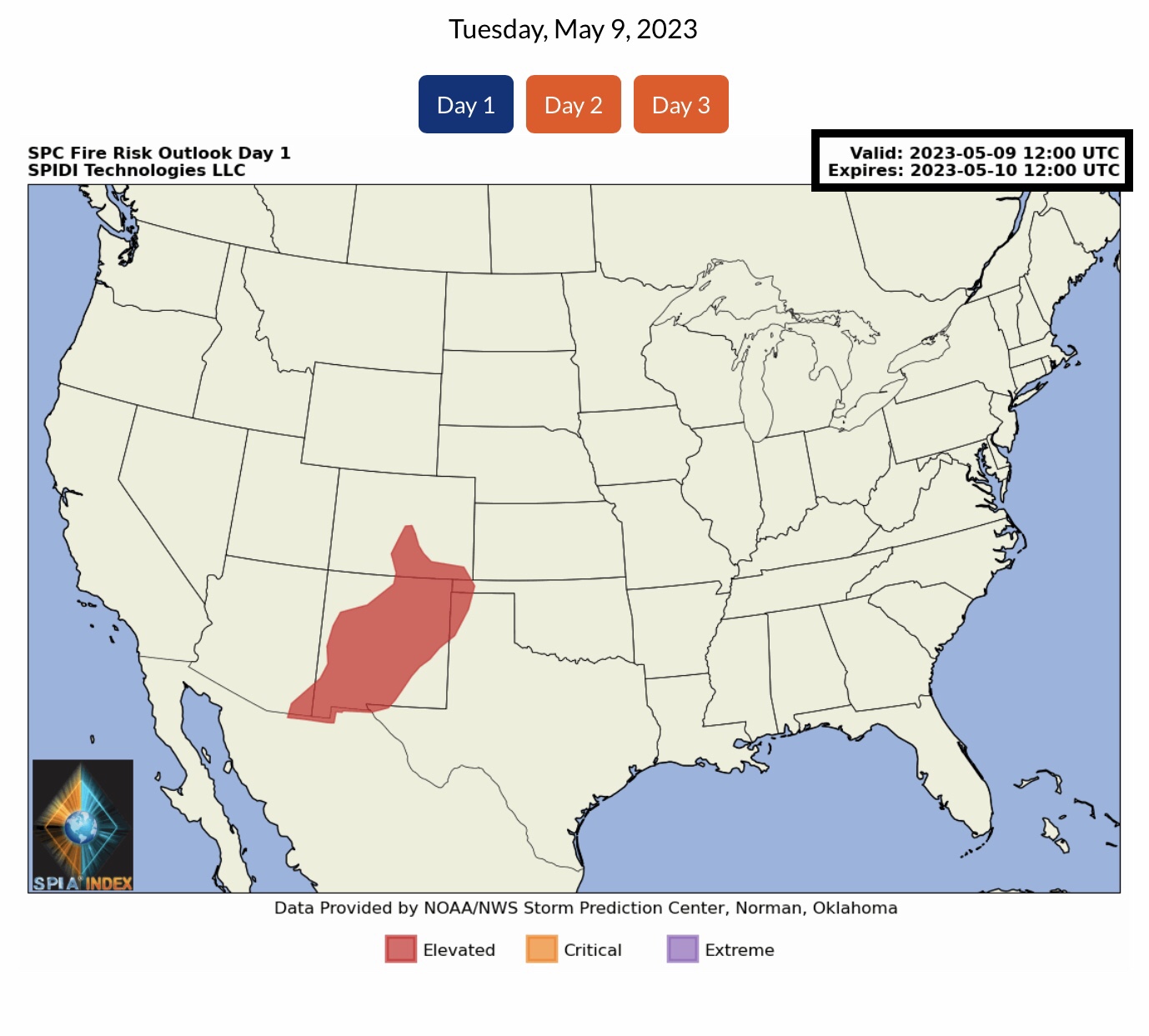
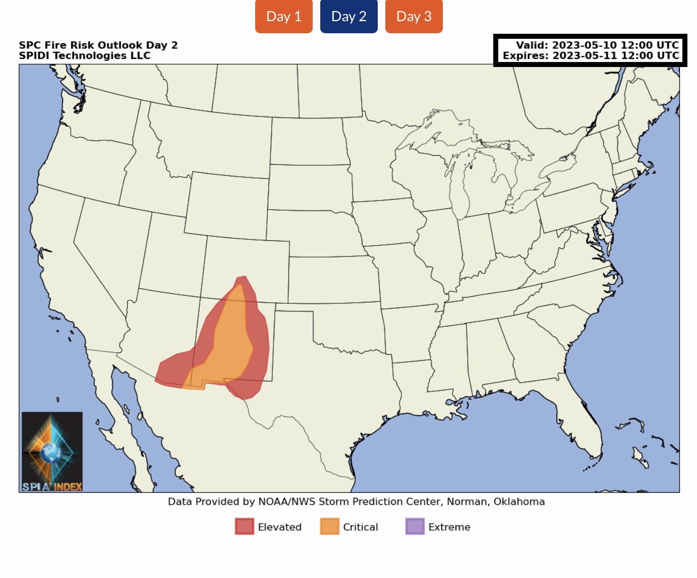
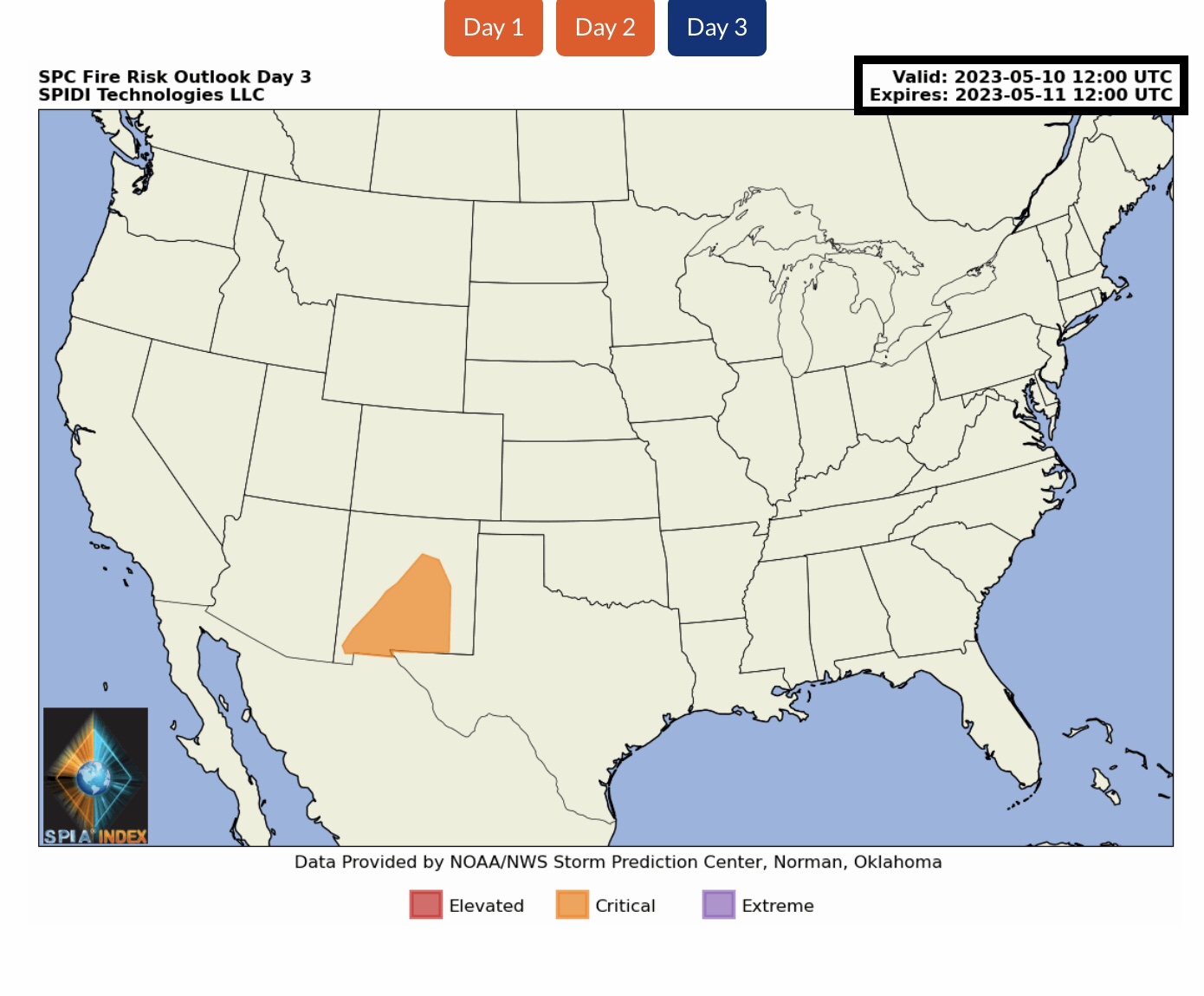
Note ELEVATED to CRITICAL Fire Risk Outlook, Days 1 thru 3, for parts AZ, CO, NM, OK and TX.
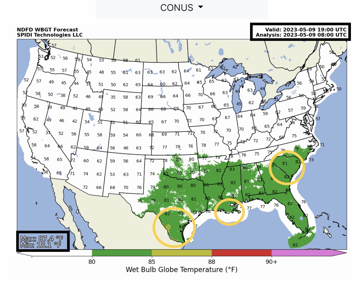
Wet Bulb Globe Temperatures will reach into the mid to upper 80s today in parts SC, GA, LA & Southern TX. Moderate Risk to Outdoor Workers exposed to direct sun.
Sid Sperry
President & CEO
SPIDI Technologies, LLC
SUBSCRIPTIONS: SPIDItech.com
Cell: (405) 627-7754
Email(s): SidSperry@gmail.com  OR  Sid.Sperry@spidiweather.com

Sent from my iPad

 Show/hide attachments