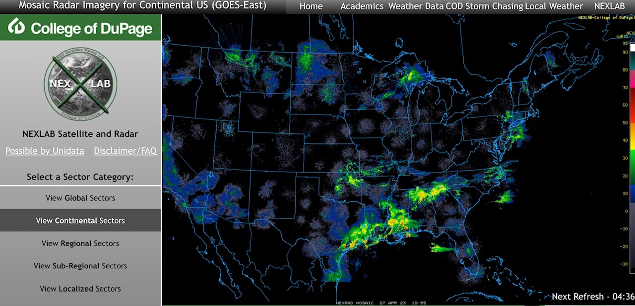
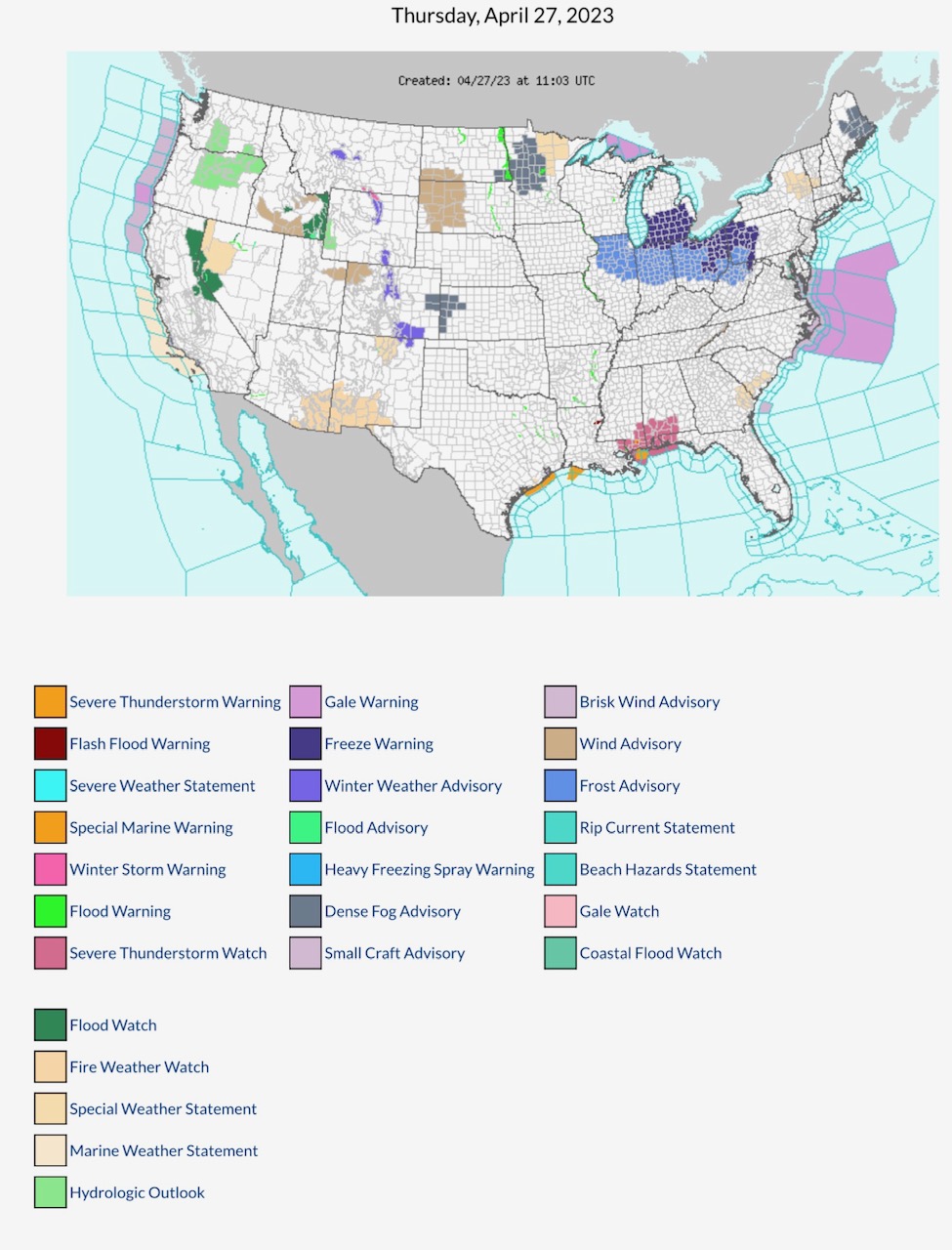
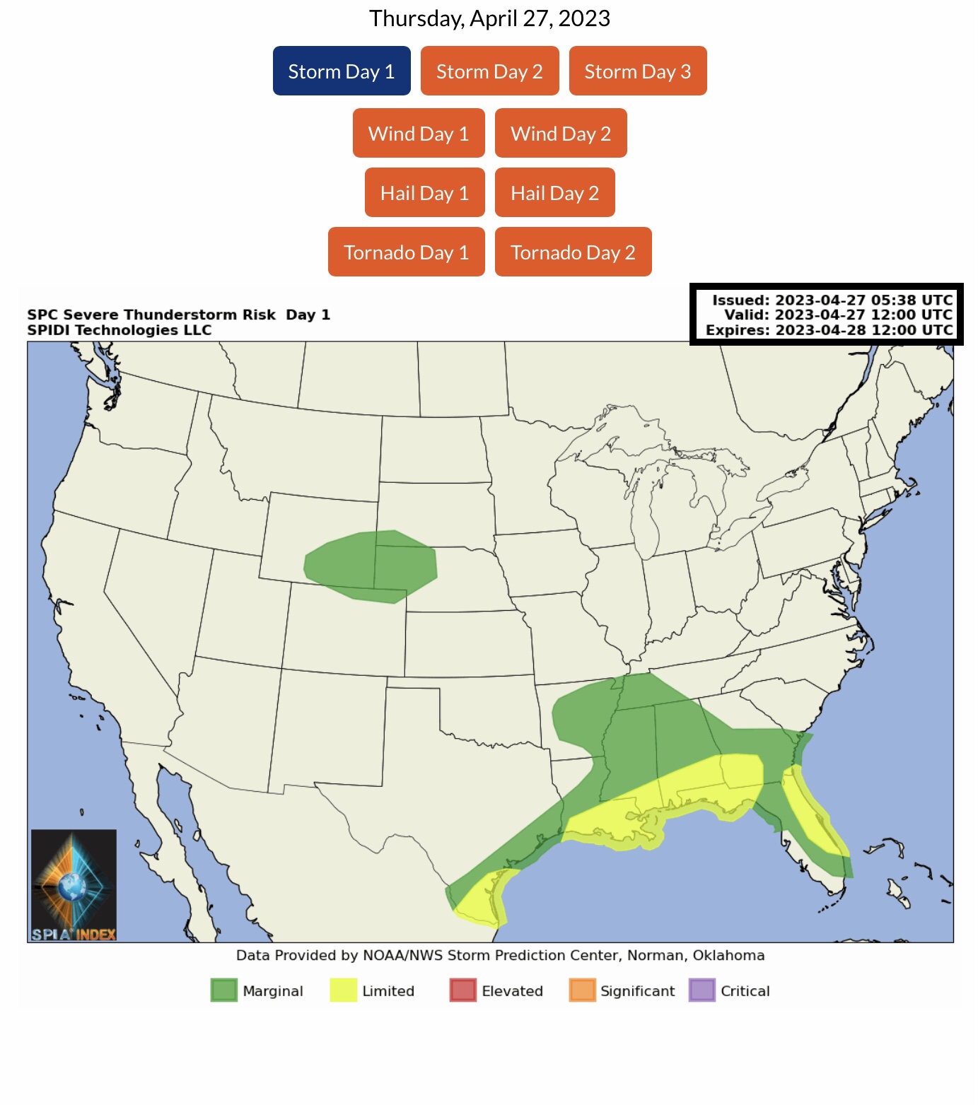
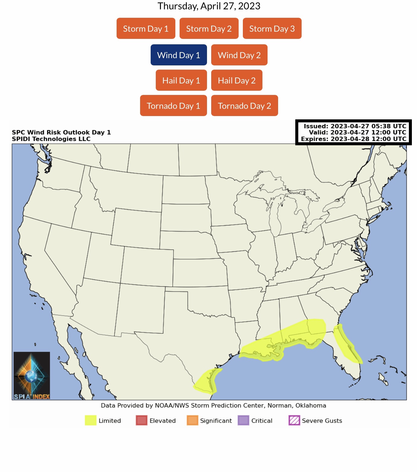
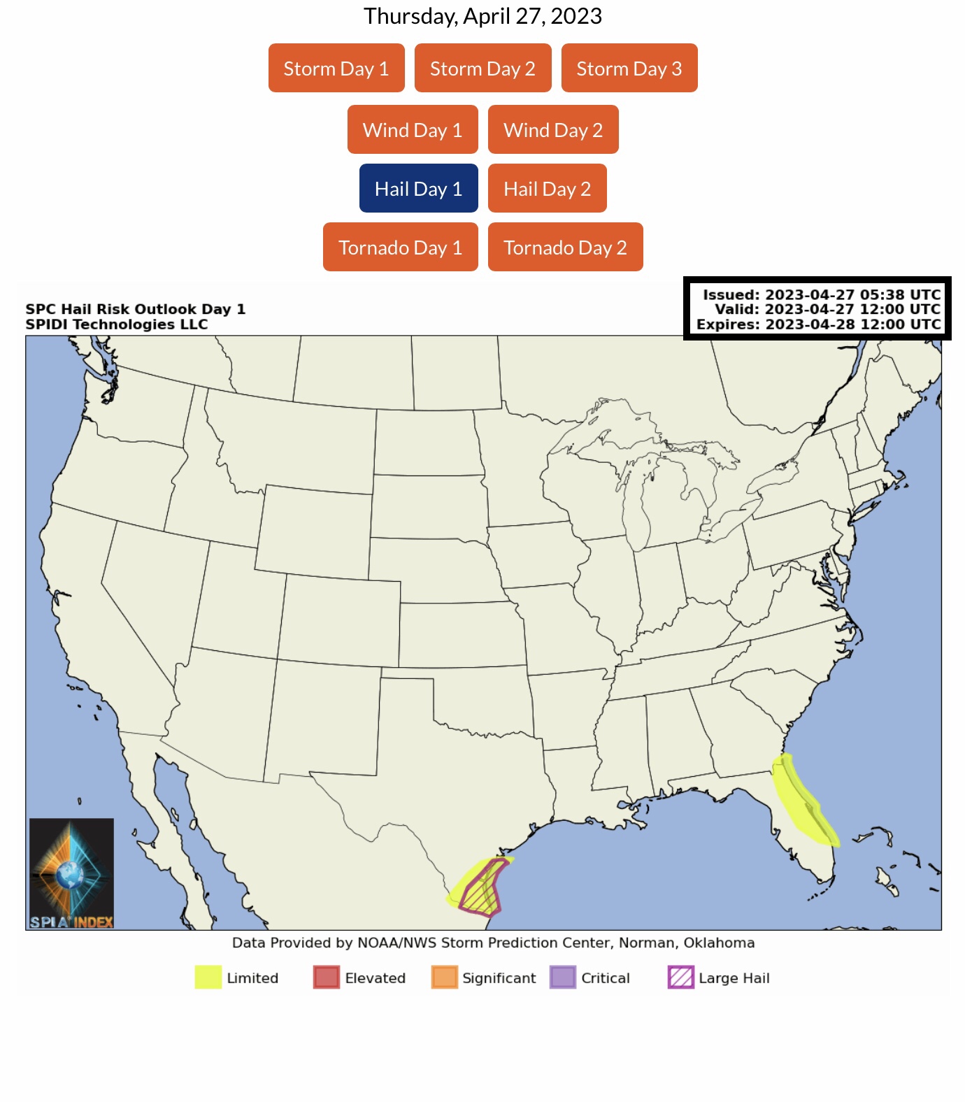
Current COD Mosaic Radar. Showers & thunderstorms ongoing in the South Central and Southeast Regions this morning. Current NWS Watches, Warnings & Advisories. Note Severe Thunderstorm Warnings & Flash Flood Warnings in parts LA, MS, AL & FL. Note Severe Thunderstorm Watch, parts LA, MS, AL & FL. Fire Weather Watch parts AZ & NM. Wind Advisories parts ID, UT, CO, ND & SD. LIMITED Severe T-Storm Risk, Day 1, parts TX, LA, MS, AL, FL, & GA. Includes High Wind & Hail Risk.
Sidney Sperry 27 Apr 2023 11:51 UTC
FYI…
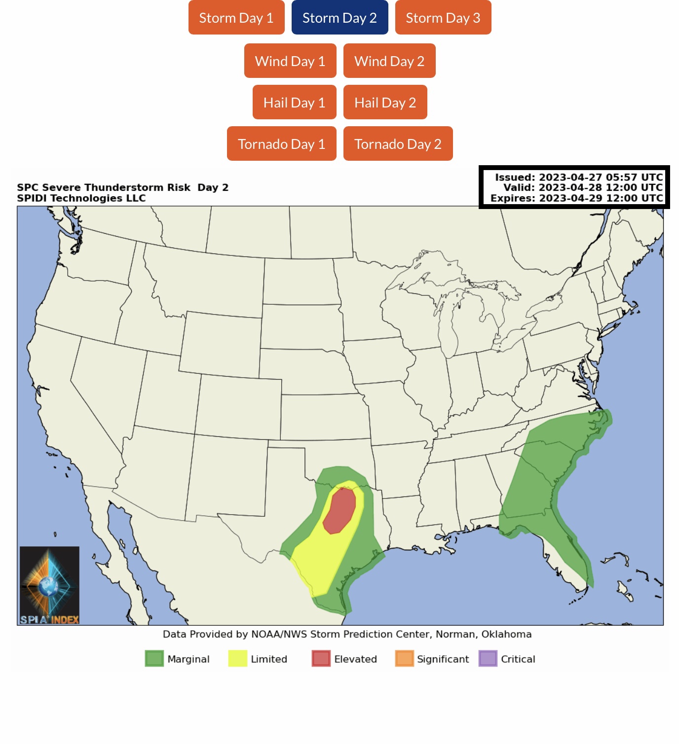
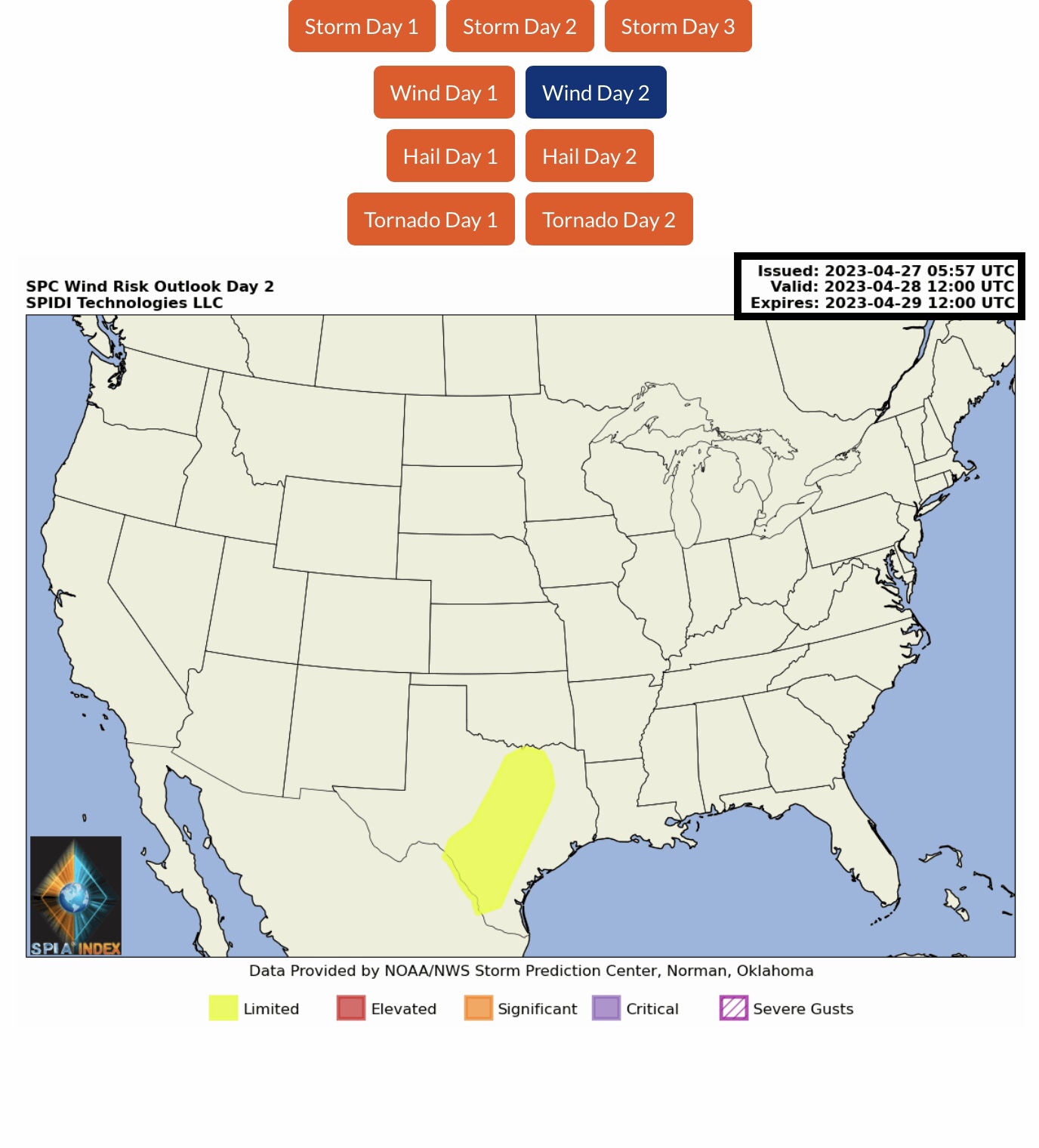
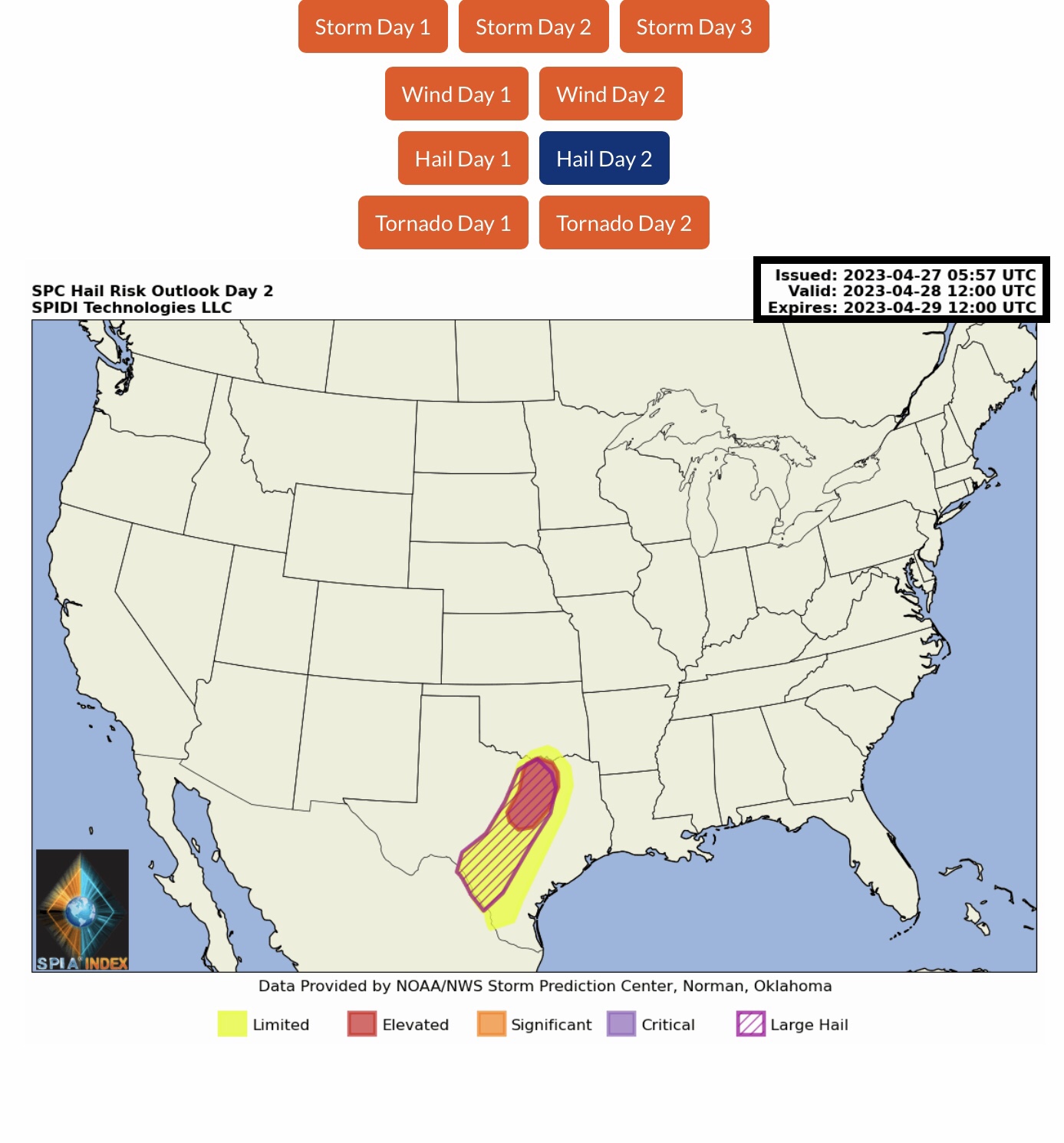
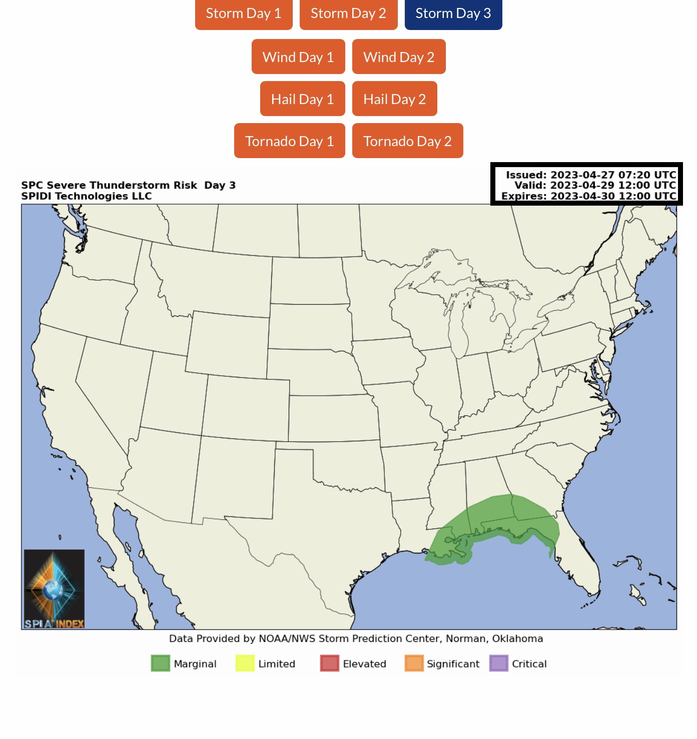
ELEVATED Severe Thunderstorm Risk, Day 2 (Friday into Saturday morning), parts OK & TX. Includes LIMITED High Winds Risk and ELEVATED Risk for Hail & Large Hail in TX.
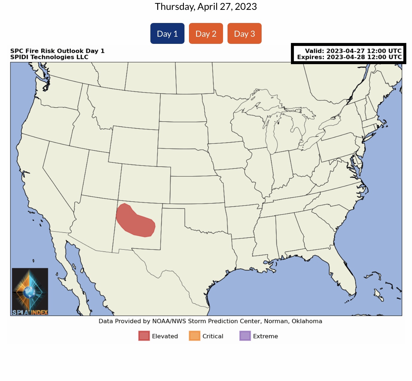
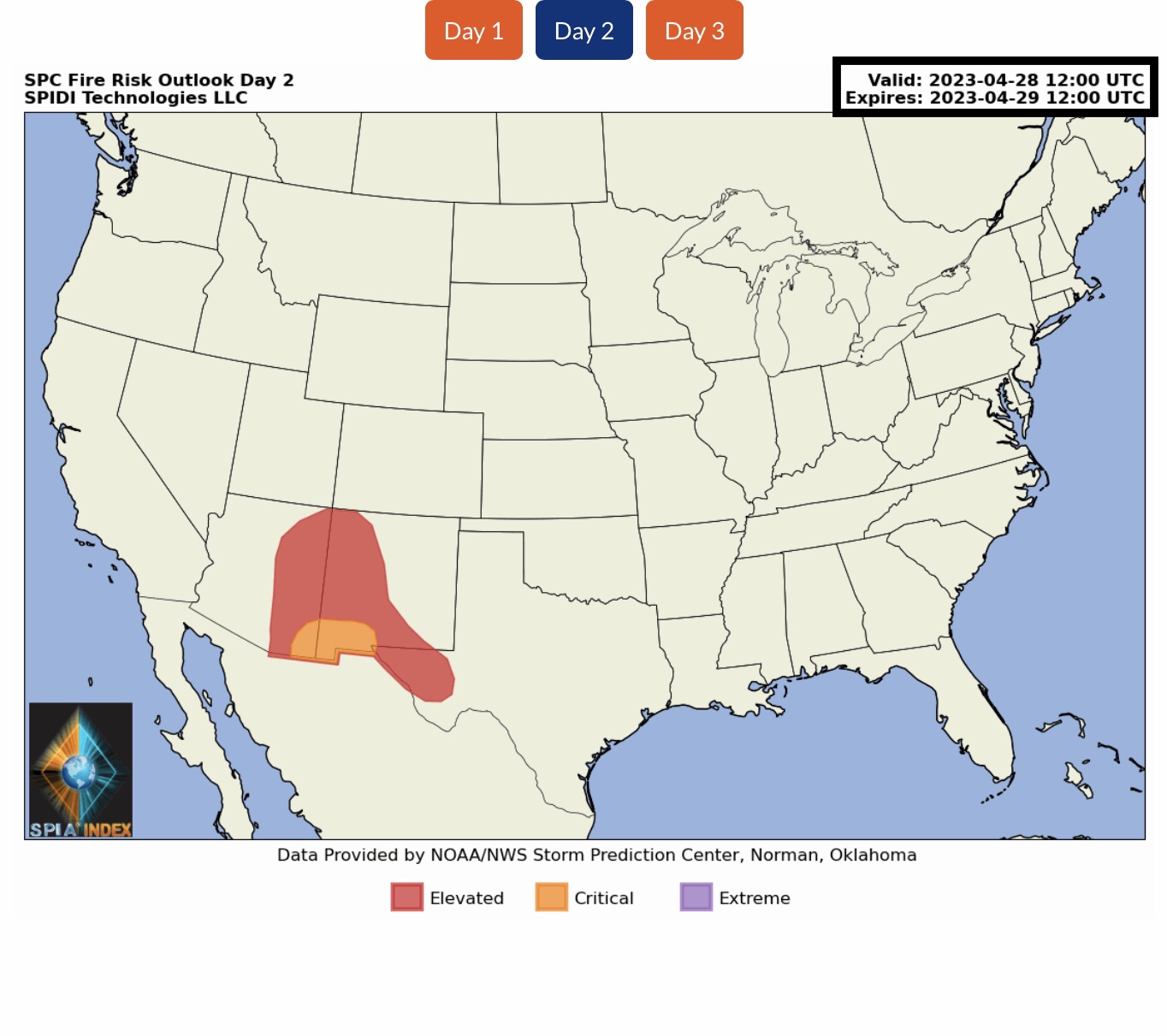
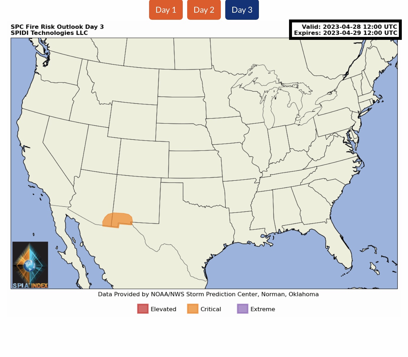
ELEVATED to CRITICAL Fire Risk, Days 1 thru 3, parts AZ, NM & TX.
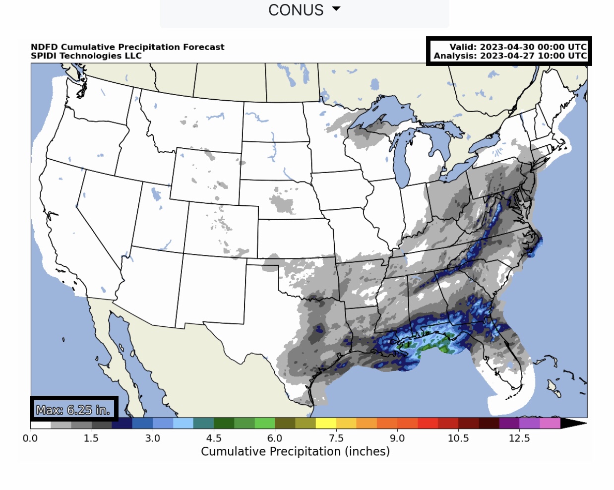
From 3” up to 6” rainfall totals over next 72-hours, parts LA, MS, AL, FL & southern GA.
Sid Sperry
President & CEO
SPIDI Technologies, LLC
SPIDItech.com
Cell: (405) 627-7754
Email(s): SidSperry@gmail.com  OR  Sid.Sperry@spidiweather.com

Sent from my iPad

 Show/hide attachments