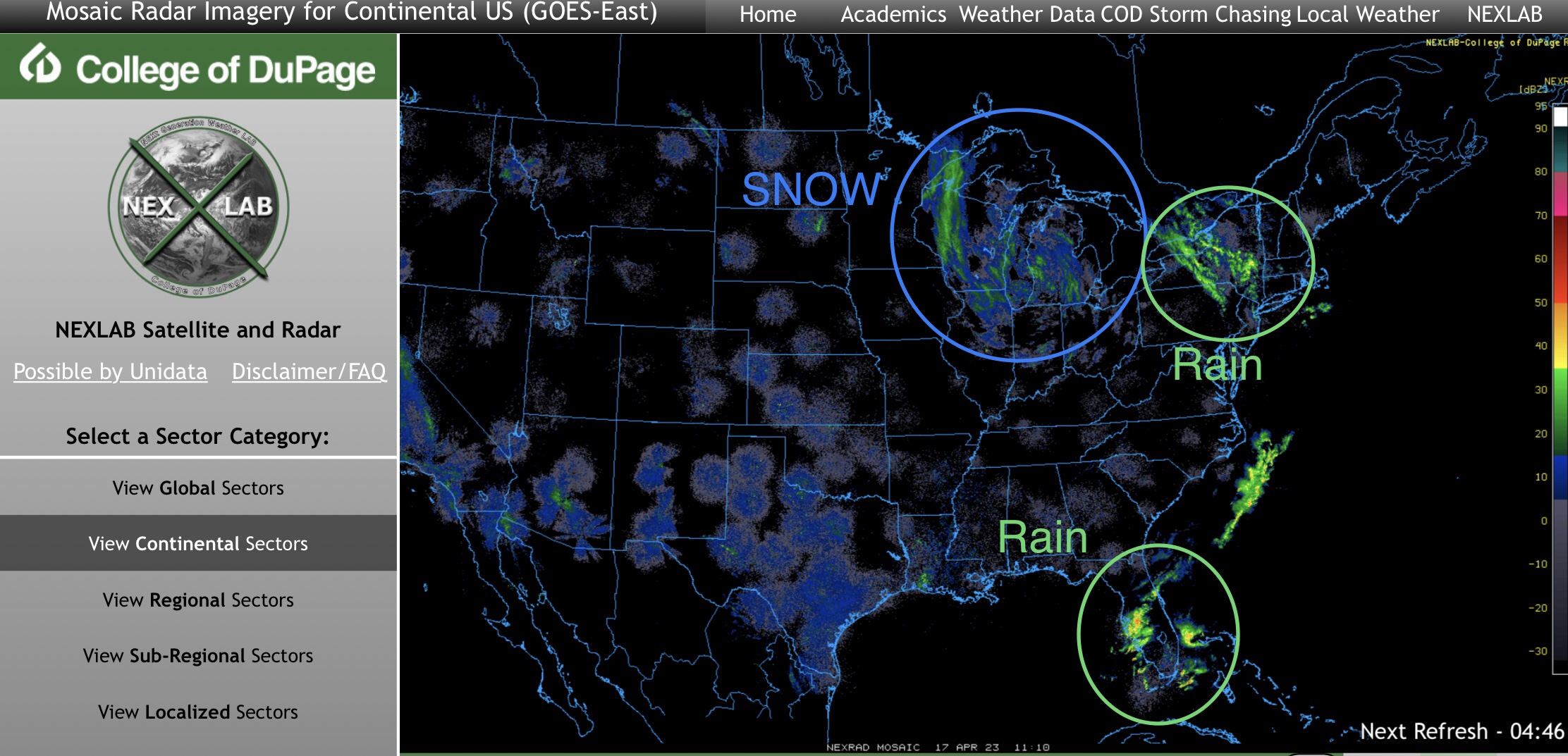
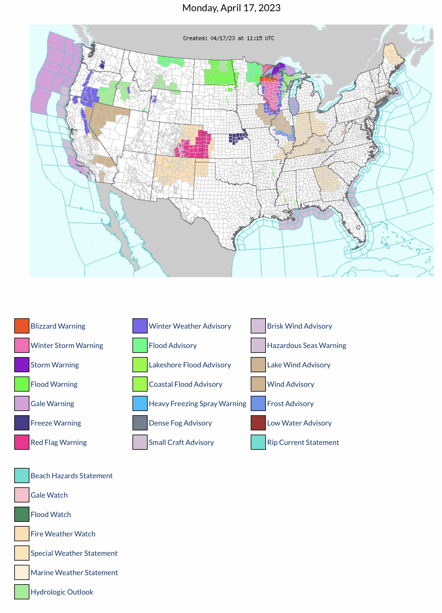
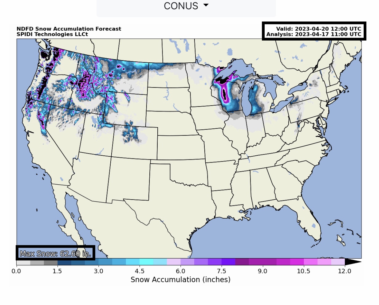
Current (6:15am CDT 4/17/23) COD Mosaic Radar: heavy snow & blizzard conditions parts WI & MN. Also snow in MI and northern IL. Rain showers across parts NY, PA & FL. Current NWS Watches, Warnings & Advisories: Winter Storm Warnings parts MN, WI & MI Upper Peninsula; Blizzard Warnings parts WI & MI Upper Peninsula. Red Flag Fire Warnings parts NE, CO & KS. Fire Weather Watch Parts CO, KS, NM, OK, TX, IN, OH, IL, MO, KY, GA, MA & ME. Wind Advisories parts CA, NV, IA, IL & KY.
Sidney Sperry 17 Apr 2023 11:59 UTC
FYI…
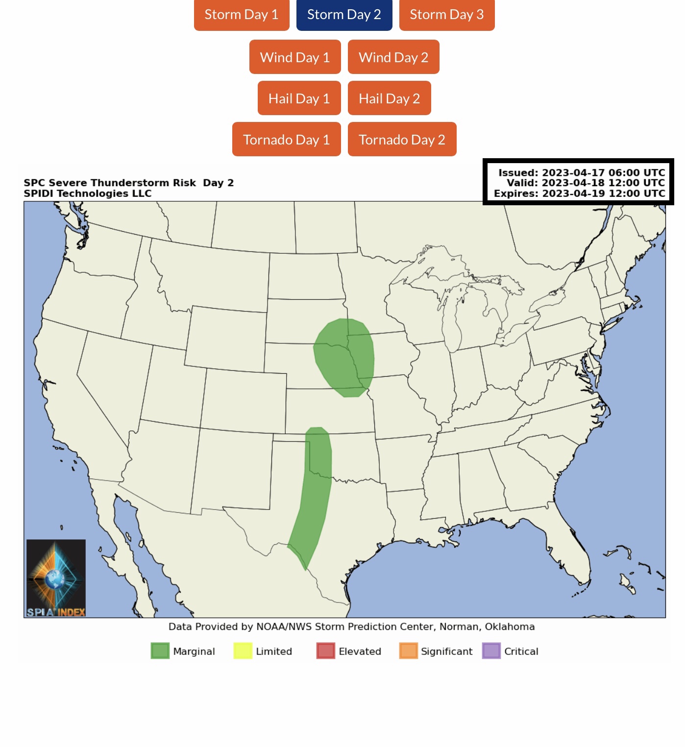
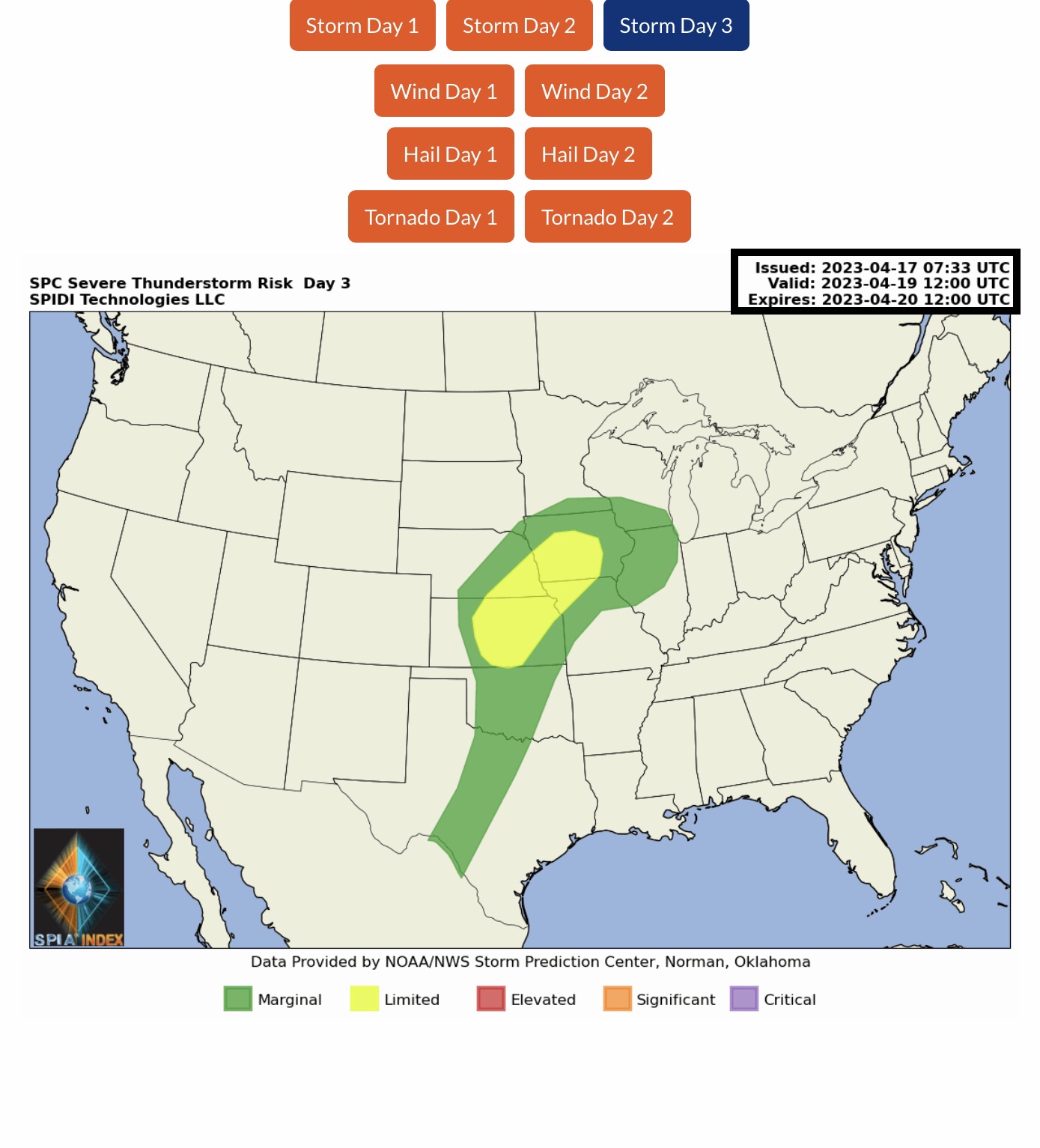
LIMITED Severe Thunderstorm Risk, Day 3 (Wednesday), parts IA, NE, MO, KS & OK.
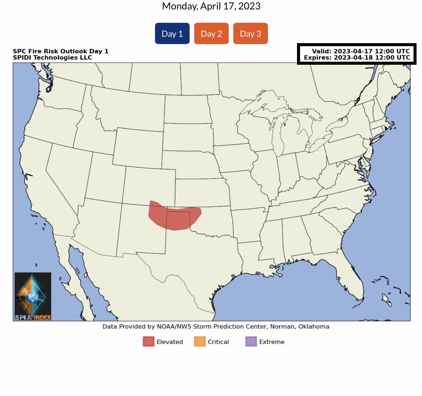
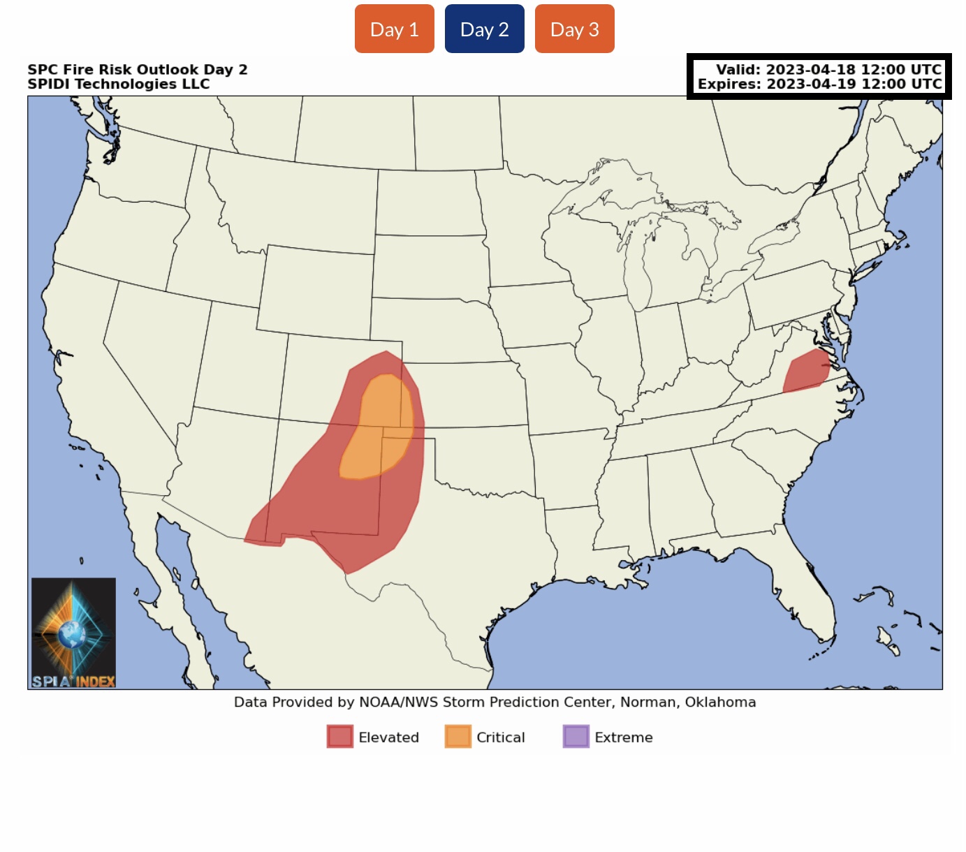
ELEVATED Fire Risk Outlooks, Day 1 (Today, Monday, 4/17/23), parts CO, NM, OK & TX. ELEVATED to CRITICAL Fire Risk Outlooks, Day 2 (Tuesday), parts AZ, NM, CO, KS, OK, TX & VA.
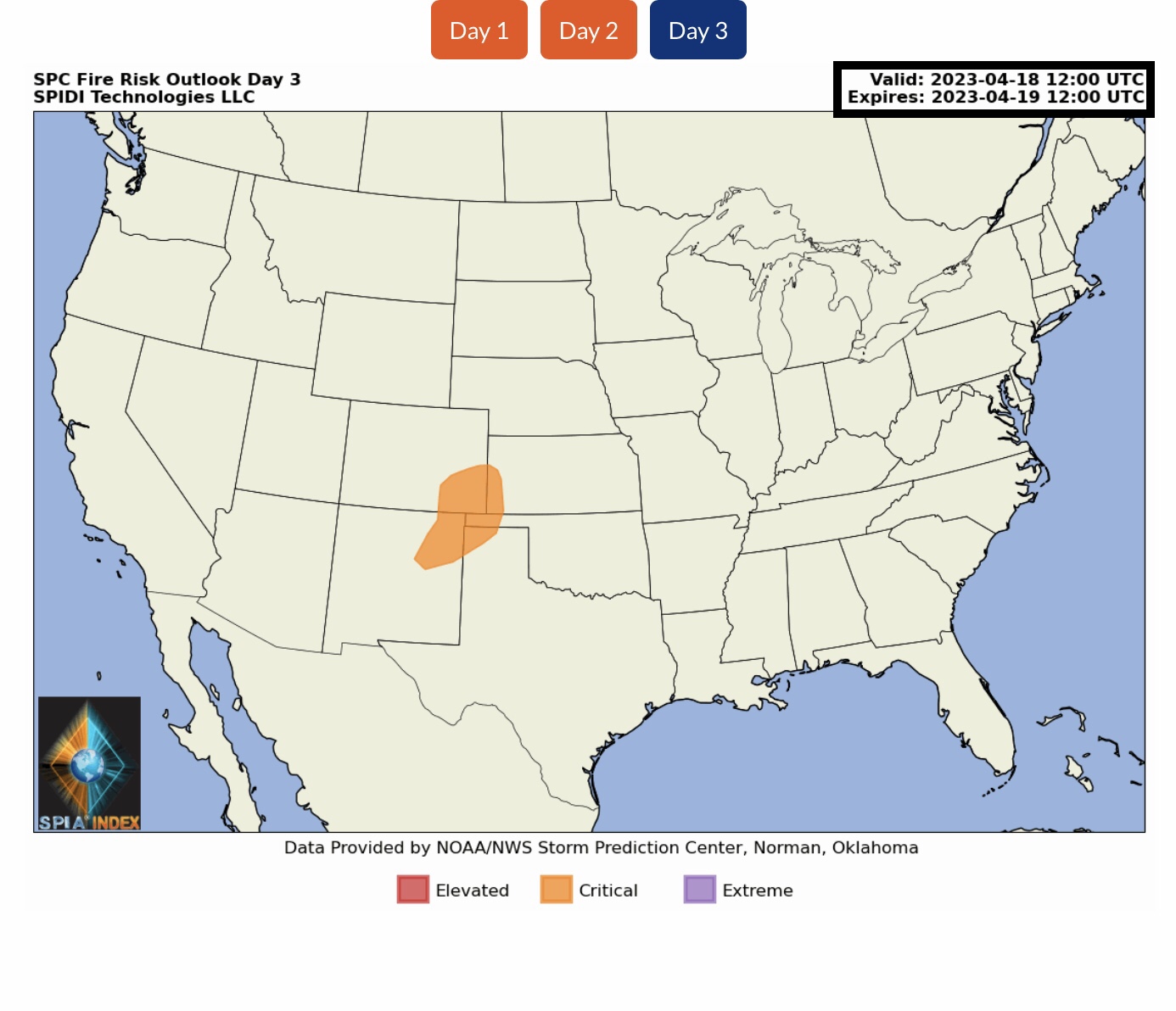
CRITICAL Fire Risk Outlook, Day 3 (Wednesday), parts CO, KS, NM, OK & TX.
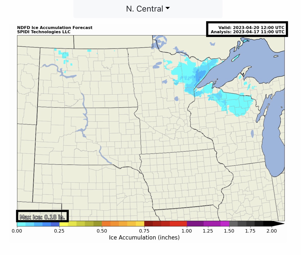
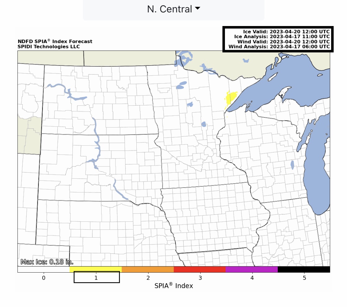
Max ICE in NWS Forecast Grids: 0.18” parts northeast MN; SPIA Index Ice Impact Forecast: Level 1, parts northeast MN, northwest WI.
Up to 20” SNOW possible parts WI and MI Upper Peninsula.
Sid Sperry

Sent from my iPad

 Show/hide attachments