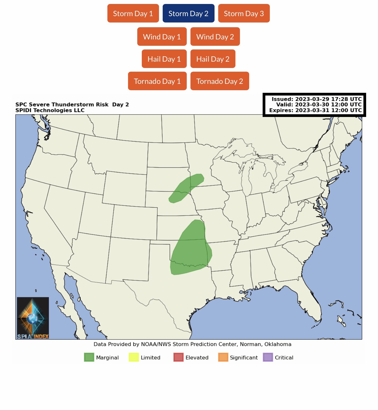
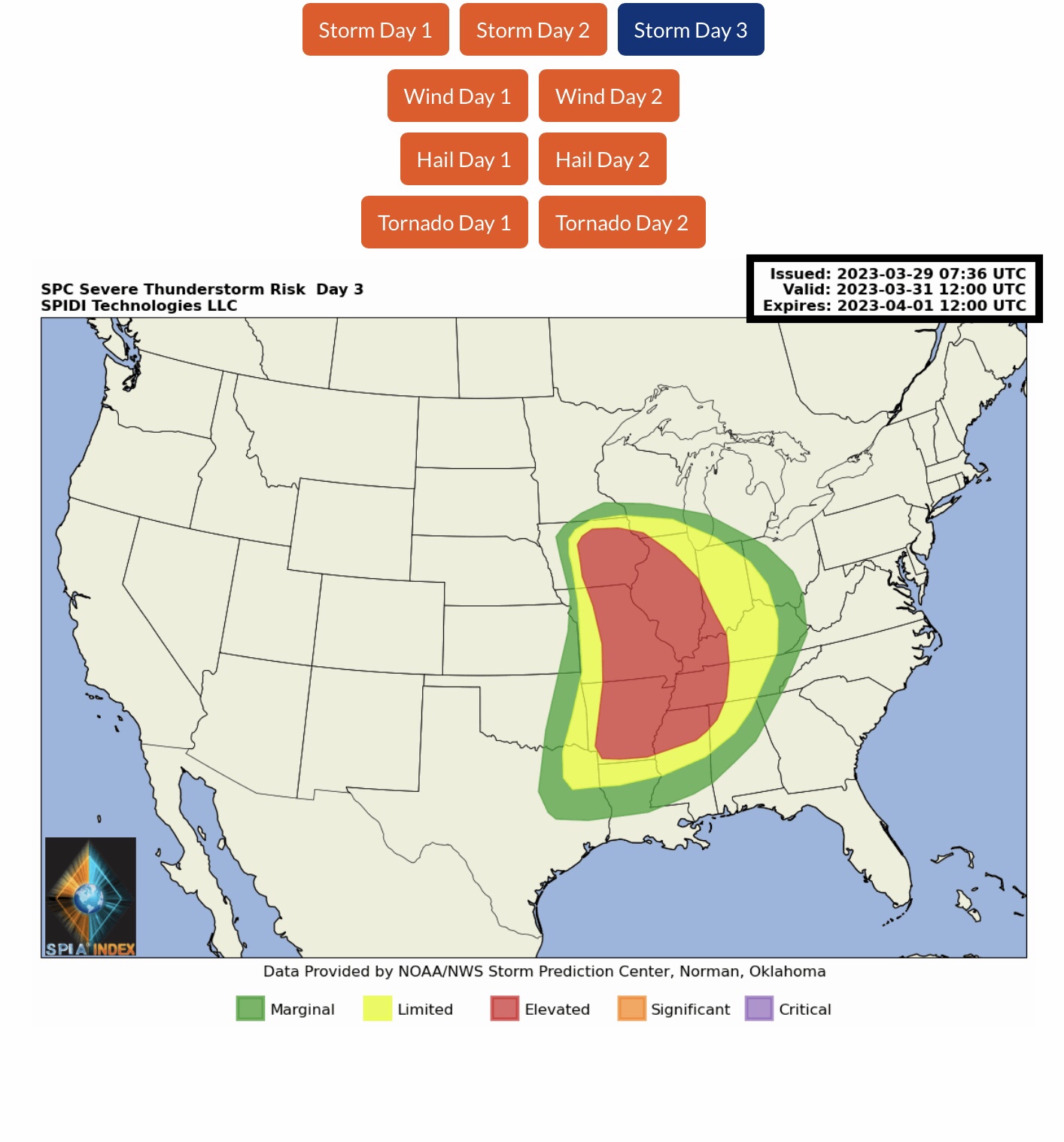
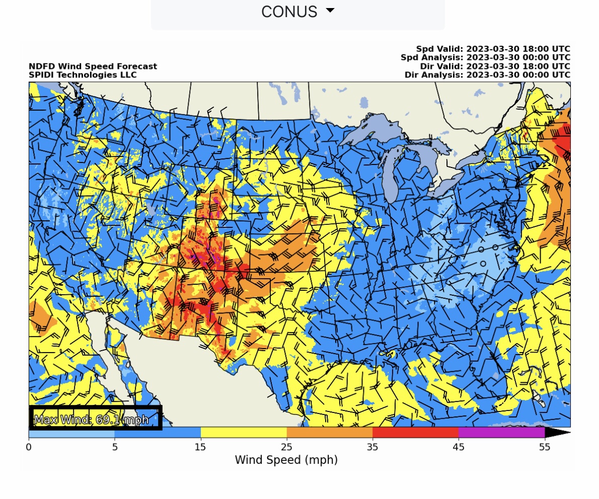
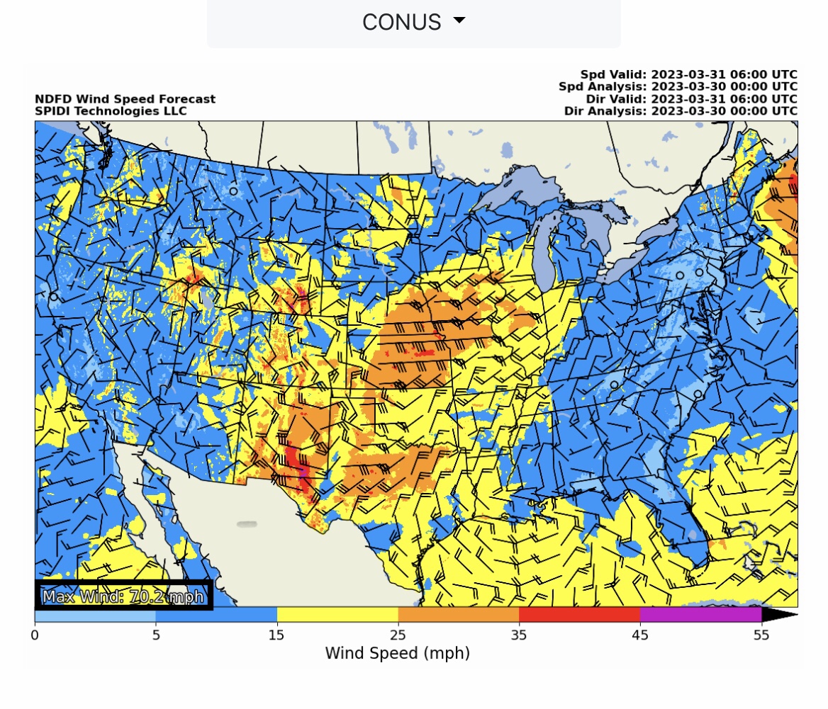
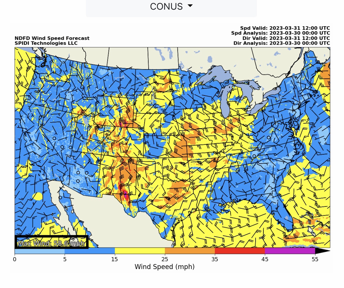
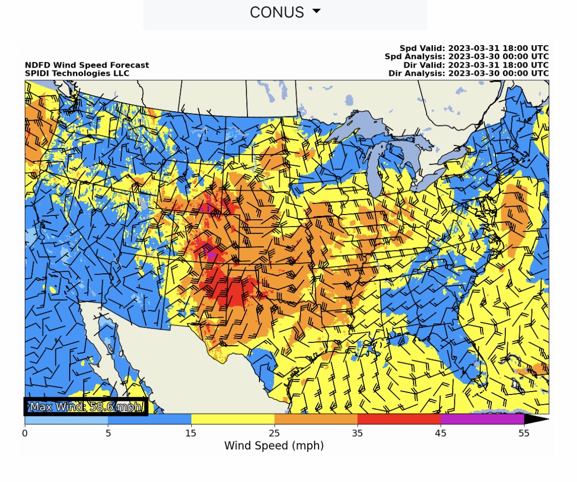
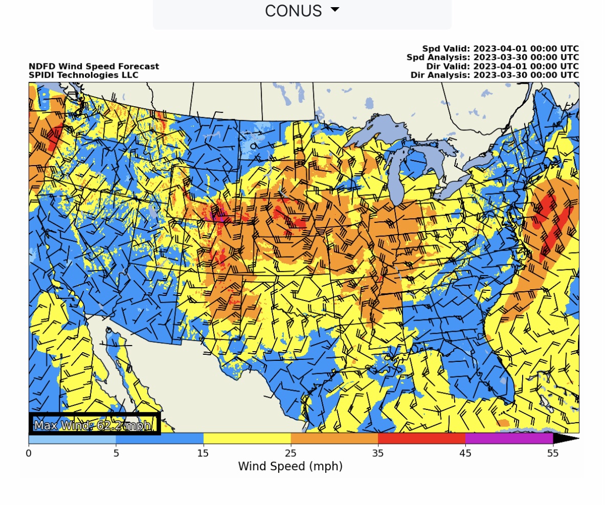
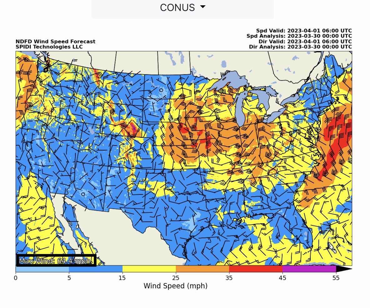
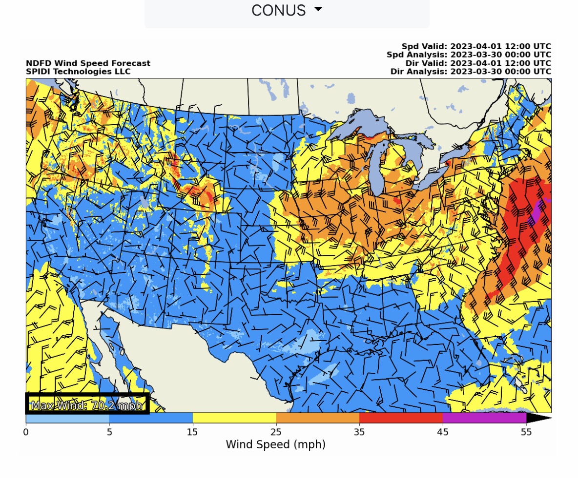
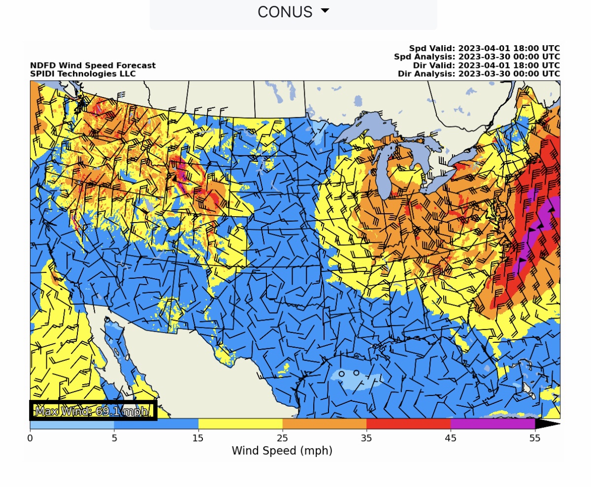
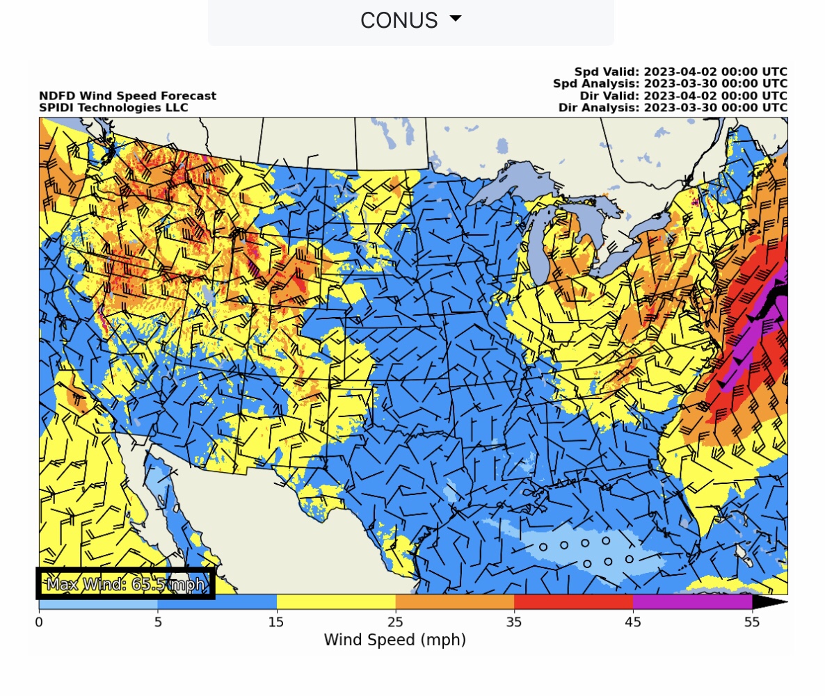
MARGINAL Severe Thunderstorm Risk tomorrow (Thursday, 3/30/2023), parts MN, SD, IA, NE, KS, OK, MO, TX & AR. ELEVATED Severe Thunderstorm Risk for Friday, 3/31/2023, parts IA, WI, MO, IL, IN, KY, AR, TN, MS & AL. NOTE: Sustained Winds over the next 24 to 60 hours (to Saturday morning, 4/1/2023) are forecast to be in the 55 to 70 mph range over large parts of the South Rockies, North Central, South Central, and Northeast Regions.
Sidney Sperry 30 Mar 2023 01:21 UTC
FYI…

These High Sustained Winds will potentially cause dust storms in the South Rockies and South Central Regions, and raise the SPIA Index Ice Impact Forecasts to Levels 3 & 4 in parts SD, MN, WI, MI and the MI Upper Peninsula. Straight Line sustained winds of 70 mph with gusts to 80 mph are possible in some areas of the U.S. over the next 24 to 60 hours, potentially causing electric and communications utility infrastructure damages.

Sid Sperry
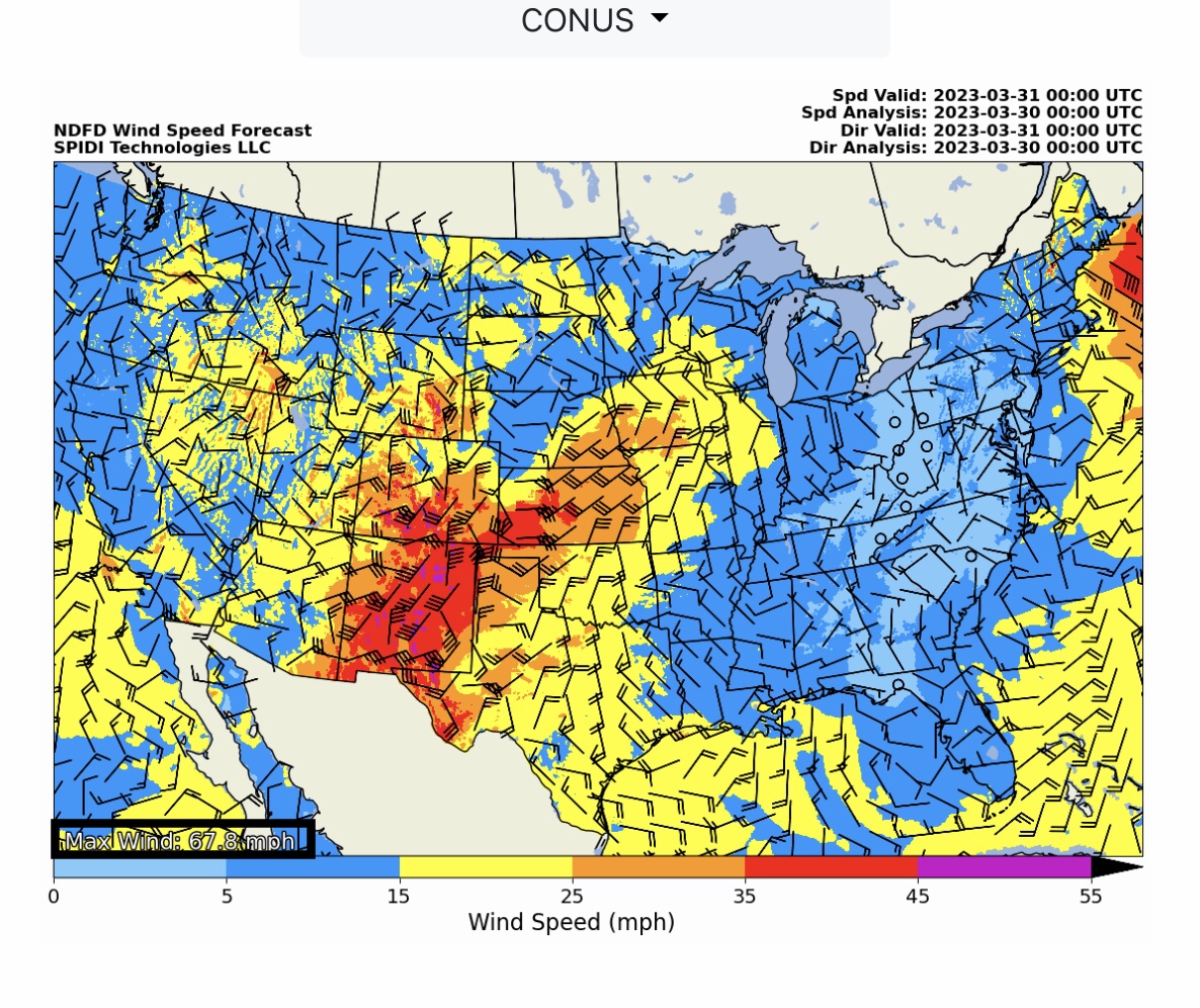
NWS Sustained Wind Speed Forecasts in 6-hour increments from 1pm CDT Thursday, March 30, through 7pm Saturday, April 1. These 55 to 70 mph sustained winds with possible gusts to 80 mph could cause infrastructure damage in some areas. EXTREMELY HIGH FIRE DANGER parts CO, NM, KS, OK & TX over next 24 to 60 hours.

 Show/hide attachments