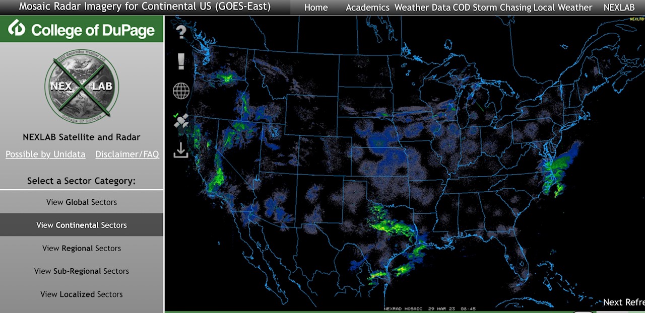
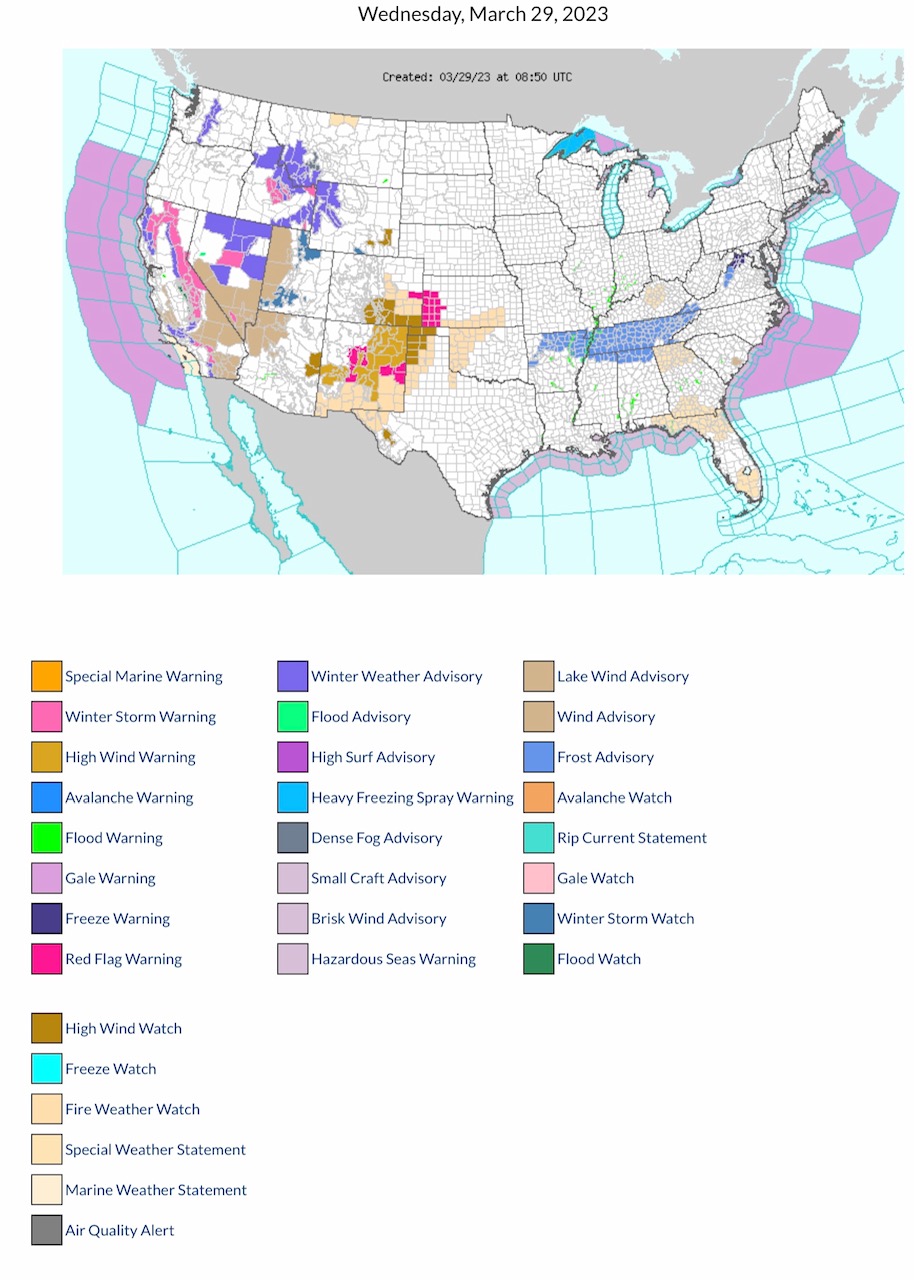
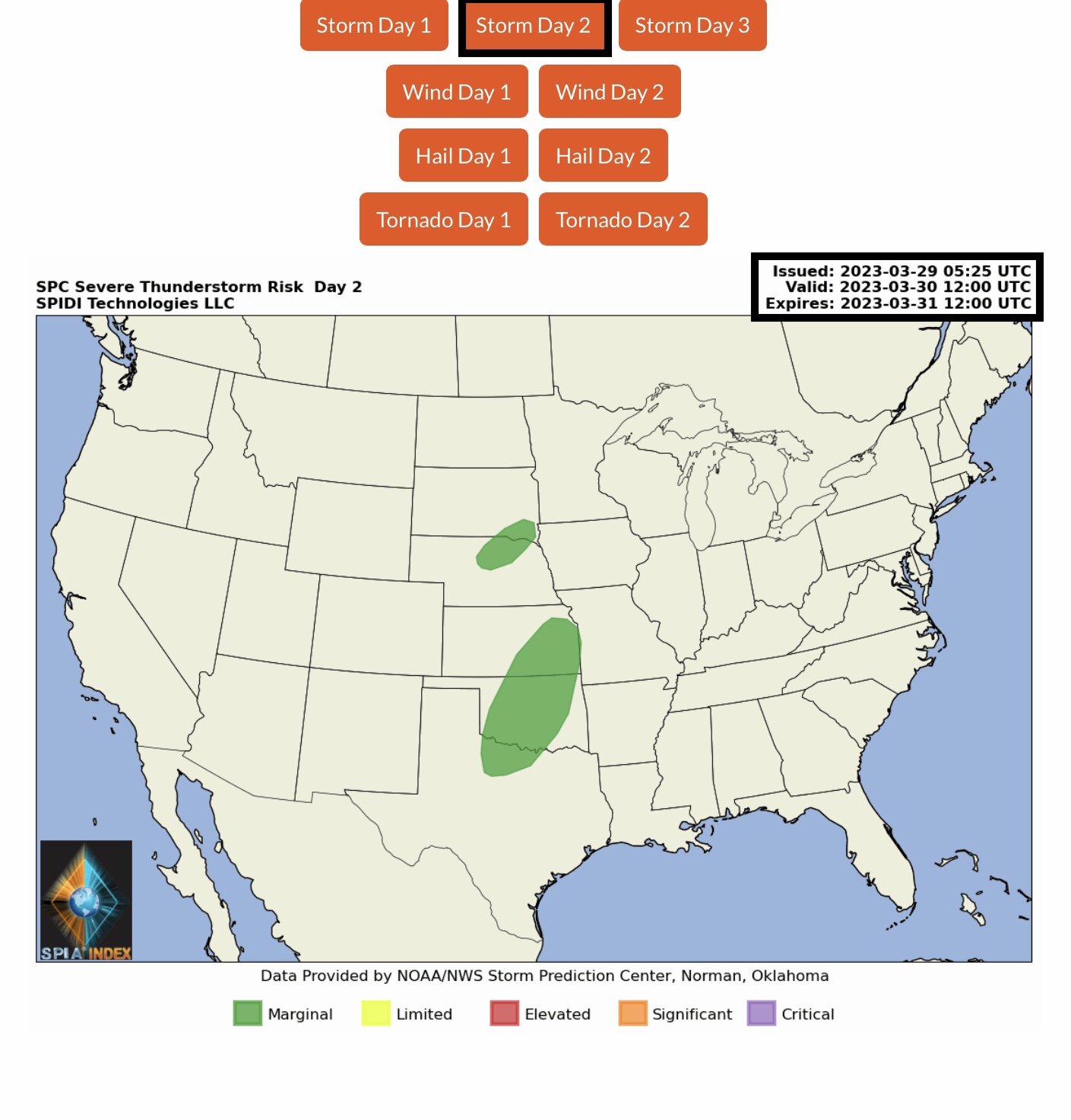
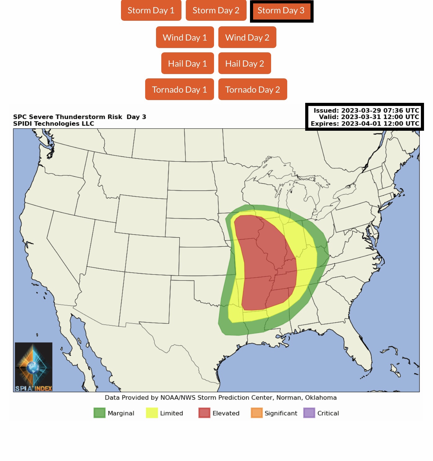
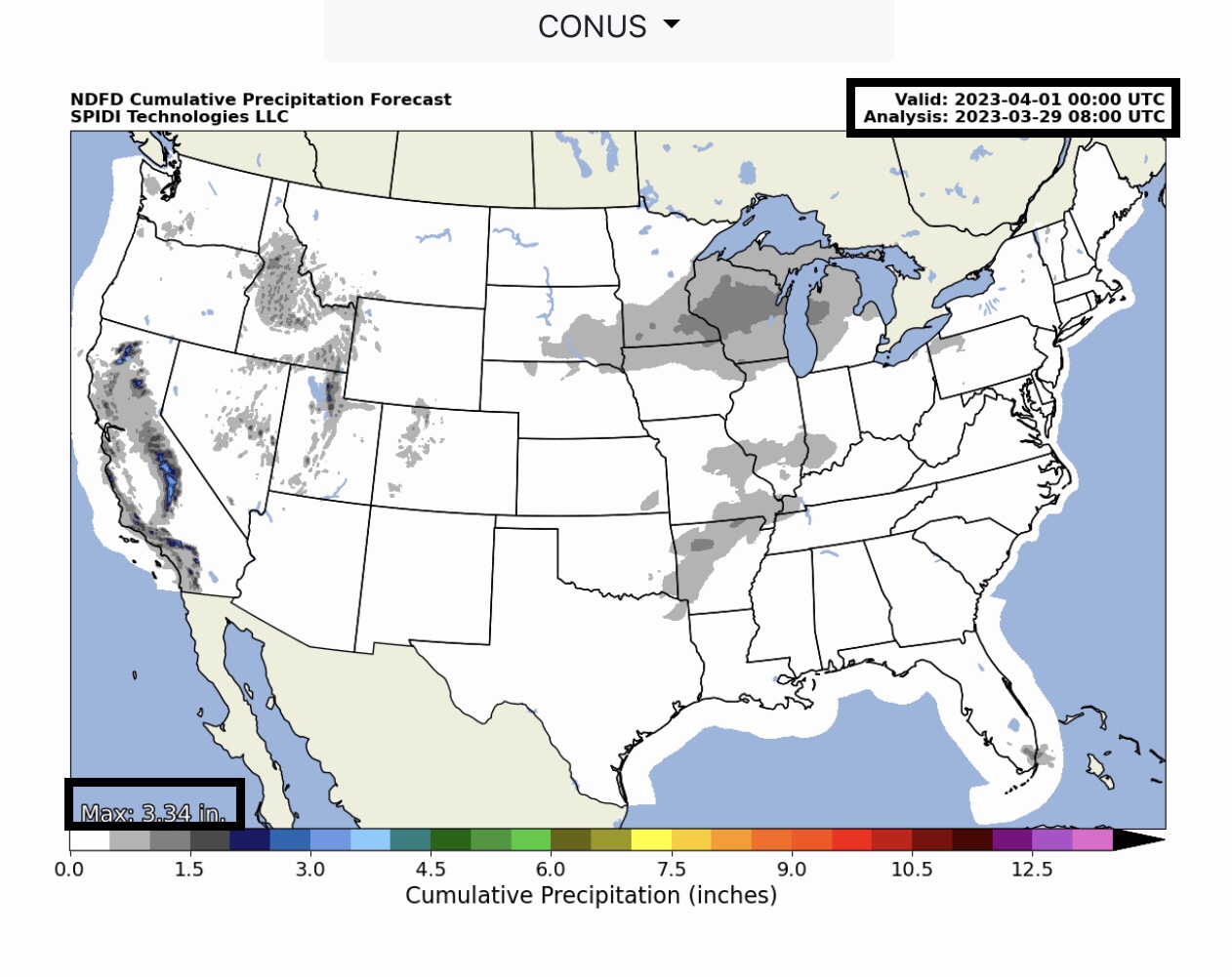
Rain Showers and some thunderstorms this morning across parts CA, NV, TX & NC. Current NWS Watches, Warnings & Advisories: Winter Storm Warnings parts CA, ID & NV. High Wind Warnings & Wind Advisories parts CA, NV, UT, AZ, WY, CO, NM, OK & TX. Red Flag Fire Warnings parts CO, KS & NM; Fire Weather Watch parts CO, KS, NM, OK & TX. LIMITED to ELEVATED Severe Thunderstorm Risk, Day 3 (Friday), parts OK, TX, LA, MS, AL, AR, TN, KY, MO, IA, IL, WI, IN, MI & OH…
Sidney Sperry 29 Mar 2023 09:59 UTC
FYI… Active Weather Pattern across South Central Region, North Central Region, Northeast Region and Southeast Region on Thursday and Friday, into Saturday AM. Severe Thunderstorms with High Winds, Hail & Large Hail, and some Tornadoes possible in LIMITED and ELEVATED RISK AREAS.
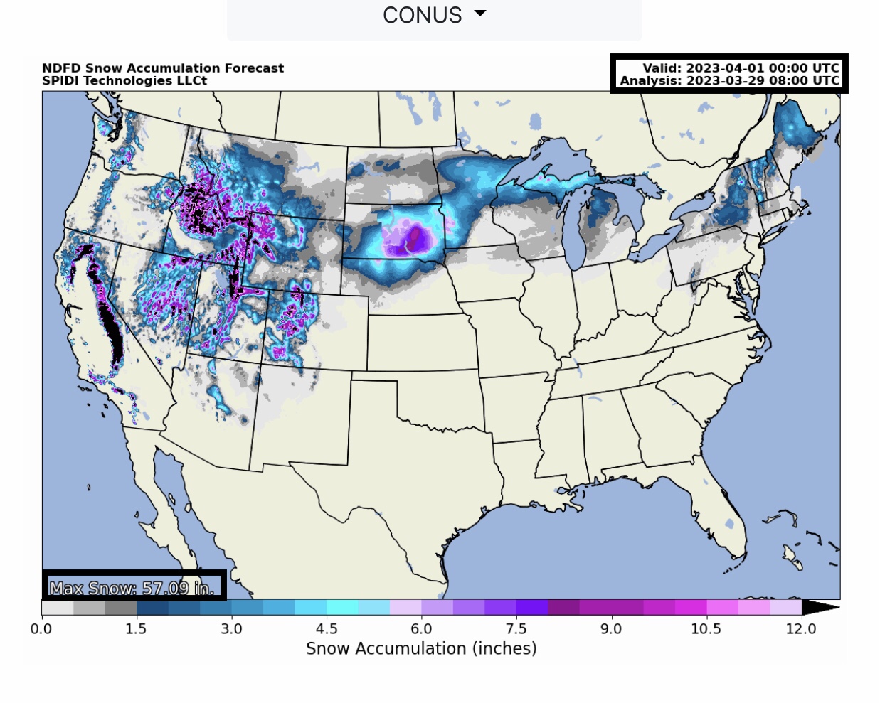
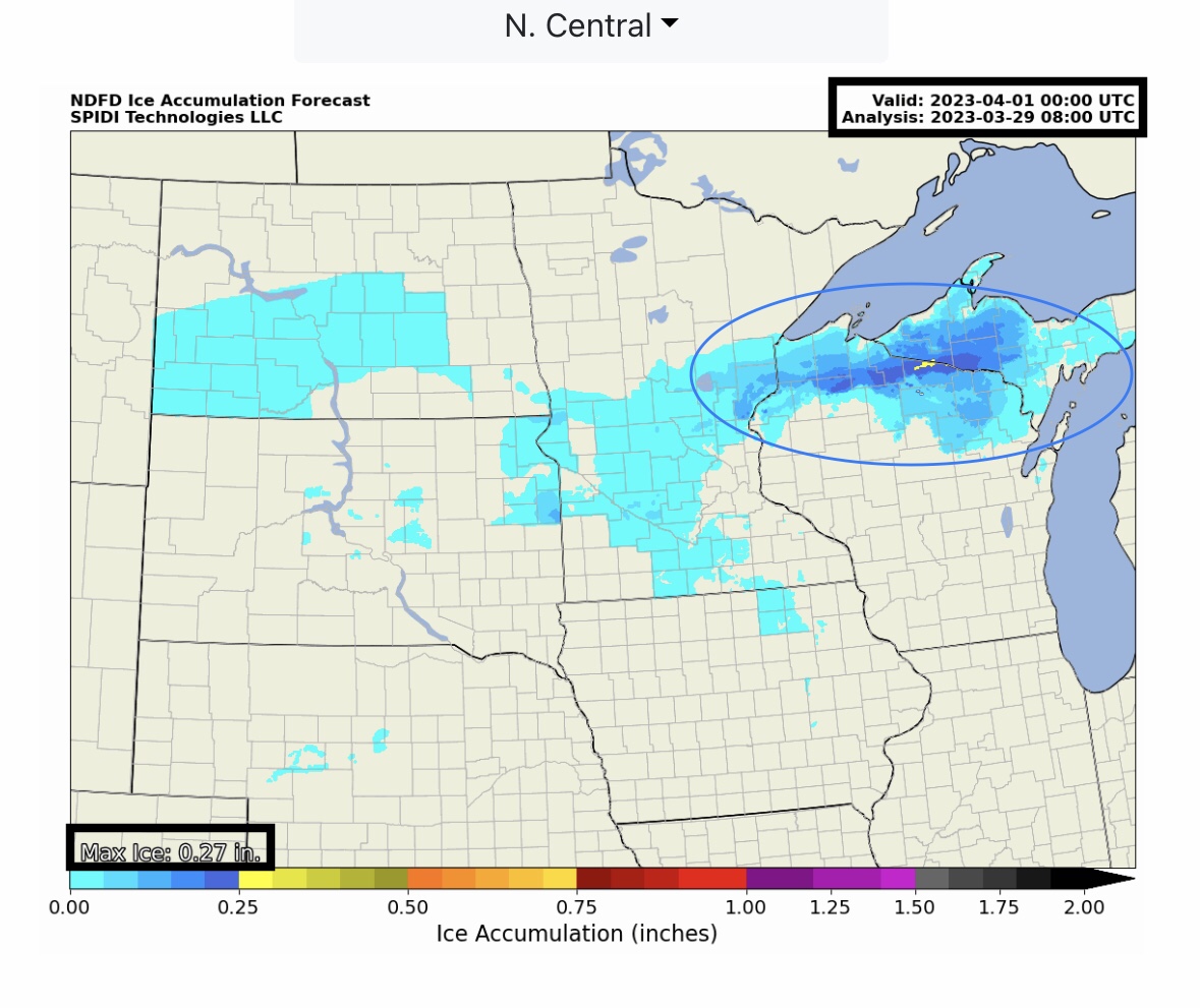
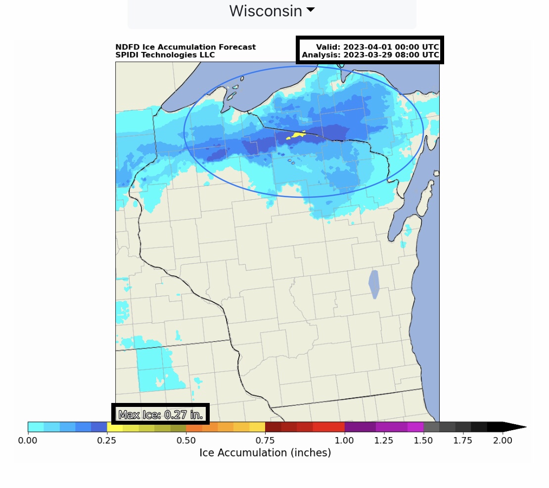
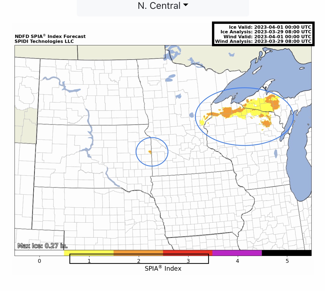
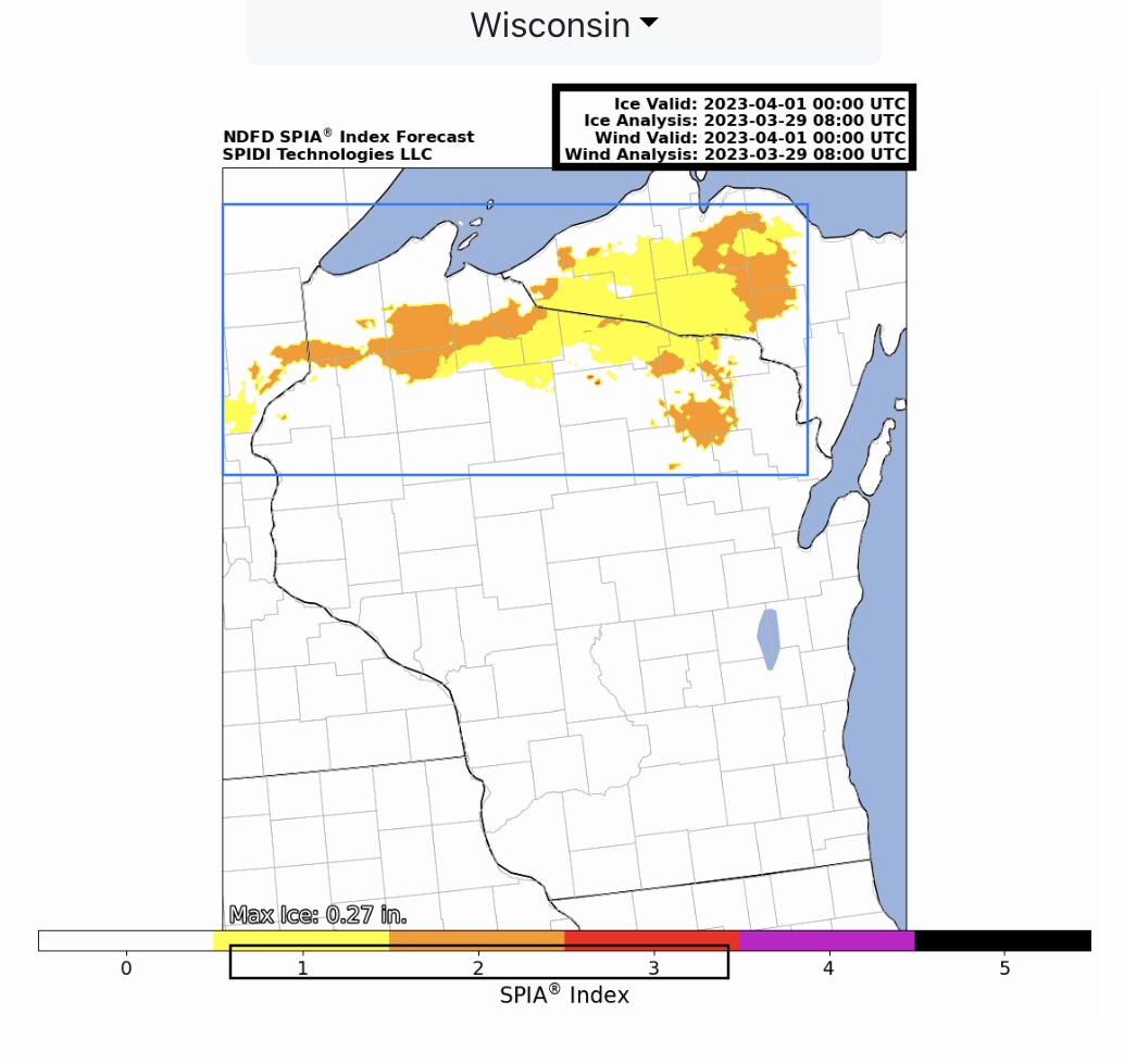
Further North, light to moderate ICE ACCUMULATION is being forecast by the NWS for the Thursday night through Saturday morning time frame, with heaviest ice forecast across parts eastern MN, northern WI, the western MI Upper Peninsula & eastern SD. Max Ice in the NWS grids: 0.27” northern WI. Current SPIA Index Ice Impact Forecast: Levels 1 thru 3, parts northern WI and the western third of the MI Upper Peninsula.
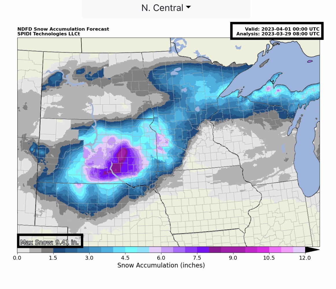
Up to 10” SNOW possible across parts eastern & southeastern SD Thursday evening through Saturday AM; from 4” to 7” possible across the western MI Upper Peninsula.
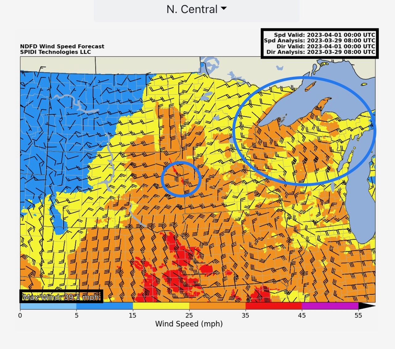
Sustained Winds of 25 to 30 mph + are driving the SPIA Index Ice Impact Forecast to Level 3 in parts of northern WI and the western MI Upper Peninsula during the Thursday night through Saturday morning time frame.
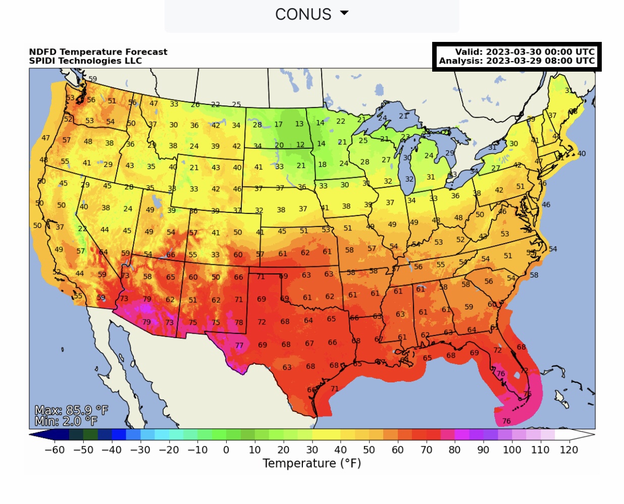
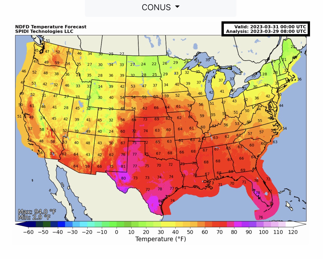
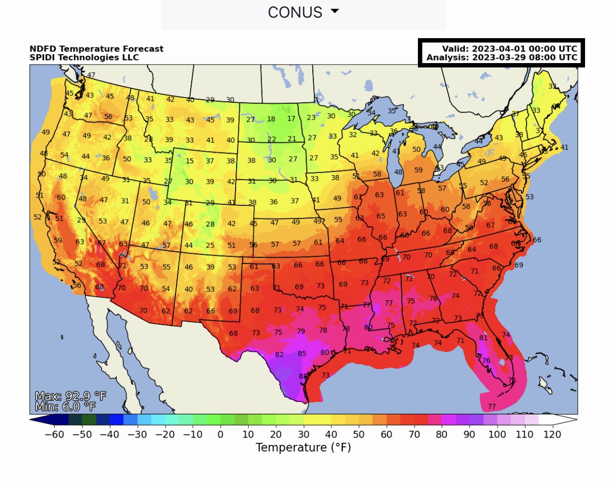
NWS NDFD Temperature Forecasts at 7pm CDT today (Wednesday, 3/29/2023), Thursday and Friday, March 30 & 31, 2023.
Sid Sperry
President & CEO
SPIDI Technologies, LLC
SPIDItech.com
Cell: (405) 627-7754
Email(s): SidSperry@gmail.com  OR  Sid.Sperry@spidiweather.com

Sent from my iPad

 Show/hide attachments