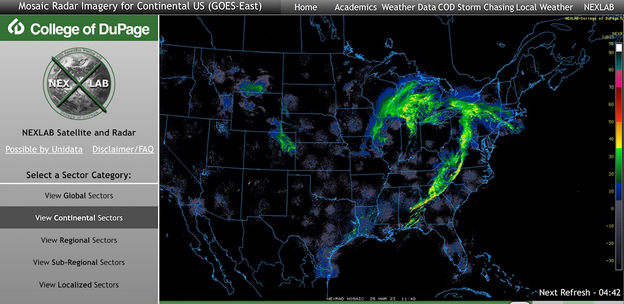
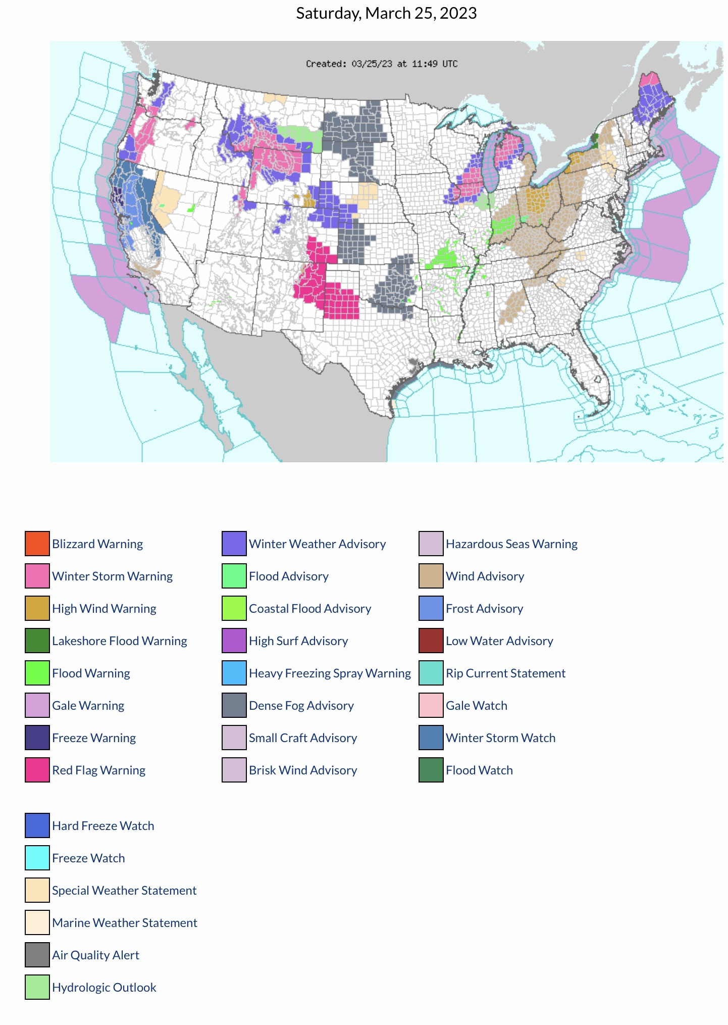
Current COD Mosaic Radar: thunderstorms continue this morning from central & southern AL into northern GA, northwestern SC, western NC and central VA. Mix of snow & freezing rain in parts WI, IL, MI, WV, NY, PA & MA. High Wind Warnings & Wind Advisories parts WY, AL, GA, TN, NC, KY, WV, IN, OH, MI, PA, NY & VT. Red Flag Fire Warnings parts CO, NM & TX. Winter Storm Warnings parts WA, OR, MT, WY, UT, IA, IL, WI, MI & ME…
Sidney Sperry 25 Mar 2023 12:48 UTC
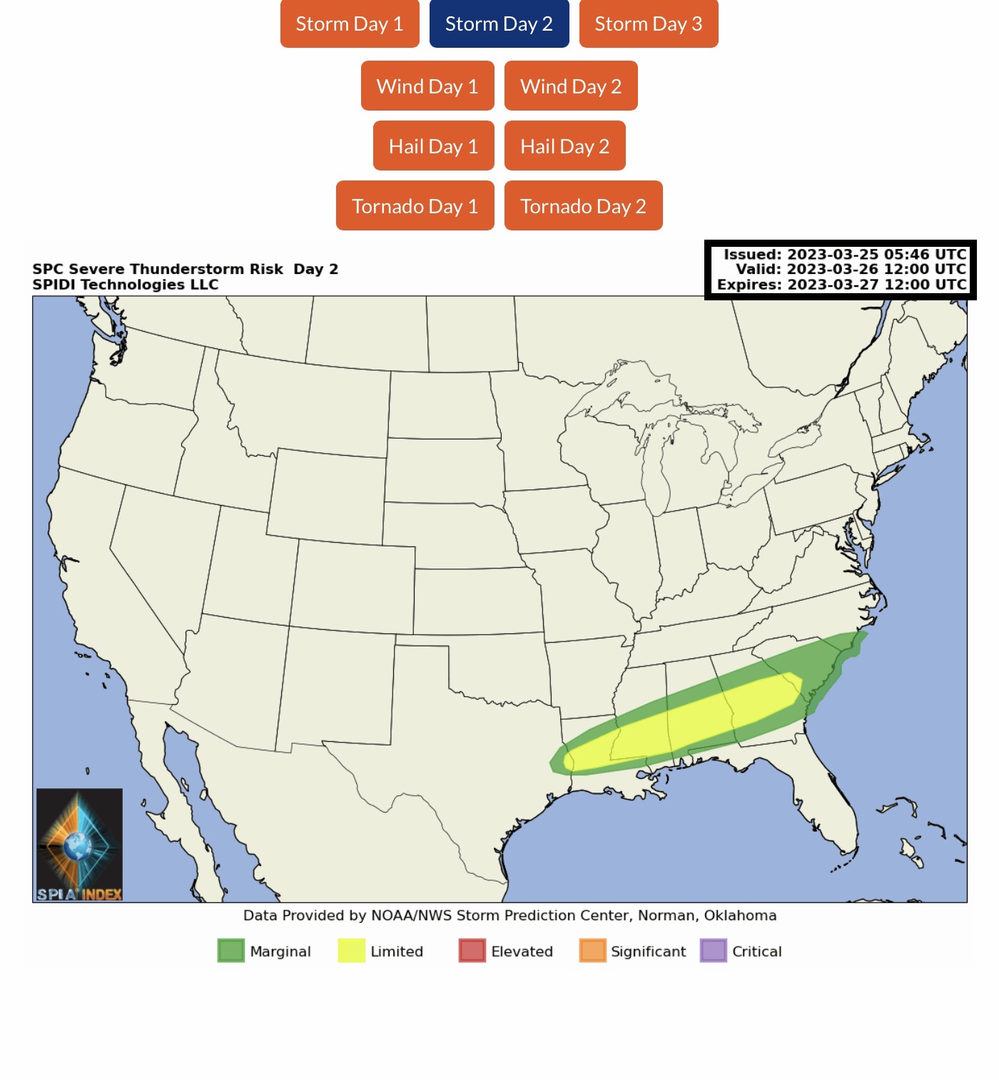
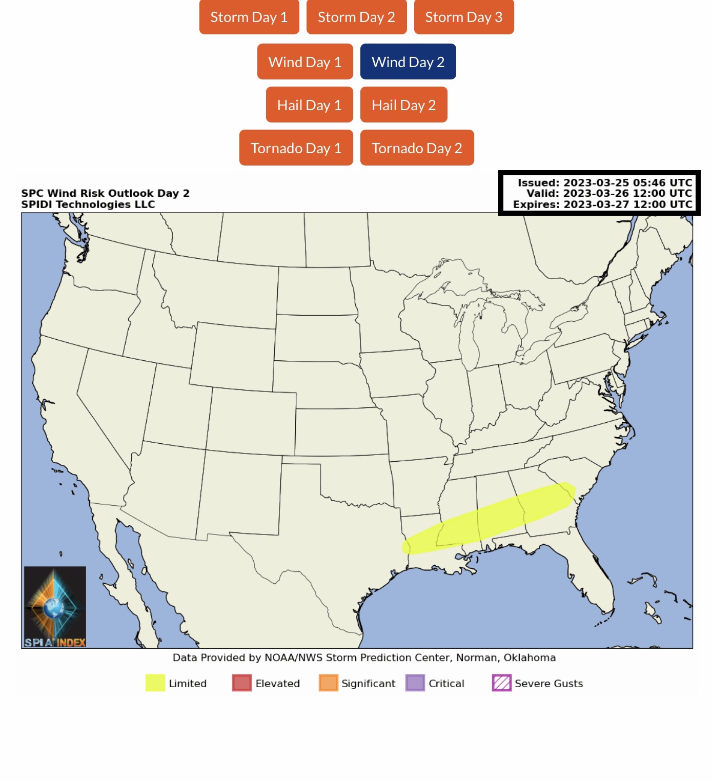
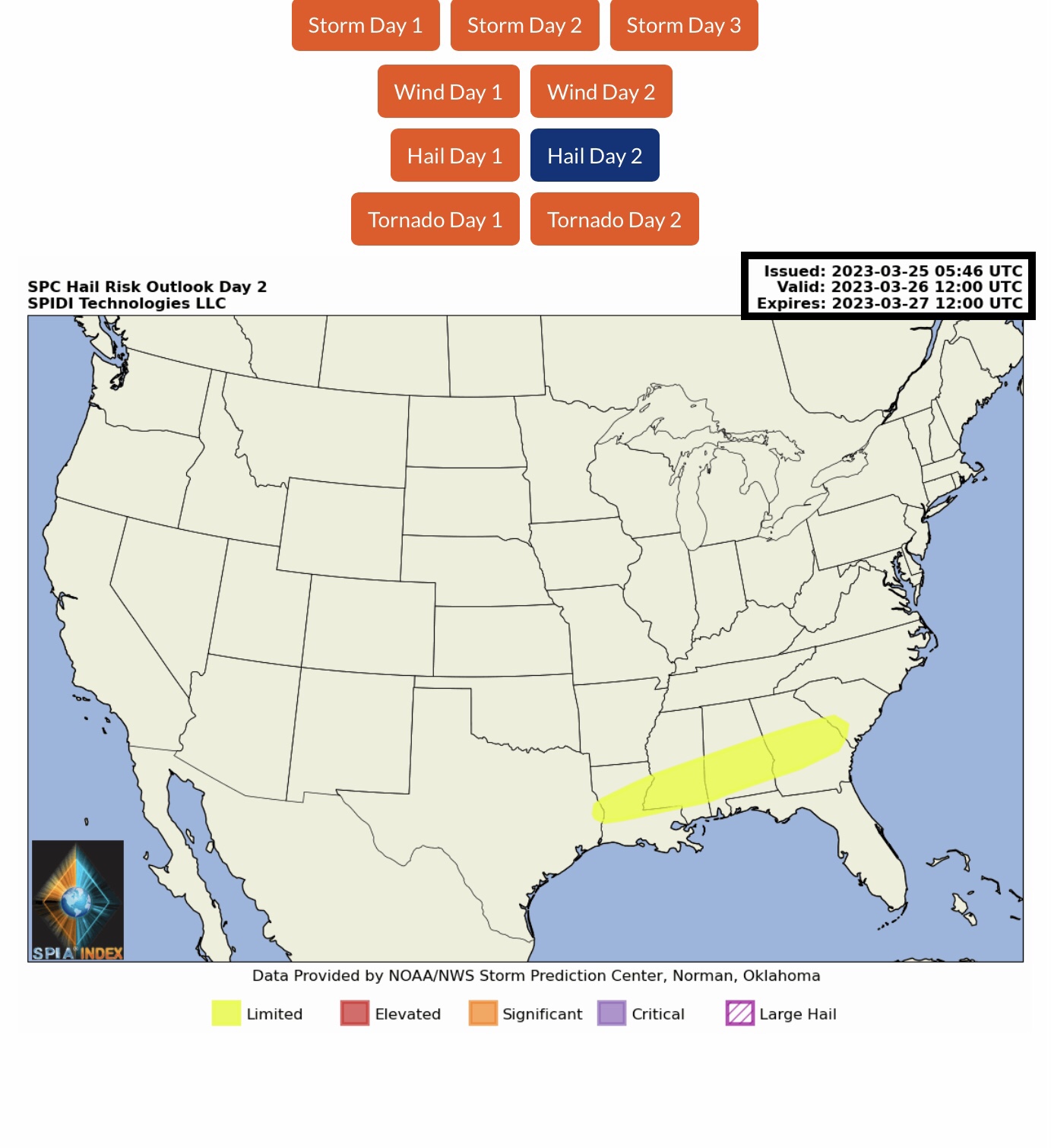
LIMITED Severe Thunderstorm Risk, Day 2 (Sunday), parts TX, LA, MS, AL, GA & SC. Includes LIMITED Risk for High Winds and Hail.
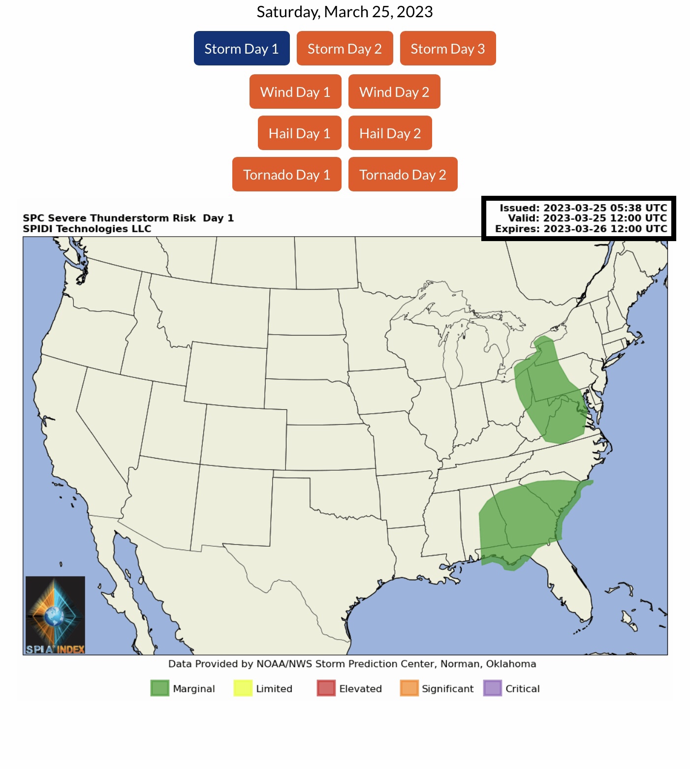
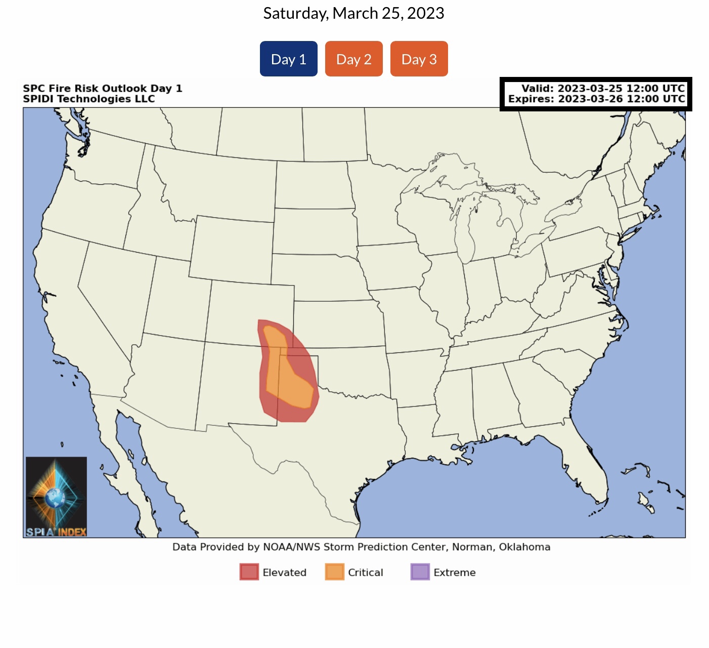
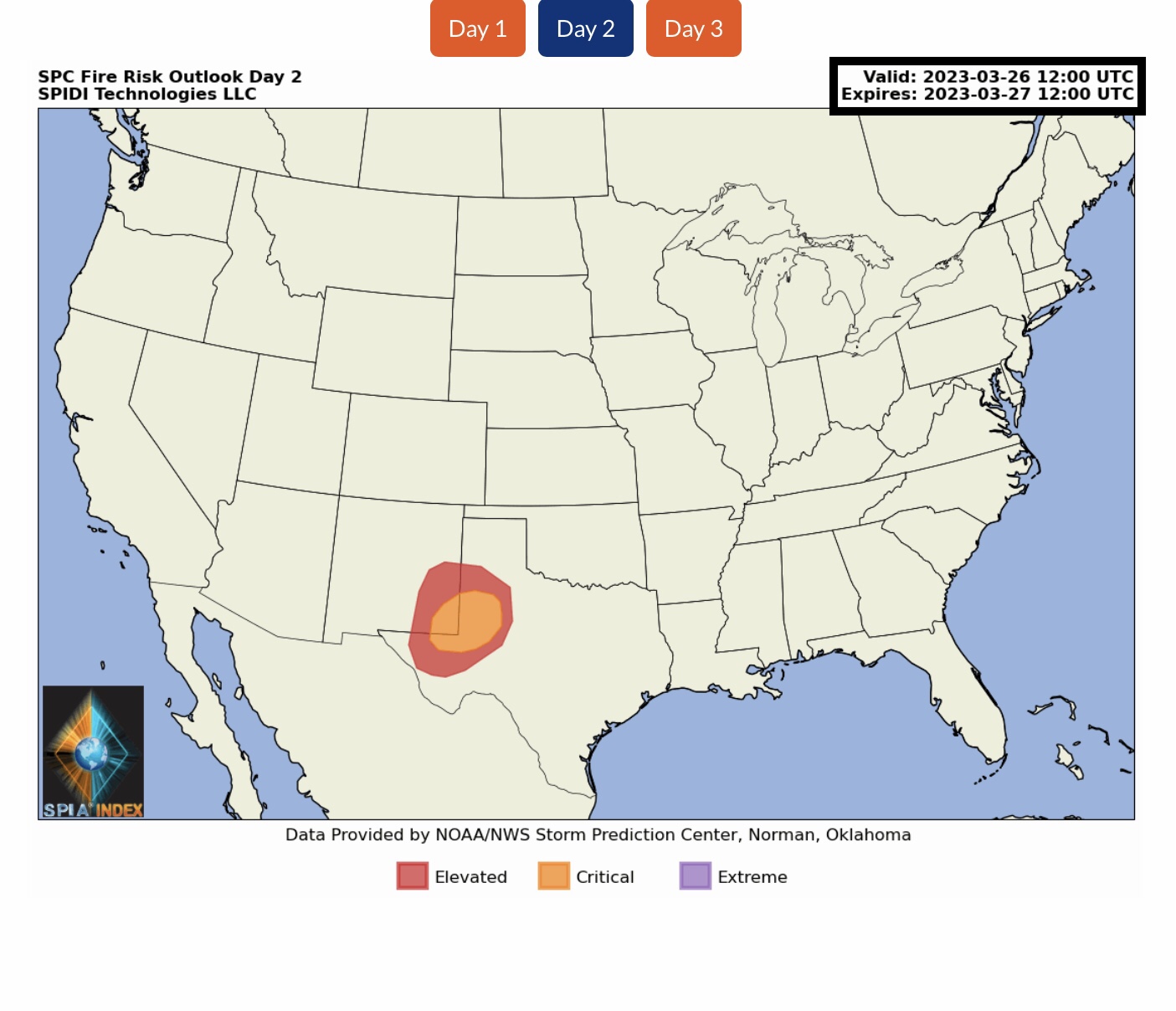
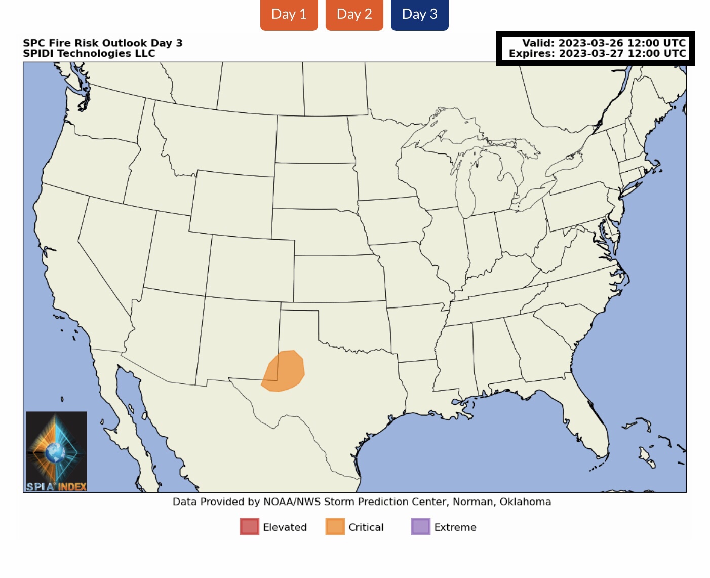
ELEVATED to CRITICAL Fire Risk Outlook, Days 1 through 3, parts CO, KS, NM, OK & TX.
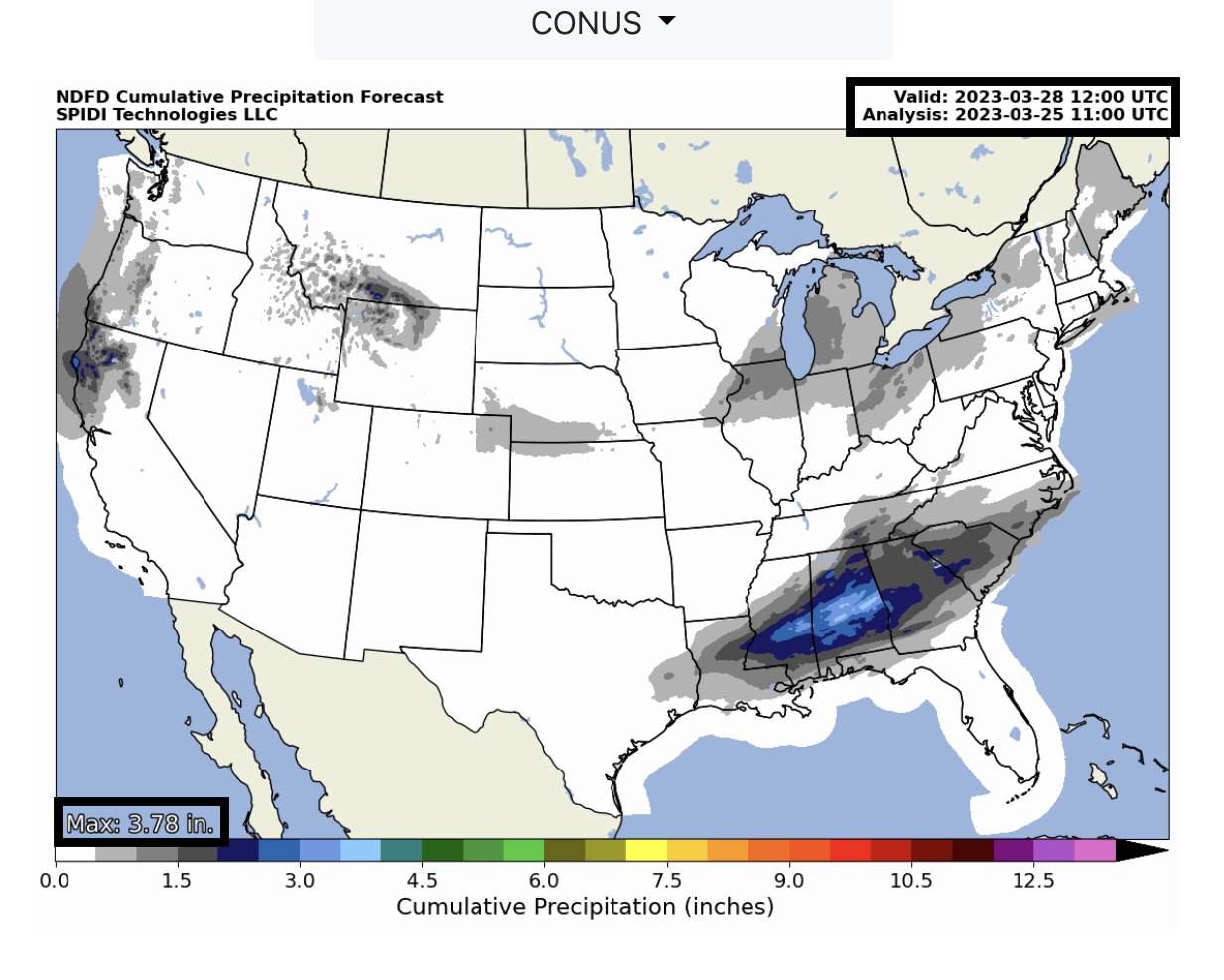
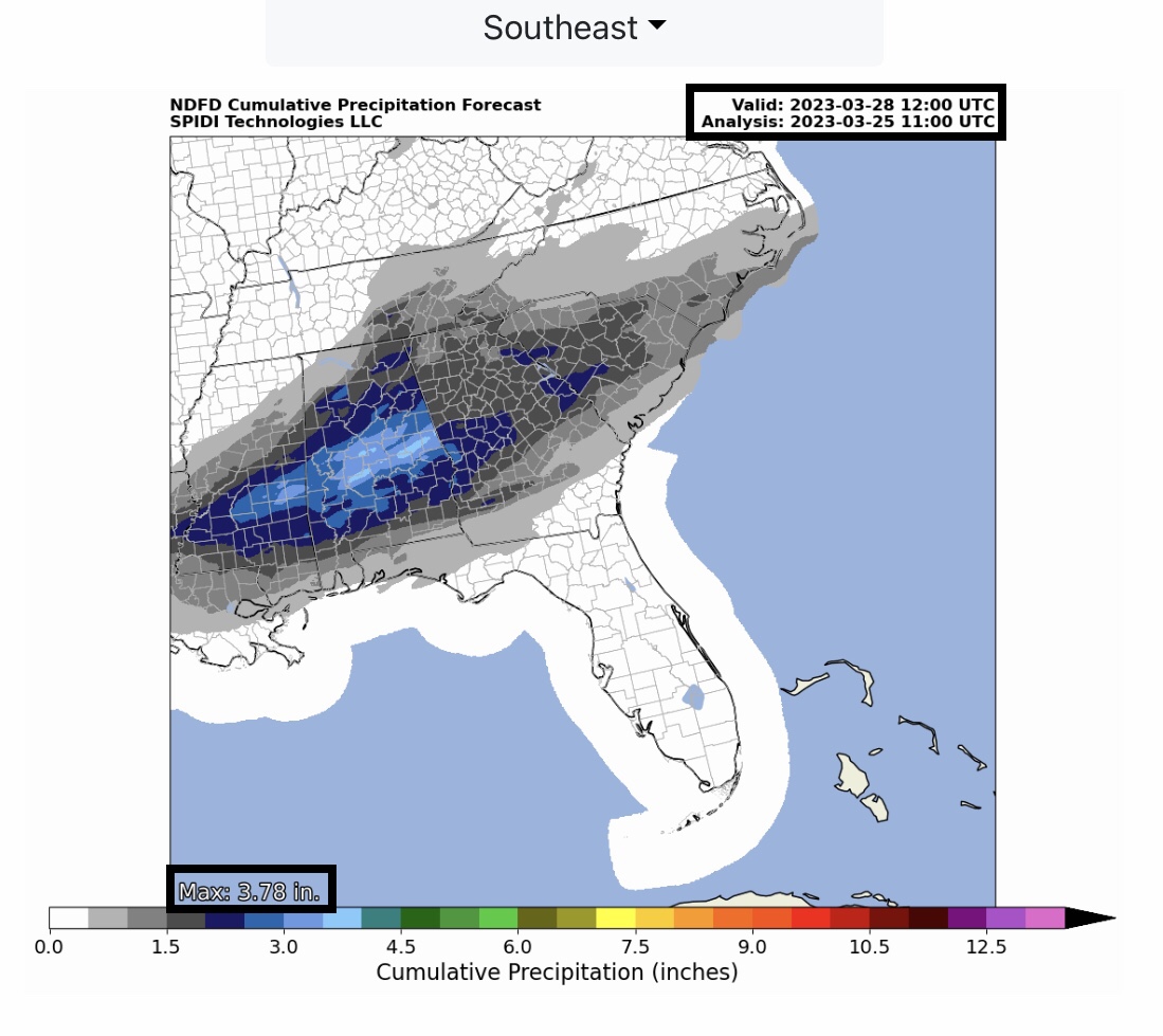
Up to 4” rainfall across portions of the Southeast Region over next 72-hours, through Monday morning. Flooding and Flash Flooding possible in some areas.
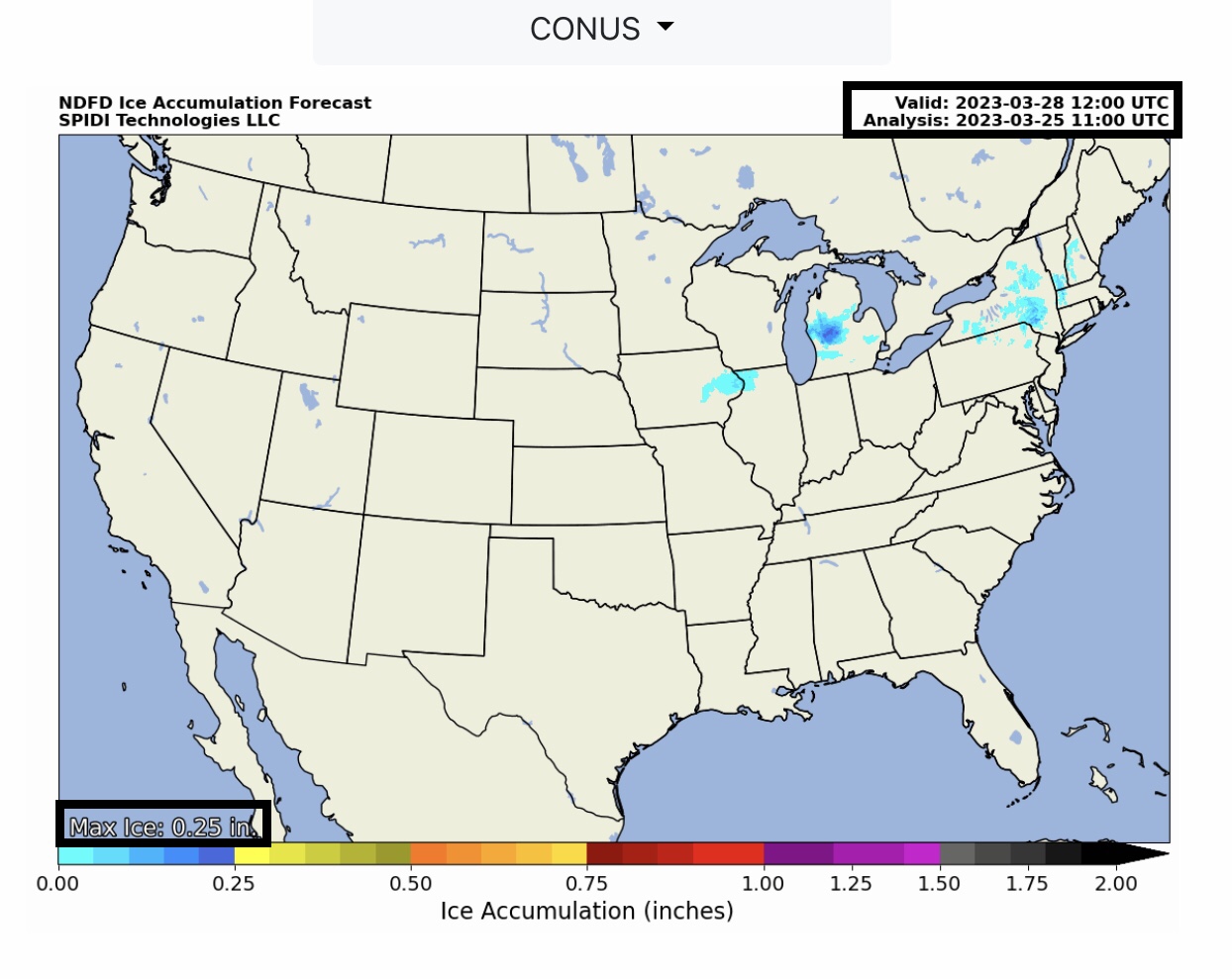
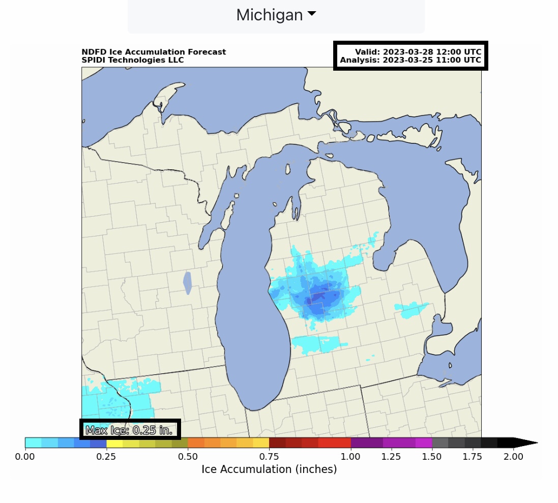
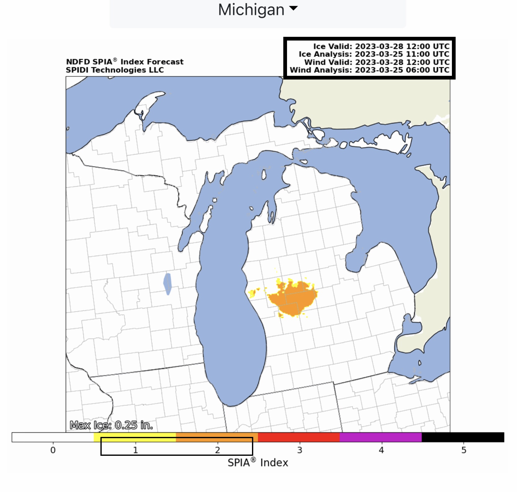
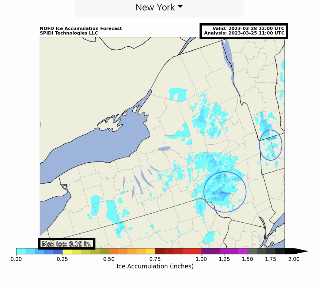
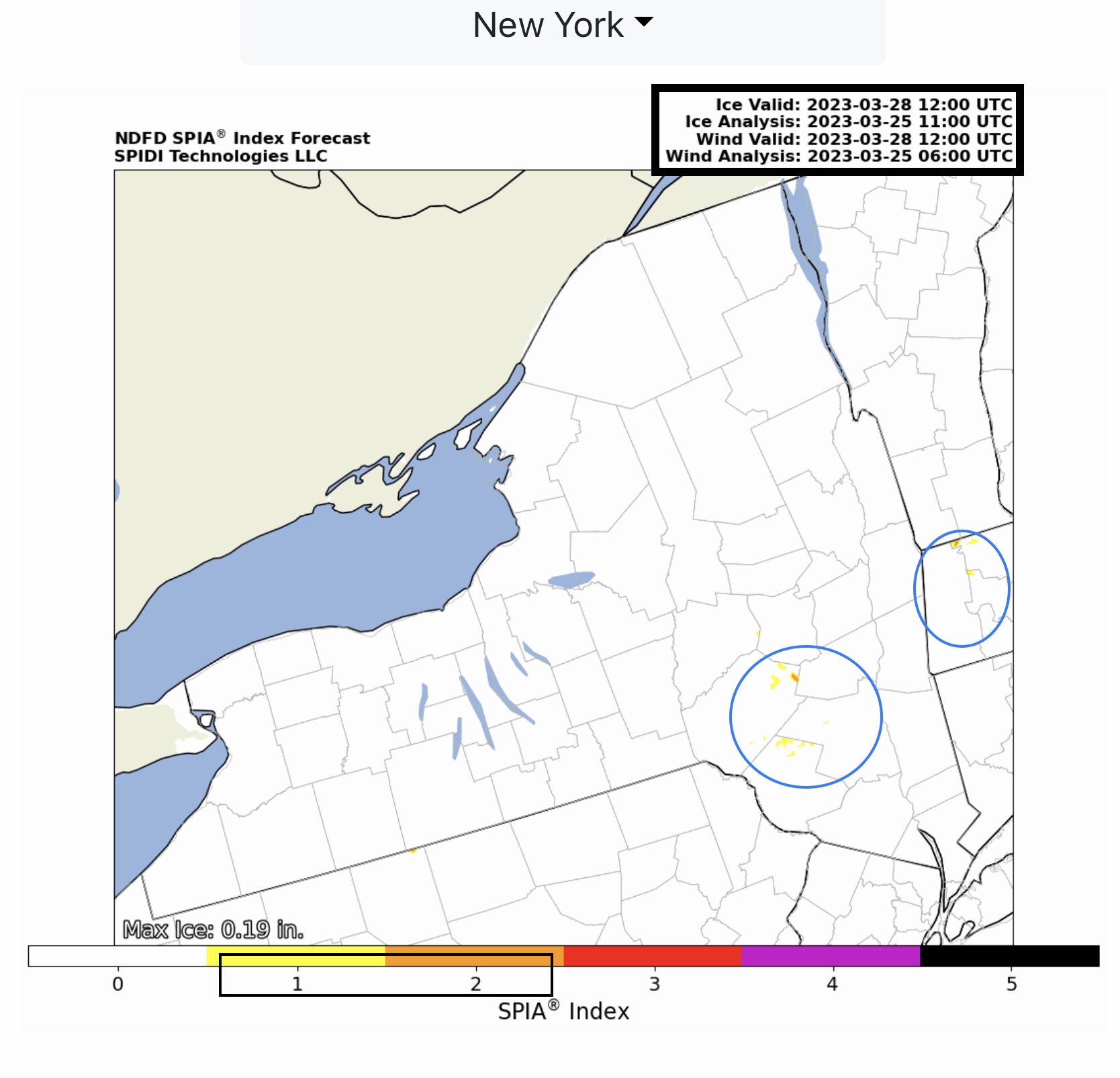
Max ICE in NWS Forecast Grids: 0.25” parts west-central MI, and up to 0.19” in parts southeastern NY and western MA. SPIA Index Ice Impact Forecast: Levels 1 & 2 parts MI, NY & MA.
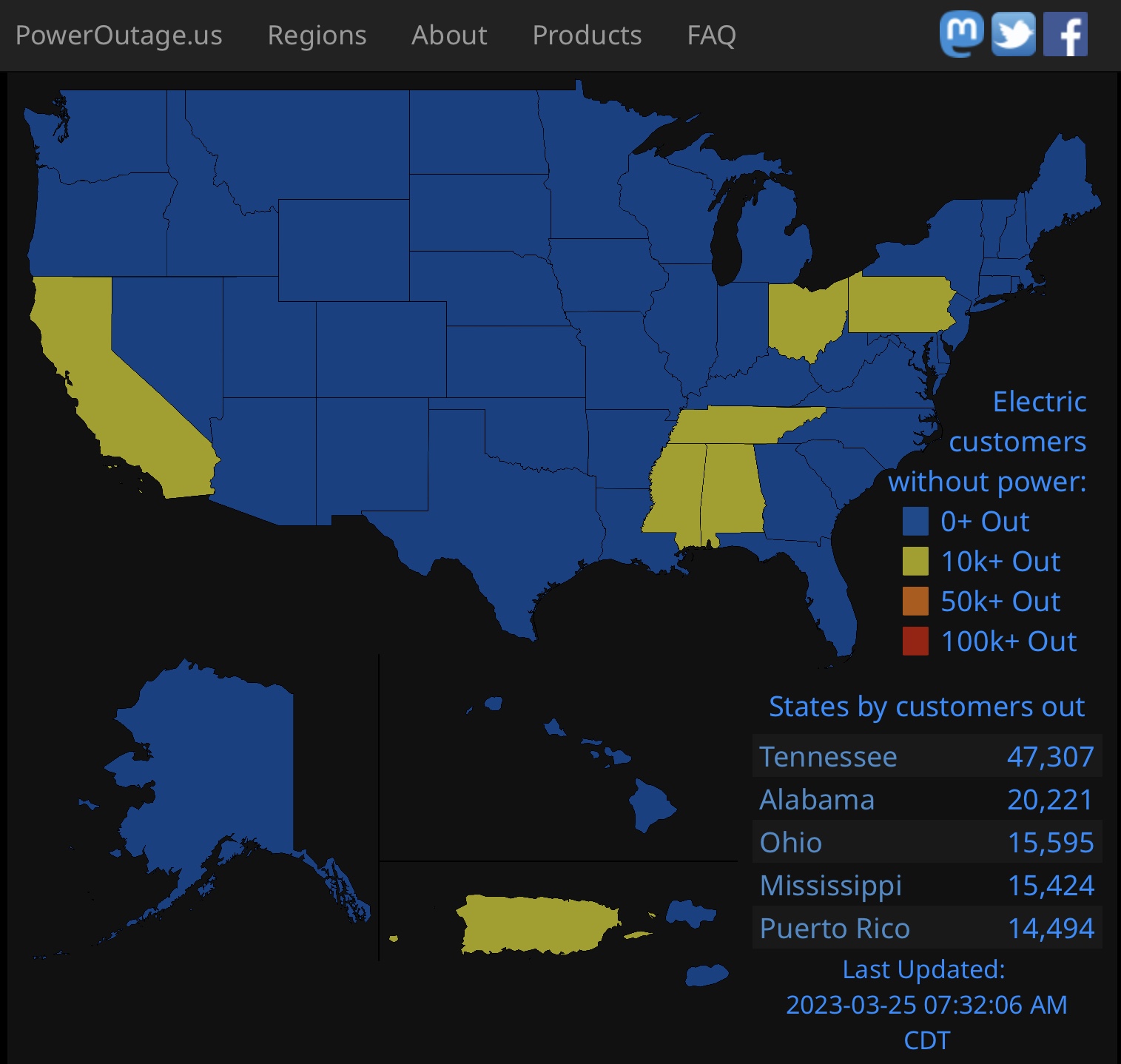
Over 100,000 electric utility outages being reported this morning by the website PowerOutage.US across parts of MS, AL, TN, OH & PA. At least 21 people killed by tornadoes that struck parts of Mississippi yesterday afternoon and evening, and that death toll may rise today as search and rescue crews continue their efforts this AM.
Sid Sperry
President & CEO
SPIDI Technologies, LLC
SPIDItech.com
Cell: (405) 627-7754
Email(s): SidSperry@gmail.com  OR  Sid.Sperry@spidiweather.com

Sent from my iPad

 Show/hide attachments